01 BIG SYCAMORE CANYON
KEY AT-A-GLANCE INFORMATION
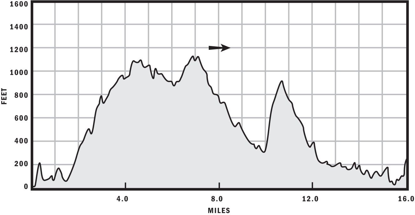
Length: 16 miles
Configuration: Figure-8
Aerobic difficulty: 4
Technical difficulty: 3
Scenery: Broad views of Oxnard, Sandstone Peak, Point Mugu, Pacific Ocean
Exposure: Fully exposed to sunshine for 80% of ride, some shade in lower areas of Big Sycamore Canyon Fire Road
Trail traffic: Moderate during weekdays, heavy on weekends
Trail surface: Approximately 30% singletrack, 70% fire road; mostly hard-packed and dry
Riding time: 2–3 hours
Access: Sunrise–sunset, 7 days a week
Maps: USGS 7.5-minute quads: Camarillo, Point Mugu
Special comments: Parking fee is $10. Ample free parking can be found along Pacific Coast Highway north and south of the area.
GPS TRAILHEAD COORDINATES (WGS84)
UTM Zone 11S
Easting 314150
Northing 3772292
Latitude N 34.04′30″
Longitude W 119.00′51″
DIRECTIONS
The best way to access this ride is to stage from the Sycamore Canyon Campground, located 15 miles south of Oxnard on CA 1 (Pacific Coast Highway) or, if coming from Los Angeles, 32.2 miles north of where Interstate 10 Freeway terminates to CA 1 in Santa Monica.
In Brief
Big Sycamore Canyon, located in the northernmost region of the Santa Monica Mountains in the Point Mugu State Park, contains a variety of trails well suited to riders of all skill levels. The pristine, quintessential California beach at the mouth of Big Sycamore Creek is a great distraction for nonriders coming along for the day. Big Sycamore Canyon, in addition to being a great place to bring the whole family, stays drastically cooler than the rest of LA County’s rides on hot summer days. After you experience the Guadalasca and Backbone trails, arguably the most entertaining singletrack in the Santa Monica Mountains, you may not want to go home at the end of the day, and you don’t have to because there are several great campsites.
Description
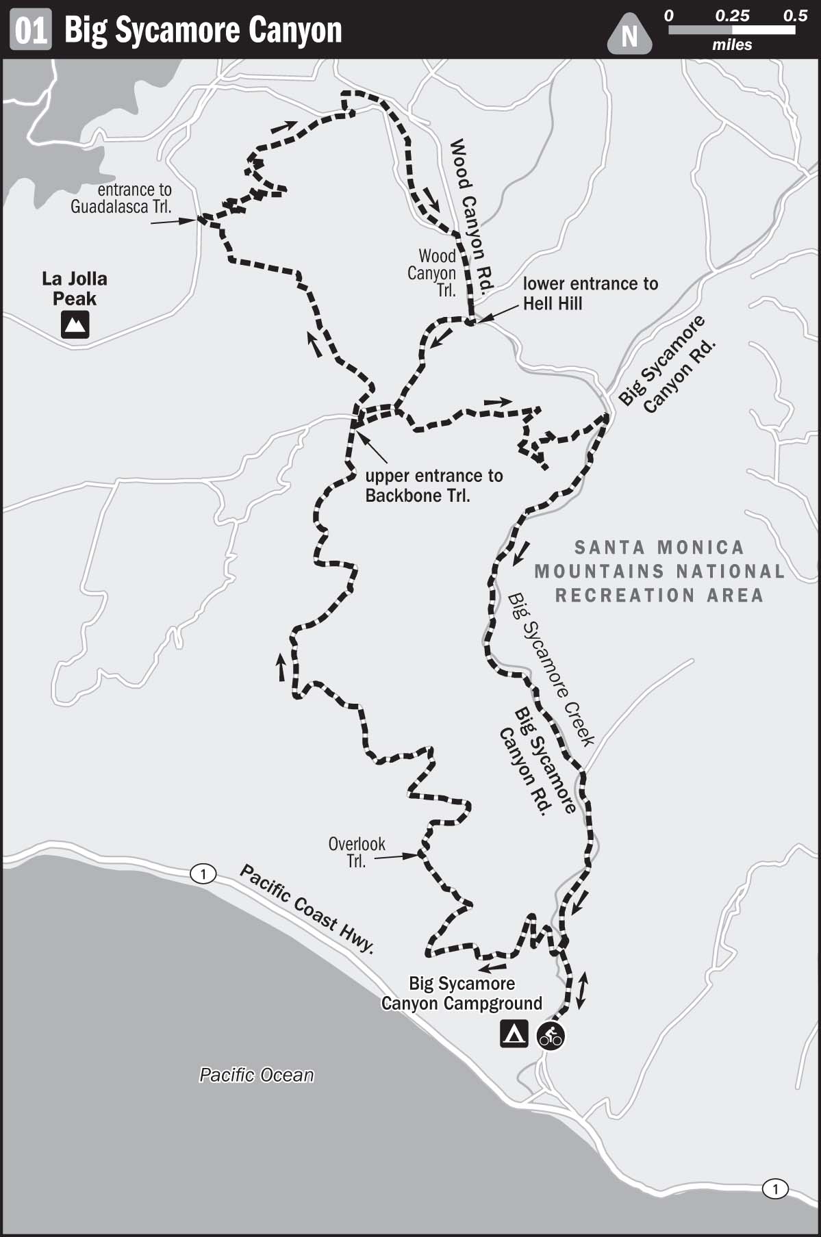
Once inside the campsite, follow the signs to the trailhead, which starts at the northern end of the campgrounds, roughly one-quarter mile from the Pacific Coast Highway (PCH). Big Sycamore Canyon Trail is a wide, flat fire road with heavy bicycle, hiker, and equestrian traffic, so take it easy here. Spin your way to the entrance to the Overlook Trail, which will be on your left side, about 0.4 miles from the entrance to Big Sycamore.
Clean ocean air, pleasant views of the Pacific Ocean, and unmolested chaparral make the Overlook Trail one of the sweetest ascents to be found anywhere in SoCal. The climbing is tough, but not relentless because a few flat spots will alleviate the pain in your lungs and legs along the way. Sandstone Peak dominates the skyline to the east, rising to 3,117 feet, making it the highest mountain in the Santa Monica Mountain range.
If you’ve had enough after 4.5 miles of the Overlook Trail, you have two bailout options. You can either descend the Backbone Trail, which will be clearly marked with a sign on your right, or go down Hell Hill, which is a fire road, also on the right about 300 feet beyond Backbone. Hell Hill is a steep beeline back to Big Sycamore, and much easier than the twisty, bumpy singletrack that is Backbone. If you have the grit, avoid bailing out here and continue up Overlook for another 1.25 miles so you can be rewarded with the Guadalasca singletrack descent. The views become more and more interesting near the summit of Overlook, at the top of which you can survey the vast agricultural plains of Oxnard.
After a brief downhill, look for the entrance to Guadalasca Trail on your right at the end of Overlook. Guadalasca is crazy fun and a great training ground for the more advanced, technical singletrack descents you will find in other less-forgiving areas of LA County, such as the San Gabriel Mountains. Watch for tight switchbacks you can crash on—without falling off a cliff—and don’t hesitate to turn around and give them another run if you dab or fall. The dense vegetation can obscure your view, so resist flying at warp speed because many riders choose this trail as their ascent. Unfortunately, this utopian section ends after roughly 2.5 miles at Wood Canyon Trail, where you turn right.
Savor the next 0.3-mile-long section of Wood Canyon Trail to the fullest because when you turn right and ascend the infamous Hell Hill Fire Road, you’ll beg for mercy and dream of the next descent. Aptly named, Hell Hill gains roughly 650 feet in 0.7 miles. If you’re on a single-speed bike, this will be a hiking section for you or anyone else who left their granny gear at home. Climbing this hill without dabbing is a true accomplishment and will give you a pass to climb any hill in Southern California—it just doesn’t get tougher than this. If you’re still pedaling at the halfway mark, you will be rewarded with a whopper endorphin rush that may have you calling it “Heaven Hill” from that point forward. If you somehow pedaled to the top on a mono-cogger, please contact Menasha Ridge Press for a free T-shirt and trail guide ($50 shipping). Better yet, look in the mirror to make sure you’re not Ned Overend.
After rewarding yourself with a snack and gloating about your accomplishment to your buddies and crowning yourself king of the Santa Monica mountain range, hang a left onto Overlook Trail and make another left so you can take your victory lap down the Backbone Trail. This section of the Backbone is a hoot, with less speed-limiting foliage than the Guadalasca Trail. Smooth-banked turns rather than tight switchbacks make this chute reminiscent of a toboggan run. Play it safe, though; this is not the Winter Olympics, and you’ll need to watch for plenty of uphill traffic. After about 1.7 miles, cross Big Sycamore Creek and rejoin the Big Sycamore Canyon Trail.
The last 3 miles of your ride rattle down the Big Sycamore Canyon Trail, which is wide, groomed, and subdued. Several creek crossings, however, will keep you vigilant in the spring and winter when water is present. You return to your point of origin about 14.5 laughter-, sweat-, blood-, and tear-drenched miles later, and reward yourself with the cold beverage you so deftly placed in the cooler at your staging area.
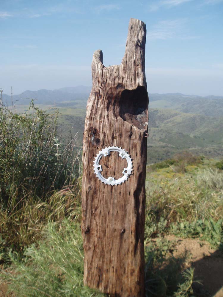
Some nice trailside artwork near the summit at Sycamore
After the Ride
Big Sycamore Canyon Trail is pretty remote, so your best bet is to treat yourself to a portable feast. If you didn’t adequately prepare, travel 3.2 miles south to Neptune’s Net Seafood at 42505 Pacific Coast Highway for a fatty spread of fried seafood and frosty brews; (310) 457-3095. This classic landmark, just across from the famous LA County–line surf spot, is filled with bikers and tourists on the weekend, so be prepared for a long line to place your order.