Here in New Brunswick the pace is slow and the friendly people take the time to talk. Magnificent wild forests cover 85 percent of the land, supporting a substantial pulp and paper industry. Under these lie lead, copper, and zinc, providing a healthy mining industry. And then there is the mining of the sea: fishing.

Fresh lobster, caught off the coast of New Brunswick.
iStock

The Acadians and Loyalists
The first people to settle in this region after the Mi’kmaq and Maliseet First Nations were the French in 1604. They arrived with Samuel de Champlain and called the land they worked Acadie; it covered the Atlantic provinces and Maine. The Acadians were constantly fighting battles with the British during the Anglo-French wars of the 17th century. French rule ended in 1713 and mainland Nova Scotia was controlled by the British. In 1755 the British governor, Charles Lawrence, delivered an ultimatum to the Acadians – take an oath of allegiance to the British Crown, or face deportation. The Acadians did not want to take the oath for fear of being forced to fight fellow Frenchmen on behalf of Britain. The infamous Deportation Order forced 14,600 Acadians into exile. Many settled in Louisiana, where the Cajuns survive to this day. When peace was declared between England and France in 1763, most of the Acadians returned to Nova Scotia, only to find their land had been occupied by new English colonists. Once again they moved on and settled in what is now New Brunswick. Today almost 33 percent of the province’s population is French-speaking, and New Brunswick is Canada’s only officially bilingual province.
For the descendants from the British Isles, the deportation was a windfall that started a trend. Many New Englanders moved, and during the American Revolution even more crossed the border. They were known as the Loyalists. With them they brought the maritime traditions of the seafaring colonies.
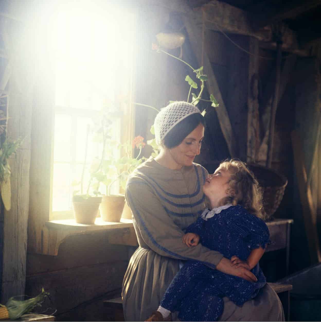
Living history at Kings Landing.
Pictures Colour Library
St John River Valley
The St John River is New Brunswick’s lifeblood. It was the route traveled by Maliseet and Mi’kmaq, Acadians and Loyalists, Scots and Danes. In the northwestern region of the province it creates a border with Maine and from there the waterway can be traced along its winding course to Saint John.
New Brunswick’s westernmost outcrop, a thumb-like parcel of land bordered by Québec, Maine, and the St John River, is popularly known as the Republic of Madawaska. The region’s inhabitants created this mythical realm in the 1800s because they were fed up with being pawns in border negotiations between Canada and the United States. With their own leader (the mayor of Edmundston) and their own flag, the Madawaskans (mostly francophones) are both proud and exuberant. At no time is their spirit more in evidence than during the festival called La Foire Brayonne (the French in this region are known as Brayons, after a tool used in processing flax). The midsummer event features both folk dancing and lumberjack competitions. Edmundston 1 [map], an important pulp and paper center and the capital of Madawaska, is situated where the St John and Madawaska rivers converge. Of particular interest to visitors is the Church of Our Lady of Sorrows, containing woodcarvings (the Stations of the Cross) by New Brunswick artist Claude Roussel.
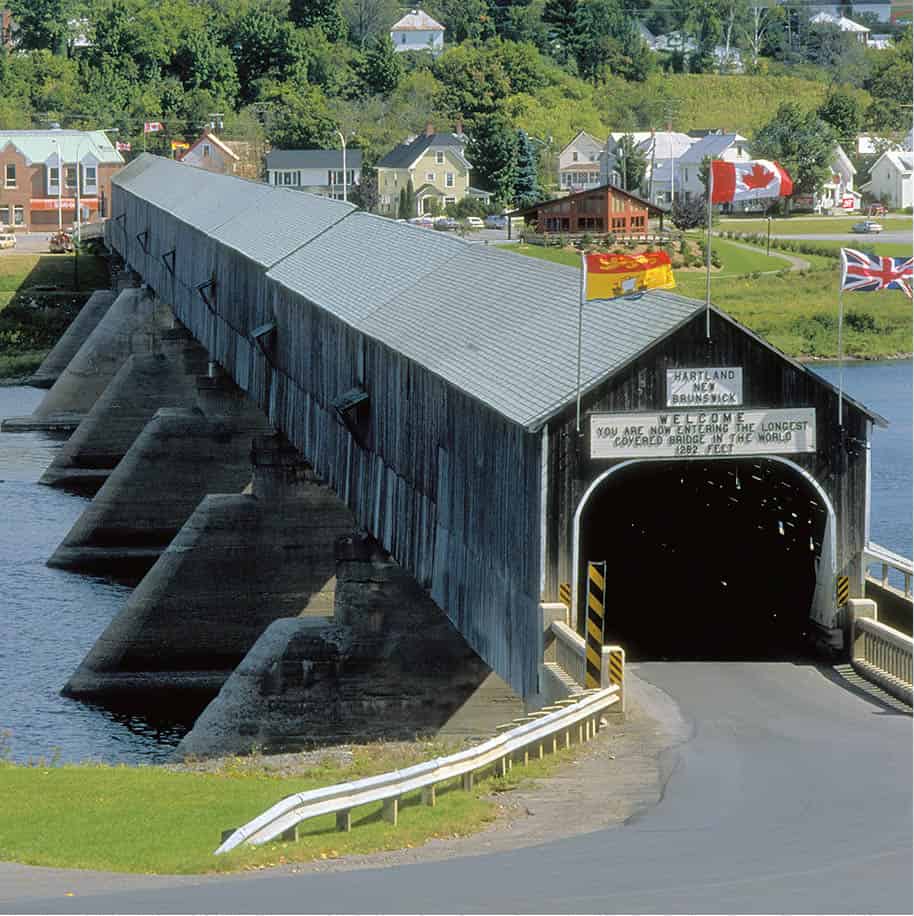
The covered bridge at Hartland.
New Brunswick Tourism
To the south, the beautiful and productive St John River Valley has always been a major thoroughfare. The northern segment of the valley, from Saint-Léonard to Woodstock, is known as the “potato belt.” This tuber is a major regional crop, celebrated each year at the Potato Festival in Grand Falls 2 [map], during which flower-strewn boats are sometimes launched over the town’s waterfalls. The gorge into which the water plunges is one of the largest cataracts east of Niagara Falls. Lying 80km (50 miles) downstream is the small agricultural town of Hartland 3 [map], known for its majestic covered bridge spanning the St John River. This is not just any covered bridge, but the world’s longest, with seven spans, traversing 391 meters (1,282ft).
Covered Bridges
The covered bridge at Hartland is one of 61 still standing in New Brunswick. Built like old barns from hand-hewn timbers, they capture the essence of bygone times. They were first erected in the late 19th century, to assist those traveling from A to B with rivers to cross. New Brunswick had an ample supply of rivers, lumber, and skilled labor eager to connect the ever-expanding settlements. By protecting the bridge from the elements, the wood did not rot as quickly, which could extend the bridge’s lifetime to 50–60 years, compared to the more typical 10 years of a conventional structure. Many of them had colorful names such as The Bridge to Nowhere (built to service a community that was ultimately not built) or the Plumwesweep Bridge, a Maliseet word for ‘salmon river’.
Just south is Woodstock, whose residents pride themselves on their tradition of hospitality. A landmark here is the restored Old Courthouse, which over the years has served not only as the seat of justice, but as a social hall, a coach stop, and a political meeting house. It’s only fitting that such a busy little town should be the birthplace of Canada’s first dial telephone system in 1900.
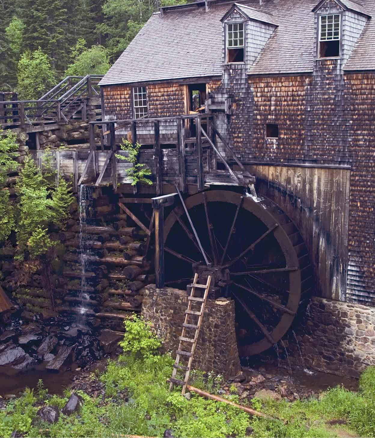
The water-powered sawmill at Kings Landing.
Pictures Colour Library
For a look at Loyalist life in the valley throughout the 1800s, visit Kings Landing Historical Settlement 4 [map] (mid-June to late Sept daily 10am–5pm), 37km (23 miles) west of Fredericton. This reconstructed village, built on the banks of the St John River, depicts daily life among the Loyalists of that era. In 1783 Loyalists exploring the valley came upon the area and, realizing its natural advantages, settled here the same year. After enduring the hardship of a very severe first winter, they proceeded to build a town whose spirit exists to this day – Fredericton 5 [map], “Atlantic Canada’s Riverfront Capital.” It is an appellation that befits this provincial capital.
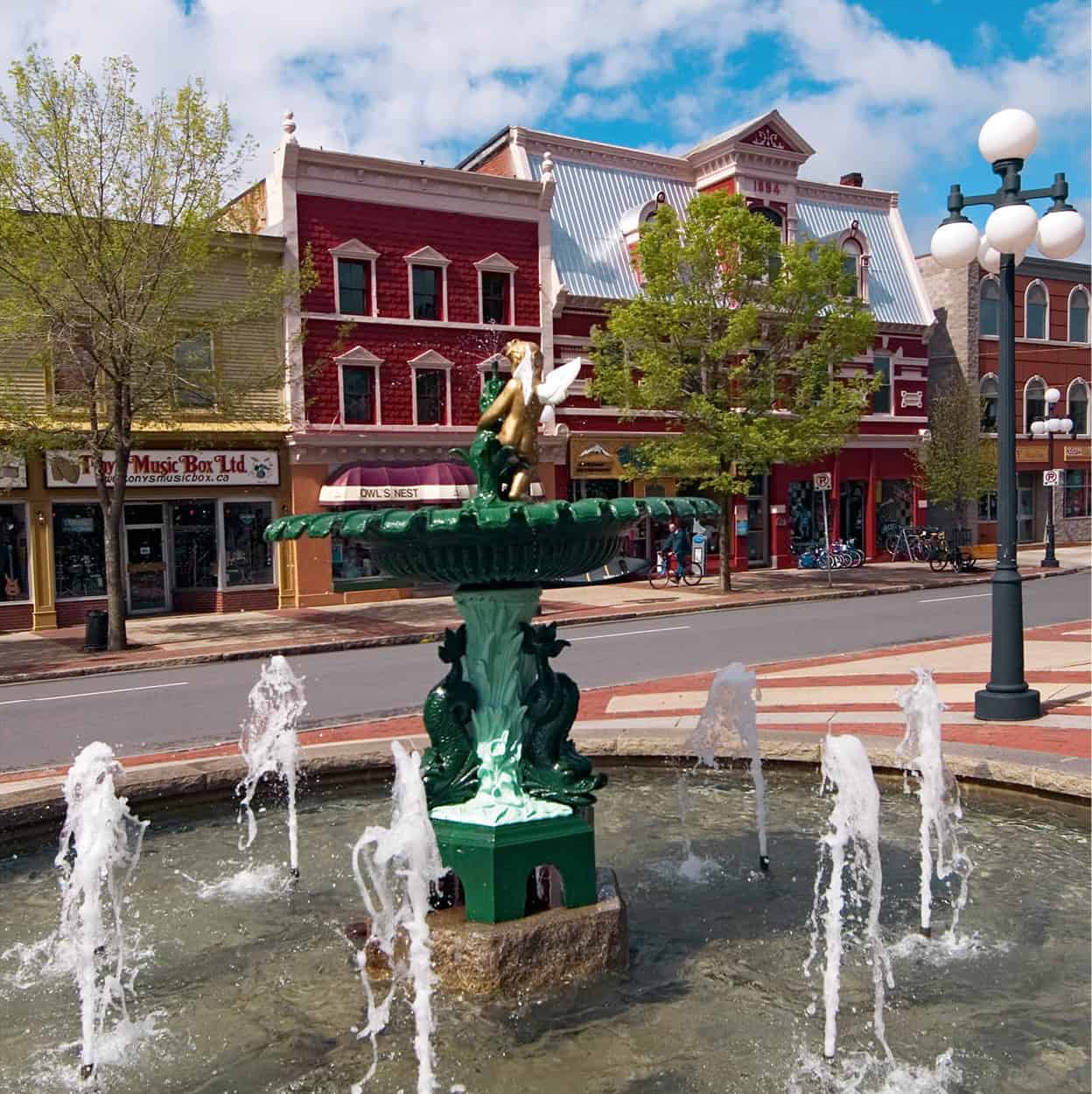
Fountains in Fredericton.
Pictures Colour Library
Fact
Mactaquac, near Kings Landing, is the site of a provincial park. People flock to this area for what is reputed to be the best bass fishing in North America.
Fredericton is the cultural center of the province, thanks in large part to the generosity and high profile of the publisher and statesman Lord Beaverbrook, who never forgot his boyhood home. The Beaverbrook Art Gallery, Queen Street (Mon–Sat 10am–5pm, Thu until 9pm, Sun noon–5pm; www.beaverbrookartgallery.org), houses a marvelous collection from the 15th century on, including the work of Dalí, Constable, Gainsborough, Botticelli, Henry Moore, and even Winston Churchill.
The Legislative Building (late June–late Aug daily 9am–5pm, late Aug–late June Mon–Fri 8.30am–4pm; free) displays portraits by Joshua Reynolds as well as a rare copy of the Domesday Book. The city’s most elegant structure is Christ Church Cathedral. Completed in 1853, it is considered one of North America’s best examples of decorated Gothic architecture.
The Historic Garrison District beside the river is the hub for museums, art galleries, outdoor concerts, and heritage walking tours. It incorporates the Fredericton Region Museum (July–Sept daily 10am–5pm, Apr–June, Sept–Nov Tue–Sat 1–4pm by appointment, Dec–Mar by appointment), which chronicles Fredericton’s military and domestic past. Re-enactments of the Changing of the Guard (July–Aug daily 11am and 4pm, Tue and Thu also 7pm; free) take place in Officers Square. Modern military life can be found by following the St John River southeast from Fredericton to Oromocto, home of Canada’s largest military training base and a military museum.
Fact
New Brunswickers are extremely particular about never abbreviating Saint John, perhaps to avoid confusion with St John’s across the sea in Newfoundland.
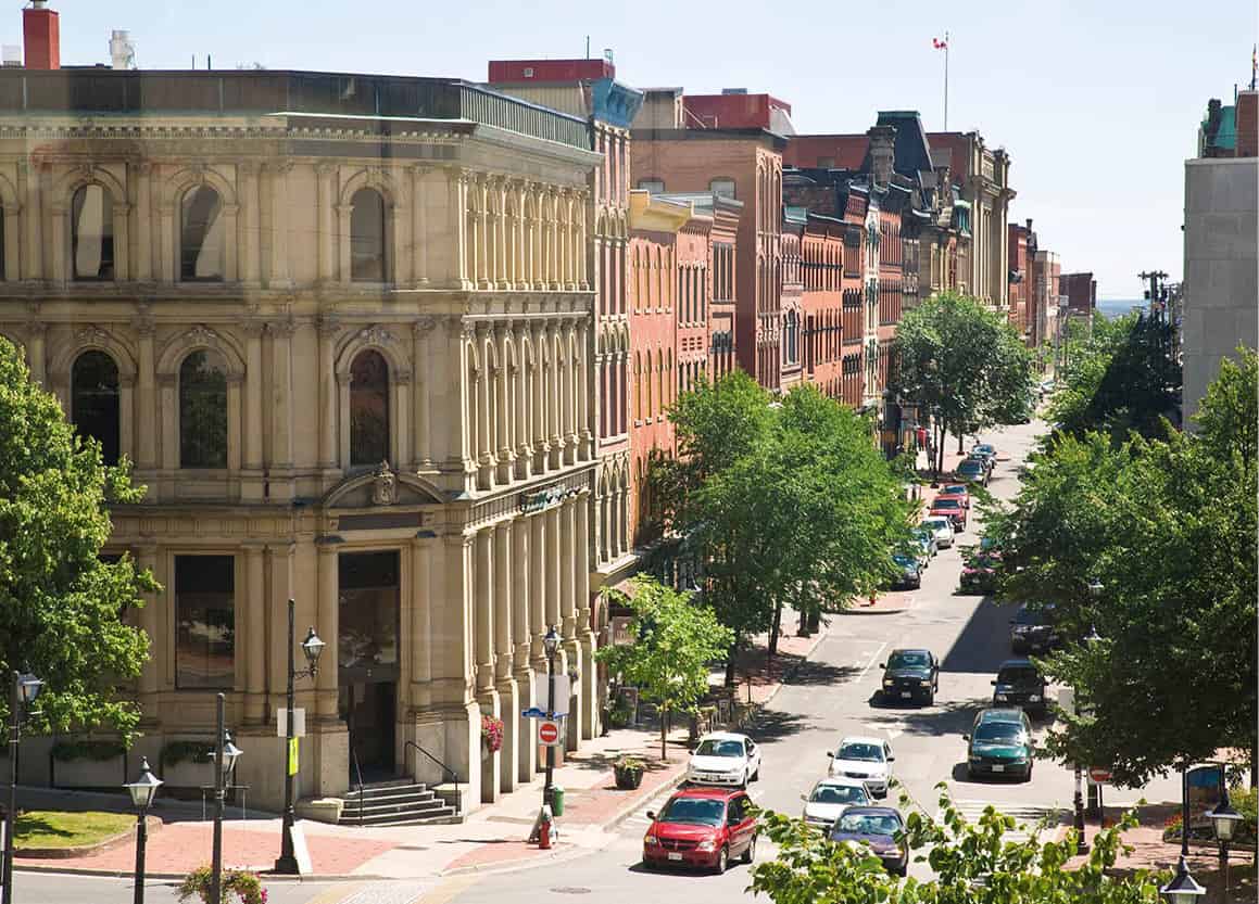
First city
Weathered Saint John 6 [map], Canada’s oldest city, sits along the Bay of Fundy at the mouth of the St John River, famed for its reversing rapids which flow toward the bay at low tide and away from it at high tide. Samuel de Champlain landed here in 1604 and gave the location its name, but its true birth came in 1783 with the arrival of 3,000 Loyalists from New England.
“The Loyalist City,” as it is known, celebrates its heritage each July during Loyalist Days. The festivities include a three-day jazz and blues festival, the annual Buskers on the Boardwalk Festival, and various summer theater presentations.
Determined, energetic, and ambitious, the Loyalist citizenry catapulted their new home into the forefront of wooden shipbuilding. The thriving port city declined following a disastrous fire in 1877 along with the eventual obsolescence of wooden ocean-going vessels. Recent waterfront development and urban renewal have provided Saint John with a much-needed transfusion. It is now a major cruise ship port of call, which has had a significant effect on the city’s economy. It also claims the first police force in North America, and the first newspaper and bank in Canada.
View of historic Prince William Street, Saint John.
Alamy
To catch up with the city’s past there are three walking tours: Prince William’s Walk, a Victorian Stroll, and the Loyalist Trail. One attraction the tours are sure to include is Barbour’s General Store (early June to early Oct Mon–Sat 10am–6pm, Sun noon–6pm), a restored and fully stocked 19th-century store in which thousands of artifacts, including 300 “cure-all or kill-alls,” bring the past to life.
Saint John’s Loyalist roots are nowhere more evident than at King Square (opposite the Loyalist Burial Ground), landscaped in the form of the Union flag; and at Loyalist House (mid-May–June Mon–Fri, July to mid-Sept daily, rest of year by appointment), a Georgian mansion completed in 1817 after taking seven years to build. Occupied for about a century and a half by Loyalist David Daniel Merritt and his descendants, it is the oldest structurally unaltered edifice in the city; indeed, one of the few buildings to survive the Great Fire of 1877. With most of its original furnishings still intact, Loyalist House is a tribute to the fine craftsmanship of 19th-century Saint John.
Eat
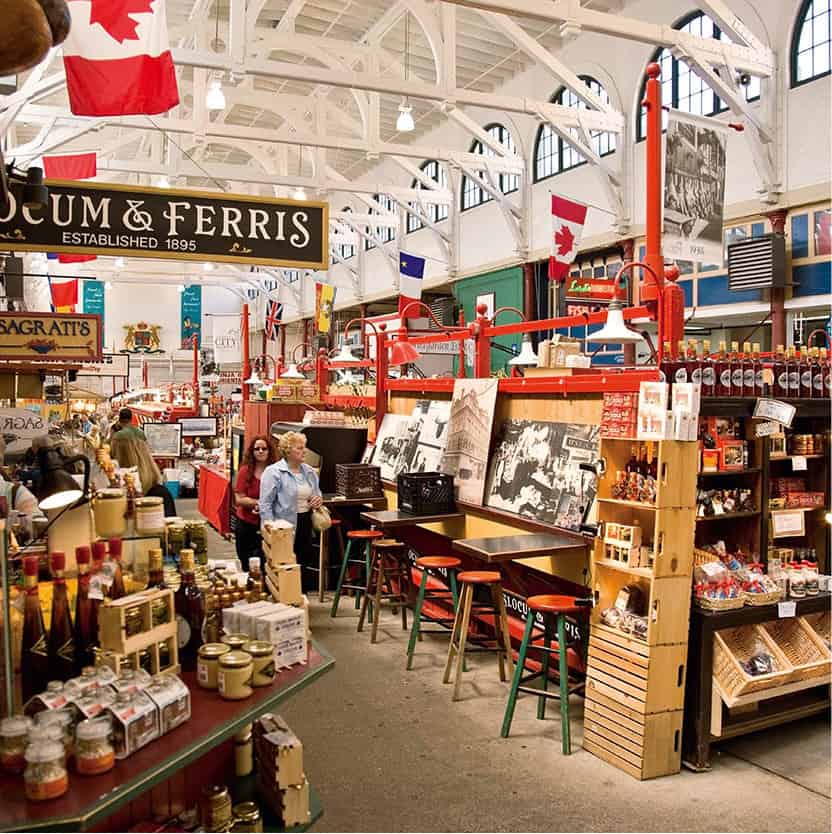
Saint John’s City Market is the place to sample dulse, a dried, deep-purple seaweed from the Bay of Fundy; and fiddlehead greens, a type of fern, which tastes similar to asparagus.
City Market, Saint John.
Alamy
Saint John’s City Market is another survivor of the Great Fire. This institution has provided unflagging service since 1876, making it Canada’s oldest market. Then, as now, the market clerk rings a bell to close commercial proceedings. The building, filled with New Brunswick produce, is a pleasure to the eye, with its ship’s-hull roof, its big game trophies, and its ornate iron gate.
The gem of Saint John’s revitalized downtown waterfront district was officially christened Market Square in 1983. Its success has brought business, tourism, employment, and pride back to the city. An early 19th-century brick facade serves as an invitation to a warm and lively center for shopping and dining. There is a boardwalk by the sea, a grand Food Hall and a regional library with a fine collection of early Canadian printed work.
In Market Square, the country’s oldest museum, the New Brunswick Museum (mid-May to Oct Mon–Fri 9am–5pm, Thu until 9pm, Sat 10am–5pm, Sun noon–5pm, Nov– mid-May Tue–Sun; www.nbm-mnb.ca), has treasures from around the world, and particularly artifacts pertaining to the history of New Brunswick. Its Hall of Great Whales is one of the most arresting displays.
For a panoramic view of the city and its waterfront, visit Fort Howe and the Carleton Martello Tower.
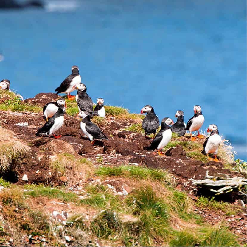
Puffins can be seen on the Fundy Trail.
iStock
The Fundy Coast
West of Saint John, the idiosyncratic Fundy Coast is characterized by picture-perfect fishing villages and the highest tides in the world (up to 50ft/15meters, twice daily). This is where United Empire Loyalists settled en masse after the American Revolution.
Carved out of the Bay of Fundy, between Maine and New Brunswick, is Passamaquoddy Bay. At its eastern edge sits Blacks Harbour, famed for possessing the Commonwealth’s largest sardine factory.
Rounding the bay takes you through St George, where visitors can meander about one of the oldest Protestant graveyards in Canada, while nearby Oak Bay is the site of a beachfront park and campground.
Probably the best-known community on the bay is St Andrews 7 [map], a fishing village, resort, and marine biological research center, studded with 18th- and 19th-century mansions. Founded by Loyalists following the American Revolution, some families floated their homes here (one piece at a time) when the border with Maine was determined in 1842 – hence the New England atmosphere. St Andrews is home of the Algonquin Resort, one of Canada’s oldest resort hotels; but its most distinctive landmark is Greenock Church. This pristine structure, encircled by a white picket fence, is embellished with a carved oak tree design, a clock, and a weathervane.
Fact
At Reversing Falls Rapids, the twice-daily high tides of the Bay of Fundy meet the St John River and spectacularly force the river to flow back upstream.
The multi-award-winning Kingsbrae Garden (mid-May–mid-Oct daily 9am–8pm) was created from the grounds of several of St Andrew’s grand old estates, offering a delightful mix of old and new gardening styles. The village also houses the Huntsman Marine Science Centre, and its newly opened Fundy Discovery Aquarium (mid-May–mid-Oct daily 10am–5pm) gives visitors a chance to see just what swims around the Bay of Fundy.
St Stephen, New Brunswick, stands face to face with Calais, Maine. These border towns have traditionally been the best of friends – even during the War of 1812 when St Stephen loaned Calais gunpowder for its Fourth of July celebration. Today, the towns hold joint festivities each summer. The world’s first chocolate bar is thought to have been invented here at the Ganong candy factory in 1910.
Fundy Trail
Linking Fundy National Park and Hopewell Rocks, the 16km (10-mile) Fundy Trail offers access – by car, bike, or on foot – to one of the last remaining wilderness coastlines between Florida and Labrador. Carved out of the Fundy escarpment, the trail hugs the top of 250-meter (820ft) cliffs, high above the Bay of Fundy’s famously high tides, and connects to paths and stairways leading to pristine beaches and tumbling waterfalls. As these waters are the breeding habitat for right whales, this is one of the best places for viewing marine and wildlife. A suspension footbridge above the Big Salmon River Interpretive Center crosses to the start of the rugged Fundy Footpath – a separate entity to the Fundy Trail – that winds some 41km (24 miles) through thick forests to the boundaries of Fundy National Park.
Roosevelt’s paradise
A paradise for birdwatchers, whale-watchers, fishermen, and other outdoor types exists on the Fundy Islands where Passamaquoddy Bay widens into the Bay of Fundy. The beauty and natural riches of the islands have attracted nature lovers, from James J. Audubon to Franklin Delano Roosevelt.
Grand Manan Island is the largest and farthest from the coast. It is a particular favorite of ornithologists, with about 360 species of birds, including the puffin, which has become somewhat of a symbol here. For the artist there are lighthouses and seascapes to paint or photograph. Campobello, the “beloved island” of F.D. Roosevelt, is accessible by bridge (from Lubec, Maine). It brings you to the Roosevelt-Campobello International Park (daily sunrise–sunset; free), a natural preserve in the southern portion of the island. Visitors can see round Roosevelt’s 34-room “cottage” (end May to mid-Oct daily 10am–6pm; free), built in the Dutch Colonial style, from where he viewed so many sunrises.
Located smack on the 45th parallel (and proud of it), Deer Island 8 [map] is a mere 12km (7.5 miles) long. It compensates for its size by having the world’s largest lobster pond and, offshore, the largest tidal whirlpool in the western hemisphere, “Old Sow,” named because of the auditory experience it provides.
The southeast
The southeast region of New Brunswick, from Saint John to Moncton, reveals the cultural texture of the province; towns and villages gradually reflect a transition from areas settled by Loyalists to those settled by Acadians.
Beyond the sea coast village of St Martins is Fundy National Park 9 [map], 80km (50 miles) east of Saint John, a showcase for the spectacularly dramatic Fundy tides and coastal terrain. It once reverberated with the clamor of a thriving lumber industry, which, along with intense trapping in the area, nearly destroyed its natural gifts. By 1930 the population of Alma, on the eastern edge of the park, once a roaring lumber town, was reduced to two struggling families. The park covers an area of rugged shoreline, forests, and gorges. Trails provide views of the Bay of Fundy and the chance to see rare birds. The towering cliffs at Cape Enrage offer the best view of the area.
Thanks to Parks Canada, the region is now being returned to a wilderness state, with its forests protected and wildlife and fish stocks, particularly salmon, being reintroduced.

Hopewell Rocks.
iStock
Hopewell Rocks, 40km (25 miles) east of Alma, is perhaps better known than the national park, and it is also better known as home of the “Flowerpot Rocks,” which is what these peculiar formations look like at low tide, when you can explore the tidal pools surrounding them.
Beyond the Fundy Coast is the city of Moncton ) [map], an old railroad town, called the “hub of the Maritimes.” It was first settled by Middle Europeans, but following the era of deportation and the influx of Acadians into what is now New Brunswick, it became known as the unofficial capital of Acadia. The Université de Moncton is the only French university in New Brunswick. Moncton is also a good place to observe the phenomenon of the Fundy tides.
Sackville ! [map] is a tiny town that resembles an English village. It is the home of Sackville Harness Limited, which has the distinction of being the only place on the continent where horse collars are still made by hand. Sackville is also a university town. The first degree given to a woman in the British Empire was handed out by the town’s Mount Allison University in 1875.
Nearby Fort Beauséjour–Fort Cumberland National Historic Site is where the French and English last battled in this region. Today, there is little echo of its past, but a rather magnificent panoramic view of the surrounding area.
Tip
Early July is the time of the Lobster Festival in Shediac, when lobster suppers, a lobster-eating contest, and a parade feature on the itinerary.
The Acadian Coast
The coastal region of New Brunswick, east of Moncton, is known as the “Acadian Coast.” Washed by the warm tides of the Northumberland Strait, it is primarily to this region that the Acadians returned following the deportation. In Bayfield, at the foot of Confederation Bridge to Prince Edward Island, 8 miles/13km across the water, the Cape Jourimain Nature Centre (mid-May to mid-Oct daily; donation) on Jourimain Island offers lovely coastal views, a historic lighthouse, an interpretation center, walking trails, and excellent birdwatching opportunities. Farther up the coast, they say that Shediac has the warmest salt water north of Virginia. It also bills itself as the lobster capital of the world.
Fact
Of interest to nature lovers, the dunes at Bouctouche, north of Shediac, support rare plants and fragile marshes, and are home to the endangered piping plover.
Tiny Acadian fishing villages are strung along the coast. Bouctouche is particularly well known for its oysters, and for the Irving Eco-Centre: La dune de Bouctouche, which introduces visitors to the ecosystem of one of the last great sand dunes on North America’s northeastern coast. The Kouchibouguac National Park @ [map], 100km (62 miles) north of Moncton, has preserved miles of deserted but fine sand beaches. It is a pleasant drive out to Point Escuminac, a place that has never forgotten its distinction as the site of the province’s worst fishing disaster. A powerful monument to the men who lost their lives here in 1959, carved by New Brunswick artist Claude Roussel, stands with its back to the sea, as a constant reminder of this tragedy.
Grande Anse lighthouse, near Baie des Chaleurs.
iStock
Farther north along the coast is the city of Miramichi £ [map], an amalgamation of Chatham and Newcastle, early lumber towns that have preserved some British culture.
This area is famous for its ballads and folklore, as well as for its illustrious native sons. Chatham’s once-busy shipyards have now been replaced by port facilities for exporting local wood products. Newcastle was the boyhood home of Lord Beaverbrook, who was exceedingly generous in his bequests to this town.
Acadian flags, a French tricolor with a yellow star in the upper part of the blue stripe, become increasingly visible as you continue northward. Shippagan is a typical fishing village, home of the exceptionally fine New Brunswick Aquarium and Marine Centre (late May to end Sept daily), devoted to the world of fishing in the Gulf of St Lawrence. A ferry will transport you to the delightfully deserted beaches of Miscou Island.
Caraquet $ [map], 20km (12 miles) west of Shippagan, is the most prosperous town on the Acadian coast and a cultural center for the region. Le Festival Acadien each August draws celebrants from up and down the coast and includes the traditional blessing of the fleet. The town also has one of the largest commercial fishing fleets in New Brunswick and the only provincial fisheries school. There are boat builders and fish markets on the wharf. Caraquet’s Village Historique Acadien (mid-June to Sept daily) has recreated an Acadian settlement reflecting the century from 1780 to 1880, a time of re-establishment here following the deportation. It is nestled near the marshland levées constructed by early Acadian settlers.
Off the coast are the waters of Baie des Chaleurs, literally “Bay of Warmth.” Named by Cartier in 1534, the bay is notorious for a phantom ship, which has been sighted along the coast from Bathurst to Campbellton. Some people believe it to be the ghost of a French ship lost in battle, while others suggest there must be a more scientific explanation.
Dalhousie and Campbellton % [map] at the western end of the Chaleur Bay were settled by Scots, Irish, and Acadians, and a fine-tuned ear is needed to place the accents. Campbellton rests at the foot of Sugarloaf Mountain; it is a center for salmon fishing and winter sports, and a gateway to Québec.
Beyond, to the south and east, lie Nova Scotia, Newfoundland and Labrador, and Prince Edward Island.