NORTH FORK OF THE ST. LUCIE RIVER
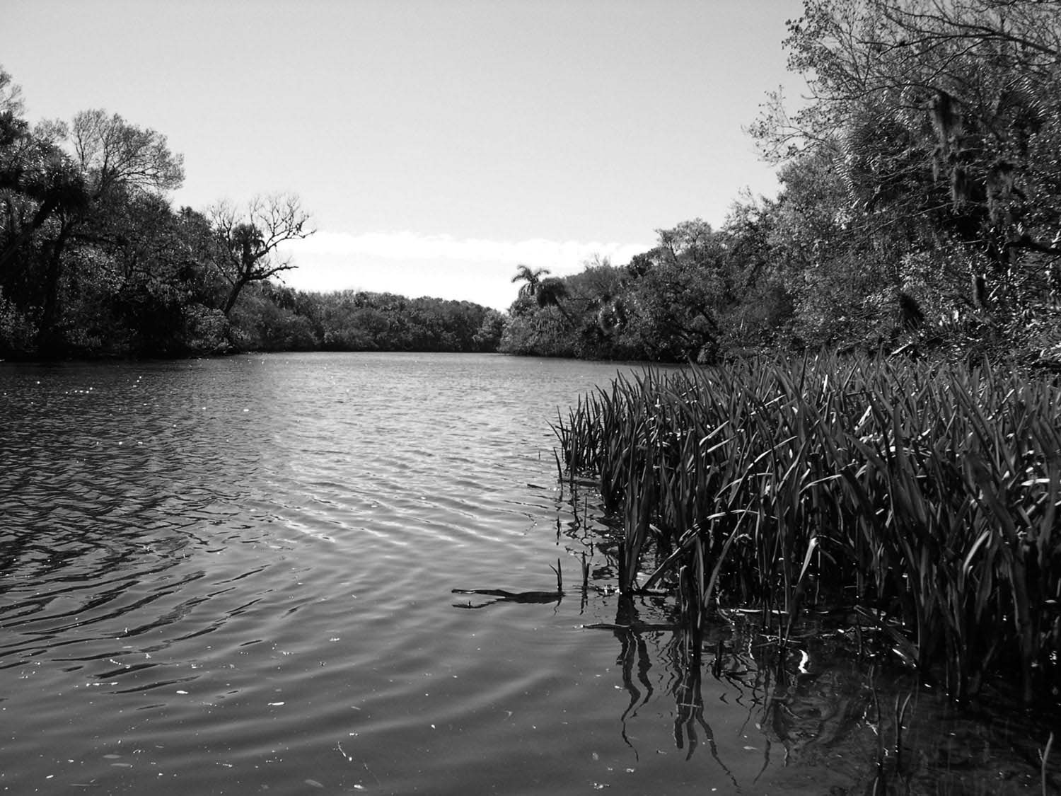
The North Fork and South Fork of the St. Lucie River join to form an extensive drainage system that enters the Atlantic Ocean at the coastal city of Stuart. The South Fork has been channelized into the St. Lucie Canal, which connects Lake Okeechobee with the Intracoastal Waterway. Fortunately, the North Fork has been designated an Aquatic Preserve, a move that has protected the river and its immediate environs from the burgeoning development that is consuming land in this part of Florida. The upper North Fork flows between banks overhung with large oaks, palms, and maples with an understory of ferns. Numerous sidestreams enter the St. Lucie at regular intervals. However, topographic maps reveal these apparent streams to be remnants of oxbows that were short-circuited many years ago. The river below Prima Vista Boulevard is not attractive to paddlers due to the extensive powerboat traffic.
MAPS: ST. LUCIE (USGS)
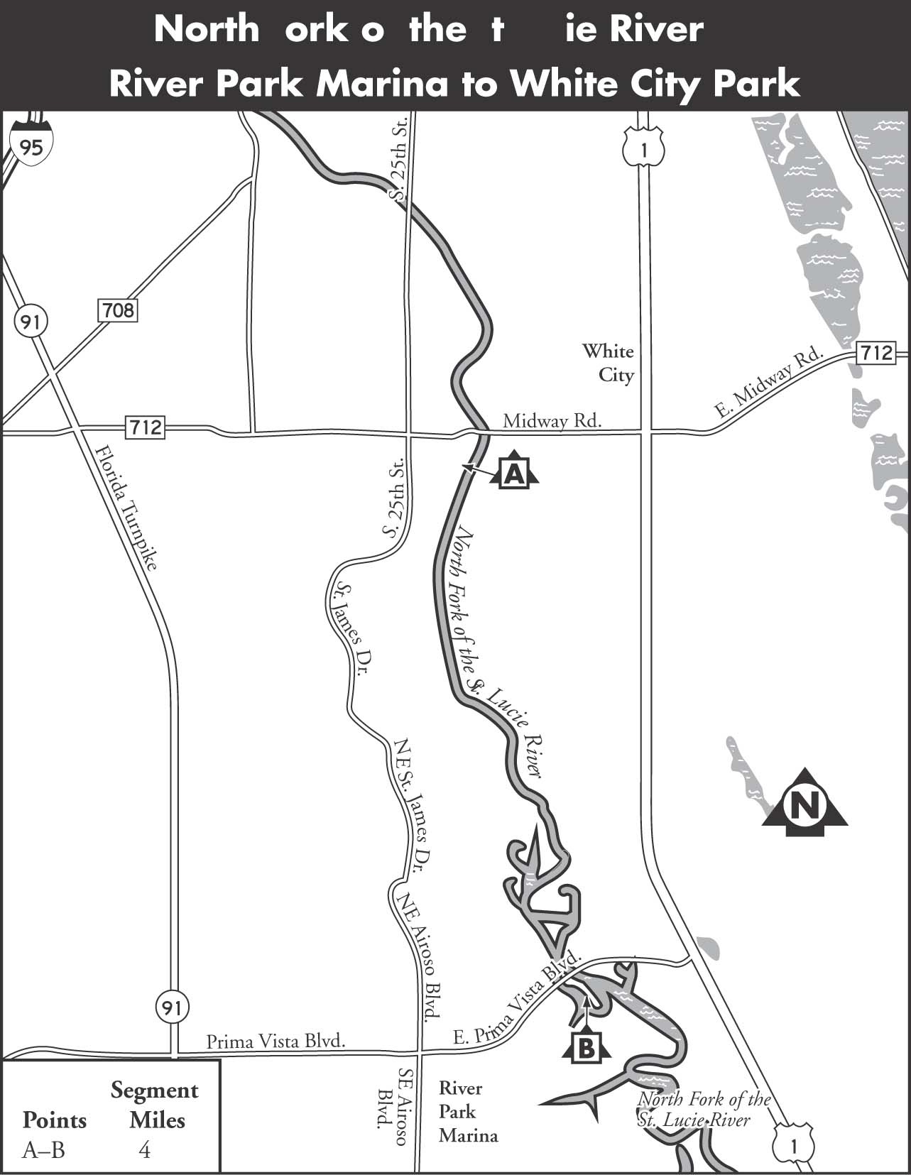
A River Park Marina to White City Park
| Class | I | |
| Length | 4 | |
| Time | 2 | |
| Gauge | Visual | |
| Level | Tidal | |
| Gradient | Tidal | |
| Scenery | B |
DESCRIPTION The St. Lucie flows south from White City Park through a corridor of high banks with some houses but is mostly bordered by the richly wooded aquatic preserve. The main channel averages 80 to 100 feet wide, so deadfalls are not a problem, but obstacles will be encountered on some of the old oxbows.
A set of power lines crosses the river 1.5 miles downstream. Paddlers with plenty of time on their hands will want to explore some of the oxbows. Most of these oxbows return to the main channel, but a few are dead ends. At 3 miles, the river passes through a wide spot that has the appearance of a small lake. Channel markers indicate the way on the lower river. Begin to look for mangroves here and expect tidal influences to increase. An intersection of five channels with a small island in the center indicates that Prima Vista Boulevard is just 0.1 mile away. After passing under Prima Vista Boulevard, paddlers must circle around a large peninsula to the right to reach the River Park Marina boat ramp.
SHUTTLE To reach the takeout from Exit 126 on I-95, take CR 712, Midway Road, east to US 1. Turn right on US 1, heading south to Prima Vista Boulevard. Turn right and then head west on East Prima Vista Boulevard, and then turn left into River Park Marina, just after the bridge over the St. Lucie River. There is a boat ramp and canoe rental here. To reach the put-in, backtrack to CR 712, Midway Road, and return west toward I-95 until you pass over the North Fork of the St. Lucie River and White City Park, which has a boat launch.
GAUGE Visual. The North Fork St. Lucie River is tidally influenced and paddleable year-round.
The current on the St. Lucie River can be nonexistent in places.