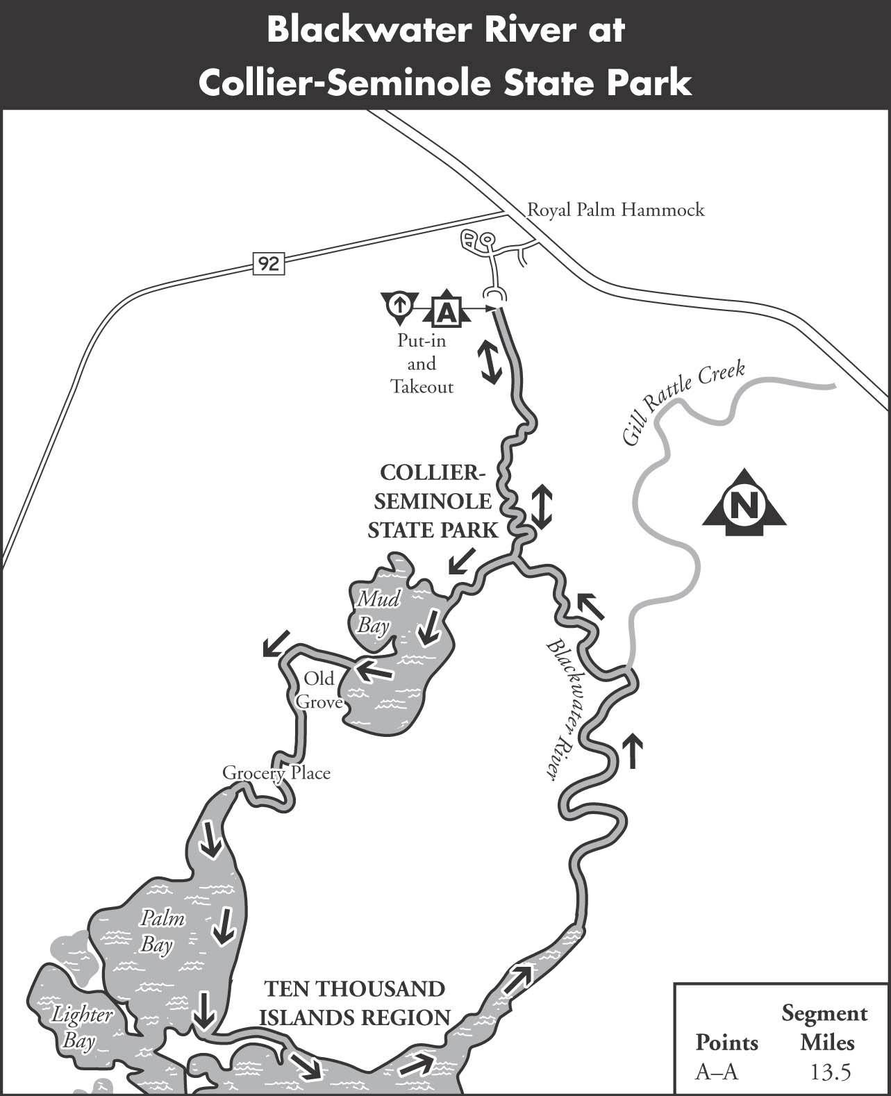
BLACKWATER RIVER AT COLLIER-SEMINOLE STATE PARK
The Blackwater River is part of a 13.5-mile canoe circuit that winds through Collier-Seminole State Park wilderness preserve. This preserve is at the western extreme of the Everglades and features a prime example of the mangrove forest that forms the outer rim of south Florida. The canoe circuit includes tidal creeks and bays as well as the Blackwater River. A diverse community of wildlife, including roseate spoonbills and manatees, inhabits the preserve. The tides add another dimension to paddling in the preserve. Current in the creeks becomes moderately swift during tidal change, and even the Blackwater River reverses flow on the incoming tide.
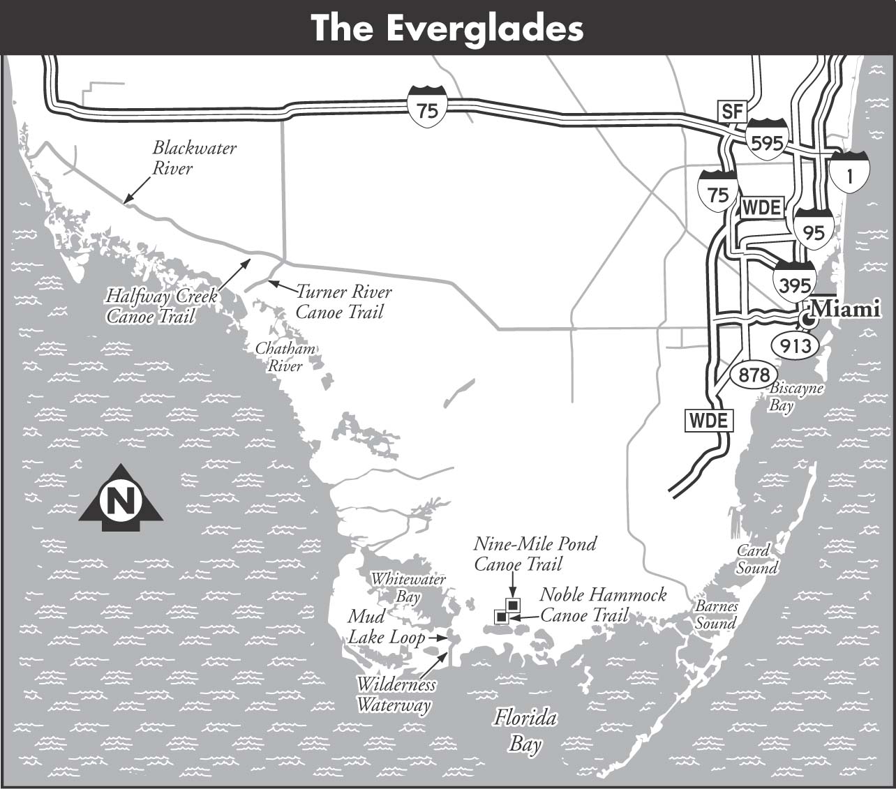
MAPS: COLLIER-SEMINOLE STATE PARK PADDLE MAP, NAUTICAL CHART 11430 LOSTMANS RIVER TO WIGGINS PASS, ROYAL PALM HAMMOCK (USGS)
A Collier-Seminole State Park Loop
| Class | I | |
| Length | 13.5 | |
| Time | 6 | |
| Gauge | Visual | |
| Level | Tidal | |
| Gradient | Tidal | |
| Scenery | A |
DESCRIPTION There are special requirements for canoeing at Collier-Seminole. All paddlers must file a float plan at the entrance station. This requirement is dictated by the high potential for getting lost among the myriad mangrove islands. The rangers will brief all paddlers on the tide situation and stress the necessity for a compass and map (a nautical chart is recommended). All paddlers doing the entire loop must travel counterclockwise through Mud Bay to Palm Bay and then up the Blackwater River. Be prepared to start your trip early in the morning, as you must return to the ranger station by a specific time, unless you are staying at the Grocery Place backcountry campsite, which also requires a permit.
The trip commences at the Collier-Seminole boat ramp. The first 0.5 miles is on a wide man-made channel to the Blackwater River. The upper river is narrow and winds through a mangrove forest. The red mangrove with its characteristic prop roots forms the first echelon of mangrove. The black mangrove, with its hundreds of pencil-like pneumatophore roots sticking out of the muck, is back on higher ground. The trail leaves the Blackwater River at 1.8 miles, where a sign directs paddlers to turn right into a tidal creek. This narrow creek almost forms a tunnel through the mangrove. A small bay marks the 2-mile point, and Mud Bay is close at hand.
Those arriving at Mud Bay at low tide will soon discover the source of its name, as there are areas where canoes must be pulled over mud bars. Bear to the left toward the large island upon entering the bay. Keep to the left side of the island and head into Royal Palm Hammock Creek. West Palm Run comes in on the right as Royal Palm Hammock Creek turns to the south. The Old Grove, one of only two spots of high ground on this trip, is passed on the left at 3.5 miles.
Grocery Place, the other high point and designated camping area, is on the right at the mouth of a stream at 4.5 miles. Early settlers arranged for supply boats to cache provisions on this spot, thus the origin of the name. Royal Palm Hammock Creek enters the open expanse of Palm Bay downstream of Grocery Place. Paddlers should stick to the left bank from this point until reentering Blackwater River.
You will enter the Ten Thousand Islands region at 6 miles, and it is very easy to get lost here among the numerous look-alike mangrove islands. For this reason it is essential to keep the mainland to the immediate left of the canoe. Another mile of paddling and you will enter Blackwater Bay. Continue bearing left and go into the mouth of the Blackwater River. Channel markers are spaced at intervals going up the river. A branch of Gill Rattle Creek is passed on the right at 7.5 miles, as is another sidestream at 10 miles.
SHUTTLE Collier-Seminole State Park is located off US 41 south of Naples.
GAUGE Visual. Try to time your trip with the tides.