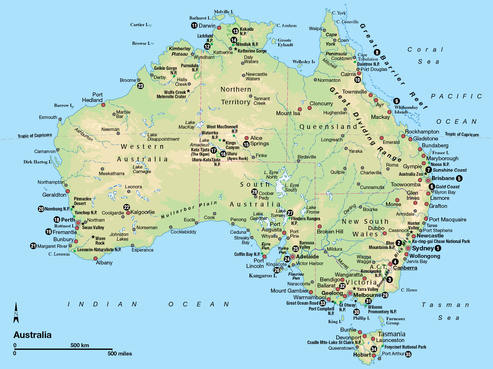
Deciding where to go and what to see in Australia may be the hardest part of the journey. How can you squeeze so much into a limited time? Where do you go in such a vast country?
About 54 million passengers a year fly Australia’s domestic airline routes. Budget airlines make flying from city to city an affordable option, although it’s best to plan ahead to get the best fares and flight times. Alternatives are slower, but often more revealing. Try the transcontinental trains and the long-distance buses, some of which are equipped for luxury travel.
Since you probably can’t see all of it, you’ll have to arrange your tour of Australia to concentrate on seeing a manageable slice or two of the continent. Planning any itinerary requires compromise, depending on the time and funds you have available, the season, your special interests and your choice of gateway city. Sydney is the main gateway into Australia, but some airlines allow you to arrive in Cairns, for example, and depart from Sydney or Perth.
This section of the guide is arranged according to the geography of Australia’s states. Although there is no visible difference between the red deserts of the Northern Territory and those of South Australia, it’s practical to consider them in the context of the political frontiers. Besides, the way that history and chance carved Australia into states comes close to providing a fairly natural division into sightseeing regions.
In each state or territory we start with the capital city gateway and fan out from there. We begin where European settlement of Australia began, at Sydney Cove. After a side trip to the federal capital, Canberra, we continue beyond New South Wales, in an anti-clockwise circuit from Queensland to Victoria, ending with a look at the continent’s lovely green footnote, Tasmania.
NEW SOUTH WALES
Sydney can’t help but dominate New South Wales (NSW), if only because most of the state’s population lives in the capital. However, beyond the metropolis, the state – six times the size of England – is a varied patchwork of terrain, lurching from dairyland and desert to vineyards and craggy mountains.
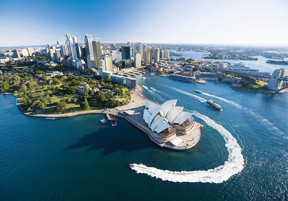
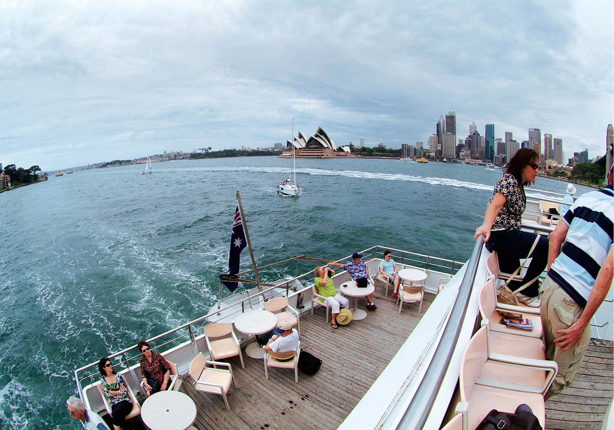
Sydney, with the famous Opera House in the foreground
Hamilton Lund/Tourism NSW
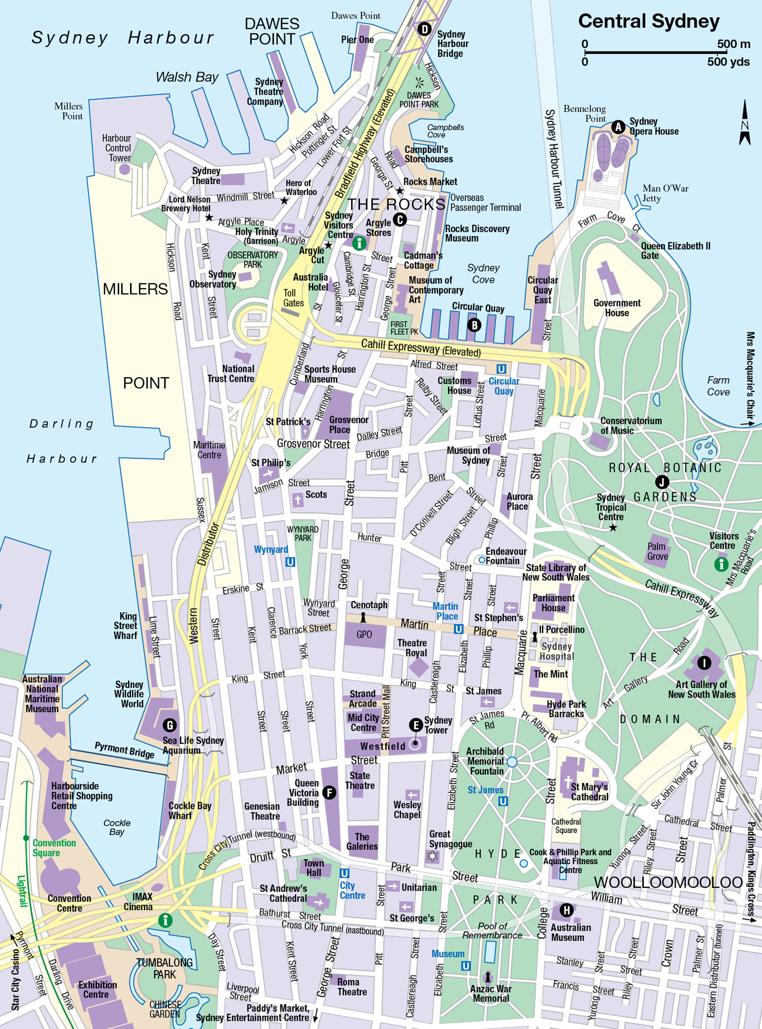
Sydney 1 [map] is Australia’s oldest, liveliest and biggest city (total population 4.6 million). If the world had a lifestyle capital, Sydney would be a strong contender –ironic considering it began life as a British penal colony. Sydney is sun-drenched, brawny, energetic, fun loving and outdoor obsessed. The city ranks well on international lists of favourite tourist destinations; its residents know this and they revel in it. After hours – and Sydneysiders do live for the after hours – Sydney offers every imaginable cosmopolitan delight. It’s a sunny coincidence that beaches famous for surfing and scenery are only minutes away.
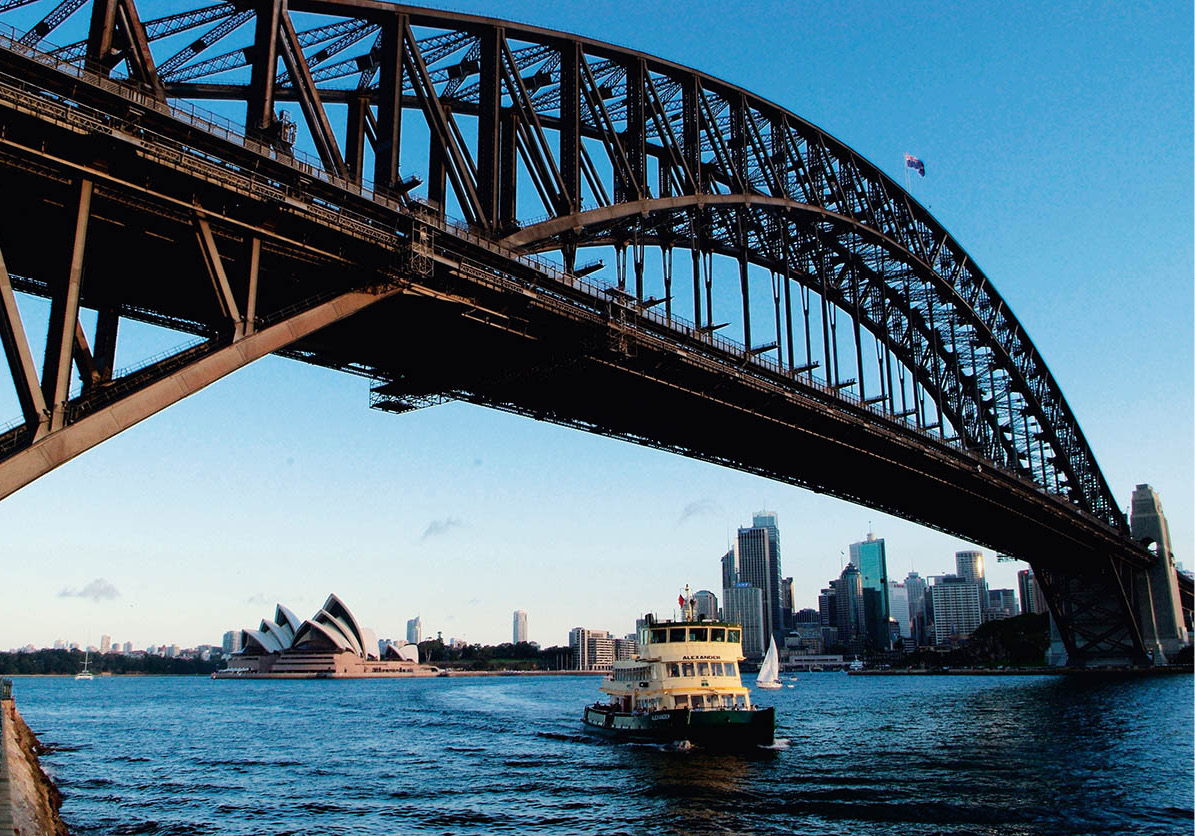
Sydney Harbour has been stealing the show ever since the first convicts arrived in 1788. For a quick appreciation of the intricacies of Port Jackson (the official name for Sydney Harbour), gaze out from the top of Sydney Tower, Sydney’s tallest building. From here you can see the clear blue tentacles of water stretching from the South Pacific into the heart of the city. Schools of sailing boats patrol the harbour, shattering the reflection of skyscrapers, the classic Sydney Harbour Bridge and the iconic opera house. It’s a pity that James Cook never noticed this glorious setting as he sailed right past on his way home to England from Botany Bay. Sydney Harbour National Park fringes a long, leafy stretch of the northern side of the harbour and also includes some harbour islands and a chunk of the southern foreshore. For information about harbour sights, click here. Exploring Sydney Harbour is as easy as jumping on a commuter ferry or taking a sightseeing tour. Most tours – by land or sea – leave from Circular Quay.
Most of the world’s great cities have a famous landmark that serves as an instantly recognisable symbol. Sydney has two: the perfect steel arch of Sydney Harbour Bridge and the billowing shell-like roofs of the Sydney Opera House. That’s what happens when engineers and architects embellish a harbour coveted by artists as well as admirals.
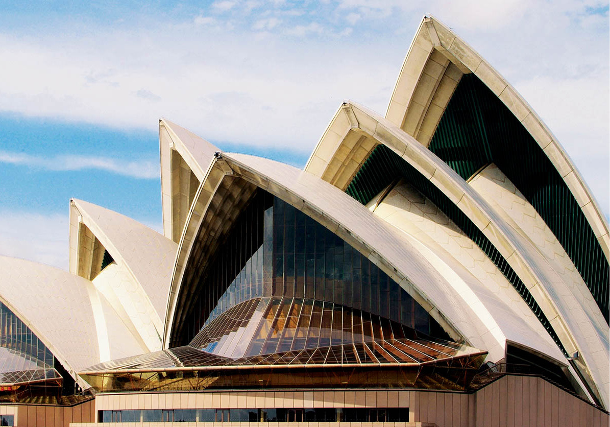
The cream ‘sails’ of the Opera House gleam in the sun
Glyn Genin/Apa Publications
Sydney Opera House
There’s a real sense of occasion and style about the structure of the Sydney Opera House A [map] (www.sydneyoperahouse.com; guided one-hour tours daily, every half-hour 9am–5pm), both inside and out. This unique building, covered in a million tiles, has achieved the seemingly impossible by improving a virtually perfect harbour. Yet its controversial architect left the country in a huff at an early stage of the building’s construction.
Pre-opera house, the promontory was the location of a tram depot, but in the 1950s the government of New South Wales decided to build a performing arts centre on the site. In 1957, a Danish architect called Jørn Utzon won an international competition to design the building. His novel plan included problems of spherical geometry so tricky that he actually chopped up a wooden sphere to prove it could be done. The shell of the complex was almost complete when Utzon walked out in 1966 due to pressure from the state government; the interior, which was in dispute, became the work of a committee. Despite this, from the tip of its highest roof (67 metres/220ft above sea level) to the Drama Theatre’s orchestra pit (more than a fathom below sea level), this place oozes grace, taste and class.
In 2002, Utzon was awarded the Pritzker Prize, architecture’s version of the Nobel Prize, and in 2004 a room in the Opera House was named after him, complete with a 14-metre long, floor-to-ceiling woollen tapestry designed by the architect installed inside. But Utzon never returned to Sydney; he died in 2008 without ever laying eyes on his finished masterpiece.
Sailing through the Harbour
Glyn Genin/Apa Publications
Circular Quay
Although cruise ships and water taxis also dock here at Circular Quay B [map] (short for Semi-Circular Quay, as it was more accurately originally named), most of the action involves ferries, which sail to various destinations including the zoo (for more information, click here) and seaside suburbs such as Manly (for more information, click here). The quay’s high-paced flow of human traffic includes hasty travellers, leisurely sightseers, street musicians, artists, hawkers and people just ‘hanging out’. Whether you see Australia’s busiest harbour from the deck of a luxury liner, a sightseeing boat, or a humble ferry, don’t miss experiencing this invigorating angle on the city’s skyline.
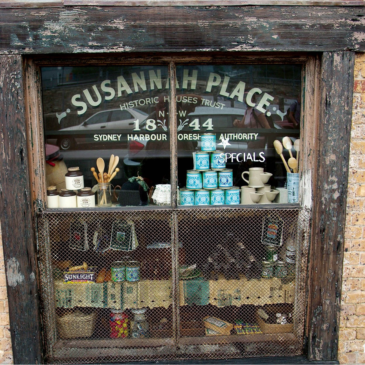
Susannah Place is an example of a working-class terrace
Glyn Genin/Apa Publications
The Rocks
To see where it all began, stroll through the charming streets of The Rocks C [map] (www.therocks.com), just west of Circular Quay. You can take a 90-minute guided walking tour (tel: 02-9247 6678 to book) or conduct your own tour. Here modern Australia’s founding fathers – mostly convicts who had been charged with anything from shoplifting to major forgery – came ashore in 1788 to build the colony of New South Wales. This historic waterfront district has everything a traveller could want: lovely views at long and short range, moody old buildings, cheerful plazas and plenty of distractions in the way of shopping, eating and drinking. There are plenty of tourists too.
But it nearly was not so. The Rocks was once one of Sydney’s most squalid and dangerous quarters, a Dickensian warren of warehouses, grog shops and brothels, where the rum was laced with tobacco juice and the larrikin ‘razor gangs’ preyed on the unwary. An outbreak of bubonic plague in 1900 was another low-light in The Rocks’ sordid history.
The whole area was due to be levelled for redevelopment in the 1970s, but there was fierce resistance from residents and academics, and the project was thwarted when the construction unions, led by activist Jack Mundey, refused to start work. This was the beginning of the Green movement to preserve the antiquities and atmospheric elements of Old Sydney.
A wide range of local leaflets and maps is on offer at the Sydney Visitor Centre (corner Argyle and Playfair streets; www.shfa.nsw.gov.au; daily 9.30am–5.30pm). You can book tours there as well.
Nearby, Cadman’s Cottage is central Sydney’s oldest (1816) surviving house – a simple stone cottage occupied for many years by the government’s official boatsman. It’s now the information centre for Sydney Harbour National Park. Not far away, the Museum of Contemporary Art (www.mca.com.au; daily 10am–5pm; free) gives new life to an Art Deco building. The museum’s collection ranges from Aboriginal bark paintings to the latest – and strangest – installation works. There are also plenty of touring exhibitions. The café on the terrace (with harbour view) is excellent.
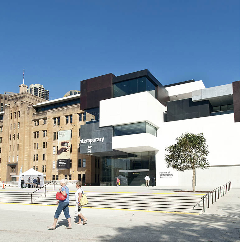
The Museum of Contemporary Art
Dreamstime
Just south of The Rocks, on Bridge Street on the site of the first Government House, the fascinating Museum of Sydney (daily 9.30am–5pm; charge) promises to take visitors on ‘a journey of discovery’ from 1788 to the present day.
North of Cadman’s Cottage are solid 19th-century bond stores, now converted to offices and shops such as Campbell’s Storehouse (which sells food, souvenirs, arts and crafts). Heading west from Cadman’s Cottage you’ll arrive at the similar Argyle Stores. Beyond is the Argyle Cut, a massive gap through the sandstone cliffs that was initially hacked out by convict labour-gangs using pickaxes.
At the top of Argyle Cut, Cumberland Street provides pedestrian access to Sydney Harbour Bridge via a set of steps. An unusual vantage point for viewing the bridge, the harbour and the skyline – from the top of one of the bridge’s massive pylons – can be accessed here. The Pylon Lookout (www.pylonlookout.com.au; daily 10am–5pm; charge) is in the southeast tower, which also contains a museum.
Not far away, the Australian Hotel, a friendly pub in the older Aussie tradition, stocks beers from every state in the country. It is one of only two pubs in Sydney to serve Bavarian-style unfiltered beers created by brewer Geoff Scharer, acclaimed as the best in Australia.
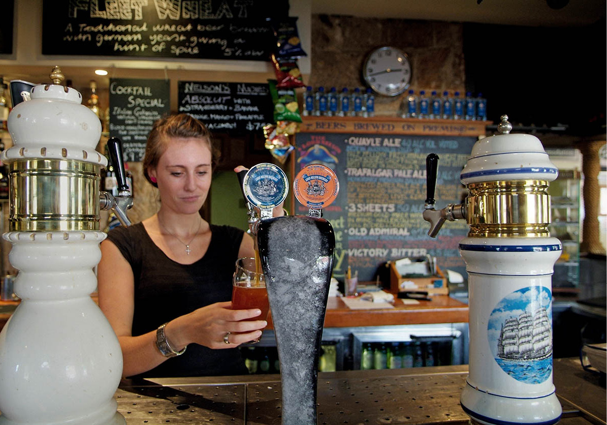
Pulling pints at the Lord Nelson Hotel
Glyn Genin/Apa Publications
The Rocks Market
Glyn Genin/Apa Publications
A little further on, in Argyle Place, you will find a neat row of terraced houses straight out of Georgian England. Two other old pubs in this area deserve mention. The first, the quaint Hero of Waterloo at 81 Lower Fort Street, was built in 1843 on top of a maze of subterranean cellars through which drunken patrons were conveyed to be sold as crew to unscrupulous sea captains; that practice has died out but the cellars remain. The second, the Lord Nelson Brewery Hotel, a square sandstone block of a building at the corner of Kent and Argyle Street, was built around 1840 and has maintained something of a British naval atmosphere ever since. It brews its own beers, some of them pretty potent.
For history without the refreshments, visit the sandstone Garrison Church, officially named the Holy Trinity Anglican Church, which dates from the early 1840s. As the unofficial name indicates, it was the church for members of the garrison regiment, the men in charge of the convict colony. It’s now a fashionable place to get married.
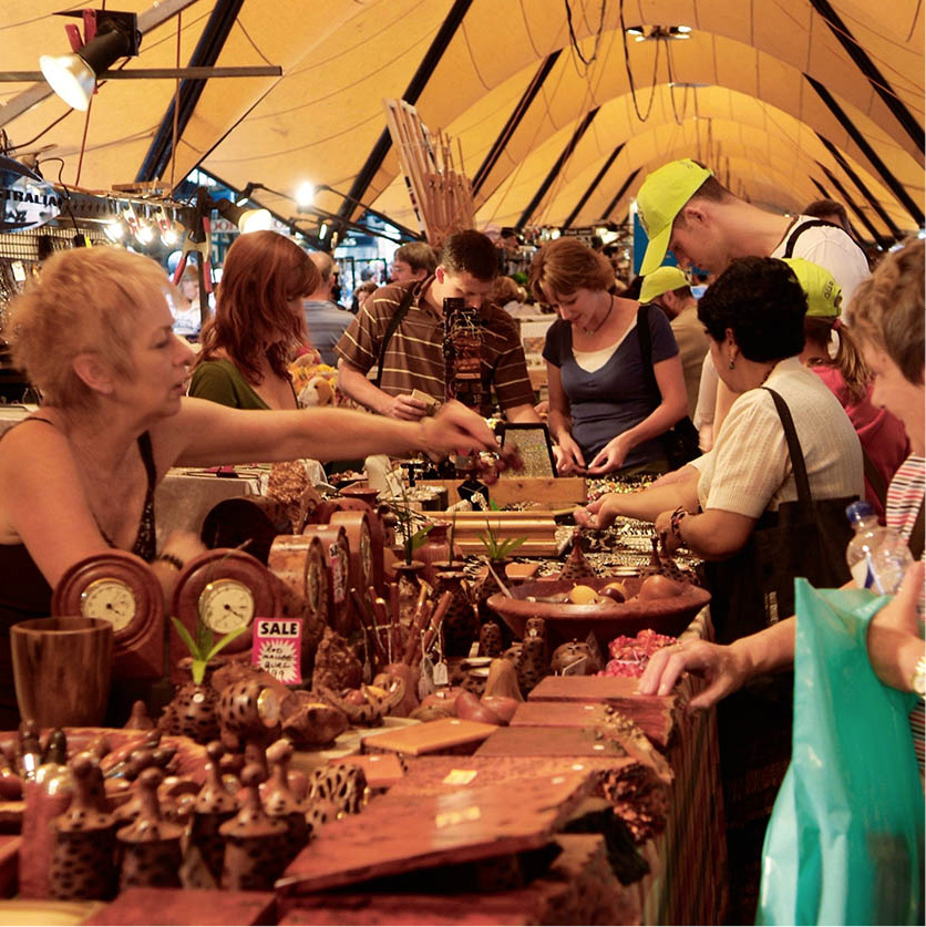
At the start of George Street, close to the Irish-influenced Mercantile Hotel, The Rocks Market (Sat–Sun 10am–5pm) takes place every weekend under a 150-metre (492-ft) long canopy. Street entertainers perform, while stall-holders sell crafts, souvenirs, toys and gifts. Nearby, Customs Officers Stairs lead down to some charming harbour-side restaurants housed in old bond stores, fronting Campbells Cove. Just across the harbour is the Opera House.
Overhanging The Rocks, Observatory Park is a perfect place from which to gaze at the sky or at Sydney Harbour. Observatory Hill here is the highest point in the city, visible for kilometres around. Since the middle of the 19th century, every day at 1pm precisely, a ball is dropped from the top of a mast to enable sea captains to check their chronometers. Sydney Observatory (www.sydneyobservatory.com.au; daily 10am–5pm) is now a museum of astronomy, and opens every evening (times vary according to season) for talks, films and star-gazing (bookings, tel: 02-9921 3485).
Another favourite lookout is Dawes Point Park, where a scattering of old cannons provides the perfect perch for watching the ferries and sailing boats.
The Sydney Harbour Bridge
Glyn Genin/Apa Publications
Here, you’re in the shadow of the Sydney Harbour Bridge D [map], with its drive-through stone pylons (purely ornamental) and colossal steel arch. The bridge stars on television each New Year’s Eve, when it serves as a platform for a spectacular fireworks display to bid farewell to the old year and welcome in the new. Pyrotechnics are fired from the arch and more fireworks on the road-span create a Niagara-like cascade into Sydney Harbour.
Linking the city and the north, the bridge’s single arch is 503 metres (1,650ft) across – wide enough to carry eight lanes of cars and two railway tracks, as well as lanes for pedestrians and cyclists. When it was built, during the Great Depression, Sydneysiders called the bridge the Iron Lung, because it kept a lot of people ‘breathing’ – by giving them jobs. It takes 10 years to repaint the steel-grey bridge, at the end of which it’s time to start again. To ease traffic congestion a tunnel has also been built under the harbour.
Pipped at the post
In 1932, at the opening ceremony of the Harbour Bridge, an Irish-born member of a proto-fascist group, Francis Edward de Groot, rode up on a horse and sliced through the ribbon with a sword before the left-wing premier of NSW, Jack Lang, could cut it.
A company called BridgeClimb (tel: 02-8274 7777; www.bridgeclimb.com.au; charge) conducts guided walks for small groups over the bridge’s massive arches. Not across the walkway below, but over the arches above. For decades, groups of daredevils had been doing this illicitly. Since the legal climb began in 1998 the waiting list has grown quite long and it pays to book your climb as far in advance as you can. You can even do the climb at dawn, twilight or at night, though excursions are understandably postponed during electrical storms. It’s not a cheap thrill: tickets start from A$198, and cost more for twilight or dawn climbs or at weekends (minimum age 10).
City Centre
A similar tour operates from the top of Sydney Tower E [map] (Centrepoint, corner of Pitt and Market streets; tel: 02-9222 9491; www.sydneytowereye.com.au; daily 9am–10.30pm, till 11.30pm Sat; charge). Skywalk offers walks outside the tower’s turret, the city’s highest vantage point, at 305 metres (1,001ft) above the street. Those without a head for heights can still take in the view; in the lifts it takes only 40 seconds to reach the observation decks, where amateur photographers get that glazed look as they peer through the tinted windows to unlimited horizons. On a flawless day you can see all the way north to Terrigal and south to Wollongong, far out to sea to the east, and as far west as the Blue Mountains. Otherwise, look down at the seething shopping streets around the tower. Pedestrians-only Pitt Street Mall is one of the city’s main retail centres, home to department stores and shops of all kinds. The Strand Arcade, which runs off the Mall, is a grand old shopping arcade full of upmarket boutiques.
A short distance towards the harbour is the city’s main square, Martin Place, flanked by the imposing Victorian General Post Office (GPO) building. This has been imaginatively converted into a stylish modern complex including a five-star hotel.
The ornate Queen Victoria Building
Glyn Genin/Apa Publications
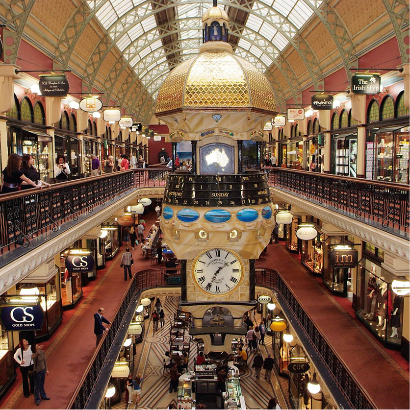
From the same era, but even grander, the sandstone Queen Victoria Building F [map] (www.qvb.com.au; Mon–Sat 9am–6pm, Thur 9am–9pm, Sun 11am–5pm) occupies a whole block on George Street opposite the Town Hall. The Byzantine-style ‘QVB’ began as a municipal market and commercial centre, including a hotel and a concert hall, topped by statues and some 21 domes.
Built in 1898 to commemorate Queen Victoria’s Golden Jubilee, it was faithfully restored in the 1980s to create a magnificent all-weather shopping centre housing nearly 200 chic boutiques, cafés and restaurants, in a cool and unhurried atmosphere of period charm. Pierre Cardin called it ‘the most beautiful shopping centre in the world’. The Galeries (www.thegaleries.com), across George Street, offer yet more shopping opportunities in a modern space.
Next door to the QVB, Sydney’s Town Hall (www.sydneytownhall.com.au; daily 9am–5pm) enlivens a site that used to be a cemetery. The Victorian-era building, home of the city council, is also used for concerts and exhibitions. The Anglican St Andrew’s Cathedral next to it dates from 1868.
Performers in Chinatown
Hamilton Lund/Tourism NSW
Chinatown and Darling Harbour
After dark, young Sydneysiders flock to the section of George Street heading south from the Town Hall, lined with video entertainment arcades, fast-food joints and a cinema complex. Sydney’s fledgling Spanish Quarter begins nearby on the corner of George Street and Liverpool Street – there’s a choice of tapas bars here.
In the adjacent Chinatown district, gourmets can enjoy the delights of Peking, Cantonese and Szechuan cuisine. The substantial local Chinese community is joined here by Sydneysiders and tourists enjoying the Chinese cafés, restaurants and shops selling exotic spices and knick-knacks. The district’s centrepiece is Dixon Street, a pedestrian zone framed by ceremonial gates.
If you’re in the area at the right time, check out Paddy’s Market in Hay Street (Wed–Sun 9am–5pm), a brick building beneath a skyscraper called Market City. Paddy’s is full of stalls selling almost anything from seashells and sunglasses to fruit and vegetables. Market City has plenty of Chinese and other Asian eateries to satisfy hunger pangs.
Nearby, the modern leisure precinct of Darling Harbour is well stocked with shops, restaurants and attractions, and a light rail system links it to more central areas. On the city side of Darling Harbour lie Cockle Bay Wharf and King Street Wharf, complexes of bars and restaurants. These areas have proved much more popular than the shopping and dining complex overlooking the harbour on the western side, mainly because they are easier to reach on foot from downtown Sydney.
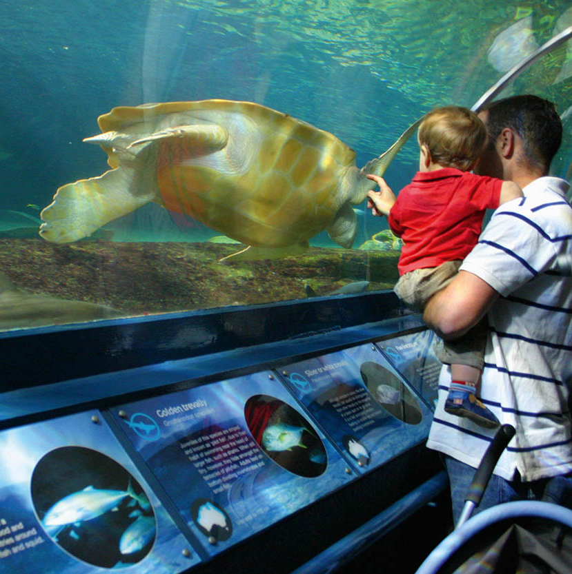
Kids love Sydney Aquarium
Dreamstime
Not far away, Sea Life Sydney Aquarium G [map] (www.sydneyaquarium.com.au; daily 9am–8pm; charge), relaunched as a Sea Life Centre in 2012 after a A$10 million refurbishment, is one of the largest aquariums in the world. In its oceanarium, large sharks weigh up to 300kg (660lb) and measure over 3.5 metres (11ft) long. The Great Barrier Reef Complex is home to hundreds of colourful species, and a visit there is the closest thing to diving on the actual reef. The adjacent Sydney Wildlife World (www.sydneywildlifeworld.com.au; daily 9am–5pm; charge) is a mini-zoo showcasing a selection of native fauna, from lizards and snakes to parrots and wallabies. The star attractions, however, are the koalas, which, for an extra fee, you can have your photo taken with.
Other nearby attractions include the Australian National Maritime Museum (www.anmm.gov.au; daily 9.30am–5pm, till 6pm in Jan; charge), a Chinese garden (daily 9.30am–5pm), an IMAX cinema, and the Sydney Entertainment Centre (www.sydentcent.com.au), which is used for concerts. Beyond the Maritime Museum, in Pyrmont, is Star City Casino (daily 24 hours).
Hyde Park
Glyn Genin/Apa Publications
Parks and Gardens
Although Sydney’s lush Hyde Park is only a fraction the size of its namesake in London, it still provides the same sort of green relief. Like most big-city parks, however, it should be avoided after sunset. The most formal feature of the semi-formal gardens, the Anzac War Memorial, commemorates the World War I fighters in monumental Art Deco style, with later acknowledgments to World War II soldiers.
Sightseers interested in old churches should mark a few targets on the edge of Hyde Park. To the north, the early colonial St James’ Church in Queens Square was the work of the convict architect Francis Greenway. Just across College Street on the east is the Catholic St Mary’s Cathedral.
You can view the cathedral’s spires while immersed in a swimming pool next door at Cook + Phillip Park Aquatic and Fitness Centre (www.cookandphillip.org.au; Mon–Fri 6am–10pm, Sat–Sun and public holidays 7am–8pm; charge). You can’t readily see the complex from the street, yet when you’re inside, its huge windows offer amazing views and let in lots of light. There are three pools – one with a wave machine. There’s a café inside, or, if you want to eat alfresco, Bodhi’s vegan restaurant does good business just outside.
The ornate Great Synagogue (tours Tue and Thur at noon) faces the park across Elizabeth Street. Jews have lived in Sydney since the arrival of the first shipment of prisoners.
The Australian Museum H [map] (tel: 02-9320 6000; http://australianmuseum.net.au/; daily 9.30am–5pm; charge) on College Street specialises in natural history and anthropology, and has lots of activities and events suitable for inquisitive minds. Highlights include a dinosaur gallery (complete with life-size models and 10 complete skeletons), an exhibit of Australia’s megafauna (giant-sized marsupials and flightless birds), a hands-on plant and animal identification centre, a gallery devoted to Australia’s unique ecosystems, the Indigenous Australians exhibition, and a human evolution gallery.
Hyde Park Barracks (http://sydneylivingmuseums.com.au; daily 9.30am–5pm; charge), designed by Greenway and located between Hyde Park and the Botanic Gardens, is now a museum of social history. On the top floor, one large room features a reconstruction of the dormitory life of the prisoners who once slept there. Next door, the Mint (10 Macquarie St; tel: 02-8239 2288; http://sydneylivingmuseums.com.au; daily 9am–5pm; free) processed gold-rush bullion in the mid-19th century.
Art Gallery of New South Wales
Glyn Genin/Apa Publications
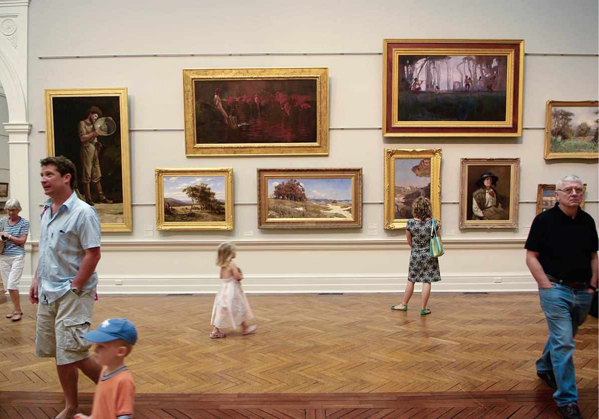
Another large park adjacent to Hyde Park is called the Domain, where concerts are held in summer. On one side of the Domain is the Art Gallery of New South Wales I [map] (www.artgallery.nsw.gov.au; daily 10am–5pm; free, charge for exhibitions) consisting of a formal exterior decorated with much bronze statuary and a modern extension that infuses light into the building and provides sweeping views of east Sydney, part of the harbour, and the suburb of Woolloomooloo. An afternoon at the art gallery will give you a crash course in more than a century of traditional and modern Australian art. The Yiribana Gallery is devoted to Aboriginal art and Torres Islander art (guided tours daily 1pm; free).
The Royal Botanic Gardens J [map] (www.rbgsyd.nsw.gov.au; daily 7am–sunset; free guided walks daily at 10.30am) began as a different sort of garden; here the early colonists tried – with very limited success – to grow vegetables. Only a few steps from the busy skyscraper-world of downtown Sydney, you can relax in the shade of Moreton Bay fig trees, palms or mahoganies, or enter the Sydney Tropical Centre (daily 10am–4pm; charge), two glass pyramids full of orchids and other tropical beauties. Near the Tropical Centre, overlooking the duck pond, is a café-restaurant where you can relax in peaceful surroundings.
There are several entrances to the gardens and many paths; the most popular entrance is by the Opera House. From here the gardens curve down around Farm Cove to a peninsula called Mrs Macquarie’s Chair. The lady thus immortalised, the wife of the go-ahead governor, used to admire the view from here. Nearby is the venue for the summer season of outdoor films that are shown here during the Sydney Festival (www.sydneyfestival.org.au) and during the St George OpenAir Cinema season (www.stgeorgeopenair.com.au). There’s a lot to see in the Gardens, and if you’re feeling tired, you can take advantage of the hop-on hop-off Trackless Train, which does a 20-minute loop between the Opera House Gate and the Woolloomooloo Gate near the Art Gallery.
Centennial Park, most easily reached from the eastern end of Oxford Street in the inner-city suburb of Paddington, has provided greenery and fresh air to city folk since 1888, when it was dedicated – on the centenary of Australia’s foundation – to ‘the enjoyment of the people of New South Wales forever’. The park’s 220 hectares (544 acres) of trees, lawns, duck ponds, rose gardens and bridle-paths are visited by about 3 million people a year, who cycle, roller-blade, walk dogs, feed birds, play sports, fly kites, picnic and barbecue.
If you fancy a ride on the bridle path, horse rental can be arranged from Moore Park Stables (tel: 02-9360 8747; www.mooreparkstables.com.au). Bicycles and pedal-carts can be hired from Centennial Park Cycles (tel: 02-9398 5027; www.cyclehire.com.au). Centennial Park Kiosk is a lovely setting for a meal and a glass of wine. Beside it stands a charming, if curious, modern stone fountain.
The Belvedere Amphitheatre here provides an outdoor venue for events and productions. In summer, a popular Moonlight Cinema programme (tel: 1300 551 908; www.moonlight.com.au) is held there. Films start at about 8.30pm, and tickets are available in advance from the website or at the gate from 7pm.
Elizabeth Bay House
Glyn Genin/Apa Publications
Kings Cross and Paddington
East of the Domain is the district of Woolloomooloo – a wonderful word, the origins of which cause some debate, but either mean ‘place of plenty’ or refer to a young black kangaroo. Woolloomooloo was threatened by demolition in the 1970s, but was saved by resident protests and union ‘green bans’.
East of Woolloomooloo, bright lights and shady characters exist side by side in Kings Cross, just one railway stop from Martin Place. ‘The Cross’, is Sydney’s version of Pigalle, in Paris, or London’s Soho – neon-filled, a bit tacky but rather fun, crawling with hedonists of all persuasions. Action continues 24 hours a day, with a diverting cavalcade of humanity – the brightly coloured, the bizarre, the stoned, the happy and the drunk. On weekends, tourists flock to The Cross to glimpse a bit of weirdness. Sometimes though, the weirdest characters they spot are other tourists.
The main drag here is Darlinghurst Road, bohemian verging on sleazy and dotted with strip joints, fast-food outlets, tattoo parlours and X-rated book and video shops, backpacker hostels and cheap hotels. Gentrification is progressing rapidly, however, and several stylish bars, restaurants and hotels have opened. The neighbouring area of Potts Point offers good eating – try Fratelli Paradiso just off Macleay Street.
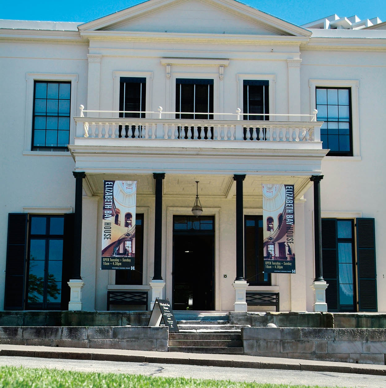
A five-minute walk (and a world away) from Kings Cross Station brings you to Elizabeth Bay House (www.sydneylivingmuseums.com.au; Fri–Sun 9.30am–4pm), a superb example of colonial architecture, built in 1835 and nestled in the posh enclave of Elizabeth Bay.
Paddington Markets
Pierre Toussaint/Tourism NSW
To the southeast of Kings Cross is Paddington, where the bohemian atmosphere and intricate wrought-ironwork (known as Sydney Lace) on the balconies of 19th-century terraced houses, remind many of New Orleans. After decades of dilapidation, it’s now a fashionable, artsy place to live and one of Sydney’s most sought-after suburbs, with house prices to match. ‘Paddo’, as the locals call it, offers plenty of good restaurants, antiques shops, art galleries, bookshops and trendy boutiques. One of the best markets in Sydney, Paddington Markets (www.paddingtonmarkets.com.au; Sat 10am–4pm) is held in the grounds of Paddington Uniting Church, 395 Oxford Street. It offers art and crafts and is enlivened by a variety of street entertainers.
Sydney’s raucous Mardi Gras Parade
iStock
Paddington’s main thoroughfare, Oxford Street, which continues into the neighbouring suburb of Darlinghurst, is one of the hubs of Sydney’s large gay community (others include Surry Hills, Newtown and Erskineville). The Sydney Gay and Lesbian Mardi Gras parade (www.mardigras.org.au), held here in late February/early March, has become a respected institution. The street is home to two good bookshops, Berkelouw and Ariel, and three of its more imaginative cinemas, the Chauvel, the Verona and the Palace Academy Twin. Victoria Barracks is Oxford Street’s renowned example of mid-19th-century military architecture, built by convicts to house a regiment of British soldiers and their families.
Take a harbour cruise to appreciate hidden beaches, islets, mansions old and new, and even a couple of unsung bridges. Various companies run half-day and full-day excursions, or you can hop aboard a commuter ferry and get off wherever you like. If you’re experienced, you could also rent a boat of your own and try weaving around the rest of the nautical traffic.
Fort Denison, situated on a small island, is graphically nicknamed ‘Pinchgut’. Before the construction of a proper prison, the colony’s more troublesome convicts were banished to the rock to subsist on a bread-and-water diet. In the middle of the 19th century the island was fortified to guard Sydney from the threat of a Russian military strike. Ironically, an attack finally came in World War II when an American warship, conducting target practice, hit old Pinchgut by mistake. You can visit Fort Denison, but only as part of a guided tour conducted by a national parks ranger (to book, tel: 02-9247 5033).
Taronga Zoo (www.taronga.org.au; daily 9.30am–5pm; charge), a 12-minute ferry ride from Circular Quay, has an excellent collection of native and exotic animals in a superb setting. Over the heads of the giraffes you can see across the harbour to the skyscrapers of Sydney. The zoo’s Nocturnal House features indigenous night-time creatures illuminated in artificial moonlight, unaware of onlookers. The Rainforest Aviary houses hundreds of tropical birds. If you arrange your visit around feeding times, you can watch the keepers distribute food while they give talks about their charges.
For excellent views of the city and harbour, catch a ferry to Cremorne Point. A paved path winds from here along the shore of Mosman Bay to the ferry wharf, a distance that can be covered easily in about 90 minutes, from where you can catch a ferry back to Circular Quay.
Sailing on Watsons Bay
Glyn Genin/Apa Publications
Another popular ferry destination is Watsons Bay in the Eastern Suburbs. This suburb began as a small fishing community and it still retains a village-like atmosphere. Doyle’s on the Beach seafood restaurant is located close to the ferry wharf, with wonderful harbour views. Nearby Camp Cove is a beach and picnic spot. A 30-minute walk from the beach along the foreshore leads to South Head, one of the headlands at the entrance to Sydney Harbour. The views are spectacular and the place gets packed each Boxing Day for the dramatic start of the Sydney to Hobart yacht race (www.rolexsydneyhobart.com).
Also accessible by ferry are Kirribilli – directly across the harbour from the city and also reached by foot over the Harbour Bridge – and Balmain, to the west of Circular Quay. Both places have lively café-and-restaurant strips and great harbour views from foreshore parks.
A quick trip from the city by bus or taxi is Vaucluse House (www.sydneylivingmuseums.com.au; Fri–Sun 10am–4.30pm, daily in Jan; charge). This splendid, 15-room mansion, begun in 1803, has its own beach, and comes complete with mock-Gothic turrets and battlements. A short walk away, down Coolong Road, is Nielsen Park, a bushland reserve that has a popular beach, as well as a café. There are good harbourside walks here too.
Surf Beaches
Further afield, both north and south of Sydney, are many kilometres of inviting beaches. Manly got its name when the first governor of the colony thought that the Aborigines sunning themselves on the beach looked manly. This pleasant resort, reached by ferry or Jetcat from Circular Quay, has back-to-back beaches – a sheltered harbour beach on one side, an ocean-facing surf beach on the other – which are linked by the Corso, a lively promenade full of restaurants and tables for picnickers.
Beyond Manly, beaches stretch all the way to Sydney’s northern limits. Among these are Curl Curl and Dee Why (which offer good surfing), Collaroy and Narrabeen (with sea pools ideal for families), and Newport, Avalon and Whale Beach (a good spot for surfing).
At the northern tip of the Sydney beach region is Palm Beach, which is in a class of its own. The beautifully manicured gardens and villas for millionaires occupy the hills of the peninsula behind the beach. You can get to Palm Beach by taking the 190 bus from outside Wynyard railway station in the city centre; the trip takes about an hour.

The golden sands of Bondi, Australia’s best-known beach
Glyn Genin/Apa Publications
Bondi is a favourite with surfers and an Australian icon. The varied characters on the sand range from ancient sun worshippers to topless bathing beauties, and include quite a few pink British backpackers. Families tend to congregate at the northern end, where there is a wading pool. The beach gets very crowded on summer weekends. Set back from the beach, Bondi Pavilion has a café and bar, and is a good place for people-watching. Behind it is Bondi’s main promenade and restaurant strip, Campbell Parade.
A string of lesser-known but lovely beaches stretch out to the south of Bondi, including Tamarama, Clovelly, Bronte and Coogee. These are best reached on foot by a scenic coastal walking track that starts at the southern end of Bondi beach. It takes about an hour to walk to Bronte; allow half an hour more for the Bronte to Coogee stretch. Buses run from Coogee to the city.
Olympic Sydney
Since the 2000 Games, Sydney’s magnificent, purpose-built Olympic Park (www.sydneyolympicpark.com.au) has been used for a range of activities and around 5,000 events are now staged there each year. The best way to get there is to catch a Parramatta Rivercat ferry from Circular Quay; these depart hourly and provide a 50-minute scenic river trip before you alight at Olympic Park wharf.
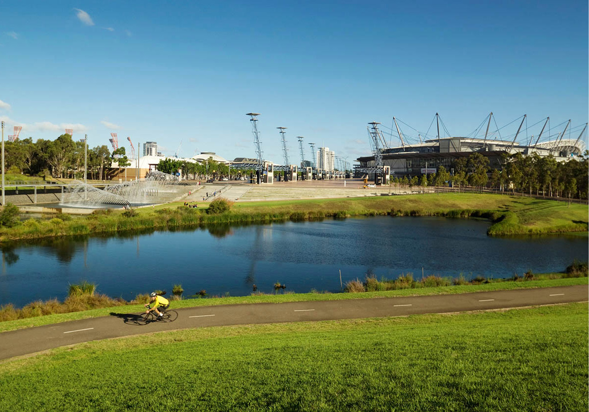
Sydney Olympic Park
iStock
The graceful, parabola-shaped centrepiece of Olympic Park, ANZ Stadium (www.anzstadium.com.au; guided tours from 11am), was Sydney’s premier Olympic venue; it now hosts football games of all codes, from rugby league to soccer and Aussie rules, as well as cricket games, and also stages the occasional concert.
Not far away is Sydney Olympic Park Aquatic Centre (www.aquaticcentre.com.au; Mon–Fri 5am–9pm, Sat–Sun 6am–8pm). Besides its pools, the centre has five spas, a river ride, spray jets, spurting ‘volcanoes’ and a water slide.
Surrounding these and other venues are extensive parklands, good for gentle walks and picnics. There is also a small number of cafés and restaurants.
Excursions from Sydney
Within striking distance of Sydney – by car, train, or sightseeing bus – a diverse choice of destinations shows the variety of attractions offered by New South Wales. Trips to any of these places will deepen your understanding of Australia and its culture.
Going West
A 90-minute trip west of Sydney by road brings you to the Blue Mountains 2 [map], a dramatic region of forested ravines and pristine bushland that is World Heritage listed. The Blue Mountains offer a wealth of adventure activities, art and craft galleries, and romantic escapes in grand country lodges or cosy bed and breakfasts.
The name derives from the mountains’ distinctive blue haze, produced by eucalyptus oil evaporating from millions of gum trees. Well-marked walking trails criss-cross Blue Mountains National Park, passing streams and waterfalls, descending into cool, impressive gorges, and snaking around sheer cliffs. This breath-taking environment is easily reached from Sydney, either by road or on a two-hour rail journey. Trains run there several times daily from Central Station.
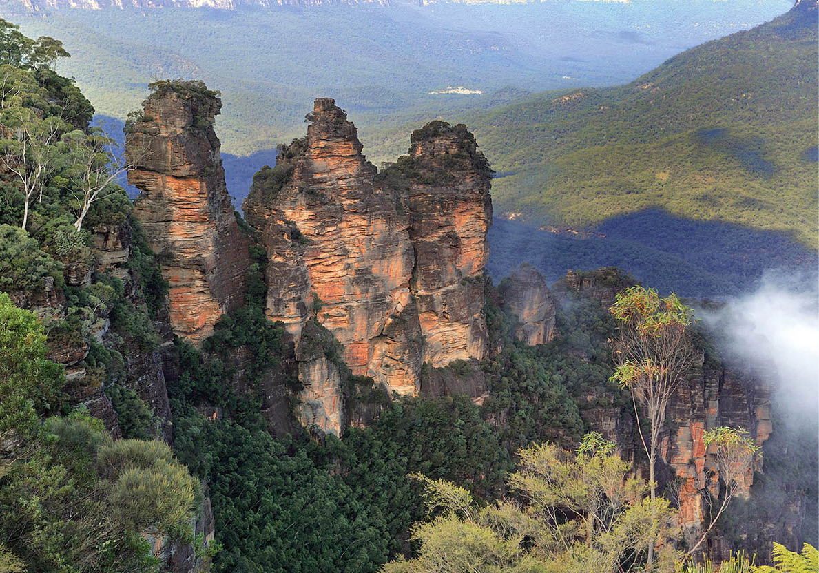
The vast Jamison Valley lies below the Three Sisters
Dreamstime
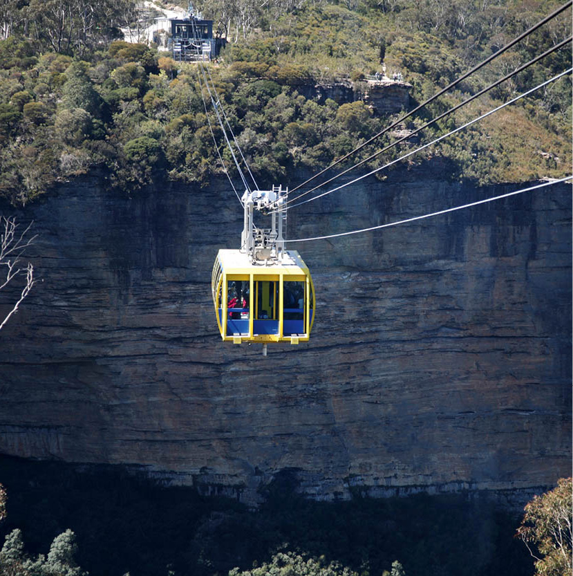
Scenic Cableway
iStock
The region’s best-known rock formation is the Three Sisters, a trio of pinnacles best viewed from Katoomba, the largest of 26 mountain towns. The Scenic Railway, the world’s steepest passenger-carrying railway, descends from the cliff-top at Katoomba into the Jamison Valley. You can walk down a series of steps by the Three Sisters, stroll along a cool and refreshing trail and catch the Katoomba Scenic Rail to the top. Above, the Scenic Skyway carries passengers along a cableway 206 metres (675ft) above the valley floor. The Scenic Cableway descends over 500 metres (1,600ft) into the Jamison Valley.
For a less touristy view of the Blue Mountains, drive to the lookout at Govetts Leap, near Blackheath, 12km (7.5 miles) west of Katoomba. The panorama is magnificent.
Of the numerous walking trails in the Blue Mountains, many involve a steep descent into a valley and a steep climb back to the top. For information about walks in the area, see www.nationalparks.nsw.gov.au.
For more than a century, spelunkers, hikers and ordinary tourists have admired the Jenolan Caves, at the end of a long, steep drive down the mountains west of Katoomba. Guided tours (tel: 1300 763 311; www.jenolancaves.org.au; daily 9am–4.45pm; charge) through the spooky but awesome limestone caverns last about an hour and a half. The atmosphere inside the caves is cool in summer, warm in winter, and always damp.
Heading North
Just north of Sydney is Ku-ring-gai Chase National Park. This area of unspoiled forests, cliffs and heathland fringing the Hawkesbury River, is home to numerous species of animals and birds. There are also many good walking trails through untouched bushland. West Head Lookout, on top of a headland, gives outstanding views of the river and ocean. The Aborigines who lived in this area long before the foundation of New South Wales left hundreds of rock carvings – mostly pictures of animals and supernatural beings. The information centre at Bobbin Head Road, Mount Colah (tel: 02-9472 8949) has maps pinpointing the locations of the most interesting carvings, as well as showing the park’s network of trails.
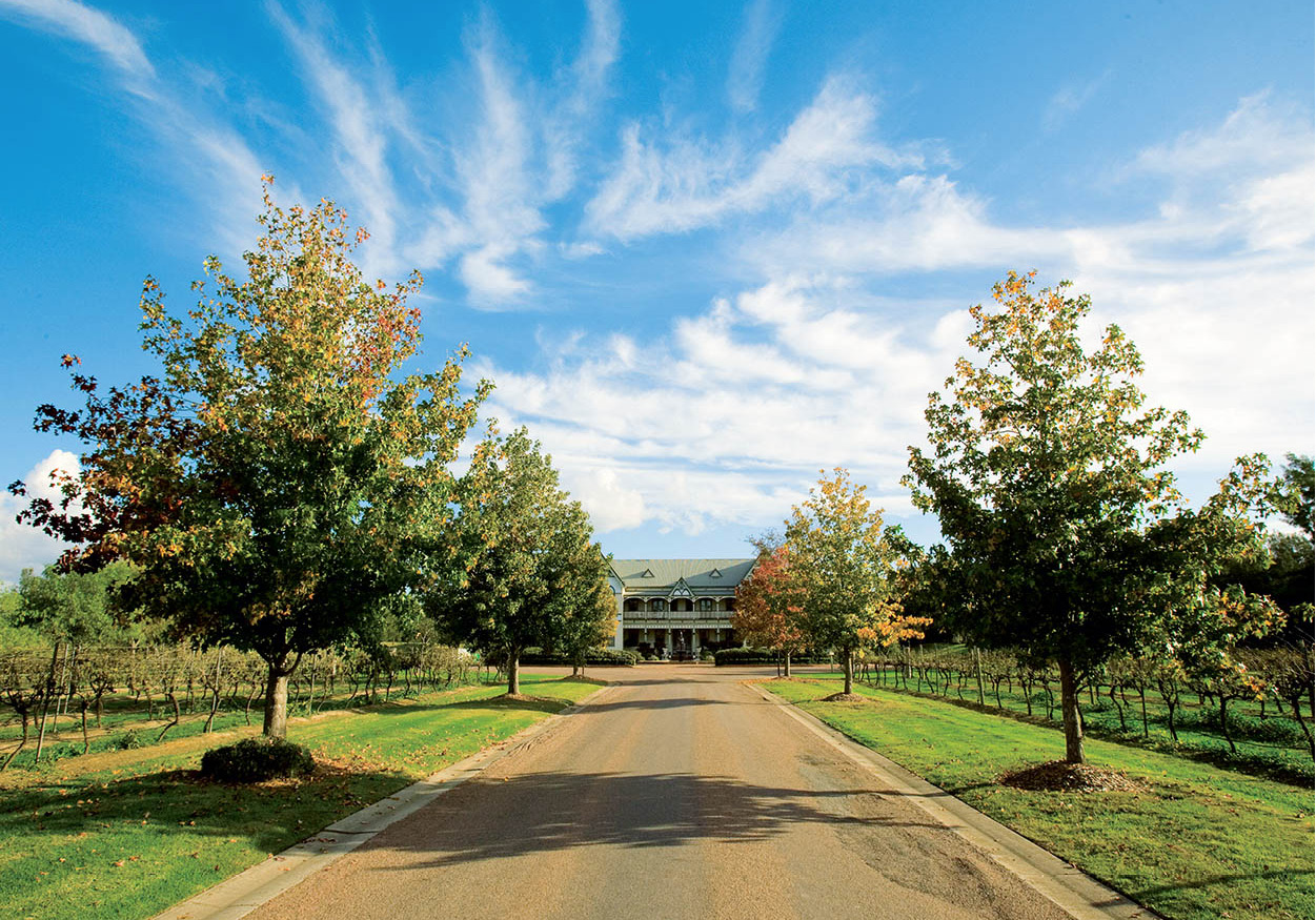
Close to Sydney, the Hunter Valley is a lush, wine-growing region in New South Wales
Tourism NSW
The Hunter
Australia is one of the world’s major wine-producing countries. The Hunter Valley, a two-hour drive north from Sydney, is the premier wine-growing area of New South Wales. The Hunter’s 120 or so wineries harvest grapes in February and March, and welcome visitors throughout the year. The gateway to the Pokolbin region, where the majority of the Lower Hunter Valley wineries are located, is Cessnock, 195km (121 miles) north of Sydney. The tourist information centre, in the nearby town of Pokolbin, supplies touring maps and brochures, or you can join a day tour from Sydney.
Most of the Hunter wineries are open for cellar-door tastings. Some of the major establishments include Tyrell’s, Lindemans, Wyndham Estate, Rosemount Estate, the Rothbury Estate and the McWilliams Estate.
Newcastle, the commercial centre of The Hunter, is located approximately 170km (106 miles) to the north of Sydney. It’s a coalmining and shipbuilding centre, and also offers well-developed recreational activities on the Pacific, the Hunter River and Lake Macquarie, the largest saltwater lake in Australia, very popular with weekend sailors and fishermen from near and far.
Further north, Port Stephens offers safe swimming beaches, a range of water activities and good fishing. Its bay is home to dozens of bottlenose dolphins, which can be viewed up close on a cruise.
In the far north of New South Wales, 790km (490 miles) from Sydney, Byron Bay provides wonderful beaches and great surf. Whale-watching boat trips offer an opportunity to see humpback whales when they migrate along the coast here in June–July and September–October. The town is a haven for alternative lifestylers and millionaires.
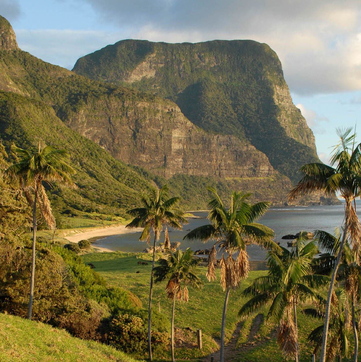
Remote Lord Howe Island, home to some fabulous scenery
iStock
Lord Howe Island
In the South Pacific, 600km (360 miles) east of Port Macquarie, Lord Howe Island is the world’s most southerly coral isle. The snorkelling and scuba diving is splendid here, but non-swimmers can go out in a glass-bottom boat. There are also numerous walking trails, many birds and some unique vegetation.
Forests, beaches, mountains and all, Lord Howe Island only amounts to a speck in the ocean – around 1,300 hectares (3,220 acres) – with a population of about 300 and a couple of cars. Bicycles and motorbikes are ideal for getting around as the roads are very quiet. You can fly out from Sydney or Brisbane in a couple of hours.
Winter sports in the Snowies
Tourism NSW
Heading South
Thanks to a bit of historical gerrymandering, Jervis Bay, 200km (124 miles) south of Sydney, and 260km (161 miles) northeast of Canberra, is not actually part of New South Wales, but a separate Commonwealth territory, like the Australian Capital Territory. New South Wales surrendered the area to Canberra in the early 20th century, in case the future capital ever needed a seaport. The coastal enclave today includes an uncommon combination of facilities: inviting dunes and beaches rub shoulders with the Royal Australian Naval College, a missile range and Booderee National Park. Jervis, named after an English admiral, is correctly pronounced ‘Jarvis’, although locals are starting to rhyme it with nervous. The sand on Jervis Bay beaches is dazzling white and the sea is crystal clear. Dolphin Watch Cruises (tel: 02-4441 6311; www.dolphinwatch.com.au) operate from the town of Huskisson – sometimes you get to see migratory whales as well as dolphins. Not far away, a delightful glade called Greenpatch, in Booderee National Park, offers some remarkably tame wildlife, including kangaroos, wallabies and multicoloured birds.
For more beautiful beaches and tame wildlife, head 95km (60 miles) south from Huskisson to idyllic Murramarang National Park, just before the town of Batemans Bay. There are cabins and camping grounds here, as well as walking trails.
The Snowy Mountains
If you’ve come to Australia in search of snow, you need go no further than the southeastern corner of New South Wales. Skiing in the Snowy Mountains 3 [map] (known as the ‘Snowies’) is usually restricted to July, August and September. But even in the antipodean spring a few drifts of snow remain to frame the wild flowers of the Australian Alps. At the top of this world is Mt Kosciuszko, at 2,230 metres (7,308ft), named after an 18th-century Polish patriot by a 19th-century Polish explorer. This is the birthplace of three important rivers, the Murray, the Murrumbidgee and the Snowy.
Kosciuszko National Park is made up of approximately 6,700 sq km (2,600 sq miles) of the kind of alpine wilderness you won’t see anywhere else: buttercups and eucalyptus and snow, all together in the same breath-taking panorama. Numerous hiking trails make for beautiful summer walks, and outside of the white season you’ll barely see anyone. Cars must be equipped with snow chains from 1 June to 10 October. However, even during the summer months the weather can change for the worse at very short notice, so be sure always to carry a warm, waterproof jacket. The best-known ski resorts in this area are Thredbo and Perisher Valley.
New South Wales Outback
Although New South Wales is the most populous and productive state (in both manufacturing and farming), as it extends into the seemingly infinite expanse of the Australian Outback, the population becomes much more thinly spread across the hard brown earth.
Dubbo, a five-hour drive from Sydney, is the sort of place where the Old Gaol, meticulously restored, is a prime attraction, gallows and all. Just out of town, the Taronga Western Plains Zoo (www.taronga.org.au/taronga-western-plains-zoo; daily 9am–5pm; charge) is Australia’s premier open-range zoo – a cageless convention of koalas, dingoes and emus, plus giraffes, zebras and monkeys.
Lightning Ridge, in the back of beyond near the Queensland border, enjoys one of the most evocative of Outback names. Fortune hunters know it well as the home of the precious black opal. Tourists are treated to demonstrations of fossicking (recreational prospecting), and there are opportunities to shop for opals.
Bourke is a small town on the Darling River whose name has come to signify the loneliness of the Outback, where dusty tracks are the only link between distant hamlets. ‘Back of Bourke’ is an Australian expression for a place that is extremely remote. Bourke looks a lot bigger on the map than on the ground.
Broken Hill (population around 20,000) is about as far west as you can go in New South Wales, almost on the border with South Australia. It’s so far west of Sydney, there’s a half-hour time difference. The town is legendary for its mineral wealth – it has produced millions of tons of silver, lead and zinc. Tourists can visit the mines, either underground or on the top. The neatly laid-out town, with streets named after various minerals – Iodide, Kaolin, Talc – has become an artistic centre, with works by Outback painters on show in numerous galleries. Pro Hart, one of Australia’s best-known and most prolific painters, was a long-time Broken Hill resident. The School of the Air and the Royal Flying Doctor Service – both Outback institutions – give a further taste of life in the back of beyond.
When the new nation was proclaimed at the turn of the 20th century, the perennial power struggle between Sydney and Melbourne reached an awkward deadlock. Each of the cities offset its rival’s claim to be the national capital. So they carved out a site in the rolling bush 300km (185 miles) southwest of Sydney, and it soon began to sprout clean, white, official buildings, followed by millions of trees and shrubs. Out of conflict emerged a green and pleasant compromise, far from the pressures of the big cities. Where sheep had grazed, the young Commonwealth raised its flag. As compromises go, it was a winner.

The Australian Parliament House
iStock
Designing the Capital
To design a model capital from scratch, Australia held an international competition. The prize was awarded in 1912 to the American architect Walter Burley Griffin. He had grand designs, but it took longer than anyone imagined to transfer his plan from the drawing board to reality, owing not only to the distractions of two world wars and the Depression, but also to a great deal of wrangling. Burley Griffin, a Chicagoan of the Frank Lloyd Wright school, put great emphasis on coherent connections between the settings and the buildings, and between the landscape and the cityscape. Canberra’s complete creation story is told in the National Capital Exhibition (Commonwealth Park, Regatta Place; tel: 02-6257 1068; www.nationalcapital.gov.au).
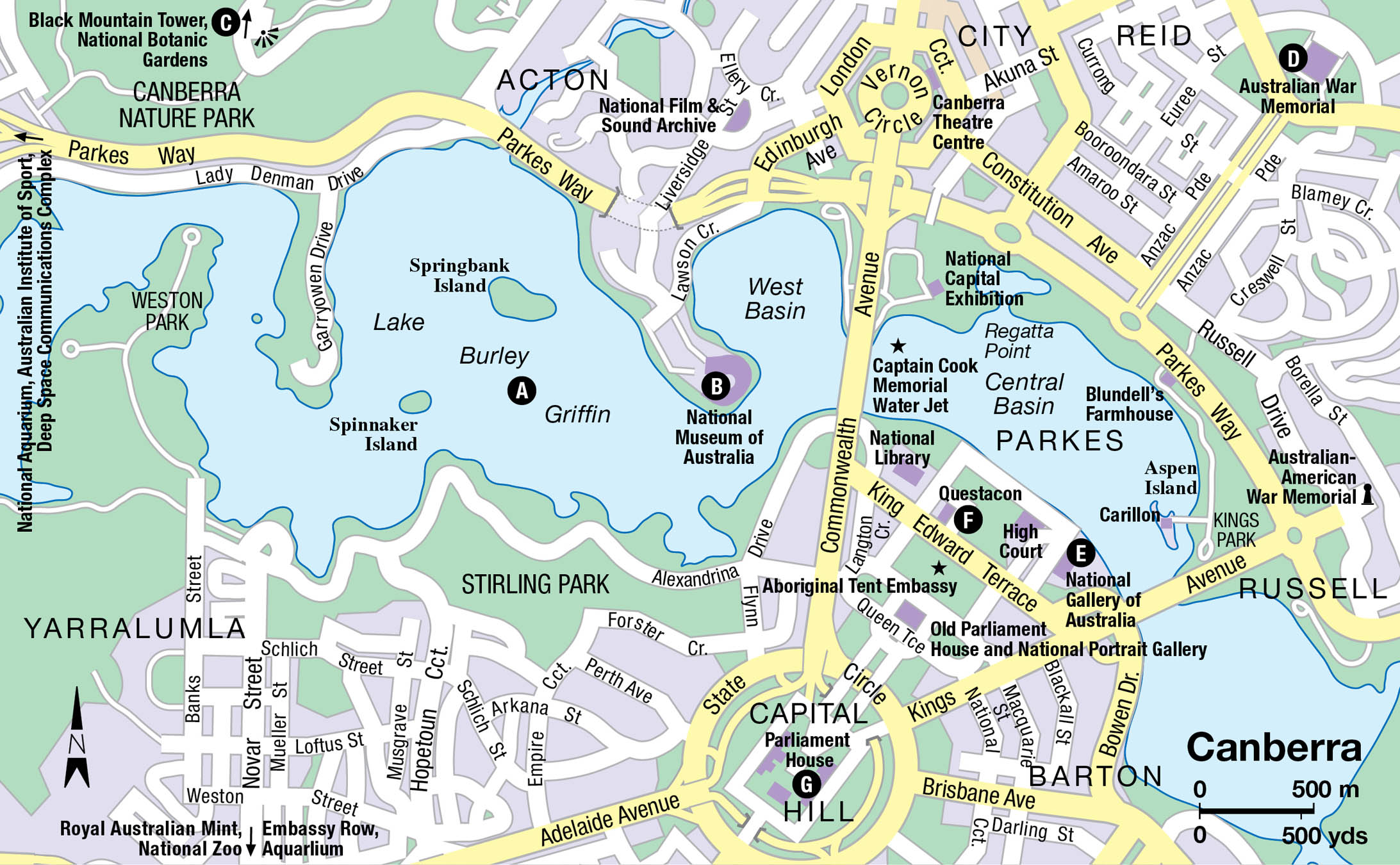
Canberra 4 [map], at the heart of the Australian Capital Territory, has a population of about 370,000. Although the city is an educational and research centre, it is essentially a company town – and the local industry is government. The ministries are here, and the parliament with its politicians, lobbyists and hangers-on, and so are the foreign embassies. The Royal Military College Duntroon, Australia’s first military college, founded in 1911, is based in Canberra, as is the Australian National University and the Australian Institute of Sport. In spite of this considerable enterprise, Australia’s only sizeable inland city is both uncrowded and relaxed.
City Sights
There are several good ways to see Canberra, but on foot isn’t one of them; the distances are greater than you think. If you do want to walk, many of the main attractions are found near Lake Burley Griffin – but you’ll still need three or four hours. It’s a good idea to sign up for a bus tour; they come in half-day and all-day versions. Or take a City Sightseeing bus, which runs a 25km (15-mile) route stopping at all the main sights. You buy a 24-hour ticket, then hop on and off at will. Alternatively, you can drive yourself around the city or hire a bike, following itineraries that are mapped out in a free sightseeing pamphlet available from the Canberra Visitor Information Centre (Northbourne Avenue, Dickson; tel: 1300 554114; www.visitcanberra.com.au; 9am–5pm weekdays, till 4pm at weekends).
An effective starting place for a do-it-yourself tour is Regatta Point, which overlooks the man-made Lake Burley Griffin A [map]. Cleverly created in the middle of town, the lake – 35km (22 miles) around – is generously named after the town planner who realised the value of water for recreation as well as scenic beauty. You can enjoy fishing, sailing and windsurfing here, or hop on a sightseeing boat with Southern Cross Cruises (tel: 02-6273 1784; www.cscc.com.au; charge). Whooshing 147 metres (482ft) into the sky from the lake everyday, between 2pm and 4pm, the Captain James Cook Memorial is a giant water jet that honours the Yorkshireman’s landing on Australia’s East Coast in 1770. The National Carillon, another monument rising from Lake Burley Griffin (actually from a small island), was a gift from the British government. Apart from concert recitals, it tells the time every 15 minutes, taking its tune from London’s Big Ben.
In a prime position at the tip of the Acton Peninsula is the excellent National Museum of Australia B [map] (www.nma.gov.au; daily 9am–5pm; free), a social history museum with themed galleries relating to the land, the people and the nation. The First Australians Gallery looks unflinchingly at the plight of the Aboriginal people after Europeans arrived, from the early massacres to the 20th-century government policy of taking Aboriginal children from their parents (the ‘Stolen Generations’).
North of the Lake
To get the best view of Canberra and surrounds, drive to Black Mountain. There are free lookouts here, or you can pay for a 360-degree perspective by going up the Black Mountain Tower C [map] (tel: 02-6219 6120; www.telstratower.com.au; daily 9am–10pm; charge), which stands 195 metres (640ft) high. A viewing platform circles the structure towards the top, and the designers couldn’t resist adding a café and a revolving (and expensive) restaurant.
On the eastern slopes of Black Mountain, the National Botanic Gardens (www.anbg.gov.au; daily 8.30am–5pm; free) are entirely devoted to Australian flora – the most comprehensive collection in the world. In spite of Canberra’s mostly mild, dry climate, numerous rainforest specimens flourish under intensive care. Walter Burley Griffin was so fascinated by the native trees and plants of Australia that he included this place in his original plan.
The only part of the capital designed with pedestrians in mind is the area around the Civic Centre. The original business and shopping district opened in 1927 – by Canberra standards that’s ancient history – and comes complete with symmetrical white colonnaded buildings in a mock-Spanish style. Nearby are modern shopping malls, the Canberra Theatre Centre on London Circuit, and a historic merry-go-round in Petrie Plaza.
Australian War Memorial
Australian Capital Tourism
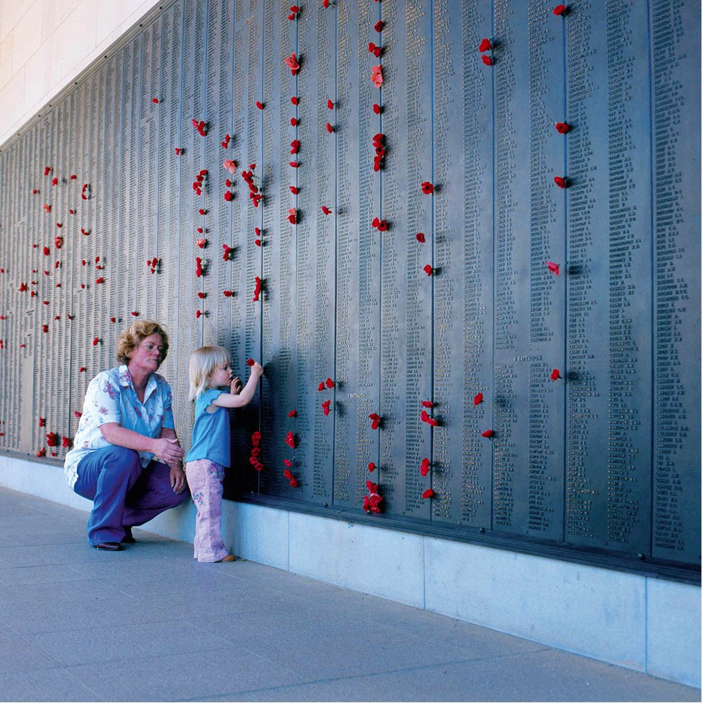
A more conventionally styled dome covers the vast Australian War Memorial D [map] (www.awm.gov.au; daily 10am–5pm; free), which is a sandstone shrine climaxing a ceremonial avenue called Anzac Parade. There are war memorials all over Australia, but this is the definitive one, with walls poignantly inscribed with the names of more than 100,000 Australian war dead. Beyond the statues and murals, the memorial is the most-visited museum in Australia. Items displayed in its 20 galleries include uniforms, battle maps, and plenty of hardware, from rifles to a World War II Lancaster bomber.
Closer to the lake is one final military monument: the 11-metre (36ft) tall Australian-American War Memorial, a slim aluminium shaft supporting a stylised eagle. It was paid for by public contributions to acknowledge US participation in the defence of Australia during World War II.

Australia’s National Gallery
iStock
South of the Lake
The mostly windowless walls of the National Gallery of Australia E [map] (Parkes Place; tel: 02 6240 6411; www.nga.gov.au; daily 10am–5pm; free) were designed to enclose ‘a museum of international significance,’ as official policy decreed. The enterprise has succeeded on several levels, showing off artists as varied as Monet and Matisse, Pollock and de Kooning, along with an honour roll of Australian masters, including Tom Roberts, Arthur Streeton, Sidney Nolan, Arthur Boyd and Albert Tucker. Further indications of the range of interests represented here are the displays of art from Pacific island peoples, Africa, Asia and pre-Columbian America. The gallery also plays host to touring international exhibitions.
A high point of the National Gallery is the collection of Australian Aboriginal art: intricate human and animal forms on bark from northern Australia, and deeply spiritual compositions of dots and whorls from the central deserts, which have evolved from ephemeral sand art to vivid polymer paint on board. The gallery also has a sculpture garden overlooking Lake Burley Griffin.
What’s in a Name?
The name of Australia’s new capital city, derived from an Aboriginal word for ‘meeting place’, was officially chosen in 1913 from a huge outpouring of suggestions. Some of the more serious citizens wanted it to have a name as uplifting as Utopia or Shakespeare. Others devised classical constructions, for example Auralia and Austropolis. The most unusual proposal was a coinage designed to soothe every state capital: Sydmeladperbrisho. After that mouthful, the name Canberra came as a relief.
One of Canberra’s best kid-friendly attractions is Questacon, the National Science and Technology Centre F [map] (King Edward Terrace; tel: 02-6270 2800; www.questacon.edu.au; daily 9am–5pm; charge), a hands-on science museum that is very much geared towards children and teenagers. There are more than 200 exhibits in seven galleries that explore the science behind sports and athletics, everyday technology and natural phenomena.
Also on the lakefront, the National Library (Parkes Place; tel: 02-6262 1111; www.nla.gov.au; Mon–Thur 9am–9pm, Fri–Sat 9am–5pm, Sun 1.30–5pm; free) houses more than 2 million books. This institution serves scholars and other libraries, and mounts exhibitions of rare books and maps. Its reading room houses an extensive selection of overseas newspapers and magazine publications. There are guided tours (free), a bookshop, and a café.
Canberra’s Old Parliament House became the seat of government in 1927 and fulfilled that role until it was replaced in 1988. It is now the home of the National Portrait Gallery (King Edward Terrace; tel: 02-6102 7000; www.portrait.gov.au; daily 10am–5pm; charge). Outside it is the Aboriginal Tent Embassy, a semi-permanent structure claiming to represent the rights of Australian Aborigines that has been around in one incarnation or another since 1972 (despite coming under attack several times).
A new parliament building to replace the old one was dedicated by Queen Elizabeth II in the bicentennial year, 1988. Parliament House G [map] (tel: 02-6277 5399; www.aph.gov.au; Mon–Fri 9am–5pm; free guided tours) is worth a visit,its interior representing the best in Australian art and design. The Great Hall is dominated by a tapestry 20 metres (66ft) wide. The combination of an unusual design (partially underground), as well as exploding building costs, made the new complex a cause célèbre during its construction, especially when taxpayers noted the lavish offices, bars, swimming pool and a sauna.
Meanwhile, they’re minting it in the southwestern district of Deakin, and you can take a look for yourself. The Royal Australian Mint (www.ramint.gov.au; Mon–Fri 8.30am–5pm, Sat–Sun 10am–4pm; free) has a visitors’ gallery overlooking the production line where the country’s coins are punched out. The factory also moonlights to produce the coinage of several other countries. The Mint’s own museum contains coins and medals of special value.
Other Canberra attractions include the National Film and Sound Archive (www.nfsa.gov.au) and the Australian Institute of Sport (Leverrier Street, Bruce; tel: 02 6214 1111; www.auspot.gov.au/ais), where there are athlete-led guided tours of the Institute (daily at 10am, 11.30am, 1pm, 2.30pm).
Out of Town
Animal lovers don’t have far to go for a close encounter with kangaroos, echidnas, wombats and koalas. The National Zoo and Aquarium (02-6287 8400; www.nationalzoo.com.au; daily 9am–5pm; charge) is only a few kilometres southeast of the city centre, in Yarralumla. You can walk through acrylic tunnels while sharks cruise past. The bird population includes parrots, kookaburras, cockatoos and emus.
The Tidbinbilla Nature Reserve (tel: 13 22 81; www.tidbinbilla.com.au; daily 9am–6pm, 9am–8pm in summer), 40km (25 miles) southwest of Canberra, is a much bigger affair – thousands of hectares of bushland where kangaroos, wallabies and koalas flourish. Next to this unspoilt wilderness, the Canberra Deep Space Communication Complex (tel: 02-6201 7880; www.cdscc.nasa.gov; daily 9am–5pm), one of only three deep-space tracking stations in the world, operates in conjunction with NASA, the US space agency. The Complex has several exhibitions on space exploration.
Another day in Surfers Paradise
Peter Stuckings/Apa Publications
QUEENSLAND
Queensland provides just about everything that makes Australia so desirable, and then adds some spectacular exclusives. The sun-soaked state gives you the choice of flashy tourist resorts, remote Outback towns, a modern metropolis, rainforest, desert or apple orchard. But the most amazing attraction of all is Queensland’s offshore wonderland – the longest coral reef in the world, the Great Barrier Reef.
Queensland was founded in 1824 as a colony for incorrigible convicts, the ‘worst kind of felons’, for whom not even the rigours of New South Wales were a sufficient deterrent. In an effort to quarantine criminality, free settlers were banned from an 80km (50-mile) radius of the penal settlement in what is now Brisbane. But adventurers, missionaries and hopeful immigrants couldn’t be held back for long. Queensland’s pastureland attracted many eager squatters, and in 1867 the state joined the great Australian gold rush with a find of its own. Prosperity for all seemed to be just around the corner.
Mining still contributes generously to Queensland’s economy. Above ground, the land is kind to cattle and sheep, and produces warm-hearted crops like sugar, cotton, pineapples and bananas. But tourism is poised to become the biggest money-spinner, for Queensland is Australia’s vacation state, welcoming tourists (domestic and international) to wild tropical adventurelands in the far north, and the glitter of the Gold Coast in the south. The busiest gateways to all of this are the state capital, Brisbane, and the port of Cairns, which has become one of Australia’s most popular tourist destinations.
As befits a subtropical city with palm trees and back-garden swimming pools, Brisbane 5 [map] has a pace so relaxed you’d hardly imagine its population is over 2 million. The skyscrapers, some quite audacious, have gone a long way towards overcoming the ‘country-town’ image, but enough of the old, elegant, low-slung buildings remain as a reminder of former days; some are wonderful filigreed Victorian monuments, some are done up in bright, defiant colours. As well as having its own attractions, the city is also a handy gateway to nearby tourist sites such as the Gold Coast and Fraser Island.
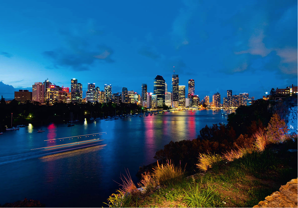
The towers of Brisbane line the river
Peter Stuckings/Apa Publications
In 1859, when Brisbane’s population was all of 7,000, it became the capital of the newly proclaimed colony of Queensland. The colonial treasury contained only 7.5 pence, and within a couple of days even that was stolen. Old habits of the former penal colony seemed to die hard.
The capital’s location, on a bend in the Brisbane River, has made some memorable floods possible over the years – such as in 2010–11, when 38 people were killed and parts of the city were declared a disaster zone – but it sets an attractive stage for Australia’s third-largest city. Spanned by a network of bridges (the first dated 1930), the river continues through the suburbs to the beaches and islands of Moreton Bay, 29km (18 miles) from central Brisbane. Some of Australia’s most celebrated types of seafood come from here, notably the gargantuan local mud crabs and the Moreton Bay bug. Despite its unappealing name, this creature, related to the lobster, is a gourmet’s joy.
Up the hill, on Wickham Terrace, stands an unusual historic building, the Old Windmill – also known as the Old Observatory – built by convicts in 1829. Design problems foiled the idea behind the windmill, which was to grind the colony’s grain, and the energy of the wind had to be replaced by a convict-powered treadmill.
The nearby Roma Street Parkland is a diverse area of waterfalls, lakes, misty crannies of tropical vegetation, and floral displays with their own ecosystem of insects and birds. It is said to be the world’s largest urban subtropical garden.
Queen Street shopping
Peter Stuckings/Apa Publications
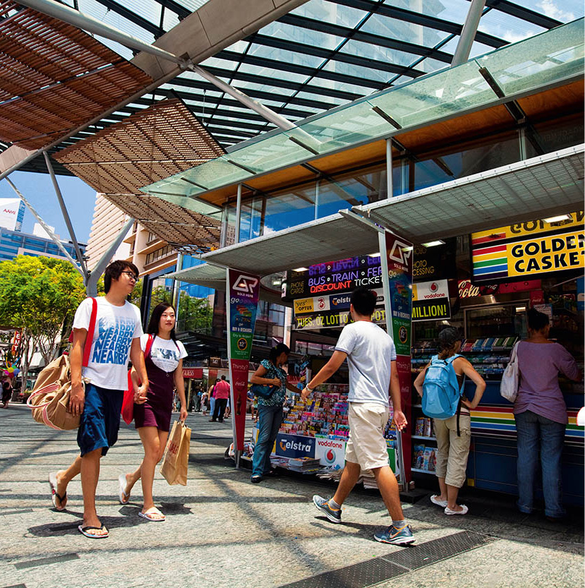
King George Square, next to City Hall, and the nearby Anzac Square, are typical of the open spaces that make the Central Business District (CBD) welcoming and pedestrian-friendly. Queen Street Mall is flanked by bustling stores and interspersed with shady retreats and cafés. Here, on a fine day, visitors from cooler climes should take a seat to enjoy the warm sun and watch the passers-by. Or you can stroll along Albert Street, from King George Square to the City Botanic Gardens.
Where central Brisbane fits into the bend in the river, the City Botanic Gardens (open 24 hours) turn the peninsula green with countless species of Australian and exotic trees, plants and flowers. Parliament House (tours Mon–Fri 9am–4.15pm), built in the 19th century in Renaissance style, overlooks the gardens and is the headquarters of the state’s legislative assembly.
Across the Goodwill footbridge from the Botanic Gardens, or Victoria Bridge from the centre of town (and also accessible by ferry), is one of the city’s main focal points, South Bank, a precinct of parks, gardens, restaurants, cafés and many other attractions stretching along the southern bank of the river.
Gallery of Modern Art
Peter Stuckings/Apa Publications
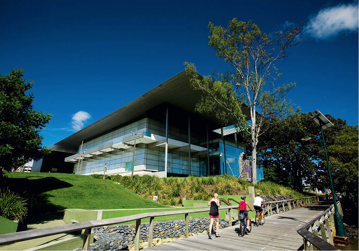
At its northern end is the Queensland Cultural Centre, which puts most of Brisbane’s cultural eggs in one lavish, modern basket. The Centre includes the Queensland Art Gallery (www.qag.qld.gov.au; Mon–Fri 10am–5pm, Sat–Sun 9am–5pm; free), the Gallery of Modern Art (same hours and website as gallery; free), the Queensland Museum (www.southbank.qm.qld.gov.au; daily 9.30am–5pm; free) and its offshoot Sciencentre (same hours as museum; charge), an interactive science museum aimed at kids and teens. Here too is the Queensland Performing Arts Centre (www.qpac.com.au), with several performance spaces.
To the south of the Cultural Centre, and linked to it by a beautiful bougainvillea-clad arbour, are the South Bank Parklands. The attractions here include a market (Fri 5–10pm, Sat 10am–5pm, Sun 9am–5pm) and an artificial beach (Streets Beach). There is also a diverse array of restaurants, making this the place to head for on a sunny day, for an outdoor meal. Brisbane enjoys a reputation for chefs who make good use of their state’s natural resources: mud crabs, avocados, macadamia nuts, mangoes, barramundi, coral trout and oysters, to name a few.
For a classic Brisbane pub, check out the Breakfast Creek Hotel (2 Kingsford Smith Drive; tel: 07-3262 5988; www.breakfastcreekhotel.com; daily 10am–2am), built in 1889, on the north side of a bend in the Brisbane River, about 5km (3 miles) east of the CBD. If you seek bars and restaurants, Fortitude Valley, just outside the CBD, is a lively precinct. Brunswick Street, the valley’s main thoroughfare, is lined with nightclubs, street cafés, ethnic restaurants and arty little shops. This suburb is also the location of Brisbane’s Chinatown. At weekends a market operates. Nightlife there can be fun, but it’s wise to take a taxi when heading home after dark. Linking Fortitude Valley to Kangaroo Point is Story Bridge, a city landmark that you can climb with Story Bridge Adventure Climb (170 Main Street; tel: 1300 254 627; www.sbac.net.au; charge).

Botanic Gardens Mt Coot-tha
Peter Stuckings/Apa Publications
To escape the heat and rush of the city, try Brisbane Botanic Gardens Mt Coot-tha (daily 8am–5.30pm; free), in Toowong, 7km (4 miles) west of the city centre. Covering 52 hectares (128 acres), these are the largest tropical and subtropical gardens in Australia and feature a giant dome enclosing 200 species of tropical plants.
From here it’s about 11km (7 miles) to Lone Pine Koala Sanctuary (www.koala.net; daily 9am–5pm; charge), one of the country’s best-known collections of native animals. By boat from North Quay in the city centre, the trip is several kilometres longer, taking one and a half hours. The stars of the show, of course, are the koalas, mostly sleeping like babies, clinging to their eucalyptus branches.
Koala mascot
The koala is Queensland’s official emblem. Its only occupation is eating eucalyptus leaves, the odour of which impregnates its whole body, providing both antiseptic protection and a deterrent to predators.
The islands of Moreton Bay, some of which are unpopulated, make this a vast fishing and sailing paradise. St Helena Island (tel: 1300 438 787; www.sthelenaisland.com.au; charge), now a national park, became a penal settlement in the 1860s and remained a high-security prison until the 1930s; the excellent tours, which set out across the bay from Manly on the Cat-O’-Nine Tails, include a night-time ghost tour where actors re-enact scenes from the convict era. Moreton Island features Mt Tempest, at 285 metres (935ft) the world’s highest stabilised coastal sand dune. On North Stradbroke Island, the Aboriginal community has developed a 90-minute tour called the Goompi Trail (tel: 07-3821 0266; charge) where an Aboriginal guide explains the flora and fauna, with Dreamtime stories, bush tucker (food) and traditional medicine.
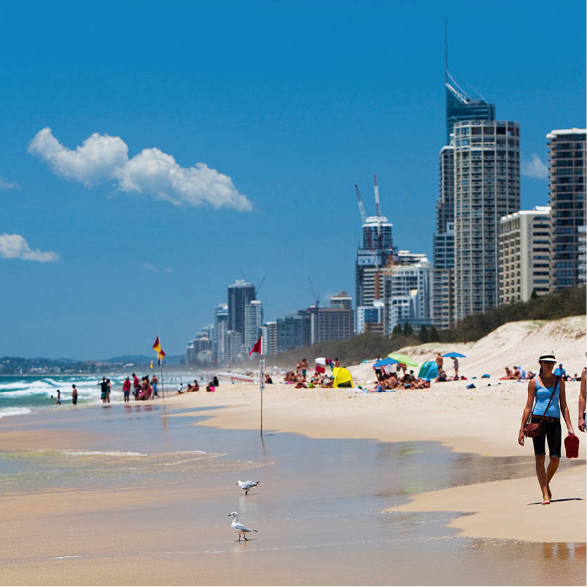
The Gold Coast
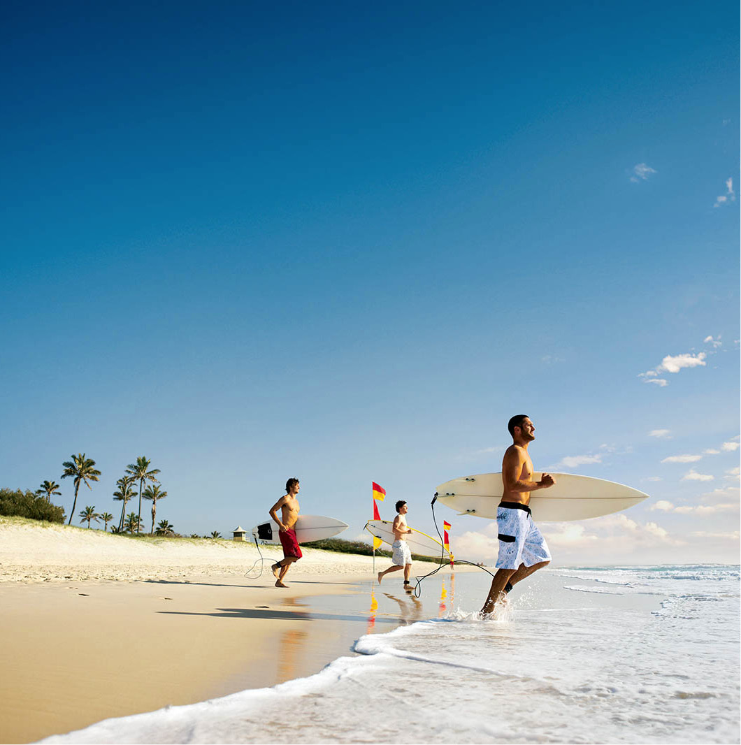
South of Brisbane, within day-trip distance if you’re rushed, the Gold Coast 6 [map] is a Down-Under version of Miami Beach. Although it may be overexploited (and best avoided during ‘Schoolies’ week in late November/early December, when Australia’s high-school leavers celebrate their graduation with raucous partying) it’s certainly dynamic, with lots of opportunities for recreation. And the beach – anything from 30–50km (19–30 miles) of it, depending on who’s doing the measuring – is a winner. More than 20 Gold Coast surfing beaches, all patrolled by lifesavers, form the backdrop for activities such as swimming, sailing, boating, surfboarding and windsurfing.
The trip down the Pacific Highway south from Brisbane (78km/49 miles, roughly an hour’s drive) is a study in Australian escapism. In the midst of forest and brushland grows a seemingly unending supply of amusement parks, luring fun-seekers with attractions for all the family; these diverting parks include Dreamworld (tel: 07-5588 1111; www.dreamworld.com.au; daily 10am–5pm; charge), Sea World (tel: 07-5591 0000; seaworld.com.au; daily 9.30am-5pm; charge) and Wet ’n’ Wild (tel: 13 33 86; wetnwild.com.au; daily 9.30am–5pm; charge). Warner Bros Movie World (tel: 07 5573 3999; www.movieworld.com.au; daily 9.30am–5pm; charge), one of the biggest, offers a Hollywood-style experience, including stunt shows, special effects and amusement rides.
Enjoying the surf on the Gold Coast
Tourism Australia
The Gold Coast’s Dreamworld operates an attraction claimed to be ‘one of the fastest rides in the world’, the Tower of Terror II (based on the original, but relaunched in 2010 – faster than ever). Visitors also flock to action-packed rides with names like Wipeout and Cyclone, watch adventure films on a huge screen or (if they want something quieter) cuddle a koala. Other Gold Coast theme-park attractions include Wet ’n’ Wild, which contains a giant wave pool, a white-water ride and a seven-storey speed slide.
Currumbin Wildlife Sanctuary
Peter Stuckings/Apa Publications
Nature-lovers can also enjoy Currumbin Wildlife Sanctuary (tel: 07-5534 1266; www.currumbin-sanctuary.org.au; daily 8am–5pm; charge), where masses of squawking rainbow lorikeets are fed each morning and evening. Other animals featured include koalas, kangaroos, Tasmanian devils, snakes and crocodiles. Currumbin is down towards the southern extremity of the Gold Coast, which ends at Point Danger. Beyond here lies New South Wales.
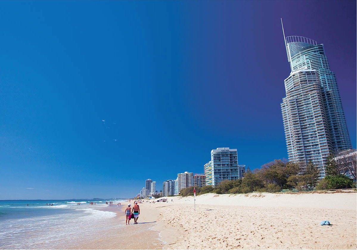
Surfers Paradise
Peter Stuckings/Apa Publications
The essence of the Gold Coast is Surfers Paradise, as lively as any seaside resort in the world and much addicted to high-rise living. Here, when you’re not sunbathing, swimming or surfing, you can go bungee jumping or just window-shop, eat out, socialise or wander through the malls, one of which, Raptis Plaza, is adorned by a full-scale replica of Michelangelo’s David. The pace is hectic, and the revelry never stops. To unwind, take a leisurely boat cruise along the Southport Broadwater or the canals. Another Surfers Paradise landmark, not far from Sea World, is Palazzo Versace, the world’s first Versace Hotel, billed as ‘six star’ and filled with all kinds of designer trappings.
Surfers Paradise is approached through a thicket of petrol stations, fast-food outlets and motels. Ahead you’ll see a skyscrapered horizon of tall, slim apartment blocks interspersed with bungalows. The high-rise skyline of Surfers Paradise must now rank with Ipanema, Miami and Cannes for architectural overkill.
The lush green backdrop to the Gold Coast is known as the Hinterland. The area encompasses luxuriant subtropical rainforests, waterfalls and bushwalking tracks, mountain villages and guest houses, craft galleries and cosy farm-stay accommodation. Lamington National Park, a World Heritage area, is well worth visiting and is an easy day-trip from Surfers Paradise.
The Sunshine Coast
For the sandy perfection of the Gold Coast with less commercialism (although they’re working on it), try the resorts of the Sunshine Coast 7 [map], north of Brisbane. Some of Australia’s best surfing is found here.
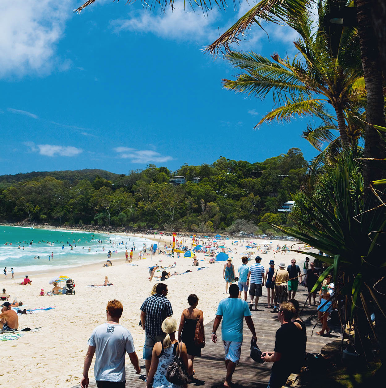
Noosa
Peter Stuckings/Apa Publications
The resort closest to Brisbane, Caloundra, has a beach for every tide. The northernmost town on the Sunshine Coast, Noosa, used to be a sleepy little settlement, and the weekend haunt of local farmers and fishermen. That was in the 1960s, before the surfers, and the trendsetters from Sydney and Melbourne arrived, but it’s still very laid back. Noosa National Park, a sanctuary of rainforest and under-populated beaches, occupies the dramatic headland that protects Laguna Bay from the sometimes squally South Pacific breezes. Fraser Island (for more information, click here) is easily reached from here.
This whole stretch is home to some of Queensland’s most gorgeous coastline. Beaches such as those fronting the towns of Maroochydore and Coolum are gems.
The Sunshine Coast Hinterland is laden with plantations of sugar cane, bananas, pineapples and passion fruit. The area is also a centre of production of the prized macadamia nut. Above Nambour, the principal town of the Hinterland, is the Blackall Range, a remnant of ancient volcanic activity. Attractive Blackall towns such as Montville and Maleny offer crafts shops, cafés and tearooms.
To the south, just off the Bruce Highway near Beerwah, is Australia Zoo (tel: 07-5436 2000; www.australiazoo.com.au; daily 9am–5pm; charge). Made famous by the late Steve Irwin, the zoo has a wide variety of Australian wildlife, as well as many exotic species.
Heading off to explore the reef
Pro Dive Cairns
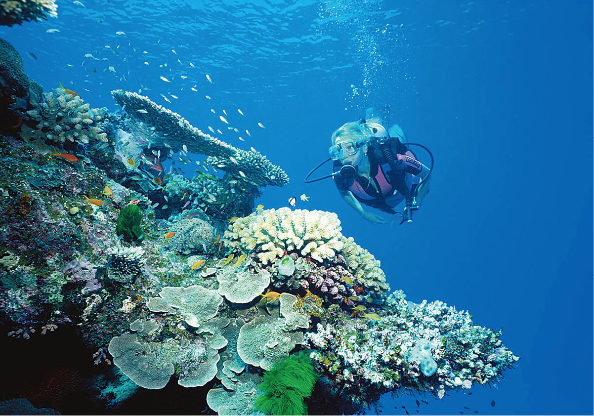
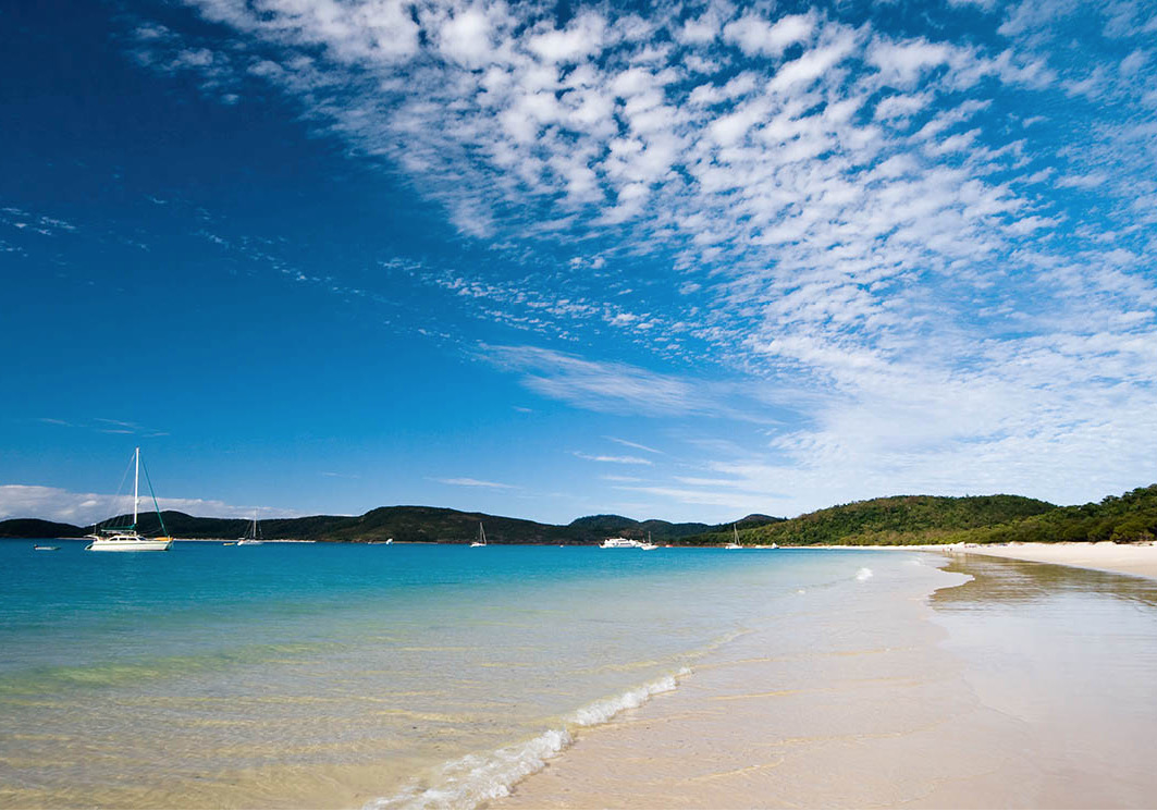
Australia’s biggest and most wonderful sight, the Great Barrier Reef 8 [map], lies just below the ocean waves. Millions of minuscule coral polyps multiply and grow into an infinite variety of forms and colours here, to create the world’s largest living phenomenon. The reef is home to at least 350 different types of coral. It stretches as far as you can see and beyond: more than 2,900km (1,430 miles) of submerged tropical gardens, sprinkled with hundreds of picture-perfect islands.
Observed more intimately through a diver’s mask, the reef is the spectacle of a lifetime, like being inside a boundless tropical fishbowl among the most lurid specimens ever conceived. Watch as a blazing blue-and-red fish darts into sight, pursuing a silver cloud of a thousand minnows; a sea urchin stalks past on its needles; a giant clam opens its convoluted, fleshy mouth as if sighing with nostalgia for its youth, a century ago.
In 1770, James Cook was exploring Australia’s east coast and literally stumbled upon the Great Barrier Reef when the Endeavour was gored by a lurking outcrop of coral. Patching the holes as best they could, the crew managed to sail across the barrier, and the vessel limped onto the beach at what is now Cooktown, where some major repairs had to be improvised.
The giant reef was proclaimed a marine park by the Australian Government in 1975, and placed on the World Heritage list in 1981, becoming the biggest World Heritage area in existence. It’s now managed by the Great Barrier Reef Marine Park Authority (www.gbrmpa.gov.au), but is under threat from government-approved industrial activity within its boundaries, including dredging, ocean floor dumping and an increase in large tanker-ship traffic.
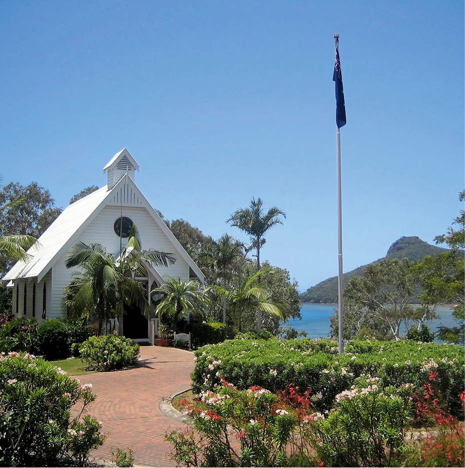
Hamilton Island chapel
iStock
There are many ways of appreciating the reef, from glass-bottomed boats and semi-submarines, to a descent into an underwater observatory at the Townsville Reef HQ (for more information, click here), which claims the world’s largest coral reef aquarium. Equipped with just a mask, fins and snorkel you can get close to the underwater world, or you can take the plunge and go scuba diving for the best encounters. If you’re not a qualified diver you can take a crash course at many resorts. Organised excursions for advanced divers are also readily available.
In some places the coral stands exposed, but visitors are asked not to walk over it, as doing so severely damages the living organisms.
Island types
Not all of the reef’s islands are made of coral. In fact, most of the popular resort islands are the tips of offshore mountains. True coral cays are smaller, flatter and more fragile.
The Reef Islands
The reef – actually a formation of thousands of neighbouring clumps of reefs – runs close to shore in the north of Queensland but slants further out to sea as it extends southwards. Hundreds of islands are scattered across the protected waters between the coral barrier and the mainland. Several have been developed into resorts, ranging from spartan to sybaritic, but not all are on the reef itself. Following are some details about these resorts, heading from south to north:
Fraser Island is actually south of the Great Barrier Reef, but it’s close enough and sufficiently interesting to rate inclusion here. About 120km (75 miles) long, Fraser is the largest sand island in the world, and a World Heritage site. Attractions include crystal-clear streams, lakes for swimming and rainforest trails. This is an unspoilt island for fishing, beachcombing and four-wheel-drive adventures, but not for sea swimming or coral dives (thanks to nasty rip tides and aggressive sharks). You can take excursions and flights to the island from Hervey Bay, or overnight at resorts, lodges, cabins or campsites.
Lady Elliot Island (www.ladyelliot.com.au) is a coral isle and part of the reef, but is situated south of the Tropic of Capricorn. Activities centre on diving, swimming and windsurfing. The gateway airport is in Bundaberg, a sugar-producing town 375km (233 miles) up the coast from Brisbane, and day-trip flights include use of the island’s resort.
Heron Island (www.heronisland.com), a small coral island right on the Great Barrier Reef, is heaven for divers. Nature-lovers can see giant green turtles, which waddle ashore between mid-October and March to bury their eggs in the sand. Heron Island also hosts thousands of migrating noddy terns and shearwaters. A resort on the island accommodates up to 250 people. There are no day trips and no camping.
Great Keppel Island (www.greatkeppel.com.au) is one of the larger resort islands, both in area and in tourist population (there’s even a backpackers). The Great Barrier Reef is 70km (44 miles) away, but Great Keppel is surrounded by coral, and there’s an underwater observatory. Its white beaches are among the best in the resort islands. Great Keppel is also one of the cheapest islands to reach from the mainland – a return ferry trip from Rosslyn Bay costs around A$50. For other angles on the island’s treasures, rent a sailboard, catamaran, motorboat and/or snorkelling gear, or try water-skiing or parasailing.
Brampton Island (www.nprsr.qld.gov.au/parks/brampton-islands), is reached by sea from Mackay, however the resort has been closed for some years (rumours of a reopening are rife). With forested mountains and abundant wildlife, the island’s mountainous interior is worth seeing, but access is hard unless you have your own boat. There’s a small campsite on neighbouring Carlisle Island, which is uninhabited and connected to Brampton by a reef that is wade-able when the tide’s out.
For a taste of paradise try one of the Whitsunday islands
Peter Stuckings/Apa Publications
Lindeman Island is the most southerly of the islands in the Whitsunday Islands 9 [map] archipelago, which was named by James Cook after the feast of Pentecost, when he passed through. The Club Med Resort here closed down in 2012 – it has since been bought by a Chinese firm, who apparently mean to refurbish and reopen it – but there’s a basic Lindeman Islands National Park campsite. Several excellent walking trails cross the island, but access without your own boat is tricky.
Perils of the Deep – and the Shallows
Take care when you explore the Reef: some species of coral can cause very painful burns. The crown-of-thorns starfish may also be lying in camouflaged ambush for you, and it has thousands of poisonous spines.
But between December and April, the greatest threat of all comes from jellyfish (‘stingers’). In summer these small, transparent, almost invisible creatures swarm along the north Queensland coast by the thousands – and their sting can be fatal. All the popular beaches have stinger net enclosures, along with vinegar for medication in case a tentacle gets through, but you should always heed the warning signs and, to be on the safe side, stay out of the water during the stinger season.
With its jet airstrip, large marina, restaurants, bars and swimming pools, Hamilton Island (www.hamiltonisland.com.au) is the slickest international resort in the Coral Sea. There are hotel rooms, apartments and bungalows for almost all budgets. Away from the main resort is Qualia (tel: 07 4948 9222; www.qualia.com.au), aimed at the top end of the market. Wherever you stay, divers can go out to the reef by catamaran or helicopter. The island’s rainbow lorikeets not only eat out of your hand but sit on your arm while they’re doing it. There are tame kangaroos, too. You can fly to Hamilton Island from Sydney, Melbourne, Brisbane or Mackay, or fly to Proserpine and take a boat from Shute Harbour.
Long Island is 11km (7 miles) long – narrow and hilly with excellent beaches. Close to the mainland and far from the reef, it has two low-key resorts: family friendly Long Island (www.longislandresort.com.au) and the eco-friendly Paradise Bay (www.paradisebay.com.au). Most of the island is national park and several trails lead through the rainforest.
South Molle Island also consists mainly of national park, plus a resort. South Molle is virtually joined to North Molle Island 2km (1.25 mile) away, and to the closer Mid Molle Island. The beaches are good (there are some quiet ones in the south), and you’ll find nice trails for walks. The Great Barrier Reef is about 60km (37 miles) away, but coral reefs exist nearby.
Daydream Island is the tiniest of all the Barrier Reef resort islands, snoozing just offshore from busy Shute Harbour. Since beaches are not the island’s strongest selling point, Daydream Island Resort and Spa (www.daydreamisland.com) has built swimming pools. The resort accommodates 300 guests plus day-trippers.
Hayman Island, the most northerly of the Whitsunday group, hosts the chic, international-class Hayman Island Resort (www.hayman.com.au), a lavish, five-star hotel. Hayman has a marina for drop-in yachts, and a choice of restaurants, bars and shops. The long, sandy beach suggests all sorts of watersports, organised for guests by the resort’s activities staff. Some tiny, uninhabited isles are so close you can walk out to them at low tide. No day-trips to Hayman are available.
Magnetic Island is virtually a suburb of Townsville, the biggest city in northern Queensland. Many of the island’s 2,000 or so permanent residents commute to work on the mainland by ferry. Being so easy to reach, it’s a busy day-trip destination – by sea or helicopter – but Magnetic Island also has plenty of accommodation of all classes. Most of the island is a national park, busy with birds and other animals (including koalas in the eucalyptus trees), and the choice of beaches is enticing. Magnetic Island, ‘Maggie’ to the locals, was given its name by James Cook, whose compass malfunctioned here.
Famous visitors to Orpheus Island have included Zane Grey and Vivien Leigh half a century ago. Over 100 species of fish and 340 of the 350 known species of reef coral adorn underwater gardens in the island’s several sheltered bays, with the channel at the southern point of Orpheus believed to host the reef’s largest range of soft corals. The island is a national park, and Orpheus Island Resort (www.orpheus.com.au) is the sole resort. Nestling in a sheltered bay on the western (mainland) side of the island, the resort accommodates a maximum of 42 guests in 21 private rooms. Day-trippers and children under 15 are banned.
Mulligan Falls in Hinchinbrook Island National Park
iStock
Hinchinbrook Island basks in a superlative of its own: ‘The world’s largest island national park’. A continental rather than coral island, but only 5km (3 miles) from the reef, Hinchinbrook has a couple of campsites (park rangers issue permits on the mainland) and a small resort with treetop bungalows. Inland from the smooth sand beaches, you will find mountains well worth climbing, as well as rainforest, waterfalls and bushland, where you’ll come across wallabies. Day-trips depart from Cardwell.
Bedarra Island, in the Family Islands group, has a very small, exclusive and pricey resort of just 16 villas (www.bedarra.com.au) on its west coast. The nearest mainland town is Tully, noted for having the highest average annual rainfall in the country.
Dunk Island, mostly national park, once had one of Queensland’s best resorts, however this was destroyed by Cyclone Yasi in 2011 and is yet to reopen. You can still reach the island by boat from Mission Beach, and there are camping sites. Dunk offers a taste of genuine tropical rainforest. In the interior you can visit the carefully tended grave of Edmund Banfield, the island’s first white resident. A journalist from Townsville, Banfield went to the island in 1898 to die quietly, having been given just weeks to live. He survived for 25 more years, writing books including The Confessions of a Beachcomber and My Tropic Isle.
Fitzroy Island, just 6km (4 miles) offshore, is easily reached on day excursions from Cairns. Fitzroy Island Resort (www.fitzroyisland.com), the only accommodation on the island, reopened in 2010 after a complete refurbishment, and is a much glossier affair than it used to be. Fitzroy has reef around its shores and rainforest in the interior. There’s a turtle rescue centre, a dive shop, good beaches and kayaks for hire.
Like Fitzroy, Green Island, one of the few resorts actually on the reef, is popular with day-trippers from Cairns, but when the crowds depart, the vacationers occupying the five-star Green Island Reef Resort (www.greenislandresort.com.au) have the tiny island, and its throngs of seabirds, to themselves. The Underwater Observatory, which claims to be the first of its kind in the world, lets you view the coral garden from the dry, some three fathoms below water level. In this situation, the fish come to look through the glass at the human beings in the tank. Another attraction, just a short walk inland from the ferry jetty, is Marineland Melanesia, which features crocodiles, stingrays, giant turtles, as well as Melanesian artefacts.
Lizard Island, a national park, situated about 30km (19 miles) off the tropical northern coast of Queensland, has rainforest, mangrove swamps and dozens of delectable beaches. The island is on the edge of one of Australia’s most productive game-fishing zones, in which the half-ton black marlin is found, a favourite of the millionaires and celebrities who stay at the exclusive Lizard Island Resort (www.lizardisland.com.au). The only other alternative is at the other end of the price scale: a very basic campsite. The island is reached by air from Cairns.
The Tropical Coast
The coast of mainland Queensland, which runs parallel to the Barrier Reef, terminates in the north with Cape York Peninsula, one of Australia’s wildest and least populated areas. If you’re heading there, it’s best to go with an experienced operator – roads are often little more than dirt tracks. Following are a few highlights from further down in Tropical North Queensland, heading along the Capricorn Coast from south to north, starting just above Gladstone.
Architecture in Rockhampton
iStock
Rockhampton sits only a few kilometres north of the Tropic of Capricorn – 23°27’ south of the Equator – the line that officially divides the tropics from the subtropics. From here on northwards, you need no excuse to order an icy beer to assuage your tropical thirst. Rockhampton, known as the beef capital of Australia, has some genuinely interesting Victorian architecture, and is worth a walking tour. To the north, the Berserker Range offers spectacular limestone caves.
Mackay is the next substantial town, and even by Australian standards it’s a long haul – about 340km (210 miles) along Highway 1, a road not noted for its scenery. Surrounded by dense fields of cane, Mackay processes one-third of the nation’s sugar crop. At the harbour stands the world’s biggest bulk sugar terminal. From July to December you can see cane crushing in progress at the Farleigh Sugar Mill, about 12km (7 miles) northwest of the town on the Bruce Highway. One of the largest parks in Queensland, Eungella National Park, lies inland from Mackay, in rugged mountain country. There are many walking tracks, ranging in difficulty from easy strolls to strenuous hikes. This is one of the few places in Australia where you can see platypuses in the wild. The best time is morning and late afternoon and there’s a platypus viewing platform near the bridge in Eungella township. Proserpine, another sugar town, is situated inland from Airlie Beach and Shute Harbour, resorts from where there are boat trips to the Whitsunday Islands.
Another 265km (165 miles) closer to the Equator, you reach Townsville (population 86,000), hub of the mining and cattle industries of Queensland’s interior and a gateway for Magnetic Island (for more information, click here). In the historic town centre, along the river, are some photogenic old buildings with filigreed iron balconies and stately columns and arches.
One of Townsville’s top attractions is Reef HQ (www.reefhq.com.au; daily 9.30am–5pm; charge), with a superb simulation of the Great Barrier Reef, an imax cinema, and a colossal aquarium. Right next door, the Museum of Tropical Queensland (www.mtq.qm.qld.gov.au; daily 9.30am–5pm; charge) combines maritime archaeology and the natural history of North Queensland. There’s also a beachside playground along the 5-km (3-mile) Strand.

Cairns
Peter Stuckings/Apa Publications
The landscape changes from dry to lush as you head north to Cairns ) [map], Australia’s largest tropical city (population over 150,000). A port laid out in grid style with huge blocks and extra-wide streets, Cairns has benefited economically from Australia’s tourist boom and grown dramatically, but in the process has lost much of its former sleepy, tropical outpost atmosphere. In a prominent position on Trinity Inlet is The Pier (www.thepier.com.au), a shopping and leisure complex, which fronts a large marina from where reef cruises and game-fishing excursions depart. The centrepiece of the waterfront, called the Esplanade, is a huge landscaped swimming lagoon. A large shopping complex, Cairns Central, is located just past Shields Street.
Cairns makes an ideal base, within reach of the Great Barrier Reef, the World Heritage-listed Daintree rainforest, the temperate Atherton Tableland, the Outback and even Cape York. Hundreds of tour options are available, and the city has become a centre for adventure tourism. From hot-air balloon and bungee-jumping to skydiving and whitewater rafting, you can do it all here.
Cairns springs into action early in the morning, when speedy catamarans leave for Green Island and Fitzroy Island and smaller boats set sail with scuba divers or fishermen aboard. Travel agencies open their doors at 7.30am and keep going until after dark. They sell a large collection of excursions – to Green Island, inland to Kuranda and the Atherton Tableland, and up the coast to Port Douglas and beyond.
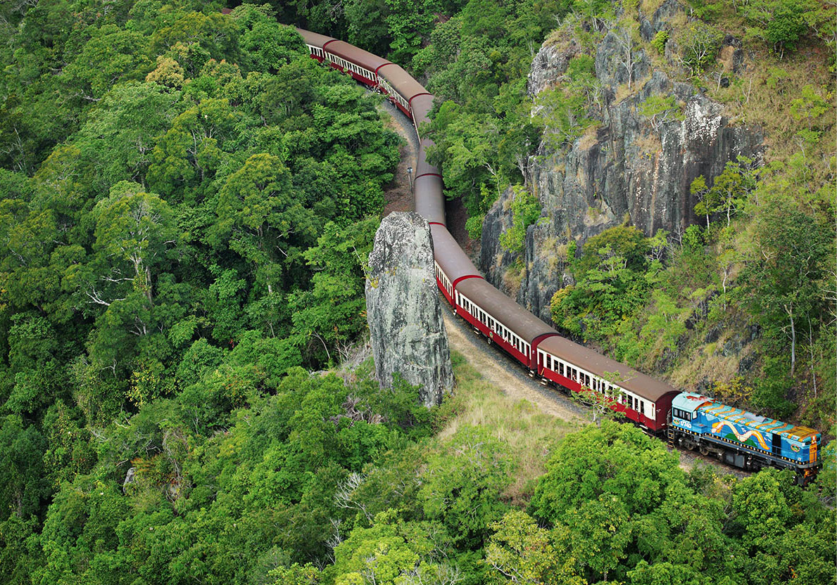
Kuranda Scenic Railway
Kuranda Scenic Railway
The town of Kuranda, ‘the village in the rainforest’, is a short distance northwest of Cairns. It is very tourist-oriented, with numerous craft shops, galleries, restaurants and two markets (one held daily 9am–3pm, the other on Wed, Thur, Fri, and Sun 9am–3pm). Kuranda is linked to Cairns by two fascinating transport systems: the picturesque Kuranda Scenic Railway (tel: 07-4036 9333; www.ksr.com.au) and the Skyrail Rainforest Cableway (tel: 07-4038 5555; www.skyrail.com.au), which transports visitors to Kuranda in six-person aerial gondolas over dense, tangled rainforest. You can buy tickets for a round trip, taking the train one way and Skyrail the other. Skyrail riders can enter the forest on boardwalks at two stations on the way to explore the rainforest. A rainforest information and research centre is located at Barron Falls Station. The Skyrail experience is even better when it’s misty or raining and the gondolas fill with a woody aroma as mists rise from below. Sweeping views of sugarcane plantations, the Coral Sea, beaches and offshore islands give way to eucalyptus forest and later to the huge fig trees, kauri pines and twisted vines of the 120-million-year-old rainforest.
The Tjapukai Aboriginal Cultural Park (www.tjapukai.com.au) at the base of Skyrail is home to the renowned Tjapukai Aboriginal Dance Theatre, which showcases the culture of the rainforest people of North Queensland. Performances, particularly at night, are primal and electrifying.
Beautiful coastal scenery is the reward along the highway north from Cairns to Port Douglas. The town’s palm-fringed Four Mile Beach is most people’s idea of a tropical paradise. Once a fishing village, Port Douglas has climbed on the tourism bandwagon, but it’s more relaxed than Cairns. The Sheraton Mirage Resort is the flashiest hotel in town. Near it, Quicksilver (www.quicksilver-cruises.com) runs catamaran services to the islands and outer reef.
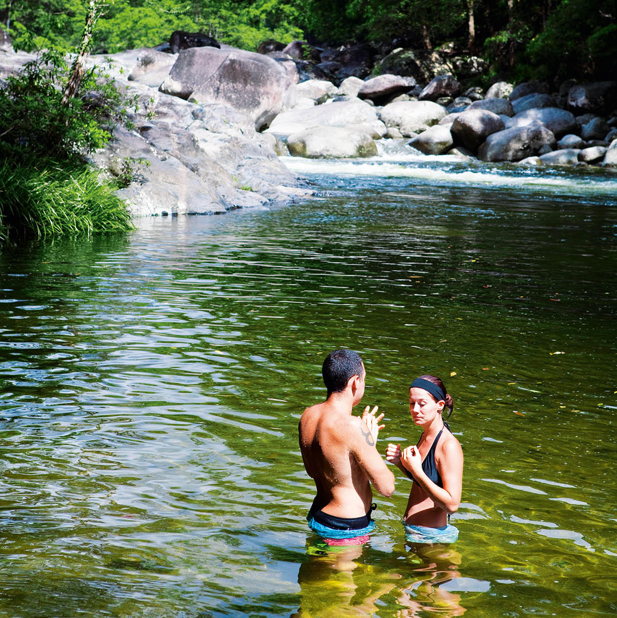
Mossman Gorge, Daintree National Park
Peter Stuckings/Apa Publications
Popular destinations near Port Douglas are the sugar-milling town of Mossman, Daintree National Park, with its World Heritage-listed rainforests, and lovely Cape Tribulation, where, as the tourist brochures say, ‘the rainforest meets the sea’. There are also crocodile-spotting boat tours on the Daintree River. From Mossman north it’s several hundred hot kilometres to the likeable river port of Cooktown, where James Cook’s battered Endeavour was beached in 1770. The James Cook Memorial Museum tells all about it.
The tip of Cape York Peninsula, north of Cooktown, is a vast expanse of marshy terrain, prone to flooding, rife with crocodiles, and only negotiable in well-equipped four-wheel-drive vehicles driven by experienced people. The rivers are impassable from December to March; Coen is the largest town on the Cape.
NORTHERN TERRITORY
On the surface, the Northern Territory might seem an unpromising tourist destination. Its deserts, torrid tablelands, occasionally hell-like humidity and monsoonal woodlands may sound uninviting, but the wildlife is enchanting, the open spaces and big-sky scenery is magnificent and the people – though few and far between – welcome visitors with Outback hospitality and charm.
The population totals only around 220,000. Their median age is 30 years, the youngest of any Australian state or territory. About one in three Territorians identifies as an Aborigine, so cultural insights are part of the agenda for foreign visitors. This is the place to explore the grandeur, magic and mystery of Aboriginal beliefs, and to learn about the complex realities of modern life for the oldest surviving civilisation on Earth.
The Northern Territory covers about one-sixth of Australia’s total area. Perhaps surprisingly, roads in the Territory are generally of a high standard and a four-wheel-drive vehicle is not necessary unless you specifically want to pursue off-road activities. The climate divides the land into two parts: the north, called ‘the Top End’, is lush, monsoonal, and very hot and humid. The rest of the Territory, known as the ‘Red Centre’, has drastically less rainfall and very hot, dry summers.
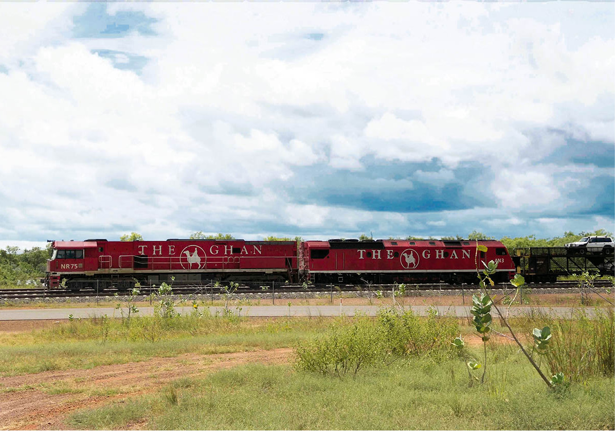
The Ghan train
Glyn Genin/Apa Publications
The Ghan train
A leisurely way to get to Darwin is by the Ghan, one of Australia’s great train trips. Run by Great Southern Railways (www.greatsouthernrail.com.au) from Adelaide, the Ghan travels twice a week (Sunday and Wednesday) to Darwin (48-hours, two-nights) via Alice Springs (24-hours, one night) and Katherine. It does the same route in reverse leaving Darwin on Wednesday and Saturday.
Australia’s northernmost port, the capital of the Northern Territory, is a young, prosperous city radiating the optimism of the reborn, for Darwin ! [map] has survived more than its share of catastrophes. It was bombed in World War II, then after being rebuilt it was wiped out by Cyclone Tracy in 1974. Subsequently planners went back to the drawing board to design a bigger and better city.
With a population of 125,000, Darwin blends more than 50 different ethnic groups, including a large Chinese community. This is reflected in the city’s wide range of Asian eating-places, ranging from up-market restaurants to budget-priced food stalls at the Mindil Beach Sunset Markets (www.mindil.com.au; late Apr–late Oct, Thur 5–10pm, Sun 4–9pm).
Darwin’s daytime temperature averages above 30°C (86°F) all year, and the humidity can be debilitating. But while transients wilt, the locals know how to withstand the tropical conditions. They dress lightly and casually – even businesspeople wear shorts to work – use air-conditioning and drink a record amount of beer to quench their thirst. Although elsewhere in Australia a stubby means a small bottle of beer, order one in Darwin and you get a 2-litre bottle – almost half a gallon. Empty beer cans often end up as raw construction material for a flotilla of fanciful boats that compete in Darwin’s annual slapstick regatta.
Even local chauvinists will admit that Darwin, approximately 4,000km (2,500 miles) from Sydney and Perth, is ‘a trifle isolated’. However, that certainly doesn’t seem to deter eager newcomers arriving from all parts of the country – if anything, it adds to the appeal of this adventurous and exotic state.
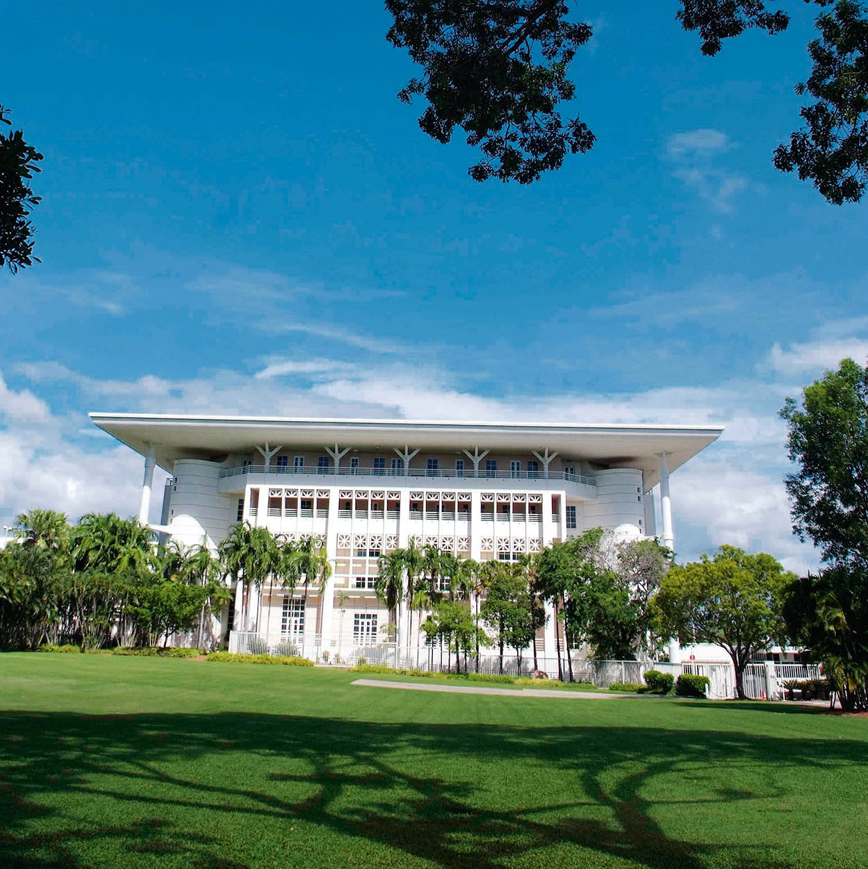
The new Parliament House
Glyn Genin/Apa Publications
City Sights
Historic buildings are the last things you’d expect to find in a city wiped out by a modern cyclone, but visitors can tour restored 19th-century buildings that bring to mind the atmosphere of the pioneering days. The old Government House, overlooking the harbour, is an elegant example of colonial style (opened in 1883). Although a series of cyclones and the wartime bombs badly damaged the building (known as the Seven Gables), it has been put back together in fine form, and is surrounded by lovely tropical gardens. It replaced an earlier government building, which was eaten by termites, and in turn, it has been replaced as the regional seat of government by a new Parliament House, opened in 1994.
Dating from 1885, the stone building known as Browns Mart (www.brownsmart.com.au) is now a theatre. The building has a chequered past. Built as a miner’s exchange, it was converted for use as a police station and subsequently served the community as a brothel.
Also on an offbeat historical theme, the Fannie Bay Gaol Museum (daily 10am–3pm) opened for business in 1883. Closed down in 1979, the jail allows visitors to follow the advance of penal progress since those early rough-and-ready days. The gallows were last used in 1952.
Other restored buildings include Victoria Hotel (built in 1894), and the former Admiralty House – now a restaurant, Char (www.chardarwin.com.au) – raised high on stilts in tropical style. A surviving portion of the old Anglican Christ Church Cathedral has been incorporated into the modern building.
At the harbour, the Darwin Waterfront (www.waterfront.nt.gov.au) precinct apartments, a convention centre, parks, a couple of swimming lagoons and a beach have been developed on former industrial land. Dozens of restaurants catering for all budgets have set up tables at the end of Stokes Hill Wharf. The precinct also houses the Indo-Pacific Marine Exhibition (www.indopacificmarine.com.au; daily in the Dry season 10am–4pm; charge), with live coral displays, and the Australian Pearling Exhibition (tel: 08-8999 6573).
Yachts and other pleasure boats dock on the western side of Darwin, at Cullen Bay Marina. Boats leave here for popular daily sunset cruises of Darwin Harbour. There are also shops, bars and restaurants.
Back in town, Smith Street Mall is a pedestrian-only shopping area, the retail heart of the city. The shady mall, with its stores, cafés and restaurants, is the perfect place for people watching. Nearby Mitchell Street, lined with bars, pubs, cafés, restaurants, hotels and motels, is the city’s nightlife hub.
Walk along Bennett Street to Woods Street to see the Chinese Temple. Notwithstanding its sweeping roofs, the building is guaranteed cyclone-proof. It serves Buddhists, Taoists and Confucians.
The Museum and Art Gallery of the Northern Territory (tel: 08-8999 8264; Mon–Fri 9am–5pm, Sat–Sun 10am–5pm; free) at Fannie Bay is worth a visit for its Aboriginal art section and the exhibition commemorating Darwin’s destruction by Cyclone Tracy on Christmas Eve 1974, which killed more than 50 people. Another popular exhibit is the stuffed body of ‘Sweetheart’, a 5-metre (16.5-ft) saltwater crocodile.
A building that looks remarkably ambitious for a town of Darwin’s size is SkyCity Darwin, a gleaming white pyramid of a leisure and casino complex overlooking Mindil Beach. Here you can try your hand at two-up, the Australian game that’s as simple as tossing two coins.
Lovers of tropical flowers will be delighted by the George Brown Darwin Botanic Gardens, 41 hectares (101 acres) of beautiful and exotic plants. In addition to the bougainvillea and frangipani, the orchids are a special source of pride.
Doctor’s Gully Road, at the end of the Esplanade, is the site of a strange audience-participation ritual, the feeding of the fish. Tourists at Aquascene (tel: 08-8981 7837; www.aquascene.com.au) wade into the sea at high tide to hand-feed catfish, mullet, bream, milkfish and other sizeable denizens of the harbour.
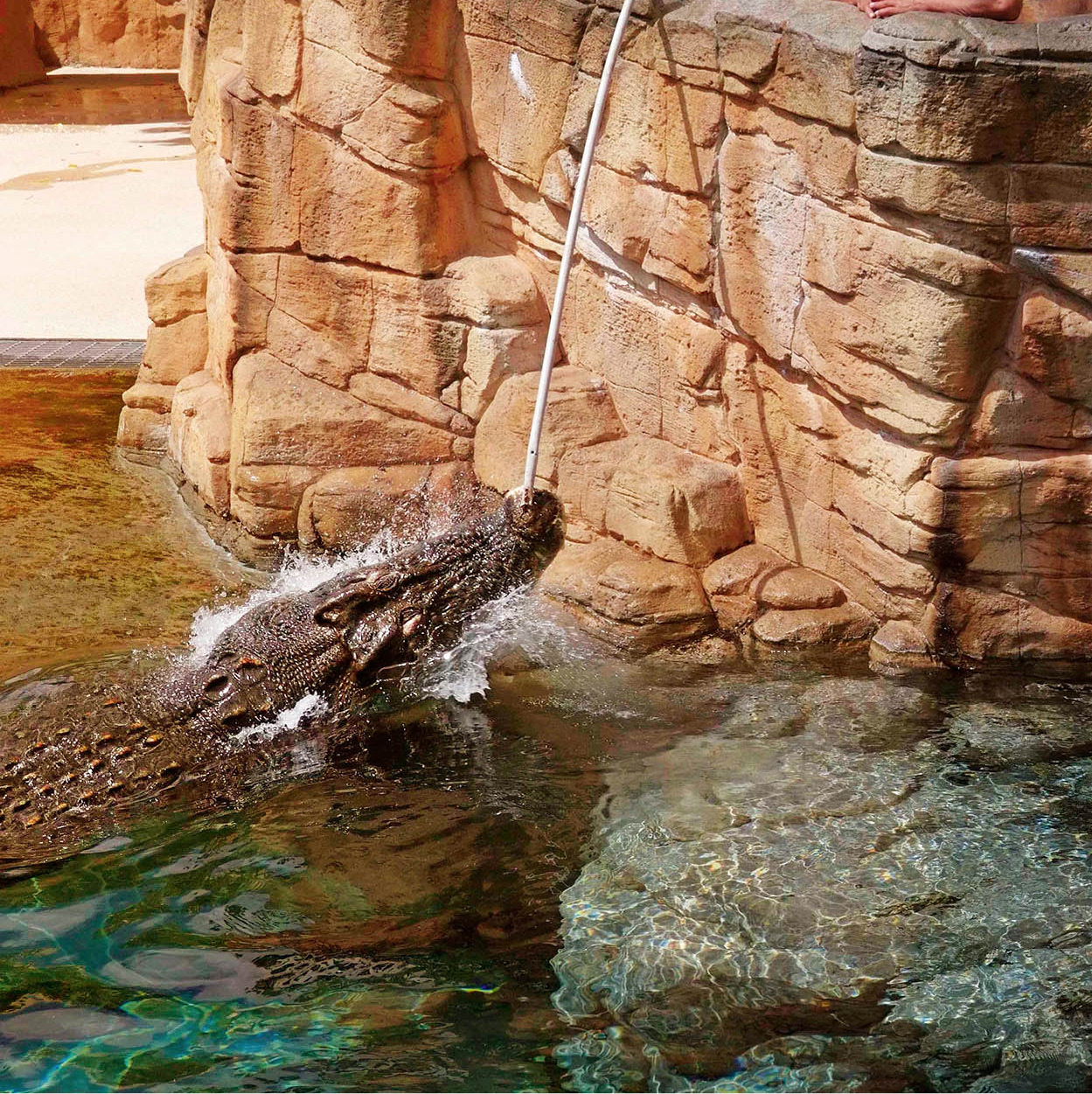
Feeding the crocs
Glyn Genin/Apa Publications
Crocodylus Park (tel: 08-8922 4500; www.crocodyluspark.com; daily 9am–5pm; charge), a 15-minute drive east from the city centre, is home to around 1,000 crocodiles. The feeding sessions (at 10am, noon, 2pm and 3.30 pm) are impressive – time your visit to coincide with one.
South and East of Darwin
About 120km (75 miles) south of Darwin, off the Stuart Highway, is Litchfield National Park @ [map]., which covers around 1,500 sq km (580 sq miles) of tropical savannah wilderness. There are rocky escarpments, waterholes for swimming, waterfalls, patches of monsoon forest and various walking trails. Here, as in Kakadu National Park (for more information, click here), you can see ‘magnetic anthills’, which are found scattered like tombstones in the bush. These are neither magnetic nor anthills – they’re termite mounds, often taller than people, and are always aligned north–south, to achieve internal climate control.
Fogg Dam Conservation Reserve, 60km (37 miles) east of Darwin, off the Arnhem Highway, is a splendid sanctuary where a dozen species of water bird coexist on magical pools. A few kilometres further east you can take a Jumping Crocodile Cruise with Adelaide River Queen Cruises (tel: 08 8988 8144; www.jumpingcrocodilecruises.com.au; charge) on the Adelaide River and watch as crocodiles leap vertically from the water next to your cruise boat, attracted by chicken meat dangled over the side by crew members.
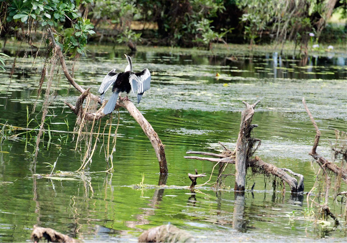
Kakadu wetlands
Glyn Genin/Apa Publications
Visitors – particularly birdwatchers and photographers – are unfailingly enthralled by Kakadu National Park £ [map] (www.kakadu.com.au; charge for non-NT residents over 16). The park covers 19,800 sq km (7,600 sq miles), and the accommodation and commercial centre is Jabiru, 250km (155 miles) southeast of Darwin. The scenery ranges from romantic to awesome. As an unparalleled outdoor museum of ancient Aboriginal art, the park is on the Unesco World Heritage List of places of ‘outstanding universal value’. Some of the paintings have been here since the era of Europe’s Palaeolithic cave art.
Nineteen different groups of Aboriginal peoples live between the Wild Man and East Alligator rivers. They lease the land to the National Parks and Wildlife Service and participate in the park’s daily management, including working as park rangers.
Nature has neatly divided Kakadu into two worlds: the plains, with their lagoons and creeks, and the escarpment, a stark sandstone wall marking the western edge of Arnhem Land. From the top of the high plateau, waterfalls tumble to the lowlands in the wet season (November–March). The floodplains entertain water birds by the thousand. Their names alone are enticing enough to turn laymen into dedicated twitchers: white-throated grasswren, white-lined honeyeater and white-breasted whistler, to list but three of the species that breed in the park. The star of the show, though, is the jabiru, a stately variety of stork. In the mangroves you’ll see striated herons, little kingfishers, broad-billed flycatchers and possibly also magpie geese, black shag, ibis and crested plover. A special delight is the sight of the delicately poised lotus bird, which seems miraculously to walk on the water. The waterways are rich in the eminently edible barramundi. Less appetisingly, the estuaries are home to the saltwater crocodile, a skilled predator that preys on barramundi, birds, small animals and, sometimes, human beings.
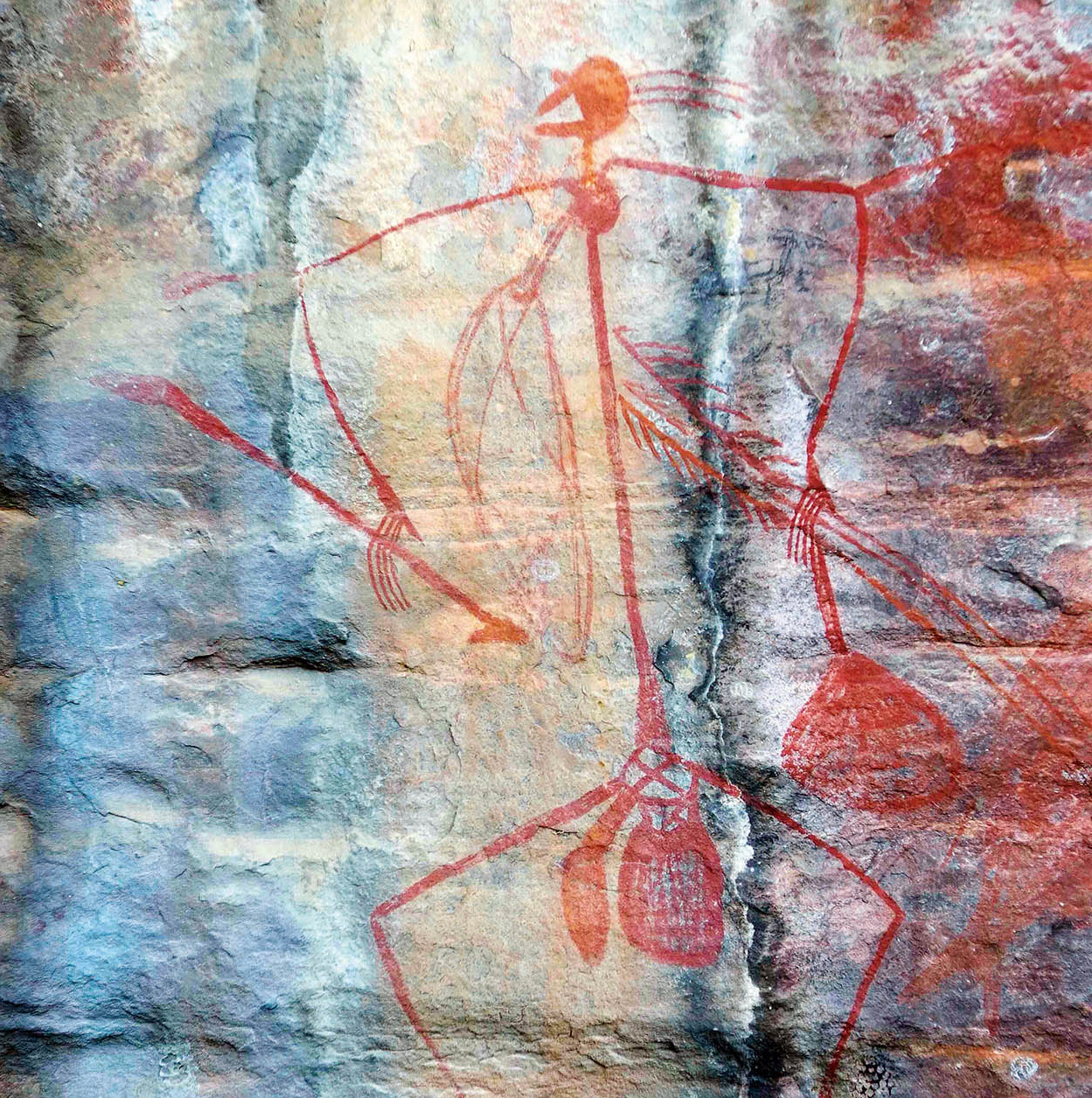
Aboriginal rock art
Glyn Genin/Apa Publications
Kakadu’s Rock Art
As many as 5,000 different sites, most notably at Nourlangie and Ubirr rocks, feature ancient Australian rock paintings in styles both primitive and eerily sophisticated. The earliest legacy consists of handprints and the imprints of objects that were dyed and thrown at cliff walls and cave ceilings for decorative effect. Many centuries later, abstract-expressionists in New York rediscovered a similar technique.
The next generation of prehistoric artists concentrated on depicting the figures of animals. Among them is a curious variety of anteater believed to have become extinct perhaps 18,000 years ago, a valuable clue to the age of some of these paintings. The same school of artists painted stick-figure humans in hunting and battle scenes using ochre pigments for colour.
Later artists introduced movement, such as hunters throwing boomerangs or spears. An innovation of this era was the employment of abstract marks around certain figures, like a modern cartoonist’s squiggles representing a character’s surprise or fear.
Thousands of years later, Aboriginal artists developed a remarkable style, now called X-ray painting. The profile of, say, a fish is clearly painted but instead of its scales we see its bones and internal organs, with the emphasis on edible or otherwise useful parts. After Australia was colonised, Europeans became a subject for the artists. There are pictures of British sailing ships and caricatures, scarcely flattering, of the new settlers holding recognisable muskets.
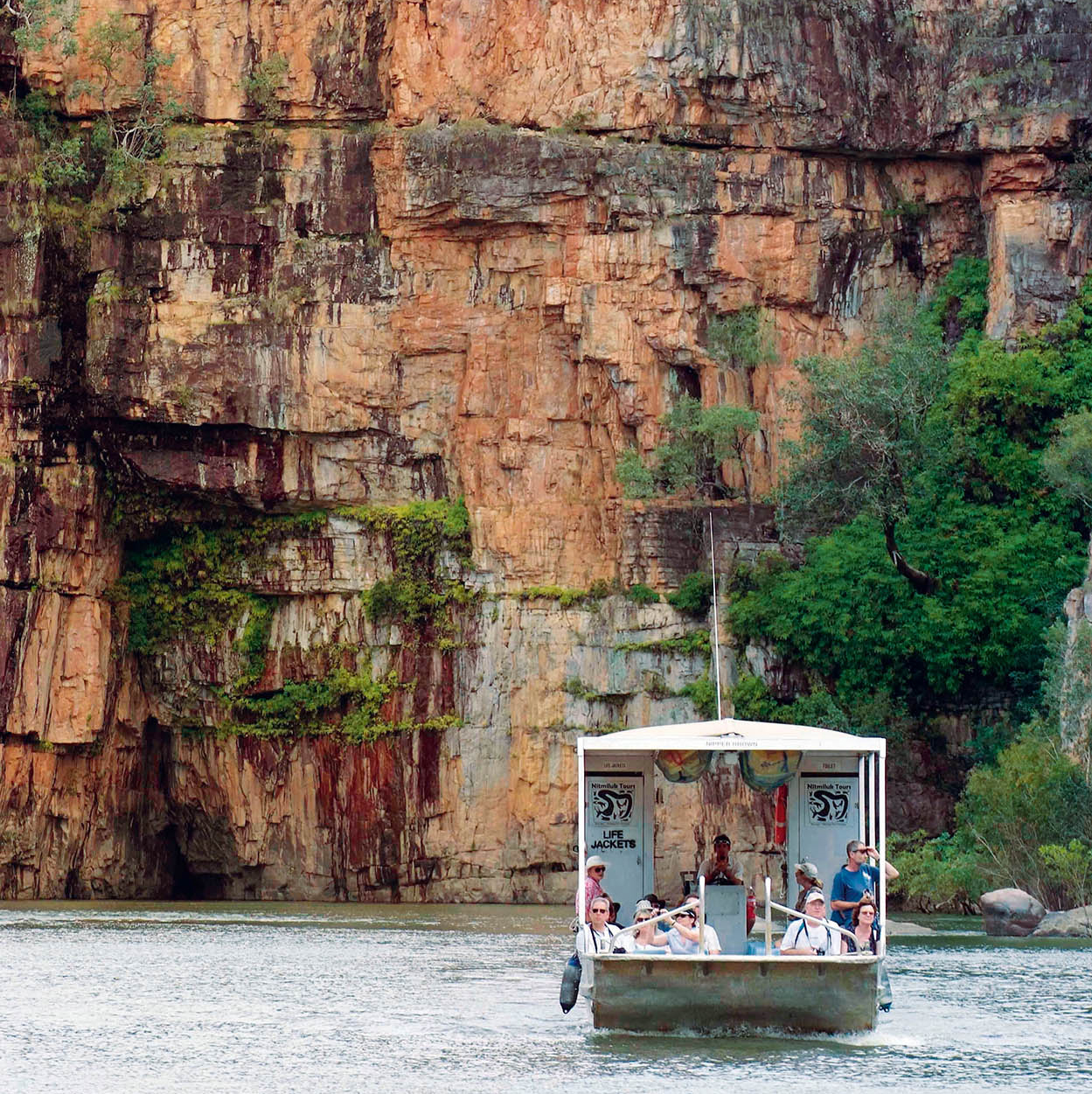
Katherine Gorge
Glyn Genin/Apa Publications
Katherine Gorge
The most spectacular natural attraction located at the Top End of the Northern Territory, Katherine Gorge is about 350km (217 miles) ‘down the Track’ from Darwin. The Track is the highway linking the Timor Sea and Alice Springs in the Red Centre of Australia; originally a rough path, fit only for bullock carts and camel trains, the route was upgraded by American servicemen during World War II to supply Darwin, which at the time was dangerously isolated and under Japanese attack.
Katherine, which is part of Nitmiluk National Park $ [map], is not a single gorge but a series of 13. In the wet season the torrents, waterfalls, whirlpools and rapids give an impression of thundering power. It is very hot and humid, and sometimes the rains cut off the roads, so is best visited in the dry season (April–October), when the water flows at a relative trickle. Flat-bottomed boats cruise along the river, mostly on the lower two canyons, where the water reflects sheer cliffsides, but more inquisitive travellers can explore the other 11 canyons upstream either by walking, hiring a canoe or swimming. The Visitor Information Centre in Katherine (tel: 08-8972 2650; www.visitkatherine.com.au) will book tours.
Among the sights are Aboriginal wall paintings portraying larger-than-life kangaroos and other native animals. Live kangaroos may be seen in the park, as well as echidnas and dingoes. Adding a tremor of excitement is the possibility of glimpsing a freshwater crocodile called Johnstone’s crocodile. Unlike ‘salties’ which are rare visitors to the lower gorges, these fierce-looking reptiles are primarily fish-eaters and, fortunately, tourists do not figure on their menu. Bird life is colourful and includes hooded parrots and black cockatoos. Katherine is also home to a Savannah Guide Station (www.savannah-guides.com.au): the eco-accredited specialist guides focus on heritage, culture, and preservation of the environment.
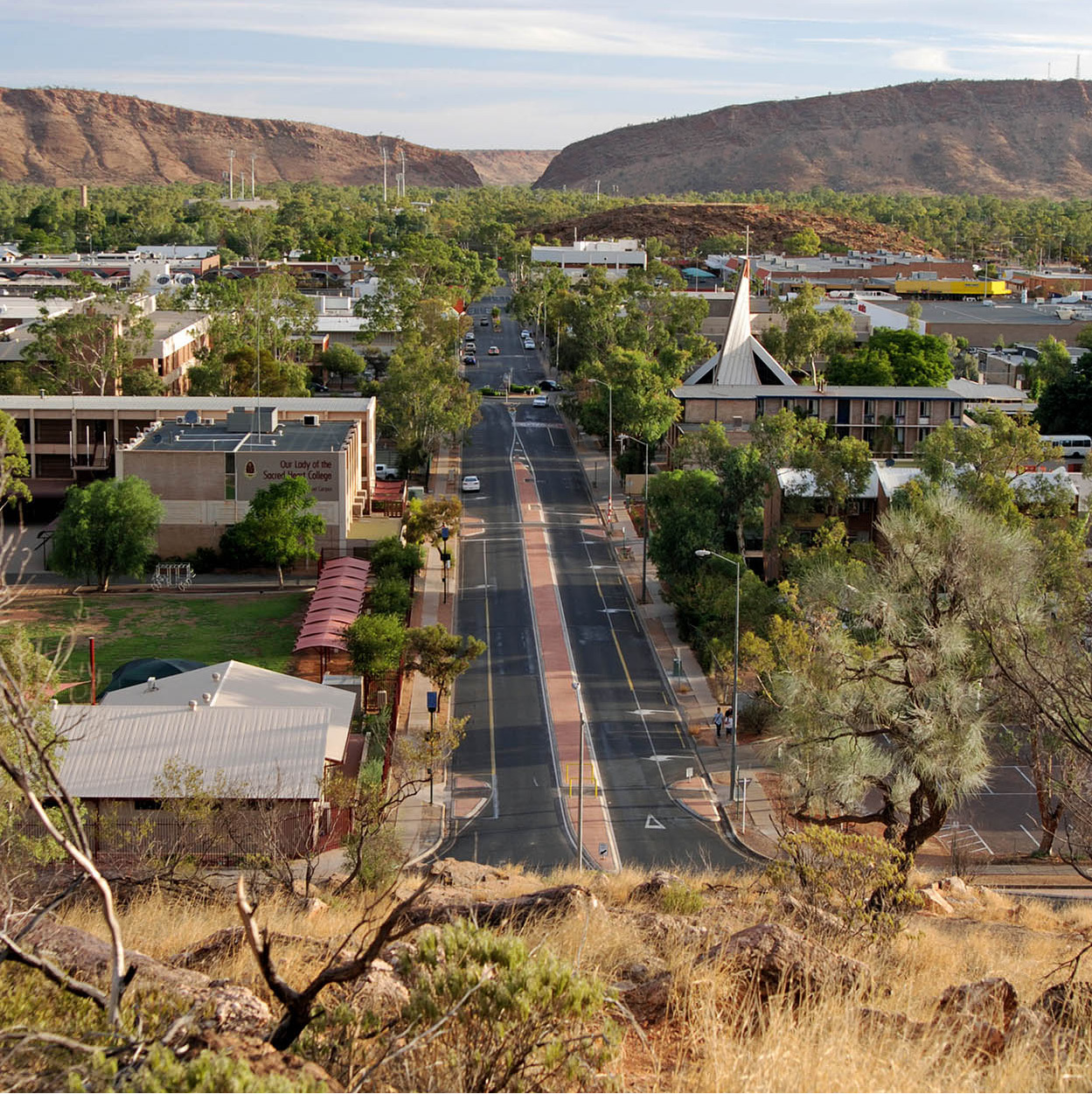
Alice Springs from Anzac Hill
Dreamstime
Traffic lights have slightly tamed the adventurous Outback atmosphere of Alice Springs % [map], the biggest town in the Red Centre, 1,500km (930 miles) south of Darwin. ‘The Alice’ still looks rather like the frontier town you might imagine: a relaxed, friendly, slightly dishevelled community of pioneers, dreamers, transients and, more recently, throngs of tourists.
The Northern Territory’s second biggest population centre has around 28,000 inhabitants. The desert climate can be extreme; in the summer it gets as hot as 42°C (108°F) and winter nights can drop below 0°C (32°F). Mercifully, the days and nights of spring and autumn are very pleasant, though the chances of seeing rain are slight. The Henley-on-Todd Regatta (www.henleyontodd.com.au), a whimsical fixture each August or September, is run on the sandy bed of the sometime Todd River, a wide wadi gullying through the centre of town. The boats are all bottomless, propelled by the racing legs of their crews.
Aboriginal land
The Aboriginal Land Act of 1976 returned about one-third of the Northern Territory to its traditional owners. You need a permit to enter many areas, but not to drive through them on a public road.
Alice Springs first grew around a waterhole discovered in 1871 by the surveying party stringing the first telegraph line from Adelaide to Darwin – and from there to the rest of the world. Alice Springs was named after Alice Todd, the wife of South Australia’s postmaster general. He won a knighthood for pushing through the project; locally, the Todd River immortalises him.
Camel trains, led by Afghan cameleers, carried the equipment for the telegraph relay station built at Alice Springs and the supplies to keep the technicians alive. When termites devoured the first telegraph poles, replacements – heavy iron poles brought in from Britain – also had to be transported by camel train. Telegraphic messages aside, Alice Springs remained isolated until World War II – and until the 1960s it was little more than a crossroads market town. In February 2004, the Alice to Darwin 1,420-km (880-mile) railway extension was completed, fulfilling a century-old promise of a key economic and tourism link.
Like many Australian towns, Alice is bigger than you might expect, but the essential sights can be taken in on a walking tour. The main street, Todd Mall, is lined with galleries selling Aboriginal arts and crafts. Here, too, is the John Flynn Memorial Church, dedicated to the founder of the flying doctor service, and Adelaide House Museum (Mon–Fri 10am–4pm, Sat 10am–noon; free), the town’s first hospital.
The Todd Tavern at the top of Todd Mall is the town’s liveliest drinking spot. There’s also an ‘international standard’ casino, Lasseters, on Barrett Drive.
The Royal Flying Doctor Service, which brings healthcare to the furthest cattle station, began in Alice Springs in 1928. You can visit the base and newly refurbished visitor centre (tel: 08-8958 8411; www.rfdsalicesprings.com.au; Mon–Sat 9–5, Sun 1–5pm; charge), on the south side of town. Opposite the RFDS is the Alice Springs Reptile Centre (tel: 08-8952 8900; www.reptilecentre.com.au; daily 9.30am–5pm; charge). Another unique service that makes Outback life slightly easier, the School of the Air is a radio, phone and internet link that links geographically isolated pupils across the country with each other and a teacher. You can see it in action at the Visitor Centre (www.assoa.nt.edu.au; Mon–Sat 8.30am–4.30pm, Sun 1.30–4.30pm; charge) on Head Street.
A couple of kilometres north of town, an unspoiled park surrounds the restored Telegraph Station (tel: 08-8952 3993 for information on guided tours). This was the most important relay station on the line; before the wires were strung a message could take three months to reach London from Adelaide. The relics here give a glimpse of 19th-century technology and the lonely life of the telegraph pioneers.
West of town, along Larapinta Drive, is the Alice Springs Cultural Precinct (Mon–Fri 10am–4pm, Sat–Sun 11am–4pm; charge), a group of museums and galleries. The Araluen Arts Centre (www.araluenartscentre.nt.gov.au) has four art galleries featuring the works of Aboriginal artists of the Central Desert region. Also here is the Museum of Central Australia, (tel: 08-8951 1121, daily 10am–4.30pm) devoted to Central Australia’s natural history, and the Strehlow Centre, displaying Aboriginal artefacts collected from the early to mid-20th century by anthropologist T.G.H. Strehlow, a researcher among the Arrernte people.
Located 3km (2 miles) out of town along Larapinta Drive is the Alice Springs Desert Park (www.alicespringsdesertpark.com.au; daily 7.30am–6pm; charge), renowned for its achievements in breeding rare and endangered species. A visit starts with a 20-minute film, then you tour walk-through enclosures and see the desert animals, which include emus, red kangaroos, reptiles and birds of prey.
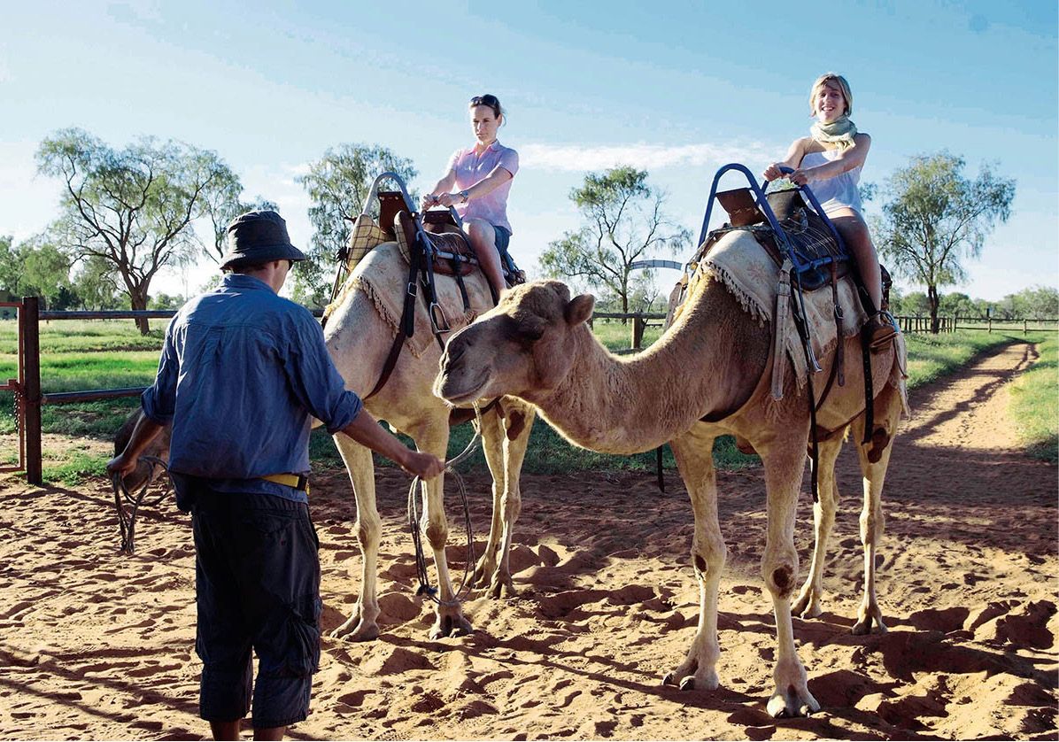
Camel-riding basics
Glyn Genin/Apa Publications
Five kilometres (3 miles) east of Alice on the Ross Highway, the Frontier Camel Farm (tel: 1800 806 499; www.cameltours.com.au) offers camel rides. In mid-July each year, the local Lions Club sponsors the Imparja Camel Cup – an exciting day of camel races at Blatherskite Park. The animals are launched from a kneeling start in a cloud of dust, and run just as fast as racehorses, though rather less gracefully.
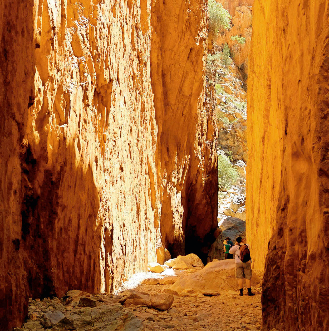
Standley Chasm
Glyn Genin/Apa Publications
A popular excursion from Alice concentrates on Standley Chasm, 50km (30 miles) to the west. This passage through the MacDonnell Ranges dwindles to the narrowest gap. The walls are so high and steep that the sun penetrates the bottom only fleetingly at midday. A few slender trees sprout from the rockface high above, reflected in the cool, still water of a natural pool at the far end of the gorge. During the wet season, from November to March, rain can suddenly flood the chasm.
A tourist drive called The Red Centre Way gives an incredible Outback experience. From Alice Springs, it heads through the western MacDonnell Ranges to Hermannsburg, a former Aboriginal mission, to Kings Canyon (in Watarrka National Park), and then on through the desert to Yulara, the site of Uluru (Ayers Rock). The trip covers about 1,200km (750 miles) and takes between three and five days. Much of the route is unsealed, so you will need a four-wheel drive vehicle. You will also need a permit to travel through Aboriginal land – for permits and information, contact the Tourism Central Australia Visitor Information Centre (tel: 1800 645 199; www.discovercentralaustralia.com).
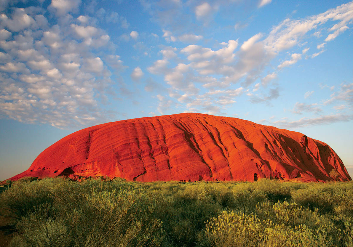
Uluru (Ayers Rock)
Dreamstime
As the sun begins to set, crowds with their cameras gather by car and bus along ‘Sunset Strip’, the tongue-in-cheek name for a dusty stretch of car park. As the onlookers watch Uluru ^ [map] (Ayers Rock; fee for a 3-day park pass) undergo its striking changes of colour, the mood is festive, friendly and relaxed. By coming here, visitors are fulfilling an Australian dream, getting to know this mystical 500-million-year-old rock that rises up from the red heart of the country.
The world’s greatest rock, which seems like it dropped by divine design into the middle of nowhere, actually protrudes from a buried mountain range. At 348 metres (1,142ft) tall and some 8km (5 miles) around, it is even more impressive than the dimensions suggest. Standing alone in a landscape as flat as a floor, and tinted as bright as in your imagination, the monolith certainly lives up to its reputation. It’s not hard to understand why the local Aborigines consider it to be a sacred place.
For the Aborigines it’s not just a rock, it’s a vital aspect of Dreamtime, encompassing the creation of the earth, linked with the life of the present and future. Aboriginal people have owned the rock under Australian law only since 1985. The local Anangu community leases it back to the government for use as a national park in return for a healthy income and participation in its management, but there is a caveat: the sacred places (signposted) around the base remain strictly out of bounds.
Tourists may climb Uluru on a defined path, but the practice is very much discouraged, as it has left a scar on the rock and deeply upsets the traditional owners. Some climbers have died during the experience and they are commemorated by plaques placed discreetly on the base of the rock. Park authorities close the climb if the temperature is over 36°C (97°F), if the track is wet, or if rain or high wind is forecast.
Since Uluru is the principle landmark in the region, there isn’t much to see from the top anyway, and so a much better way to get to know the Rock is to circumnavigate its base on foot, either on your own (you won’t get lost) or on a ranger-guided tour. Up close, the monolith reveals caves, dry rivulets, furrows, wounds and gashes, and what might be taken for fanciful engravings 60 metres (200ft) tall. Alternatively you can take a 30-minute scenic flight from Yulara or a day-trip by air from Alice Springs to get a bird’s eye view of the rock and its surroundings.
From ground-level, the most inspiring views of the rock are to be seen at dawn and dusk. It’s well worth getting up at 6am to stake out the mighty silhouette from 20km (12 miles) away, waiting for the sunrise. As first light strikes the lonely monolith it appears to catch fire, glowing red, then orange, finally seeming to emit rays of wondrous power. Only then the desert world comes to life: a hawk squawks, a rabbit rustles the brush, and hordes of pesky flies begin to buzz.
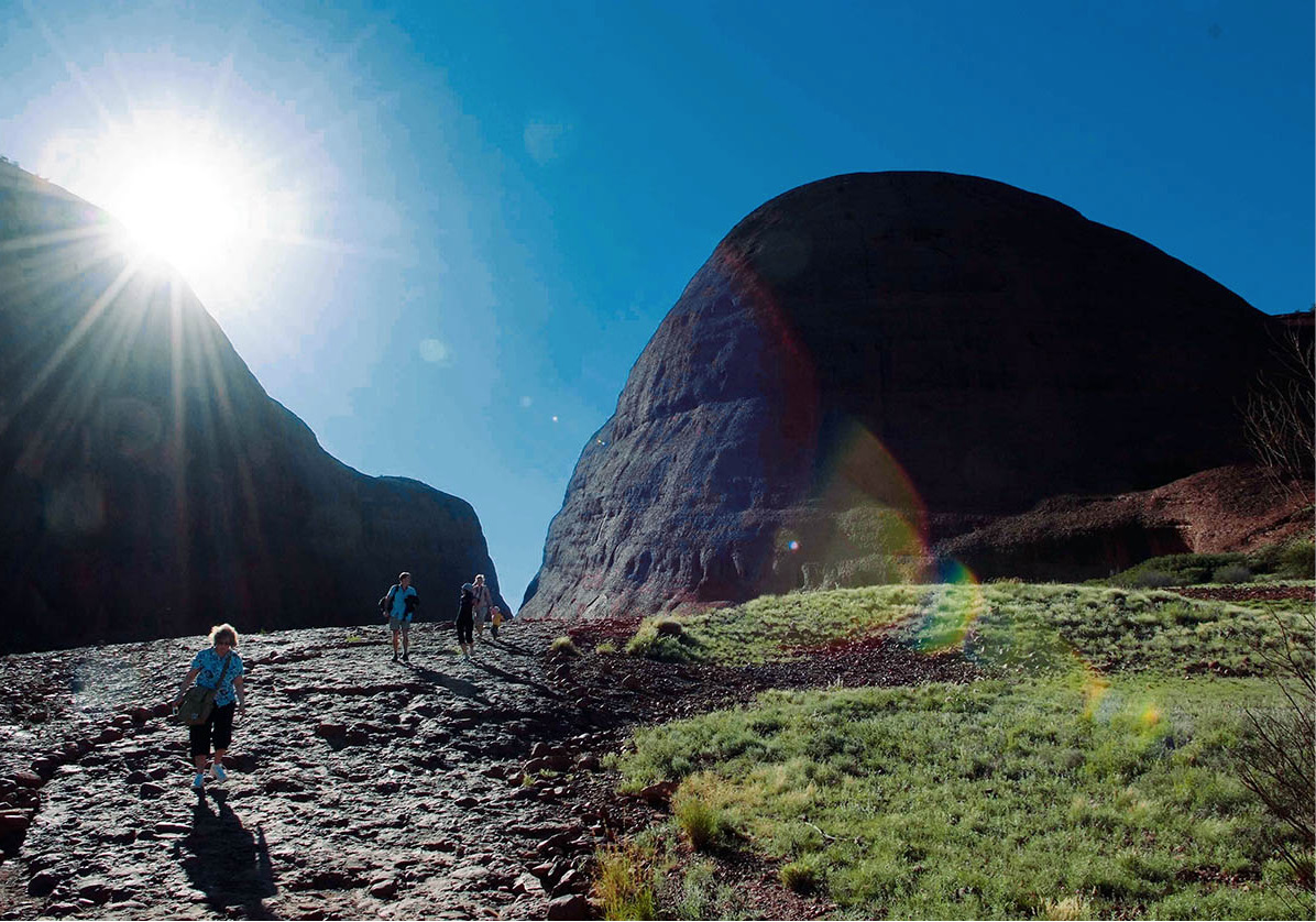
The path to Kata Tjuta: the name means ‘many heads’
Glyn Genin/Apa Publications
Only 36km (22 miles) by road west of Uluru, is another stupendous rock formation, Kata Tjuta (The Olgas) & [map]. From afar, Mt Olga and its satellites look like a scattering of dinosaur eggs or sleeping elephants, but they’re actually higher than Uluru. Here, too, dawn and dusk colour the most fascinating views, the fantasy shapes changing with the hues and the movement of the shadows. You can get to know Kata Tjuta by a choice of hiking routes. The popular trail from the car park up to the lookout is officially described as ‘suitable for family enjoyment’, but it’s steep and tricky enough to deter both the very youngest and oldest generations.
The Yulara Development
To cope with hundreds of thousands of visitors each year at Uluru, a comprehensive resort has been built in the township of Yulara. It could have been a disastrous blot on the landscape, but the Voyages Ayers Rock Resort (www.ayersrockresort.com.au) fits in discreetly, about 20km (12 miles) from the rock. The complex is low-slung and does not detract from the majesty of the surroundings.
Facilities range from campervan sites to a five-star hotel (with gardens, pool, spa, restaurants and bars and, of course, air-conditioning), right through to one of the finest glamping (glamorous camping) spots on Earth, Longitude 131° (http://longitude131.com.au). Here, visitors (including royalty) pay a large price for an exceptional view of the Rock from their beds, set in safari-style mega posh tents. The visitors’ centre in the complex offers information, literature and audio-visual shows explaining the desert, the wildlife, geology, mythology and other angles to enhance your appreciation of the Red Centre.
Several airlines serve Yulara, and the views of the desert on the way are spellbinding. Otherwise you can take a bus or drive; it’s about 450km (280 miles) by paved road from Alice Springs, a whole day in which to become acquainted with the desert in its many forms.
The best time of year to visit is between May and October, when the days are sunny and warm and the nights surprisingly chilly. In January, by contrast, the mean maximum temperature is 36.6°C (98°F) – not conducive to hiking.
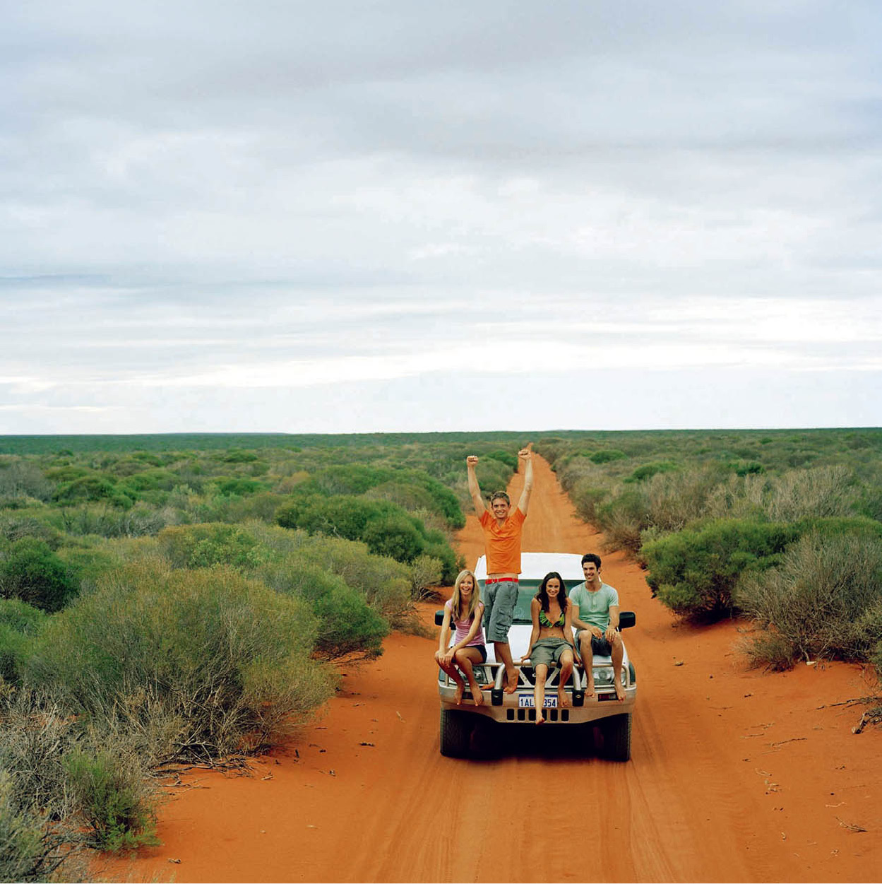
Be prepared going into the Outback
Tourism Australia
Surviving the Outback
Three-quarters of Australia is desert – ‘burning wastes of barren soil and sand’, as the poet Henry Lawson described it. These vast empty spaces on the map hold an irresistible challenge for intrepid adventurers. Only vaguely comparable with desert of the Sahara type, the remote Outback supports vegetation – sometimes even luxuriant vegetation – and fascinating wildlife. But if you do want to venture off the surfaced roads and explore, there are a few precautions you must take.
Do not even consider driving into the Outback in the summer; the heat is unbearable. In the 1840s, explorer Charles Sturt recorded temperatures of 69°C (157°F) in the open and 56°C (132°F) in the shade.
Rain can also be a source of disaster; after many years of drought, a sudden deluge can transform the land into an enormous flood plain. Never camp in a dry riverbed.
Your vehicle should be a reliable four-wheel-drive, with a complete set of spare parts: two spare tyres and tyre repair kit, two spare tubes, coil, condenser, fan belt, radiator hoses and distributor points, a tin of radiator leak fixative, spark plugs, an extra jack (with a large baseplate to prevent sinking in sand or mud), snatch strap, 5 litres (a gallon) of engine oil, a pump, a tool-kit, an axe and a small shovel. Keep the petrol tank full and carry at least 20 litres (5 gallons) in reserve.
You will need to take reliable maps and be sure to plan your route in detail – and then stick to the plan relentlessly. At your point of departure, advise the police of your route, the estimated time of arrival at your destination, and the amount of rations you are carrying. Report to the police again when you arrive. Always seek local advice about the hazards you may encounter. If you wish to enter Aboriginal lands, you must first obtain permission, and at least four weeks’ notice is required. Enquire at the government tourist office for the appropriate address (for more information, click here). In some areas you have to be equipped with a two-way radio or satellite phone.
Take adequate supplies. Most important is water – you will need 6 litres (1.5 gallons) per person per day, best carried in metal containers. Emergency rations should be made up of high-energy foods such as dried fruit, with canned meats, soup and fruit drinks. Some invaluable components of your first-aid kit will be aspirin, water-purifying tablets, salt tablets, diarrhoea pills, insect repellent, disinfectant, bandages and sun-block. Your personal survival kit, which you should carry with you at all times, must contain a compass, map, whistle, waterproof matches, pocket knife, bandage and adhesive plaster.
Other essentials include the following: a set of billycans (pails or pots with lids and wire bails), several sheets of heavy-duty plastic (2-metre/6ft square) and a length of rubber or plastic tubing. A piece of nylon rope (30 metres/100ft long) may also come in handy.
Wear loose, light cotton clothing and a hat. Take warm clothing for nighttime. Space blankets can prove a boon: the shiny aluminium side turned towards the sun reflects heat away from the body, keeping the temperature normal. To keep warm, turn the shiny side inwards.
Do not drive at night. Kangaroos are a real hazard, and you may collide with cattle, camel and water buffalo, attracted to the roads at night because the surface retains warmth.
Be cautious
Glyn Genin/Apa Publications
In Case of Catastrophe
If your car breaks down, above all do not panic. Stay with your vehicle; it will be a welcome source of shade, and it is more easily spotted by aircraft than a person on their own. Do not risk searching for help during the day or night.
Make visible distress signals, using brightly coloured clothing or anything that contrasts with the earth.
Move around as little as possible, to conserve your body fluid. All your physical exertion should take place during the cool night hours.
Your main preoccupation must be water. It is important to ration your supply and set about collecting more by making a solar still, as follows: dig a hole about 1 metre (3ft) square and 50cm (20in) deep, away from any shade. Place a large billycan (pail or pot) in the bottom of the hole, and surround it with leafy foliage. Then cover the hole with a sheet of plastic and seal the edges completely with earth, making sure that the plastic does not touch the interior walls of the hole. If you have a length of rubber or plastic tubing, place it in the bottom of the billycan before you seal the edges of the sheeting, leaving the other end outside to act as a siphon. Place a small stone in the centre of the plastic sheet, right over the billycan. Moisture from the foliage will condense on the underside of the plastic sheet and will drip slowly into the billycan. In this way you will collect about 2 litres (0.5 gallons) of water per hole per day, so it’s best to make several stills, at least 3 metres (10ft) apart. Change the position of the still every few days.
Small animals – frogs, lizards and snakes – are attracted to the stills and may provide an extra source of food. In principle, anything that walks, crawls, swims, flies or grows from the soil is edible, but beware of anything that has a bitter taste and of plants with a milky sap.
Another source of food and water in the northwest of Australia is the bottle-tree, which preserves water in its trunk for months after the wet season has ended. In an emergency you can also eat the rind of bottle-tree pods, chopped up and stirred with water.
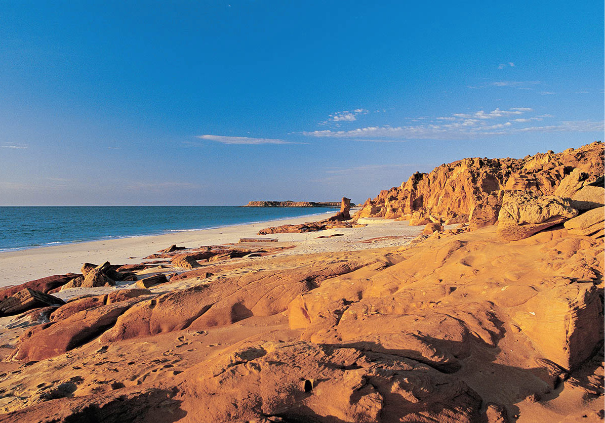
Western Australia
Tourism Australia
WESTERN AUSTRALIA
When it comes to elbow room, the state of Western Australia has no competition. It’s 10 times bigger than Great Britain, and covers more land than Texas and Alaska combined.
Most of the state’s vast expanse is desert, semi-desert or otherwise difficult terrain. The bulk of the population of 2.3 million has therefore gravitated to the Mediterranean climate found around the beautiful capital city of Perth. Closer to Jakarta than to Sydney, Perth faces the Indian Ocean with an open, outward-looking stance. Here the cares of the big-population centres of eastern Australia seem a continent away – largely because they are.
The state’s Outback produces great wealth, and even the forbidding deserts are bursting with minerals. It was gold that brought the state’s first bonanza, during the 1880s and 1890s, followed by nickel, bauxite and iron. Considerably more appealing are the above-ground riches: the hardwood forests, the orchards, the vineyards and the springtime wild flowers. And, since the climate is so sunny, it’s only fair that there is a beach for every possible mood along the 6,400km (4,000 miles) of coastline.
The first European to set eyes on a Western Australian beach (in 1616) was Dirk Hartog, a Dutch navigator making his way from the Cape of Good Hope to Java. It was not long before other Dutch travellers touched base here, and one of them reported spotting a wallaby – he thought it was a giant cat with a pouch for its kitten. Later, in the 17th century, the British adventurer William Dampier sailed along the coast and happened upon an inlet he named Shark Bay, near Carnarvon. He could hardly wait to leave; the land seemed hopeless for farming, there was no drinking water, and he dismissed the indigenous population as ‘brutes’.
More than 200 years after Hartog’s ‘discovery’ of Western Australia, the British finally got around to colonising it. The site chosen, on the Swan River, became Perth. But what the Colonial Office considered a good idea turned out to be less brilliant in practice. It would take more than nice scenery and a temperate climate to attract settlers to what seemed, even by Australian standards, to be the end of the world. Problems of development persisted, including poor communications, financial difficulties and a shortage of workers. Prospects for the new frontier became so precarious that the colony’s leaders had to make an appeal to London, asking the government to send over a supply of forced labourers – convicts.
From Coast to Coast
It takes just 4.5 hours to fly from the South Pacific to the Indian Ocean, from Sydney to Perth, but if you have 68 hours to spare, you can make the journey by train. The Indian-Pacific, a luxurious but not particularly rapid train operated by Great Southern Railways (www.greatsouthernrail.com.au), crosses the country twice a week in each direction. On its 4,352-km (2,702-mile) journey, it dissects the Nullarbor Plain, one section forming the world’s longest stretch of straight track – 479km (298 miles) without a bend. There are numerous stops, but few towns, and none of any importance. In fact, there’s not much to see – nothing but scrub, blue sky and telegraph poles for days on end – but passengers are well catered for with an observation lounge, a bar and even a music room.
Even when these were forthcoming, nothing really worked in Western Australia until the gold rush during the 1890s, when the population quadrupled in just 10 years. Throughout the 20th century and up to the present, the exploitation of mineral deposits throughout the state has provided the main basis of its wealth – from uranium and iron ore to gas and oil. Once it was launched on the road to prosperity, there was no stopping Australia’s largest state. Its isolation finally ended in the early years of the 20th century, when the transcontinental railway linked Perth and Sydney.
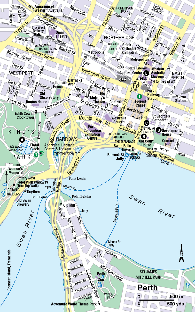
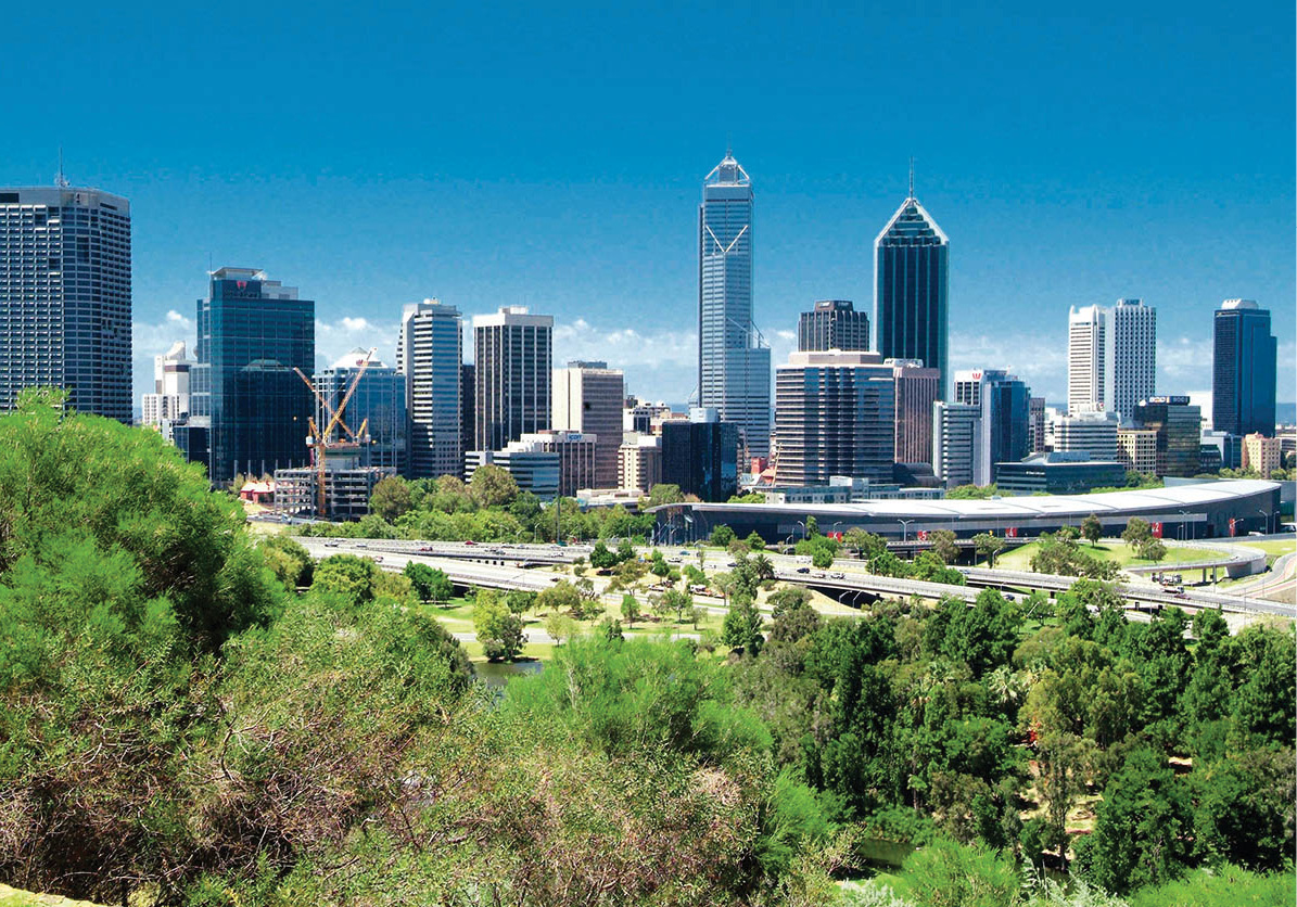
Perth’s skyscrapers
Glyn Genin/Apa Publications
Bright new high-rise office buildings scrape the clear blue skies of Perth * [map]. If this city, brimming with vigour and enthusiasm, were a person, you might imagine it had been born with the proverbial silver spoon in its mouth: a handsome, healthy, clean-cut youngster with every possible advantage, inevitably growing up to become an unqualified success in life.
Although history refutes the silver-spoon theory, you can’t miss Perth’s easy self-confidence. The people are relaxed, friendly and eager to help strangers. They are proud of their efficient town and its up-to-date facilities – the stylish shopping arcades, the art galleries and Entertainment Centre – and the great sailing, swimming, surfing and fishing right on its doorstep. The inhabitants won’t fail to inform you that this tidy city sprawling magnificently along the looping Swan River is Australia’s sunniest state capital.
Sunshine aside, Perth has called itself ‘the city of lights’ since the early days of the American manned space programme. As John Glenn, the first American to orbit the earth, passed over the city, middle-of-the-night Perth switched on every light bulb in town. It was a friendly gesture that brightened the lone astronaut’s flight and put Perth’s name in lights.
City Sights
Few will get a chance to enjoy a spaceman’s perspective, but the view over Perth from King’s Park A [map] is a good compromise. These 400 hectares (990 acres) of natural woodland and wild flowers, manicured lawns and picnic sites, solemn monuments, bike tracks and lively playgrounds are found on the top of a bluff called Mt Eliza, right on the edge of the city centre. From here you look down on the wide Swan River as it meanders toward the sea, on the business district with its gleaming skyscrapers, and on the complexity of the well-landscaped municipal freeway system.
Indigenous black swan
Dreamstime
The Swan River was named after the indigenous black swans found here, first noted with amazement by the 17th-century Dutch navigator Willem de Vlaming. The river begins about 240km (150 miles) inland in the wheatlands of Western Australia. For most of its long journey, under the name of the Avon River, it is only seasonally navigable. But in Perth, with the Indian Ocean close enough to salt it, the Swan widens into a lake, and invites reflection – and attracts flotillas of yachts. By the riverside in the centre of town, the Old Court House B [map] (Wed–Fri 10am–2.30pm; free) really is old, especially by local standards. Built in Georgian style in 1836, it’s the oldest public building in Perth and houses the Francis Burt law museum.
Stirling Gardens, surrounding the courthouse, is a restful hideaway. The ‘Ore Obelisk’ monument here looks like a giant shish-kebab impaling all of the minerals mined in Western Australia; but don’t expect to find gold or diamonds on the skewer – they don’t seem to count.
Nearby, fronting the river, the Barrack Street Jetty, where ferries leave for Rottnest Island, is the site of the striking steel, glass and copper Swan Bells Tower (daily 10am–4pm; charge), completed in 2001. The 82.5-metre (270-ft) spire houses the 14th-century bells of the church of St-Martin-in-the-Fields, London – a Bicentennial present from Queen Elizabeth II – which ring out every day except Wednesday and Friday, noon until 1pm. A top-floor observation deck gives views of the Perth skyline.
The Town Hall C [map], at the corner of Hay and Barrack Streets, was built in the 1860s by convicts. If you look closely at the outline of the windows of the tower, you may perceive the design of broad arrows – the prison symbol that was stencilled on convict uniforms. Similarly Tudor in inspiration, but even less of an antique than the Town Hall, London Court is a 1930s shopping mall done up in 16th-century style. It fits in quite happily with the modern stores and interconnecting shopping precincts radiating from the Hay Street Mall, Perth’s main shopping street. Cars are prohibited here, so the window-shopping is very relaxed.
A couple of blocks north, across Murray Street Mall, is Forrest Place on the corner of Wellington Street. Here, in Albert Facey House, you’ll find the Western Australian Visitor Centre (tel: 1800 812 808; www.bestofwa.com.au; Mon–Fri 9am–5.30pm, Sat 9.30am–4.30pm, Sun 11am–4.30pm).
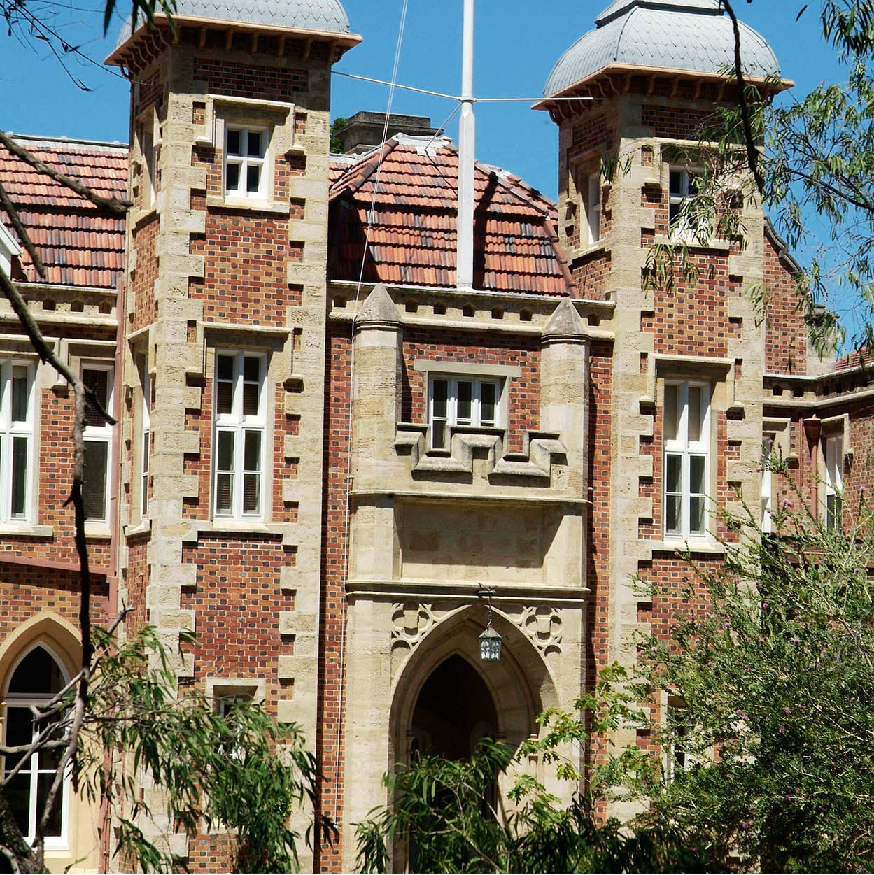
Government House
Glyn Genin/Apa Publications
In a city as young as Perth, with its skyline of tall, modern office buildings, those historic structures that have escaped the developer’s demolition ball are proudly pointed out to visitors. Government House D [map], on St George’s Terrace, Perth’s main street, is the official residence of the Western Australia governor. Its Gothic effects date from the 1860s. Built by hard-working convicts, the house is used nowadays for state occasions and to accommodate visiting VIPs.
Heading west, St George’s Terrace leads directly to the Barracks Archway, the last vestige of a headquarters building of the 1860s; this crenellated three-storey structure has been preserved as a memorial to the early colonists. Behind the brick archway you can glimpse Parliament House, where the state legislature sits.
On the other side of the railway tracks (you can cross the unusual Horseshoe Bridge by foot or car) stands the Perth Cultural Centre E [map] (www.perthculturalcentre.com.au) which is made up of the Western Australia Museum (tel: 08-9212 3700; www.museum.wa.gov.au; daily 9.30am–5pm; free) and the Art Gallery of Western Australia (www.artgallery.wa.gov.au; daily 10am–5pm; free), the State Library and the Perth Institute of Contemporary Arts (PICA; tel: 08 9228 6300; www.pica.org.au; Tue–Sun 10am–5pm; free). Part of the Western Australian Museum is the Old Gaol, which was constructed and used by convicts in 1856. The museum offers more than penal relics – there is also an extensive collection of Aboriginal rock paintings, head-dresses and weapons, and a 10-tonne meteorite. The Art Gallery of Western Australia displays paintings from several continents.
Also north of the city centre is the Northbridge district, which is full of lively ethnic restaurants, pubs and nightclubs, especially around James and Lake streets. If you’re in the mood for gambling, head east for the Burswood Entertainment Complex, near the Causeway Bridge. Here, under one roof, you’ll find a casino, a nightclub, restaurants, bars, and Perth’s two main entertainment venues, a 2,300-seater theatre and the 20,000-seater Burswood Dome, which can pack them in for rock concerts, ballet, sporting and other events.
In the centre of town is the Concert Hall, the headquarters of the state’s symphony orchestra. If you’re looking for stage plays, the most atmospheric house is His Majesty’s Theatre (825 Hay Street; tel: 8-9265 0900; http://hismajestystheatre.com.au), a plush Edwardian pile.
Well north of the centre, in the seaside suburb of Sorrento, the Aquarium of Western Australia (Hillary’s Boat Harbour; 91 Southside Drive; tel: 08-9447 7500; www.aqwa.com.au; daily 10am–5pm; charge), an underwater-tunnel aquarium with interactive displays, offers whale-watching trips in season. For action entertainment, try the thrill rides at Adventure World Theme Park (179 Progress Drive, Bibra Lake; tel: 08-9417 9666; www.adventureworld.net.au; Thur–Mon 10am–5pm, during school holidays daily 10am–5pm; charge), 15km (9 miles) south of the city.
To the Coast
It’s only 19km (12 miles) down the river from Perth to the capital’s Indian Ocean port, Fremantle – an enjoyable outing on one of the cruise boats that ply the Swan River. The river tours begin in the centre of Perth, at the Barrack Street Jetty. On the south side of the Narrows Bridge, note the Old Mill (Mill Point; tel: 08-9367 5788; Tue–Fri 10am–4pm, Sat–Sun 1pm–4pm), built in 1835, an imposing white windmill in the Dutch style from the first half of the 19th century. Perfectly restored, it’s open for visits and tours.
Beyond this, on the opposite shore, just past Kings Park, spreads what looks like another transplant from Europe. The campus of the University of Western Australia was constructed and landscaped in a Mediterranean style, from the shrubs right up to the orange-tiled roofs. Matilda Bay harbours only a relative handful of the swarms of sailing boats that call the Swan River home. During World War II this was a base for Catalina flying boats. The bay is now the site of the Royal Perth Yacht Club.
The coastline of the Dalkeith district, near Point Resolution, is called Millionaires’ Row, and the view of these fine mansions from the perspective of the river might evoke a dash of envy.
Freshwater Bay was named by the crew of HMS Beagle, the survey ship made famous by Charles Darwin. Beyond this bay, and a zigzag, the river tapers to a fairly narrow-gauge artery spanned by two bridges. Long-suffering convict labour built the first bridge at this site in 1866. It proved a boon to one of its creators, a celebrated outlaw named Moondyne Joe, an escape artist. The night before the ribbon-cutting ceremony, he broke out of Fremantle Prison and became the first person to cross the bridge over the Swan River, making a clean getaway.
Fremantle
Although it’s a serious international port, you’ll remember the city of Fremantle for its casual charms. The town’s special character combines Mediterranean-style sunniness with lovely Victorian quaintness and a down-to-earth demeanour.
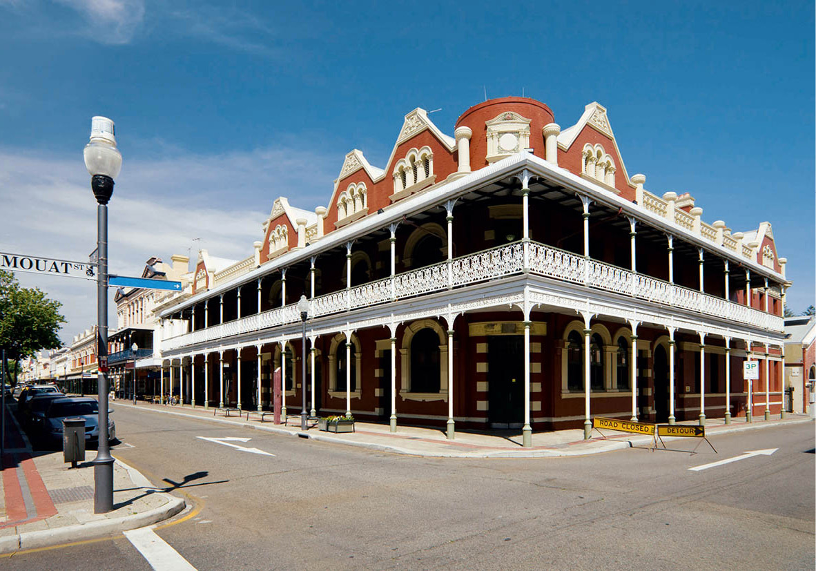
Fremantle’s quaint architecture
iStock
For many years Fremantle ( [map] – ‘Freo’ to the Aussies – lay becalmed, a long way from tourist’s eyes. Then came the America’s Cup saga and suddenly Freo was saturated with world attention. New-found pride inspired the townsfolk in their sparkling campaign to restore the old terraced houses and other relics in time for the 1986–87 defence of the Cup.
Whether you think of Fremantle as a yachting base or a workaday port, you’ll want to see the sights of the harbour, where dream yachts, trawlers, ocean liners and cargo ships of every stripe rub shoulders.
Fremantle’s highest point is Monument Hill in War Memorial Park. There are three memorials altogether, including one for the US personnel based in Fremantle who died in World War II. Another, an original periscope, commemorates the British and Allied submarine crews who perished in the same conflict. This is the place to watch the sun set over the Indian Ocean.
Back near the waterfront, and wasting an enviable view, the 12-sided Round House (tel: 08-9336 6897; www.fremantleroundhouse.com.au; daily 10.30am–3.30pm; free) looks like the forbidding, windowless prison it used to be. Actually, it’s much more cheerful from the inside, with a sunny courtyard. Constructed in 1831, the Round House specialised in housing less serious criminals, although it was the site of the state’s first hanging.

Old Fremantle Prison
iStock
The more compelling penal complex is the Old Fremantle Prison (tel: 08-9336 9200; www.fremantleprison.com; guided tours daily 10am–5pm), convict-built in 1855 and continuously in operation as a maximum-security prison until the early 1990s. Since 1992 it has been one of Fremantle’s most popular attractions; the fascinating guided tours leave every 30 minutes, and after-dark candlelit tours are also offered.
In pride of place on Victoria Quay is the Western Australian Maritime Museum (tel: 08-9212 3700; www.museum.wa.gov.au/maritime; daily 9.30am–5pm; charge), which highlights the state’s maritime history. The Shipwreck Gallery (daily 9.30am–5pm; free) is housed separately, in the convict-built Commissariat building on Cliff Street. Here’s a chance to see some notable wrecks such as the wooden hull of the Batavia, the flagship of the Dutch East India Company, which went aground in 1629 and was salvaged and restored in the late 20th century.
The Fremantle Arts Centre (tel: 08-9432 9555; www.fac.org.au; daily 10am–5pm; free), at the other end of town, houses a gallery of contemporary art in a converted Victorian lunatic asylum, and stages concerts and other events.
If you’re visiting Fremantle at the weekend, check out the lively markets (www.fremantlemarkets.com.au) held in a two-faced venue comprised of the Yard (Fri 8am–8pm, Sat–Sun 8am–6pm) and The Hall (Fri 9am–8pm, Sat–Sun 9am–6pm) sandwiched between Henderson Street Mall, South Terrace and William and Parry streets.
Quokka Arms
The Rottnest Hotel (www.hotelrottnest.com.au), popularly known as the Quokka Arms, was built in 1864 and originally served as the summer residence of the governor of Western Australia.
Rottnest Island
Don’t be put off by the name: there is nothing rotten in the state of Western Australia, and certainly not on Rottnest Island (www.rottnestisland.com), but even in translation, the name does the island no justice. Commodore Willem de Vlaming, who landed here in 1696, confused the indigenous quokkas (a species of small wallaby) with a species of rat, and called the island Rottnest, or ‘rat’s nest’. In spite of bequeathing the island this unkind and misleading moniker, the Dutch explorer considered Rottnest (rebranded ‘Rotto’ by Aussies) an earthly paradise. You may well agree.
A good reason for going over the sea to Rottnest (18km/11 miles from Fremantle) is to see the fetching little quokkas, bounding around with babies in their pouches, like their marsupial cousins. Other attractions are peacocks and pheasants, introduced when the governors of Western Australia used the island as a summer residence. And you can spot dozens of other species of wild birds, including osprey. Since 1941 the island has been a wildlife sanctuary, where it’s forbidden to tamper with any of nature, even the snakes.
Rottnest is a quiet, idyllic, barefoot sort of island (except, perhaps, during ‘Schoolies’ week in late November/early December, when WA’s high-school leavers celebrate their graduation with raucous partying). The number of cars is severely limited. Bikes are the most popular way of exploring the 40km (25 miles) of coastline. The snorkelling is amazing, as are the swimming, fishing and boating opportunities.
Two ferry operators serve Rottnest Island from Perth or Fremantle: Rottnest Express (tel: 1300 467688; www.rottnestexpress.com.au; departs from Fremantle and Barrack Street Jetty in Perth City) and Rottnest Fast Ferries (tel: 08-9246 1039; www.rottnestfastferries.com.au; departs from Hillary’s Ferry Terminal in Sorrento). It’s a 30-minute cruise from Fremantle and about double that from Perth. You can fly there in 20 minutes.
Excursions Inland
Just to the east of Perth, the Darling Range is the beginning of a great inland plateau. Amid the tall trees and colourful wild flowers are lookout points with superb views of the city and the sea. Waterfalls, brooks and dams serve to refresh the relaxing scene.
The Swan Valley, only about half an hour’s drive northeast of Perth, is a high-priority destination for wine lovers. The area is noted for its small, family-run vineyards. The wine-making tradition in the Swan Valley dates back to the foundation of Western Australia. If wine tasting and driving seem incompatible, you can take a coach tour of selected vineyards, or the popular river cruise with stops at one or two cellars.
Further east, the 150km (90-mile) green expanse of the Avon Valley provides pastureland for cattle and grows the grain to feed Perth and beyond. The colony’s first inland settlement, York is proud of its history. More than a dozen 19th-century buildings, including an extravagantly designed Town Hall, have been restored; several now serve as museums. Just outside town, one of the early farms has been restored to a ‘living museum’ in which you can watch blacksmiths and wheelwrights at work. Clydesdale horses still plough the fields.
Yanchep National Park, 50km (30 miles) to the north of Perth, is known for its eucalyptus forests, wild flowers (in bloom in September) and a series of limestone caves. There is also an island-studded lake called Loch McNess, named after a local philanthropist, Sir Charles McNess. Don’t bother looking for a Loch McNess monster. You can, however, see a koala colony here.
For those interested in wild flowers, the coastal town of Geraldton, 420km (260 miles) north of Perth, makes a good base for exploring the surrounding areas, such as Kalbarri National Park, where the flowers are at their best in August.
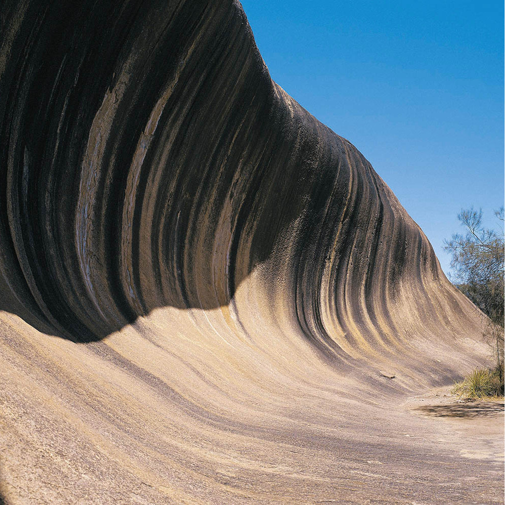
Wave Rock
Tourism Australia
Natural Wonders
A feature reckoned to be more than 2.5 billion years old is Wave Rock (www.waverock.com.au), one of those natural phenomena worth a long detour – it’s a 700km (437-mile) round trip by road from Perth. The rock stands near the small town of Hyden, about 350km (220 miles) inland from Perth, in the wide-open spaces where the wheat, oats and barley grow. The rock itself takes the form of a stupendous surfer’s wave, as tall as a five-storey building, eternally on the verge of breaking. Walking under the impending splash is one of the state’s most popular tourist activities. Other extraordinary rock formations in the area have expressive names like Hippo’s Yawn and The Humps.
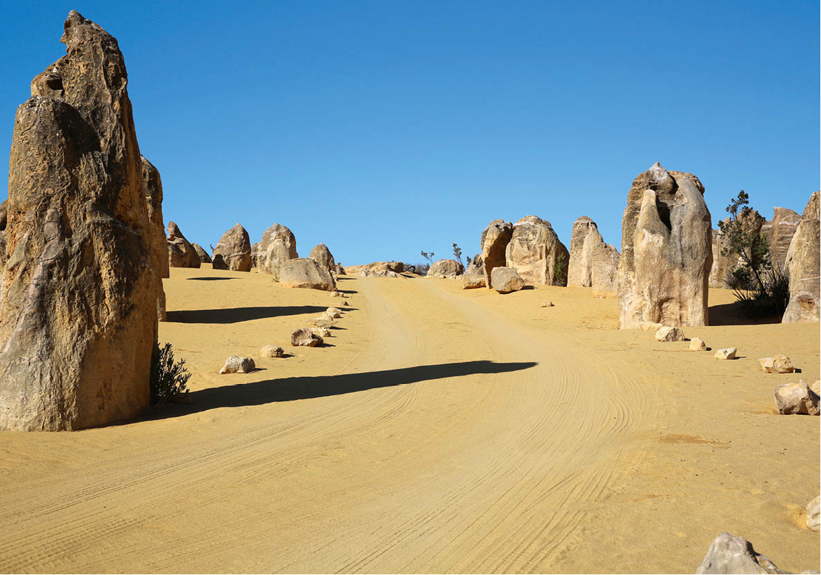
Pinnacles Desert
iStock
In Nambung National Park ‘ [map] about 250km (155 miles) north of Perth, the Pinnacles Desert is notable for myriad limestone pillars, jutting like stalagmites from the desert floor. Standing as high as 5–6 metres (16–20ft), the Pinnacles are scattered over perhaps 400 hectares (1,000 acres). When Dutch explorers first sighted the Pinnacles from their vessels in the 17th century, they thought they had found the ruins of a long-deserted city. In fact, they are entirely natural. Limestone formed around the roots of plants growing on stable dunes about 30,000 years ago. The plants died and the dunes moved on, leaving the calcified structures exposed. The park’s entrance is located near the fishing village of Cervantes.
The Southwest
Excursions to the southwestern corner of Western Australia encompass a delightful variety of scenery: beaches, vineyards, orchards, wild flowers (at their best in September) and forests of jarrah, karri and marri – eucalyptus species not found anywhere else. You can see some of these majestic trees – some up to 70 metres (230ft) high – in Leeuwin-Naturaliste National Park, just to the west of Margaret River (for more information, click here), and near Pemberton, about 140km (90 miles) south of the town of Margaret River.
Bunbury is a pleasant vacation town in the southwest, 180km (110 miles) from Perth; here you can swim with relatively tame dolphins at Koombana beach. The Margaret River ⁄ [map] region, between Cape Naturaliste and Cape Leeuwin, is honeycombed with limestone caves, some of which are open to the public. Near Yallingup, Ngilgi Caves (tel: 08-9755 2152; daily 9.30am–3.30pm; charge) form a fantastic underground world of elaborately carved limestone, and the tours are highly recommended.
Margaret River lies at the heart of the state’s top wine-growing and gourmet-dining region. Specialities include brie-style cheese, fresh berries and marron (freshwater crayfish), while accommodation ranges from boutique guest-houses to five-star hotels or campsites. Places to stay include Cape Lodge, built with a South African influence. Margaret River township is the perfect spot from which to tour the region’s noted vineyards, including Vasse Felix, Clairault, Sandalford, Leeuwin Estate, Xanadu and Cape Mentelle. This area is also famed as one of the nation’s best surfing locations. The closest beaches are at Prevelly, 10 minutes’ drive from town.
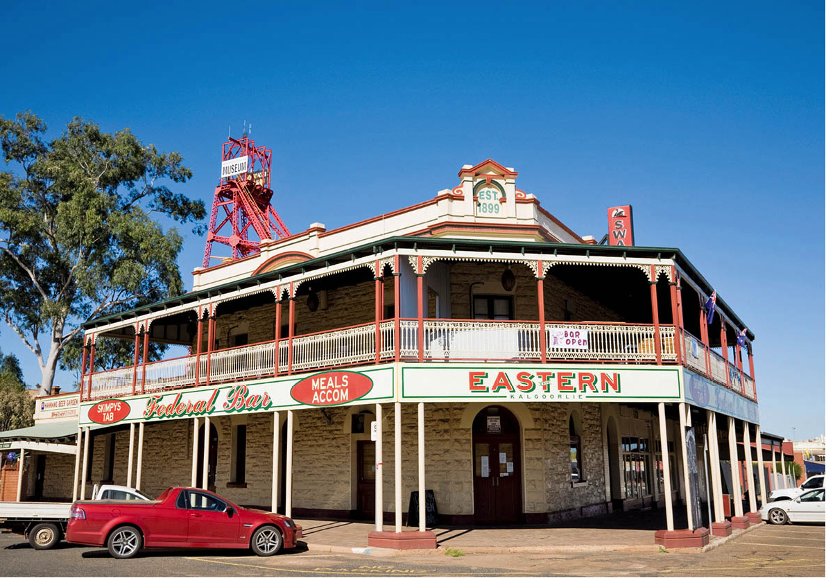
Kalgoorlie townscape
iStock
The Goldfields
Kalgoorlie ¤ [map], located around 550km (340 miles) east of Perth, retains the atmosphere of the anarchic gold-rush town it was in the 1890s. The streets, laid out in a grid, are wide enough for stagecoaches or camel trains to make a U-turn. It’s like a Wild West movie set, with verandah-skirted saloons for every occasion. Optimists still scan old worked-over sites in search of forgotten nuggets – and the occasional whopper still turns up.
The first big strike of Kalgoorlie gold came in June 1893, when an Irishman named Patrick Hannan stumbled onto enough glitter to really kick up a fuss. A bronze statue of the bearded prospector has a place of honour in Kalgoorlie’s main street, which bears his name.
When Hannan’s news spread, thousands of prospectors rushed headlong into the goldfields. The almost total lack of water was the first desperate hardship they faced, and death from dehydration and disease took a heavy toll. The solution was found by another Irishman, an engineer named C.Y. O’Connor, who constructed a 560-km (350-mile) pipeline from a reservoir near Perth. You can still see the big above-ground pipes by the side of the road. Wounded by criticism of the project, O’Connor killed himself before the first drop of water reached Kalgoorlie.
As the prospectors came in from the surrounding desert with their sudden wealth, Kalgoorlie – and its neighbouring twin town of Boulder – turned into a rip-roaring supplier of wine, women and song. The pubs ran riot; many still retain their frontier atmosphere. Another old mining tradition is the red-light district of Hay Street, although apparently only three of the notorious ‘tin-shack’ brothels are still in business. You can gauge how prosperous the town was from the elegance of the Victorian buildings, most notably in the three-storey Western Australia Museum, Kalgoorlie-Boulder (daily 10am–4.30pm; free). This institution is stacked with exhibits detailing the life and work of those early prospectors.
Just north of Kalgoorlie, 5km (3 miles) along the Goldfields Highway, on the site of a disused mine, is the Mining Hall of Fame (daily 8.30am–4.30pm; charge), which highlights Australia’s mining industry. There are gold panning demonstrations and former miners conduct underground tours.
A year before Paddy Hannan’s big strike at Kalgoorlie, gold was discovered at Coolgardie, about 40km (25 miles) to the west. Today Coolgardie proudly bears the slogan of ‘ghost town’. The historical markers here seem to far outnumber the population, which at the turn of the 20th century was 15,000 and now stands at only about 800. Any good ghost town needs an interesting cemetery, and the inscriptions on the headstones in Coolgardie’s graveyard tell revealing stories of the harsh frontier life. Among the Afghan camel drivers buried here, at least one is listed as having been murdered.
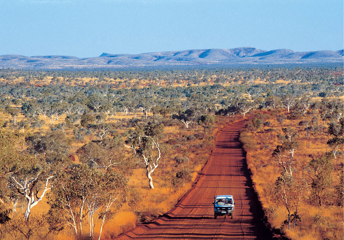
The Kimberley
Tourism Australia
The Kimberley
More than 1,500km (930 miles) north of the gold lode, one of the richest diamond mines in the world gives a sparkle to the rugged and remote Kimberley region of Western Australia.
The Argyle mine produces a sizeable heap of exquisite pink diamonds – a coveted rarity in the gem world – as well as vast quantities of industrial diamonds that are used for grinding and drilling. Huge machines, beside which humans look like Lilliputians, move the ore along to the Argyle processing plant, where millions of glittering carats are then yielded per year.
Wet and dry
Like all of Australia’s tropical north, the Kimberley has two seasons: the Dry (April to October) and the Wet (November to March). Avoid the wet season. Not only is the humidity very high at this time, but torrential rainfall can rapidly turn rivers from mere trickles into raging torrents, flooding vast tracts of land. Many minor roads are closed for the entire wet season.
The Kimberley, a dramatic, elemental and spectacular area of waterfalls, thunderstorms, searing heat and torrential rain (the latter two depending on season), is thought to hide as many as half of all the diamonds on earth.
More than three times the size of England, the Kimberley has fewer people per square kilometre than almost anywhere else in the world. Some 30 percent of land is Aboriginal-owned and nearly half the population of 29,000 are indigenous Australians.
The enormous region is particularly known for Aboriginal rock art, including the mysterious ‘Bradshaw figures’, named after explorer Joseph Bradshaw, the first European to describe them. In 1891, Bradshaw wrote: ‘The most remarkable fact in connection with these drawings is that wherever a profile face is shown, the features are of a most pronounced aquiline type, quite different from those of any native we encountered. Indeed, looking at some of the groups, one might almost think himself viewing the painted walls of an Egyptian temple.’ The drawings are believed to have derived from an unknown culture that flourished some time before 15,000BC – long before the Egyptians had built their temples.
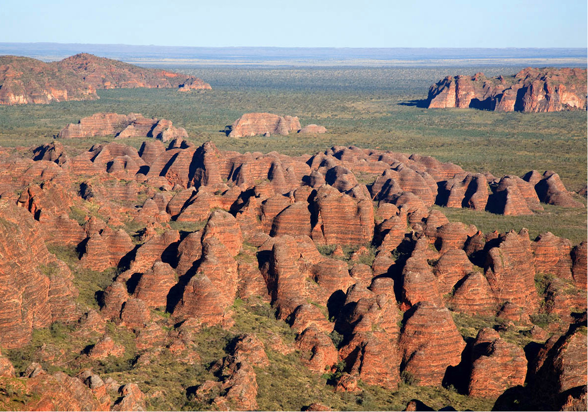
The extraordinary Purnululu National Park
Dreamstime
Until a few decades ago, the Kimberley was the domain of intrepid explorers. It has been opened up since, with tour operators using four-wheel-drive vehicles, boats, helicopters and small aircraft to reach the region’s far-flung attractions: towering gorges on the Fitzroy River; Purnululu (Bungle Bungle) National Park with its orange-and-black beehive-striped mounds; the sandstone and volcanic country of Prince Regent Nature Reserve; the stunning gorge on the Fitzroy River of the Geikie Gorge National Park; the tidal ‘waterfalls’ near Derby; and the eerie Wolfe Creek Meteorite National Park. The Wolfe Creek crater was formed 300,000 years ago and is 850 metres (930yds) across, with a rim 50 metres (165ft) high. Aborigines call the area Kandimalal, which means ‘the place where the snake emerged from the ground’. Europeans only discovered it in 1947. Its name was used for a disturbing Australian horror movie, Wolf Creek, released in 2005.
Coastal Attractions
On the coast, Broome ‹ [map] has a romantic past. It once supplied 80 percent of all the world’s mother-of-pearl, when divers from Japan, Malaya and the Philippines went out on boats, diving for oysters and the pearls within them. The Asian aura is still prevalent, even though the mother-of-pearl business died with the introduction of cultured pearls and plastic buttons. Pearl farms do still operate, and you will find evidence of past glories in Chinatown, in the old Japanese boarding houses, and in the gambling and other pleasure palaces – all reminders of the port’s early 20th-century heyday.
The main attraction today is Cable Beach, a fantastic 22km (14-mile) stretch of golden sands, so named when the underwater communication link between Broome and Java (and on to London) was established in the 19th century. At Gantheaume Point, low tide exposes dinosaur footprints about 130 million years old. If you stay late on the beach in March–April or August–September you may be lucky enough to see a natural phenomenon called ‘the Staircase to the Moon’, an illusion caused by the full moon reflecting on mud flats. It can be seen from the jetty at extreme low tides.
SOUTH AUSTRALIA
South Australia – like its official animal symbol, the hairy-nosed wombat – is pretty self-reliant and much more attractive than you may first think. Almost everything the state needs can be found within its borders: coal and gas under the desert, grain and cattle in the fields, fish from the Southern Ocean, and world-renowned wines from scenic vineyards. South Australia produces more wine than any Australian state, just under half of the nation’s total.
The sights of South Australia are as many and varied as its resources: with the rugged grandeur of the Flinders Ranges, the sand dunes of the north, the green banks of the Murray River, and the surf of the Great Australian Bight.
The state’s history is distinctive. There were no convicts – the colony was founded as a planned community run by wealthy idealists. The ‘free settlers only’ tag is a source of local pride. Sobriety and morality were keystones of the master plan, giving rise to a reputation for stuffy puritanism. Fortunately, the influence of the state’s ‘wowsers’ (killjoys) has long faded. For example, Maslins Beach just outside Adelaide became Australia’s first legal nudist beach (for more information, click here).
In some social respects, South Australia has led the rest of the country. It was first to grant votes to women, first to appoint an Aboriginal governor and first to appoint a woman governor. Spread across 1 million sq km (390,000 sq miles), the state occupies one-eighth of the entire continent, but because most of the state is unendurable desert, the inhabitants number only about one-thirteenth of Australia’s total population. More than three-quarters of these may be found living contentedly in the graceful capital city.
Festival Frenzy
Sydney, Melbourne and Perth may all have their arts festivals, but none compares in size, prestige or sheer excitement to Adelaide’s. Few cities in the world have such an extraordinary range of performance spaces, from the gleaming white Festival Centre to the outdoor amphitheatres and intimate lofts. The ‘official’ Adelaide Festival (www.adelaidefestival.com.au) lures the high-profile international acts, kicking off with free weekend concerts and firework displays in Rundle Park. The Fringe Festival (www.adelaidefringe.com.au), for less mainstream performers and artists, attracts thousands of acts from all over Australia, Europe and North America. Every spare corner of indoor space is devoted to some art exhibition, and every stretch outdoors to a site-specific installation.
Adelaide
Adelaide › [map] is easy to reach. Its international airport is efficient, land transport links are good and the city offers a cheerful introduction to Australia. Adelaide’s sunny, dry climate beams on the city’s many parks and gardens, as well as its elegant squares and broad boulevards.
With a population of over one million, Adelaide is a relatively sophisticated capital, where culture and good living are important elements of the local scene. There is a significant art gallery and the world’s largest collection of Aboriginal artefacts in the South Australian Museum. The city puts on a world-acclaimed international festival of the arts every other year (even-numbered years) and a fringe festival annually. Founded by Peter Gabriel in 1982, the WOMADelaide (World of Music, Arts and Dance; www.womadelaide.com.au) festival takes place every February–March, and has an international flavour as well as an indigenous one.

Central Market
Glyn Genin/Apa Publications
Every day, the locals here pay tribute to international culinary art, dining out in hundreds of excellent restaurants. Chefs work with top quality raw material. You can see and taste it at the Central Market (www.adelaidecentralmarket.com.au; Tue 7am–5.30pm, Wed–Thur 9am–5.30pm, Fri 7am–9pm, Sat 7am–3pm) in Gouger Street, which features fresh produce from all parts of the state, including McLaren Vale olives, Coffin Bay oysters, Barossa mettwursts and Riverland dried fruits.
Nightlife encompasses concerts, theatres, clubs and a casino. The city has come a long way since the days when outsiders joked, ‘I went to Adelaide once but it was closed.’
Adelaide was founded two generations after the settlement of Sydney, in the reign of King William IV, and named after his queen, the former Princess Adelaide of Saxe-Meiningen. Although the southern coastline had been well charted, the idea of building a city beside the Torrens River didn’t catch on until the 1830s. Before the first earth was turned, the city was planned on paper, street by street and park by park. The business district covers the area of 2.6 sq km (1 sq mile). The model, with its built-in green belt, was a winner, and so it remains to this day.
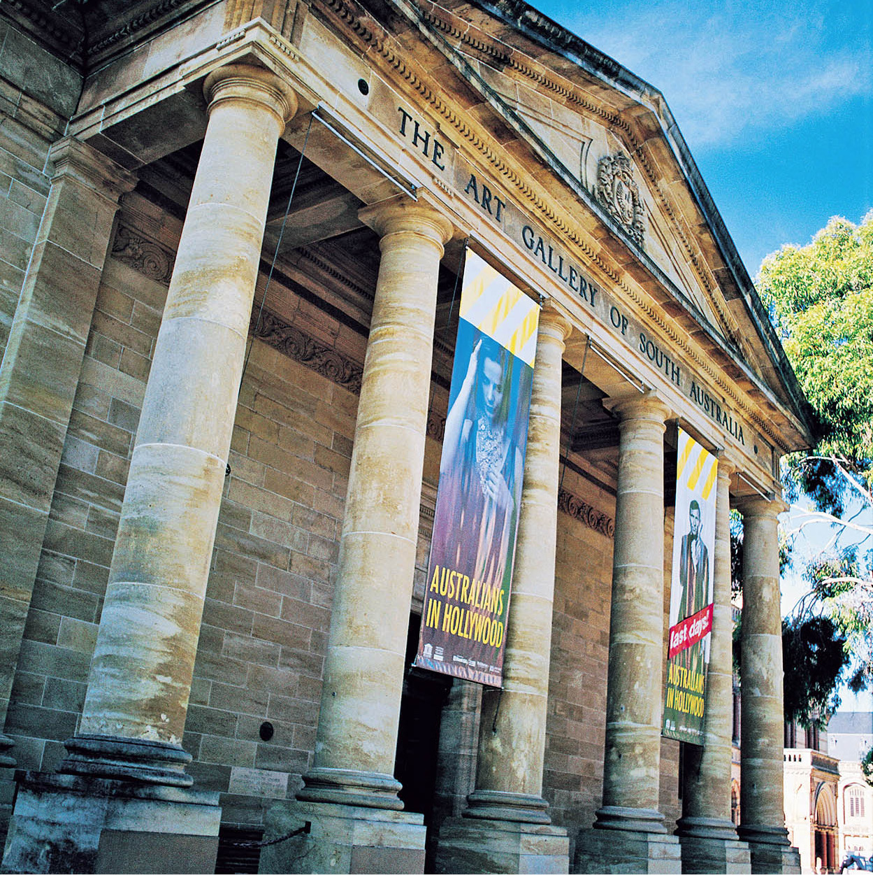
The Art Gallery of South Australia, on North Terrace
Tourism Australia
City Sights
The stateliest of streets in Adelaide is North Terrace, which delineates the northern edge of the business district and is lined with trees and distinguished buildings – mansions and museums, churches and memorials. Between the Terrace and the landscaped bank of the river is the Adelaide Festival Centre (www.adelaidefestivalcentre.com.au), which calls to mind Sydney’s Opera House, but with angular planes in place of billowing curves. Adelaide also managed to truncate Sydney’s lavish price tag, but the relatively budget-priced $20-million complex still has a theatre for every occasion. The 2,000-seat Festival Theatre is convertible, in three hours, from an opera house to a concert hall with outstanding acoustics. A theatre for drama seats 600 people, an experimental theatre a further 400 and an outdoor amphitheatre another 1,000.
There are 90-minute backstage tours of the establishment (Tue and Thur 11am) and a theatre museum preserves South Australia’s rich history and interest in the performing arts. Outside, bold sculptures are strewn around the plaza. You can eat outdoors in the Festival Centre’s bistro overlooking the river, picnic on the lawn of the surrounding Elder Park, or take a sightseeing boat up the river to the zoo (www.adelaidezoo.com.au; daily 9.30am–5pm; charge), where you can pet the kangaroos and admire an outstanding collection of Australian birds, as well as many other international guests, both feathered and furry.
Behind the Festival Centre, South Australian Parliament House (www.parliament.sa.gov.au; guided tours on non-sitting days, Mon–Fri 10am and 2pm) is dignified by 10 Corinthian columns and so much expensive stonework it enjoys the nickname ‘marble palace’. The foundation was laid in 1881 but work continued, on and off, over the following 58 years. Across the road is Government House, the official residence of the Governor of South Australia.
Next door there’s a startling change of pace: Adelaide Skycity (www.adelaidecasino.com.au) is a casino in a dazzling conversion of the old railway station. Just behind the State Library is the Migration Museum (Mon–Fri 10am–5pm, Sat–Sun 1pm–5pm; free), tracing the history of immigration.
Elsewhere along North Terrace, the University of Adelaide is at the heart of a cluster of cultural institutions. Whale skeletons fill the show windows of the excellent South Australian Museum (www.samuseum.sa.gov.au; daily 10am–5pm; free) as an alluring invitation. Inside is a monumental collection of Aboriginal artefacts. A large-screen video display relates the story of the Aboriginal Dreamtime hero Ngurunderi. Other countries are well represented in a comprehensive survey of ceremonial masks, shields and sculptures from South Pacific islands. And you can see a traditional trading vessel from New Guinea, with a bamboo deck and a sail made of bark.
The Art Gallery of South Australia (www.artgallery.sa.gov.au; daily 10am–5pm; free), which officially opened in 1881, covers many centuries of world art, ranging from ancient Chinese ceramics to contemporary Australian prints, drawings, paintings and sculptures. The gallery is also home to an extensive collection of Aboriginal art.
Two more historic buildings on North Terrace are Holy Trinity Church, the first Anglican church built in South Australia (begun in 1838), and Ayers House (tel: 08-8224 0666; www.ayershouse.com), a 45-room mansion furnished in an opulent 19th-century style. The house was owned by a local businessman and statesman, Sir Henry Ayers, after whom an admiring explorer named Ayers Rock. He was premier of South Australia seven times, and used Ayers House for state functions. Its ballroom, the hub of the Adelaide social scene, was regularly washed down with milk to make the floor fast and smooth.
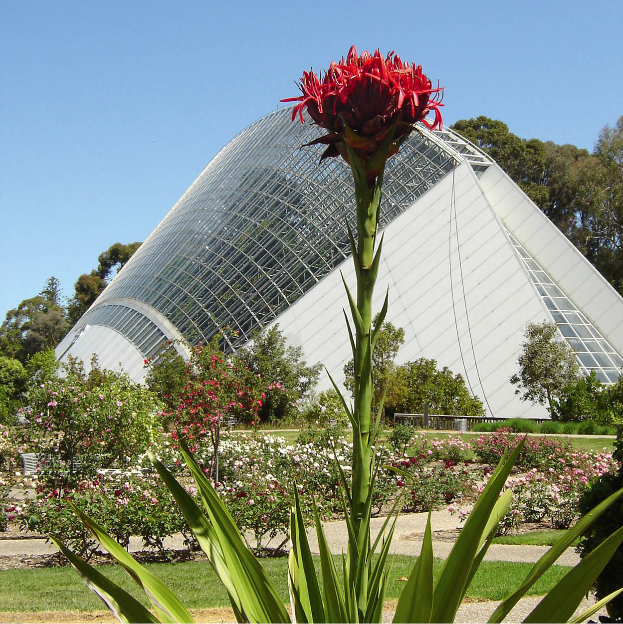
Bicentennial Conservatory
Dreamstime
To the north of Ayers House lie the Botanic Gardens, 20 hectares (50 acres) of lawns, trees, shrubs and lakes, with some exceptional botanical buildings as well, from the old Palm House brought from Germany in 1871 to the extraordinary Bicentennial Conservatory of 1988. The restaurant has an excellent reputation.
Parallel with North Terrace is Rundle Mall (www.rundlemall.com), an all-weather pedestrian mall, and the heart of Adelaide’s shopping area. Its trademark is a sculpture comprising double-decked spheres of stainless steel reflecting the animation all around. The mall’s merchants include department stores, boutiques, cafés and restaurants, all enlivened by street entertainers. The Myer Centre and the Adelaide Central Plaza are multi-storey shopping centres packed with speciality shops and the city’s two department stores. Rundle Street (the eastern extension of Rundle Mall) is an arty and pleasant quarter, and contains Adelaide’s two best pubs, the Exeter (www.theexeter.com.au) and the Austral (www.theaustral.com.au). The westward extension of Rundle Mall, Hindley Street, has clubs, live entertainment, amusement arcades and strip joints.
Located on Grenfell Street is Tandanya (www.tandanya.com.au; Mon–Sat 10am–4pm), an outstanding Aboriginal and Torres Strait Islander cultural centre showcasing art galleries, a workshop and performing arts. The shop offers authentic Aboriginal and Torres Strait Islander souvenirs.
North of the city centre, Light’s Vision is not a sound-and-light show, as its name may suggest, it’s a monument to the foresight of Lt-Col William Light, who was sent out in 1836 to find the ideal site for a model city, then devise the total plan for its development. Atop a pedestal on Montefiore Hill, his statue peers over the parklands, pointing at the city of Adelaide, which he created.
Nearby Places
Adelaide has an outstanding public transport system, including the highly efficient O-Bahn, a ‘bullet bus’ that steers itself along its own smooth roadway at speeds of up to 100kmh (over 60mph). But nostalgia persists: the last surviving tramcars still clatter along between the edge of Victoria Square and the seashore at suburban Glenelg. This lively beach resort, from where a fishing pier forges far out to sea, was the original landing-place of the colonists who founded South Australia. A full-size replica of their vessel, a converted freighter named HMSs Buffalo, moored nearby, is now a restaurant. Also in Glenelg, in the historic town hall, is the Bay Discovery Centre (www.hold fast.sa.gov.au; daily 10am–5pm; admission free), dedicated to the social history and culture of the region. Among other beaches near Adelaide, from north to south along the Gulf of St Vincent, you will find Semaphore, Grange, Henley Beach, West Beach, Somerton, Brighton and Seacliff.
South and east of the city, the Adelaide Hills provide a backdrop of forests, orchards and vineyards. There are pleasant drives, lovely walks, fine views, and plenty of picnic possibilities. The highest of the hills, Mt Lofty (770 metres/2,525ft) is only 15 minutes out of town by car, and features some good bushwalks. You can see wildlife at close range at Cleland Wildlife Park (www.clelandwildlifepark.sa.gov.au; daily 9.30am–5pm; charge).
Hahndorf, a village situated 30km (19 miles) southeast of Adelaide, has changed little since it was settled in 1839 by German refugees. Many of the original buildings in this oldest surviving German settlement in Australia have been restored, and various folklore events brighten the tourist calendar, especially the Founders Day Festival, a marksmanship and beer-drinking celebration in January, and St Nicholas Night in December.
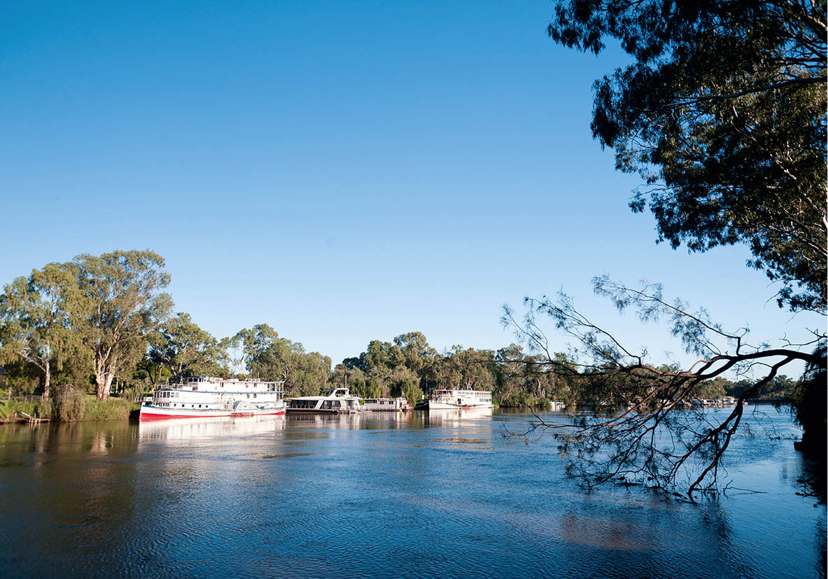
Paddle boats on Murray River
iStock
Up the River
The Murray River begins life in the Snowy Mountains in the Australian Alps, forms the frontier between Victoria and New South Wales, and enjoys its last meandering through the state of South Australia. It is the river that accounts for the beautiful vineyards, orchards and pastures along the way, not to mention the boating, fishing and water-skiing. In the 19th century the river was a main thoroughfare for both passengers and cargo, but the advent of railways and highways left the Murray more of a pleasure route.
Paddle steamers churn up nostalgia along the lower Murray, an hour’s drive from Adelaide. Boats offer short excursions or voyages of several days. It’s also possible to hire a houseboat and ply the river at your own pace, in which case you can fish for your own dinner. The Murray cod run to gargantuan sizes, and you can also catch ‘yabbies’, which are akin to crayfish.
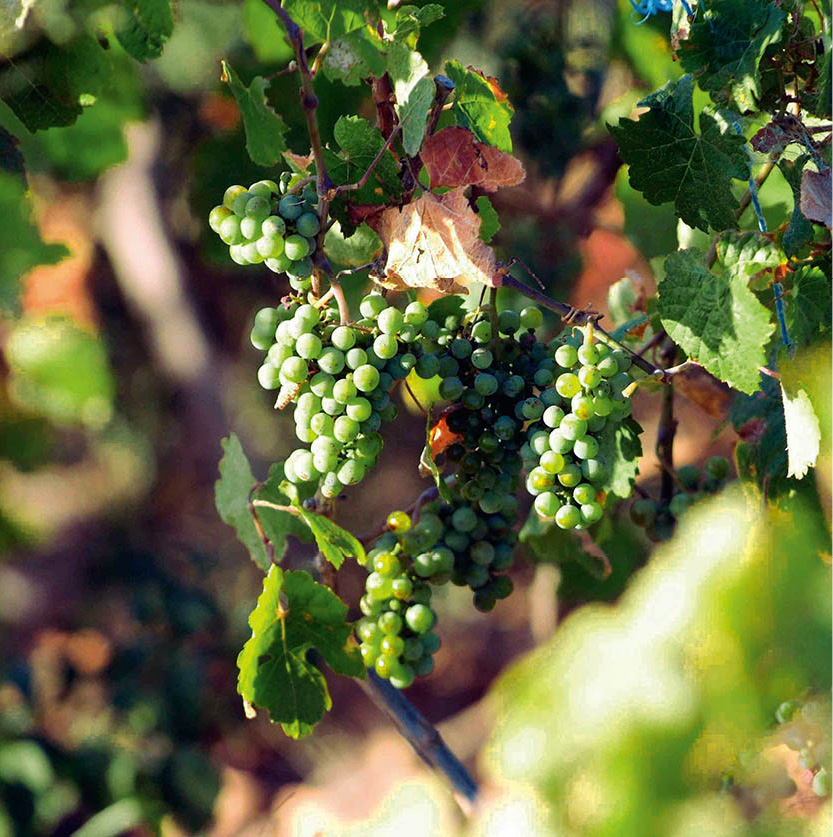
Barossa vineyards
Glyn Genin/Apa Publications
Australia’s best-known wine-producing region, the Barossa Valley fi [map], just 50km (30 miles) northeast of Adelaide, is also one of the prettiest. The scenery is beautiful: soft hills, sheep-grazing land, cosy villages and rows of vines that produce some famous wines – the 50 or so wineries produce about a quarter of Australia’s total vintage. The valley is easy to explore: just 30km (19 miles) long by 14km (9 miles) wide. Accommodation ranges from luxurious colonial mansions to historic settlers’ and miners’ cottages, small motels and fully-serviced caravan and tent sites.
The Barossa was founded by German Lutherans who arrived in 1842, fleeing religious persecution at home. The Germanic atmosphere became a real liability when Australia entered World War I. Some of the Teutonic place names were changed for ‘patriotic’ reasons, and the government shut down a German printing house for fear that it would produce subversive leaflets. Nowadays, the valley’s Germanic atmosphere is all part of the charm. You’ll see neat stone cottages with filigreed verandahs and decorous gardens, and be able to taste bratwurst and sauerkraut to the accompaniment of oom-pah music.
The Barossa Valley is only about an hour’s drive northeast of Adelaide, a perfect distance for an easy all-day excursion devoted to sniffing out the local colour and sampling the wines. There are guided tours (some departing from Adelaide) and cellar-door tastings. Be warned – the vineyard route is so popular that the roads and cellars can get crowded on Sundays and public holidays. Every alternate year (the odd numbers) the Barossa Valley stages an ebullient Vintage Festival (www.barossavintagefestival.com.au) in March or April, a week-long carnival as earthy as the wines it celebrates.
Why ‘Kangaroo’?
On one of his visits ashore, Captain James Cook asked a local what the strange leaping animal was. ‘Kangaroo’, came the reply. Cook passed on this intelligence to the whole world. An urban myth has it that the word kangaroo means ‘I don’t understand you’ in an Aboriginal language; in fact, it comes from the word gangurru, meaning grey kangaroo.
There are around 45 species of kangaroos and wallabies, ranging in size from the red kangaroo, taller than a man, to the musky rat kangaroo, the size of a guinea-pig. Members of the family have adapted to many habitats: open plains, woodlands, rocky outcrops and cliffs – and some even climb trees. A young kangaroo, born in a near-embryonic state, crawls into its mother’s pouch and attaches itself to a teat. It develops there for another four to eight months, depending on the species. Even when it is capable of venturing out it returns to the pouch between expeditions.
Kangaroo Island
South Australia’s favourite escapist resort, Kangaroo Island fl [map] is so big that you could spend a week finding the best places for swimming, fishing and sightseeing. Approximately 145km (90 miles) long and 30km (19 miles) wide, it’s the country’s third largest island, after Tasmania and the Northern Territory’s Melville Island. For tourists in a typical rush, though, there are one-day excursions. It’s only half an hour by air from Adelaide, but the most common route is by car ferry from Cape Jervis on the Fleurieu Peninsula (for more information, click here) to the settlement of Penneshaw across the rough Backstairs Passage (a 45-minute trip each way).
The English explorer Matthew Flinders, who circumnavigated Australia at the beginning of the 19th century, chanced upon Kangaroo Island in a storm. His hungry crew, amazed by the reception committee of fearless, friendly kangaroos, consigned some of them to the stew pot. Grateful for the sustenance, the great navigator named the place Kangaroo Island. Right behind the Flinders expedition came a French explorer called Nicolas Baudin. Despite having lost out to the British on his chance to claim the territory, he mapped much of the island’s coastline and contributed some French names to its features. They are still on the map: places such as D’Estrees Bay, Cape Du Couëdic and Cape D’Estaing. In later years, settlers acknowledged Baudin’s effort and built a white-domed monument to him at Hog Bay, called Frenchman’s Rock.
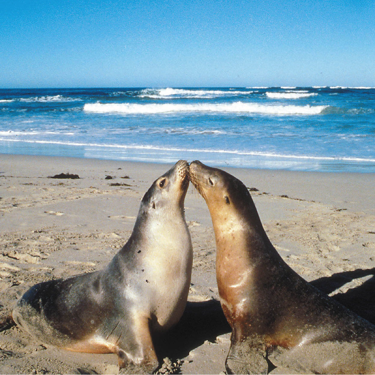
Seal Bay
Jon Davison/Apa Publications
The capital of Kangaroo Island, Kingscote, has a permanent population of around 1,700. Dolphins and seals can be seen frolicking just offshore, and there is a penguin colony nearby. The island is renowned for its unspoilt coastline of bays, cliffs and beaches. Flinders Chase National Park, South Australia’s biggest nature reserve, takes up its western end. The animals there are wild, but in the absence of predators, the kangaroos, koalas and emus have become extroverts, often trying to sponge or steal food from visitors. On the south coast, Seal Bay belongs to Australian sealions. They are so unafraid of humans that you can wander among them, guided by a national park ranger. Birdwatchers are thrilled by local species, which show clear differences from mainland relatives, and a noisy population of migratory birds from distant lands.
Three Peninsulas
Just to the south of Adelaide, the Fleurieu Peninsula is an easy-to-reach, easy-to-like vacationland of surfing beaches, vineyards and history. At the beginning of the 19th century, the French explorer Baudin named the peninsula after his navy minister, Count Pierre de Fleurieu. The first industry to be based on the peninsula was whaling, centred on Victor Harbour. It’s now the area’s biggest town, and a very popular year-round resort.
Yet another historic location is Maslins Beach on the Gulf St Vincent coast. Here, in 1975, a new leaf was turned in the evolution of Australian social customs. This was the nation’s first legal nudist beach.
Further inland, scores of vineyards basking in the sunshine of the Southern Vales are the reason for the peninsula’s fame. They’ve been making wine here since 1838, to great effect. Many of the wineries encourage wine drinkers to stop in and try the vintages. The best-known area of wine production is McLaren Vale.
The Yorke Peninsula, located to the west of Adelaide, first became important during the 19th century as a copper-mining district. The majority of the region’s miners were drafted in from Cornwall, England, and their touch can still be seen in the design of the old cottages and churches in the area, and the baking of Cornish pasties. Museums and the ruins of the mine superstructures provide constant reminders of the peninsula’s heyday, which continued until the 1920s.
The Eyre Peninsula encompasses beach resorts, wheat fields, bushland, industrial centres and a prized wilderness, the Lincoln National Park. Set atop magnificent cliffs at the tip of the peninsula, the park is home to kangaroos and birds as diverse as emus, parrots and sea eagles. Fishing boats big and small lay anchored in the attractive deepwater harbour of Port Lincoln, the tuna-fishing capital of Australia, and you can visit the home of the great white shark on a cruise to Dangerous Reef.
Port Lincoln celebrates Tunarama Festival (www.tunarama.net) on the foreshore of Boston Bay each January over Australia Day weekend (26 January). Highlights include the Tuna Tossing Championship, which sees world-class athletes turn up to throw large fish.
About an hour’s drive west of Port Lincoln is Coffin Bay National Park, an unspoilt stretch of coast. Fishing and swimming are the main draws, and there are many isolated beaches and bays to explore.
The biggest city on the peninsula is Whyalla, which grew from a solid base of heavy industry – as heavy as iron and steel. If visiting a blast furnace is your idea of fun, join a tour of the local steelworks (tel: 08-8645 7900); you can also visit the iron ore-mining area.
The Eyre Peninsula reaches as far west as the small town of Ceduna, where the vast expanse of the Nullarbor Plain begins. It’s more than 1,200km (745 miles) from Ceduna westward to the next town of any significance (Norseman, in Western Australia). Filling stations do occur, but the route is lonely and gruelling. Nullarbor is Latin for ‘treeless’, an indication that the plain is also waterless. But water is there if you know where to look for it: underground in limestone caverns. The highway follows the dunes and cliffs that lie along the length of the Great Australian Bight.
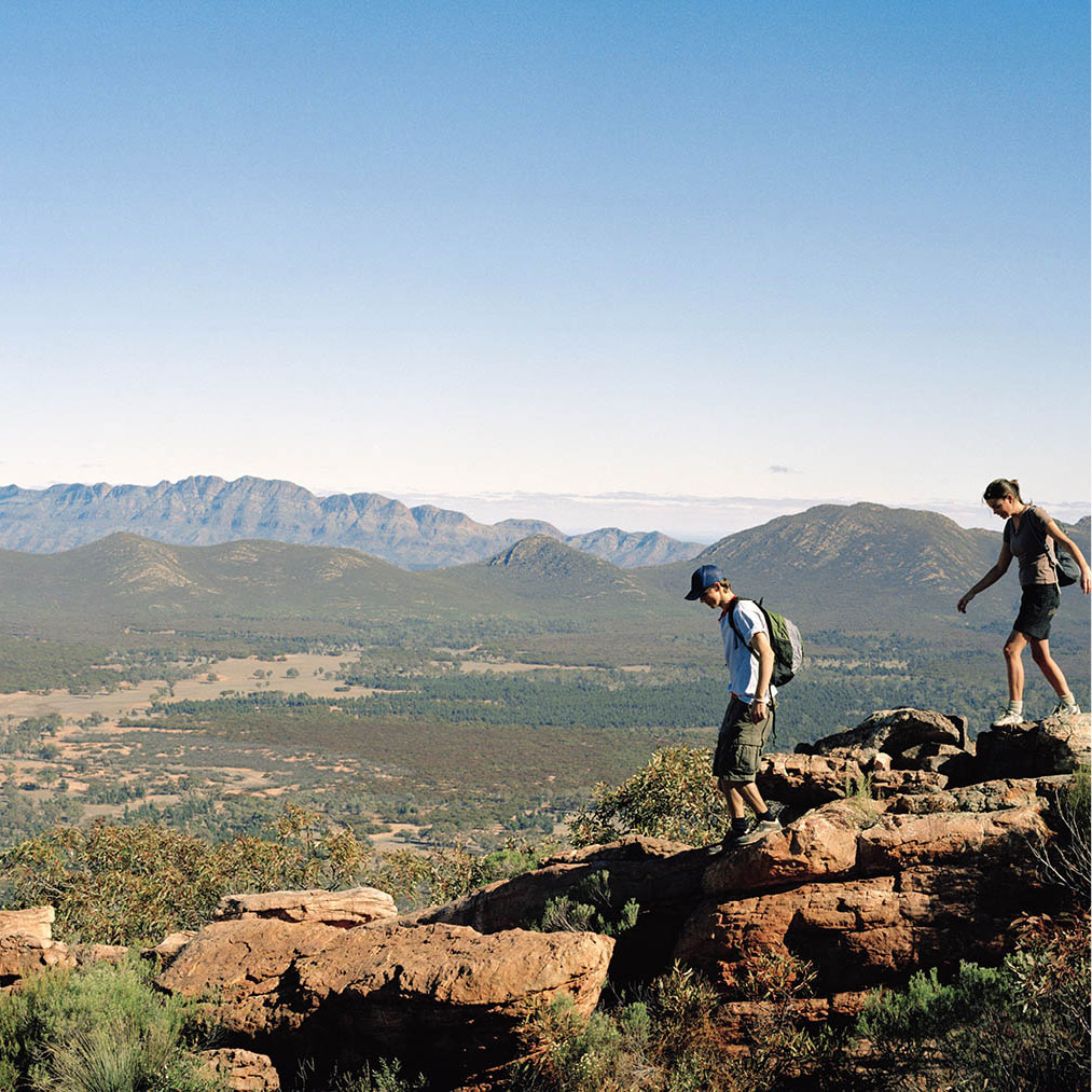
Flinders Ranges
Tourism Australia
The Flinders Ranges
For scenic splendour, South Australia’s Outback competes well with the remote areas of the other states, nowhere more impressively than at the southern end of Flinders Ranges National Park [map] ‡, 450km (280 miles) due north of Adelaide. Rising from a landscape as flat as the sea, the tinted peaks speak poetry to lovers of robust scenery. In the spring the rugged wooded hillsides come to life with a flood of wildflowers, but at any time of year the scene is intriguing. The mountains, like the desert, are much more colourful at close range.
An outstanding phenomenon found in the Flinders Ranges is a huge natural basin called Wilpena Pound. Rimmed by sheer cliffs, the saucer is approximately 20km (12 miles) long and 8km (5 miles) wide. Although it looks like a crater, it was actually formed by folding rocks. Wilpena Pound is not only spectacular as a scenic and a geological curiosity, it also wins admiring squawks from birdwatchers. This is a place where you can spot species including butcherbirds, wagtails, galahs, honeyeaters and wedge-tailed eagles.
The flat floor of the Pound is perfectly designed for bushwalks (suggested routes are signposted) – but not in summer, when it’s too hot. In any season it’s essential to carry drinking water. There’s only one way into the amphitheatre, through a narrow gorge occupied in rainy times by Wilpena Creek.
An area of such grandeur was bound to inspire Aboriginal myths and art over thousands of years. Timeless rock paintings can be inspected near Wilpena at Arkaroo, and at Yourambulla Cave, south of the village of Hawker.
What’s an opal?
Opal is not a crystal but more like quartz, made up of silica with a small amount of water. Unlike diamonds, opals are used only for jewellery.
Coober Pedy
The opal-mining town of Coober Pedy ° [map] must rate as one of the most bizarre tourist attractions in the world. When you say ‘desert’, this is what it means: in the summer the daytime temperature can reach 50°C (122°F) in the shade, supplies of which are extremely limited. In the winter the nights become unpleasantly cold. Yet nearly 3,500 people make their home in this far corner of the Outback.
At first glance, the town looks very much like a hard-hit battlefield. The almost treeless terrain consists of hundreds of mounds of upturned earth. But beneath the surface, things are not so bleak. The name Coober Pedy comes from an Aboriginal phrase meaning ‘white fellow’s hole’, for the settlers have survived here by burrowing hobbit-like into the side of a low hill. The temperatures within are constant and comfortable, regardless of the excesses outside. Among the dugouts are residences of some luxury, with electricity and wall-to-wall carpets. Also underground is a Roman Catholic chapel, plus several motels and B&Bs, a café, a restaurant, a bookshop, opal shops, museums and a pottery shop.

Opal quartz
iStock
Regular tours by bus or plane bring the curious crowds to Coober Pedy, which is about 950km (590 miles) northwest of Adelaide. The tours visit underground homes as well as the local opal fields, where most of the world’s opals are mined, with demonstrations of opal cutting and polishing. Having learned the intricacies, you can buy finished stones and jewellery on the spot. Or try noodling in the mullock heaps: all you need is a rake or a sieve to sift through the rubble at the top of each mineshaft, and if you’re lucky you may find an overlooked gem. No permit is required for non-profit fossicking, although you must obtain the permission of the landholder first. Tours to Coober Pedy also explore the desert landscape outside town.
VICTORIA
By Australian standards, the state of Victoria is a midget. About the same size as Great Britain, it is the smallest state on the mainland, but its more than 5.5 million inhabitants give Victoria Australia’s highest population density.
Over 70 percent of Victorians (4 million of them) live in the capital, Melbourne, a centre for finance, industry, culture and sport. The city folk live within easy striking distance of the state’s bushland and 19th-century boomtowns, the sea, the vineyards and the ski slopes. Some of the scenery is so rich and pretty that the state’s first name was Australia Felix – Latin for bountiful or lucky. For tourists, the state’s relatively small size and varied landscapes make for convenient exploration.
Victoria was the earliest state to industrialise, but it’s still a leading farming power as well – hence the nickname of ‘Garden State’. This agricultural potential remained unexploited until the 1860s, after the state’s gold rush fizzled out. Unemployed ex-prospectors eagerly fanned out as farmers, working land they had bought for £1 per acre. Immigrants in search of a figurative pot of gold followed in a steady flow that reached a tidal wave after World War II, with the policy of ‘populate or perish’. This produced both curious ethnic pockets around the state and the cosmopolitan effervescence of a multicultural society within the dignified confines of the capital city.
It Could Have Been Batmania
Australia’s second city could have sounded so different if the Governor of New South Wales, Sir Richard Bourke, had not been a traditionalist. The first settlement of tents and huts on the Yarra had been called Bearbrass, for reasons that are not entirely clear. Yarra Yarra was also suggested as a possible name for the growing town, and so was Batmania, in honour of J. Batman, a settler from Tasmania who bought 40,000 hectares (100,000 acres) from the Aborigines. (The fact that he bought the territory, albeit at a derisory price, rather than simply stealing it, was a rare occurrence for the period.) But when Bourke visited the region in 1837, he decreed that the town should be named, in the customary fashion, after a British dignitary – in this case the Prime Minister, Lord Melbourne.
Elegant parks and gardens splash green patterns across the map of Melbourne · [map], softening the rigours of its precise grid plan, and offering merciful breathing space on the edges of the city centre’s hubbub. This is a friendly city of serious buildings and imposing Victorian architecture. Its air of distinction may have something to do with the fact that the city was founded not by prisoners (as was Sydney) but by adventurous free enterprisers with their own vision of success.
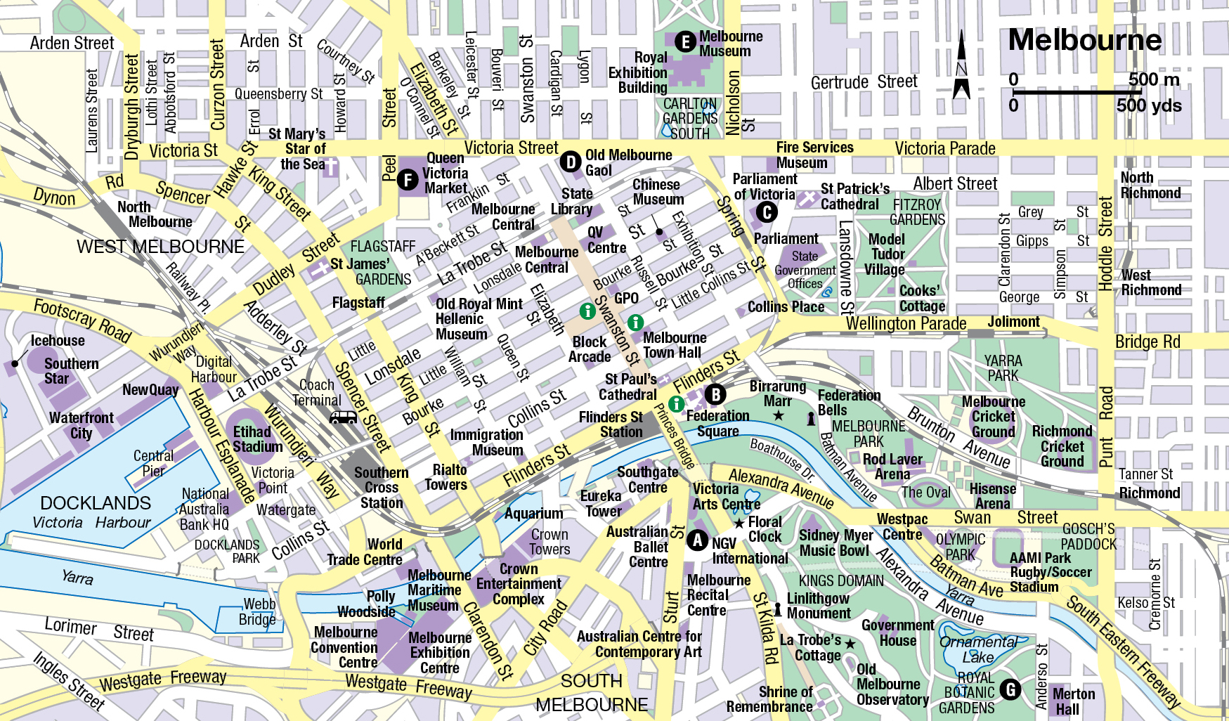
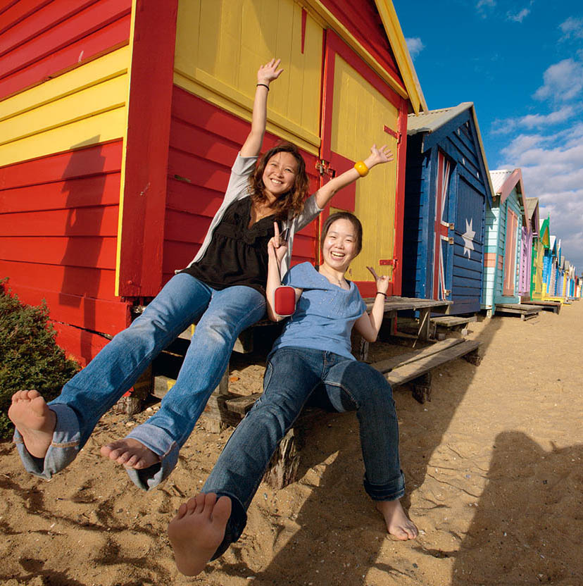
Happy Melburnians
Virginia Star/Apa Publications
It’s all so grand you might forget Melbourne’s rough-and-tumble pioneering days. The gold rush broke out in Victoria in 1851, only a few months after the fever hit New South Wales. A gold strike at Ballarat so electrified the state that Melbourne itself risked becoming a ghost town; businessmen locked their offices or shops and rushed off to the goldfields, and gold-crazed crews abandoned their ships. New immigrants rushing in to fill the gap lived in shacks and tents. Successful diggers, on their return to Melbourne, had so much money to dispose of that morals loosened considerably.
Australia’s two largest cities, Sydney and Melbourne, are fierce rivals. Sydneysiders blast Melbourne’s climate; Melburnians ridicule Sydney’s self-satisfaction and lack of culture. Whatever Sydneysiders say about Melbourne’s unpredictable weather, the southerners can point to several international surveys that rank their city higher than their northern rivals in terms of quality of life.
Melbourne is sport mad. ‘Footy’ – Australian Rules Football – is the main attraction here. Cricket is also a passion. Both are played at Melbourne Cricket Ground (the MCG), a focal point of the city’s sporting and cultural life. And as for the horses, the Melbourne Cup is so all-engrossing that the first Tuesday in November, when the race is run, counts as a legal holiday.
In the last couple of decades of the 20th century, Melbourne was a city that emptied after dark, but all that has changed dramatically. Residents have moved back into the inner city, and the Central Business District now has cafés, bars and nightclubs. Melburnians have something of a reputation as gourmets and with some 3,000 restaurants in the city they are spoilt for choice.
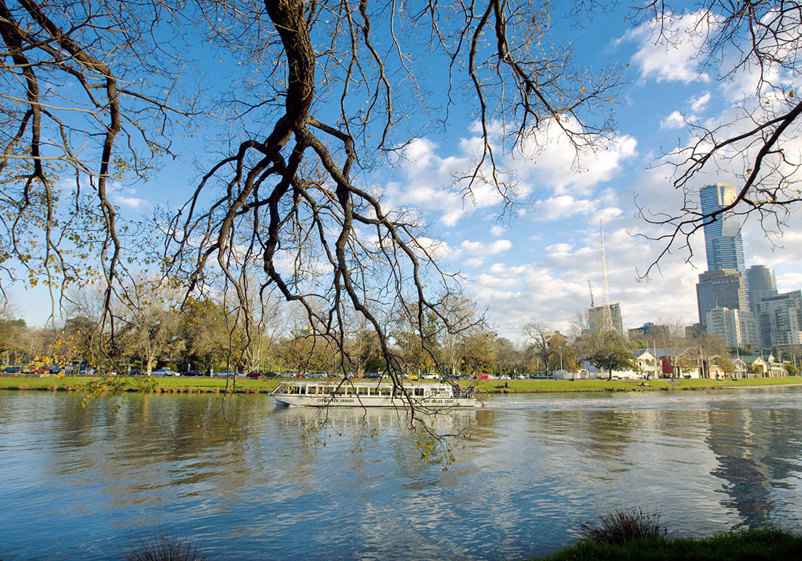
Melbourne landscape from the Yarra
Virginia Star/Apa Publications
City Sights
A pleasant aspect of Melbourne can be viewed from the level of the Yarra, the river at the centre of the city. On the last few kilometres of its journey to the sea, the Yarra plays host to freighters, pleasure boats and rowing regattas. And it waters the gardens, reflects the skyscrapers and invites cyclists and joggers to follow its course along pretty paths. For a look at the skyline and a glimpse of river commerce, take one of the cruise boats that leave from Princes Walk by Princes Bridge.
Aerial views over the river and the city illustrate the ample hectares of green in the parks and gardens in among the business-like blocks. The best vantage point is the observation deck of Eureka Skydeck 88 (inside the Eureka Tower; www.eurekaskydeck.com.au; daily 10am–10pm; charge), 285 metres (935ft) above Southbank, a riverside shopping and strolling precinct on the southern bank of the Yarra. The view extends beyond Westgate Bridge to the west, the Dandenong Ranges to the east and the shimmering expanse of Port Phillip Bay to the south. Those with a good head for heights can try The Edge (additional fee), a glass cube jutting out of the building, which gives those inside a feeling of hanging in mid-air.
Also at Southbank is the Crown Entertainment Complex, housing the 500-room Crown Towers Hotel and the Crown Casino, one of the country’s largest gaming establishments.
Just past the Crown complex and the Melbourne Exhibition and Convention Centre is Polly Woodside, a square-rigged, 70-metre (230ft), iron-hulled sailing barque, recalling the adventurous times of the last days of sail in the late 19th and early 20th centuries. Launched in Belfast in 1885, the restored ship is the centrepiece of the Melbourne Maritime Museum (tel: 03-9656 9804; www.pollywoodside.com.au; Sat–Sun 10am–4pm, daily in school holidays; charge), which is run by the National Trust.
Dame Edna mosaic adorning the Docklands
Virginia Star/Apa Publications
If you walk a little way downriver and cross over a footbridge, you’ll find yourself in Melbourne’s Docklands (you can also get here on a free City Circle tram from central Melbourne). An ambitious urban renewal programme has revamped this former port, which has Victoria Harbour at its heart. There are parklands, marinas, apartments, offices, shops, bars, cafés, restaurants and leisure facilities, including the huge Etihad Stadium (Docklands Stadium; www.etihadstadium.com.au). One attraction that has managed to be half Melbourne Eye and half eye sore, is a giant observation wheel, the Melbourne Star (tel: 03-8688 9688; www.melbournestar.com) which was originally installed in 2008 but only stayed open for 40 days before being closed because of structural issues. The 120-metre wheel, with seven spokes to reflect the seven-sided star on the Australian flag, was eventually rebuilt and reopened in December 2013. Also new to Docklands is the Medibank Icehouse (tel: 1300 756 699; www.icehouse.com.au), an ice-sports and entertainment venue with two Olympic-sized ice rinks, a 1,000-seat stadium and a winter sports gym.
Near the river, just south of the heart of town, on St Kilda Road, an Eiffel Tower–style structure marks the modern Victorian Arts Centre (www.artscentremelbourne.com.au). This elegant colour-changing spire rises from flowing curves suggesting a ballet dancer’s tutu. The first part of the complex to open, in 1968, was the National Gallery of Victoria, now called NGV International A [map] (www.ngv.vic.gov.au; Wed–Mon 10am–5pm; free). The collection showcases international art, old and new. Among the most interesting items on display is a vast Tiepolo painting from the 1740s, The Banquet of Cleopatra, plus sculptures by Rodin, Henry Moore and Barbara Hepworth, and a first-class survey of classical Chinese porcelain. The Ian Potter Centre, at Federation Square, houses the Gallery’s wealth of Australian art (for more information, click here).
The Theatres Building, directly beneath the symbolic spire identifying the Arts Centre, is the place for opera, ballet and musicals. Under the same roof are a playhouse for drama and a smaller studio theatre for performances of more intimate works. The adjoining, circular Hamer Hall, which seats 2,700 people, is used for symphony concerts, but the acoustics can be changed to suit other types of performance. If you’re not going to a concert, nip in for a glance at the artwork in the lobby, or take a guided backstage tour. The complex provides dining opportunities from snack bars to luxury-class restaurants. The Centre also includes a Museum of Performing Arts.
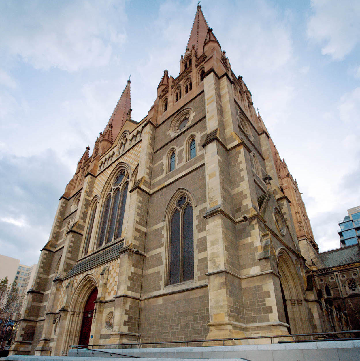
St. Paul’s Cathedral
Virginia Star/Apa Publications
Just across Princes Bridge on the north side of the river, the spires of St Paul’s Cathedral are not as old as they look; they were added in the 1920s, several decades after the original Gothic-style structure was completed. The church is a refreshing hideaway in the midst of the busiest part of the city, a few steps away from the main suburban railway station, Flinders Street. Also here is a less obvious historic landmark, Young and Jackson’s (www.youngandjacksons.com.au), whose upstairs bar contains a notorious oil painting of the nude ‘Chloe’, which has delighted many generations of beer drinkers since it scandalised Melbourne’s art exhibition of 1880.
Just south of St Paul’s Cathedral is Federation Square B [map] (www.fedsquare.com; free), a futuristic-looking group of modern buildings built around a public square, which hosts various events, festivals and big-screen broadcasts of major occasions (including World Cup football matches). It also houses the Ian Potter Centre: NGV Australia (www.ngv.vic. gov.au; Tue–Sun 10am–5pm; free), a three-floor space with 20 galleries dedicated to Australian art – contemporary, colonial and indigenous.
From here, stroll through Birrarung Marr, an 8-hectare (20-acre) riverside park that honours the traditional owners, the Wurundjeri people. The name means ‘river of mists’ in their Woiwurrung language. There are several stunning sculptures and installations, and it’s the scene for a number of festivals and events. It’s a great spot to watch the Moomba festival, Australia’s largest free community event, held on the Yarra annually during the Labour day long weekend (second Monday in March), featuring a floating parade, stalls, fireworks and river sports. A highlight is the Birdman Rally, where wannabe superheroes jump off a 4-metre platform into the Yarra, wearing homemade ‘wings’ – the person who ‘flies’ the furthest wins. Famously, while the name is officially supposed to translate into ‘let’s get together and have fun’ in the local indigenous language, rumour has it that the founders of the festival were tricked by their Aboriginal advisers, and Moomba actually means ‘up your bum’.
Melbourne Town Hall, on the corner of Swanston and Collins Streets, dates from the 1860s. It’s used for concerts and official events, and can hold about 3,000 people. It’s the central venue for the annual Melbourne Comedy Festival (www.comedyfestival.com.au), which attracts top-quality international acts each March–April.
Collins Street – combined with Bourke Street, which runs parallel, and Bourke Street’s various arcades and laneways – are one reason Melburnians claim the best shopping in Australia (other places that add to this reputation are the more boutique-based shopping suburbs of South Yarra and Prahran, and the large factory outlets in Richmond and elsewhere). Two large department stores – Myer and David Jones – are located close together in pedestrians-only Bourke Street Mall, between Elizabeth and Swanston streets. The outstanding example of an old-time Melbourne shopping institution, the glass-roofed Block Arcade (www.theblockarcade.com.au) is an 1892 copy of Milan’s Vittorio Emmanuele Galleria. Have afternoon tea at the historic Hopetoun Tea Rooms (www.hopetountearooms.com.au) inside the arcade. The nearby Royal Arcade (www.royalarcade.com.au) is also worth investigating. Also running off Bourke Street Mall are narrow laneways lined with avant-garde boutiques and numerous cafés, which contribute to the city’s well-developed coffee culture – considered to be one of the best in the world. Try Cathedral Arcade or Flinders Way for the best of independent and local fashion designers. One end of the mall is dominated by the Victorian-era Melbourne GPO (www.melbournesgpo.com), which has been renovated as a hub for sophisticated fashion and food shopping.
By way of historic buildings, Melbourne likes to show off. The Parliament of Victoria C [map], set in its own park facing Spring Street, has been called the finest legislative headquarters this side of London; many of the furnishings found here are copies of those in Westminster. The federal government used this as its temporary headquarters in the early 20th century, just after Federation. The building is open for guided tours when the state parliament is not sitting.
Older than any of the city’s well-preserved Victorian buildings is Cook’s Cottage in Fitzroy Gardens. The great discoverer never lived in Melbourne; the stone house was transplanted in 1934 from Great Ayton in Cook’s native Yorkshire. In truth, it would be more accurate to call it Cook’s parents’ cottage, since there is no evidence that the good captain ever lived in it.
In Australia, jails are very popular tourist attractions (perhaps not so surprising, given its history). One of the most fascinating is the Old Melbourne Gaol D [map] (www.oldmelbournegaol.com.au; daily 9.30am–5pm; charge), situated across the road from the modern Police Headquarters on Russell Street. Opened in 1854, the penitentiary was the scene of more than 100 hangings. The death masks of the most famous prisoners are displayed, along with other penal memorabilia, such as a ‘lashing triangle’, last used in 1958. The best-known character on death row, the celebrated bushranger Ned Kelly, was executed here on Melbourne Cup Day 1880. You can step inside the executive-sized cell that was his last residence on earth; it has a fine view of the gallows. The nearby State Library displays the homemade suit of armour he was wearing when captured.
Within walking distance is the Royal Exhibition Building, a beautiful leftover from the 1880 Melbourne International Exhibition. Next to it is a much more modern building housing the Melbourne Museum E [map] (www.museumvictoria.com.au; daily 10am–5pm; charge), devoted to history, natural history and ethnography. Exhibits include an impressive indoor rainforest, dinosaur skeletons, an Aboriginal culture gallery and a gallery of boats of the Pacific islands.
Melbourne’s Chinatown centres on Little Bourke Street. Special streetlights and gates define the area, where you’ll find Chinese restaurants, cafés, a church and exotic shops. The Chinese Museum (www.chinesemuseum.com.au; daily 10am–5pm; charge) documents Chinese immigration history. The area has had a unique flavour since the gold rush days, when fortune-hunters from China crowded into this low-rent district before and after their efforts out in the bush. Chinatown today glows on the maps of local gourmets.
Queen Victoria Market
Virginia Star/Apa Publications
As does Queen Victoria Market F [map] (www.qvm.com.au), which sums up the bounty of Australian agriculture. Just about everything that grows can be found here, piled up in irresistibly fresh pyramids, as if the best fruit and vegetables had been borrowed from every market from Sweden to Sicily. The best time to take in the atmosphere (and get the freshest produce) is early morning, but note that the market is closed on Mondays and Wednesdays. In addition to produce, you will find a flea market.
Parks and Gardens
South of the river are the Royal Botanic Gardens G [map] (www.rbg.vic.gov.au; 7.30am–dusk), classed among the finest in the world. Thirty-six hectares (90 acres) of superb rolling landscape remind the visitor that Melbourne has four seasons (often in one day). Each time of year has its specialities, and seasonal leaflets are available for self-guided walks. Over 13,000 species are represented, amid lovely lakes and lawns, including a selection of brightly tinted trees and plants from the Northern Hemisphere. Seasonal open-air film screenings take place here at the Moonlight Cinema (www.moonlight.com.au/melbourne).
Between the Botanic Gardens and Kings Domain is Government House, the state governor’s mansion, and La Trobe’s Cottage, its early 19th-century predecessor. The timber cottage was shipped over from Britain to serve as a home for Charles La Trobe, who became Victoria’s first Lieutenant-Governor back in 1851. One of La Trobe’s achievements was to establish a wine industry in Victoria.
Across from the cottage, the Shrine of Remembrance (daily 10am–5pm) was originally built in remembrance of the dead of World War I, but now commemorates those Australians who have fallen in all armed conflicts. Once a year, every Armistice Day at 11am, a beam of sunlight coming through an opening in the roof strikes the Rock of Remembrance. It’s a powerful and poignant experience.
The nearby Melbourne Observatory (open for tours only, see www.rbg.vic.gov.au) once housed the largest telescope in the world, the Great Melbourne Telescope.
In Parkville, to the north of the centre, the Royal Melbourne Zoological Gardens (www.zoo.org.au; daily 9am–5pm; charge) have kangaroos, koalas and platypuses, plus elephants, giraffes, monkeys and other creatures. In summer, there’s evening musical entertainment.
Melbourne’s Suburbs
The inner-city suburb of Carlton – a short tram trip from the city – combines the restored elegance of Victorian architecture with contemporary dynamism. The latter may be attributed to the area’s immigrant colony, mostly Italian. Hence there is a great profusion of outdoor cafés, pizzerias, trattorias, pasticcerias and gelaterias.
Lygon Street, Carlton, is Melbourne’s very own slice of Italy, replete with numerous pasta restaurants interspersed with wine bars, cheese shops, quality fashion boutiques and delicatessens. Jimmy Watson’s (www.jimmywatsons.com) bar and restaurant in Lygon Street is a Melbourne institution.
In South Yarra, 2 hectares (5 acres) of lawns and gardens surround Melbourne’s finest stately home, Como House (www.comohouse.com.au; daily 10am–5pm; charge) in South Yarra. Now run by the National Trust, this example of the colonial era’s high style was completed with the addition of a gold-and-white ballroom in the 1870s.
Toorak, the snootiest of suburbs, is rumoured to harbour more money than any other neighbourhood in Australia. The mansions make tourists and most other passers-by stand and gape. Shops on Toorak Road are full of stylish delights.
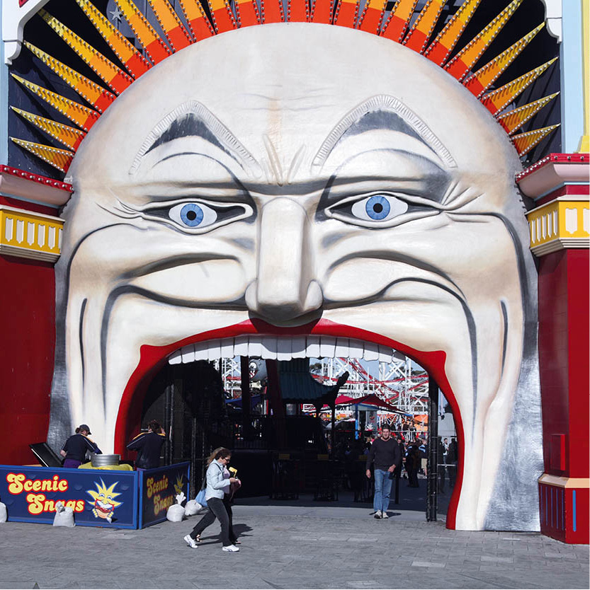
Fun on the Esplanade at St Kilda
Jerry Dennis/Apa Publications
A totally different shopping experience awaits in the seaside suburb of St Kilda. On Sundays its Esplanade is taken over by artists, antiques dealers and flea market entrepreneurs of every sort. Acland Street’s restaurants, cafés and bakeries preserve a middle-European Jewish flavour.
Brunswick Street, in Fitzroy, reflects the city’s bohemian side. Restaurants and cafés, Spanish bars on nearby Johnston Street, comedy and live-band venues – all buzzing with activity day and night. Fitzroy’s streets are crammed with alternative lifestyle shops, second-hand clothing and funky furniture.
Excursions
A favourite day trip goes out to the Dandenong Ranges, volcanic mountains where flowered hillsides and eucalyptus forests make for total relaxation. Only an hour’s drive from town, the mountains won’t exactly take your breath away; Mt Dandenong itself claims an altitude of only 633 metres (2,077ft).
One highlight of a day among the small towns, farms, parks and gardens is a ride on Puffing Billy (www.puffingbilly.com.au), a restored steam train plying 13km (8 miles) of narrow-gauge track from Belgrave to Menzies Creek. The line was given over to passenger operations from 1900 to 1958. Four years later it was converted to the tourism business. The train never achieves great speed. In fact, an annual race pits Puffing Billy against hundreds of runners.
The William Ricketts Sanctuary (Mt Dandenong Tourist Rd; tel: 13 19 63; daily 10am–4.30pm; charge) is an extraordinary collection of sculpture produced by a Caucasian loner who became obsessed with Aboriginal culture and its near-destruction by his fellow whites. Ricketts carved incredibly lifelike faces of Aboriginal people, accompanied by their spiritual symbols. The result of his artistic toils is unorthodox.
In Sherbrooke Forest Park, part of Dandenong Ranges National Park, you can give your lungs a treat, savouring the elixir of ferns and mountain ash and whatever flowers happen to be in bloom. The forest is immensely tall, with mountain ash monuments as high as 20-storey buildings and ferns as big as palm trees. This is the place to see – or at least hear – the lyrebird, a great mimic; it does imitations of other birds, human voices and even of inanimate objects such as passing cars. Among the residents of the park are the echidna (a hedgehog-like anteater), the platypus and the koala.
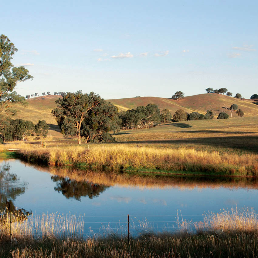
Yarra Valley
iStock
Healesville, less than 60km (37 miles) to the east of Melbourne, is the place to go for an intimate look at Australian animals on their home ground. Healesville Sanctuary (www.zoo.org.au/healesvillesanctuary; daily 9am–5pm; charge), nearby in the Yarra Valley, contains more than 200 native species such as kangaroos, wombats and emus. The sanctuary was founded in 1921 as a research establishment for the study of local fauna, and is committed to the care and conservation of Australian wildlife.
The Yarra Valley was the site of the first commercial winery in the state, dating back to the middle of the 19th century. The region’s vineyards, numbering about 80, are world-class; well worth a wine-tasting outing or a visit to one of the winery restaurants.
Another wine region near Melbourne is the Mornington Peninsula, an 80-minute drive south of the city. In addition to the 50 wineries with cellar doors, there are beaches (bay and ocean-facing), national parks, coastal walking trails, lovely rural scenery and pleasant villages such as Red Hill, Shoreham and Flinders.
For a magical experience for both adults and children, try a long day-trip to Phillip Island º [map] (www.visitphillipisland.com), 120km (75 miles) southeast of Melbourne, home of the fairy penguins (also known as little penguins), the world’s smallest members of the penguin family. Hundreds of these engaging birds, standing only about 40cm (16in) high and looking quite formal in their blue-grey plumage with white fronts, come home to their burrows at sunset. The number varies depending on activities at sea, where they spend most of their time fishing. For reasons of their own, perhaps sensing danger, they tread water offshore until night falls, and only then do they venture onto the beach. After decades of being stared at, they still feel insecure arriving on the island.
Before dusk falls, hundreds of tourists gather behind ropes on Summerland Beach and in viewing platforms on the sandhills above for the Penguin Parade (www.penguins.org.au; charge). You’re not allowed to upset the penguins: no flash photography, no running, no sudden movement. The penguins observe all this and wait for the first star to appear in the sky. Then the first brave penguin scout scrambles onto dry land and cautiously lurches across the beach and up the hill to its burrow. In small groups the others follow, waddling through the sand dunes up to their burrows right at sunset, just as their ancestors have done night after night for thousands of generations. It can take an hour or more for all the birds to get ashore – take warm clothes, for the nights are chilly even in summer.
Nearby you’ll find signs to The Nobbies and Seal Rocks, home to the country’s largest Australian fur seal colony (early December, the peak of the breeding season, is the best time to see them) – and plenty of great white sharks too, who come to feed on them, although this doesn’t seem to worry the surfers at the neighbouring beach.
Other attractions include a historic heritage farm (on Churchill Island, accessed from Phillip Island) and a Koala Conservation Centre.
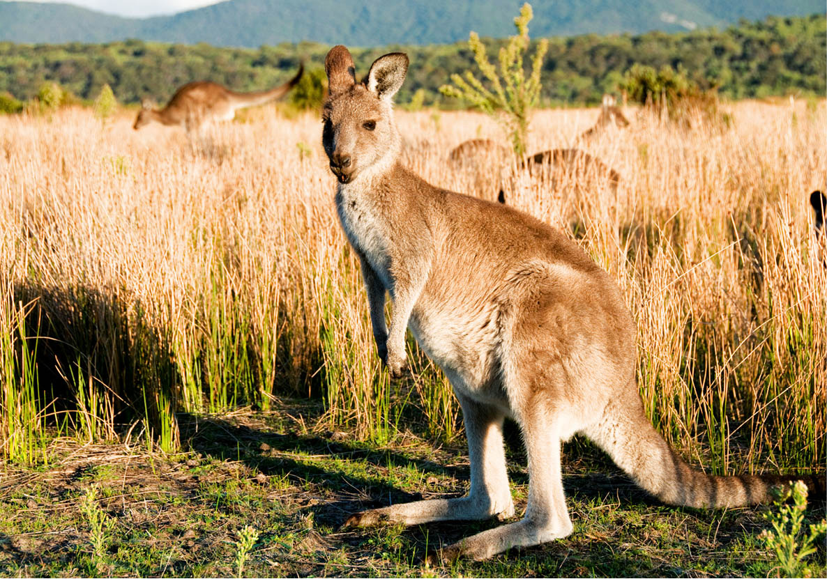
Kangaroos in ‘The Prom’
iStock
Wilsons Promontory
Until the Ice Age, the southernmost tip of the Australian mainland was connected to Tasmania. When the ice melted the heights became an island. Since then the dunes have built up, linking the massive promontory to the rest of Victoria. The varied and spectacular scenery has made Wilsons Promontory ¡ [map] the state’s most popular national park (so popular that camping spots are assigned via a lottery at peak times), which is making a recovery from some devastating bush fires in 2009.
The coastline ranges from magnificent granite headlands to peaceful sandy beaches. Walking trails wander through forests and moorland and flower-covered heathland. Wombats, koalas, kangaroos, wallabies and emus can all be seen here. Known locally as ‘The Prom’, the peninsula is about 240km (150 miles) southeast of Melbourne.
The Goldfields
A drive of 113km (70 miles) west of Melbourne takes you well over a century back in time to the town of Ballarat ™ [map], rich with all the atmosphere of Australia’s golden age. This is real gold-rush country, and it is still a prize destination for tourists.
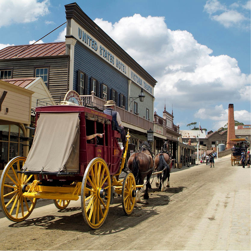
Stagecoach ride, Ballarat
iStock
Ballarat has a bittersweet history. Gold was discovered in 1851, and thousands of miners trekked to the fields. The early arrivals simply scooped up a fortune, but latecomers had to work harder, following the ore ever deeper.
Almost from the outset the government collected a licence fee from the miners. Many newcomers couldn’t afford to pay a tax, so they tended to lie low when the licence inspectors swooped. In the midst of growing antagonism between the authorities and the miners, charges of murder and official corruption pushed the diggers to revolt. In the Eureka Rebellion, insurgent miners were besieged in their stockade. A battle cost 35 people their lives, mostly diggers. The anguish endured for years, inspiring poets and politicians.
When peace returned to the goldfields, and many of the miners’ grievances were answered, Ballarat went back to the business of making a fortune. In 1858 a group of Cornishmen came upon what they called the Welcome Nugget, weighing in at an enormous 63,000g (2,220oz). It was eventually put on show in the Crystal Palace in London before being minted.
To see what Ballarat was like in the 1850s, visit Sovereign Hill (www.sovereignhill.com.au; daily 10am–5pm; charge), an open-air museum recreating the sights, sounds and smells of the gold rush. Local people dressed in Victorian-era clothing operate the old shops, post office, bakery and printing office of what appears to be a real town. Tourists are invited to try their hand with a digger’s pan. The Gold Museum (daily 9.30am–5.20pm; charge) traces the history of the mineral since biblical times and displays nuggets and gold coins. The Eureka Rebellion is re-created nightly in the show ‘Blood on the Southern Cross’.
In the real Ballarat, the principal public buildings on the town’s wide tree-lined streets are a long-lasting monument to the good old days. Some of those who got rich quick had the good taste to spend some of their money on the finer things, hence the statues of mythological subjects in marble in the Botanical Gardens, and the admirable collection of early Australian art housed in the Ballarat Fine Arts Gallery (daily 9am–5pm; charge).
Another treat for nostalgia fans is the town of Bendigo, situated 150km (93 miles) northwest of Melbourne. The town’s unusual name is a very roundabout corruption of Abednego, the Old Testament companion of Shadrach and Meshach. In the 1850s, Bendigo Creek, running through the centre of town, was besieged with panning miners.
The Central Deborah Mine (www.central-deborah.com; daily 9.30am–5pm; charge), the last commercial mine to operate in Bendigo, is now a museum; a visit includes a one-hour underground mine tour. From the mine you can take a ‘Talking Tram’, an antique vehicle rigged up for tourists on an 8km (5 mile) itinerary. The last stop is the joss house (Chinese temple). One curiosity of Bendigo was the size of the Chinese population. Chinese miners worshipped in a prayer house constructed of timber and handmade bricks. The remains that stand today are filled with relics of the early Chinese fortune hunters.
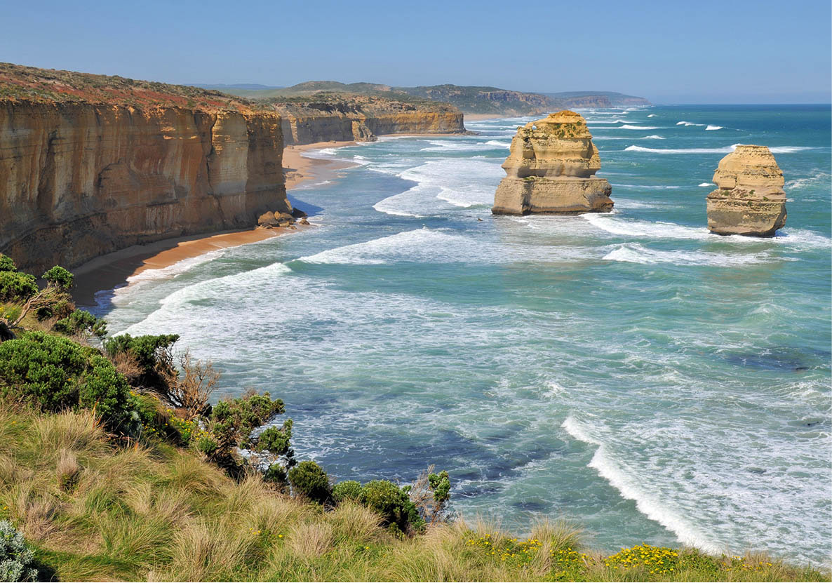
View from the Great Ocean Road
Dreamstime
Beyond Torquay is the beginning of the Great Ocean Road # [map], which skirts nearly 200km (125 miles) of spectacular coastline and is undoubtedly one of the world’s most beautiful drives. It was built by ex-servicemen of World War I in homage to their comrades killed at the front.
A great number of ships have gone aground in these treacherous waters. Along Shipwreck Coast, the wrecks of more than 80 sailing vessels rest on the seabed. Rising above the road are the bush-covered Otway Ranges, most of which fall within Great Otway National Park, which has many bushwalking options. The surf provides recreation, too. Bells Beach, situated between Torquay and Anglesea, hosts the Bells Surfing Classic every Easter. Just before you reach Lorne, follow the signs for Erskine Falls, splendid cascades that are worth the 20-minute detour. Lorne and, further west, Apollo Bay are popular seaside resorts, well provided with restaurants, cafés and shops. From Apollo Bay, the Great Ocean Road leaves the coast to wind through the forest behind Cape Otway, where the lighthouse has watched over the entrance to the Bass Strait since 1848.
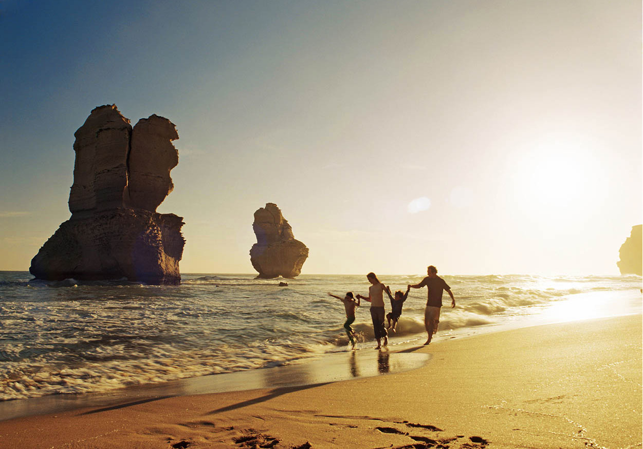
Twelve Apostles
Tourism Australia
Beyond Princetown lies the spectacular coastline of Port Campbell National Park, where breakers have battered the soft limestone cliffs, creating grottoes and gorges, arches and sea-sculptures rising from the surf. The Great Ocean Road allows occasional glimpses of the drama below, which includes the stark rock stacks known as the Twelve Apostles and the spray billowing through London Arch. Take time to stop at all the vantage points.
After Peterborough and the spectacular Bay of Islands comes Warrnambool (www.visitwarrnambool.com.au), once a busy port and now a pastoral and holiday centre. Warrnambool has become known as the ‘southern right whale nursery’, with these magnificent animals visiting the waters here to give birth between late May and early October. Whales and their newborn calves can often be seen (and heard) from Logan’s Beach. Around the original lighthouse is the Flagstaff Hill Maritime Museum (www.flagstaffhill.com; daily 9am–5pm; charge), a re-creation of a 19th-century port, complete with shipwrights, chandlers and sailmakers.
Along the coast is the fishing-village charm of Port Fairy, where brightly painted boats tie up at the jetty with their catches of lobster and crab. Port Fairy Bay was named by Captain James Wishart who brought his tiny cutter, the Fairy, into the Moyne River to find shelter during a sealing expedition in 1810, but the town was called Belfast for a period. Sealers and, later, whalers built quaint stone cottages which still nestle under the tall Norfolk Island pines shading the streets. In March each year, a very popular three-day folk festival draws music lovers to the town.
Wiping Out the Aborigines
When Van Diemen’s Land was first settled, the island’s Aboriginal people are estimated to have numbered between 3,000 and 7,000. They were different from the indigenous mainland peoples, in looks and culture. As the British seized the land and wiped out the animals and birds that the indigenous tribes needed for food, the Aborigines fought back with punitive attacks. Enraged, the white men retaliated with all the force at their disposal. The survivors of this genocide were exiled to Flinders Island in the Bass Strait, an outpost best known for its shipwrecks. Although there were belated efforts to protect the people, the last of the full-blooded Tasmanian tribespeople died in 1876. They were not entirely exterminated, however, as mixed-blood descendants of the Aboriginal women who had been abducted by British and American whalers and sealers and taken to islands in the Bass Strait (including Flinders) founded a flourishing Aboriginal movement.
TASMANIA
If you think of Tasmania as the last stop before the South Pole, you’re right: Antarctic expeditions actually set sail from Hobart. No matter what direction you’re heading in, it’s a staging post you will hate to leave. Tasmania’s scenery owes more to solar than polar influences. Although snow covers the hills in winter, it’s a verdant island enjoying a temperate climate.
Suspended 240km (149 miles) to the south of southernmost mainland Australia, Tasmania is small only by the swollen standards of the continent. With an area of approximately 68,000 sq km (26,250 sq miles), it’s bigger than Sri Lanka and Switzerland.
‘Tassie’, as the state is familiarly known, calls itself the Holiday Isle and pushes tourism. Its early residents would have had a bitter laugh at that, interspersed with an oath or two, for the island used to be the place where incorrigible prisoners were sent. While humble embezzlers and petty larcenists were transported to Sydney, the batterers and escape artists tended to be tagged for Tasmania.
Early explorers happened upon Tasmania because it lies on the 40th parallel – the Roaring Forties – along which an unfailing westerly wind blows around the globe. Their sailing ships could hardly miss the place. But that’s not to diminish the achievement of the Dutch navigator Abel Tasman, who discovered the island in 1642. He named it after his sponsor, Anton van Diemen, governor of the Dutch East Indies.
The Dutch never saw a future for Van Diemen’s Land, and Britain eventually claimed the island simply to cut out the French. Because of the cruel conditions inflicted on the prisoners, Van Diemen’s Land acquired a sinister reputation. The very mention of the name could send a shiver down a sinner’s spine. The transportation of convicts was abolished in 1852, and three years later the name was changed to Tasmania in memory of its discoverer and to improve the state’s image.
Since then, Tasmania has become something of a tourist paradise. One day, some brilliant entrepreneur may put it on the world map and the crowds will arrive. Until then, if you like wild scenery, open moors, green hills, deserted beaches, Georgian architecture, temperate-climate forests, uncrowded towns and open-hearted people, you could become a Tasmaniac.
Hobart
Everybody knows that Sydney Harbour is the exciting one, glamorous and instantly recognisable the world over. Hobart ¢ [map] is the lovable harbour, a perfect ocean port on the Derwent River, with soft mountains rising beyond. It might have been transplanted from quite another seafaring latitude, as brisk and tidy as Bergen or Helsinki.
You never know what kind of ships you’ll see here: freighters, fishing boats, luxury yachts or ice breakers. Sail power still matters here: Hobart’s Constitution Dock is the finishing line of the gruelling Sydney to Hobart yacht race.
Hobart, Australia’s second oldest capital city, has kept a powerful array of historic monuments, from stately official buildings to quaint cottages. Best of all, they’re still in use.
With a population of around 210,000 (suburbs included), Hobart is small enough to get around and get to know, and as unsophisticated and satisfying as the local fish and chips.
In this deepwater port, the ships come right into the centre of town, to Sullivans Cove. The waterfront, always colourful, is the place to begin exploring the city on foot or by taking a cruise from Brooke Street. You can watch crates of giant crabs, lobsters and scallops coming ashore, and follow their destiny to the floating fast-food restaurants moored at Constitution Dock, where the yacht races end. There’s a choice of waterfront bars, cafés and restaurants, mostly fish-themed, alongside and at trendy Elizabeth Street pier and Murray Street pier.
Also bordering the docks, Salamanca Place (www.salamanca.com.au) is home to a long row of sandstone warehouses from the 1830s, now occupied by artisans’ workshops, boutiques and restaurants. On Saturday, the huge Salamanca Market (8am–3pm) takes over, with stalls selling various arts and crafts, knick-knacks, flowers and vegetables, while buskers perform and pass the hat. Behind Salamanca Place, Salamanca Square is fringed with lively al fresco cafés, restaurants and bars.
Altogether more serious is Parliament House, built in 1840, also facing the waterfront. The state’s bicameral legislature operates in a low-rise stone building, which displays some admirable architectural details. Another venerable structure still in use is the Theatre Royal on Campbell Street, Australia’s oldest live theatre. Built in a luxurious style in 1834, it has featured stars like Noel Coward and Laurence Olivier.
Overlooking Salamanca Place, and reached on foot by Kelly’s Steps, Battery Point is the historic heart of Hobart. The battery in question was a set of coastal artillery guns installed in 1818. Ten years later signal flags were added, for relaying the big news of the day, such as ship arrivals or prison escapes. The area is worth an hour or two of exploration to absorb the atmosphere of the narrow streets, the mansions and cottages, churches and taverns. National Trust volunteers lead excellent walking tours (tel: 03-6344 6233 for bookings). One of the colonial mansions is now the Narryna Heritage Museum (www.narryna.com.au; Mon–Fri 10.30am–5pm, Sat–Sun 2–5pm; charge), with period furnishings, vintage vehicles and various farm implements.
The Tasmanian Museum and Art Gallery (www.tmag.tas.gov.au; daily 10am–5pm; free) is worth visiting for the collection relating to the Tasmanian tiger (thylacine). This striped, dog-like marsupial is believed to have been hunted to extinction by the 1930s, but some people swear they have seen living ones. If you prefer marine exhibits, visit the Maritime Museum of Tasmania (www.maritimetas.org; daily 9am–5pm; charge), in Argyle Street.
The centre of Hobart is linked to the suburbs and the airport by the graceful Tasman Bridge across the Derwent River.
For a panorama of Hobart and the valley of the Derwent River, ascend Mt Wellington. You can forget your mountain-climbing equipment. A paved road goes all the way to the summit, 1,270m (4,167ft) above the sea, but there’s also a rugged footpath. It often snows on the mountain in the winter months, but it rarely blocks the road.
Excursions from Hobart
A popular tourist destination up the river at Claremont is the Cadbury chocolate factory (guided tours Mon–Fri). Fans of Willy Wonka just love it – and guided tours include as much chocolate as you can eat.
Those with a more savoury tooth might prefer touring the imposing Cascade Brewery (www.cascadebreweryco.com.au; daily guided tours), the oldest in Australia, at 140 Cascade Road. The excellent beers, made with pure Tasmanian water, are famously labelled with a Tasmanian tiger logo.
At the Moorilla winery on the Berriedale peninsula in Hobart, Mona (Museum of Old and New Art, www.mona.net.au; Wed–Mon 10am–5pm, until 6pm in summer; charge for non-Tasmanians) is one of Australia’s most interesting art galleries – but be warned, many of its exhibits are not for the prudish.
At Taroona, situated beyond Wrest Point Casino at upmarket Sandy Bay, you can visit the remains of a different kind of factory, the Shot Tower. Though it looks like an ordinary chimney, this 48-metre (157-ft) high tower, built in 1870, was used in the manufacture of gunshot and musket balls. You can climb the internal spiral staircase (300 or so steps) to the very summit for a view of the countryside and the Derwent Estuary.
A complex of modern office buildings at Kingston is the working headquarters for Australia’s extensive operations in the neighbourhood of the South Pole. The Commonwealth Antarctic Division coordinates logistics and research in fields such as glaciology, botany, physics and medicine.
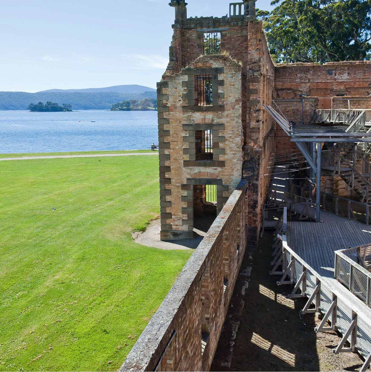
Port Arthur
Dreamstime
Port Arthur
Tasmania’s most-visited historic highlight is the penal colony of Port Arthur ∞ [map] (www.portarthur.org.au; daily 8.30am–dusk; charge), an hour’s drive from Hobart on the scenic Tasman Peninsula. Be sure to visit some of the spectacular natural features such as the Blowhole, Pirates Bay Lookout and Tasman Arch on the way there. Port Arthur’s past is so grim, you’ll be astonished at just how picturesque it looks. Founded in 1830 as Australia’s ultimate prison settlement, Port Arthur supposedly housed the most intractable convicts – those who had committed second offences after being transported to Australia – plus a few political prisoners, including some Irish rebels. It rapidly became one of the world’s most-dreaded institutions.
Chain gangs, toiling under the lash, built these stone buildings, which have survived for more than a century. The story is detailed at the visitor centre, as well as in the compelling museum in what used to be the penal colony’s asylum.
The biggest building still standing, at four storeys high, was designed originally as a storehouse but became a penitentiary for 650 inmates. Other surviving buildings are the Asylum (many prisoners went mad) and, next door, the ‘Model Prison’. Both have been restored. Convicts designed and built a large church, now in picturesque ruins. Its 13 spires represent Christ and the apostles. Then there is the mortuary, which did a lively business; more than 1,700 graves occupy the nearby Isle of the Dead. Other than by dying, Port Arthur was practically escape-proof, with sharks waiting on one side of the narrow Eaglehawk Neck and half-starved killer dogs on the other. In total, some 10,000 prisoners did time at Port Arthur during its 47 years of operation.
Port Arthur’s tragic history was added to in 1996, when it was the scene of Australia’s worst mass murder – an indiscriminate attack by a lone gunman, which left 35 people dead, including several members of the facility’s staff. A tasteful memorial can be seen in the grounds, but it’s tactful not to ask too many questions – many of the guides and workers were there on the day and memories remain raw.
Admission to Port Arthur includes a brief walking tour and a harbour cruise, leaving from the information centre. Boats run twice daily to the Isle of the Dead. Avid ghost hunters should take the famous Port Arthur Ghost Tour run nightly – bookings are essential.
Wine appreciation
The wineries around Launceston offer tastings, and most of them also have very good restaurants.
Launceston
Tasmania’s second city is an agreeable, roomy town at the head of the Tamar River. Launceston exudes an English flavour, with elm trees, rosebushes, and patriotic statues and plaques. The journey north from Hobart skirts soft green hills studded with sheep. In the villages, to enliven the scene, the houses have roofs the colour of fire engines.
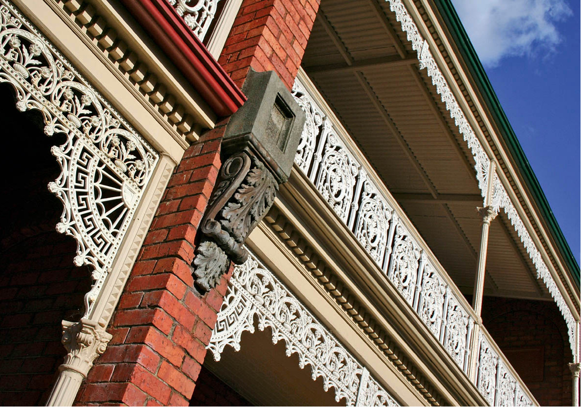
Victorian building facade in Launceston
iStock
Launceston was founded in the year 1805, as Patersonia. Soon afterwards, the name was changed to match that of the town of Launceston in Cornwall, the birthplace of the colony’s governor. The historic aspects of the town are well preserved, starting in the centre, the Civic Square, the location of the Macquarie House (1830). Restored to mint condition, this historic building is now a café.
The main building of the Queen Victoria Museum (daily 10am–5pm; free), situated just a short stroll away on Wellington Street, has something for everyone, from stuffed platypuses to blunderbusses and prisoners’ chains. One surprising attraction here is an intact Chinese temple (joss house), which originally served the Chinese tin miners in the Tasmanian town of Weldborough. Downstairs, the Queen Vic Café is one of Launceston’s best. The museum’s art collection has moved to the striking new Inveresk site, a multi-million-dollar transformation of a railway yard on the North Esk River.
Tasmania is known for its talented craftspeople, whose output is on show at the Design Centre (www.designcentre.com.au; Mon–Fri 9.30am–5.30pm, Sat–Sun 10.30am–3.30pm; charge), on the western edge of City Park. The highlight is the collection of contemporary furniture made from various species of Tasmanian timber.
Cataract Gorge, a stirring geological feature, is within walking distance of the centre of town. Here the South Esk River slices between steep cliffs on its way to the Tamar. There are hiking trails, boating opportunities and, for sightseers who don’t suffer queasy spells, a chairlift – the longest single-span lift in the world at 308 metres (336yds) – spans the canyon. Nearby is the Boag’s Centre for Beer Lovers (www.boags.com.au; Mon–Fri 8.45am–4.30pm, Sat 10am–4pm; free), housed in the historic Tamar Hotel, where you can take a tour of the brewery that makes one of Australia’s best beers (tel: 03-6332 6300 for tour bookings).
Wilderness
Much of the southwestern quarter of Tasmania is untouched by civilisation. There is a reason why it has remained unspoilt: it’s often unapproachable by road. Four-wheel-drive vehicles, canoes, rafts or just sturdy legs are the best methods of penetrating these wild places. In Tasmania a higher percentage of the total land area has been made national park than in any other state.
Even so, attempts by various commercial interests to log or dam unspoiled wilderness regions have triggered clashes with Tasmania’s strong conservationist movement. The Wilderness Society (www.wilderness.org.au) campaigns to save the state’s remaining stands of old-growth forest available for logging.
The best known Wilderness Society campaign was the successful Franklin Blockade of 1982, which helped save the wild Franklin River from damming. Base for the campaigners was the West Coast fishing port of Strahan, which now derives its income from scenic cruises on the pristine Gordon River (into which the Franklin flows) and flights over the Franklin, which can also be experienced on gruelling four- to 10-day rafting trips. The West Coast Wilderness Railway (tel: 1800 628 288 for bookings), a redevelopment of a 19th-century line, now links Strahan to the nearby town of Queenstown, its surrounding hills once laid bare by the effects of decades of copper mining and smelting, but now gradually becoming green as plants re-grow.
South West National Park, covering most of the southwestern corner of Tasmania, has a variety of spectacular scenery, including rugged mountains, glacial lakes, icy rivers and forests of giant Antarctic beech trees – a grand adventure playground for experienced, well-prepared hikers.
Much more accessible is Cradle Mountain–Lake St Clair National Park, a few hours’ drive northwest of Hobart. Here you’ll find a wonderland carved out by glaciers: craggy mountain peaks, lakes and tarns, alpine heathlands and extensive buttongrass plains. Extending through the length of the park, from the jagged grandeur of Cradle Mountain reflected in tranquil Dove Lake, south to the glacier-gouged deepwater basin of Lake St Clair, is the 80km (50-mile) Overland Track, a wilderness walk that takes at least five days to complete. But it’s not necessary to exert yourself: you can enjoy day walks and the breath-taking scenery from very comfortable lodges located at Cradle Mountain or Lake St Clair.