4 Commuter Trail

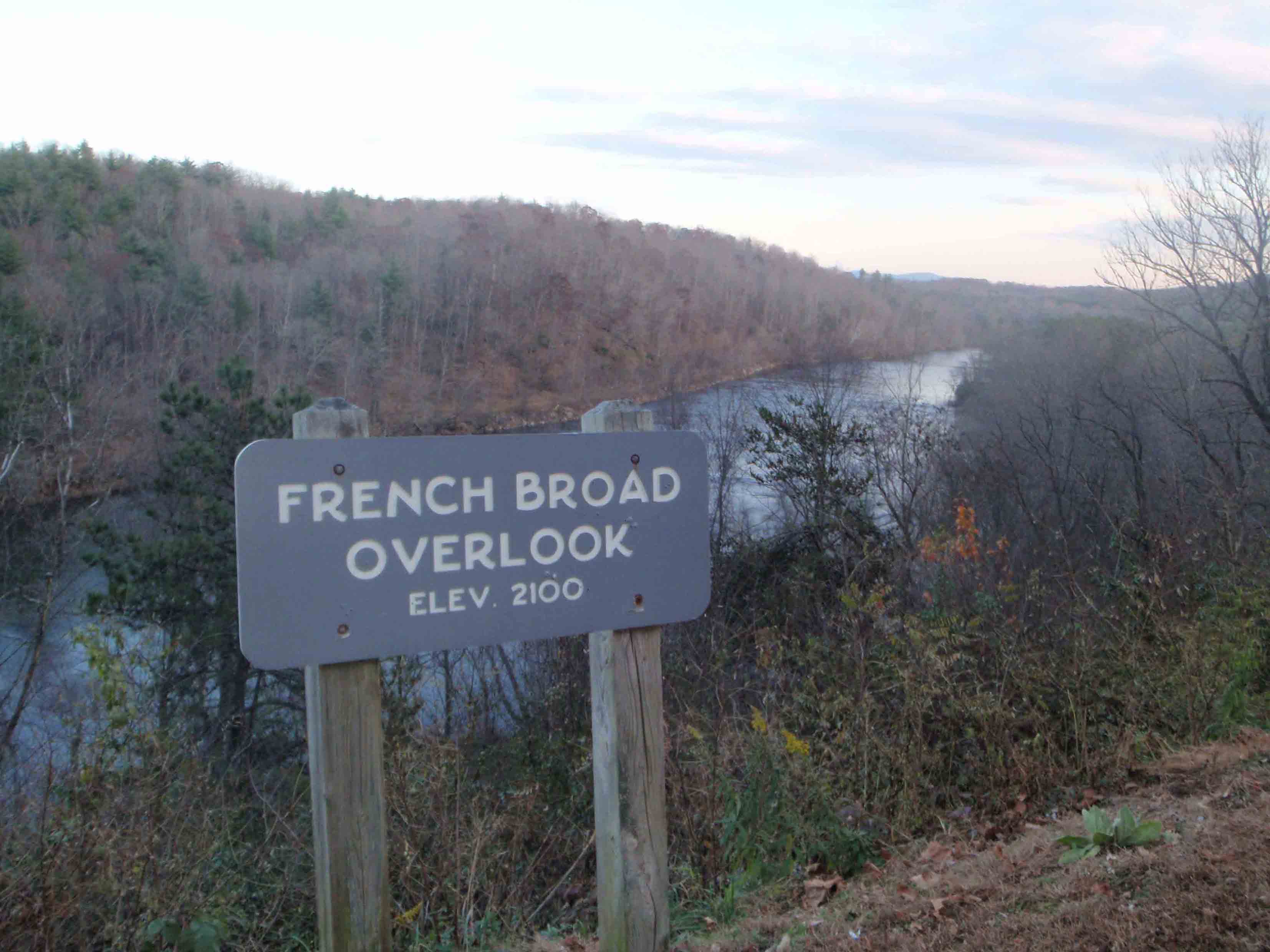
A VIEW OF THE FRENCH BROAD RIVER FROM THE BLUE RIDGE PARKWAY
SCENERY: 
TRAIL CONDITION: 
CHILDREN: 
DIFFICULTY: 
SOLITUDE: 
GPS TRAILHEAD COORDINATES: N35° 33.718' W82° 29.643'
DISTANCE & CONFIGURATION: 9.8-mile shuttle (one-way with 3 sections: 3.5 miles, 3.6 miles, and 2.1 miles)
HIKING TIME: 5.5 hours
HIGHLIGHTS: Multiple access points near major roads
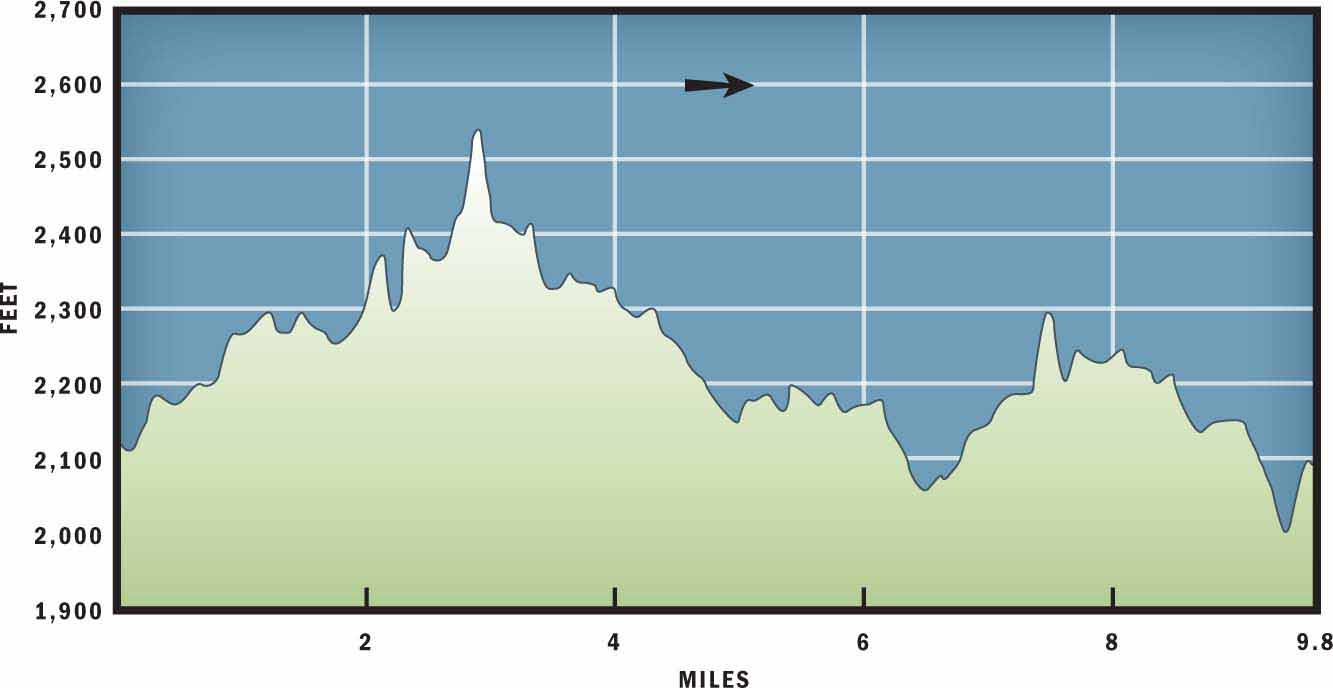
ELEVATION: 2,000 feet at the French Broad River to 2,500 feet on the north slope of Busbee Mountain
ACCESS: Free and always open
MAPS: Asheville, Skyland, and Oteen
FACILITIES: None
WHEELCHAIR ACCESS: None
COMMENTS: Due to the convenient location and popularity of this trail, hikers should stay alert for speedy trail runners and off-leash dogs.
CONTACTS: Blue Ridge Parkway (828) 298-0398 and nps.gov/blri; Mountains to Sea Trail (919) 698-9024 and ncmst.org


Overview
What this trail lacks in scenery, it makes up for in convenience. With major access points at US 74, US 25, and NC 191, the path is a popular destination with commuters and nearby residents, especially before and after work. The trail stays well hidden within the woods and provides a wilderness feel in an urban environment. The route parallels the Blue Ridge Parkway through a narrow but beautiful mixed forest filled with tall hardwoods and sweet-smelling pine trees.
Route Details
Sometimes on the trail, as in real estate, the value of property can be summed in three words: location, location, location. And for many Asheville residents the convenience and accessibility of the Commuter Trail makes it one of their favorite places to hike. The elevation gain-and-loss on this trail is particularly mild for Western North Carolina, and many hikers will want to travel the entire distance of the trail. In this case, you should park a car at the French Broad River before starting the hike so that you will have transportation at the end of the route. Thankfully, unlike many trail shuttles, this drive is an easy and straightforward jaunt down the Blue Ridge Parkway. Also, as a warning, this route travels over several overpasses, and one in particular—over I-26—is very high off the ground. If you do not like being exposed to heights, then perhaps plan to hike between the overpasses instead of completing the entire route. For hikers with less time—or for those who don’t want to worry about the logistics of a car shuttle—this hike’s Route Details are provided in three sections. Note that the entire route, through all three sections, follows the white-blazed Mountains to Sea Trail (MST).
Section 1 (US 74 to US 25A): Begin this 3.5-mile section of trail at the Blue Ridge Parkway US 74 overpass, where parking is available on the shoulder of the road. Start the trail to the northwest of the bridge. Almost immediately after delving into the forest, the sound of traffic will disappear and you will find yourself in a mixed forest of oak, poplar, and pine trees. The first 0.5 miles of trail offer short rolling hills that eventually lead to a break in the trees where power lines have been built. From this spot, a housing development is visible to the north and you are reminded just how close you are to civilization.
At mile 1.4 you will intersect an old roadbed. Continue straight on the MST and follow the path downhill on such a gradual grade that it often goes unnoticed. Over the next mile, you will cross three seasonal creek beds that can look like a dry ditch or a small creek, depending on the weather. After the final crossing at mile 2.2, you will start a gradual climb up the slopes of Busbee Mountain. The trail will intersect two spur trails to the right that once again lead to nearby housing developments, before arriving at a small wooden bridge that spans a drainage culvert. At 2,500 feet the west side of the bridge is the highest point on the Commuter Trail. From the culvert the trail will lead you 0.7 miles on a fairly level path before exiting the forest at the Blue Ridge Parkway overpass across US 25A.
Section 2 (US 25A to the I-26 Overpass): The 3.6-mile section of trail between US 25A and I-26 travels through a thin ribbon of forest that separates Biltmore Forest from South Asheville. The trail starts to the north of the parkway just past the bridge over US 25A. There is room for one or two cars on the north shoulder of the road.
The trail in this section will take you within the confines of the forest for 0.4 miles before exiting at the Blue Ridge Parkway and utilizing a bridge that spans the railroad tracks below. Past the railroad tracks, the trail will return to the forest for a 0.3-mile stretch before once again taking advantage of an overpass across US 25. After crossing the bridge, you will need to look for the trail to resume on the south side of the parkway. From there you will remain on shaded singletrack trail for 2.9 miles.
As you walk the trail, you will notice that sections have been reforested with young pine trees—a project of the Blue Ridge Parkway. The Commuter Trail would not be possible if it were not for the thin corridor of land that protects the Blue Ridge Parkway. The parkway (which is owned and operated by the National Park Service) is, in fact, the longest National Scenic Route in America and also the most visited.
Two miles past US 25, the trail crosses a creek via a wooden bridge. Past the bridge, there is an old roadbed that continues straight, but the MST veers off to the left. Follow the MST 100 yards to another stream crossing. From there you will hike 1 mile, mostly uphill, to reach the Blue Ridge Parkway Overpass across I-26.
Section 3 (I-26 Overpass to The French Broad River Overlook): If you do not like heights, then you will not want to walk across the I-26 Overpass. Instead, park on the west side of the bridge and begin your hike on the north side of the parkway.
The next 2.1-mile section is mostly downhill. After hiking a level 0.4 miles, the trail will cross the Blue Ridge Parkway and remain relatively flat for the next 0.3 miles before starting its descent to the French Broad River. A mile past I-26, you will arrive at an intersection with an old roadbed. To the left you can view the old roadbed traveling underneath the parkway, but you will want to continue straight and hike for another 0.7 miles to arrive at the bridge over the French Broad River. Again, if you do not care for heights, then you may want to avoid this traverse. But if you decide to cross the bridge, you will be rewarded with great views of the river to the north and south. On the west end of the bridge, leave the MST and hike a few hundred feet along the Blue Ridge Parkway. Within minutes, you will reach the western terminus of this hike at the French Broad River Overlook.
Nearby Attractions
Located at the center of this hike, US 25 offers a variety of restaurants and shops close to the trail.
Directions
East Terminus: From downtown Asheville, take I-240 east toward Oteen. From I-240, take Exit 9 toward I-40 and the Blue Ridge Parkway, then immediately veer onto US 74. After 0.5 miles turn right onto the Blue Ridge Parkway. Parking is on the north shoulder of the road.
West Terminus: From downtown Asheville, travel I-26 south to Exit 33. Turn left off the exit onto NC 191. Travel 2.1 miles on NC 191 to a traffic light. At the traffic light turn right toward the NC Arboretum and Blue Ridge Parkway. At the next stop sign, turn right on the parkway. Travel 0.1 mile and turn left into The French Broad River Overlook and parking area.