5 Destination Center Track Trail

THE TRAIL TRAVELS UNDERNEATH THE BLUE RIDGE PARKWAY.
SCENERY: 
TRAIL CONDITION: 
CHILDREN: 
DIFFICULTY: 
SOLITUDE: 
GPS TRAILHEAD COORDINATES: N35° 33.940' W82° 29.193'
DISTANCE & CONFIGURATION: 1.4-mile loop
HIKING TIME: 1 hour
HIGHLIGHTS: The Blue Ridge Parkway Destination Center
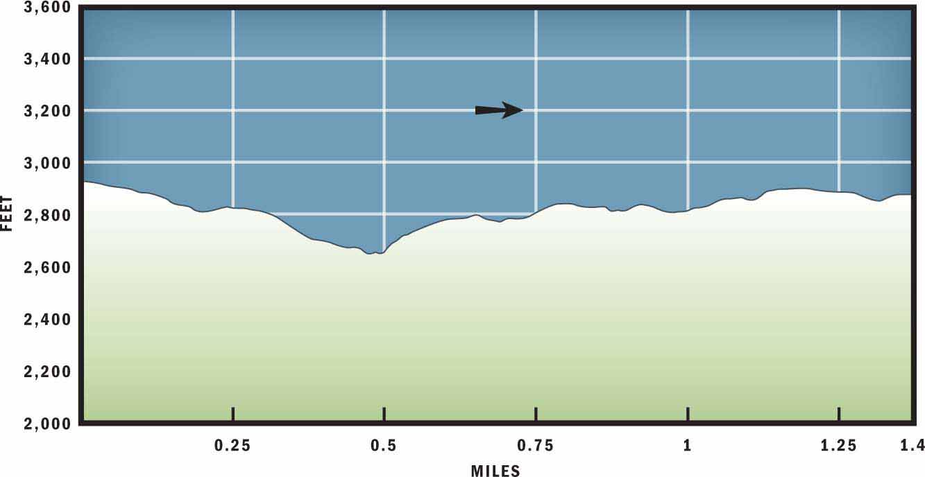
ELEVATION: 2,264 feet at the trailhead to 2,121 feet south of the parkway
ACCESS: Free and always open; however, vehicle access to this hike is unavailable when the Blue Ridge Parkway is closed.
MAPS: USGS Oteen
WHEELCHAIR ACCESS: Yes, at the Destination Center
COMMENTS: The Destination Center is open daily, 9 a.m.–5 p.m.; closed Thanksgiving, Christmas, and New Year’s days.
CONTACTS: (828) 298-5330; nps.gov/blri


Overview
This hike is especially well suited for those with children—and for those who are children at heart. Start at the Destination Center to learn about the Blue Ridge Parkway through educational exhibits and interactive technology. When it is time to move on to the trailhead, you will see a child-friendly sign that describes the hike and provides information and activity brochures that correspond with the ensuing 1.6-mile loop.
Route Details
The state-of-the-art, LEED*-certified Destination Center offers an enjoyable beginning to this hike. Kids and adults will lose track of time among the visually appealing exhibits and interactive games. One highlight is the large, sliding LED screen that allows you to virtually travel the length of the Blue Ridge Parkway. Another appealing draw is the informational video that shows every 30 minutes. (*Leadership in Energy and Environmental Design)
After exploring the family-oriented Destination Center, walk to the opposite side of the parking lot to the Track Trail. There you will find a beautiful blue sign mounted on a stone arch. The animated dog on the sign offers several tips and suggestions for children to make the most of the hike. Pamphlets available beneath the sign are designed to help younger hikers identify plants and insects along the trail.
The Track Trail and informational brochures are part of an initiative called Kids in Parks. The Blue Ridge Parkway Foundation founded the program and co-sponsors it—along with the Blue Ridge Parkway and Blue Cross Blue Shield of North Carolina. The mission statement of the Kids in Parks program as stated on the kidsinparks.com website is to “increase physical activity of children and their families, to improve nutritional choices, and get kids outdoors and along the Blue Ridge Parkway.”
As part of the initiative, the Blue Ridge Parkway Foundation is constructing several Track Trails near the Blue Ridge Parkway, which provide children interactive and educational materials to help them make the most of their hikes. In addition to the trailhead information and brochures, your child can log on to kidsinparks.com/tracker/ to participate in the online Track Trail program. The website asks kids to answer a few questions about what they learned on the trail—in return for free prizes! (Sorry grown-ups, this online component is just for kids.) The following hike at the Blue Ridge Parkway Destination Center was the first Track Trail created and serves as a pilot for similar trails under way in communities along the Blue Ridge Parkway.
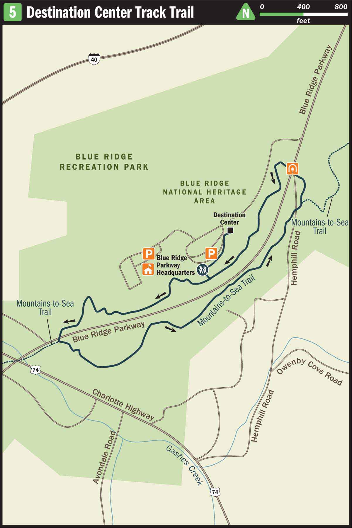
From the blue sign, travel into the woods on a dirt path behind the trailhead marker. In a few feet, the trail will split. Begin the loop by turning right and continuing slightly downhill. After 0.1 mile the blue blazes that mark the trail will lead past a large gray building to the right. This structure serves as the main headquarters for the Blue Ridge Parkway and its rangers, landscape architects, and park superintendent; they work to preserve and protect the National Scenic Road, which extends 469 miles from the Great Smoky Mountains near Cherokee to Rock Fish Gap near Waynesboro, VA.
After 0.5 miles you will exit the woods at the Blue Ridge Parkway, and the trail continues on the opposite side of the road. If you are hiking with children, exercise extra caution before crossing, as commuter cars often zip down the parkway. Across the road, the Track Trail joins the white-blazed Mountains to Sea Trail (MST) and veers east. The next 0.5-mile stretch is great for children to search for bugs such as granddaddy longlegs or grasshoppers. It is also a good area for using the brochures to help identify the different types of ferns that line the path, including hay-scented fern, bracken fern, and Christmas fern.
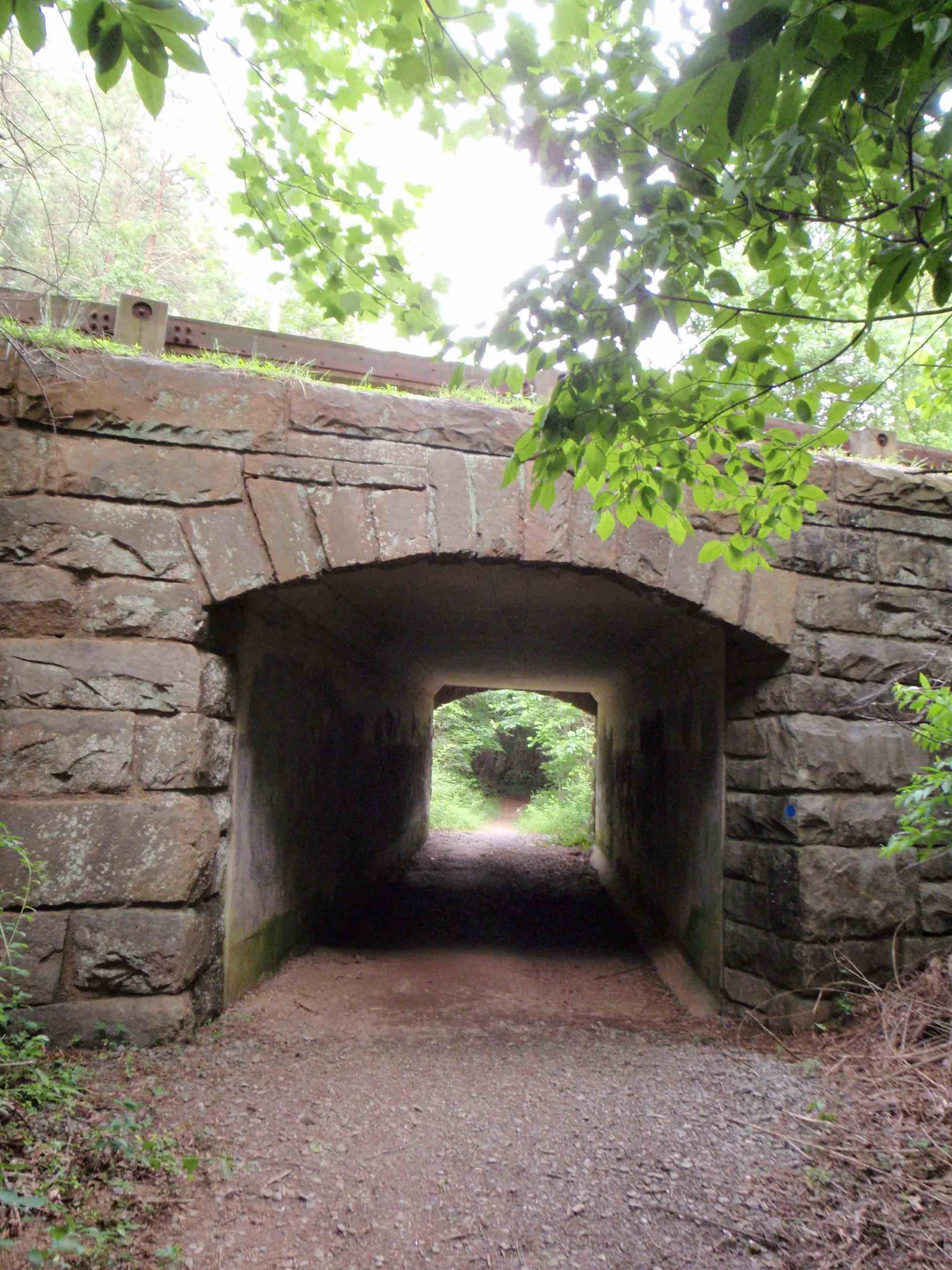
On this part of the path, 1 mile from the trailhead, you will come to a junction. The MST continues uphill to the right, but you will want to go straight and rejoin the blue blazes that lead back toward the Destination Center. You know that you are still on the correct path when you travel through a tunnel underneath the parkway. In the wintertime, this tunnel often has bedazzling icicles adorning the front and back entrance.
Back on the other side of the parkway, you will pass a gravel ATV trail on your right that leads directly to the Destination Center. Your group may be eager to revisit the Destination Center, but to complete the loop you will veer left and follow the trail another 0.2 miles. Then turn right on the short trail stem that leads back to the Destination Center parking lot.
Directions
From downtown Asheville, take I-240 east toward Oteen. From I-240, turn left onto Exit 9 toward I-40 and the Blue Ridge Parkway, then immediately veer left onto US 74A. After 0.5 miles turn right onto the Blue Ridge Parkway. Travel the parkway north 0.5 miles and then turn left onto Hemphill Knob Road. Park at the Destination Center.