7 Lake Powhatan

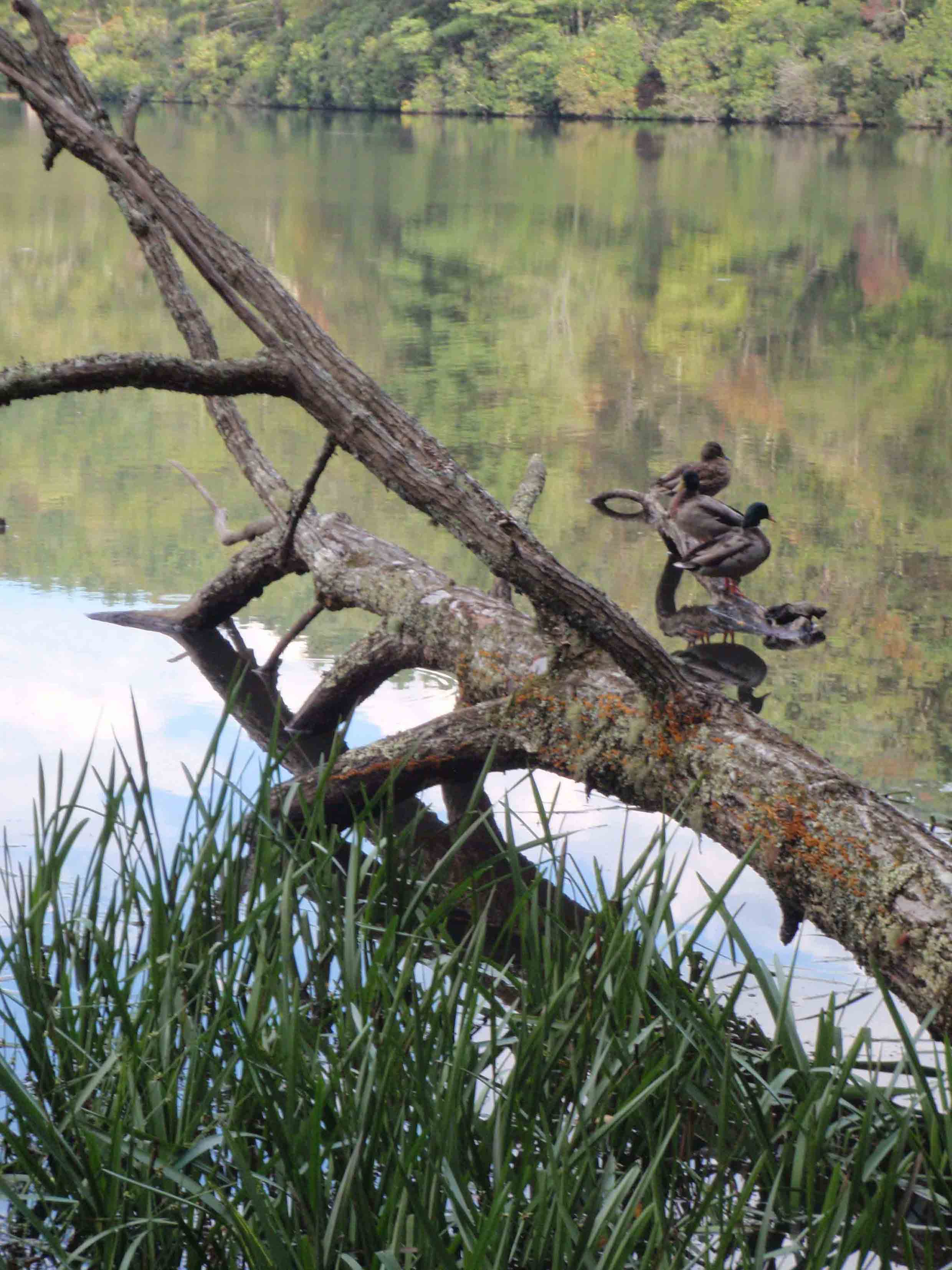
DUCKS REST ON A FALLEN TREE AT LAKE POWHATAN.
SCENERY: 
TRAIL CONDITION: 
CHILDREN: 
DIFFICULTY: 
SOLITUDE: 
GPS TRAILHEAD COORDINATES: N35° 29.250' W82° 37.443'
DISTANCE & CONFIGURATION: 1.6-mile balloon
HIKING TIME: 1 hour
HIGHLIGHTS: Views of Lake Powhatan, the fishing pier, and seasonal swim area
ELEVATION: 2,163 feet at the trailhead to 2,168 feet at Lake Powhatan
ACCESS: The trails at Bent Creek Experimental Forest are free and always open. Lake Powhatan Recreation Area is open 7 a.m.–10 p.m. and costs $5 to access by car. (The following hike avoids this fee by entering the boundary on foot.)
MAPS: USGS Skyland and Dunsmore Mountain
FACILITIES: Pit toilets at the trailhead; portable toilets at the fishing pier
WHEELCHAIR ACCESS: Yes, at the fishing pier, via Lake Powhatan Recreation Area
COMMENTS: The beach at Lake Powhatan is open for swimming Memorial Day through Labor Day, when the lifeguard is on duty.
CONTACTS: Bent Creek Experimental Forest (828) 257-4832 and srs.fs.usda.gov/bentcreek; Lake Powhatan Recreation Area cs.unca.edu/nfsnc/recreation/connections/pisgah_day_use.pdf


Overview
The level terrain and varied scenery on this trail make this hike ideal for families with young children. Starting at the Hardtimes Trailhead, the route follows both gravel roads and a singletrack trail to the dam at Lake Powhatan. From the dam, the path leads through a rhododendron tunnel to the beach on the north end of the lake and then to the fishing pier on the opposite shore. Then the route travels on a forest service road through towering hardwood trees back to the parking area.
Route Details
This hike takes you through Bent Creek Experimental Forest and Lake Powhatan Recreation Area. By parking and beginning the hike at the Hardtimes Trailhead in Bent Creek Experimental Forest, you will avoid a parking fee in the Lake Powhatan Recreation Area. However, if you wish to access the recreation area directly, or if there are individuals in your party who want to see the lake but are unable to hike, then it is possible to pay $5 per vehicle and drive directly to Lake Powhatan and the wheelchair-accessible fishing pier.
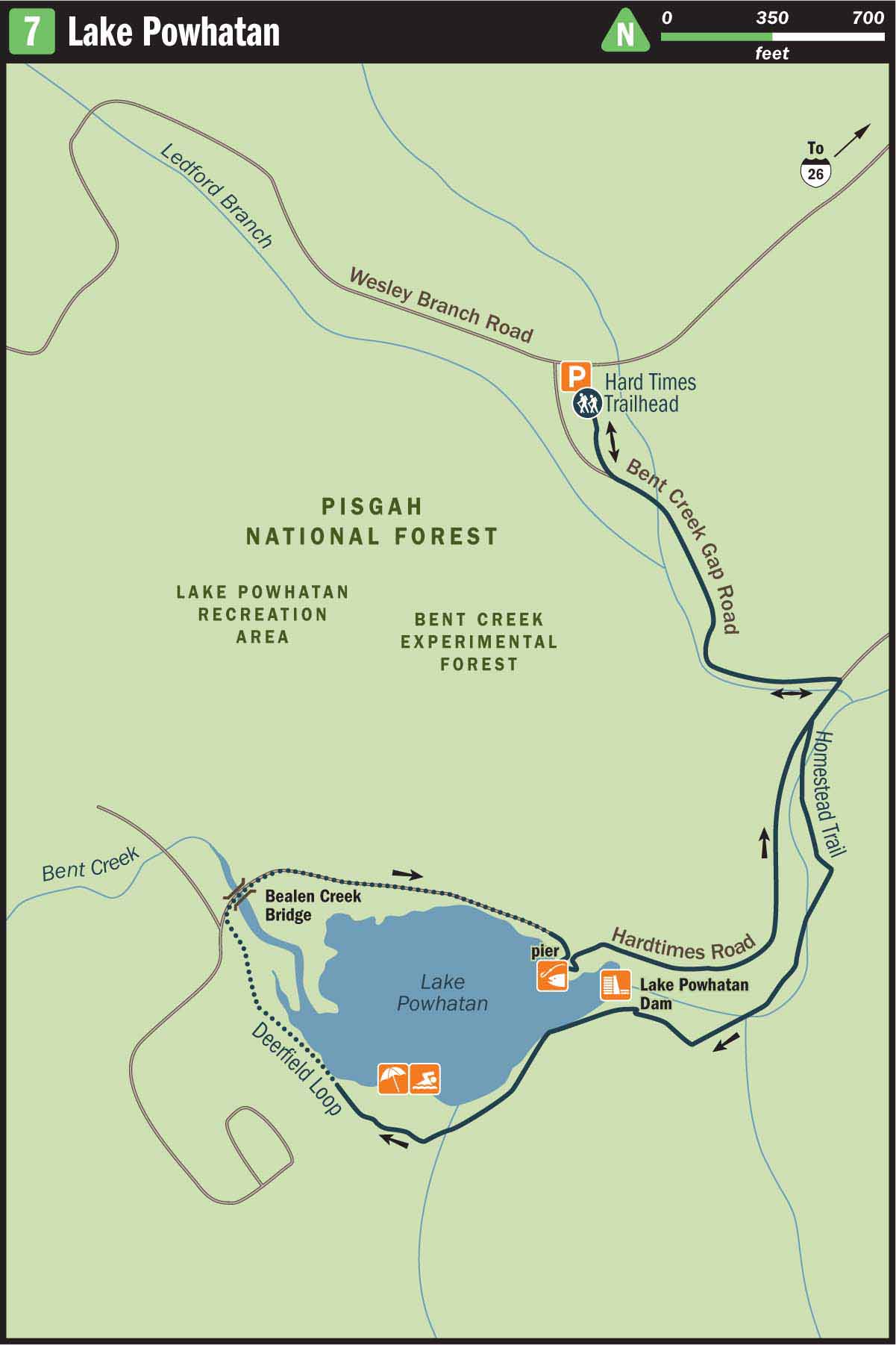
To begin your hike, walk south from the Hardtimes Trailhead and away from Wesley Branch Road. You will pass a forest service gate that is typically closed. Continue on the gravel road past the gate. You are now hiking on Bent Creek Gap Road, a gravel treadway that is closed to vehicular traffic, except for authorized vehicles. But it is a popular road for mountain bikers, so don’t be surprised if one comes whizzing behind you. On occasion, there are even off-road unicylists who train in Bent Creek. Talk about having good balance!
After passing the Hardtimes Connector dirt trail on your right, you will come to an intersection with another wide gravel road. Bent Creek Gap Road continues to the left, but you want to turn right to access Hardtimes Road. Once on Hardtimes Road, you will follow Bent Creek for a few hundred feet and then turn left and cross the creek on a cement bridge. On the other side of the bridge, take an immediate right to leave the gravel road and join the orange-blazed Homestead Trail.
The Homestead Trail will continue to parallel Bent Creek until you reach the dam at Lake Powhatan. You will know that you are close to the dam when you can hear a sound, similar to a waterfall, coming from the right of the trail. There is an unmarked spur trail leading a few feet to the left that reveals great views of the dam and Lake Powhatan.
Leaving the Dam, you will continue on the Homestead Trail and contour the banks of Lake Powhatan. However, even though you are traveling very close to the water, you may not be able to see it through the dense rhododendron and mountain laurel thicket that lines the path.
After hiking 0.8 miles, you will arrive at a trail junction. The trail to the left leads to Deerfield Loop, but you want to veer right and continue on the Homestead Trail. A few hundred feet past the trail junction, you will leave the forest behind and come into an open field at the west end of the lake. From there the swimming beach is clearly visible. If you are hiking in the summer, the beach is a great place to take a quick dip before moving on down the trail. However, even in the off-season the sandy shoreline provides a nice resting spot to enjoy a snack and observe some of the resident ducks that make Lake Powhatan their home.
When you are ready to resume hiking, continue along the banks of the lake and locate the orange blaze that leads back into the forest on the north end of the beach. This trail takes you on a short wooded walk near the lake and then terminates at a large wooden bridge that spans Bealen Creek and the surrounding wetlands. Walk across the bridge and stay extra vigilant as you peer into the wetlands to your left. You may be able to notice signs of beaver activity, and in recent years an otter has been spotted in this area.
On the opposite side of the bridge, a short connector trail leads past a utility shed to join a gravel road. Turn right on the gravel road and follow it to the fishing pier on the east end of the lake. The pier is open for fishing from the first Saturday in April to the last Saturday in February. The lake is hatchery-supported and stocked with trout, but in order to test your luck with a fishing pole you will need a state fishing license. Even without a license it is fun to watch other anglers reel in their latest catch.
When you leave the lake, continue east on the gravel road, along the north bank of Bent Creek. At the same time that you depart the fishing pier parking area and reenter the forest you will also reenter Bent Creek Experimental Forest. At this point the gravel road you are hiking transitions to the start of Hardtimes Road. Follow this road back past the cement bridge over Bent Creek and then take your next left onto Bent Creek Gap Road. This road will lead you on a 0.3-mile slight ascent back to the Hardtimes Trailhead and parking area.
Nearby Attractions
Lake Powhatan Recreation Area offers overnight camping and daytime recreational opportunities. The day-use fee is $5 per vehicle, and overnight rates start at $17 per person. Facilities include flush toilets, showers, and picnic tables.
Directions
From I-26 take Exit 33 and turn left onto NC 191/Brevard Road. Travel 1.9 miles and then turn right onto Bent Creek Ranch Road. In 0.2 miles the road makes a sharp left-hand turn and becomes Wesley Branch Road. Follow Wesley Branch Road 2 miles; the Hardtimes Trailhead will be on your left.