19 Coontree Loop

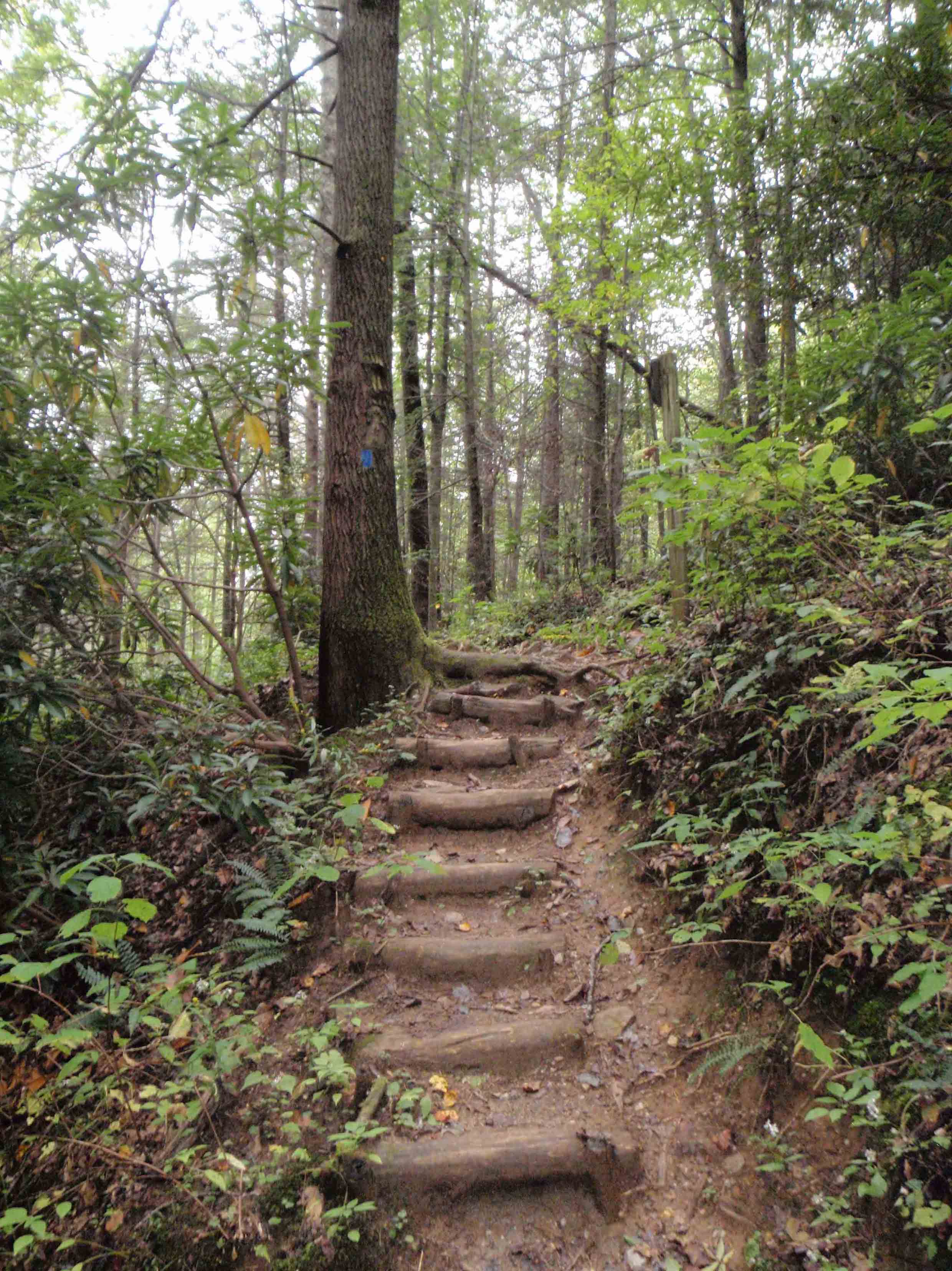
THE COONTREE LOOP TRAVELS THROUGH A DENSE HARDWOOD FOREST.
SCENERY: 
TRAIL CONDITION: 
CHILDREN: 
DIFFICULTY: 
SOLITUDE: 
GPS TRAILHEAD COORDINATES: N35° 17.348' W82° 45.786'
DISTANCE & CONFIGURATION: 3.7-mile balloon
HIKING TIME: 2.5 hours
HIGHLIGHTS: Lots of creekside walking and winter views of Black Mountain
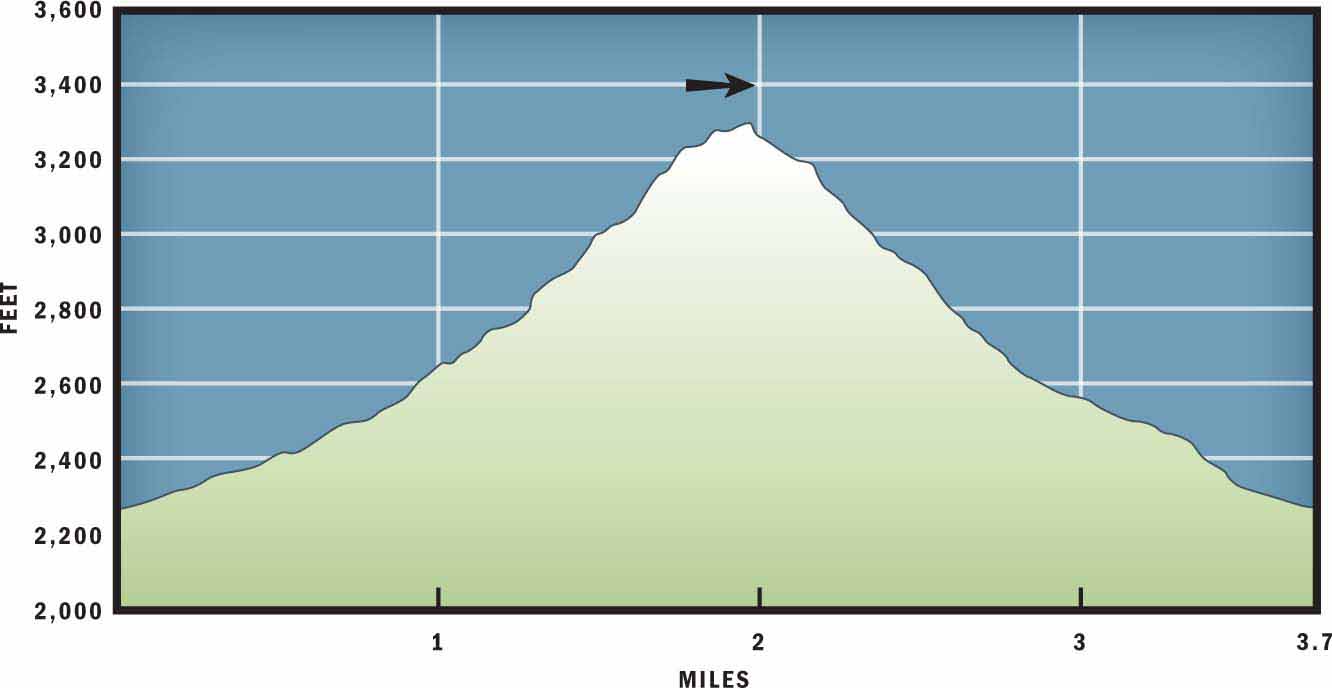
ELEVATION: 2,254 feet at the trailhead to 3,296 feet on Coontree Ridge
ACCESS: Free and always open
MAPS: USGS Shining Rock
FACILITIES: Pit toilets, picnic tables, and grills at the trailhead
WHEELCHAIR ACCESS: At the restroom facility
COMMENTS: Trail erosion makes for uneven footing on the route’s descent, so consider bringing hiking poles.
CONTACTS: (828) 257-4200; fs.us.gov/nfsnc


Overview
If you enjoy quiet hiking beside a small mountain stream, this hike is for you. The route allows you to explore the headwaters of two neighboring creeks and reveals terrific ridgeline views of Pisgah National Forest during the winter. Starting at the Coontree Picnic Area, the route ascends steadily to the eastern slopes of Coontree Mountain, where it then travels along the narrow spine of the ridge before descending through a hardwood forest to the trailhead.
Route Details
Start at the Coontree Picnic Area and Trailhead off US 276. The picnic tables and grills near the Davidson River make this hike a nice option for those who may want to picnic or grill out after their walk.
Cross US 276 on the east side of the Coontree Parking Area. There is a small creek that travels almost unnoticed beneath the highway. Once you have crossed over the creek, look for the blue-blazed Coontree Loop to begin on your left. The trail delves immediately into the woods, where a canopy of beech and hemlock trees covers the trail and sycamore trees line the creek banks.
Sycamores are easy to identify with their bark’s patchy combination of green, brown, tan, gray, and white colors. Unlike that of other trees, sycamore bark does not grow or expand with the tree but instead flakes off like dead skin cells. This process reveals the different layers and leaves the trunk of the sycamore looking like it has been dressed in camouflage clothing. A phonetic clue for remembering how to identify a sycamore is: if you see a tree that looks “sick” because of its mottled exterior, then it is probably a “sick” amore tree.
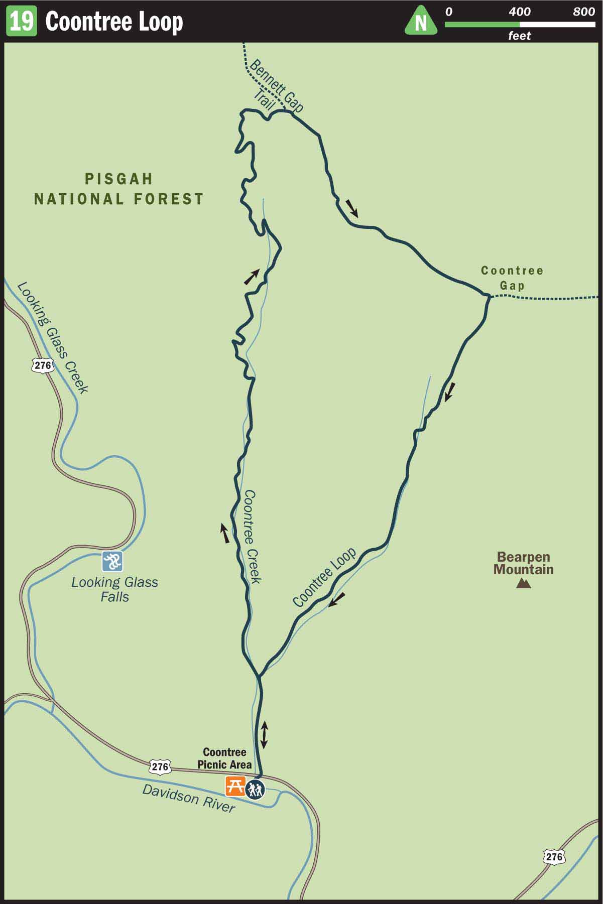
At 0.2 miles you will hike across a log bridge and then arrive at a trail junction where the path splits. This is where the loop portion of the hike begins. Although both trails are designated as the Coontree Loop and travel the same route, it is best to veer left (north). By hiking clockwise you will enjoy a more gradual grade to the ridgeline.
After the trail divides you will begin subtly climbing through a hardwood forest. Beneath the towering trees grow several varieties of ferns and fungi. The moist conditions and thick moss near the creek create an ideal environment for oyster mushrooms and red brick top mushrooms. Although the Appalachian Mountains boast dozens of edible mushrooms, remember that you should never eat a mushroom unless you are able to identify it with 100 percent certainty—and you should never pick any mushrooms or fungi in Pisgah National Forest without a forest service permit.
As you continue up the incline, you will come to several spots where log bridges and stepping stones allow you to cross Coontree Creek. Eventually the grade of the path will increase and the trail will feel more overgrown. The forest transitions from tall, vertical hardwood trees to sprawling mountain laurel and rhododendron.
After 1.8 miles the trail will come out on the ridge of Coontree Mountain. Turn right (southeast) and continue to follow the Coontree Loop, which now coincides with the red-blazed Bennett Gap Trail. During the winter this ridgeline provides great views of Chestnut Knob to the right and Black Mountain to the left. While the names are identical, do not confuse Black Mountain peak just south of the Blue Ridge Parkway with the town of Black Mountain that lies east of Asheville.
Travel along the top of the ridgeline for 0.6 miles until you come to a gap in the ridgeline. There, Bennett Gap Trail veers to the left and contours the ensuing ridgeline; however, you will want to turn right on the Coontree Loop. The path leads you quickly down the slope of the mountain and to the headwaters of another small stream.
Pay careful attention to your foot placement, as this section suffers from some erosion. Because of its steep slant and lack of switchbacks, heavy rains cause the trail to resemble a small gully that is lined with loose rocks. This fact should not deter you from wanting to hike the trail, but the steep incline can become technical in wet weather and you may want to consider traveling the loop counterclockwise if the tread is wet or if the forecast predicts rain. If anything, signs of trail erosion should prompt you to consider volunteering with a local trail maintenance group, such as the Carolina Mountain Club, to help rebuild the trails and protect them from becoming further washed out.
At 3.4 miles the trail crosses a gurgling stream and climbs a handful of wooden steps to complete the loop portion of the hike. Remember to turn left there and return down the stem of the trail to the Coontree Loop parking area. Do not veer right, unless you are having so much fun that you decide to hike the 3.1-mile loop segment a second time.
Nearby Attractions
Highway signs alert you to English Chapel, directly off US 276. In fact, you will pass it 3 miles before reaching the Coontree Picnic Area and trailhead. Originally built in 1860, the chapel is a Methodist church that once served the surrounding families as both a place of worship and a school building. In 1940 the congregation rebuilt the declining structure with rock from the Davidson River. The church exterior is always available for viewing, and outdoor recreationalists are invited to attend a Sunday service each week at 9 a.m.
Directions
From Asheville, take I-26 to Exit 40, the Asheville Airport and Brevard Road exit. Turn right off the exit and follow NC 280 for 17 miles to the outskirts of Brevard. At the intersection with US 64 and US 276, turn right and enter Pisgah National Forest. Continue on US 276 for 4.7 miles. Coontree Picnic Area and Parking will be located directly off the road to the left.