Meriwether Lewis was selected by President Thomas Jefferson to be the official leader of the epic expedition of the Corps of Discovery. Because of his success on the journey, Lewis has been called “The greatest pathfinder this country has ever known.” The Lewis and Clark expedition was widely hailed upon its return and Lewis reaped the benefits of this acclaim. He was appointed governor of the Louisiana Territory in 1808.
William Clark became friendly with Meriwether Lewis when they served together in the military in 1795, and quickly accepted his invitation in 1803 to serve as co-leader of the Corps of Discovery. William Clark returned from that adventure and became a respected administrator of Indian affairs during the early years of American expansion into the West.
Both Lewis and Clark kept written accounts of their journey. Here is Clark’s elk skin–bound journal with astronomical and altitude measurements and observations (the explorers’ way of determining their exact location), from October 26, 1805. The night before, he wrote this: “. . . as it was necessary to make Some Celestial observations we formed our camp on the top of a high point of rocks, which forms a kind of fortification in the Point between the river & Creek. . . .”
A keelboat was used for the first part of the voyage. It could be sailed, rowed, or poled along. This is a drawing from Clark’s field notebook of the boat as he saw it.
The meeting at Council Bluffs was crucial to the success of the expedition, as it was the first council between Lewis and Clark and the Indians. It set the stage for the many conversations and negotiations that were to come. Noted by Clark on August 3, 1804, at Council Bluffs: “. . . our Party paraded & Delivered a long Speech to them expressive of our journey the wishes of our Government, Some advice to them and Directions how They were to Conduct themselves. . . .”
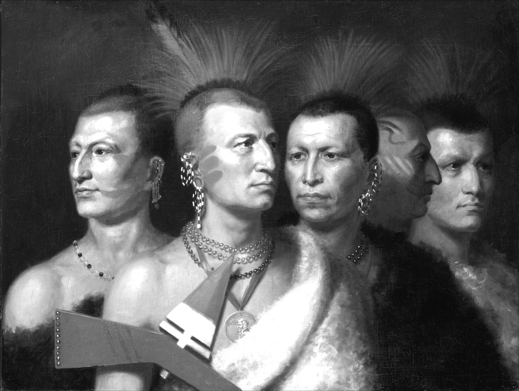
Given to various Indian leaders as a proclamation of peace, the United States peace medal worn by the Indian chief in the foreground was a treasured possession. Any Indian who accepted a medal was expected to be loyal to the United States. With the exception of John Adams, every president from George Washington to Benjamin Harrison issued peace medals embossed with his likeness on one side. At Council Bluffs, Clark wrote: “. . . we Sent him the speech flag Meadal & Some Cloathes. After hearing what they had to say Delivered a Medal of Second Grade to one for the Ottos & one for the Missourie and present 4 medals of third Grade to the inferior chiefs two for each tribe.”
The Corps of Discovery spent the winter of 1804–1805 at this Mandan village. It was essential that the expedition establish good relations with the local people in order to encamp there for the winter. Upon their arrival, Clark wrote: “. . . I walked up & Smoked a pipe with the Chiefs of this Village they were anxious that I would Stay and eat with them, my indisposition provented my eating which displeases them, untill a full explenation took place. . . .”
At the confluence of the Yellowstone and Missouri rivers, Lewis put down his thoughts in his April 25, 1805 journal entry: “. . . I ascended the hills from whence I had a most pleasing view of the country, particularly of the wide and fertile vallies formed by the missouri and yellowstone rivers, which occasionally unmasked by the wood on their borders disclose their meanderings for many miles in their passage through these delightfull tracts of country.”
When the expedition neared Three Forks on Monday, July 22, 1805, Lewis wrote of Sacajawea: “The Indian woman recognizes the country and assures us that this is the river on which her relations live, and that the three forks are at no great distance. This piece of information has cheered the sperits of the party who now begin to console themselves with the anticipation of shortly seeing the head of the missouri yet unknown to the civilized world.”
Painting hides was an important art form of the Plains Indians. This painted buffalo robe is probably the oldest known one in existence. Lewis and Clark obtained it from the Mandans and sent it back to President Jefferson in the spring of 1805. Depicted on it is a 1797 battle between the Mandans-Minitaris and the Teton Sioux-Arikaras.
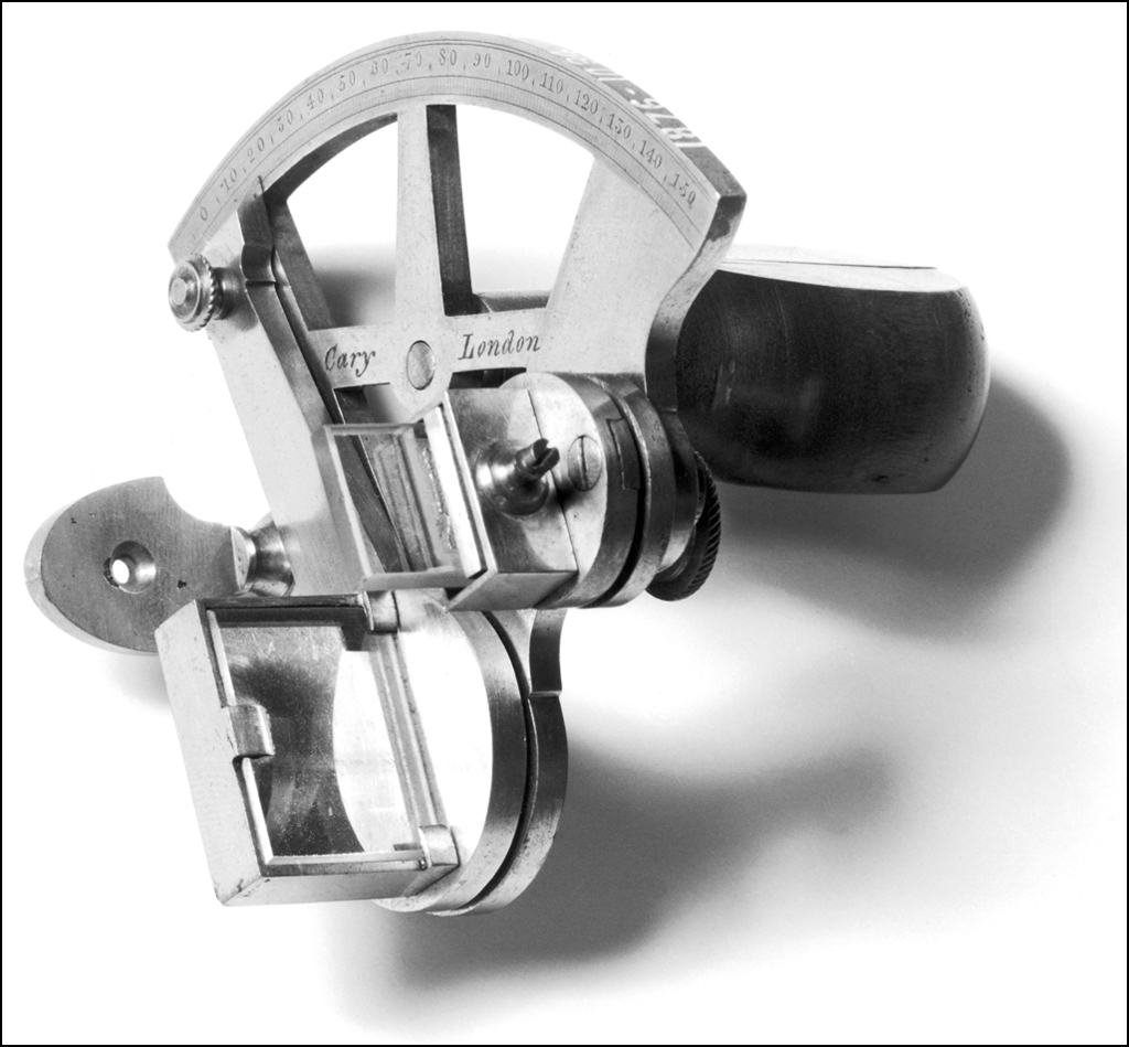
The pocket sextant was made in the late 1700s. Using a compass, a sextant, and a watch, explorers like Lewis and Clark were able to make rough maps, chart rivers, and fix their positions.
This modern map of the continental United States shows the approximate locations of Camp Wood, where the journey began, Fort Mandan, and Fort Clatsop, where the expedition finally saw the Pacific.