The roots of Colombia as a nation can be traced directly to its Caribbean coastline. It was on this area of South America’s coastline that the first Spanish explorers arrived, and it is at modern day Santa Marta where the first official settlement was founded. It was from these shores that Spanish armies first moved down the Magdalena River toward the Andes, in search of gold and the famed lost city of El Dorado. It was also here that the Spanish built a great fortress city to protect their spoils, Cartagena de Indias. When revolutionary fever swept the country, some of the most critical battles, power grabs, and gambits played out in the theater of the Caribbean.

Cabo San Juan de la Guia, Tayrona National Park.
Getty Images
To say that Colombia began with the first European arrivals would be a misnomer. As a society, Colombia started some 10,000 years ago with the earliest hunter-gatherer tribes, migrants from Mesoamerica, who made their way to the front door of the continent, Colombia’s Caribbean coast, before continuing southward along the same bodies of water later traveled by the Europeans. These early Caribbean people were known as the Kalina, and through the years they evolved into agrarian societies until their descendants, the Tairona, had established nothing short of an empire in and around the Sierra Nevada de Santa Marta mountains. At the height of their power they were one of the most highly populated indigenous groups in the country, aside from the Muisca of the Andes. The Tairona and the Muisca both spoke a language called Chibcha, which was the principal linguistic group in the country at the time.

Barranquilla Carnival.
iStock
As the Tairona people lived in some of the most remote and inaccessible parts of the coast, they were able to preserve their bloodline despite the best attempts by Spanish authorities to eradicate them. Today the descendants of the Tairona are the Kogi people, and they still reside in the Sierra Nevada de Santa Marta and have autonomous control of their land. Various national parks and NGOs are here, including the Tairona Heritage Trust (www.taironatrust.org), and they exist to preserve the culture of Colombia’s Caribbean peoples as well as the coastal environment. It was the Tairona who believed – as the Kogi believe today – that the earth is the true mother of us all, and that to pollute or defile land is to blaspheme against God.
The culture
Just as the Bogatanos and the Caleños have their own pronounced culture, so do the Costeños. Eight of Colombia’s 32 departments can be found along its 1,760km (1,094 miles) of Caribbean coastline, and some 10 million people reside here. That’s a lot of culture, and these people stand out, demographically speaking, from other areas of the country. Predominantly Costeños make up a group referred to as pardo, a mix of European, indigenous, and Afro-Caribbean heritage.
New ethnic and cultural influences were introduced when a wave of immigrants from the Middle East arrived on the Colombian coast from places such as Turkey, Lebanon, and Syria. All of this co-mingling of different peoples over hundreds of years has benefited the culture of the coast greatly, and it can be seen, heard, and tasted in the area’s art, music, and food.
Tip
Mosquitoes breed at the Caribbean coast in seemingly endless numbers. Always be sure to keep bug spray with you wherever you travel in this region.
Barranquilla
Barranquilla 1 [map] was founded as a humble port city on the west bank of the Magdalena River, and it retains that distinction even today, except on a much grander scale. Barranquilla is a thriving port that is ever growing and ever expanding, with new shopping malls and apartment towers perpetually in construction in the affluent north of the city. To the east you’ll discover working-class industrial neighborhoods where the congested streets are lined with factories, auto repair shops, bars, and motels. This central area near the river is quite run down, but this is where the real Quilleros (those from Barranquilla) live and work. Culture can be found here in the form of outdoor markets and museums.
Most visitors to Barranquilla are simply passing through via the international airport, which offers slightly better fares than nearby Cartagena. Barranquilla has played an important part in Colombia’s history, represented by the stately Republican architecture found in the homes lining the streets of the old district. Also, it is in Barranquilla where Colombia holds its own version of Carnival – second only in size and scope to those in Brazil. 40 days before Easter, at the end of February or the beginning of March, this city becomes the scene of the country’s biggest party (for more information, click here). In 2003 Unesco declared the Barranquilla Carnival a “masterpiece of the oral and intangible heritage of humanity.”

Bicycle rickshaw in Barranquilla.
Alamy
Getting your bearings
With over a million inhabitants, Barranquilla is hardly a tiny hamlet. Since most the suburban neighborhoods outside of the center can seem difficult to differentiate from one to the other, it’s best to have at least a general idea of the place by the time you arrive. If you are arriving by land then you will likely find yourself at the Terminal de Transportes Metropolitano (Carrera 14, no. 54–98; tel: 5-323 0034; www.ttbaq.com.co), the bus terminal located in the far south of town. To travel locally by bus, you can take the Transmetro, which runs north through the center and into the north of the city along the river. Another is Ruta 90/ Carrera 9, which runs east, crossing the Puente Pumarejo over the Magdalena River (great views over the bridge) and continuing through mangrove forests along the coast until you reach Santa Marta. Route 90 also heads west to Cartagena.
Central Barranquilla
In the center you’ll find the historic heart of Barranquilla, the Plaza San Nicolas A [map]. There’s a statue of Christopher Columbus here, but the real standout is the Catedral San Nicolás de Tolentino (Carrera 42, no. 33–45), which sits at the west end of the plaza. The facade of this early 17th-century neo-Gothic church rises intimidatingly, with its twin steeples stabbing at the sky. The imposing design is softened by the church’s cool white paint job with bright red trim, as well as soft arches hugging yawning windows and tall carved-wood doors. The interior keeps to the same color scheme, with more arches lining a long nave leading to the pulpit.
A few blocks north of the Plaza de San Nicolás is the Paseo Bolívar B [map], a wide pedestrian-only throughway along Calle 34. Here, and extending west along Calle 45, you’ll find the city’s main commercial districts. At the end of the Paseo Bolívar at Carrera 46 is the Parque Cultural del Caribe, a modern green space that is home to the Museo del Caribe C [map] (Calle 36, no. 46–66; tel: 5-372 0581; www.culturacaribe.org; Tue–Thu 8am–5pm, Fri 8am–6pm, Sat–Sun 9am–6pm). This blocky grey monolith is a multistory introduction to the culture of the coast. It features items from indigenous times, including ceramics and woven baskets, and the exhibits continue through the Spanish colonization and into more recent times. There are also audiovisual displays and video presentations. However, the text accompanying the exhibits is in Spanish only.
A few blocks farther west, along Carrera 43, you’ll find another landmark in the city. Bar Restaurante La Cueva is a local institution, an upscale café famous as the preferred watering hole of rowdy Costeño journalists back in the 1950s, one of which was a young Gabriel García Márquez. The café has an attached store/foundation (fundacionlacueva.org) that sells books and promotes cultural events.
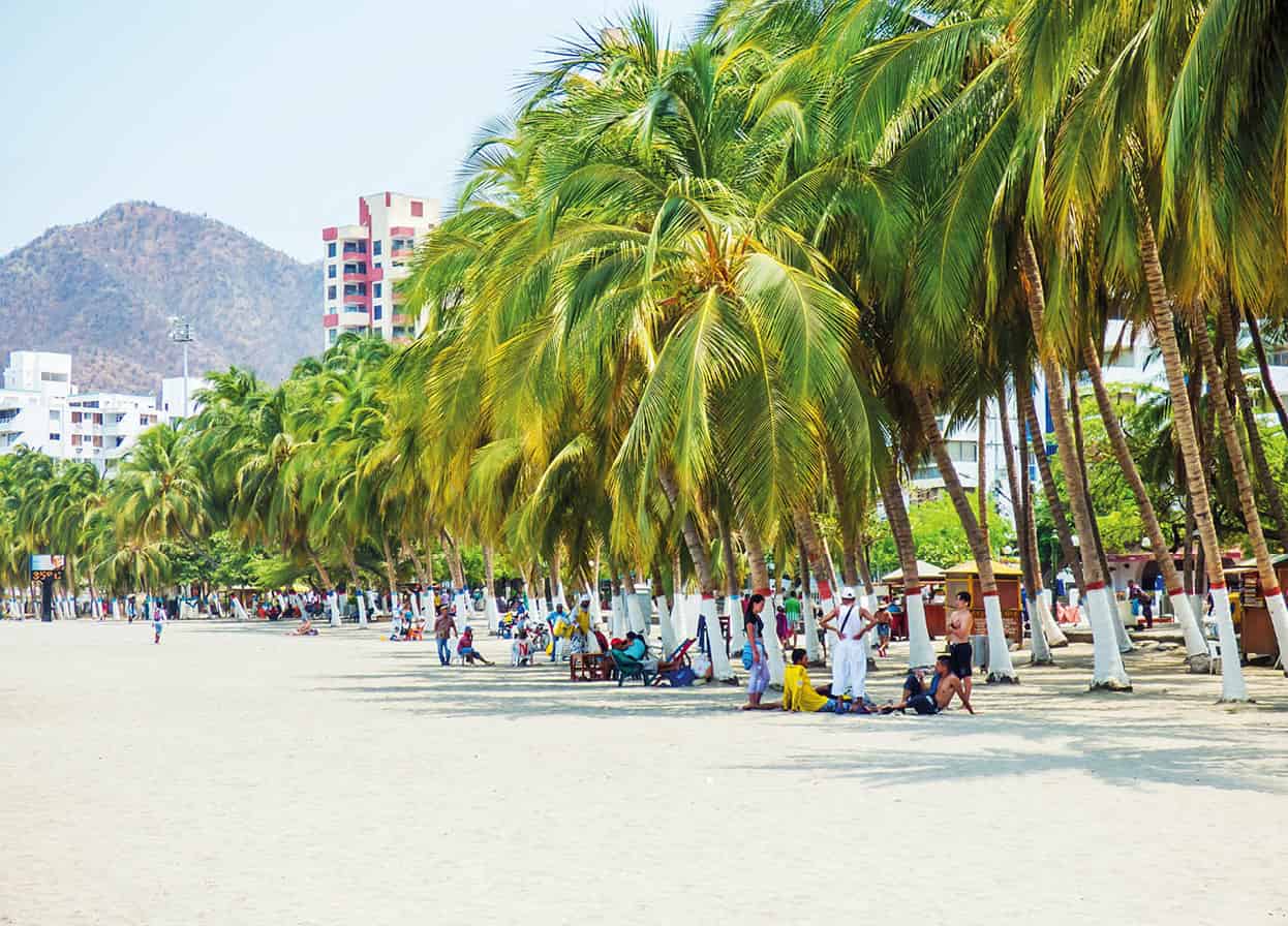
Barranquilla’s main beach.
Getty Images
West of the Center and farther north
Just northwest of the Paseo Bolivar is the Plaza de la Paz Juan Pablo II D [map] (also known as the Plaza de la Paz). This plaza is known for being home to the other of the two most famous churches in Barranquilla, the Catedral Metropolitana María Reina (Carrera 45, no. 53–140; tel: 5-385 4689), which looms over the plaza’s west end. Completed in 1982, it’s a newer alternative to the Catedral San Nicolas Tolentino, but just as grand. The Modernist building is an architectural marvel of the city due to its large and rectangular front facade, which features seven dominating stained-glass windows in the shape of diamonds. Inside, the stained-glass mosaics really comes to life, flooding the room with color and complimenting a pyramid just at the top of the building, which also features intricate glass images on pious themes. Also inside is a flowing sculpture of Christ hanging over the pulpit, which could only be the work of famed Colombian sculptor Rodrigo Arenas Betancourt. Even if you don’t go in, swing by at night and you’ll likely be treated to a show when they light up the entire building.
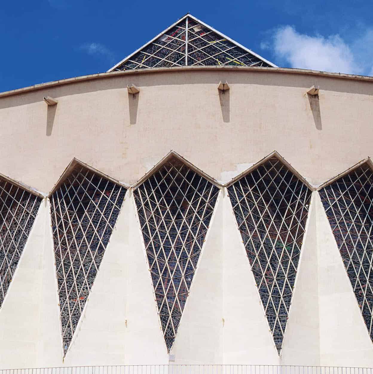
Catedral Metropolitana María Reina.
Getty Images
A dozen or so blocks to the northwest from the Catedral Metropolitana you’ll find one of the true gems of the city, the Museo Romantico E [map] (Carrera 54, no. 59–199; daily 8am–5pm). The museum is housed in a lovely old Republican mansion that was donated by a wealthy family, and features various items detailing the history of Barranquilla, including a number of Carnival costumes. There’s also a room dedicated to García Márquez that features some of his notes, first editions, and typewriters. In truth lack of funding has taken a toll on this museum, and it is struggling – which is all the more reason to make a visit.
To the very northwest of the city, where the Pacific Ocean mercifully becomes visible, are upscale suburbs teeming with shopping malls, boutiques, and fancy bars and restaurants. These areas include El Prado, Altos del Prado, and Ciudad Jardín. One lovely park around here, located at Calle 72, is Parque Tomás Suri Salcedo F [map].
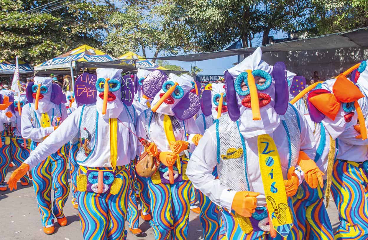
La Marimonda, a popular carnival character.
Shutterstock
Barranquilla Carnival
“Quien lo vive, es quien lo goza!” (“Those who live it are those who enjoy it”) – the official slogan of the Carnaval de Barranquilla.
When we think of the great carnivals and parades in the Western hemisphere, Rio de Janeiro’s Carnival and New Orleans’ Mardi Gras instantly come to mind. Although those two juggernauts have rightly earned their place on the Mount Olympus of revelry, other carnivals exist and they’re just as worthwhile. The most dedicated of partiers will want to head to a coastal city in Colombia for the Carnaval de Barranquilla (www.carnavaldebarranquilla.org).
The party begins
Carnaval de Barranquilla kicks off on the Saturday before Ash Wednesday and features many hours of float processions led by the Carnival Queen. Officials describe the entire event as a folkloric and cultural celebration. Like other carnivals, the Carnaval de Barranquilla is a group effort, with community members working throughout the year making costumes and choreographing the activities that make up the celebrations. The first such carnival took place in the 19th century, evolving from humble beginnings as a slave holiday. It has been going strong ever since, evolving into the world’s second largest carnival outside Rio de Janeiro.
Music and dance
The music and dance of Barranquilla’s Carnaval has influences in Africa, Spain, and Europe, and this is most apparent in the drum-heavy cumbia heard throughout the festivities. However, a variety of Caribbean music is celebrated here, including porro, puya, and merecumbés. The costumes, parades, and dances are elaborate. Some even take the name of various animals. One example is a popular song and dance performed during the carnival called El Torito (little bull), which originates from Spanish folk and Christmas songs.
The characters of Carnaval
It’s not uncommon to see the dancers wearing tribal masks indicative of the fauna of the region. Animals from donkeys to dogs to bulls are represented in these masks. One of the most popular characters is La Marimonda, a colorful hooded mask denoted by a comically oversized nose and big floppy ears. Out of all the characters in the carnival festival, this one’s origins are wholly Colombian. The Marimonda was invented in Barranquilla as a type of harlequin character to symbolize merriment and mischief.
The party winds down
Sunday sees the Great Parade, and Monday is filled with music from Caribbean bands and orchestras. The Tuesday before Ash Wednesday is the last gasp of Carnaval, featuring the symbolic burial of the character Joselito Carnaval, who represents the joy of the occasion. The next day is Ash Wednesday, the official start of Lent.
The Barranquilla Carnival is a truly epic party. However, first-timers should pace themselves. This is an event that requires stamina – it’s a marathon, not a sprint. Also, be prepared for the most common of Barranquilla Carnaval traditions – revelers spraying one another with cans of foam.
Around Barranquilla
The city of Barranquilla may not offer the pristine beaches of other coastal areas like Santa Marta or Cartagena, but head just a few kilometers outside of the city and you’ll find stretches of sand worth the effort. One such option is Puerto Colombia (www.puertocolombia-atlantico.gov.co; buses leave from the Paseo Bolivar), which is located about 19km (12 miles) to the west of Barranquilla. The historical legacy of the beach was that it was the original ocean port of Barranquilla, and the pier that juts out from its shore was built in 1900. It’s a nice beach for relaxing, but don’t expect clear water. If you really want to kick back and enjoy life here, hit up the beach bar at Hotel Pradomar and sip a fruity cocktail under a palapa. Good surfing can be found here from February through May, when the waves are at their peak. Continue traveling northeast back toward Barranquilla and you’ll hit some other good beach spots, like Salgar, and closer to the river you’ll find Los Flores, both of which have no shortage of great seafood shacks and restaurants.
There are some little-discovered gems of towns the more you travel south along the Magdalena River from Barranquilla. One such option is Soledad, a little colonial town notable mostly for its center cathedral with multiple red-painted domes. In a way this church is reminiscent of the Catedral San Nicolás in Barranquilla, but this version is smaller and with gold trim around a white facade instead of red. Continue south and you’ll arrive at Santo Tomás, where you’ll want to go on Good Friday if you enjoy the spectacle of processions of locals flagelating themselves with whips.
A national park worth pointing out in the area is Via Parque Isla de Salamanca. This island southeast of Barranquilla and just across the Magdalena is mostly made up of mangrove swamps. Initially it was created to protect these mangroves after the construction of the highway running from Barranquilla to Santa Marta destroyed much of the ecosystem. There isn’t much tourism infrastructure here, but it’s a decent place to see wildlife, including some 99 species of reptiles and 199 species of birds, and in 2000 it was named a Unesco Biosphere Reserve.
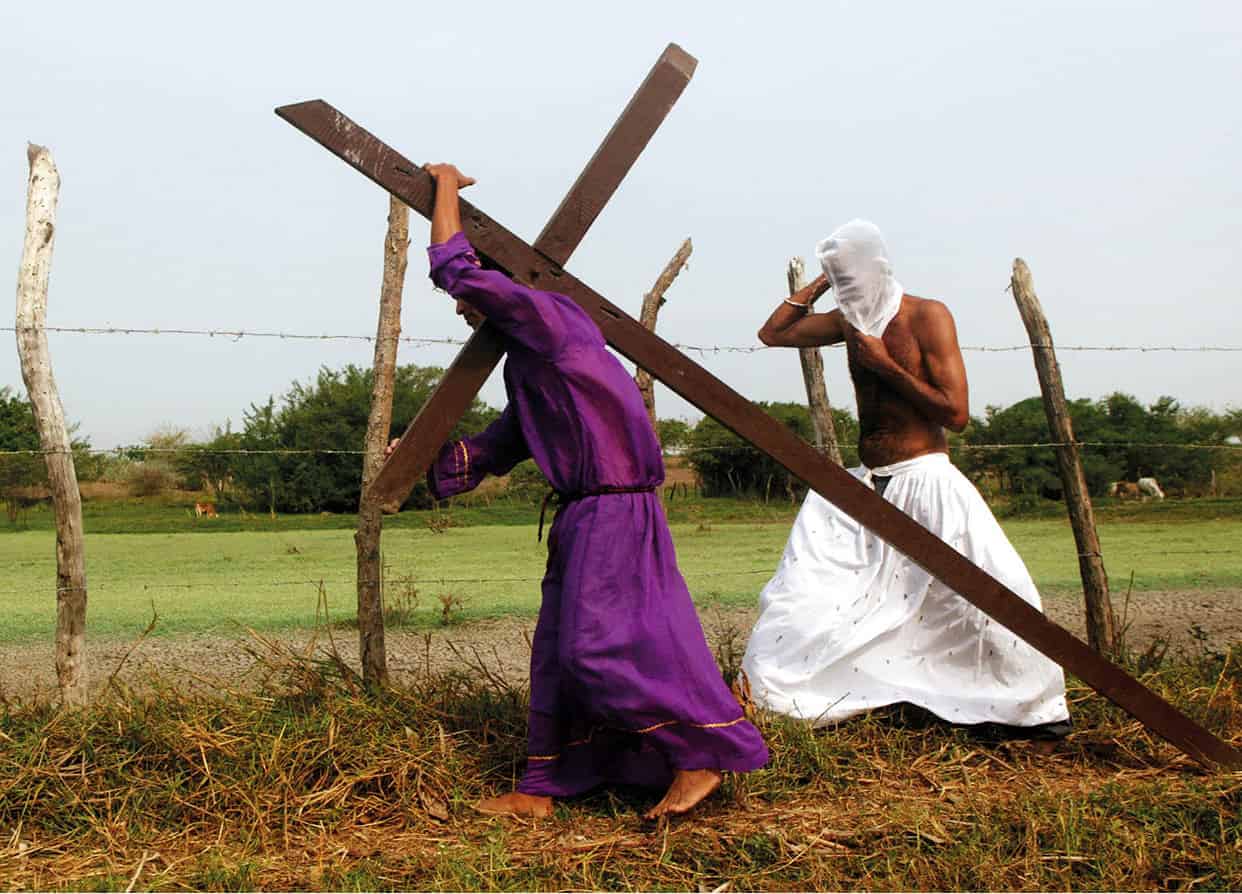
Holy week celebrations in Santo Tomás.
Alamy
Santa Marta
Santa Marta 2 [map] is the place where Europeans first arrived, and the same place where death took hold of the man who gave Colombia its independence. Today, Santa Marta is the capital of Magdalena Department, and most of it is working-class residential neighborhoods and budget shopping districts, where local Samarios (residents of Santa Marta) pack the streets day-in and day-out. The road from Barranquilla to Santa Marta passes along beaches and mangroves home to shantytowns and all but abandoned fishing villages. When you do arrive at the picturesque heart of Santa Marta, on the bay, colonial buildings replace the shanties and vacationers outnumber the destitute. It’s hard to imagine such a tiny place being home to so much storied history, the scene of so many happenings that all led to Colombia becoming Colombia.

The beach at Santa Marta.
Getty Images
Fact
Santa Marta is officially the first Spanish settlement in Colombia, having been founded by the conquistador Rodrigo de Bastidas back in 1525.
Up until the early years of the 16th century it was only the peaceful Tairona people who occupied this stretch of the coast, trading between tribes and living in harmony with the earth. Then, when the Spanish did arrive, they found a native people adorned in gold and a land location within close proximity to the Magdalena River, thus providing a route inland. No wonder they decided to stay and form a settlement. Of course the Spanish never reaped their instant riches, and by the end of the century relations with the natives had become somewhat contentious. Some of the Tairona managed to escape to the hills, where they were able to preserve their bloodline, and their descendants, the Kogi people, still occupy the same area today.
Santa Marta continued to thrive, despite more than a few raids by British, Dutch, and French attackers. However, it was nearby Cartagena de Indias that the Spanish Crown made their principal seaport, and they fortified the city accordingly. With no real stores of valuables, and precious little sea traffic, Santa Marta would slowly decline in importance over the centuries, to the point it became nothing more than a charming colonial coastal town. Still, it is a very well preserved one, and many old buildings dating back to the 1500s populate its historic center. All in all there’s a lot to see in this Caribbean colonial marvel, but luckily the town is small enough that visiting its myriad museums and sites means never walking more than a few blocks. Conveniently, the town is a perfect jumping off point to what might be the most beautiful national park in the entire country, the Parque Nacional Tayrona.
Finding your way inland
Santa Marta is located on an ocean bay, but it also lies at the mouth of the Río Manzanares, which runs southeast through town. This river is one of many that drains the Sierra Nevada de Santa Marta mountains. Standing at Carrera 1, which runs north and south along the waterfront, you’ll be able to see the tall green cliffs that hug both ends of the bay. Between Carrera 1 and the water is a seafront promenade, which is probably the most attractive part of town, especially at sunset. Here you’ll find plenty of upscale restaurants and nightlife options, but this area is much better for a casual stroll or picnic by the water than it is for revelry.
Walking the promenade you’ll also notice that the city hasn’t forgotten its indigenous residents. There are various statues by the water celebrating Tairona heritage, including one on the south end of town, at Carrera 1 and Calle 22, called La Herencia Tairona, which features a proud indigenous couple holding court over their place in the world. The best place to get your bearings around here is at Carrera 1 and Calle 15. This is the center of Santa Marta, and if you head east on Calle 15 you’ll pass right along Plaza Bolívar.

Exploring Ciudad Perdida.
Getty Images
The center
This is where you’ll find all the grand plazas, old colonial buildings, and rich museums for which the city is famous. Just know that perpetual work is required to maintain many of these old buildings, so if luck isn’t on your side you might be turned away at a museum due to renovation. Still, the expansive and leafy Plaza Bolívar, complete with an equestrian statue of the Liberator, will in all likelihood remain open now and forever. This plaza is also a good base for exploring other parts of the city.
Nearby is one of the oldest buildings in Santa Marta, the Casa de la Aduana, which is now the Museo del Oro (Calle 14, no. 2–07; tel: 5-421 0251; Tue–Sat 9am–5pm, Sun 10am–3pm; free). This old colonial customs house dates back to 1531, but the museum it now houses was inaugurated in 2014. The museum showcases the history of Santa Marta through multiple exhibits over two floors. Like other gold museums, this one features pre-Columbian archeological finds, such as ceramics and gold work produced by the Tairona people. In the building there’s also a scale model of the Ciudad Perdida, Colombia’s premier indigenous ruins. Before being converted to a customs house in 1776, the Casa de la Aduana was a church-owned residence, home to the Chief Justice of the Inquisition. Some say it was even the first brick building in Colombia.
Ciudad Perdida
The demographic growth of the indigenous Tairona people over the centuries before colonialism meant they needed developed areas where they could live in communities. Out of all of their villages, none are as famous as Ciudad Perdida (the Lost City). This 13-hectare (32-acre) city was located in the Sierra Nevadas and at its height was home to up to 2,400 Tairona who lived in round houses set on stone-paved terraces. An even larger – although slightly less awe-inspiring – former city and archeological site, known as El Pueblito, exists nearer the coast and was probably home to around 3,000 Tairona. Today you can visit this archeological site by booking treks from tour operators in Santa Marta. The tours involve trekking four or five days through the jungle and typically cost around US$600.
Out of all the colonial churches in Colombia, the Catedral Basilíca de Santa Marta (Carrera 4, no. 16–02; mass times: Mon–Fri noon and 6pm, Sun 7am, 10am, noon and 6pm) might just be the most impressive. This isn’t because it’s the biggest or most ornate church in the country, although the domed roof and massive corner bell tower radiate a brilliant bright white in the afternoon sun, but because it sits on the former site of what is said to be the first Catholic church in Colombia. Some even believe it is on the site of first Catholic church on the continent, which was founded around 1531. However, the church that stands here today was finished in 1766. Inside it’s as virginal white as it is on the outside, with long, shrine-lined aisles leading to a grey marble altar, winged angels standing sentinel on either side of the pulpit and hoisting candelabras to the sky. The church held the remains of Simón Bolívar from his death in 1830 and until they were transferred to Venezuela in 1842.
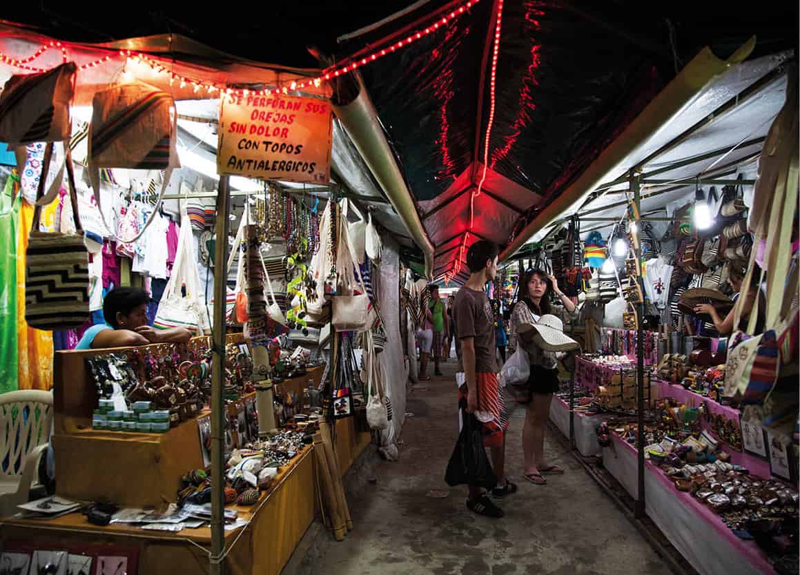
Santa Marta’s artisan market.
SuperStock
Five blocks south of Parque Bolívar is the intimate and aptly named Parque de los Novios (also known as Parque Santander). It’s a smaller park with a white gazebo and an imposing statue of Santander in the center. The area is fronted by whitewashed government buildings whose elegant colonial architecture stands out. On the south side is the Palacio Justicia, and to the east is the Antigua Escuela Cuarto, built in 1927 as a girls’ school that was run by nuns and now part of the Palace of Justice. As for beach fun in the center, most locals just head to the center bay. You’re flanked by shipping cranes to the north and the marina to the south, and everywhere along the beach you’ll find street vendors selling everything from beer and shrimp cocktails to shaved ice and chuzos (meat skewers). Just back from the beach is a nice mercado artesanal (artisan market; daily 8am–9pm) selling good knit bags, clothing, jewelry, and handicrafts.
The Quinta de San Pedro Alejandrino
The Quinta de San Pedro (Avenida Del Libertador s/n; tel: 301-241 5913; daily 9am–4:30pm; open later during high season), a small villa on a former 17th-century sugar plantation, is where the great Liberator, Simón Bolívar, spent his final days. The general who routed Spanish armies seemingly at will, who danced away the night before going to war the next morning, whose prowess on the battlefield was matched only by his zest for life and commitment to liberty, arrived here penniless and infirmed in 1830. At the end his body was racked with tuberculosis, having prematurely aged him decades beyond his 47 years. He died surrounded by a few close friends and associates; and on that day, December 17, 1830, Bolívar’s dream of a united South America died with him.
The Museum itself is little more than the home with the room where Bolívar spent his final hours, and includes a few personal items. Paintings and memorabilia from the 18th and 19th centuries are also on display here. Also here is the Fundacion Museo Bolivariano de Arte Contemporeano (www.museobolivariano.org.co; daily 9am–5.30pm), a museum featuring contemporary works by Latin American artists. Enjoy a stroll around the expansive grounds of the villa, taking in the various monuments to Colombia’s greatest hero, his only remaining contemporaries the old cedar and saman trees dotting the gardens.
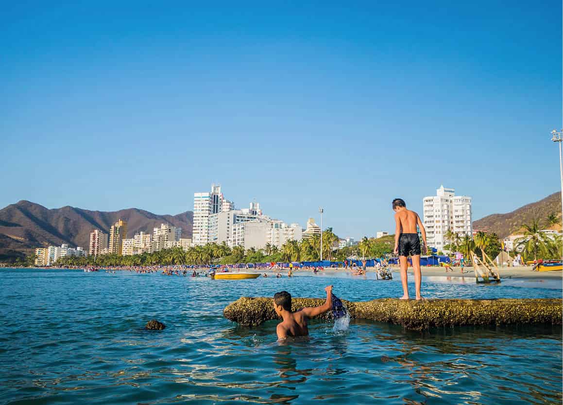
Rodadero Beach.
Shutterstock
Rodadero
Despite the tourist bars, nightclubs and restaurants, Santa Marta is more of a laidback colonial city. The more modern and vibrant Rodadero, located just 4km (2 miles) south of Santa Marta (minibuses run between Santa Marta and Rodadero, leaving from Carrera 1), is where you can find the hustle and bustle. The seemingly endless Rodadero Beach is lined with high-rise hotels and restaurants (all serving solid pescados and mariscos). Much of the beach is tree-lined, providing welcome shade, and street vendors roam the promenade selling drinks and seafood cocktails. At night you’ll find people lining the embarcadero, blasting music, drinking, and co-mingling. It’s a great time, but you should also look out for petty crime.
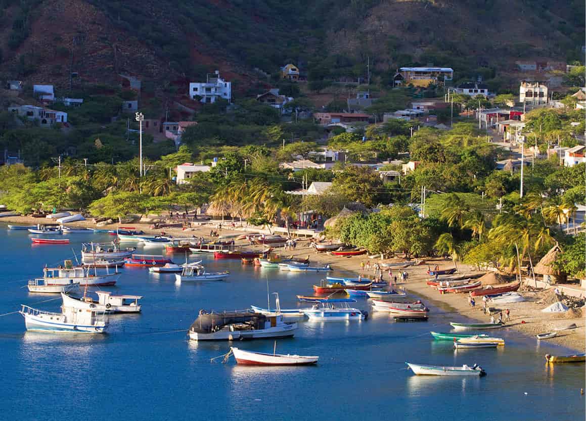
Taganga beach.
Getty Images
From the north end of the beach, head to the Acuario Rodadero (Aquarium; tel: 317-364 1113; www.acuariorodadero.co), where seals, sharks, and dolphins are on display, as well as myriad other aquatic animals. From here you can take a short walk north to Playa Blanca, another popular local beach, although much more secluded than Rodadero Beach. There are plenty of thatched-hut beach bars and restaurants here where you can enjoy some fried fish and ice cold beer.
Taganga
Located 3km (2 miles) north of Santa Marta is the picturesque fishing village of Taganga 3 [map] (15 minutes by bus, leaving from Carrera 1 in Santa Marta). The pace of life is still slow here, but recently development and the tourism boom have knocked most of the sleepiness out of the village, as its streets are now prowling with backpackers and vacationers. However, Taganga still radiates a more relaxed vibe than Santa Marta, and the new tourism infrastructure means there are some good options for diving and fishing operators along the coast. Just north and around the corner from Taganga is Playa Grande, another quasi-secluded beach perfect for a day of lazing, drinking and eating. Watching the sun set over the Taganga’s main beach, after all the tiny wooden fishing vessels have returned and tied up for the day, is still one of the most pleasant ways in all of Colombia to pass the time. Continue east along the coast from Taganga and you’ll reach the stunning Parque Nacional Tayrona 4 [map] (for more information, click here).
Tip
The indigenous Kogi tribe (descendants of the Tairona people) still have authority over Parque Nacional Tayrona. Consequently, they typically close it once a year (usually February) for one month for spiritual cleansing purposes.
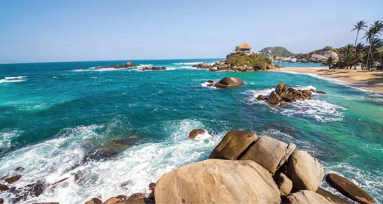
Cabo San Juan del Guia.
iStock
Parque Nacional Tayrona
Parque Nacional Tayrona isn’t just the beautiful Caribbean image you see on the postcards – it’s a place of great spiritual significance to the indigenous cultures of today and generations past.
Spend just a few minutes on the coast of Parque Nacional Tayrona (park hours 8am–5pm) and you’ll see why the indigenous peoples were so protective of their lands. To the south are the lush green mountains of the Sierra Nevadas, and in front of you, you’ll see pristine white-sand beaches fronting aquamarine seas and crystalline lagoons.
The Tairona people (whom the park was named after) preserved these pristine lands in accordance with their earth god, and luckily for us it’s still here to be enjoyed today. Sadly, though, increasing tourism hasn’t always spelled good news for this part of Colombia and the residents who still occupy this area of the Sierras, the Kogi people.
The park
Parque Tairona runs 85km (53 miles) north along the coast from Tagonga, just outside of Santa Marta. Most of this stretch is still undeveloped, and just offshore are any number of coral reefs. Snorkeling is good here, and the best spots are Cabo San Juan de Guia and the smaller La Piscina beach. El Pueblito is one popular inland attraction; it is here you’ll find the ruins of an indigenous community. Many of the beaches are ideal for swimming, except Arrecifes. This is a picture-perfect stretch of windswept sand, but riptides are frequent.
When you see pictures advertising Parque Nacional Tayrona, you’re likely seeing images of Cabo San Juan. This windswept cove is home to one of the country’s most beautiful beaches, the iconic boulders hugging the sand. Jutting out from the middle of the beach sits an equally iconic mirador that offers sweeping views of the Caribbean. There are a couple beach restaurants and bars here that serve food here, mostly fried fish and coconut rice.
Getting there
Buses leave every 15 minutes or so from the Mercado Publico (Calle 2, no.8–81) to the El Zaino entrance of Parque Nacional Tayrona. However, most people choose to book a package to the park through local providers, because once you arrive it’s still a long way to the nearest beach. If you choose to take another bus from the entrance, they’ll drop you off near to Cañaveral Beach. Here you’ll see the famous ‘ecohabs’ (www.ecohabsantamarta.com), individual thatched-hut accommodations that overlook the water.
What to know
Some of the bays in the western end of the park, closest to Santa Marta, are easily accessible by road. These include Villa Concha, just 5km (3 miles) east of the city, Neguanje, and Playa Cristal. Just take one of the buses leaving from the Mercado Publico every day at 7am (return at 4pm). Camping is available in the park, including at a site near Cabo San Juan, which is usually crowded due to its gorgeous views. Prices are around US$5 per night for tents, and you can rent a hammock for around US$7 per night.

