You’ll know you’ve arrived in Guajira when the green of the Sierra Nevada de Santa Marta Mountains gives way to desolate expanses of land home to no other plantlife than cacti and the stout trupillo tree. Guajira extends to the self-named peninsula, which marks the northernmost tip of South America. As with Tierra del Fuego in southernmost Argentina, arriving here feels not just like you’ve encountered the end of a continent, but the end of the entire world.
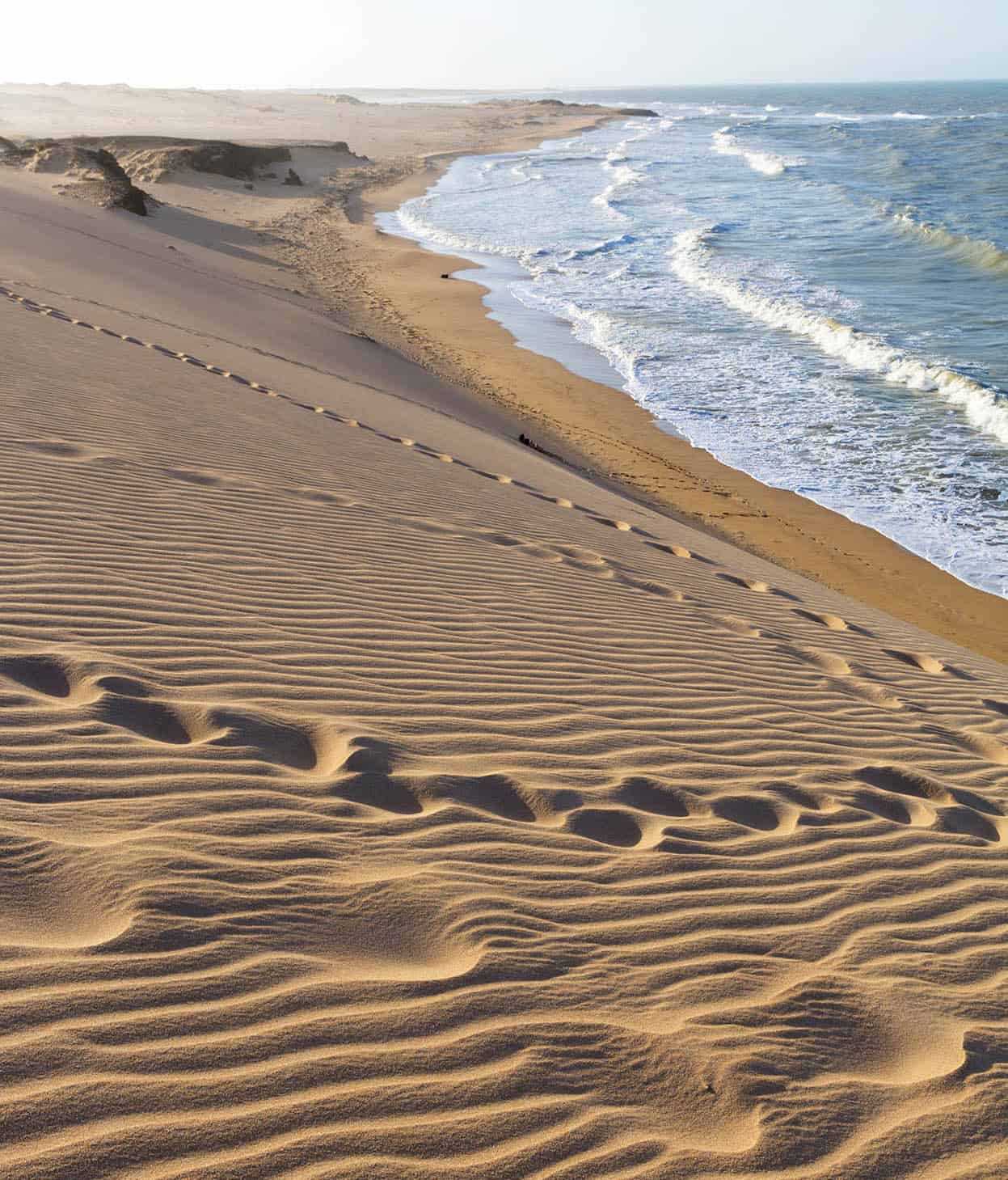
Deserted beach near Punta Gallinas.
Shutterstock
There’s very little plant life in Guajira, and aside from the flocks of flamingos and other birds it can seem like the harsh terrain’s sole purpose is to beat back any signs of life. However, what does exist here – and who have for centuries – are the Wayúu people, Colombia’s largest indigenous group with the best preserved of all the native cultures. For most of their existence they managed to live apart from most Colombian culture, speaking their own language (wayuunaiki, which is in the Maipurean family of languages) and forming their own local governments on the peninsula. Despite being at near-constant war with the Spanish since their arrival, the Wayúu were never subjugated. Today, other than the harsh elements, the indigenous have to contend with man-made obstacles to health and prosperity (see box).
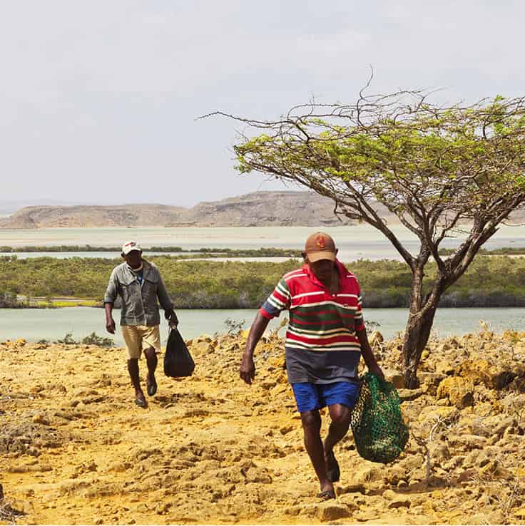
Fishermen in Punta Gallinas.
SuperStock
The history of Guajira
Despite its remoteness, Guajira’s position on the Colombian coast means it was discovered by colonisers around the same time as other explorers were first setting foot in nearby parts of the country. A Spanish explorer named Juan de la Cosa was the first to touch down on the coast of Guajira, in 1499. Back then the area was home to various indigenous groups; however, as the Spanish multiplied in numbers and created more and more settlements, the numbers of the indigenous began to dwindle. The village of Riohacha, which would eventually become the capital of the department, was founded in 1535 at Cabo de la Vela (later relocated to its current location), around the time Colombia’s other major cities and towns were being created.
The region was officially part of Magdalena Department until 1871, when it was separated and became a new Colombian territory. In the 1930s, Guajira saw an influx of immigrants from the Middle East – people from Lebanon, Jordan, Palestine, and the countries Ottoman Empire – and they predominantly settled in the border city of Maicao, which is home to the third-largest mosque in Latin America. La Guajira officially became a Colombian Department in 1964. In the intervening years Guajira was neglected, but today, it remains one of the most remote, fascinating, tragic, and beautiful areas of the country.
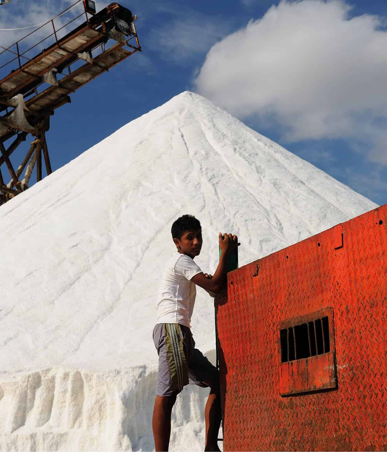
Young boy working in a salt mine.
Shutterstock
The economy
Aside from Chocó Department, Guajira is one of the poorest regions in the country, and most of its residents live well below an already rock-bottom poverty line. The biggest industry in the region comes in the form of the open-pit coal mine located in Correjon, southern Guajira, which produces some 25 million tons of coal for export each year. There is some contention about the mine, as it sits near the principal water source in this parched region of Colombia, the Río Rancheria. This north–south-running river delivers much-needed water to the residents in the north, but many say the mine is appropriating too much of it before it gets to the indigenous people. Natural gas and salt mines are major economic sectors in the area as well.
Indigenous under threat
Over the year, the Wayúu people have somehow managed to survive in some of the harshest conditions in Colombia. Life in the arid desserts of Guajira is unforgiving, but they’ve adapted and thrived over time, becoming accustomed to a life of hardship. After having survived colonization by the Spanish, the Wayúu are under threat yet again. In 2011 the government initiated a truly epic failure of a civil-engineering project: the Cercado Dam. In theory the dam was supposed to mitigate the effects of regular droughts in the region, but so far all it has done is impede the water flow. Little water makes it past the cattle ranches and coal mines to the middle of the province, where most Wayúu live. As a result, they have been forced to search for alternative water sources, such as faraway wells, which are often polluted. It’s been estimated that as many as 5,000 Wayúu children have died in the past six years due to a lack of clean drinking water. A glimmer of hope arrived in the form of the Inter-American Commission on Human Rights, which demanded that the Colombian government protect the health of its indigenous population. As a result, the government built wells and desalination plants in the region, which has eased some of the suffering.
Riohacha
Travel 160km (100 miles) east from the colonial town of Santa Marta and you’ll arrive in what feels like fishing village, yet just happens to be a department capital. Riohacha 1 [map] may not look much on the surface but on weekends, when its people come out to play, it becomes a lively city. Most important is that this city is a gateway to the Wayúu culture, which is one of the richest in the country.
Tip
Water from the local wells is not safe for outsiders to drink. The locals have acclimatized to the water here, but if your body is unfamiliar with it, drinking from the wells will make you sick.
As with many places in Colombia, greed is what attracted the first visitors to Guajira. Riohacha, where it currently sits, was founded in 1544 by Nicólas de Federmán, and it quickly became famous for its pearls. These natural jewels were so popular, in fact, that pirates periodically attempted to sack the town until the 18th century, when pearling ceased. Once pearls ceased to be a factor, Riohacha ceased to be a destination point for outsiders.
Today Riohacha is mostly known for its long wooden pier that divides the town’s two principal white-sand beaches. The water here may look dirty, but it’s just the silt kicked up by the waves. A couple of blocks from the shore is the church, where a local-born hero of the revolution, José Prudencio Padilla, is buried. In 1823 he led the fleet of Republican ships that defeated the Spanish at the Battle of Lago Maracaibo. In the central park, you’ll see a statue of him. While you’re in Riohacha you should make time to visit the town’s old municipal market (Mon 6am–6pm, Sun 6am–noon), located in the center, and the more modern market, located in south Riohacha. Most people who come to Riohacha will likely be passing through on their way to the northern coast, or even on into Venezuela. This is as good a place as any to stop and take a breather before continuing your travels. Try to visit on a weekend, when more life fills the city, and lively bars playing atmospheric music spring up seemingly out of nowhere.
Tip
Try reserving all tours and excursions to the Guajira peninsula from Riohacha. After Uribía, tourist infrastructure and transportation become increasingly scarce.
To and from Riohacha, and practicalities
If you are arriving in Riohacha for the first time, you will want to get your bearings. Guajira not only borders the Caribbean Sea to the north, but to the south lies the Gulf of Venezuela. If you are planning any excursions in the area, it is best to make all arrangements in Riohacha, but it’s also possible to organize trips from Bogotá. For reliable arrangements outside of Guajira contact Colombian Highlands Travel Agency (for more information, click here) located in Villa de Leyva.
Transportation is shoddy and sporadic in Guajira, which is why it’s best to arrange excursions within the region. There are more buses to/ from Riohacha in the morning than the afternoon, although there are private transportation options for excursions to Cabo de la Vela and farther north. Be warned that any excursion to the remote parts of Guajira can be a time-consuming proposition. Taxis can take you as far north as the outposts of Uribía and Manaure, and from there its dirt roads all the way to Cabo de la Vela and beyond. It’s best to take a tour to these areas, and they typically last three days.

Flamingos near Punta Gallinas.
SuperStock
When to go
September through November is the rainy season in Guajira, so try to avoid the area during this period. If planning a trip to Cabo de la Vela, you will want to avoid Christmas and Easter as well, since the cape is filled with visitors and there are vehicles everywhere. It’s best to go when there are as few people around as possible, as the emptiness and tranquillity are part of the experience.
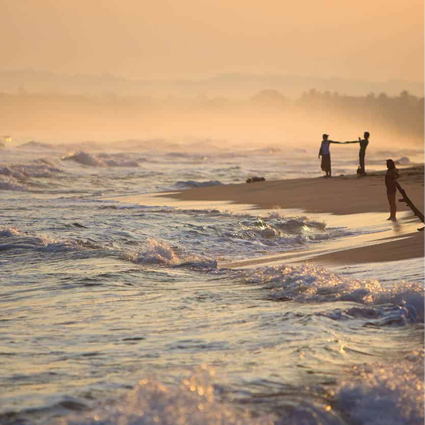
On the beach at dawn near Palomino.
Shutterstock
Palomino
Palomino 2 [map] may be small, even tinier than the fishing village of Taganga, outside of nearby Santa Marta, but it is exploding in popularity as much as any other coastal hotbed in Colombia. New hotels and hostels are being built all the time in order to keep up with the influx of visitors. It’s not difficult to see why people flock here: it’s tranquil, there’s a river running right into the ocean, and it affords great views of the Sierra Nevada Mountains, including Pico Bolívar.
Mostly people come for the beach. It has become very popular in recent years with visitors on the hunt for Colombia’s lesser-known, drop-dead gorgeous Caribbean Coast beaches; this one has earned a spot on the list. It’s long and inviting, and not nearly as crowded as anything you’ll find near Cartagena and Santa Marta. There are strong currents here, though, so watch out for red flags on the beach denoting riptides.
Santuario Los Flamencos
Some 25km (15 miles) west of Riohacha, the national park of Santuario de Fauna y Flora Los Flamencos 3 [map] covers 7,000 hectares (17,300 acres), most of which is made up of mangrove swamps. These are separated from the Caribbean by sandbars, and various streams feed the sanctuary’s two largest lakes, Laguna Grande and Laguna de Navío Quebrado. The saline vegetation here is an attractive spot for flamingos, and whole colonies of these birds have made it their home. Despite the wet and dry seasons, many flamingos stay here throughout the year, while others migrate here during the wetter months from Venezuela and as far away as Florida.
Just beyond the Laguna de Navío Quebrado’s sandbar is a long stretch of coastal Caribbean beach that is nicely tucked away off the well-beaten tourist track. Here you can stroll along the white sands, with gentle aquamarine waters lapping at the shore, for hundreds of meters without passing anyone other than the occasional local. There are some beach bars and restaurants here run by local families that offer hammocks, meals, drinks, and rooms for the night.
The area is dotted with indigenous Wayúu communities, and the park guides all come from these villages. It’s possible to arrange nature tours through local hostels, for around US$5 and lasting roughly one hour. The guides will typically point out the unique flora and fauna in the park, singling out various trees that possess medicinal qualities. The Wayúu rely on the plantlife in the area for a number of purposes, including everything from soap and shampoo substitutes to cholesterol-lowering wonder cacti.
Arriving at Santuario Los Flamencos
The sanctuary is located near Camarones, which is 3km (2 miles) outside of Riohacha. You can take a shared taxi for US$1–2 from near the old market to Camarones, and then a taxi 3.5km (2.5 miles) to the park entrance at Guanebucane. There’s a visitor center at the north end of Laguna de Navío Quebrado, and some cabana lodging options here (http://ecoturismosantuario.weebly.com) called Los Mangles (open Feb–Mar). They also arrange birdwatching boat trips on the lake throughout the year for about US$7, lasting up to 3 hours.
Uribía
Riohacha may be the capital of the department, but Uribía 4 [map], located where the mangroves and lakes east of Santa Marta finally give way to the parched desert of the northern peninsula, is the indigenous capital of the country. The 14,000 residents of the town are mostly all of Wayúu descent, as are the nearly 100,000 that live in the areas surrounding Uribía. When you arrive here you’ll note a marked change in the weather: the wind is furious. Many older residents of northern Guajira wear the effects of the elements, with weatherbeaten and sun-scorched faces.
For most travelers, Uribía serves merely as a transition point between Riohacha and the northern coastal areas like Cabo de la Vela and Punta Gallinas. Transportation leaves from the central Plaza Bolívar, across from the cemetery, and seats in a four-wheel-drive jeep from Uribía to Cabo de la Vela can be purchased for around US$7 (one way). It’s best to leave for the coast in the morning, but there are transportation options all day.
One reason outsiders should come to Uribía specifically is to enjoy the biggest indigenous festival in the country: The Wayúu Festival. This occurs in May and locals celebrate their heritage with dance, song, and plenty of authentic food. The people couldn’t be friendlier, but ask their permission before taking a photograph. For more information, see www.colombia.travel/en/fairs-and-festivals/wayuu-cultural-festival.
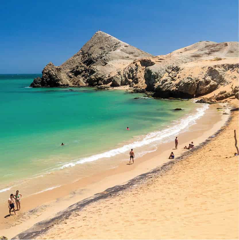
Playa del Pilon, Cabo de la Vela.
Shutterstock
Cabo de la Vela
In Cabo de la Vela 5 [map], on the northern Guajira coast, turquoise waters lap at a scorched desert shore, making the cape at once beckoning and forbidding. Even the harsh breezes can’t drive away the fun; in fact, they facilitate it. Offshore winds form the perfect conditions for kitesurfing, and it’s the premier activity in this little town of 1,800. There are some great operators here, and some say amateurs can learn the ropes in a single afternoon of training – although you might want to plan on spending a day or two learning the fundamentals of proper balance and kite manipulation. Either way those with a few days to spend will be zipping across the surface of the sea in no time.
Where
Cabo de la Vela is the place to go for kitesurfing in Guajira, maybe even in all of Colombia. The conditions are perfect just off the cape and ensure that you can skim along the water all day long.
The town is small enough that you can traverse it end-to-end, seeing everything there is to see in about 30 minutes or so. In the center are mostly hospedajes that double as restaurants, and there’s a great place to grab an empanada and iced fresh mandarina or pineapple juice at the small stand called El Yovas, located at the east end of town. At the most easterly end of the cape, past Refugio Sau Ipa, is a lookout point topped by a wooden cross. It’s a great and quick hike to the top, where you can survey all of Cabo de la Vela to the west.
Punta Gallinas
Many people make the trek from Uribía to Punta Gallinas 6 [map] to spend time at this unique spot, which is the northernmost point on the South American continent. There is little here except scattered indigenous communities and some of the most striking landscapes on the planet. There are few places in South America where you’ll feel closer to the end of the world; but when you leave the beach and dive into the perfectly warm ocean, you’ll never feel closer to it.
Tours can be booked to and from Punta Gallinas from either Uribía or Cabo de la Vela, and includes a tour of the coast, including stops at the official northernmost point, as well as a cape featuring steep sand dunes and great swimming. It’s possible to book overnight stays here through Hospedaje Alexandra, the only lodging option with infrastructure to handle visitors. Buses leave in the morning from Uribía to Punta Gallinas; 5am from Cabo de la Vela.

Wayúu people living on the Guajira Peninsula.
SuperStock
Parque Nacional Natural Macuira
Colombia is such an appealing country because it contains just about every kind of topography, including tropical jungle and desert, and this is perfectly illustrated at the Parque Nacional Natural Macuira 7 [map], where you can find tropical jungle and desert – in almost exactly the same place. This natural phenomenon is known as the Serranía de Macuira (named after the Wayúu’s ancestors, the Makui) and was subsequently been turned into the Parque Nacional Natural Macuira. It resembles a mirage, that lush green vision desert wanderers see when they’re suffering from exposure, but this is the only real ‘mirage’ in the world.
It exists in large part because of geography unique to this one specific point in Guajira. The 250 sq km (96 sq mile) area that comprises the park is set in one of the only mountainous zones on the peninsula, and it sits at around 550 meters (1,800ft) above sea level. The highest point is Cerro Palúa, at 865 meters (2,838ft), and there are two other mountains, each sitting at around 750 meters (2,460ft). High levels of humidity here form the conditions necessary to produce lush vegetation and elfin cloud forest. This is only seen elsewhere in the country in the Andes páramo, which begins at heights above 2,700 meters (8,860ft). A technical term many scientists have given this ecosystem is a ‘Biogeographical Island’.

Sand dune in Macuira National Park.
Shutterstock
A unique climate
The microclimate in this oddity of a desert/jungle park is what allows the unique vegetation to flourish. Moisture comes in from the northeast, creating clouds at night that dissipate in the morning, resulting in about 450mm (18ins) of annual precipitation that feeds the rivers running through the park, and which all evaporate once they reach the desert sand. The climate also allows for other life besides vegetation. The park is a birdwatcher’s dream, and many rare species exist here, such as the cardinal. There are also some 15 species of snakes, including the colorful but dangerous coral snake. Local guides will happily point out the flora and fauna of the area. Spending time with the local guides is also a great way to learn about Wayúu culture as well.
What to know
The park is open to the public, but parts of it, including the elfin cloud forest, are restricted. To access these areas, be sure to enter the park with a guide. It is possible to consult the friendly local indigenous members in the surrounding settlements, such as Nazareth, and hire their services. You’ll soon find that all the park officials are locals. There’s a park-information cabin in Nazareth, which also has a camping space just large enough to fit five or six tents. Some Wayúu in the surrounding settlements will let you hang a hammock on their property, and some of the settlements offer basic food. However, it’s best to stock up on provisions in the last real town, which is Uribía.
Be sure to talk to your guide and explain the purpose of your trip; they will then give you a 30-minute induction before entering the park. Those who are planning on renting a car in Guajira should not travel alone when trying to arrive at the park. Every year the rains of the wet season alter the dirt roads on the peninsula in some way, and getting stuck out in these remote areas near the park is a far from ideal scenario. Part of the Venezuelan border cuts through the southeastern part of the Guajira Peninsula. If you wish to access the park along the Venezuelan side, you will need a visa.
Maicao and crossing from Colombia to Venezuela
The Caribbean Coastal Highway 90 continues from Riohacha east to Maicao 8 [map]. This paved road is in good condition and will get you near the Venezuelan border in about 90 minutes. You can also travel from Maicao north to the outpost of Uribía in about 40 minutes. There are various buses throughout the day servicing both locations.
As a city, Maicao doesn’t exactly beckon travelers. It mostly acts as a transition and stopping point for those traveling to and from the Venezuelan border. The town’s commerce is made up of mostly clothing and textiles, and after dark most of the activity ceases and the streets become unsafe. There is a large Middle Eastern population here, resulting from mass immigration in the 1930s. In 1997 they founded one of the largest mosques in Latin America: the Mosque of Omar Ibn Al-Khattab. Due to Maicao’s proximity to the Venezuelan border, its fortunes have risen or fallen, more or less, in accordance with that country’s economy. However, during the 1980s and 90s, Maicao also suffered some of the residual violence of the government’s war with the guerrilla groups operating in the nearby Sierra Nevada de Santa Marta mountains. Kidnapping and assassinations were common, but today the threat is negligible or non-existent.
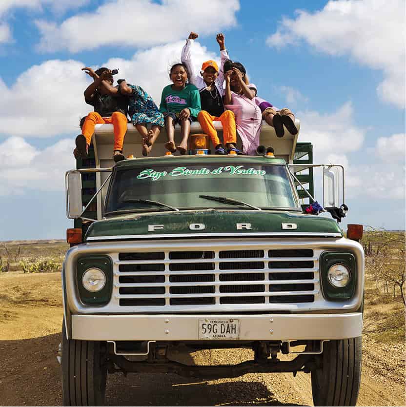
Wayúu children on a truck.
Shutterstock
The Venezuelan border is located 8km (5 miles) east of Maicao at the town of Paraguachón. It’s best to take care of all visa requirements at the Venezuelan consulate in Cartagena Bocagrande, (Carrera 3, Edificio Centro Ejecutivo, Piso 14 Of. 14–02; tel: 7-665 0353; Mon–Fri 9am–noon, 1.30–4pm) or in Barranquilla (Carrera 52, no. 69–96. Edificio Concasa. piso 03; tel: 5-368 2207; barranquilla.consulado.gob.ve; Mon–Thu 8am–noon, 1.30pm–4pm, Fri 8am–noon). There is no Venezuelan consul in Maicao and there have been reports of unreliability at the office in Riohacha. If you are interested in a transit visa you will need to show proof of an onward ticket to a third country within three days. If you are a US citizen you must apply for a visa at a Venezuelan embassy in the United States before attempting to cross the border. At the border, Venezuelan immigration is open daily 6am–9pm, and Colombian immigration is open daily from 8am–5pm.
Transportation between Maicao and Maracaibo (the first main city in Venezuela) is unreliable. There are private taxis (known as por puestos) that make the trip for around US$10 per person, or there are infrequent buses that run at odd times or fail to show up at all. The Brasilia Bus Company has an office in Maicao, but they don’t run to Maracaibo. If you are entering Colombia from Maracaibo ensure that the driver stops at the Colombian entry post for your entrance stamp. From the bus terminal in Maracaibo you can find minibuses leaving for the Colombian border during the morning only, or private and shared taxis leaving throughout the day. For other immigration formalities contact Migración Colombia in Riohacha (Calle 5, no. 4–48; www.migracioncolombia.gov.co; Mon–Fri 8am–noon, 2–5pm).
