c. 80 Million BCE
The Rockies
Areas that make up the central cores of stable continental crust—cratons—date back to the earliest era of crustal formation in the early Archean. Once they’ve grown to true continental size by billions of years of accretion along their edges, these central regions are generally considered to be geologically “quiet” areas. Thus, it is perhaps unusual to see evidence of relatively young large-scale mountain-building so far from the edges of stable continental interiors. And yet there they are, far from the western boundary of the North American plate: the Rocky Mountains. How did they get there?
The original rocks that make up the ancestral roots of the Rocky Mountains were made from pre-existing layers of ancient continental crust and shallow seafloor sediments that were fractured, deformed, metamorphosed, melted, and uplifted by the continental-plate collisions that formed the supercontinent of Pangea about 300 million years ago. After then, however, those ancestral Rockies were mostly worn down by erosion for a few hundred million years, while all of the exciting new mountain-building took place far away, on the western margin of the plate.
But the events farther west eventually did have a local effect. Specifically, the Farallon oceanic plate was sinking (subducting) under the western edge of the North American plate at a shallow angle, causing its tectonic and volcanic effects to be felt far inland. Around 80 million years ago, the friction and compressive stresses from the oceanic plate sliding underneath and pushing up on the continent began causing enormous faulting and uplift in the region of the ancestral Rockies. Once again, huge peaks were raised up, in 20 million years of mountain-building that stretched from modern-day northern British Columbia down to New Mexico. When the bulging of the continent ceased, the highest resulting mountain peaks of the newborn Rockies were likely to have been over 20,000 feet (6,000 meters) tall, as high as the Himalayas are today.
Over the last 60 million years, the part of the North American craton around the Rocky Mountains has gone relatively quiet again, with wind, water, and glaciers eroding the Rockies down by 30 percent or so to their present (still impressive) heights.
SEE ALSO Continental Crust (c. 4 Billion BCE), Plate Tectonics (c. 4–3 Billion BCE?), The Appalachians (c. 480 Million BCE), Pangea (c. 300 Million BCE), The Sierra Nevada (c. 155 Million BCE), The Atlantic Ocean (c. 140 million BCE), The Himalayas (c. 70 Million BCE), Basin and Range (1982), Yellowstone Supervolcano (~100,000)
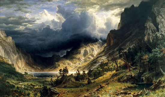
A Storm in the Rocky Mountains, Mt. Rosalie, painted by Albert Bierstadt in 1866, captures the dramatic geologic and meteorologic nature of this relatively young mountain belt.