Rim of the Golden Gate
“Thou seest the white seas fold their tent,
O Warden of two continents.
Thou drawest all things, small and great,
To thee, beside the Western Gate”
—BRET HARTE
194. Facing a little cove within the sheltering arm of Black Point, protected on the north and west by the semicircular sea wall that is Municipal Pier, is 34½-acre AQUATIC PARK (open 9-4; 10¢ for use of dressing room, locker, shower; suits not furnished), foot of Polk St. This $1,500,000 municipal recreation center was made possible by WPA funds, laborers, and artists. To create its quarter-mile Stretch of clean sand and smooth surf, workmen excavated (1935-38) a large part of that area into which had been dumped in 1906 the debris from the ruins of Chinatown, uncovering jewelry and watches, pieces of jade, and coins from a dozen nations.
The triple-decked white concrete CASINO (William Mooser, Sr., and William Mooser, Jr., architects), resembles a streamlined battleship riding at anchor. Spectators’ galleries facing seaward flank its convex ends. Its main entrance on Polk Street, a broad modern door-way and heavy lintel of greenish-grey slate, is the work of Sargent Johnson; the design and incised sculpture of conventionalized marine subjects are modern in conception. Decorating the 100-foot-long main lounge are large murals by Hilaire Hiler depicting undersea flora and fauna. Mr. Hiler's use of brilliant shades of violet, blue, vermillion, orange, rose, and gold against a sober blue-green background has produced a beautifully luminous effect. Outside the lobby a long veranda overlooks the water; at either end are circular Chambers: The Rainbow Room—a ladies’ lounge with a ceiling decorated in prismatic colors, and the Blue Room. The motif is nautical throughout, from the ground floor—whose dressing rooms and lunch counter face the broad concrete promenade—to the oval-shaped Pilot Room, a cocktail lounge occupying the fourth floor. At each end of the Pilot Room and of the spacious third-floor banquet hall are large sun decks.
The view from the casino decks is superb. The red-leaded Golden Gate Bridge contrasts sharply with the blue Bay and the buff and purple hills of the opposite shore. To the east are the abandoned Golden Gate Ferry slips, the smokestacks of foreign steamships, and—frequently—the tall masts of sardine purse-seiners at anchor. Grim Alcatraz is closest to this part of the mainland.
Notable among the park's ultramodern conveniences are those designed for its bathers. Each person returning from the water passes through a photo-electrically operated chlorinated shower and foot bath on his way to the dressing rooms and fresh-water showers. He dries himself in currents of warm air and retrieves his Street clothes from metal Containers that will be sterilized with live steam before they are reissued.
On this site in the 1870’s were the Neptune Baths, from which William C. Ralston swam to his death in 1875, and industrial units of a woolen mill and smelting company.
195. Popular with fishermen of all ages and Sunday promenaders is the 1,850-foot-long white concrete MUNICIPAL PIER, foot of Van Ness Ave. The semicircular sea wall, constructed in 1929-34, Swings northeastward to protect Aquatic Park's little harbor. From adjacent TRANSPORT WHARF NUMBER 4, steamers operate daily to and from Alcatraz and Angel Islands.
196. Neighbor on the south to Aquatic Park is the adjoining city block of red-brick buildings housing the D. GHIRARDELLI AND COMPANY CHOCOLATE PLANT (private), 900 North Point St., organized in the 1850’s by Domingo Ghirardelli, three of whose eleven grandchildren are active in the firm today. The plant moved here from its original location in the old Phoenix Building in 1897, that it might be near the Belt Line Railroad and utilize the brick building abandoned by the Pioneer Columbia Woolen Mill. Mrs. Marie Oetzel, an early resident, says: “The first woolen mill on that site burned in 1861 and a new one was built. This closed down in 1883. I remember it well. They hired Chinese and housed them in two high narrow buildings down by the water, just about where the park club-house [Aquatic Park Casino] now Stands. When they were dyeing wool the Chinese would run the finished batch down a long ramp, made of redwood logs, into the salt water to set the color. The whole beach would change color for a few hours; shells, rocks, and sand would look like a colored picture.” Also in the immediate vicinity from about 1865 to 1885 were the smelters and refineries of the Selby Company. Said Mrs. Oetzel: “When the old Selby Smelter closed, a Mrs. Kelly put up some bathhouses. There were also some arks along the beach in which some artists and musicians lived. One or two of them were used by the Tivoli Artists, who played in the old Tivoli Theater. Kenori's Boat House was there also. He made some fine oars and small boats for the rowing clubs: the Ariel, South End, and Dolphin.”
Nucleus of the rapidly expanding chocolate plant was the old woolen mill's building. Today the firm is one of the largest of its kind in the West, its range of distribution reaching from the Mississippi River to the Orient and the islands of the Pacific. The 50 varieties of its product include the ground chocolate originated by Domingo Ghirardelli. In the main office of the plant is a large mixing machine brought round the Horn from France in the 1860’s—a heavy circular chocolate mill three feet in diameter with stone rollers used for grinding the raw cacao—and a primitive Mexican hand mill used by the Aztecs. (No better medium for the grinding of chocolate than stone has yet been discovered.)
S. on Polk St. to Bay St.; W. on Bay
197. Thrust northward into the Bay, its land boundaries Van Ness Ave., Bay and Laguna Sts. (main entrance Van Ness Ave. and Bay St.), is FORT MASON UNITED STATES MILITARY RESERVE (usually open 24 hrs.; subject to close without notice), whose 68½ acres enclose the site of Spanish fortifications built nearly 150 years ago. On April 4, 1797, Governor Diego de Borica instructed engineer Alberto de Cordoba to complete certain necessary repairs of Castillo de San Joaquin and to construct another battery where it would “further impede the anchorage of any hostile vessel in La Yerba Buena.” Location chosen by De Cordoba for his Battery San Jose was Point Medanos (later called San Jose), today's Black Point, northernmost natural promontory of the reserve. Original defense for the little battery was five brass eight-pounders; by 1798 it had achieved a sixth cannon; but by the turn of the Century it was virtually abandoned. When General and Mrs. John C. Frémont in the 1850’s moved to Black Point—said to have been so named because of its dense, somber laurel thickets—there was no trace of Battery San Jose.
The area was set aside for military purposes by President Millard Fillmore in 1850-51, but not until 1863 were troops quartered in the area. Meanwhile lawsuits had been waged over boundaries, water rights, and private claims which were to reduce the original 100-acre reserve to its present size.
Unsuccessful in their fight to gain possession of the area were Frémont and four friends who claimed it by squatters’ rights. Colonel Richard Barnes Mason carried out the Presidential order to dispossess, thus incurring an enmity that culminated in a challenge by Frémont to a duel, which was never fought. In 1882 the reservation was named for Colonel Mason (California military governor 1847-49).
Fort Mason today contains 102 frame buildings, including several commissary warehouses, a supply depot and 13 units occupied by officers. Residential headquarters of the Commander of the Fourth Army (Seventh and Ninth Corps Areas), a rambling old house overlooking the Bay, incorporates the little one-room headquarters built by Major Leonidas Haskell about 1850.
Point of embarcation and arrival for troops stationed abroad are the three ARMY TRANSPORT DOCKS in the northwestern corner of the reserve (foot of Laguna St.). A primary port of the United States Army Transport Service, Fort Mason is the home of the Army transports Grant, Somme, Cambrai, and Meigs. Annually provisions valued at more than $12,000,000 are shipped to Army outposts in Alaska, Panama Canal Zone, Hawaii, the Philippines, and the Far East. Through a tunnel under the reservation Belt Line locomotives haul freight cars between the Embarcadero and the docks. More than 25,000 replacement troops leave here each year to relieve garrisons in service overseas.
N. from Bay St. on Laguna St. to Marina Blvd.; NW. on Marina (or NW. from Bay St. and Van Ness Ave. on a Fort Mason road to Marina Blvd.; NW. on Marina)
Comparatively new and fashionable is that residential district of stuccoed flats and broad-windowed apartment buildings known as The Marina, extending from Van Ness Avenue west to the Presidio and north from Lombard Street to Fort Mason and the Bay. The older part of the district was built up during the Panama-Pacific International Exposition of 1915; the newer, since 1922, on some 50 of the several hundred blocks on which the exposition was located.
198. Lying north of broad Marina Boulevard between Webster St. and Yacht Harbor, are the block-wide, level lawns of MARINA PARK (parking area; comfort stations). Baseball and football players, picnickers, and kite and model airplane enthusiasts have replaced the local amateur aviators who made the park their unofficial landing field until 1925. In that year Marina residents objected so strenuously to the aerial menaces to their lives and property that the Park Commission decided to use the land for its originally intended recreational purposes. The tiny cove at the eastern end of Marina Park, near the Army Transport Docks, is crowded with small fishing craft (boats rented). Where the oil-covered pilings of the abandoned wharves push up from the water, implacable fishermen stand guard over bobbing corks or haul oily crabnets from the cove. Cleaner is the small enclosed bathing lagoon at the park's western end.
199. Berthed in municipally owned YACHT HARBOR, Marina Blvd., Scott, and Lyon Sts., are about 200 craft, ranging in size from the tiniest of catboats to Templeton Crocker's black-hulled, two-masted schooner Zaca, Veteran of far-ranging scientific expeditions. Sail and motor boats moored here dot the Bay on pleasant Sundays and participate in periodical regattas.
200. On the 1,500-foot-long breakwater that shelters the harbor is the home of the ST. FRANCIS YACHT CLUB (private), a two-story cement-faced structure roofed with red and orange tile, all but obscured from the mainland by green pines. Spanish in both exterior and interior—with beamed ceilings looking down on rooms furnished in heavy dark wood and warmed by great open fires—the decorative motif is nevertheless marine. A large glass-enclosed lounge affords an unusually fine view of the Bay and its shores. Among the clubrooms open to its 300 members are a dining room, a bar, steam and locker rooms, and courts for badminton, handball, and squash. Active in formation of the Organization (1928) was Hiram Johnson, Jr. Non-profit and given to the promotion of frequent social events, the club's primary interest is yachting. Its annual open racing season (for craft of all classes) attracts sportsmen from the entire Bay region.
201. Beyond the club, at the eastern tip of the breakwater, Stands a MINIATURE LIGHTHOUSE of stone and granite once publicized by Robert (“Believe-It-or-Not”) Ripley as the only municipally owned lighthouse in the world chartered by a national government. The granite in the 30-foot-high tower came from tombstones in an abandoned Lone Mountain Cemetery. A small park area guarded by reclining stone lions surrounds the little building.
S. from Marina Blvd. on Baker St.
202. Where indoor tennis courts are covered by the long roof of the PALACE OF FINE ARTS (open weekdays 8:30-11:30; Sun. 8-5; courts $1 an hour; lighted), foot of Lyon St., visitors to the Panama-Pacific International Exposition of 1915 enjoyed the art treasures of the fair. The tan stuccoed facade of the semicircular building (outer circumference 1,100 feet; width, 135 feet) and its fronting peristyle of terra-cotta Corinthian columns follow the curve of a lagoon in which water fowl glide about two anchored gondolas. In the center of the colonnade, opposite the main entrance, is an ornamental domed rotunda supported by eight pairs of columns flanking as many arches. The palace's designer, Bernard Maybeck, is said to have been inspired by Brocklin's painting, The Island of the Dead.
After the fair, in 1918, the palace again housed an art collection—that of the San Francisco Art Commission; but after 1921, when the group moved its exhibit, the building was allowed to deteriorate. In 1927 the Government deeded that ten-acre portion of the Presidio on which the palace stood to the City of San Francisco, but not until 12 years later did San Francisco begin to expend the $500,000 necessary for its restoration.
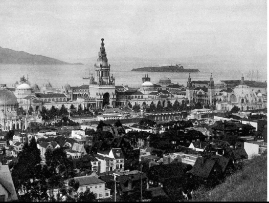
The restored palace mirrored in the placid waters of the lagoon is all that remains of the $50,000,000 exposition that reached from Fort Mason to the Presidio. President William Howard Taft broke the first earth on the site October 14, 1911, and four months later issued an invitation to all nations to participate in this great celebration of the opening of the Panama Canal. On the early morning of February 20, 1915, more than 150,000 noisily enthusiastic persons marched through the city streets to the fairgrounds. Only celebrants who did not walk to the Scott Street gates were a group of pioneers whose carriage followed slowly behind the marching leaders of the two-and-one-half-mile-long parade: Mayor James Rolph, Jr., Governor Hiram W. Johnson, and fair official Marshall Hale (whose brother, Robert, first had suggested the celebration to Congress in a letter dated January 12, 1904).
Said a contemporary writer of the exposition: “From the city's heights one looks down on a facade three-quarters of a mile long, dominated at its center by the lofty seven-storied… Tower of Jewels, 432 feet in height, and broken on either side by an open court ornamented with lesser towers. As the eye rests upon the rectangular group, eight great domes claim the attention, distinguishing the location of an equal number of exhibit palaces, domes of sea-green color, pale against the intense blue of the sky and the bright red of the tiled roofs. One notes that the avenue bisects the group at right angles, widening along the lateral axis into three courts…
“And now the eye withdraws from this central group-building, attracted by the two domed structures in the South Gardens, Festival Hall and the Palace of Horticulture. To the east, rests the Palace of Machinery… To the west across the still lake, and curving to its shores…stands the Palace of Fine Arts…. Passing through the main entrance, underneath the Tower of Jewels, we enter the Court of the Universe. Elliptical in shape, 700 by 900 feet, it contains a sunken garden capable of seating seven thousand persons, is entirely surrounded by handsome colonnades…the facades of the four palaces being modified to form the walls of the court. The entrance from the lateral avenue on the east and west are surmounted by magnificent archways…. Passing westward along the avenue between the palaces of Agriculture and Liberal Arts, the visitor enters the Court of the Four Seasons…. The corresponding court on the east is the Court of Abundance. Two minor courts open to the south, that on the east, the Court of Flowers; on the west, the Court of Palms.
“To the north… Stretches the long Esplanade, threaded with walks and driveways…while over beyond the superb Palace of Fine Arts in bewildering array the dignified Foreign Pavilions and imposing buildings of the states arrest the attention…”
Twenty-five foreign nations contributed to the “bewildering array,” many duplicating famous structures of their lands—such as Turkey's mosque of Sultan Ahmed I and Japan's sacred temple at Kioto, Kin Ka Ku Ji. The 43 states and territories represented showed equal imagination: New York built a Fifth Avenue mansion; New Jersey, George Washington's Trenton Barracks; California, a Spanish mission.
Dedicated to sheer fun was the “Zone,” with its $10,000,000 worth of amusement concessions. And in the background the 3,600,000-candlepower scintillator on its special pier at Yacht Harbor swept the night skies with color, painting the fog that rolled in from the Bay with every hue of the rainbow.
W. from Baker St. on Lombard St., which leads into Lincoln Blvd.
THE PRESIDIO OF SAN FRANCISCO, UNITED STATES MILITARY RESERVATION (usually open 24 hours; subject to close without notice; speed limit 20 m.p.h.; night parking prohibited), entered at Lincoln Blvd. and Lombard St., is a wooded tract of 1,540 acres extending from Lyon St. west to the ocean and from West Pacific Ave. and Lobos Creek north to the rim of the Golden Gate. Largest military post within a city's limits in the United States, the reservation includes general headquarters of the Ninth Corps Area, fortifications hidden by sand dunes and heavily forested hillsides, barracks for enlisted men, officers’ quarters, a guard house, recreation centers, a hospital, a cemetery, sleek parade grounds, aviation field and hangars, warehouses, and supply depots. A fortified area since 1776—when it was chosen by Juan Bautista de Anza as military headquarters of the soldiers of Charles III of Spain—the Presidio has been occupied by Spanish garrisons, was host to Frémont's buckskin-clad followers, welcomed volunteers during the Spanish-American War, and trained doughboys for service in the first World War. In 1906 the Presidio became a tent city of refugees of the fire. In 1917-18 it played host in an even grimmer way, housing a concentration camp for enemy aliens.
Associated with the Presidio are some of the most illustrious names of the United States Army. Stationed here were Generals William Tecumseh Sherman, P. H. Sheridan, E. V. Sumner, Winfield Scott, Irvin McDowell, and A. S. Johnson. Brigadier-General Fred Funston commanded the post during the reconstruction of the city in 1906 and General John J. Pershing was in command for a short time before leading the Punitive Expedition into Mexico.
203. Largest military hospital in the West and one of five Army general hospitals in the country is 1,000-bed LETTERMAN GENERAL HOSPITAL. Its 48 acres—on which are 56 permanent structures—are in the eastern end of the Presidio, that part of the reservation most protected from fog and wind. Wide lawns and a profusion of palm trees and shrubs surround the yellow and white buildings. Staffed entirely by Army medical officers, it is the hospital for reception and definitive treatment of the Army's seriously ill stationed on the Pacific Coast and in near-by States, and for the sick returned from the Canal Zone, Alaska, and transpacific stations. In the Red Cross “hut” on the hospital grounds vaudeville and motion pictures are provided. Further recreational facilities are tennis courts and a library of 10,000 books and periodicals.
The institution was less pretentious when built in 1898 and named in honor of Jonathan Letterman, Medical Director of the Army of the Potomac. One of the finest medical officers of the Civil War, Letterman designed the pavilion type hospital used (with slight modification) by many countries.
204. Still in use is the old STATION HOSPITAL (near the Administration Building) constructed in 1854 of materials shipped around the Horn.
205. West of the hospital grounds, bordered on the north by Lincoln Blvd., is the MAIN PARADE GROUND, flanked by great red-brick barracks and their background of eucalyptus trees. At the northern end of the parade ground a sentry walks his post before the red-brick Guardhouse.
206. Nearby Stands the OFFICERS’ CLUB (private), only survival of the adobe buildings erected by the Spanish. In 1776 it was the headquarters of Lieutenant Jose Joaquin Moraga of the De Anza expedition (see A Frontier To Conquer: The White Men came), who completed the garrison and dedicated the Presidio on September 17 of that year. A plaque on the building reads in part:
“… Officers Quarters
Under
Spanish, Mexican, and American Rule
Oldest Adobe Building in
San Francisco.”
Bronze cannons cast 250 years ago in Madrid, veterans of Pizarro's conquest of Peru, flank the club's entrance. A third, pointing at a marker honoring Lieutenant Moraga, bears on its breech the royal arms of Spain and the date 1679.
207. The NATIONAL MILITARY CEMETERY, Infantry Ter. and Lincoln Blvd., 25 acres of landscaped hillside overlooking the Golden Gate, is surrounded by groves of laurel, cypress, and eucalyptus trees. Among the remains of more than 16,000 men buried here are those of officers and enlisted men from abandoned cemeteries at Fort Klamath, Oregon; Fort Colville, Washington; the Modoc Lava Beds (scene of California's Modoc Indian Wars of 1872-73); and Old Camp Grant in Arizona. Headstones bear the well-known names of McDowell, Shafter, Funston and Ligget. “Two Bits October 5 1873” is the inscription on a marble stone over the grave of an Indian interpreter from Fort Klamath, A huge heart-shaped plot with a granite monument, dedicated to the “Unknown Soldier Dead,” marks the burial place of 408 soldiers of the World War. “Pauline C. Tyler—Union Spy” is engraved on the headstone of the grave of Pauline Cushman Tyler, young actress who was in the Union services during the Civil War and later received the honorary commission of brevet-major.
208. CRISSY FIELD, stretching along the Golden Gate between Marine Blvd. and Mason St., is the scene of the weekly (Tues. 2:30 p.m.) “Retreat Formation” by troops of “San Francisco's own,” the 30th Infantry, and the annual encampment of the Citizens’ Military Training Camp. On Army Day, the maneuvers, parades, artillery demonstrations, and anti-aircraft bombardments held here are open to the public, as are the divisional reviews of all troops of the post. The eastern end of the field is occupied by polo grounds and the numbered supply depots and warehouses of the Quartermaster Corps. Named in honor of Major Dana H. Crissy, Air Service pilot who was killed in the Transcontinental Air Races of 1919, the field was used as an army aviation base from 1919 until supplanted in 1936 by Hamilton Field (see North Bay Tour).
N. from Lincoln Blvd. on Long Ave. to Marine Dr.; W. on Marine
209. FORT WINFIELD SCOTT, near the northern limits of the Presidio, is headquarters of both the Ninth Coast Artillery District and the harbor defense distributed among Forts Barry and Baker (see North Bay Tour), Forts Miley and Funston. Within its area are the heavy gun units of the Coast Defense. In 1921 the fort was officially designated as a saluting station to return the salutes of foreign vessels of war visiting the Port of San Francisco. Officers and enlisted men occupy new grey stucco buildings, among them the Signal Corps Radio Station.
210. Fort Point, the promontory (parking space) beyond Fort Win-field Scott, is the northernmost point of the San Francisco Peninsula. On the shoreline below is OLD FORT SCOTT (private)—called until 1882 Fort Point—marking the Site of Castillo de San Joaquin, beside the southern anchorage of the Golden Gate Bridge. December, 1794 saw completion of the early castillo by the Spanish. It is recorded that the adobe walls trembled on their foundations of sand at the mere firing of a salute, that the guns “were badly mounted, and, for the most part, worn out.” By July 1, 1846 the guns were dismounted and useless, although Frémont in his Memoirs relates that on that date he and 12 of his men spiked the “large, handsome pieces.”
Designed after Fort Sumter, the present old brick fortress, with walls 36 feet thick, encloses a paved courtyard at the waters’ edge. Today as obsolete as the square-riggers which were its enemies, its only modern facilities are a powerhouse and searchlight.
Retrace on Marine Dr. to Lincoln Blvd.; W. (then S.) on Lincoln to Washington Blvd.; S. on Washington to Park Blvd.; S. on Park
211. Occupying 162 acres in the southern and central part of the reservation are the PRESIDIO GOLF LINKS (greens fee $2; $1 to officers and their guests Mon.-Fri.; $2 Sat. and Sun.), Washington and Park Blvds.
212. Adjoining the golf links on the west are the grounds of the six-story, white granite MARINE HOSPITAL, foot of Fourteenth Ave., with its surrounding staff quarters (the medical and nursing staff of 82 live on the premises), laboratories, laundries, and green-houses. Number 9 of 25 similar institutions operated by the Federal Public Health Service, its 500 beds are open to merchant sailors and all Federal employees except those in the Army and Navy.
This hospital was built in 1932. The city's first Marine Hospital, a four-story brick building, had been erected 79 years earlier on Rincon Point. The first such institution in the country, said to be the oldest Government service, was founded at Norfolk, Virginia, in 1798, to combat cholera and yellow fever, and occupational diseases caused by unsanitary living conditions aboard early American merchant vessels. A merchant sailor's ticket of admission to these hospitals is a certificate from his ship's master and surgeon presented within six months of his discharge.
213. Just east of the hospital and within the Presidio is little MOUNTAIN LAKE, Government-protected sanctuary for ducks and gulls. In 1939 the lake was reduced to half its former size when earth excavated in lowering the grade of the Funston Avenue approach to the Golden Gate Bridge was dumped into it. MOUNTAIN LAKE PARK (play apparatus), Lake St. between Eighth and Funston Aves., Stretches along the lake's southern shore outside the Presidio.
Retrace on Park Blvd. to Lincoln Blvd.; S. on Lincoln, which leads into El Camino del Mar
214. Property of the War Department, but open to picnickers, bass fishermen, and sunbathers is BAKER'S BEACH, foot of Twenty-fifth Ave., a long sandy strip along the western edge of the Presidio (accessible by trails from the southwestern corner of the Presidio and from the foot of Twenty-fifth Ave.). The beach was named for Colonel Edward Dickinson Baker (for whom Fort Baker in Marin County; Baker, Oregon; and San Francisco's Baker Street also were named). An eloquent orator and lawyer, Baker came here in the 1850’s and canvassed the State in the cause of the Union. After making himself unpopular by defending Charles Cora during the Vigilante trial of 1856, he moved to Oregon, where he became a United States Senator, but returned to command the first regiment of California volunteers in the Civil War. He was killed in battle in 1861. Near Sea Cliff, the impassible promontory at the southern end of the beach, is an old red-brick pumping station which long ago pumped water from Lobos Creek (southern boundary of the Presidio) through a tunnel at Fort Point to downtown San Francisco, but which now supplies only the reservation.
N. from El Camino del Mar on Twenty-seventh Ave. to Sea Cliff Ave.; W. on Sea Cliff, which leads into a footpath; N. on the footpath
215. Toward purchase of the short, irregular crescent of JAMES D. PHELAN MEMORIAL BEACH STATE PARK (barbecue pits; comfort stations), the man for whom the park is named left a bequest of $50,000. A five-year wrangle over the property by the city, the State, the Allen Company (Sea Cliff development group), and the newspapers culminated in its purchase in 1933 by State and city for $160,000. It still popularly is called China Beach, a name applied since Chinese fishermen camped on the protected inlet—their nightly bonfires giving rise to the legend that the cove was a rendezvous of pirates. Announced by the Recreation Commission as the only spot on the city's ocean frontage between Fort Point and Fleishhacker Pool safe for bathing, plans call for “terraced gardens for the sloping hill-sides; leafy walks; an alluring tea house; tennis courts; and an artificial pool…”
Retrace on footpath to El Camino del Mar; W. on El Camino del Mar
In the extreme northwestern corner of city and peninsula are the 270 green-lawned acres of city-owned LINCOLN PARK, facing sea-ward on the north and west, bounded on the east by Thirty-third Ave. and on the south by Clement St. and Fort Miley Reserve. The terrain slopes gently to the south and east and drops abruptly to the sheer cliffs above the Golden Gate. El Camino del Mar winds the length of the park, at one point skirting high above the rugged rock-strewn shore. Across the Bay, beyond the Golden Gate Bridge, lie the soft Marin Hills and Point Bonita (see North Bay Tour); closer are Land's End and Phelan and Baker's Beaches.
Beneath Lincoln Park's smooth lawns lie the graves of thousands of San Franciscans who died during the latter half of the nineteenth Century. Among the cemeteries here were the burial grounds of Chinese and Italians, and here was Potter's Field. The city has kept its promise made when it purchased the property in 1910, and has not disturbed the graves.
216. On the formally landscaped summit in the northern section of the park Stands the city's largest art museum, the CALIFORNIA PALACE OF THE LEGION OF HONOR (open daily 10-5; parking area; organ concerts Sat. and Sun. 3-4), a memorial to California's dead in the first World War, the gift (1924) of Adolph B. and Alma de Bretteville Spreckels. The cream-colored palace, closely resembling the eighteenth-century classic Palais de la Légion d'Honneur (Paris, France), is approached through a Roman arch flanked by two porticoes with double rows of Ionic columns. The porticoes abut the two wings of the palace to form a rectangular court. The wings are flanked by peristyles, each with 22 columns, and the main facade is fronted by a portico with six Corinthian columns. One of the five original bronze casts of Auguste Rodin's The Thinker occupies the center of the court. The entire building is set off by a stone balustrade. Bronze equestrian statues (Anna Hyatt Huntington, sculptress), El Cid, and Jeanne d'Are, flank the path leading to the entrance. A marble plaque beside the doorway, the gift of France, reads: “Hommage de la France aux héros Californiens morts pour la défense du droit et la liberté” (France's homage to the California heroes dead in defense of right and liberty).
Of the museum's 19 main-floor galleries, those to the left and rear of the central foyer contain the permanent collection, which includes a series of fine seventeenth-century Flemish tapestries, French tapestries of the seventeenth and eighteenth centuries—many from the Gobelin works, and a set of modem Gobelins presented by the French government. The paintings include a few of the early Italians, Vivarini, Beltraffio, and Fra Bartolemmeo; there are two fine Guardis, among them the Rialto Bridge; a Caneletto, and other eighteenth Century Venetians. The Dutch school is represented by Rubens, Cuyp, David Teniers, de Vos, and Ruisdael; the Spanish, by Murillo, Velasquez and El Greco's St. Peter. The English eighteenth-century paintings number portraits by Raeburn, Lawrence, Reynolds, Hoppner, and Romney. There are two Constables and Turner's Grand Canal at Venice. The French eighteenth-century school, including Fragonard, de Troy, and Boucher, is well represented; the work is hung in galleries containing some fine pieces of French furniture of the same period. Among the works of sculpture are bronzes and marbles by Rodin and others influenced by him, including Arthur Putnam, and a bronze bust by Jacob Epstein.
The galleries to the right of the main foyer are used for loan exhibits. The lower floor houses a little theater and the Albert Bender collection of oriental painting, sculpture, and ceramics.
In the center of the driveway before the museum a 120-foot wooden flagpole marks the western terminus of the Lincoln Highway (US 40). A few yards east is The Shades, three nude male bronzes by Rodin, standing with heads bowed and arms outstretched. The group is a memorial to Raphael Weill, pioneer merchant and philanthropist. The semicircular stone balustrade at the edge of the parkway overlooks a curious obelisk of bronze, rising 24 feet from a 7-foot-square granite base hearing the information that it was “presented to the Ladies Sea-men's Friend Society by Dr. Henry Cogswell. A landmark of the seamen's last earthly port and resting-place in which he waits the advent of the Great Pilot of his eternal destiny….”
S. from the Palace of the Legion of Honor on an unnamed drive
217. Facing the driveway near one of the main entrances (Thirty-fourth Ave. and Clement St.), in the southeastern section of the park, is headquarters of the 18-hole LINCOLN PARK MUNICIPAL GOLF COURSE. LINCOLN PARK CLUBHOUSE (greens fee 50¢ Mon.-Fri.; 75¢ Sat. and Sun.; $2 monthly; clubs 50¢ a set; locker $1 a month; restaurant), a large one-story white frame building resembles a comfortable country home. Near by is the CHILDREN'S PLAYGROUND (play apparatus; handball courts).
Retrace on unnamed drive to El Camino del Mar; NW. from El Camino del Mar on a footpath
218. A WPA-built trail, below El Camino del Mar just northeast of the Palace of the Legion of Honor, skirts the cliffside to LAND'S END, the wave-dashed headland forming the northwest rim of the city.
219. From the rocky shoal waters the hoarse siren of MILE ROCK LIGHTHOUSE, a few hundred feet offshore on the larger of the two Mile Rocks, echoes along the cliffs when fogs shroud the Bay; its light, atop a white cylindrical tower 78 feet above the water, is visible for 14 miles. Before the construction of the light (1903-06) the S. S. Rio de Janeiro foundered on Fort Point Reef (see The Harbor and Its Islands) in 1901 and sank with a loss of more than 100 lives and a reputed fortune in bullion and silk. Visitors intrepid enough to under-take the extremely rough passage and climb a rope ladder—or be hoisted, like the stations’ supplies, by a rope swung from a boom—make arrangements for the trip with the Coast Guard at the Customhouse.
220. The path around Land's End follows the shore beneath the MARINE LOOKOUT STATION OF THE CHAMBER OF COMMERCE, a buff-colored, three-story, towerlike, stuccoed structure equipped with a telepscope with a 30-mile range. The purpose of the station is to report vessels entering the harbor to their owners, the Immigration Department, the Customhouse, the press, supply houses, taxi companies and hotels. Craft are identified after they pass the light-ship near the Farallones. The waves below the station wash over the boilers and hull of the lumber schooner Coos Bay. Farther west the skeletons of the Frank H. Back and the Standard Oil tanker Lyman Stewart lie in the surf.
221. Near the wreckage of the Lyman K. Stewart, a few stark, jutting beams compose the remaining FRAMEWORK OF PELTON'S TIDE MACHINE—formerly referred to as “Pelton's Folly”—a structure built on an isolated rock facing the sea. Here Alexander Pelton planned to harness the tides and thus develop electric power. An experimental plant costing $250,000 was three times swept out to sea. When his backer (said to be Adolph Sutro) would advance no further funds and his own were exhausted, Pelton abandoned the project.
Retrace on footpath to El Camino del Mar; W. on El Camino del Mar to Seal Rock Ave.; E. on Seal Rock
222. The UNITED STATES VETERANS’ ADMINISTRATION FACILITY (open Mon.-Fri. 8-4, Sat. 8-12), Seal Rock and Forty-fifth Aves., is housed in a group of ultra-modern hospital buildings constructed of terra cotta and reinforced concrete, combining pyramidal motifs of Mayan Temple architecture with modem design. Built in 1933 as a diagnostic center, the facility serves all veterans’ hospitals west of the Mississippi River. (By special arrangement, a limited number of Canadian veterans are admitted for treatment.) One of 81 such institutions in the United States, it is more than a hospital, serving as a clearing house for veterans seeking compensation adjustments, physical examinations, and similar services. A Consulting staff of 39 of the Pacific Coast's best-known physicians and surgeons augments the staff of 27 doctors and three dentists. There are 41 nurses, 90 ward attendants, and 35 kitchen workers (all lesser employees are Civil Service). Among the subsidiary buildings—in addition to laboratories and clinics—are quarters for nurses and married attendants, two duplex buildings for physicians, surgeons’ homes, and a library, recreation hall, and canteen.
With a capacity of 336 beds, the facility serves more than 2,000 patients annually and examines about 4,000 more for pension and disability purposes. The principal work is done in the clinical and pathological laboratories, the X-ray diagnosis laboratory, and the physiotherapeutic division.
223. The facility is in the extreme southern section of FORT MILEY UNITED STATES MILITARY RESERVATION (private), whose 50 acres were set aside in 1900 and named in honor of Lieutenant Colonel John D. Miley, who had died at Manila the preceding year. A fortified reserve, it is surrounded by a strong wire fence and patrolled day and night by sentries. In 1911 Fort Miley was made a subpost of the Presidio.
Retrace on Seal Rock Ave. to El Camino del Mar; S. on El Camino del Mar to Point Lobos Ave.
224. SUTRO HEIGHTS (open daily 9-5; no vehicles permitted), Pt. Lobos and Forty-eighth Aves., once the home of Adolph Sutro, is now a public park. One of many enterprises of the Comstock millionaire who invested a fortune in the preservation of the city's natural beauty, the Heights are his most intimate memorial.
Sutro Heights commands a view of three miles of ocean beach below. Among the tall groves of trees in the park are scattered statuettes representing characters of folklore and fiction, among them a group from the stories of Charles Dickens. A white-painted wooden arch and gateway flanked by reclining stone lions marks the park's entrance. Directly within are an octagonal-shaped station house formerly used by a gatekeeper, and twin life-sized iron figures of guards in seventeenth-century cuirasses and helmets. A graveled central pathway, formerly a driveway, leads southward into the center of the garden under trees of a myriad variety, among them palms, firs, monkey trees, Monterey cypresses, and several from the islands of the South Pacific; a Norfolk Island pine, a Hawaiian cazana, and an aurecara of New Zealand. A smaller path, branching from the main pathway, leads to the top of the heights on the garden's western edge, a steeply descending cliff with terraced rock gardens planted in evergreens and perennials. A low granite wall on the edge of the terrace serves as a base for statues and urns placed alternately. Here also are two large muzzle-loading cannon, near each of which, as if in readiness, stand piles of huge iron shot. These ornaments originally decorated one of the city's earliest pleasure resorts, Woodward's Gardens.
A few paces back from the cliff's edge stood Adolph Sutro's home, built in the late 1870’s and condemned and demolished in 1939. Only evidence today that a mansion once was here is a small stone strong-room, fitted with a heavy iron door and furnished with a safe hearing the imprint, “Adolph Sutro.”
A native of Germany but a resident of California since 1850, Sutro had achieved wealth and prominence as a mining engineer. Visiting the property for the first time in the early 1880’s, accompanied by his small daughter Emma, he was attracted by its possibilities, and forth-with purchased it from Samuel Tetlow, onetime proprietor of the Bella Union. He at once erected a new home on the site, acquired a stable of thoroughbred horses, imported statuary from Europe, and collected rare plants from many parts of the world. In the following years he spent more than $1,000,000 improving the estate, which at one time employed fifteen caretakers and three gardeners, in addition to a corps of house servants.
The Heights quickly became a fashionable gathering place, and its owner's hospitality a thing of renown. On one occasion a performance was given of Shakespeare's As You Like It, the cast of which included Ada Rehan and John Drew, both of Augustin Daly's company. It proved eminently successful, although the footlights were only Japanese lanterns; the stage, one of the lawns in front of the mansion.
An uncommon foresight moved Sutro to acquire properties adjoining the Heights, and his estate eventually embraced much of the city which now skirts the sea-front. With Edward B. Pond, then mayor of San Francisco, he planned the magnificent system of boulevards from Thirty-third Avenue westward to the ocean, an area which included the sites of what is the present Lincoln Park and the Veterans’ Facility, the Cliff House, and Sutro Heights. Sutro's public-spiritedness was perpetuated by his descendants. “Open house” was always maintained at Sutro Heights; a sign placed near the entrance gate for many years invited the public “to walk, ride, and drive therein.” Sutro Heights in 1898 came into the possession of Sutro's daughter, Dr. Emma Sutro Merritt, who left it as a public park to the city on her death in 1938.
W. from El Camino del Mar on Point Lobos Ave.; N. from Point Lobos on Merrie Way to a footpath; W. on footpath
225. Easternmost tip of San Francisco is POINT LOBOS, called Punta de los Lobos Marinos (Point of the Sea Wolves) by the Spanish because of its proximity to the sea lions on Seal Rocks. Lieutenant Juan Manuel de Ayala, who had sailed past the point and through the Golden Gate in the San Carlos on the evening of August 5, 1775, had charted the promontory as Angel de la Guarde (Guardian Angel). Somewhere on the heights above, on December 4, 1774, Captain Fernando de Rivera y Moncado and Father Francisco Palou, with four soldiers from their exploring party climbed a summit from which they saw “a great bay…its waters were as quiet as those of a great lake.” On a rocky headland, “which up to this time had never received the footprint of Spaniard or Christian,” they set up a cross, supporting it by two rocks.
Seventy-nine years later enterprising Yankees were erecting a cross of a different nature on Point Lobos: that carrying the Pacific Coast's first telegraph wires to the Merchants’ Exchange by way of Telegraph Hill. A lookout signalled news of the arrival of vessels to the several-mile-distant city.
Retrace to Point Lobos Ave.; W. on Point Lobos, which becomes Great Highway
226. The sprawling buildings of the SUTRO BATHS AND ICE RINK (open Mon.-Fri. 10 a.m.-11 p.m.; Sat., Sun., holidays 9 a.m.-11 p.m.; skating 35¢ Sun. afternoons and every evening, 25¢ other times; skate rental 15¢; swimming 50¢), Point Lobos Ave. near Great Highway, covering three acres of sloping beach in the lee of Point Lobos, were built in 1896 by Adolph Sutro. Long advertised as the world's largest are the six indoor pools; of both fresh and salt water, these vary in size, depth, and temperature. Also here are a floodlighted ice rink and an outdoor sand plot for sunbathing. It is said that 25,000 persons have visited “Sutro's” in one day. Wide-tiered galleries and promenades—bordered with palms, tropical plants, natural history specimens, and gay-colored tables and chairs—accommodate 7,000 spectators. One of the resort's numerous decorative palms attained such proportions that it became necessary to cut a hole in the floor above, through which the tree extends to the ceiling of the second story.
Seen from the windows of the resort is a part of the battered hull of the American-Hawaiian freighter Ohioan, which—reported the Chronicle on October 8, 1936—lost its hearing “in a peasoup fog off the Golden Gate…[and] with 42 officers and crew ran aground between Point Lobos and Seal Rocks, below Sutro Baths, just before midnight last night….” The Ohioans 1,500-ton cargo of general merchandise was valued at $450,000; the ship itself, at $350,000. Most of the cargo was saved, much of it undamaged, but the vessel was lodged so firmly on the rocks that it could not be refloated. Much of the steel in the hull was salvaged. Hundreds of curious visitors flocked to view the wrecked steamer. Two years later they again crowded the same stretch of beach to stare at the body of a large whale washed up near the Ohioan during a severe storm.
The carcass of a 120-ton whale had been deposited near by several years earlier. The Chronicle facetiously advertised on May 16, 1919: “Wanted—Somebody to remove…one huge, ancient and long-dead whale…before… Sunday.” Towed to sea, the mammal had returned with the tide. Finally it was destroyed by fire. Said the Chronicle: “Mourners stand away off as last sad requiem sobbed by winds.”
227. The CLIFF HOUSE, Point Lobos Ave. at Great Highway, a white stuccoed building terraced along the edge of the cliff south of Sutro Baths, is a modern restaurant, bar, and gift shop. Both the barroom and the Sequoia Room—a cocktail lounge—are finished in red-wood, from smooth walls to rustic beamed ceilings, and both house huge brick fireplaces in which open fires glow on chill days. From the lounge and the blue and white dining room in the rear of the building guests seated at the great plate glass windows on clear days look beyond Seal Rocks for miles across the Pacific.
The present Cliff House is the third to occupy the site. (Contrary to popular opinion, the first Cliff House was not built by Samuel Brannan of lumber salvaged from a wrecked ship. A roadhouse called Oceanside House was built elsewhere by Bela Brooks of the salvaged materials.) The first was built in 1863; its first tenants were, according to the Morning Call of February 26, 1894, “a couple of Frenchmen, whose names and memories are lost in obscurity.” Traffic to the cafe in the 1860’s was by way of the Point Lobos Toll Road, built by James Phelan, William Herrick, John Buckley, and Salem Burdell. A horse-drawn omnibus made the trip from Portsmouth Square to the beach; the fare was 50¢. The road followed Point Lobos Avenue (most of which has been renamed Geary Boulevard). Second tenant was retired Seaman Captain J. R. Foster, who leased and managed the Cliff House for nearly two decades. Foster's resort was at first highly successful, for “it was for many years the only recreation point the inhabitants of our then sparsely settled city had when they wished to take the fresh air. Previous to the building of this palace a ‘ride to the Mission’ was the only luxury of the kind indulged in and this was performed on horseback over the sandhills….” When the Cliff House became less fashionable and less attended, Foster made it a rendezvous of politicians and (continued the Call) “of the hetairie of San Francisco. The plazas used to be thronged with these gaily dressed nymphs, the rooms resounded with their carousals, and Captain Foster…winked the other eye when he directed the attention of a surprised visitor to the beauty of the ocean view….”
When Adolph Sutro purchased the property about 1879 it was known as the Cliff House ranch. Said Sutro: “I believe there was a dilapidated little farm house down on the beach.” On the same beach in earlier years had been Seal Rock House (also confused by some historians with the Cliff House)—”a curious architectural conglomeration” formed by frequent additions to an original “nondescript building”—said to have been managed by Captain Foster.
The Cliff House's first mishap occurred in January, 1887, when the schooner Parallel, with her cargo of 80,000 pounds of dynamite, was driven into the bluff below; abandoned by captain and crew, the vessel was pounded against the rocks until the dynamite exploded and seriously damaged the building's foundations. On Christmas, 1894, the Cliff House burned to the ground. Reported the Call: “The fire was a hidden one between ceiling and walls…started from a defective flue…. Toward midnight hacks began to arrive from the city with those curious to view the destruction of one of the most noted resorts in the world…. Jets of flame followed it until the bold brow of the cliff shone out… It lit up the white forms of the plaster gods and goddesses on the parapet, and revealed the low house of the master and the ghastly figures under the trees [of Sutro's Heights]…. The hoarse bellowing of the frightened seals as they fled from the rocks to the depths was heard…. The corpulent king of the herd, Benjamin Harrison Cleveland, who succeeded Ben Butler, was first to seek refuge from the falling embers….”
Adolph Sutro erected the second Cliff House two years later—a picturesque structure in the design of a chateau with spiralling towers. The dedication of what jokingly was called “Sutro's gingerbread palace” occasioned great celebration. With this auspicious start began another era of popularity for the resort. It was a favorite of James Flood, James Fair, John Mackay, and Claus Spreckels; played host to Presidents Hayes, Grant, McKinley, Roosevelt, and Taft; and was a rendezvous of such theatrical and literary lights as Sarah Bernhardt, Adelina Patti, Mark Twain, and Bret Harte. In 1901, E. D. Beylard of Burlingame (wrote Oscar Lewis and Carrol Hall) “inaugurated a tally-ho service for the benefit of the Palace [Hotel] guests. Beylard borrowed his idea from the East, where…smart hotels were offering daily rides on the tops of coaches driven by young men of social importance. The Beylard tally-ho…each afternoon…proceeded, via Golden Gate Park, to the Cliff House; there the four horses were changed and the return trip was made by a different route. Twelve passengers were carried and the charge was two dollars per person.”
The Cliff House withstood the earthquake and fire of 1906, only to be destroyed by fire the following year. Immediately rebuilt by Sutro, its popularity continued until Prohibition. One attempt to operate it on a temperance basis was unsuccessful. In 1937 the abandoned Cliff House was purchased by concessionaires George K. and Leo C. Whitney, who modernized and reopened the famous old cafe. Their gift shop adjoining the building is said to be the largest curio shop in the world.
228. Legal residents of the city and wards of the Park Commission since 1887, when their hauling ground was deeded by Congress to the City and County of San Francisco, are the sea lions on SEAL ROCKS, 400 feet offshore below the Cliff House. Known as Steller sea lions, they are closely related to the fur seal; both are of the eared seal family. Unlike the more modest leopard (or harbor) seal, also found along the California coast, they are polygamous, gregarious, and noisy—filling the air with their raucous roaring and barking. These Seal Rock lions breed during the latter half of June (the cow produces only one pup in a season) at their rookery on Ano Nuevo Island, about 25 miles south. Once slaughtered almost to extinction—both by fishermen, who believed that the animals interfered with their nets and depleted the fish supply, and by hunters, for their oil and hides—they are protected today by State and Federal laws. Hardly had they recovered from their alarm at the burning of the Cliff House in 1894 when the earthquake of 1906 provided a more serious disturbance—one so great that they retreated to the Farallones and did not return for several years.

The City's Sights

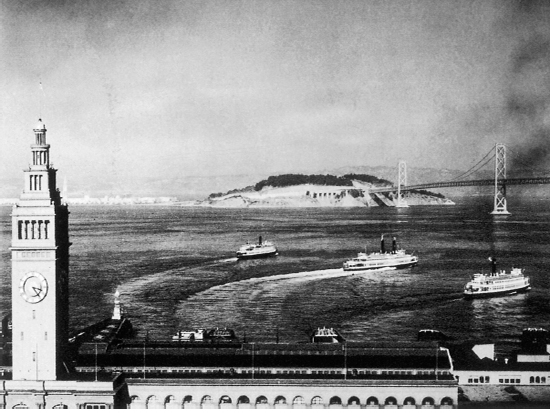
FERRY BUILDING AND BOATS
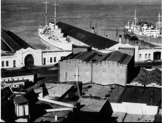
SHIPS AT DOCK
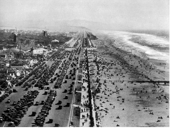
HIGHWAY AND OCEAN BEACH
PANAMA PACIFIC INTERNATIONAL EXPOSITION (1915)
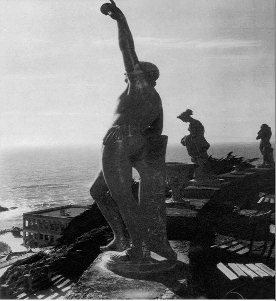
SUTRO HEIGHTS
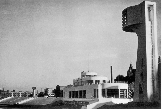
AQUATIC PARK
M. H. DE YOUNG MEMORIAL MUSEUM, GOLDEN GATE PARK
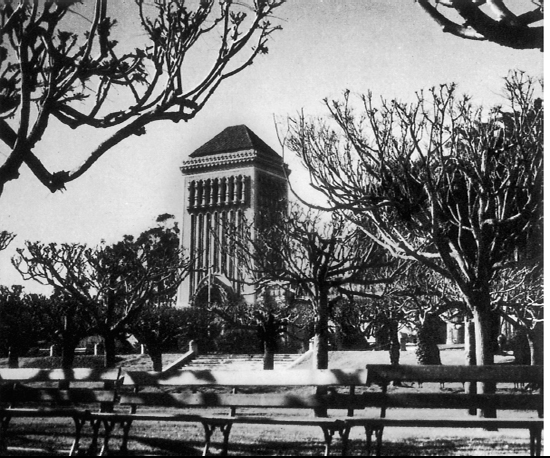
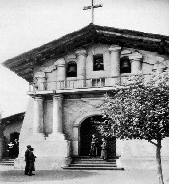
MISSION DOLORES
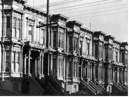
CARPENTERS’ GOTHIC
BAY WINDOWS CATCH THE SUN
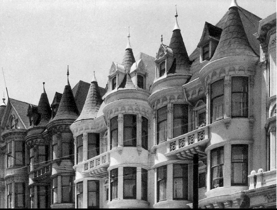
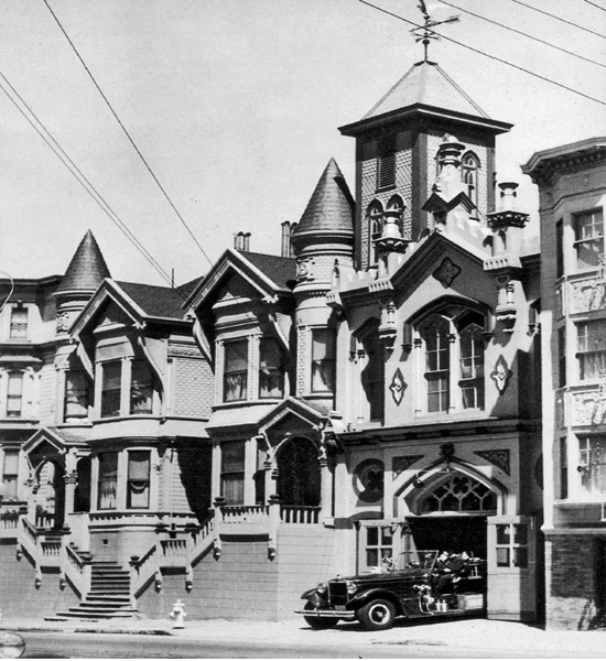
THE PRIDE OF ANTIQUARIANS
(ENGINE COMPANY NO. 15—2150 California Street)
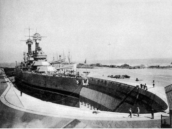
U.S.S. CALIFORNIA IN DRYDOCK AT HUNTER'S POINT
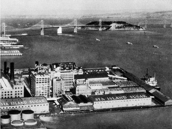
SEA ISLAND SUGAR REFINERY
Crowds have gathered on occasions to watch swimming races around the Seal Rocks. More thrilling were Performances by tightrope walkers James Cooke and Rose Celeste, who balanced to the rocks and back on different occasions in the 1860’s. A Suspension bridge to the rocks constructed later was abandoned after it overturned with about 20 pedestrians, injuring several.
229. The OCEAN BEACH, between the Cliff House and Sloat Blvd., is thronged on pleasant days with picnickers, surf and sun bathers, equestrians, and sightseers. The pedestrian esplanade bordering the sea-wall affords a broad view of the Pacific. A vicious undertow is created by the sudden drop beyond the edge of the surf and annually takes its toll of the unwary.
230. At the northern end of the Ocean Beach is PLAYLAND AT THE BEACH, an amusement area consisting of 22 various “rides,” a score of games of chance and “skill,” shooting galleries, fun houses, many eating places (ranging from tiny hamburger Stands to the well-known Topsy's Roost, a fried chicken and dance establishment), a penny arcade, and other concessions familiar to modem amusement zones. In 1929 George and Leo Whitney, professional concessionaires, forced to return from operating Melbourne, Australia's Luna Park by the out-break of the World War, were successful in taking over this entire area from its several owners. Born in Kansas about 1890, the Whitney brothers’ careers began early with their perfection of a “quick-finishing” Photographic process. Their first small photography shop was so successful that they began operating penny arcades; profits from these financed their concessions at the Alaska-Yukon Exposition of 1909, in Seattle, Washington.
One and one-half million dollars raised by bond issue in 1927 financed the two-year construction of the Great Highway, which extends along Ocean Beach from the Cliff House south to Sloat Boulevard, a distance of nearly three miles. Construction of the 4,298-foot-long Esplanade, extending from the highway's northern end to Lincoln Way, had begun as early as 1916, but was not completed until the new funds were acquired. Several methods of protecting the road along the ocean had failed until City Engineer Michael O'Shaughnessy designed the present tight cut-off wall of reinforced concrete interlocking sheet piling, which extends 13 feet below extreme low tide. Extending shoreward from the parapet wall, the Esplanade consists of flanking 20-foot sidewalks, 15 feet of lawn, and a paved highway between 150 and 200 feet in width. For a Stretch of 3,000 feet, opposite Golden Gate Park, the Great Highway is the widest boulevard in the United States. Paralleling the road between Lincoln Way and Sloat Boulevard is a bridle path—a link in the continuous pathway from the Presidio to Fleishhacker's by way of Golden Gate Park.
Great Highway be comes Skyline Blvd.
231. Set in a little Valley encircled by wooded hills are the 128 landscaped acres of FLEISHHACKER PLAYFIELD AND ZOO-LOGICAL GARDENS, foot of Great Highway at Sloat and Skyline Blvds. This recreation center dates from 1922, when the city acquired from the Spring Valley Water Company 60 acres on which to construct a playground and pool. Only 37 acres at first were developed; opened in 1924, the park was named for Herbert Fleishhacker, then president of the Park Commission, who had donated the pool and the Mothers’ House.
Said to be the world's largest outdoor plunge is the SWIMMING POOL (open daily 9-5; suit, towel, and locker rental: adults 25¢, children 15¢; 20 life guards); 1,000 feet long, 150 feet wide, with a graduated depth of from 3 to 14 feet, several thousand persons can swim at one time in its 6,500,000 gallons of warmed salt water. Considered a noteworthy achievement is the system of heating the sea water. Nearby under windblown cypresses are plots for sunbathing.
The PLAYFIELD (open daily 9-5; free), in addition to an unusually large variety of play apparatus, boasts a merry-go-round, a miniature railway, and donkey rides (small fee). Larger children and adults use the tennis courts, baseball diamond, and sporting greens. Facing the one-foot-deep wading pool for tots is the MOTHERS’ HOUSE, a low, stuccoed, tile-roofed building providing a resting place for mothers and children; the gift of Fleishhacker, it is a memorial to his mother. Interior murals and mosaics are the work of WPA artists.
Adjoining the playground is the Zoo (open daily 10-4:30; free). Begun in 1929 with a few lion cubs and monkeys, gradually more animals were acquired (by purchase and donation), until the animal, bird, and reptile population reached 1,000. Noted is the fine collection of “cats,” which includes lions, tigers, leopards, lynxes, and panthers.
In 1935 sixty-eight acres adjoining the zoo were purchased, and here WPA labor constructed the fine ZOOLOGICAL GARDENS (Lewis Hobart, architect), modeled after Germany's famous Hagenbeck Zoo. Here, among man-made streams, waterfalls, islands, cliffs, and caves, are simulated natural habitats of many animals—separated (where practical) from spectators only by moats and designed to give the animals the illusion of freedom. The concrete of the bear pits resembles natural rock. The aquatic bird building Stands on the shores of a specially built lake; the “flight cage” is 220 feet long, with rocky refuges, nesting places, trees, shrubs, and a running stream. Also in the gardens are Monkey Island; the pachyderm house, with its separate enclosures and private swimming pools; lion dens; and a lake built for beavers and thoughtfully supplied with “chewy” logs. The gardens are (1940) only 80 per cent completed.
Heated local controversy attended the trial of Wally, the elephant, who in 1936 attacked and killed his keeper. Only intensified by Wally's execution by court order, the discussion continued for several months.
232. Adjoining Fleishhacker Playfield and Zoo on the south is FORT FUNSTON (private). Bordered on the east by Skyline Blvd., it Stretches for about a mile and a half along the coast. Established as a military reservation during the Spanish-American War (1898), it was known as the Laguna Merced Military Reservation until 1917, when it was renamed in honor of Major-General Frederick Funston, Commander of the Army troops who policed San Francisco after the 1906 disaster. During the 1940 “war games” the reservation was the scene of spectacular practice firing in which machine gun tracer bullets “repulsed” a night landing of the “enemy.”
233. Historic LAGUNA DE NUESTRA SEÑORA DE LA MERCED (Sp., Lake of Our Lady of Mercy), Lake Merced and Skyline Blvds., is about five acres of fresh water surrounded by sand dunes and golf courses; one of the latter divides the lake into north and south parts by a narrow neck of filled-in land. Wild flowers grow in profusion on the shores, and among nearby rolling sand hills vegetable gardens flourish. The city-owned lake was abandoned as a source of water supply in the 1930’s. In 1939 it was leased to Thomas P. Cusick, whose improvements have made it popular with fishermen and devotees of skeet shooting. The lake's original depth was lowered 30 feet on the night of November 22, 1852, by a mysterious disturbance surmised to be a temblor; in Spanish colonial days the water flowed westward through a narrow Channel to the ocean.
234. Spreading between the north and south waters of Lake Merced is HARDING PARK GOLF COURSE (greens fee 75¢ Mon.-Fri.; $1.50 Sat., Sun., holidays; $3.00 monthly), a 200-acre tract included in property purchased by the city from the Spring Valley Water Company. The 18-hole course is operated by the Park Commission, which began to improve the property in 1922 and opened it to the public in 1924.
235. In the extreme southwest corner of the city, bisected by Skyline Boulevard, is the OLYMPIC GOLF CLUB AT LAKESIDE (private), country club of the Olympic Club. Enclosed within its 278 acres purchased in 1920 are two 18-hole golf courses and four tennis courts, although athletics here are subordinated to social functions.
Retrace on Skyline Blvd. to Lake Merced Blvd.; SE. on Lake Merced
236. The PACIFIC ROD AND GUN CLUB (private), near Lake Merced Blvd. on the southwest shore of Lake Merced, is housed in three wooden buildings made of six schoolhouses purchased from the city. Waters of the south lake abound in black bass, blue gills, and other fresh-water fish; these are replenished from the north lake breeding ground, which is closed to fishing and boating.
237. In a little hollow surrounded by rolling hills and vegetable gardens is the SITE OF THE BRODERICK-TERRY DUEL, Lake Merced Blvd. at the San Francisco-San Mateo County Line. Two granite shafts mark the positions of the contestants in the encounter which welded California's political factions on the eve of the Civil War. About ten yards north a granite memorial bears the information that “United States Senator David C. Broderick and Judge David S. Terry fought a duel on this ground in the early morning of Tuesday, September 13, 1859. Senator Broderick received a wound from which he died three days later. The affair marked the end of dueling in California….” Terry, Chief Justice of the California Supreme Court, had accused Senator Broderick of defeating his candidacy for re-election. (Previously Broderick had befriended the fiery Southerner, who in 1856 had been imprisoned for stabbing an officer of the Vigilance Committee.) On learning of Terry's arraignment of him before the 1859 State Convention of the Democratic Party, the “grand, gloomy and peculiar” Broderick remarked: “I have said that I considered him the only honest man on the supreme bench, but now I take it all back.” Informed of this statement, Judge Terry demanded a retraction; and when this was refused, “the satisfaction usual among gentlemen….”
Arriving at the appointed spot with their respective seconds in the raw foggy dawn, each contestant was provided with a Lafoucheux dueling pistol (these hair-trigger weapons had been chosen, according to custom, by the Challenger). With his back to the rising sun, nervously fingering his weapon, Broderick fired at the count of “one,” his bullet striking the ground midway between him and his adversary. Terry, with deliberate aim, shot Broderick through the right breast. Followed by a crowd of some 60 spectators, a carriage hearing the fatally wounded Senator drove the ten miles to Black Point where he died in the home of Leonidas Haskell.
238. A wooden plaque among rolling hills marks the northernmost CAMP SITE OF THE RIVERA Y MONCADA EXPEDITION, Lake Merced Blvd. just north of the San Francisco-San Mateo County Line; here at eleven o'clock on the morning of December 4, 1774, headquarters were established by the third Spanish party sent to explore San Francisco Bay. It consisted of 16 soldiers, Father Francisco Palou, and a muleteer (with mules laden with provisions for 40 days), under the command of Captain Fernando Rivera y Moncada. An hour later Rivera, Palou, and four soldiers proceeded up the coast, where they planted a large wooden cross on Point Lobos. Returning to their hill-side camp—which then overlooked a small stream running into Lake Merced—the whole party followed Portola's old route back to Monterey without having chosen a site for the projected Mission San Francisco de Asis—the selection of which had been one of the chief purposes of the expedition.
E. from Lake Merced Blvd. on an unnamed western extension of Stanley St. to Junipero Serra Blvd.; S. on Junipero Serra
239. Organized in 1895, the SAN FRANCISCO GOLF CLUB, LTD. (private; greens fee $2), Junipero Serra Blvd. and Palmetto Ave., occupies an 18-hole course of 184 acres bordered on the south by the city and county limits. Located here is the INGLESIDE MEN'S CLUB (private; bar, restaurant).
Retrace and continue N. on Junipero Serra Blvd.
240. The INGLESIDE PUBLIC GOLF COURSE, INC. (greens fee 75¢ Mon.-Fri.; $1 Sat. until n, $1.25 11-4, 50¢ after 4; $1.25 Sun. until 1:30, $1 1:30-4), Nineteenth Ave. and Junipero Serra Blvd., has been operated privately since 1926 on 140 acres leased from the Spring Valley Water Company. The San Francisco Golf Club occupied this site until 1919.
NW. from Junipero Serra Blvd. on Nineteenth Ave.; W. from Nineteenth on Sloat Blvd.
241. SIGMUND STERN MEMORIAL GROVE (barbecue pits; picnic tables; sanitary facilities), Sloat Blvd. between Nineteenth and Twenty-fifth Aves., occupies a natural amphitheater 100 feet below Street level. The grass-carpeted glade is sheltered by eucalyptus trees planted nearly 70 years ago by homesteader George Greene, a New England horticulturist who came around the Horn in 1847. When it became known in the early 1850’s that Congress was to pass an act giving title of this property to those holding land there, Greene and several other homesteaders erected a fort, and for weeks guarded their property day and night against encroachers. In 1892 Greene established the Trocadero Inn; boasting an open-air dance pavilion and trout lake, it was until 1916 a popular resort. The inn was used in 1907 as a hideout by ousted political boss Abe Ruef, and it was here that he was captured.
Mrs. Sigmund Stern purchased about 12 acres of the land and presented it to the city in 1931 as a memorial to her husband, with the provision that it be used only for recreational and cultural purposes. Enlarged later by the purchase of additional acreage by the Recreation Commission, and again in 1937 when another gift of Mrs. Stern made possible the acquisition of still more land, the park today covers more than 33 acres. The remodeled Trocadero Inn is a clubhouse available to organized groups for social and recreational usage (reservation must be made at the San Francisco Recreation Commission office, Room 370, City Hall).