Regions mountainous and wild, thinly inhabited, and little cultivated, make a great part of the earth, and he that has never seen them must live unacquainted with much of the face of nature, and with one of the great scenes of human existence.
Samuel Johnson
I was happily presumptuous in assuming everything washed would be dry before bedtime—and appreciated the climate that made this possible. We strung lines and hung our washing between the pines. I went over our supplies and made a shopping list for Ali. At 1700 he rode Taza off to the souk which, being eve of souk day, would have some shops open. Somehow Tamri freed himself of his tether and set off over the fields after them with Hosain in loud pursuit, teaching us some new vocabulary. From a knoll above camp I watched them vanish towards the souk (about 3 km distant), Tamri giving Hosain a good canter. No doubt Tamri would soon find Taza, his companion, and receive a good hammering from Hosain. Some nasty flies at that site actually drew blood on the mules—the only such I’ve seen in all my Atlas years. A scented hawthorn by the cook tent was in blossom and attracted dancing flies, wasps and hornets and when we dined in the light of the moon, there was a flirtation of crazy moths.
That night I was able to enjoy the magic of lying out under the stars, such a cobweb of stars and the fairy lights of glow-worms. The soft noises of the night included winds whispering in the fronds of fan palms, the sharp voices of a fox or jackal and the muffled clip-clop from a late traveller. The only drawback to sleeping out is a lack of privacy: sleep late and you’re likely to wake to a ring of silently observing children.
If all days were equally good, some were more equal than others. And we were slipping pieces steadily into the jigsaw knowledge of the Atlas. Shipton, as a young man exploring the Alps regularly, wrote of how he ‘began to have that exciting feel of connected knowledge of country’. This is something those who ask questions like “Why climb the Munros over again?” or “Haven’t you done enough in the Atlas now?” know nothing about. There may not be visible excitement but the deep satisfaction of knowing what one views from a summit or meets along the journey only increases with the passing of time; one starts to possess the land, not wander through.
The new day was to insert abundant fresh spice into the cake of our ‘connected knowledge’ and prove one of the best days of GTAM, ‘an extraordinary day’ I was to write in my log, very late, by candlelight. I added, ‘I don’t remember such non-stop, dramatic uphill ever. Fit, thank heavens, so able to enjoy life’. The varied landscapes we travelled through I now remember as special.
We wandered through magnificent Aleppo pine forest initially, the way cheery with people riding in for the souk. We’d ascertained that our path was now a piste, curving down to the Oued Tessaout and on to a village, Tallent, but the mule path cut corners as ever and we descended a steep little glen quite beyond delineation on the map. On a prow before the final twists down to the flood plain we studied the wide flow of water. People were crossing at two places and we chose the upper. We took off our trousers to splash across, like the locals, with varying degrees of skill and enjoyment and plenty of comments from the spectators who’d probably never seen such wimps or such white, female legs. The Berbers, while showing a modest rectitude normally have few inhibitions. If a girl is trampling her washing in a stream she is quite happy to show a great deal of leg. I recall an incident at Imlil where a man was rebuilding a terrace wall washed away in a spate and, having to actually stand in the water to work, he, quite unabashed, took off all his clothes to do so.
Charles A nearly went up the first valley south, towards Jbel Tissili, whereas our route was initially downstream for the long Assif n’ Terga (which outflanked this huge chunk of mountain and the western thrust of Anghomar) then over a pass to reach the Azib Anfergal and to connect with the known country of Peyron’s GTAM. The brevity of Peyron there and the unreliability of the map were to ginger the day on several occasions. The valley was intensely cultivated and the spring flowers a joy, the path edged with cistus, euphorbias, broom and dazzling, genuine Erodium guttatum, brilliant as Juba’s robes. Even the common daisy is Bellis rotundifolia caerulensis, i.e. tending to blue, which hardly conveys the delicate mauve tints of the flowers.
I quoted Peyron: ‘Descend towards the meanders of the Tassawt (Tessaout) river. A little before the hamlet of Tallent, splendid views are obtained towards Jbel Rat. The river is fairly wide at this point and in winter/spring crossing can be troublesome. To keep dry feet, organise a mule shuttle’, to which someone laughed “How useful! Our mules are probably drinking mint tea back at the camp”. (Thumbing lifts across rivers on a mule is something we have done often enough and I’m always astonished at how one always seems to appear at the right moment.)
Our trouble began when we realised Tallent was shown in two different places on the different maps and the path up to Terga (Targa) had been abandoned because the piste now continued further down the Oued Tessaout to a bridge near a village, Tiwghza, and then zigzagged up to Terga direct. We knew nothing of the new bridge and piste and, already across, worried away to find the Peyron line. At one stage the path we were on ended in someone’s yard where a toddler went bawling off at the sight of us. We were at once invited in for tea! The man of the house then insisted on showing us the way which meant he ambled ahead of us all the way up to Terga. As half the party was lagging badly and could miss the complicated and decaying track I suggested he went ahead to get the kettle on and find some bread for us. A village was overspilling a cliffgirt thrust of crag in one of the river loops far below while Rhat and Tignousti dominated our backward glances. Only on a last crest before turning into the Terga glen did we see the piste snaking up and our cavalcade as remote blue dots on the lower bends. The whole area appealed immensely. My log gasped, ‘Sun all day. Just love it. Flowers. A very heaven’.
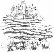
So was Terga. ‘...an imposing village cluster...nestling at the foot of austere arid slopes. A few poplars and the usual patchwork of fields bravely attempt to strike a gay, verdant note.’ was Peyron’s restrained description, although what we found astonished. The valley was massively cultivated and there were several large villages on both flanks of the valley, an unexpected oasis ringed with habitation, the people noisily friendly and helpful. We were ushered into one of the first houses and sprawled in the coolness of the guest room. My hands were given a wash then a tray of glasses was placed before me to make the mint tea. My brew met the approval of our host and was welcomed by our laggards and then by the mule lads. A big vegetable tagine suddenly appeared with plenty of fresh bread rather like naan. The far wall had a frieze of what looked like little coloured flags but were the labels peeled off flat torch batteries. There was also a portrait of the king (of course) and a bouquet of dried flowers. Nicola commented: “Add the Pope and JFK and it could be a cottage in Kerry”.
We dropped steeply into the valley and up a spur opposite to end in a confusion of houses. An old man raced ahead to show us the way but when he saw the mules coming there was a right old barney and they were sent back down to take a route on the other side of the valley; it appeared our demanding track had tight places where the mules wouldn’t pass with panniers so once more we made a hopeful rendezvous with Ali and continued our upward way. We didn’t see them for the rest of the day and when they appeared, they were on the opposite crest, tiny dots lost in the austere aridity. The Assif n’ Terga cut down continuous gorges yet wherever there was the slightest relenting in the wildness, a path wiggled down to tiny cultivated plots or grazings. Flocks wander everywhere so one must never trundle boulders—even if goats have a habit of doing so onto people.
Our track traversed determinedly along and up. We had an escort of about a dozen (two-legged) kids. They showed us a small pathside source with the usual old sardine tin left as a cup for the wayfarer and we lunched on a breezy crest. At a side-valley a man heading down rescued us from their eager attentions and, walking out on opposite banks of the side-valley, we exchanged waves and ever fainter “Bye-byes!” The exit from the side-stream was up bare gravels with little adhesion then we flanked in and out an extensive hollow under a dominating wet overhang, dramatic at every step, to eventually reach a natural big red wall we’d seen from afar. Kestrels were keeking about as we zigzagged up and over into another discovered paradise.
Dominated by the screes and scarps of Jbel Issermad, this west flank produced a surprise of springs rushing out and down the slopes, like kids released from school, to water a huge area of secret cultivation. Peyron noted rock carvings with small meadows, but the meadows were lush, extensive and rich with flowers which so excited all of us that we quite forgot to look out for the carvings. There were plenty of people too, mostly planting potatoes in this alpine market garden. There were sheets of colour: orchids, star of Bethlehem, vetches, asphodels, campions, clumping alyssum, salvia, thistles, hyacinths and chrysanthemums—among those I recall or can name. Beyond the meadows, bare red spurs and pitons (pinnacle-shaped hills) contorted the onward track. There were several streams, and with plenty of water and well fed we enjoyed the hot day without any dehydration worries.
I left Francis and the girls at one stream to push on in hope of seeing the mules. When finally spotted, they were tiny dots coming steeply down the other side of the valley, competently displaying their skill at scree running. A long seguia tapped a distant source and led the water round to tumble down in an artificial fall. Once the mules were down, they had to follow the main valley, stream and path often synonymous, while our path continued to weave in and out the lofty spurs, dotted with remnant oak forest and a few pines. From a final spur we looked down onto a flood plain with azibs and terraces and many feeder streams, the ground painted yellow as rape fields with a small ragwort. Anghomar bulked hugely at the head of the valley, the high horizontal banding vertically broken by snow-filled gullies creating the familiar streaky bacon effect and the lower slopes grey, unrelenting screes. Though the flat was over 2000 m, Anghomar still dominated, a huge wreck of a mountain, the summit 3610 m.
Ali and I actually met on the first terraces—perfect timing. And there we camped. We’d left Aït Tamlil at 0715 and it was now 1715, although Peyron covers not only all of that day’s route but also crosses the big pass under Anghomar, deals with a gorge and camps in the valley beyond, in one 10-hour day! We put in two camps and felt we’d done well, and I can only reiterate the warning that if Peyron gives a long day the normal walker will be well advised to consider it as a two-day stint. This was our fiftieth day on the trail and by the following day, we’d have covered 500 miles. The site is chiefly recalled from sharing accommodation with two fat vipers, spotting a third as we set off.
The Koran has the eloquent picture of the dawn ‘breathing away the darkness’ which described perfectly our mornings in the mountains where first light came like babies’ breath and the cold shadows rushed off in hot haste. They say that in the desert, day is despair and night made welcome, but in the mountains the biting night is feared and day the delight. As we had plenty of sleep our dawns were certainly highlights. We set off with Anghomar dark against a golden sky. “Just another bloomin’ sunny day”, a comment on our first-ever trip, which once more became a bit of a catch phrase.
Bits of stringy path and plenty of boulder hopping focussed the mind; care had to be taken to follow the correct side valley for our pass. Grazing paths went off everywhere and there were many side valleys. A slow-moving caterpillar line of sheep and goats moved across the screes opposite. The 50,000 map, usually so bad on names and paths, was more helpful on that occasion and we turned off, correctly, to begin the ascent of a valley which led to a solitary, smart azib where we sat in the sun awhile. Two youths, just into their teens perhaps, jumped when they rounded the building and almost stood on us. They were having a quiet brew at that last water when we left but they soon passed us on the tizi and sped off beyond. The climb up to the pass was scree and soil set at the maximum angle possible and we rested at the col to dry off our sweat soaked shirts. We had three maps, and all gave the 2800 m col a different name. The gorge on the way down had two names. I commented, “We could do with Harvey’s maps out here. Or even the OS, bless ’em. I’ll never complain about our home maps again”. At least we had maps, for it is virtually impossible to buy maps for trekking—even when going to the Rabat map offices in person.
This 2800 m tizi lay between mighty Anghomar (3610 m or 3581 m, depending on the map or Inghemar 3609 m in Peyron) and Jbel Taghalliyn (Tighaline) (3310 m or 3326 m) and a path of sorts led round to the southeast ridge of the resonantly-named peak, across slopes which were dotted with dainty blue flax flowers. We wended in and out the bumps on the ridge, the floral differences between north and south slopes very marked and at one stage I yelled for David as I’d found something I’d not seen before. The flower was the same as our old friend Ranunculus calandrinioides but instead of wavy sword-shaped leaves, these had leaves the shape of table-tennis bats. Anghomar has quite a known flower reputation and David reckons variations occur on several of these huge brutes of hill simply because they are as isolated as islands. Matthiola (stock) was also plentiful on Tighaline and, for once, I (and David) reached the summit last. Lorraine had gone ahead like a gazelle.
From the summit we could see just about everywhere we’d been since coming round the Rhat: M’Goun was still white though less so, ahead villages by Anmiter and Telouet could be seen, as could the large dam south of the mountains at Ouarzazate. Jbel Siroua and Toubkal were visible. North, below us, lay a huge hollow strangely ringed with circles of exposed strata while to the west lay Peyron’s ‘sizeable chunks of uninhabited uplands’.
I’d observed the mules reach the tizi, but was then puzzled when they crossed on our track to the next col, dithered, and then angled along rather than down. This was not the plan so I grabbed a salmon sandwich and some Christmas cake and raced off down a scree of knuckle bone sized pieces to intercept them as they wended along, rather aimlessly, on the crest of the ridge above the valley into which they should have descended. The explanation was that Ali had taken the two names of the one col I’d given him as being the names of two cols and was taking both, only there wasn’t a second. They went on over easy ground and cut down to the Assif n’ Tamda while I took a more direct route down, brutally steep but assisted by the moving surface.
Lower, on whitish rock, a marble perhaps, there was a happy abundance of flowers: flax, a miniature rock rose (Helianthemum), ornithogolum, blue hedgehog broom and chrysanthemums, one streaked with scarlet. Out of this dry hollow (corrie) the Assif n’ Tamda suddenly burst as a full-blown stream. (I don’t understand why it is named Tamda, which means lake.) Cold as the water was, I was glad to splash in it after my sweaty sprint and I lay sunbathing to dry afterwards. The valley was ungrazed and lush, the blue broom forming huge cushions two metres across, but slowly the valley turned into a gorge with a faint track on which I could see the marks of our mules’ passage. Relishing another paddle my eye was caught by a line of tiny blue dots wavering among the grass stems, which turned out to be ants carrying the wings from a couple of butterflies. They looked like a line of miniature blue sails. A dipper scolded past and an eagle hung on a curtain rail of cloud.
From habit I noted possible campsites and one extra good source then, well down the gorge, saw tarpaulin blue ahead, the loads off the mules and the muleteers having tea—welcome as ever—but not what was expected or wanted. Looking down between the gorge walls we could see the Azib Anfergal fields where we intended to camp, less than two kilometres off, but now quite beyond reach through the gorge as far as the mules were concerned. The path had been washed away in a spate and several boulder overhangs and tricky slabs where a stony pathway had once been were now bare. So, the mules actually had limitations. “Haven’t you taught them to abseil yet, Ali?”
As it was already 1500 and the next day was a shorter, lazy day (which would be quoted back at me) the best thing seemed to be to camp where we were. We retraced quarter of an hour to the good source. On the way I saw what looked like a toadflax growing on a wall in creamy white drapes and later led the delighted experts to Sarcocapnos baetica, one on their list of ‘hoped to see’ rarities. Trying to write at the tents was made difficult by thousands of ghostly moths battering about. When we lit the lamp they flew into the mantle and broke it almost at once. For days afterwards moths appeared out of the most unlikely places in our gear. Polaris lay right up the ‘V’ of the gorge and a satellite passed over, later a fat and jealous moon dimmed the stars and glowed like a lantern hight down the cliffs onto the site.
Porridge was our popular breakfast alternative to muesli. We briefed Ali and then set off with David not well again, a recurring nuisance. The cliffs where the mules had been stopped from descending the gorge were hanging gardens of sarcocapnos, this exciting rarity now being seen in plebeian plenitude, as always seemed to happen. There was some nice scrambling and route picking down the lowest section of the gorge where vertical strata fanned up like fossilised palms. Cutting corners to gain the upper Ounila valley gave us a tedious steeplechase, except I rather like teasing away at a challenging route (tedium to me being an easy walk on a marked way). As David had not been seen for some time we perched on a knoll for an hour till he and shepherding Charles K appeared.
Charles A and I wended over to explore some marshes, Peyron’s Aghbalou n’ Ougerzram: a round pond and springs that feed the infant Oued Ounila not far above the Anfergal meadows. The pond was a frog and toad bedlam (Bufo viridis can change colour like a chameleon) and the drier banks were studded with the pale blue thistle-buttons of Carduncellus pinnatus acaulis. On another visit, we watched a snake eating another snake here. I suspect a muleteer had killed one by a blow on the ‘neck’, and the other was being an opportunist cannibal. The victim had been grabbed several inches down its length so swallowing a double thickness proved quite a mouthful but, as we watched, the unhinged jaws sucked in the last of the head and the elongated thickness moved along an inch or two at each swallow. We left it to a long meal, speculating on what would happen if the snake it was eating was longer than itself.
We sat on another knoll for an hour, to see and be seen. Doctor Charles A went off to investigate if there was anything he could be doing to help. Eventually, I followed the others. An old man was bringing down such a huge load of grass on his mule that it appeared to be a mobile green stack on short legs.
Over on the left were azibs under a huge cliff and further on, tucked in, was ‘our’ azib where Charles, Vi, Inge, Mohammed from Anmiter, his helper and myself had once survived a night of heavy snowfall. We spent some of it in the frozen bell tent (eating) but were then thankful for the spacious shelter of the low-roofed azib (sleeping). That storm effectively put an end to our first Anghomar plans but we struggled on up to the tamda. The scenery under snow was so startling that, out of devilment, I included a slide of the frozen waters in a lecture on Spitzbergen, and nobody noticed. This defeat (and warning) motivated our circling approach on GTAM, cutting out the high Tizi n’ Fedghat which might have been snowbound.
Peyron describes the up-valley going as tiresome with tussock and scree and the path difficult to find in places, but we found the path was excellent and the going easy. There were a few short steep sections and in general the place looked very like the Pass of Ryvoan in the Cairngorms, even producing a Lochan Uaine on cue. The lac came unexpectedly soon, a brilliant, startling blue like Viking eyes, so cool among the warm tones of the surrounding screes. I cleared the stones off an area for the cook tent and my own then walked around the lac and explored a grassy spur back a bit but failed to find a source. (The water supply proved up-valley; an odd, short length of stream which didn’t reach the lake and had started as a resurgence.) We lunched, those of us present, the temperature over 80°F in the shade, except there was no shade.
About to go off on another water hunt, I returned at a run as Charles K and the mules had arrived but not David or Charles A. Apparently, the mules had passed them without being seen and David and the doctor were still down the valley, the former incapacitated according to Charles. As soon as the mules were off-loaded, Hosain and Charles rode off on Taza and one of Mohammed’s mules to find the others while we pitched all the tents, a task that left us dripping. The tents were like ovens, so we made frequent drinks to survive in the open. Ali and muleteer Hassan rode off for bread as an alternative to baking some and, I suspect, to enjoy socialising. Eventually the stragglers rode in: Charles K supporting David on one mule and Charles A behind Hosain on Taza. David came off his mule like a sheriff shot by an injun arrow in a western, except we caught him. He was dumped in his tent with both ends open for a hint of a draught.
Lorraine had been up the valley and returned to say there were two more lakes, one really big. This was interesting. The 50,000 map did show two lacs but the smaller one didn’t exist if this by the tents was one of them. Slowly I realised that there were really just two lacs and this one, possibly seasonal, wasn’t on the map at all. The altimeter rather bore this out. In our winter visit we’d only been aware of one lac and looking at slides, that was obviously the upper pair, recognised from the large flat cover of ice and snow. Of the lower there had been no sign, simply being buried under snow. Others have been misled. When Charles de Foucauld crossed the Atlas he saw Djebel Anremer (sic) and wrote: ‘C’est de cette montagne que sort l’Ouad Jounil. A son sommet est un étang, toujours rempli d’eau ..... un object de vénèration profonde pour les Musulmans des environs (Its from this mountain flows the Oued Ounila. At its summit lies a lake which never dries out...an object of deep veneration by the local Moslems). Walter Harris heard there was a crater lake at the summit. I wonder if they were being misinformed on purpose, to keep them away. Anghomar was often called Jbel Ounila then. Even today, a thousand people will gather for the August moussem and goats and sheep are sacrificed at the top of the mountain. Of course, a lac couldn’t exist at the top of any mountain here and, interestingly, the source above our camp didn’t come from the main lacs but spouted out at a higher level. Not surprisingly, this odd location has lured us back several times since GTAM.
Once the heat of the sun had ebbed slightly I walked to the far end of our lac and dived in fully clothed! I then washed all my garments and myself and splashed around very pleasantly. Eventually most of the others followed suit. The water was not at all cold but harboured hundreds of toads who provided a noisy continuo overnight. Ali and Hassan didn’t turn up until 21.30, long after dark. Young Tamri had led the way back and Ali was quite impressed; mules obviously have good night vision.
All except David were up for an alpine start, 0300, and off at 0345. Although the moon was nearing half, the light was so bright we hardly needed torches as we walked up to the lacs, glad of Lorraine’s recce the day before. First light found us on the long flood plain beyond, a treadmill of gravel tramping that seemed interminable. There was light enough to spot the path zigzagging up on the right to reach the Tizi n’ Taghaghayt or we might have boxed ourselves in the gorge which had spewed out that plain. The tizi at 2838 m was gained in time to watch the changing tints of dawn, a scene enhanced by the hamri red landscape in front of us. The scale was brought home when someone pointed out there was still the equivalent of a considerable Munro to climb. Anghomar (or Inghemar, meaning elbow) is a dozen kilometres long with most of the south flank an endless succession of scree slopes. However, from the eastern end, an arm runs out and down over several bumps to the tizi, then round to Zarzemt (3113 m) south of the lacs. By heading up that crest we reckoned to miss most of the screes (Anghomar and Zarzemt being the A to Z of screes). There was a little scrambling on the crest then we were able to skirt to keep in the shade, enjoy water from a stream and have a snack with a sunrise view of where we’d been the previous week. We climbed ever-steeper and higher, but with easy going, and found ourselves at the iron trig point on the summit, arriving with that sudden joy like opening a door to smiling sun.
Anghomar is the highest summit between Jbel Rhat and Taska n’ Zat so the view was extensive. Charles K suggested going along the long summit ridge westwards which most did but I had my eye on Zarzemt so, with Nicola, I set off down by the ascent route initially. A good way down we met David! Twenty-four hours before he was barely conscious so we were astonished to see him there. Nicola bluntly told him he was daft. We cut down to the stream in the corner and managed to find a long traversing path I’d spotted at dawn which led back to the Tizi n’ Taghaghayt. It soon became clear the ‘path’ was an old seguia carrying water round to the arid south. Running under boulders, squeezing tightly between rocks, no mule could have passed. (A year later Ali, having missed out that time, did Anghomar and used the seguia line as well.)
At the tizi I suggested Zarzemt and Nicola rather doubtfully agreed. Initially, we had some good scrambling on the shattered ridge of dark volcanic rock, but the going was tiring and Nicola decided she’d had enough. She turned for home down easy ground to the lacs where she had a swim. The lacs were vivid blue, the sort of colour that would be bad taste in clothing. I watched Nicola with a touch of envy as I headed on up but the final upthrust of crag was superb rough limestone which gave enjoyable scrambling. Crimson-winged finches were working the scrub. Beyond lay what Nicola would have described as Burren country: a plateau-like tilt of caramel-coloured limestone pavement, pockmarked and savagely carved, not a place to make sudden contact between bare skin and bare rock. The rock was like sharks’ teeth. Like the Burren, the plateau was a natural rock garden. I was quite irritated reading an old guide that night, which stated that alpine flowers are not abundant in the Atlas, Anghomar is not really worth the effort, and our beloved Tichka Plateau of not much interest.
The ridge down gave periodic glimpses of the various lacs. Choughs were sporting along the scarp, diving so fast their wings thrummed like thrown stones. A deep glen cut off the end of the ridge but I used a traversing path to swing round to just above our campsite, giving me a bird’s eye view of the colourful dots of tent. I chuntered down slopes as crumbly as cheese, right into camp. Tea or drinks that had been cooling in the edge of the lac were instantly offered. Most of the afternoon I spent by or in the lac. The traverse group came up-valley and David came down the screes to camp. Our appetites being pretty good after the big peak we had fish soup, haggis, with plenty of vegetables and Christmas pudding for supper. At my urging, everyone decided to tackle Zarzemt the following day. Anghomar sprawls like a big grey rhino, Zarzemt its horn.
The following day’s camp was established back down-valley at the Azib Anfergal, flat fields between a crag and the river with a water channel by the tents. Anfergal means ‘place of a thousand dead’, and records a 14th Century battle. A few years previous, there was a bit of a tushie over tribal grazing rights and a couple of men were actually killed, which explained the moribund agriculture. (Both sides were banned.) Charles K and the girls were in first after climbing Zarzemt and the botanists long after. A stiff chergui (desert hot wind) had most people cringing in a cave at the foot of the rock wall while the interior of the cook tent provided a good imitation of a hammam. Only one of the three big gas cylinders was functioning, so cooking was slow even with small backup stoves. Ali and Hosain had gone for a romp to Anmiter and were expected back the following day. The wind, perversely, dropped as soon as we’d eaten and it was a warm night again, the ‘mothlike stars flickering out’. Finally, we could take layers of clothes off to sleep; it hadn’t been that long since we were piling on thermals. Being warm is rather pleasant.
A reasonably early departure paid off for the easy and beautiful walk down the Oued Ounila valley. When David went to fill his waterbottle a snake dived into the tempting hole presented—and stuck! Snakes were rather common on that site. There were goats being driven along the slopes, producing a weird cacophony of grunts, groans, bleats and yells as they went, their dust kicking up against the golden sunlight so it rose in fiery-edged clouds. The Zat snows appeared tantalisingly distant down the ‘V’ of the valley, our next objective, beyond the Tizi n’ Tichka.
We had a long pause by the stream as it threaded through a jungle of oleander below fields, purple-hazed with orchids a metre high. At the first village, Ighourzane, we found the mules tethered by a small village shop that seemed to sell everything except the items we wanted. We scoffed chocolate Taggers and Cocas, though. The view down into the valley was a sea of green, upon which a perched village with a fine tighremt was balanced. On our previous visit, the ‘sea’ had been foaming white as the trees are all almonds—a spectacular sight.
We followed a sturdy matron walking with the week’s washing in a huge basin balanced on her head, the ubiquitous packet of Tide perched on top. When we swung down to the Tighza school we found our lads sitting against a wall with tea and walnuts on the go. After we’d indulged, we continued to a confluence of rivers (with several springs) where there is always a gathering of women washing blankets and clothes which are then hung on the layered banding of the cliffs, a colourful spectacle like warships dressed over all. Small girls romped about the cliffs as sure-footed as goats. Nicola and Lorraine went over to say hello and there was a great deal of laughter and banter.
Ighris is a bigger village with some architectural interest and a new mosque tower. ‘In recent years this has become a road-head for expedition vehicles that pick up or deposit cargoes of package tourists at regular intervals throughout the summer’, complains Peyron while giving praise to the ‘picturesque castellated kasbahs of Anmiter’. The trekkers now tend to be using the fine Tighza gîte and Anmiter steadily loses its architectural gems. Charles A and I were so far ahead that we lost touch with the others. We rebelled at the hard, hot piste and turned off to wend paths through the lush fields and river edge. The air was sweet with the smell of wild roses. Our route was a bit of an obstacle course but it finally brought us along a concrete seguia right into Anmiter below Elyazid Mohammed’s house where we were to stay. We could see the others striding down the hot piste on the other side of the valley and we had consumed several glasses of sweet reviving tea before they joined us, their local—unwanted—guide being astonished to see us there already. This character claimed to be the guardien of the lacs but had been sponging off us since the previous night’s camp and obviously hoped for a lift to Marrakech. When he found we were staying for two nights, had no car and planned to walk to Telouet, he disappeared! A lunch tagine followed and most of the gang flaked-out in the cool, rooftop-level guest room until the temperature eased off after 1700. We gathered later on the roof, squatting around the low table set on a spread of brick-red carpets and blankets. Bismillah. We broke bread for a vast, scrumptious tagine. (You rarely encounter a poor tagine.) Most of the gang chose to sleep on the roof.
The following day was grimly hot and stuffy, yet Charles K led everyone on a long hike down the Oued Ounila until they rebelled. With Flowers’ time running out I stayed and dealt with mail and logistics so our ‘couriers’ could carry letters home. The Flowers gang hadn’t found my sleeping bag at the Hotel Ali (or Imlil) so Lorraine kindly agreed to leave me hers, a very light Snugpak which reduced to half the size of a football. Hosain and Mohammed had been to Telouet so supper was served at the latest for the whole trip. We found an attractive praying mantis, green with spots. Several people were startled in the toilet chamber by a noise at the window, only to find a broody hen ensconced on the sill.
Much of Anmiter (pronounced Ani-meter) is red: soil and buildings alike. The village must have been very impressive a generation ago but many of the ksour and tighremts have fallen and others are decaying. Some, on the edge of cultivation, have been restored rather than supplanted and soar, strikingly handsome, with geometric brick patterns and rising towers, to castellated tops. Several of Majorelle’s paintings on display at the gardens in Marrakech are of Anmiter. The Ounila valley down from there has interesting villages and then becomes a gorge with spectacular settings, with mosque and zaouia buildings and decaying tighremt. There are some cave dwellings on cliffs, largely abandoned now, but once used for safe storage and refuge. The green thread of well-dressed valley lies far below the rim where the rough piste runs. The gorge ends at the tourist trap of Aït Benhaddou, a village of character, partly restored as a film set and all too accessible for the massed tourism based on Ouarzazate. Busloads of the overweight and underdressed debouch for a ten-minute tour, an expensive mint tea, and depart.
Peyron comments: ‘Talwat [Telouet] to Anmiter is a road; 2½h. on foot; ride a truck or hire a taxi’, which we considered both heretical and unnecessary as there is an alternative track offering an excellent walk. The road itself passes through an area where salt was once mined and white stains still seep from the slopes. (Salt mining was the origin of Glaoui wealth.) We made an early breakfast but our hosts kept producing further types of bread and bowls of taghboula, the standard gruel-like porridge, with first tea and then coffee. By the time we escaped the day was already shimmering hot, the view reduced by a clammy haze so one strained to see anything, as if viewing a painting in an art gallery from too far away. As we walked, we stirred up clouds of dust, fine as talcum powder.
From a short way down the Ounila valley we were able to turn up into the hills which run northeast—southwest like swooping herds, parallel strata, undulating but easy to walk along. At one hollow, paths led off to the four cardinal points of the compass and, not for the first or last time my spirits soared at the sight of new roads leading I knew not where. I cursed my too many lazy years in the Atlas when we did little new and over-much that was repetitive. Pity I couldn’t swap a surplus Toubkal ascent for days of novelty. But I wasn’t quite ready to ‘hang my hat on a pension’, and the decade following GTAM would prove the most active and rewarding of all.
Eventually, we turned north to break through the parallel crests and reach the Anmiter—Telouet road at its highest point, the Tizi n’ Tanbdout. We dropped down through an area with the appearance of rocky acne, a violently weathered landscape which nevertheless gave some odd flowers. There was a skullcap and an astragalus with bladders like papery Chinese lanterns. We were led off-road to investigate a brilliant red patch which turned out to be a vetch, then stuck to wandering mule tracks rather than goudron. Areas were snowed with a white rock rose and then we wended through a brilliance of Erodium guttatum (storksbill), the air scented with thyme and the river banks hazed with tamarisk; altogether a more interesting walk than expected. On a subsequent trip, we headed westwards for longer up in the hills, to descend directly into Telouet which was even better. The Tastwiyt hills backing Telouet are fascinating but seldom visited. (The Scottish explorer Joseph Thomson climbed one in 1888.)
We kept to the riverbed (resurgences) and only crossed to reach the green-tiled kouba of Sidi Wissatane (the local patron saint). It looks down on the past glory of the Dar Glaoui and so to the welcoming auberge (Chez Ahmed), where we found the Berber contingent sprawled on the couches under a brown nomad tent. Greetings were exchanged:
“La bas!”
“La bas!”
It had to be time for tea.
Lunch was a Berber omelette tagine, rather like glorified scrambled eggs. A youngster was sent off on a bicycle to the souk area to buy the eggs. A few cafés and shops and a large empty square was Telouet, the residential villages sprawled out around it. We tried most of the cafés at one time or another but ended that day with a walk around the mosque and a track between the village and the fields leading over to the stark Glaoui palace-fort. The village had a mediaeval feeling, quite in keeping with the lord’s castle. After dark, we were entertained by some of the locals. Young girls in glittering kaftans danced while an ever-changing group of instrumentalists beat out rhythms and any and all joined in the raucous vocals: a music of wind and water wildness. Not a few dancers had marked negroid features, doubtless the descendants of Glaoui slaves in the not-so-distant past. There was an interval to allow us to demolish harrira and chicken tagines and, after a few more dances the girls vanished into the house to consume their share of supper. Payment was made by tucking 10 dh notes into the girls’ headbands.
Lying on the sagging couch inside the huge guest tent that night, I thought it another strange place to be passing through. The moon was picking out the towers of that secure eyrie of one of the most extraordinary raptor families in modern history, in whose dungeons the traveller often ended. T’hami El Glaoui had been the despotic ruler of the Atlas and south on behalf of the French, an extraordinary mix of mediaeval ruler and European playboy, feared rather than loved. Everyone had been to the Dar Glaoui at some time that day to marvel at the decayed splendour, the swank and pomp of power reduced to rubble. Death doesn’t omit to call on the dictator and if the rise of the house of Glaoui was dramatic, its fall was even more so, the story chronicled in the bloody classic Lords of the Atlas by Gavin Maxwell. I had the privilege of reading some of this in manuscript, and the author inspired me to visit the Atlas for the first time.
We first visited Telouet over thirty years ago, and the place had changed very little in the intervening years. As in the case of healthy old persons, the decay is insidiously invisible. A tile falls here, a beam cracks there, a fissure spreads, a wall leans. The warning notices not to explore should be heeded. Where the roof is sound there is survival of a sort but the older parts—the outworks, mud-built and roofless—have reverted to their elements, levelled to the ground or left behind as stark hummocks and spikes like the towers of termites. Half the buildings seen in old photos have vanished, yet Telouet is still a vivid throwback to the Middle Ages. Less than fifty years ago, black guards stood at the huge door, chained prisoners starved in their cells, barbs lined the stalls of the stable and boar-hounds yowled in the night. The setting is now no less desolate, distant and distressing.
Over in the open ground above the Dar Glaoui we’d passed three khaima tents and while we sat over refreshing drinks, a stream of 4 × 4 vehicles drove up, nose to tail. They were numbered and obviously drove in order, each following the number displayed on the rear window of the predecessor (if it could be seen for the dust churned up). There were only two people in each vehicle. Eventually, there were sixty-seven 4 × 4s lined up along the slope by the tents, like some strange other-world armoured division drawn up in battle array, ready to assault the mediaeval fortress below. They certainly invaded the Dar Glaoui (armed with Sidi Harazem bottles) and were all back within half an hour, another site on their itinerary ticked off. They then invaded the two dining tents for a Berber lunch, the waiters scurrying from the third (kitchen) tent with endless tagine dishes, being filled from vast vats of simmering stew. Others carried in conical baskets containing bread. As soon as they had eaten they were out again, into the 4 × 4s, and away.
The golden early light on the old kasbah saw me wandering off with my camera before breakfast. After checking our onward route we gathered on the square for a second breakfast at the Café Ropos (sic) the owner insisting on treating us to tea. (As soon as we’d walked in the day before he’d commented “Ah, you must be Hamish; we knew you were coming”.) The tea was perhaps to stall us, as the coffees took nearly an hour to come as they had to await the arrival of a taxi from Ouarzazate bringing the milk! Both Pepsi and Coca Cola lorries arrived together and we counted something like 1500 empties being taken out to the rivals. Some years previous, one of the firms put it about that the other used pig’s fat as an ingredient in their product which, not surprisingly, severely dented the sales statistics of the opposition. They regained the lost ground, however, by putting about a counter-claim that the others’ drink made men sterile.
One year I kept a note of the menu misprints in cafes. There were Quoissongs with the morning coffee and you could dine heartily on Stick and chaps, Scheese omelit, Herbet omelit, Plan omelit, Hana borger garnied, Roost chicken, Lamp stew, Spare rebes, Orange whit shugr, Flambed pan keses and Fruids salad. To drink: Bootled water, Green or Black pee and Coffee all calor. At the foot of one menu was written, Mercy!
The square was livelier with the souk el Khemis due the next day and we sat in sweet content just watching life go by but, eventually, our minibus arrived to bear us off to Marrakech (after another Berber omelette in the tent). We also took farewell of Taza and Tamri. Mohammed from Anmiter was offering them stabling while we were away on our necessary but short intermission. We felt decidedly odd whirling along in a vehicle again.
The line of the modern road over the Tizi n’ Tichka was chosen in order not to intrude on the Glaoui HQ of Telouet. Imagine the surveyors faced with a virgin barrier such as the High Atlas and the engineers having to create the route, or the thousands who toiled (1925–39) to give birth to the reality. The road brought commerce, the real conqueror, so while the Dar Glaoui crumbles an echo on the breeze brings the hungry purr of camions on the pass.
That day (24th May) was hot and close and, with the best will in the world, we all failed to stay awake for the scenic run down to Marrakech from the Tizi n’ Tichka. The hills quickly reeled back into haze. Our first port of call was the ice cream parlour behind the Hotel Ali for mammoth coupés. Those going home could relax—and did—but Charles and I had an assault course of logistics to deal with: organising tickets and plans for Ali and Hosain, going over plans with Aït Idir Mohammed for the next stage and paying for the bus. A mammoth re-packing was required, with gear to join us at the Tizi n’ Test—Ijoukak stage via newcomer Graeme, clothes and other items for the very end, our own needs to organise, some items for home, some for Imlil, some to the Base case in the Hotel Ali, and films (about 30) to make ready along with the rest of our mail. By the time we’d washed clothes and ourselves it was 0200. Walking was the easy part of the expedition. We resumed at 0600 with various letters to people who’d be joining soon and only after seeing everyone off (the Flowers to the airport, Ali and Hosain for a bus home) were we able to deflate ourselves over a coffee in the Iceberg.
We were in Marrakech because the GTAM was going to run for over three months and tourists only have a three-month allowance, not that many are aware of this. The Tizi n’ Tichka, the most famous pass over the Adrar n’ Dern (the ‘mountain of mountains’ as the Berbers call the Atlas), was a very natural place to make the break and we’d decided to visit what was Moorish Spain for a short break and then re-enter Morocco. With hindsight I’d have taken even longer on the traverse and spread the journey over two late spring seasons, thus gaining better weather and the chance to climb more along the way. We could have made the trek within three months, but that would have introduced an element of artificial hurry, alien to our desires. To Spain we would go then, except our minibus driver told us the railways were on indefinite strike.