So geographers, in Afric-maps,
With savage-pictures fill their gaps;
And o’er unhabitable downs
Place elephants for want of towns.
Jonathan Swift
Charles, Tony and Graeme were off first, a precedent of sorts, as I was taking a lazier day. This is something Charles is incapable of doing but I feel pacing is important and, besides, the stress of organising, planning and coping with the practicalities is as exhausting as any hill day and, just ahead, there were going to be the most complex arrangements of the whole GTAM. The others traversed two peaks on the south rim, Awlim (3043 m) and Askawn (3078 m), which have never been ascended via their impressive-looking granite crags. The views southwards from there look out over the big Sous plain to the many-tinted ranges of the Anti-Atlas. ‘Wee’ Moulay Ali, the mountain dominating the southern Tagmout valley, sticks up as an exaggerated Pap of Glencoe.
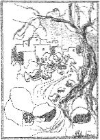
Our various parties over the years have made many ascents of wee Moulay Ali, perhaps the first foreign ascent and certainly the first in winter. We even beat Ali in reaching the summit, which towers over his natal village of Amghlou. Peyron is either brief or dismissive of what lies south of these peaks, perhaps because his natural way in was from the north (Seksawa) and perhaps also influenced by the granite bareness of Souk Tnine Tigouga. But the country is one of the finest we’ve found and return to annually with our approach from Taroudant. The journey always unreels bright variety: from date palms and prickly pear through argan forests and orange groves to almond and walnut spreads, to remnant oak forest and a barren mountain world of granite and marble—one of the favoured places of the earth. Wee Moulay Ali dominates views looking up the southern valleys and, not surprisingly, has gathered several stories and legends, including one concerning Portuguese treasure. Anything with foreign, old or mysterious connections is apt to be labelled Portuguese.
A girl herding her flock in the Medlawa came on a cave on the lower slopes of Moulay Ali and, summoning up courage, went in. There she discovered unaccountable treasure and laughingly began to fill every corner of her clothes with gold. In the end she even took the baby from her back and laid him on the ground so she could use the carrying cloth as a sack to bear off more treasure. She then ran down to the family home and poured out the treasure onto the kitchen floor. Unladen, she ran back for more and to rejoin her flock and her baby brother. However, she could not find the cave, and neither cave nor baby has ever been seen since. The girl went crazy with grief and wandered the hills, weeping and wailing for many weeks until she, too, vanished. They say if you go on the slopes of Moulay Ali at night you can still hear her cries echoing among the granite crags. Some locals quite believe there is a treasure on Moulay Ali and justify this by demanding to know how, otherwise, just one or two families in the Medlawa are so rich and prosperous. Treasure obviously occupies their thoughts for Ali told another legend of wishful thinking.
A lost traveller stumbled on a cave in the desert and crawled in to escape the killing heat. Following the passage, he came on a lost city where the streets were lined with gold and the gardens akin to paradise. Stumbling out again he continued on his journey but took care to drop white pebbles along his way and, miraculously, soon came to a well and was saved. He told nobody of his discovery but gathered together his best friends and relatives and they set out on the marked route for the cave and the prospect of a caliph’s wealth. But the djinnoun of the desert were displeased and had moved the marking white pebbles and the party was led far into the sands of the Sahara where their bones no doubt lie until this day for no one ever saw them again.
Although I set off late from the Guenfis meadows, the grass crackled underfoot from a silvering of frost. I headed west, which was quite a pull up to escape our frost hollow, and undulated over a dip to reach a larger meadow marked by a French concrete building. This faces the Tizi n’ Tifighelt pass up from Tigouga, with its scores of hairpin bends. There is no short or easy way onto the Tichka Plateau. The meadows by the ruins are often yellow with daffodils and the Nfis flows with chuckling humour. We’d once found it almost impossible to lay down sleeping bags without crushing the flowers. A spiralling of choughs speckled the blue, too high to be heard.
Beyond the French ruins I turned up a side valley and over the neck behind a hump of hill that fills the centre of the plateau then dropped again before the final run to the infant Oued Nfis below the Tizi n’ Targa. The last bit of valley was lined with purple orchids. This switchback route along the northern slopes is less demanding and quicker than following the meandering oued with minor gorges and other hindrances. I arrived at 1000, and not long after my telephoto lens picked up figures on top of Awlim. This peak should not be mistaken for the finer peak of that name further west, one of the horns (Tinergwet the other) that are clearly seen from the rooftops of Taroudant. The mules arrived soon after and were turned loose on the lush strip of grass where we’d camp. They soon ate to repletion and lay sprawled for much of the day. We were advised not to sit downwind of the bloated beasts!
My rest day was spent sorting and parcelling food, going over the plan of what lay ahead and, when the others returned, ensuring that all was agreeable. As Ali baked bread I did much of the supper preparations, noting that we were tight on food—the planned Aziz supply team simply had to turn up. We made do with mushroom soup, curry and rice, apricots and custard, coffee and cake—it was probably not a good thing to be downwind of any of us that night.
A pack of yowling jackals traversed over to the tizi and down beyond. They had followed the line of an abandoned seguia from the stream where it tumbled down from higher feeders by some tiered azibs. Above us lay the remains of another French-built building, part of a gîte for visitors. Nothing much survived except the arched doorways. Ali’s fragile old mother had danced before a colonel’s party there when she was a girl. One of our Flowers gang once pitched in the ruins to break the strength of a gale. Another Hosain, who’d been chef to Yemeni princes, still managed to cook a classy supper and we had a great singsong round the fire with pots and pans, basins and water carriers used as instruments and everyone in djellabas or duvets and balaclavas. The dusty goat and sheep droppings blew everywhere in and out of the tents. The gardeners in the party rather wished they could have bagged and sold the product.
I slept well since the planning was done and it would only be tested in the doing. We had called up additional help from Ali’s boss Aziz in order to get established at the Tizi Oumzra, the first saddle on the ridge west of the plateau, where we’d have two nights and a crack at the northern outlier of ‘big’ Moulay Ali. There would likely be three bivouacs while westing along the ‘Ridge of a Hundred Peaks’ before regrouping with Hosain at the village of Arg, he having taken Taza and Tamri round by a huge southern diversion. The hours poring over maps and gleaning every piece of information paid off as we kept to that final schedule. It was the highlight of the whole GTAM: a classic multi-day ridge, a Cuillin with sun.
We’d had several attempts over the years to try and ski on the Tichka Plateau. One sortie came to a halt below village level on the south as heavy snowfall meant the camionette could not even reach Tigouga. Another approaching up the Nfis found too little snow on the plateau and, a year after GTAM, Taza and Hosain between them scuppered another effort. With Ali, Hosain, Charles and Taza we were almost the complete GTAM team again. We came up the southern Medlawa to Tagmout and pushed on only to find the gorge below the Tizi n’ Targa corrie was full of concrete-hard avalanche snow. Without a proper recce, Hosain drove Taza on and they ended on slabs. Taza scrabbled horribly and finally went over backwards to cartwheel down the slope, a horrible yet fascinating sight. She stopped on the rocks in a jumble of rucksacks, skis and panniers with loaves of bread and bottles of Sidi Ali rolling on below. Hosain had been stunned by a crack from Taza’s head, but the mule miraculously only had one wound: a fist sized hole on a thigh. I squeezed most of a tube of Savlon onto this, used suture tapes and tried to bandage—but a mule’s girth takes a lot of bandage! Taza carried on grazing as if nothing had happened, and Hosain was all for continuing. The skis were all in order and the only item of gear damaged was a kettle, which had been completely flattened. Maybe the site was jinxed. I’ve only seen three mule accidents in all my Alas years and it was almost on the same spot that a mule took a tumble while carrying camp for the BBC Wilderness Walks filming—right in front of the camera.
We had a rare static day at our GTAM site at the head of the Tichka Plateau. Tucked in below the Tizi n’ Targa it would be more correct to say ‘seeming head of’ for the infant oued came down over some flowery crags from higher meadows to the north. It is an area with the huge restfulness of an unplanned garden filling a secretive basin. There is a rim of peaks over the 3000 m height, this circling array climaxing in Imaradene (Tassiwt). From checking on past visits I’d marked the start of our flanking way westwards, breaking out of that high world onto the start of the long ridge westwards. Graeme, being new to the area, went off for Imaradene (3351 m), the highest point at that end of the plateau. Ali took old Mohammed and young Omar down to the Medlawa to visit family and friends in his natal village. I sat in the shadow of a crag to add a chapter to my book, working until the shadow’s chill drove me down for a coffee. Before I could drink the beverage the support squad arrived: two mules, four adults and two lively boys, an influx that set the camp buzzing.
With the numbers we had to eat in shifts: a tagine for the arrivals, one for us at dusk and a chicken (live on arrival) for a late feast. We gorged on melons and fresh vegetables. In Taroudant you don’t just buy an orange: it is a Navel, or Valencia, a Maroc Late, or Washington Sangria. Our arrangement with Aziz had been for three porters and these had come—but so had he (on a mule) along with his boys simply for a bit of a jolly at our expense. Charles and I were not pleased, even less so when Aziz installed himself in Ali’s tent (Ali still absent), and had the cheek to ask me if he could have it after GTAM. “Very nice tent. You give it me, eh Hamish?” Charles spluttered but we kept quiet somehow. This occasion was to be our final dealings with Aziz who had let us (and many others) down too often.
Thanks to several Europeans, myself included, Aziz had been set up in Taroudant as Tigouga Adventures, the only trekking company in the Western Atlas. He had every chance to create a good business but would not play straight and his crooked dealings saw very few groups employing him a second time. Ali had been taken on to help and did most of the fieldwork (at which he is brilliant). However, while walking across the Tichka Plateau about a year before GTAM, he had burst into tears explaining he was being treated like a slave as Aziz never paid him. Aziz had also taken all the clothing and equipment that had been given to Ali. The last straw was when Aziz double-booked us for a bigger, more profitable group, and denied all knowledge of our booking. The Rough Guide, which had listed his services, was receiving vitriolic mail, all very embarrassing as I’d been involved. However, with GTAM looming we hadn’t much option but to use him to send up the support we needed for the ridge traverse.
At supper, Charles hissed: “Do you see he’s wearing Ali’s sandals?” He’d taken them while Ali was in Taroudant during our brief break in Spain. After GTAM, Ali was supposed to keep Tamri (and Hosain keep Taza) but Aziz somehow forced Ali to sell her. After GTAM, Ali didn’t go back to Aziz but that meant he was only left with what he stood in—all his other possessions (ice axe, crampons, winter sleeping bag etc.) were lost. However, a decade later, Ali is a highly regarded leader, married with two delightful boys. Aziz is in gaol.
During supper a shepherd boy arrived with his hundred sheep and goats, shook hands all round and sat to share mint tea and oatcakes with us. After a look at the sun’s position and a glance at his watch he ordered his flock (by voice alone) to begin making for the col. Ten minutes later he shook hands all round once more and strode off with effortless gait. Their azib lay 200 m down on the southern Medlawa side of the tizi. When we went up to look at the afterglow, a pillar of smoke wavered up from his lonely bivvy site and we bore the scent of it back with us to our draughty meadow strip. The Milky Way curdled across the sky and Polaris stood over the crags marking the start of the final effort, the crux of the whole GTAM: unknown ground with, no doubt, some interesting problems.
We had made a concentrated weight-cutting exercise to reduce our gear to basic necessities. There’s nothing like a tough carry to discover how much one can do without. Perhaps we should be less lumbered anyway. I quoted Socrates, who, viewing the souk at Athens, commented, ‘What a lot of things I don’t need to have’. After a lifetime of backpacking I have this down to a fine art with a Basic List at the back of my diary from which I work. Equally important, of course, is not to forget essentials.
Our very first (winter) visit to the Tichka Plateau had given us a glimpse of what appeared to be a magnificent Alpine-like ridge running westwards from the upper end of the Tichka Plateau. I had thought of Alexander Pope’s words then, but they had more relevance now!
‘...We tremble to survey
The growing labours of the lengthening way;
Th’ increasing prospect tires our wond’ring eyes—
Hills peep o’er hills, and Alps on Alps arise!’
Reading had produced little information. Peyron stated: ‘To date only partial bits of this ridge have been followed’, which was carrot enough. He only touched on the odd peak or pass. We found a photograph of Awlim’s east face in a 1929 La Montagne mostly given over to Louis Neltner whose first ascents included Awlim and Tinergwet in 1927. There’s a reasonable outline map though, oddly, the Tichka Plateau doesn’t exist. The Plateau may not have had European visitors until the Polish 1934 visit, when they climbed Imaradene from the north and added Big Moulay Ali, Tinergwet and Awlim (Aoulime) again.
We dubbed the crest the ‘Ridge of a Hundred Peaks’ which was poetic licence, there only being about a dozen distinct peaks and as many tops to traverse. The ridge, however, with the allotted three bivouacs, would be quite enough for the old men. I’d done a careful graph-like diagram in the Route Book of all the ups and downs and was pleased that we did very much as expected. With minimum food in our packs there was no room for error.
Controlled chaos might be a good description of our breakfast. With 14 people and 6 mules packing and going, Hosain’s “Bonne chance” in our ears, the humans set off up to the azibs and crags with one chosen mule doing a right flanker to keep on easy ground. When the mule appeared in the upper basin we filled all the water containers, loaded the mule and wended up to the crest where a cast or two soon pinpointed our way off. We (Charles, Tony, Graeme, Ali and I) carried our own packs with additional fresh food for two nights while the three locals had to hump rucksack-filling water containers, this supply allowing us two bivouacs on the first pass, the Tizi Oumzra, from which we were determined to have a crack at big Moulay Ali before starting westwards. Aziz and his boys simply saw us off, having contributed nothing.
We took a sad farewell of the Imlil pair of old Mohammed and young Omar, the latter a great favourite with everyone, his bubbling enthusiasm making him a sort of juvenile Hosain. Hosain alone had not come up to set us on our way, but stayed to strike camp and head off for the long circuit to Arg. He was walking down the Medlawa, all the way to Zawyat Tafilelt, home to Imoulas, then over the demanding Tizi Ifguig to descend past Jbel Tichka where he’d hopefully find a house for us all to stay in at Arg. Walking that route would have taken us four or five days: he took two! The Imlil mules reckoned to be home in five days. There were hugs all round and we went off on our different routes.
Our way led down steep loose ground with a couple of craggy gullies to scramble across, awkward with a hefty pack and a five litre container of water in one hand. Beyond that there was just a long traverse across steep slopes which largely consisted of prickly bushes of many kinds. The helpers beat us to the Tizi Oumzra and the local shepherds homed in on this event with understandable curiosity. Ali knew the senior shepherd, enough to arrange that he’d guard our gear on the following day so we could all go off for Moulay Ali, a relief to me at least, as nobody had volunteered the watchman’s role. The water carriers soon left and, after a brew, Charles, Tony and Graeme went off to recce the ridge out to Moulay Ali, one of the last unclimbed problems in the Atlas.
Ali had a long talk with the oldest shepherd, the pair of them perched on the crest of the saddle like a pair of gnomes. The man had a face as weathered as a walnut but was lean and supple for all his years, with the presence of a monarch. In those hills, I reckon he was. The central peak on the ridge out to Moulay Ali had not been visited by shepherds, they knew no route along the crest so that was that as far as I was concerned (certainly for GTAM). We had to husband ourselves and not go to excess lengths at that stage even if we had approached Moulay Ali with the hopes of a terrier awaiting the postman.
I rigged a shelter against the sun and sprawled in the shade to think of my book instead of Moulay Ali. There was a tempering breeze on the south so cooking had to be done on the other more sheltered flank. I went over all the food logistics again and prepared the vegetables for supper. A beetle in a vivid orange and green away-strip tried to climb into the pot. Shepherds kept appearing and I’d hear, then see, flocks picking lines across the most unlikely places. When two flocks became mixed, one of the strays was lifted by its hind legs and wheelbarrow-ed back to its mates. Graeme was back first, traversing across the nasty slopes from the first col on the side ridge. Tony and Charles weren’t back till 1700 and were somewhat weary as a result. They had gone down to the first col and then tried for the Central peak only to run up against the vertical wall of a gap which dropped hundreds of metres down the flank. In a sort of mockery of our efforts the sun set down that first dip on the ridge, a molten globe. It flared and died, then the sky repainted itself over and over in tones of red, mauve and gold.
Ali had been up Big (Ras) Moulay Ali quite a few times previously, but by an alternative route. From the top northwest corner of the upper Tichka plateau area, there is a gap below the peak of Tamguerd Lma’dene (3256 m) which gives a horrendous descent before the ascent of Moulay Ali. He’d had at least one epic when a companion became exhausted. Charles and I had dropped down from the Tizi Oumzra on a previous recce and had failed to find the Moulay Ali route from Ali’s description though we tried one or two interesting lines. It was too late in the day for any more, but it had proved a useful recce and showed water sources and the easy zigzag of an old mining track from the Tizi Oumzra. The normal way to Moulay Ali is from the north, using a high valley to the northeast, then up the West Ridge. (Ali and an Imlil guide would ultimately make the first Moulay Ali climb from the south, traversing the ridge and Central peak which had defeated us on GTAM.)
Our day began with a considerable loss of height and we tried to minimise this with a shortcut but its technicalities lost us any time and effort saved. After the initial zigzags we took a traversing fork left which led to a gully and a one-time adit. We had to pick our way down the spur above the gully, a long, slow choice which simply added to our store of negative information. Once far enough down, we had to make a long, rising ascent over rubbishy slopes before arriving at a slightly greener area. We were pushed over loose, grit-covered slabs to a pinnacled ridge, a surface to keep the nerves tingling. The arete crossed, we angled up to a short chimney, where Graeme wondered how goats could deal with such a spot. I told him how I’d seen goats descend a much bigger chimney by simply bouncing off the opposing walls in turn, each time twisting so as to hit the wall with all feet together. A rising line followed where the shepherds had wedged stones to help access, an exposed spot with a gully dropping below us right to the bottom. We wove in and out, rising all the while, crossing necks of small walls or crests. We followed the easiest options to suddenly come on the tizi of the linking ridge, between the Central, unclimbed peak and Moulay Ali itself.
A clean buttress of yellow rock formed a shady nook where a platform had been built overlooking the tizi. The Central Summit was a long way beyond that as we could see on the profile photographs I’d brought with us. We had a good rest and studied the route of the main crest westwards for the following day, the huge valley beyond Moulay Ali dominated by Mtdadene. The lowest point on the crest had a comment from Peyron saying it was a bad mule crossing but Ali and I were instantly dreaming up possible circular treks that could include the valley. What a view there would be of Moulay Ali! Ali is quite unique among the Berber guides I know in maintaining a passion for new exploration. On any summit we automatically cast practical eyes on our surroundings and discuss other possible ploys. (Another active decade passed before those particular dreams became reality.)
As Moulay Ali’s summit was savagely steep, the rocks many-hued or shiny with mica, it was a delight. There were plenty of climbing routes but it also yielded excellent rock for scrambling, rock which seemed to come in every colour and texture. When we reached the summit there was no Ali. But then his voice came from below my feet: he was hiding in a man-made cubby-hole. The whole hollow summit looked for all the world like a ruined broch with the tumbled remains of man-made structures—old shrines presumably. Tall mulleins and buttercup-bright wallflower grew on the ruins and Ali lit a skeletal bush to send a smoke signal to the shepherd on the Tizi Oumzra. 1st July seemed a suitable date. We had a lazy lunch but I kept wandering round that high rim just trying to absorb the wrap-around view. There was a lifetime of exploring in sight. We had a tube of cheese and chives with oatcakes and I recalled the amused astonishment that squeezing out cheese had once caused among the local women we met on the col behind the other ‘wee’ Moulay Ali. The girls tried the cheese and liked it fine, producing bread and walnuts in return.
We descended faster by some scree and followed ledges along and down to the tizi where we’d left surplus water. We drank plenty during the day so weren’t dehydrated. Down in the valley we cut over to the sleepy stream where I washed my stockings: they were dry when we set off half an hour later. Charles insisted on carrying water up from there, a tedious task. I followed up the stream and filled my Sigg bottle later before enjoying plenty of scrambling onwards. I kept meeting a boy in a blue gandoura who was obviously fascinated by strangers. When I came in to camp he was sitting on the crest. He couldn’t have been more than twelve, yet moved on the harsh landscape with the ease of drifting smoke. The older shepherds talked non-stop while we brewed and rested and I noted half a box of sugar had been used that day. Berbers have a sweet tooth. The old men look as if they, literally, only have a tooth each. Tinned turkey and fresh vegetables, after soups I’d bought in Gibraltar, made a good meal. The shepherds slowly drifted off as the sun’s rays wrapped up Moulay Ali and posted the hills into dark. We had enjoyed what I call ‘a day of glory given’.
Beauty, for me, is not just seen in inarticulate nature. Much as I love the pristine snows of the arctic north the fact that there is no human being within 200 miles makes me sad rather than glad. Humans, willy-nilly, are part of this terrestrial sphere. Ireland’s hills are richer than the Scottish Highlands simply because they are still peopled: from a wild, high ridge one can catch a whiff of turf reek, hear children’s laughter or see friendly white homes. It is the same in the Atlas. The ancient shepherd on the Tizi Oumzra was a figure of majesty to me, the boy a prince of the peaks. They belonged there as naturally as the scrub or the rufous slices of rock. Their nobility and graciousness is as natural as the sun. In contrast, we were clumsy, overburdened intruders.
This is not some naïve view of Rousseau’s noble savage, nor should they be so viewed. Years ago I sat on a rooftop at Aroumd with an unlovely group of Americans. The fresh spring air brightened the bursts of blossom and we could see the massive peak of Toubkal in the background. One of them turned to me said something like, “Say Hamish do you think they understand scenery? Do they appreciate views?” My reply was wasted sarcasm, “Oh I think so. They sang its praises a thousand years before America was discovered”. I still gasp at the arrogance of the question. Our host, to them, was just a peasant, a sort of vacuous being—quite beyond their understanding. But for years after their visit I’d be asked, with a smile, “Any Americans this year, Hamish?” The ‘ignorant’ peasant had the sharper eye for the heart’s character. The Americans pitied the Berber out of real ignorance, to the Berber the brash visitors were simply as transient as autumn wasps and as influential. “They go away. I can look at Toubkal tomorrow.” We flabby westerners (flabby of flesh, spirit and mind) need to learn to walk humbly in the earth except it is probably too late. We have trampled too hard on too many and the cruel footwear of our west’s walking tramples on the happier, barefoot world.
Besides the shepherds on the tizi there had been other human elements: an explosion from the mines to the north (on Jbel Tabgourt) and aircraft flying overhead (to and from Agadir one assumes) so even this ‘remote’ spot was only just that. Whereas so many wild areas of the world are simply abandoned these days, in the Atlas new cultivation and building is seen everywhere, pistes are replacing ancient mule tracks, electricity has arrived and mines obtrude - an impressive progress under difficult conditions.
We were up for another cruel, draughty dawn and packing up was a last-minute job. I needed to wear clothes for warmth, but also wanted them as padding in the rucksack against my back so had all the small but heavy items to pack, such as Gas cartouches and tins of meat. We left the two big water cans for the shepherd as a thank you, along with some food we felt we could do without as we were fighting every ounce of the way. We would eat simply but adequately to fuel our long days’ efforts, would drink a lot, which is more important, and had Therm-A-Rests to ensure good sleep. We were confident of managing a Cuillin Ridge or three over the following few days. Water would be our main worry but we had Ali, with his inborn skill no outsider could ever match, to sniff out that essential. (Not literally, as Ali had lost his sense of smell as a youth).
I’ll try and avoid a catalogue of largely unpronounceable names but at the same time I would like to provide a helpful and practical record for those who will repeat what was an excellent traverse, quite apart from being the climax of GTAM. We had the fun (which I now spoil) of setting off into the relatively unknown with a fair chance of technical difficulties (and lack of water) throwing our plans awry. We’d done all we could in the planning stage, however, and we had to dance to the puppet strings of expectation. We’d applied Thoreau’s maxim: ‘Simplify, simplify’, to an extreme.
The first bump, Asziud, is where the untraversed ridge out to Big Moulay Ali breaks off and we outflanked this oft-visited top to tackle the first problem that had been a worry for years: Aqelmoun (3251 m). It has a shining white marble summit with the strata stood on end, an oddity that can be seen from far off down the northern Medlawa valley. The peak looked potentially difficult, and the north side was sheer cliffs. There was an intermediate peak first and the gap between is lost on the maps as ‘Aqelmoun’ is printed over it. We made a tortuous way down to the foot of the marble ribs and found all the difficulties could be outflanked on the south, which was immensely cheering not only for Aqelmoun but for anything else that might bar the way. At the highest flanking point we left our packs at a visible spot and enjoyed scrambling up the gleaming white rock, back along the crest to the highest point of Aqelmoun. We could see Charles still coming up so helpfully yelled down what we’d done only to receive a voluble response. He was not enjoying carrying a half-filled water carrier, sloshing about—as if any of us were!
We faced a long descending ridge, either followed on the crest or flanked but then found a deep gap running down to the south. This looked easy but was all jagged edges needing care. We would only drop below the 3000 m mark twice on the ‘Ridge of a Hundred Peaks’ and this long tizi of Imdlawn was 2971 m. Ali had raced on ahead and had a brew waiting for us in a nook out of the sun. ‘Racing’ is misleading; Ali doesn’t need to race to leave us far behind, he is just super-fit and utterly at home in the hills, and drifts along with the ease of waves heading for the shore.
The Imdlawn pass is rarely used as there is no call to take mules over these days; traders travel in the lower valleys by camionette. The vast valley of Aderdour lay to the north, and heading south would take us to Fiyil and Tagmout. Fiyil and some other villages thereabouts still have some roofs that are pitched and thatched rather than flat: quite an oddity. Sadly, as older buildings fall down from neglect and families re-house themselves more comfortably, the pitched roofs are gradually disappearing.
The slope reared up to Adrar n’ Fiyil (3114 m), which lay out on a spur slightly to the south covered in a foul, loose scree. We gladly left the rucksacks while claiming the summit, the second of two bumps naturally. Continuing, we crossed a rubbly bump and then a green-tinted one that had a strange flat area hidden in it. The map gave Tizi Igdal but we saw no indication of any pass, the north still being Moulay Ali’s large basin, the south draining as the Agounsane valley which joins the main valley well below Tagmout. We travelled steadily southwest all day. Ali had a brew ready again and we lunched on the last of our bread and Kiri, the processed cheese, wrapped in squares rather than the wedges of La Vache Qui Rit.
Looming ahead was the huge bulk of Mtdadene (3366 m), or ‘Tentaden’ as a shepherd pronounced it. He confirmed we could outflank the peak and so avoid climbing up and down with packs on our backs. From Mtdadene a ridge curved northwards as the bounding wall of the great northern corrie of Aderdour, with a fine summit of jagged Aguer Skawn (3255 m) nicely balancing Moulay Ali. We duly crossed the high, complex east face to reach Mtdadene’s southwest ridge which ran down to the major Tizi n’ Tizzirt (2816 m) below which we hoped a small valley would have a stream for our overnight stop. As there were many grazing flocks we could not take the chance of leaving gear unattended so we sat down to relax while Ali nipped up Mtdadene and back in an annoyingly fast time.
The relaxing was very pleasant, although studying the route ahead was rather sobering. Our view from the top of Mtdadene was thrilling as always when completely new. North, we could see a sinuous new piste line following a long crest for Afensou and the mines. All the drainage went to the last major vehicular pass we’d cross, the Marrakech–Agadir highway. The warm palette of the landscape vanished to hazy horizons. Over the Tizi n’ Tizzirt lay our next peak Wanourt off on a south spur, with a huge rock face on the flank and the crest beyond ending on graceful Azegza, which had long caught our eye as a desirable objective, dominating the foothills as it does. (Climbed on the final Christmas of the Millennium, Azegza proved a happy viewpoint to the ‘Ridge of a Hundred Peaks’.)
Mtdadene had a shelter on the top, perhaps an old shrine and Ali had scratched our initials on a slab, laughing gently at our slowness. We straggled down again, following our own lines and, on reaching Ali, he shot off to try and find water in that small valley flanking the crest down to the col. He went a long way and we had to follow with an amount of uncertainty. Charles, who likes things to be clear, was not too happy. The water Ali found was a mere trickle, but by the cunning positioning of a leaf supported by a twig he managed to turn this into an effective spout. We had to do considerable digging in screes and levelling off to create bed spots and the stoves had to be set in stone-built nooks to protect them from a sneaky wind. Brews, soup, meat with pasta and dried veg, dried fruit, drinks and biscuits would become our standard lightweight menu. I forced myself to write my log of the day before sleeping, using the last vivid horizontal rays that lit up the flank opposite like fire: ‘Dawn was ours, And sunset and all the colours of the earth’. Snuggling down under the cold growth of stars I slept well enough to be quite peeved at finding it was time to rise again. Good sleeping goes with good living; when one can no longer sleep then the living is in questionable disarray.
The Tizi n’ Tizzirt (2816 m) was the lowest point of the whole ridge traverse and had a good if tortuous mule track crossing it, though now probably most used for grazing access to the higher slopes. We traversed along and up to the tizi then enjoyed the ascent beyond which was largely a white strata staircase, the geological agony that set such strata on end often being a contribution to our ease. I finally traversed across and left my rucksack before walking up to the highest point where the ridge curved out to Wanourt (3182 m). This peak lay on a contorted ridge to the south with a succession of false tops. On the left, there was a magnificent slabby rock face (still waiting climbers) while on the right there was a hollow with a brook treading through, akin to the meadows on the Tichka Plateau. We toyed with the exposure as we worked along to the summit, then just sat and gazed.
The whole Sous was covered in cloud, with tentative fingers of white creeping up the valleys to disperse like breath on a frosty morning. Out of this rose endless spurs of hill, in every shade of blue from duck egg to deepest ultramarine. One always associates blue hills with the Highlands where the dampness is assumed to be contributory yet there in the harsh, hot, dry south, the blues were the boldest of all. It was like the view from Jbel Rhat but biting deeper, morning clarity as against evening dissipation. Rhat now seemed a long way back. We could see Jbel Siroua on the margin of the visible—and it had been seen from Rhat. We were now on the last horizon assault, the ultimate momentum was driving us forward.
Continuing along the main spine we crossed a cleft bump at 3175 m, then the Tizi Igherm at 3166 m (with edge-up strata of charcoal-dark shaly rock). A hot pull up gained Tit Oulli (Willi) (3247 m) which sounded a bit Gilbert and Sullivan-ish, but soon became renamed Shit Willy. Redemption lay in a summit brew prepared by agile Ali but the way ahead was a crocodile-cruel mess of rock and scree with deep gashes and no alternatives. The easiest and safest way was to utilise all the exposed dark, shiny rock and scramble down to a deep-cut tizi with large cliffs that guarded the south for the rest of the day.
A surprisingly pleasant ascent took us up the double-headed Adrar Oulzguim (3235 m). All the southward drainage led to Hosain’s home Imoulas valley so we felt we were progressing. Toubkal and the Siroua were becoming very small features. The valley down to Imoulas is big and fertile where irrigated; an unexpected verdure for a south-facing valley. There was a thrill, being perched alone on that rugged place. One can see why Christ was led high up into the mountains to be tempted. While part of me was sad at the prospect of finishing, that final flourish, inescapably there, fully occupied the mind. The thrill grew day by day and I looked on the views like a starved man outside a pâtisserie. Mallory certainly knew that greed for adventure, finding in it ‘sheer joy’.
Jagged edges led us down off Oulzguim. I was startled first by a falling stone then by choughs exploding like shrapnel just a few metres away. We dropped to traverse lower, easier ground before cutting back onto crags and the corrie headwall of scree. We’d last seen Ali at about the lowest point (Tizi n’ Tamjlocht, 3034 m) and were wondering where he’d gone when he came up from the north side with a replenished container of water. We promptly declared a lunch break. Ali is an enviable mix of gazelle and otter; while we were still coming along he’d descended and re-ascended 300 m to find water. He wasn’t even puffed and gave us another folk saying, what we called Ali-isms, ‘A camel is dear at a penny if you do not need a camel. A cup of water is cheap at a thousand gold pieces if dying of thirst’. We perched on rocks on the lip of the now huge northern cliffs—not the place to drop anything—and revelled in the eyrie-like exposure. From miles below us drifted up the piping voices of young shepherds. Choughs tumbled in the blue.
We then hid all the water we carried (as the containers would be treasure to any shepherd boy) and dropped down the northern Tamjlocht corrie to the water level. The village to the north named that part of the crest, but not those to the south where access was barred. The time was 1445 and looking ahead there seemed little chance of finding water higher so we had to make the most of what was available. We built a stone shelter for the stoves, soaked vegetables and Tony then used his forestry background to produce a brew on a scrub-fed fire. Gleaning burnable material was a useful occupation. The runnel was small but the line down the hill was marked by thistles. Ali had shown us to beware of thistle lines, usually they don’t have water and one could lose hundreds of metres on fools’ errands. My ability as a water-finder is not bad but Ali’s is on a unattainable level, the craft of a man’s affinity with this tough natural world. Later Graeme did a good job of fire-nursing so we had tea, stewed apples, and soup for the main course all prepared without using any of our gas supplies.
From a crag across our steep green slope, pixie-like figures watched us by the hour out of a halo of burning sun. None of us were very good at just doing nothing and we began supper earlier than necessary and set off afterwards, sooner than was best for digestion, a steady stomp up to the crest. Eating down at the water source allowed us to use as much of that diamond-precious commodity as we liked. What we carried up thereafter (or had left at the tizi) would see us through the next day with no concern over supplies. The following night’s supper supply of water was assured assuming we kept to schedule; there were still several surmises and surprises to unwrap.
The white sun may have glissaded towards the horizon but we still had a hard, hot haul back up to the ridge. I went slow and steady, always the tortoise uphill, and arrived to find Ali had found all the water containers we’d so carefully hidden. My log records: ‘Quite good up to the initial 3153 m top (we named it Birkwane East) and then became more jagged in character. Excellent fun but we were all tiring rapidly (just when accidents happen) and the sun, losing its bid to stay up any longer, had been packed-off to bed, not before setting the spires of Atlas on fire.’ Just below the creamy-coloured rocks of the summit of Adrar n’ Birkwane (3173 m) we called a halt upon finding a good area for clearing bivvy spots. I put on the tea and we had two mugs and a packet of Golden each (a plain but much-liked biscuit). Awlim was dramatic in the last flood of red light which also lit every top way back to the triangle of Ras Moulay Ali, small but still prominent. For an easy day as had been suggested at breakfast, we’d done not too badly. My notes continued: ‘I set two bushes alight to dry off sweaty socks and, into bed, ate hoarded oakcakes and honey and now write up my log by torch light in the hour of stars wedged between dusk and moonwash. Shooting stars (one almost comet-like), a satellite and a UFO that blinks every ten seconds as it slowly travels from horizon to horizon. Wouldn’t be anywhere else for all the worlds. Here is the deep magic one finds in the tidal stillness of high places.’
I woke with a start to find Ali had already put on water in a shelter he’d made of stone slabs, protecting the stove from a cold, seeping wind that had us dressed in all spare clothing. An efficient breakfast, I noted, just tea and muesli although plenty of each; it could hardly be otherwise. A ten minute scramble took us, by a variety of personal lines, to the knife-edge summit of Adrar n’ Birkwane which, with serious scrambling approaches from any direction, must make it one of the rarer peaks to bag even if so overshadowed by Awlim, now near and awesome. We had to take turns to be on top as there wasn’t room for more than one at a time on the pinnacle.
The route on to the waterlessTizi Oumassa before Awlim was hedgehog-like in quality. It gave a full hour’s scrambling with our morning shadows dancing ahead of us. Originally we’d hoped to sleep on the col, maybe finding water close by so we were thankful how things had worked out: our water bottles were full and there was enough for a brew.
Most of the information I’d found on that east side of Awlim dated back to French or Polish expeditions of the late 20s and, Peyron apart, I doubt if many eyes since have seen what so impressed those early visitors. Awlim is all rock, the east face split by the Couloir en Y. Wrapped round to the south are cliffs, steep or sheer, of beautiful red tints—all untouched. Descriptions of the Y-gully made it sound tricky, but it was fairly obvious and technically easy. Les Flammes de Pierre and such names had been given to recognisable features. A series of jagged ledges led to La serpent verte and more wandering about led to the main ascent on the edge of (or briefly, in) the big Y Gully, which had a belly button of old snow. Both the tizi and the peak held a diverse and abundant alpine flora. We revelled in the ascent and tumbled out onto a crest by the north summit. As the south summit was marginally higher, we traversed and scrambled over to find a superlative viewpoint with the diminuendo of blues we’d had on Wanourt, the sort of view that makes one whisper. To the west, however, there was only Tinergwet bulking large. We were running out of Atlas.
Awlim was a third-time-lucky for me and a second for Charles. Charles, Keith and I had once succeeded with Tinergwet but then (wisely I think) left Awlim alone as we were very tired after a long ascent from the south. The following time, with an Over the Hill Club (OHC) group, we camped higher up the valley and were on the col between the peaks for dawn. However, there was a lot of snow about which we weren’t equipped for, and the intensely cold wind was biting through all the clothes we piled on. We tried, but retreated. Only Ali, with one lad who’d done Tinergwet too, was able to add Awlim. Louis Neltner, the lucky geologist, made the first ascent of Awlim (Aoulime) in 1927 and was back a year later to ascend Awlim again, by the route from the east. He also made the first ascent of Ras Moulay Ali in 1928, and the actual summit of Jbel Siroua. The 20s was the Golden Age of Atlas exploration.
After some summit photographs (Awlim demanded the formalities) Ali shot off to make tea on the wide saddle of the Tizi n’ Tajelt (3231 m) leading to Jbel Tinergwet. Ali had been up several times and, with his fast movement on rock, he’d disappeared by the time we’d even set off—and discovered the best scrambling ridge of the whole trip. There was even a Thearlaich—Dubh Gap! Lower, it was possible to outflank much of the crest on the north side. One by one we joined Ali’s underground café.
He had discovered a cave below a large boulder, obviously used by shepherds, and made tea there out of the sun and the breeze. I peeled off sweaty stockings and dried them on the hot whaleback of rock where we sat. I was sad with the sweet sorrow of a completed challenge for Jbel Tinergwet ahead, fine though it was, would be our last major summit of GTAM. At 3551 m metres it rises as a curving wave above the broad tizi and Charles and I recalled our first time there when the peak flared in colours of sunrise flames. I’d compared its shape to the Sydney Opera House though the mountain is a bit more disciplined. With the OHC gang the dawn colours had remained muted but, like a paper lantern, the globe of a full moon hung over the summit. Now Tinergwet stood in stark day clarity, a cut-out shape stuck on blue wallpaper.
The slope swells up from the tizi and, looking back, the figures of the others appeared as tiny dots, like ants on a trail. Even on the ultimate ascent the scale still shook me but I smiled as before long I would reverse the process and gaze up some minor Scottish hill and see an Atlas giant and make crazy estimates of times and distances. There’s a story of an alpine guide doing this in Edinburgh where he was shown a snowy Arthur’s Seat (all of 251 m) and asked how long he thought it would take to climb. The guide considered and then voiced doubts if it could be done in a day.
The going on Tinergwet became rougher and, to use the lie of the dislocated strata, we bore well to the left, almost to the far ridge where Ali paused on a shelf of pink rock so we could lunch: tube cheese and oatcakes. There was no spare water for brewing and we rationed our own drinking supplies. (The bivvy planned for that night was ‘anywhere past Tinergwet’.) A last steep tilt of rock and looseness and the angle eased and we stood by the tumbled remains of the trig point. We so far forgot ourselves as to shake hands on it. Ali hugged me with glittering eyes. GTAM had been his dream as much as ours and perhaps meant even more for he had made a mountain journey beyond the imaginings of even the best of the guides. That was Ali: the rare talent of being both cerebral as well as physical and if that meant moments of pain and suffering it also gave the visions and the wilder wings of glorious success which the average Toubkal plodder would never know.
For much of that day (and the day before) we had in sight the new piste which wove a line along the major but lower east–west crest from Jbel Tabgourt to the north of us. Often the dome-like swellings of a crest are easier for creating new roads than the deep-cut cliffs and gorges of the valley bottoms. That was a new way in to the Peyron-lauded Seksawa (his northern equivalent of our opposing Medlawa) and I’m sure a part of him is dismayed at the intrusion. Letting our eyes follow that wiggling line westwards, we were aware of the track vanishing into the maroon-hazed depths of the huge trench where the Marrakech—Agadir highway lay, the last great road over the Atlas, just a few days from the seaboard. Peyron’s suggested GTAM description starts at the road, which always puzzled me as there was such good mountain landscape right to the ocean. Jbel Tabgourt, that northern outlier, is 3208 m and, on memorable visits has given us the finest panoramic views of that end of the Atlas.
The descent off Tinergwet I dismissed in my log as a ‘foul flank’. We’d left our rucksacks where we’d eaten so had to traverse from there. We dropped down a gully to the south and wove a complex route along before a rake led us up to a 3394 m tizi. Beyond, the crest was a crumbly white marble intrusion leading to a contrasting black jagged summit and a complex continuation before we gained what we called the southwest top of Tinergwet. At 3434 m, it is quite a peak in its own right. I wondered if any European had been there since the Polish lads in their knickerbockers and pith helmets in 1934. We zigzagged down to continue the ridge westwards (still over the 3000 metre mark) with our tired minds beginning to think of some bivvy spot on the crest.
It suddenly struck me we could bale off to the north into a high valley with abundant grass patches and a thread of silver-glittering stream. These were the springs of the Assif Tichka, something of a mirror image of the infant Assif Nfis, though a deeper-cut plateau. The low crest (Jbel Tichka) deflects the Assif Tichka to the south further along, while the Nfis breaks out to the north. There was a delicious opposing symmetry to this layout, I thought. I also solved something that had puzzled me for years: the exact location of Jbel Tichka, since most general maps of Morocco seemed to place this name with complete randomness. Was it synonymous with Jbel Tabgourt? Was it Imaradene and/or the Tichka Plateau? This anomaly even existed in the 20s. Neltner, who explored there thoroughly, commented on everyone looking for this Jbel Tichka which was vaguely located around Awlim/Tinergwet. He discovered tichka was the local word for pastures so the present Jbel Tichka is apposite, looking to the Assif Tichka pastures while the Tichka Plateau is famously pastureland.
The demarcating Tizi Ifguig has an interesting derivation, the name referring to the zigzag stitching used to create matting for mosques. The marble banding along the south flank mimics this exactly. West of Tinergwet our crest fell, crest by crest to Tizi Ifguig beyond which nothing remained over 3000 m. There was nothing to call for the bold Jbel Tichka name which appeared on some maps as it was just a tree-spotted crest at 2300–2400 m that bound the Assif Tichka on the north—or so it appeared as we sat on one top.
Ali had shot off down to find a campsite. We scrabbled down a gully and loose flanks, sidestepped a red bluff and joined him by the blessed stream. We drank water, we brewed water, we sat in water, we washed smelly stockings and clothes in water. Had we been otters we could not have revelled in the stuff with greater pleasure. Sweat, dust and blisters were forgotten. The Assif Tichka appealed at once and I wrote ‘If ever I head for Jbel Tinergwet again, it will be up this delectable valley and not the hard slog from the deep-set south’.
The upper valley of the Assif Tichka was filled with flocks of sheep and goats and our baths had to be taken quickly and discreetly. Blessed climate too when one can wash everything and know the clothes will dry in under an hour while spread on the warm rocks. The flocks slowly worked their way down past our site heading for their overnight azibs, a rhythm of life we were copying, free from the western mania for material things. An old shepherd in ragged djellaba and selham and rubber-tyre-soled sandals was last to leave the warm heights.
We scraped level platforms among the scrub and stones, drank several hot drinks and prepared a simple supper while eyeing the last two 3000-ers of our crest. One pointed, one rounded, they took on the fiery colours of sunset and lingered long as beacons in the afterglow.