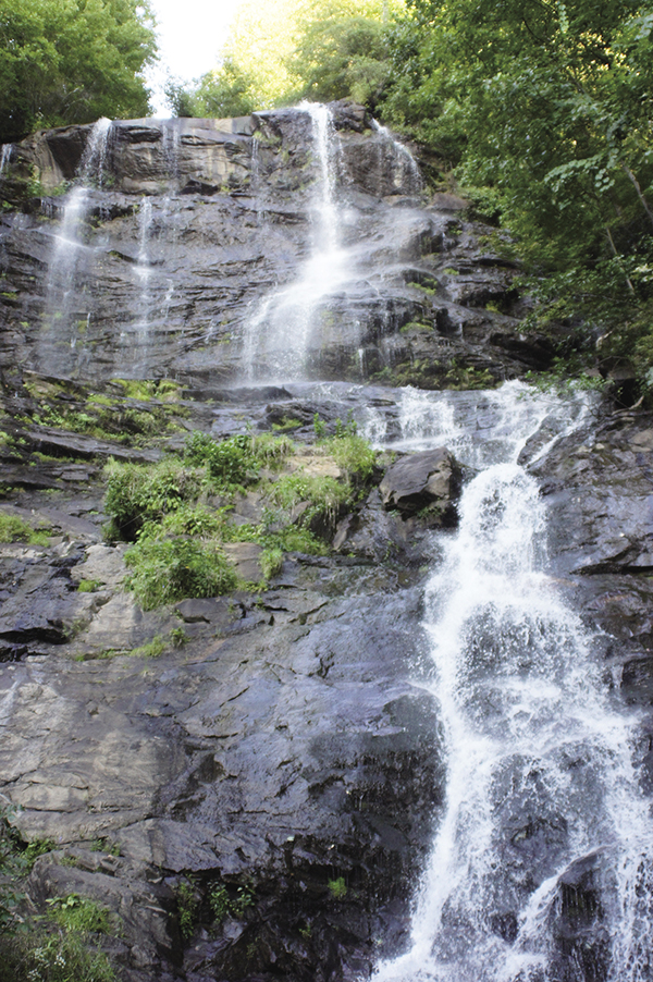
Only a small portion of Amicalola Falls’ 729-foot drop can be seen at a time.
1 Amicalola Falls
Majestic! This impressive waterfall has the claim to fame of being Georgia’s tallest, falling 729 feet as it makes its way down the mountainside. Amicalola Falls is so tall that it is difficult to see it all at once. Each section you can view, however, is well worth the visit. The falls can be reached by climbing the many man-made steps or via an alternative route, which is accessible for those in wheelchairs or with strollers.
Height: 729 feet
Distance: hiking trail, 0.6 mile out and back (wheelchair-accessible route, 0.5 mile)
Trail surface: Paved path and man-made steps; crushed recycled tire material
Approximate hiking time: 30 minutes
Blaze color: No blazes
County: Dawson
Land status: State park
Trail contact: Amicalola Falls State Park; (706) 265-4703; www.gastateparks.org/AmicalolaFalls
FYI: Open daily 7 a.m. to 10 p.m.; day-use fee is required to visit the falls.
Maps: DeLorme: Georgia Atlas & Gazetteer: Page 14 G4
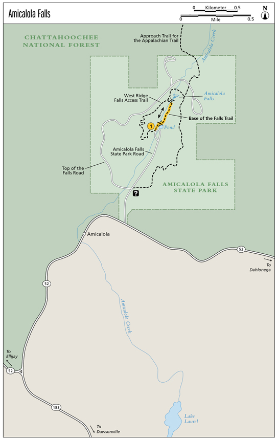
Finding the trailhead: From the junction of GA 52 and GA 9, drive west on GA 52 for 13.8 miles. Turn right onto Amicalola Falls State Park Road at the sign for Amicalola Falls State Park and Lodge and travel for 0.7 mile to where the road dead-ends.
From the junction of GA 52 and GA 183, drive east on GA 52 for 1.45 miles. Turn left onto Amicalola Falls State Park Road at the sign for Amicalola Falls State Park and Lodge and follow the directions above.
The trailhead is located at the northwest end of the parking lot at the trail information signpost. GPS: N34 33.805 / W84 14.814
To access the ADA parking area for the alternative hiking route: Once inside the park, turn left onto Top of the Falls Road and travel for 0.9 mile to a right turn into the ADA parking area. GPS: N34 33.921 / W84 14.931
The Hike
From the trailhead, hike around the pond; the stone path quickly leads to a footbridge. Cross the bridge and the paved path begins a steep ascent that you’ll follow for the remainder of the way to the lower observation deck of Amicalola Falls.
The trail continues to climb as you make your way up the 175 steps of the man-made stairway to reach a bridge over the falls at the upper observation deck. This vantage point offers the best close-up and personal view of Amicalola Falls.
The trail then continues across the falls and up another 425 steps to the brink of the falls. (Note: You can also reach the brink of the falls by driving up Top of the Falls Road and parking at the lot signed for Upper Amphitheater. You cannot see the waterfall from the brink, but the creek runs through a lovely picnic area, and the views of the surrounding mountainsides are spectacular.)
Only a small portion of Amicalola Falls’ 729-foot drop can be seen at a time.
Alternative route: From the ADA parking area, hike in a generally easterly direction for approximately 0.25 mile until you arrive at the bridge over the falls at the upper observation deck for Amicalola Falls. Although this trail is wheelchair accessible, there is a bit of a grade to it.
Cherokee for “tumbling waters,” Amicalola does just that. It is not only the tallest waterfall in Georgia but also the tallest cascading waterfall east of the Mississippi River.
The park, which has a long-term parking area, was designed and created to give “thru-hikers” of the Appalachian Trail (AT) a good starting point. The Southern Terminus Approach Trail for the AT takes you up the Amicalola Falls Trail, passes the falls, and then continues to Springer Mountain, where the AT begins (or ends, depending on the direction you hike it).
Miles and Directions
0.0Start by going around the pond to the left and hiking north-northeast back into the woods. The trail quickly leads to a footbridge. Cross the bridge and continue hiking northeast on the paved path as it makes a steep ascent.
0.2Arrive at the lower observation deck for the falls. (N34 33.978 / W84 14.715). From here the trail leads up a staircase of 175 steps.
0.3Arrive at the upper observation deck for Amicalola Falls (N34 34.011 / W84 14.686). Return the way you came.
0.6Arrive back at the trailhead.
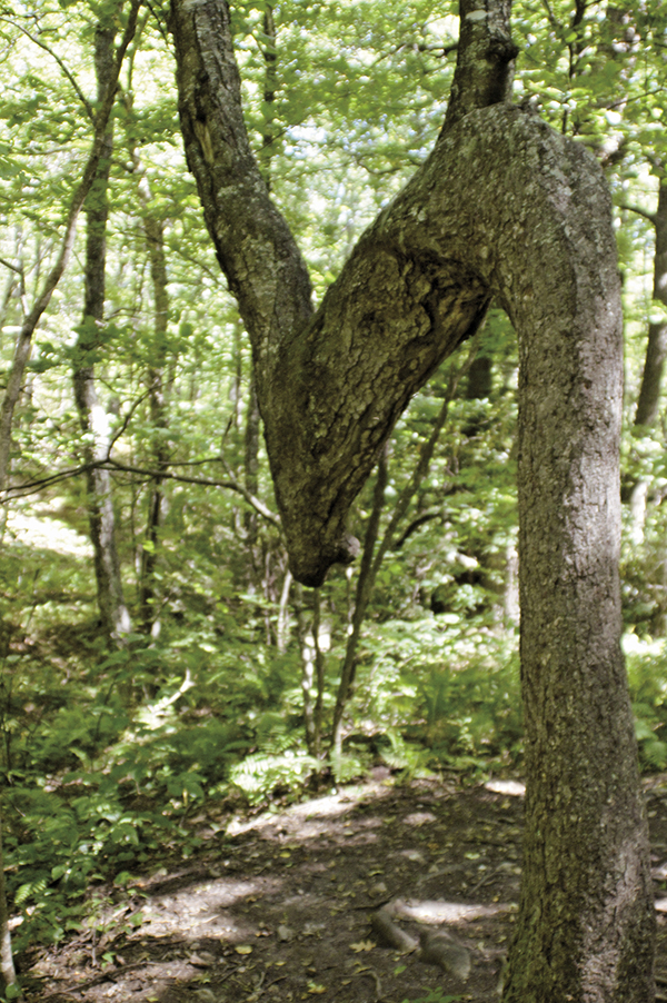
A trail tree points the way.