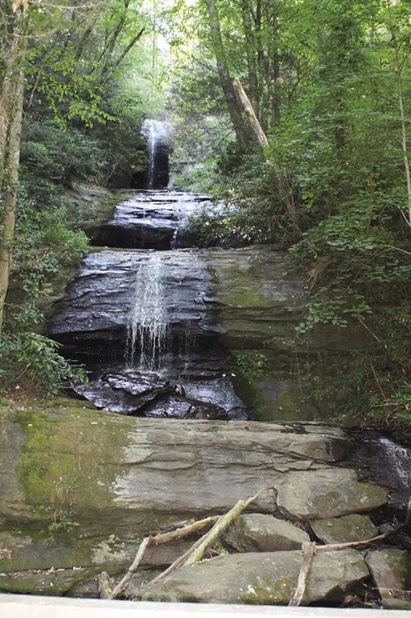
Upper DeSoto Falls sits tucked away from the crowds.
9 DeSoto Falls
Astonishing! Twice the pleasure here, with both the Lower and the Middle Falls of DeSoto Falls to visit on the same trail. Despite being only 30 feet tall, DeSoto’s Lower Falls creates a lot of sound for a smaller waterfall. Like a younger child trying to speak up for itself, this one demands the attention it deserves.
See map on 8 Little Ridge Creek Falls
Height: Lower Falls, 30 feet; Middle Falls, 90 feet
Distance: 2.6 miles out and back
Trail surface: Hard-packed dirt with a short section of paved road
Approximate hiking time: 1 hour, 15 minutes
Blaze color: No blazes
County: Lumpkin
Land status: National forest
Trail contact: Chattahoochee National Forest, Chattooga Ranger District; (706) 754-6221; www.fs.fed.us
USDA Forest Service DeSoto Falls Campground; (706) 745-6928
FYI: Recreation area is open 7 a.m. to 10 p.m.; small day-use fee
Maps: DeLorme: Georgia Atlas & Gazetteer: Page 15 E8
Finding the trailhead: From the junction of US 129 and GA 180 east, drive south on US 129 for 8.9 miles. Turn right into the DeSoto Falls Recreation Area at the sign and head down the hill. Take the first left into the large parking area.
From the junction of US 129 and US 19 at Turner’s Corner, drive north on US 129 for 4.0 miles. Turn left at the sign into the DeSoto Falls Recreation Area and follow the directions above.
The trailhead is at the northwest corner of the parking area, next to the self-pay station and the restrooms. GPS: N34 42.395 / W83 54.916
The Hike
Follow the wide gravel path past the restrooms and head into the picnic area. After passing through the picnic area, the trail leads you to a T junction at a paved road. Go left here, entering the campground. A short distance into the campground, you will see a wooden footbridge that heads over Frogtown Creek.
After crossing the footbridge, immediately come to a T junction. The left leads downstream toward Lower Falls; the right leads to Middle Falls. Head left and the trail takes you up and around several switchbacks for 0.3 mile to where it dead-ends at the base of Lower DeSoto Falls. Backtrack to the T and head the other way toward Middle Falls. While this is a longer trek, I personally feel that Middle Falls is worth the extra work.
Symmetrical and sophisticated, DeSoto’s Middle Falls creates a perfectly planned path as it flows down the mountainside. From the T junction, follow the wide and well-maintained trail upstream. The relatively flat path meanders through the forest and takes you to a small wooden footbridge. Cross the bridge and in a short distance you see some side trails on your right heading to the creek. Bypass these, continuing straight ahead (north) on the main unblazed trail.
Upper DeSoto Falls sits tucked away from the crowds.
The trail now begins to rise and fall before leading to another wooden footbridge. A short distance after crossing this one, a trail forks off to the left (west) and up. Take this left fork and follow the path west to where it dead-ends at the base of Middle DeSoto Falls.
Some of you may remember the time when you could also visit the Upper Falls here. The trail to Upper Falls, however, is now closed due to erosion. Once again, this is why we do not shortcut on trails.
DeSoto Falls Scenic Area is named for the Spanish explorer Hernando de Soto. Hernando was the first European to explore the interior of Georgia, which he did in the late 1530s. The falls got their name when some early settlers found a piece of armor near the falls and attributed the relic to de Soto and his men.
Miles and Directions
0.0Follow the wide gravel path northwest into the picnic area. Head right (north) through the picnic area, passing more picnic tables.
0.1Come to a T junction at a paved road. Go left (west) at the T and head into the campground.
0.2Inside the campground, you will see a trail information sign and a wooden footbridge over the creek on the left. Cross the footbridge (north-northwest) and immediately come to a T junction. The right leads east to Middle Falls; the left leads west to Lower Falls. Go left (west) for now and follow Frogtown Creek downstream. The trail begins its ascent as it takes you around several switchbacks.
0.5The trail dead-ends at the base of Lower DeSoto Falls (N34 42.440 / W83 55.061). Backtrack to the T at the footbridge over the creek.
0.8Arrive back at the T, and hike straight ahead (east) toward the Middle DeSoto Falls, following the wide and well-maintained trail upstream.
1.0Cross a small wooden footbridge and continue hiking north. Bypassing the side trails that lead to the creek, stay on the main path as the trail begins to rise and fall.
1.5Cross another wooden footbridge and continue hiking northeast. Shortly after crossing this footbridge, follow the trail that forks off to the left (west) and up.
1.6The trail dead-ends at the base of Middle DeSoto Falls (N34 43.017 / W83 54.934). Retrace your steps to the T junction at 0.8 mile.
2.4Arrive back at the T junction, and go left (south) over the footbridge and return to the trailhead the way you came.
2.6Arrive back at the trailhead.