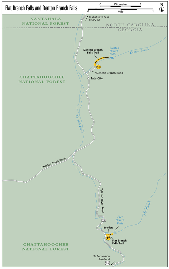
17 Flat Branch Falls
Soulful! This waterfall lies obscured from the masses. Located within the Tallulah River Basin, Flat Branch and the many other creeks found here flow freely into the grand Tallulah River.
Height: 100 feet
Distance: 0.5 mile out and back
Trail surface: Hard-packed dirt
Approximate hiking time: 30 minutes
Blaze color: Blue surveyor’s tape tied to trees
County: Rabun
Land status: National forest
Trail contact: Chattahoochee National Forest, Chattooga Ranger District; (706) 754-6221; www.fs.fed.us
Maps: DeLorme: Georgia Atlas & Gazetteer: Page 16 B1
Finding the trailhead: From the junction of US 76 west and US 441 in Clayton, drive west on US 76 for 7.9 miles. Turn right onto Persimmon Road at the sign for Tallulah River Campground and travel 4.0 miles to a left turn onto Tallulah River Road (FS 70). Continue for 1.4 miles to the Tallulah River Campground. Bypass the campground and continue straight ahead on the now unpaved Tallulah River Road for another 1.7 miles until you’ve crossed the fourth bridge past the Tallulah River Campground. Immediately after crossing the fourth bridge, park in the small pull-off on the right.
From the junction of US 76 and GA 197, go east on US 76 for 3.0 miles. Turn left onto Persimmon Road at the sign for Tallulah River Campground and follow the directions above.
The trailhead is located at the south end of the bridge on the east side of the road. GPS: N34 56.770 / W83 33.019
The Hike
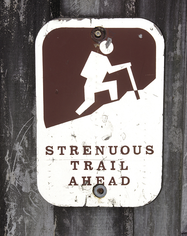
The trail has been recently cleared and marked with blue surveyor’s tape, so it should be easier followed than in days past. Follow the hidden, narrow trail as it takes you steeply uphill and into the woods. As you follow the strenuous incline, bypass what sounds like the falls on the left, and continue hiking until you reach some very large boulders on the left. Continue past the boulders on the right, following the trail until you reach the creek. Follow the creek upstream as you continue to climb toward the falls.
Trust me, you’ll know when you’ve reached this one. Flat Branch Falls is a huge 100-foot rockslide that cannot be mistaken. Do not be deceived by the shortness of this trail. This is a very strenuous hike. If you are a hard-core waterfall hunter, it’s worth the climb. Others should skip this one and head down the road another 3.3 miles to nearby Denton Branch Falls instead.
There are many theories on the origin of the word Tallulah. The story I enjoy most is that of a Native American village named “Ta-lu-lu,” which sat along the river’s edge. The village once stood where Lake Burton sits today and was said to have gotten its name from the sounds of a certain native frog that could be heard echoing throughout the valley ta lu lu lu lu!
Miles and Directions
0.0From the trailhead, hike northeast up the very steep hill and into the woods. As you follow the strenuous incline, bypass what sounds to be the falls on the left.
0.1Reach some very large boulders on the left. Go around them on the right and continue hiking southeast.
0.2The trail leads to the creek. Head right (northeast) here and continue climbing as you follow the creek upstream.
0.25Arrive at Flat Branch Falls (N34 56.784 / W83 32.890). Return the way you came.
0.5Arrive back at the trailhead.
Always hike within your limits.