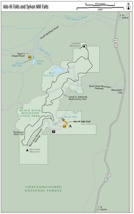
33 Ada-Hi Falls
Aspiring! Like a weeping wall, Ada-Hi Falls is more of a trickle than a waterfall. The water almost appears to seep from the rock face. The spring that feeds this simple fall is a mere 300 feet above the waterfall, so it doesn’t have time to collect the momentum and volume that most other falls have. Although the waterfall itself is not much to see, the trail and road to the trailhead are excellent for viewing a variety of wildflowers.
Height: 35 feet
Distance: 0.6 mile out and back
Trail surface: Mulch path
Approximate hiking time: 20 minutes
Blaze color: No blazes
County: Rabun
Land status: State park
Trail contact: Black Rock Mountain State Park; (706) 746-2141; www.gastateparks.org
FYI: Open 7 a.m. to 10 p.m.
Maps: DeLorme: Georgia Atlas & Gazetteer: Page 16 B3
Finding the trailhead: From the junction of US 441 and US 76 east, drive north on US 441 for 3.0 miles. Turn left onto Black Rock Mountain Parkway at the First Christian Church and head up the mountain. At approximately 1.0 mile you will see a large sign for Black Rock Mountain State Park on the left. Do not turn left here. Instead continue straight ahead, still heading up the mountain until you reach the gate at the entrance to the park. Enter the park and continue up the mountain until you come to a fork. Go left at the fork, following the signs a short distance to the campground entrance. There’s a small parking area on the right just before the campground office.
From the junction of US 441 and GA 246, drive south on US 441 for 4.6 miles. Turn right onto Black Rock Mountain Parkway at the First Christian Church and follow the directions above.
The trailhead is located just before the campground office, on the east side of the road. GPS: N34 54.381 / W83 24.462
The Hike
The obvious mulch path rapidly descends a fairly steep grade into the forest. Not to worry though; there are benches along the path where you can rest on your way out, and the abundance of wildflowers along the path makes it worth every step. The trail leads across a small footbridge and then down multiple levels of steps to an observation deck at Ada-Hi Falls.
Named for the Cherokee word for “forest,” Ada-Hi sits at the highest elevation of any waterfall in Georgia. This makes sense being that it is located within Black Rock Mountain State Park, at 3,640 feet Georgia’s highest-elevation state park. The park is named for the sheer cliffs of dark-colored biotite gneiss, which seem far more impressive than Ada-Hi Falls. On a clear day you can see four states (Georgia, North Carolina, South Carolina, and Tennessee) from atop Black Rock Mountain.
Miles and Directions
0.0From the trailhead, the obvious mulch path descends southeast on a fairly steep grade.
0.2The trail takes you across a small footbridge and then down many levels of steps.
0.3Arrive at the base of Ada-Hi Falls (N34 54.482 / W83 24.568). Return the way you came.
0.6Arrive back at the trailhead.
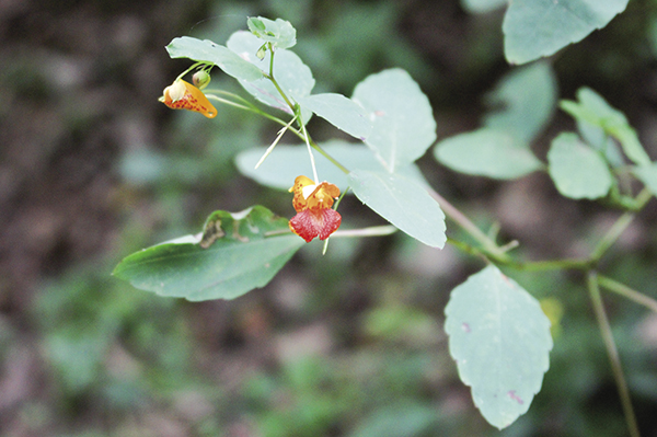
Much like the mountain laurel, the native touch-me-not blossoms spring open and toss out their pollen when touched.