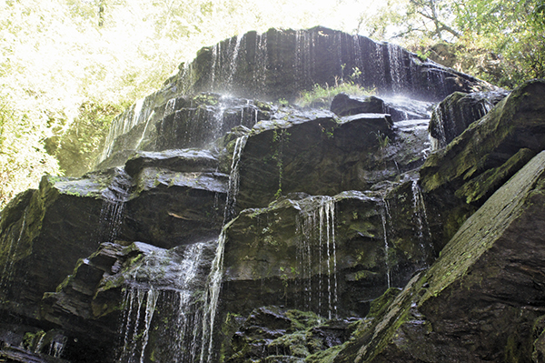
The indescribable Yellow Branch Falls is a must-see.
43 Yellow Branch Falls
Three-dimensional! Absolutely surreal, Yellow Branch Falls is like a Mayan village up on a hillside, with its many facets seeming to come to life. The depth of this waterfall is unlike anything I’ve ever seen before. Definitely one of the most unusual waterfalls I’ve ever experienced, Yellow Branch Falls is my new favorite waterfall.
Height: 60 feet
Distance: 3.0 miles out and back
Trail surface: Hard-packed dirt
Approximate hiking time: 1 hour, 30 minutes
Blaze color: No blazes
County: Oconee
Land status: National forest
Trail contact: Sumter National Forest, Andrew Pickens Ranger District; (864) 638-9568; www.fs.fed.us
Maps: DeLorme: South Carolina Atlas & Gazetteer: Page 22 A2; DeLorme: Georgia Atlas & Gazetteer: Page 16 D5
Finding the trailhead: From the junction of SC 28 and SC 107, drive south on SC 28 for 2.7 miles and turn right at the sign into the Yellow Branch Picnic Ground. Bypass a road that immediately heads up and to your right, and continue straight ahead for 0.2 mile to where the road dead-ends at a parking area.
From the junction of SC 28 and SC 183, drive north on SC 28 for 5.3 miles. Turn left at the sign into the Yellow Branch Picnic Ground and follow the directions above.
The trailhead is accessed from the southwest side of the parking lot. GPS: N34 48.335 / W83 07.731
The Hike
A short path on the southwest side of the parking lot takes you west-southwest to a large trail information sign and the trailhead. The trail follows a tiny brook downstream as it makes its way into the thickness of the forest before leading you to a small stream. Rock-hop across, and continue hiking as you rock-hop two more small creeks. Shortly after rock-hopping the third small creek, where the trail begins to bend left (northeast) you will see a side trail on the right (south) with a set of steps that head down to a wooden footbridge. (There should be a marker on a tree reading Falls at this side trail.) Go down the steps and cross the footbridge.
Continue to follow the obvious trail as it takes you along the forest floor. After a short distance, the trail forks at yet another creek. Go left here, cross the creek, and pick the trail up on the other side. The now easy-to-follow trail heads southeast and leads you away from the creek. Although you can’t hear any water, trust me; patience pays with this one.
The indescribable Yellow Branch Falls is a must-see.
The trail continues through the forest as it makes a slow descent and crosses another wooden footbridge. A short distance after this footbridge, the trail narrows and forks up and to the right (south). Follow this right fork as it takes you around (west) and crosses another footbridge.
Continue hiking southeast as the trail begins to climb and circle the mountainside. As the trail begins to head back downhill, you’ll hear the encouraging sounds of water. Remember . . . patience. This is not your waterfall. Continue north on the main trail, again moving away from the sounds of the water. Soon the sounds of your destination come into range and you begin the final descent to the base of the three-dimensional Yellow Branch Falls.
The Yellow Branch Picnic Ground has been around since at least the1930s, with one of the original buildings still standing today. Oconee County, within which the picnic ground is located, has been around for hundreds of years longer. Many stories exist about how the county came to be named, most of which stem from Native American roots. The theory I prefer is that it takes its name from the Cherokee word Uk-oo-na, meaning “watery eyes of the hills.” Take a peek at the abundance of creeks, lakes, and waterfalls around here and you’ll understand why I prefer this one.

Miles and Directions
0.0From the trailhead, hike southeast, following the tiny stream downstream and into the forest. Rock-hop across the trickling stream and continue southeast. Rock-hop two more small streams and continue hiking south.
0.3Come to a side trail on the right (south) with a marker on a tree reading Falls and some steps that head down to a footbridge. Head down the steps and cross the footbridge. Continue hiking south on the obvious trail as it takes you along the forest floor.
0.5Come to a fork where the trail reaches the creek. Go left (east) here, cross the creek, and pick the trail up on the other side. From here the trail heads southeast and away from the creek.
1.0Cross another wooden footbridge. A short distance after the crossing, the trail narrows and forks up to the right (south). Follow this right fork as the trail takes you around to the west.
1.1Cross another footbridge and continue hiking southeast as the trail begins to climb and circle the mountainside.
1.5Arrive at the base of Yellow Branch Falls (N34 47.701 / W83 08.025). Return the way you came.
3.0Arrive back at the trailhead.
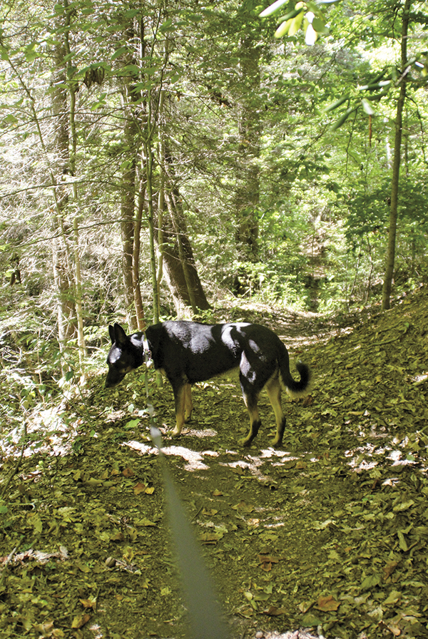
Dogs are allowed on most trails, but make sure you keep them on a leash, for everyone’s sake.