45 Cedar Creek Falls
Symbiotic! As the waters of Cedar Creek flow past, I can’t help but ponder the complex, yet simple, ways of nature. The amazing link among all living things within an ecosystem always leaves me in awe.
Height: 20 feet
Distance: 1.2 miles out and back
Trail surface: Wide forest road
Approximate hiking time: 40 minutes
Blaze color: No blazes
County: Oconee
Land status: National forest
Trail contact: Sumter National Forest, Andrew Pickens Ranger District; (864) 638-9568; www.fs.fed.us
Maps: DeLorme: South Carolina Atlas & Gazetteer: Page 22 A2; DeLorme: Georgia Atlas & Gazetteer: Page 16 D5
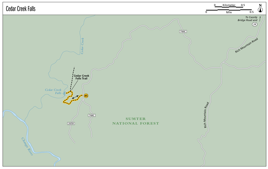
Finding the trailhead: From the junction of SC 28 and SC 107, drive south on SC 28 for 1.9 miles. Turn right onto Whetstone Road and travel 0.7 mile to a left turn onto Cassidy Bridge Road. Continue for 0.85 mile before turning left onto the gravel FS 744 (Rich Mountain Road). Travel 3.2 miles and turn right onto FS 744C. Continue for 2.5 miles to FS 2658 on your right. Park here, but don’t block the gate.
From the junction of SC 28 and SC 183, drive north on SC 28 for 6.1 miles. Turn left onto Whetstone Road and follow the directions above.
GPS: N34 45.706 / W83 11.161
The Hike
Begin by hiking down the gated FS 2658. After approximately 0.25 mile on the forest service road, the road bends to the left and you will see two stone-blocked roads shooting off to the right. The first road is before the bend and heads down; the second is after the bend and goes up. You want to take the first.
Go around the boulders and follow the wide path alongside the creek. The wide path bends to the left (north) and then reaches a fork at the creek. Go left (southwest) at the fork and down, and soon find yourself alongside Cedar Creek Falls.
Several side trails make their way steeply down to the base. Choose your path, but use caution! The way to the base is extremely steep, and once you arrive at the base of Cedar Creek Falls, you are also at the brink of Blue Hole Falls. (Note: Although Blue Hole Falls is just a stone’s throw away, I have not included it in this guide because there is no safe way to reach it.)
Cedar Creek is one of the many feeder creeks to the Chauga River. The nearby Cassidy Bridge Campground offers primitive camping and is very popular among hunters during season. Between the campground and the National Forest Service Rifle Range off Cassidy Bridge Road, don’t be surprised if you hear gunshots while visiting this waterfall.
Miles and Directions
0.0From the parking area, hike north-northwest down the gated FS 2658.
0.25Where FS 2658 bends to the left, two stone-blocked roads shoot off to the right. Take the road before the bend which heads downhill (northeast). Go around the boulders and follow this wide path alongside the creek.
0.5Arrive at the creek and a fork, with the main trail heading right (northwest) and down and a side trail heading left (southwest) and down. Take the trail to the left and soon arrive alongside Cedar Creek Falls. Carefully follow one of several steep trails down to the base.
0.6Arrive at the base of Cedar Creek Falls (N34 45.727 / W83 11.374). Return the way you came.
1.2Arrive back at the trailhead.
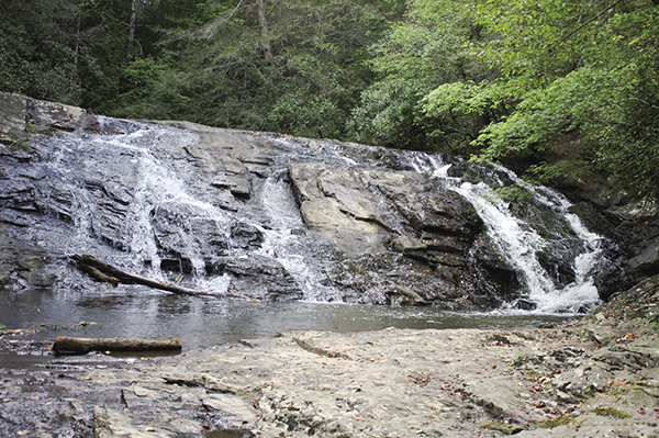
Cedar Creek Falls is a perfect place to relax on the rocks and soak in the sun’s rays.