
Illustrations

PLATE 1. Aurora from space taken by Space Shuttle (STS-39) crew in 1991. NASA

PLATE 2. Magnetic field lines near a sunspot taken with the NASA TRACE satellite. TRACE

PLATE 3. A glimpse of the solar corona showing a cloud of ejected material. Also in the view are several planets near the Sun around the time of the May 5, 2000, “End of the World” conjunction, together with the Pleiades star cluster. This planetary conjunction was not visible from the Earth because of the closeness of the planets to the Sun. The NASA/ESA SOHO satellite’s LASCO instrument was able to artificially “eclipse” the Sun to reveal the planets close to the solar limb.

PLATE 4. A transformer damaged by a geomagnetically induced current that literally “fried” the transformer’s insulation. John Kappenman, Metatech Corporation

PLATE 5. The origin of solar activity is believed to occur deep inside the Sun. This computer model shows the interior of the Sun detected with the Stanford University helioseismometer on the SOHO spacecraft. Over one million points were measured on the surface. The red colors show where the computed speed of sound is higher than theoretical models predict and reveal complex interior layers. The Sun’s core is detected at a temperature 0.1 percent lower than fifteen million degrees, suggesting a slightly reduced solar output. SOHO/MIDI

PLATE 6. The changing face of the Sun between sunspot minimum in 1996 (left side) and sunspot maximum in 1997 (right side), obtained with the SOHO EIT instrument. Note that the solar minimum surface is smoother and less structured by active regions compared to the Sun near solar maximum.
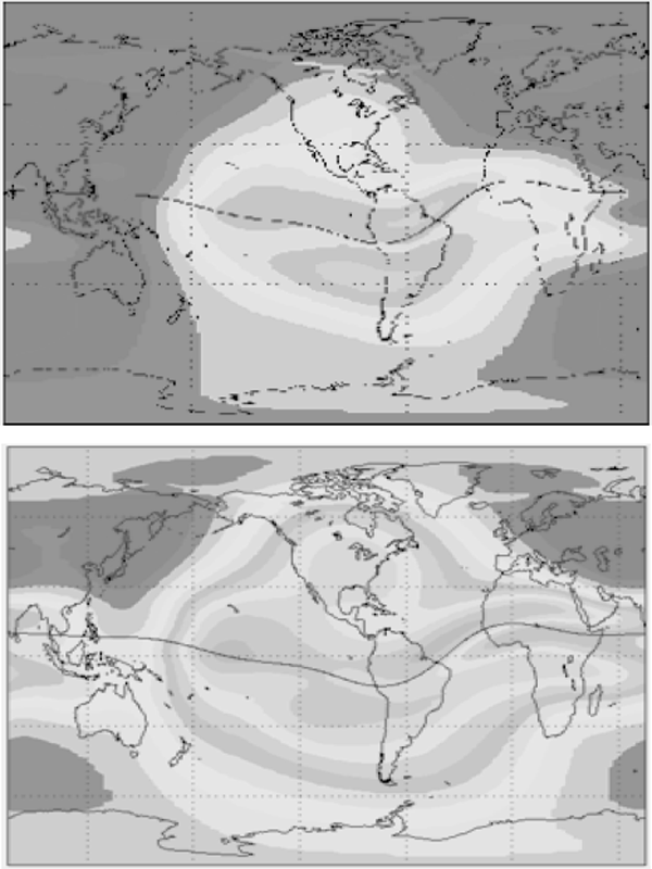
PLATE 7. Solar minimum and maximum reflected in the changing properties of the Earth’s ionosphere. Ionospheric electron density maps for December 1995 near solar minimum (top) and December 1990 near solar maximum (bottom). National Geophysical Data Center, NOAA
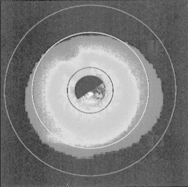
PLATE 8. The Earth’s outer atmosphere extends thousands of miles into space and provides a constant friction to satellites. This image is a model produced by the NASA IMAGE satellite team to anticipate what the satellite’s geocoronal imaging camera (GEO) will see. Also shown are the orbits of communication satellites (red circle), and typical distances to GPS satellites in MEO orbits (yellow), and LEO satellite (black) networks. IMAGE
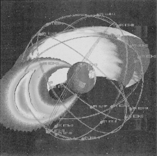
PLATE 9. The Global Positioning System satellites actually orbit inside the donut-shaped inner Van Allen radiation belt, seen here in cross-section. This model shows the location of the high-energy proton belt. Red colors indicate the most intense concentrations of particles. U.S. Air Force
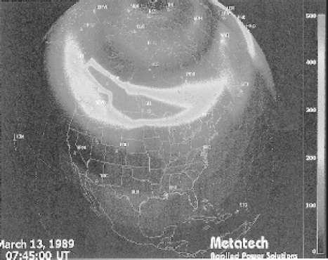
PLATE 10. Magnetic disturbances during the March 1989 blackout at 07:45:00 universal time. Within seconds, the disturbance traveled eight thousand miles from Canada to Great Britain. John Kappenman, Metatech Corporation
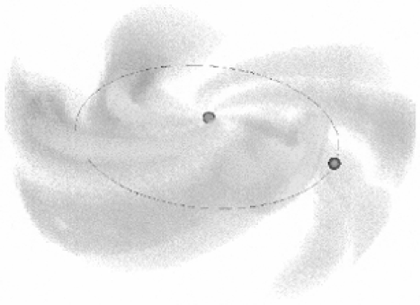
PLATE 11. Images of the solar wind detected by scattered sunlight. Note the pin-wheel-like structure of material ejected from coronal holes and other active regions on the solar surface. The Earth’s orbit is drawn to scale. Earth and Sun dots are not drawn to scale. Bernard Jackson, University of California Santa Barbara

PLATE 12. From space, the aurora borealis appears as an oval of light centered on the north magnetic pole. This is a Dynamics Explorer satellite view of the auroral oval during the March 1989 Great Aurora. Note the large equatorward extent into North America and the especially bright knot of auroral emission over South Carolina. Dynamics Explorer Satellite