Six
MAJOR CONSTRUCTION PROJECTS
Although many people in the late 1800s looked at the beautiful land in the Estes Park area and thought of preservation, others thought mainly about its use. With the completion of a railroad from Denver to Cheyenne, eastern slope farmers saw new markets and eyed meltwater for irrigation. Gradually an idea developed to divert water from what is now the northwest corner of Rocky Mountain National Park to the eastern plains through La Poudre Pass and down the Cache La Poudre River. The Larimer County Ditch Company started construction of the Grand Ditch along the Never Summer Range. Each summer, it grew longer, and three miles were completed in 1894. After the formation of the park, Congress approved taking park land for the Long Draw Reservoir. Another act of Congress approved lengthening the ditch three miles, and the Grand Ditch project was finally completed in 1936.
The Grand Ditch was not the only project facing those concerned with preservation of the new park’s land. Almost immediately, everyone realized better roads were necessary. The Fall River Road across the Continental Divide that was built between 1913 and 1920 was not adequate to handle the traffic coming into the new national park. In 1929, construction began on Trail Ridge Road, which was completed in 1932. Great pains were taken to protect the environment as this road was built.
Additional construction took place in Rocky Mountain National Park during the Great Depression, when small groups of the Civilian Conservation Corps were housed in the park. They worked on park buildings and improved trails and overlooks.
To secure additional water for the semiarid eastern plains, Colorado farmers proposed building a tunnel under Otis Peak through Rocky Mountain National Park to provide irrigation water and hydroelectric power. Although many groups opposed it, on December 21, 1937, Pres. Franklin Roosevelt approved funding to begin the Colorado Big Thompson Project. On June 23, 1947, the first water flowed through the Alva B. Adams Tunnel from Grand Lake to Lake Estes and down the Big Thompson River. Additional tunnels, power stations, dams, and reservoirs were completed by 1954.
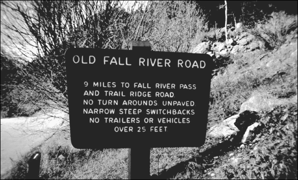
Building a useable road across the Continental Divide had been discussed for a number of years. It was not until 1913 that the State of Colorado agreed to fund the project. The road would connect Estes Park and Grand Lake with a scenic route across the Divide. This road sign reminds tourists about to turn onto the road that it is steep, narrow, and offers no place to turn around.

In September 1913, convicts from the Colorado State Penitentiary moved into cabins along the Fall River. They served as the work crew for the seven-year Fall River Road construction project. Businessmen and Rocky Mountain Park enthusiasts alike realized that more and more people would be coming to tour the area. After early work, traditional road crews replaced the convicts.
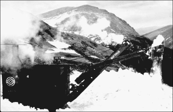
Keeping the Fall River Road clear of snow was always a problem. In 1913, after construction on the road began in September, the severest snowstorm in the state’s history hit during the first five days of December and halted construction. Four feet of snow covered the ground. Once the road was finished, steam shovels, like this one photographed in 1925, had the difficult job of clearing the snow.
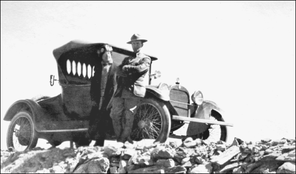
In 1921, park superintendent L. C. Way stands beside the automobile that was the first car on Fall River Road. In addition to automobiles, Circle Tours became popular. Tourists would get on a bus in Denver, drive to Estes Park for an overnight, then go to Grand Lake via the Fall River Road, and back to Denver over Berthoud Pass.
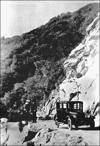
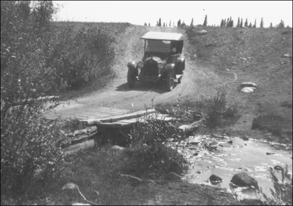
These early visitors on the Fall River Road leave their car to take in some of the remarkable scenery in the area. Among the many points of interest for 1920s tourists was a stop at Chasm Falls where tourists could cross a bridge and watch the falls below. The bridge was removed following an accident.
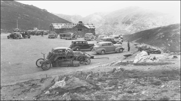
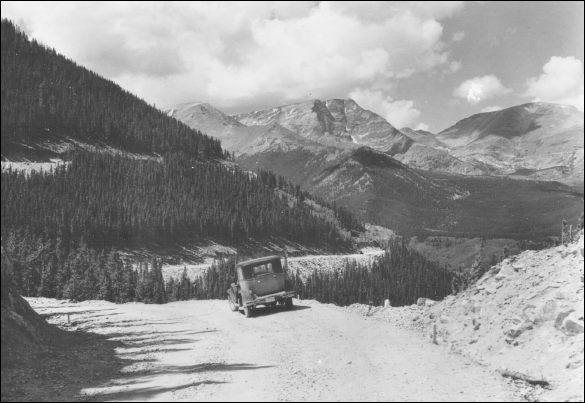
When completed, the Fall River Road left Endovalley and climbed by way of 16 switchbacks a distance of 9.4 miles to Fall River Pass. Driving the road was a challenge to ordinary motorists and to the Rocky Mountain Park Company buses. By 1937, automobile traffic on Fall River Road was more common. These people are parked at the Fall River Pass store.
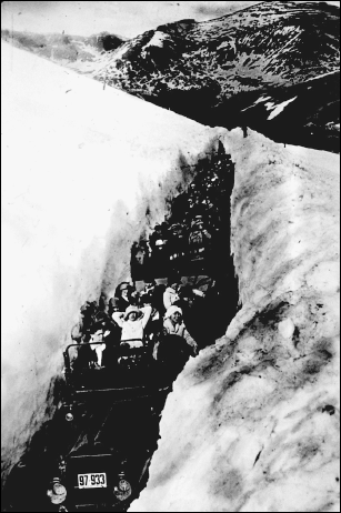
Some cars could not negotiate the road. Some navigated the switchbacks in reverse because their reverse gears had more power than their low one. Even though there were difficulties in traveling over Fall River Road, it was popular. Tourists in snow caravans like the one pictured here had an exciting and exhilarating experience.
Park superintendent Roger Toll took this picture in October 1922 of a bridge over Alpine Brook on the Longs Peak Road. This small side road leading from the main road between Estes Park and Allenspark (currently known as the Peak to Peak Highway) gave automobile access to the east trailhead of Longs Peak.

The old Fall River Road was hard to keep free of snow and difficult to drive at best, so by the middle of the 1920s, there was uniform agreement that a new road was desperately needed. Construction began in 1929 on Trail Ridge Road and was completed in 1932. The highest point on this road is at an elevation of 12,183 feet.

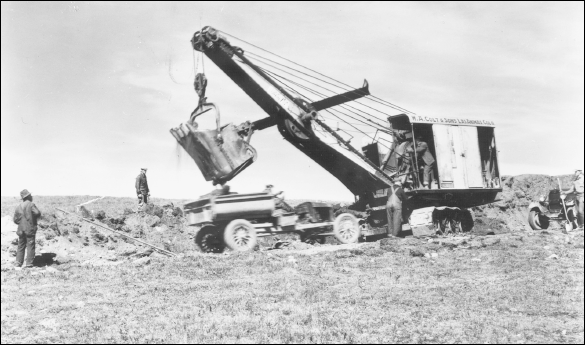
Congress approved $450,000 for the construction of Trail Ridge Road in April 1929. The contract for building the eastern portion of the highway went to W. A. Colt of Las Animas. Colt knew that most work would have to be done between the snow-free periods of mid-June to mid-October. Pictured here is early construction on Trail Ridge Road in 1929.
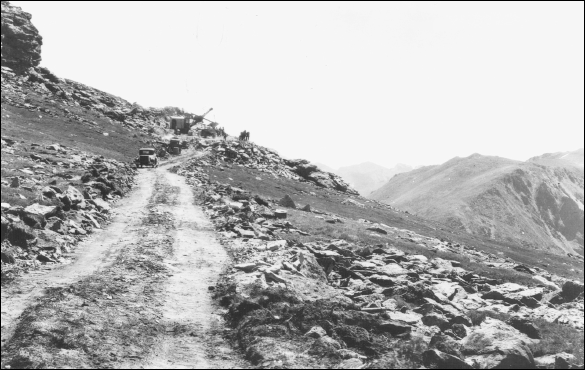
Hidden Valley was a base camp for some of the Trail Ridge Road construction crew. Colt had 150 laborers to work on the eastern portion, along with 35 men who served in such jobs as foremen, mechanics, power-shovel operators, and cooks. This 1929 picture gives a good view of the rough and rocky terrain where the men worked.
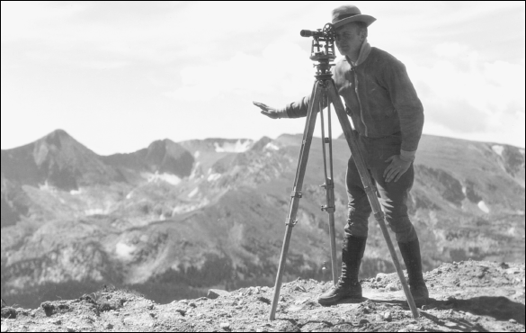
The contract for the western portion of Trail Ridge Road from Fall River Pass to the floor of the Colorado River Valley went to L. T. Lawler of Butte, Montana. In August 1930, this surveyor is at work. Although progress was rapid in the summer, it stopped with early snows. The severe winter of 1930–1931 held up the western construction crew until May and the eastern crew until June.
In this picture, a construction crew labors on Trail Ridge Road, trying to complete as soon as possible a scenic highway into the area. The need for a modern highway was clear. Rocky Mountain National Park was well established by 1929. That year, nearly 300,000 people entered the park. It had become a booming recreational area.

Road crews tried to lessen environmental damage. After a blast, debris was removed and displaced rocks were put back in place, lichen-side up. In addition to foremen, park officials traveled up and down the road to see that work was being done properly. Chief ranger John McLaughlin took this photograph in August 1932 of rock-cut construction work on Trail Ridge Road.
In 1933, Trail Ridge Road, called “Highway to the Sky,” was opened, although paving work continued for several years. On its completion, the Rocky Mountain News called this highway the “scenic wonder of the world.” About 10 miles of the road were above 11,000 feet. No grade was steeper than seven percent.
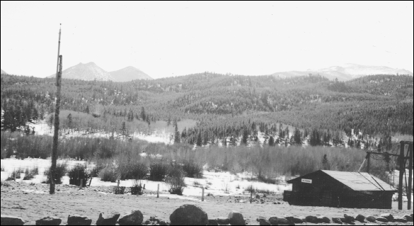
The first unemployed men who constituted the beginning of the Colorado group of the Civilian Conservation Corps (CCC) arrived in Rocky Mountain National Park on May 12, 1933. This program provided men to work on such projects as improving trails, building overlooks, and chopping down beetle-killed trees. This is a photograph of the CCC Camp NP-11-C, No. 2, taken by ranger H. Raymond Gregg in February 1941.
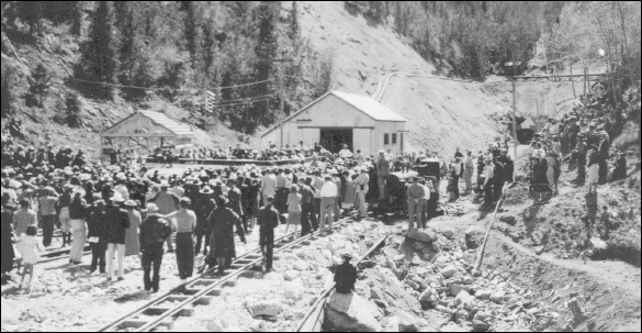
The controversial Alva Adams Tunnel brought water to Colorado farmers on the semiarid eastern plain. The tunnel had been opposed by conservationists and urged forward by farmers with political clout. President Roosevelt approved a feasibility study in 1937 to begin what was called the Colorado–Big Thompson Project. This crowd of people photographed by ranger H. Raymond Gregg is at the east side of the Alva Adams Tunnel in 1940.

On June 23, 1947, the first water flowed eastward through the Alva Adams Tunnel from Grand Lake. The 13.1-mile aqueduct carried water under Otis Peak on the Continental Divide to Lake Estes. Water is delivered to cities and towns and helps irrigate thousands of acres of northeastern Colorado farmland. Naturalist Robert J. Haines took this picture of the east portal of the Alva Adams Tunnel on February 8, 1977.