Old Ute Trail
Trail Ridge was so named because Native Americans used it as a route across the mountains. Perhaps as long as 11,000 years ago, hunters of now extinct camels and long-horned bison followed the ridge from one hunting ground to another. During the last 8,000 years, Native Americans used it to journey from Estes Park to Grand Lake. The most recent of these high-altitude travelers were bands of Ute and Arapaho, much longer than a century ago. They were accompanied by dogs, the beasts of burden with the longest history in the park. The dogs carried packs, rather similar to modern dog packs with the load hung on both sides. The dogs also dragged platforms, travois, which gouged parallel ruts across the tundra.
Tundra vegetation is very slow to heal; probably these ruts never did. Rather, they were obliterated as Utes and Arapaho hauled bigger travois with horses, introduced to North America by Europeans. Use of the trail, however, evidently decreased long enough to allow the travois ruts to heal before wagon ruts came to mark the route used extensively by pioneers traversing the mountains. Early pioneers in the area saw no trace of Native American paths on Trail Ridge. Modern archaeologists, however, have discovered signs of Native American presence that the first explorers on the scene failed to notice. North of the road the trail is only a trace, little used and largely healed over.
The Ute’s route began in Beaver Meadows, threaded through Windy Gulch to the present road’s location just above tree line, followed the road’s route across the tundra, descended from Gore Range Overlook to Forest Canyon Pass, on down to Milner Pass, and out to Grand Lake along the Kawuneeche Valley. The Ute Trail was identified in 1914 by aged Arapaho brought down to the area from Wyoming to convey to settlers how Native Americans had related themselves to these mountains. Many of their names for natural features are used in some form today.
Those working with the Arapaho to preserve this heritage understood their informants to say that the Old Ute Trail had been called the “Child’s Trail” because it was so steep that children had to get off the horses and walk. Although there are places in Windy Gulch where this might have been true, this explanation seems dubious because the Ute Trail is the least steep of the three routes over the mountains in the national park. (Flattop Mountain and Fall River Pass were the others.) Perhaps the Arapaho were trying to convey to the whites that this was a trail used by their short (like children) enemies, the Ute.
A 6.0-mile stretch of the Old Ute Trail between Beaver Meadows and Trail Ridge Road still is used by walkers, both children and adults. On the way it passes through a wide variety of plant communities, allowing hikers to experience nearly every type of environment in Rocky Mountain National Park. However, walking the full length of the trail usually involves some logistical complications, and it is helpful to have transportation available at both ends. You must shuttle cars between the two trailheads or find a cooperative driver to act as chauffeur. Of course, as on any other trail in Rocky Mountain National Park, there is much enjoyment to be had in walking for a mile or two along the Old Ute Trail from either trailhead and then walking back to your car.
The lower trailhead is in Upper Beaver Meadows. To reach it, drive past the park headquarters building on US 36 and into the park through the Beaver Meadows entrance. Continue straight, bypassing the Bear Lake turnoff, to an unpaved road that meets US 36 from the left (west) at 0.7 mile from the Beaver Meadows entrance. (If you are approaching from the opposite direction, the unpaved road is 2.7 miles south of where US 36 and US 34 join at Deer Ridge Junction.) Turn onto the unpaved road and drive 1.5 miles to the picnic area at the end of the road.
The Old Ute Trail begins on the south side of the parking lot at a crossing of Beaver Brook. The way is very wide and obvious through a grassy meadow into an aspen grove. A fenced-in area is an elk “exclosure,” an experiment to determine how vegetation reacts to protection from browsing elk herds. The difference in plant growth inside the exclosure is obvious. In early July you might see some rare orange wood lilies in this vicinity, particularly inside the exclosure, where they receive extra protection against picking.
Soon a maintenance vehicle track branches off to the right to a water filtration plant. Follow the path to the left to a trail junction. From the junction, the left-hand fork, which is used mainly by horse riders, extends for 1.0 mile to Moraine Park. The Old Ute Trail follows the right-hand fork toward Windy Gulch Cascades, a good destination just 2.0 miles from the lower trailhead for those who do not want to hassle with car shuttles to the upper trailhead.
At its base the Old Ute Trail winds through classic—that is, open—montane zone forest of ponderosa pine, aspen, juniper, and Douglas-fir. About 1.0 mile from the trailhead (after passing a spur trail to the left that goes to Moraine Park), the path climbs a bit more steeply through thick Douglas-fir forest on the northern side of a lateral moraine, a rocky ridge dumped by a glacier.
Below an interesting rock prominence, the trail levels in a very narrow gulch. Aspens predominate at first, but soon Engelmann spruce and subalpine fir take their place in the forest. This delightful cool gulch is the result of the lateral moraine (on the left) having been dumped by a glacier beside Beaver Mountain (on the right). Here and there to the left along the trail you can see faint spur paths where hikers have climbed to the ridgeline of the moraine to look down into Moraine Park.
The gulch is easy and comfortable to walk. It is filled with beautiful trees and flowers and seems to have a rather hidden, secret mood. But the unusual way in which it was formed probably contributes most to its special charm.
At the upper end of the gulch, the Beaver Mountain Trail branches right. An easy and very pleasant path, it passes through Douglas-fir, ponderosa pine, and grassy meadows, crossing Beaver Brook and several other aspen-filled drainages. The best vista comes about 0.7 mile from the Old Ute Trail. A view of Longs Peak opens up after you pass through a drainage and its aspen grove. Farther on, note how grasses are coming in after Douglas-fir beetles have killed the trees, allowing sun to reach the forest floor. This trail circles back to Beaver Meadows, forming a loop hike about 5.0 miles long. It is used also by horseback riders in summer; be sure to step well off the trail as they pass.
Beyond the Beaver Mountain Trail junction, the Old Ute Trail climbs onto a sunny south-facing slope. The grade moderates amid alder bushes and quaking aspens at a stream crossing. Another short steep stretch follows. The trail levels again before descending slightly to the top of Windy Gulch Cascades.
The top of the cascades overlooks the Big Thompson River Valley. Standing on an open rock ledge and looking southwest up the drainage, you get excellent views of glacier-sculpted Notchtop, Knobtop, and Gabletop Mountains. The rounded green summit of Mount Wuh, on the opposite side of the valley, blocks views any farther south along the Continental Divide. But Longs Peak and its neighbors stand out well, defining the horizon to the southeast.
All in all, the view from this easily reached high point is quite good—despite the fact that you cannot see Windy Gulch Cascades. Here the wall of the valley is so steep that from the top of the cascades they are out of sight below.
A few steps from the viewpoint, the trail enters cool, charming woods where the stream flows from Windy Gulch, which is uphill from the cascades. This is a good spot to watch for dippers, stream-loving birds resembling large gray wrens, which do a funny bobbing dance on spray-splashed rocks.
Windy Gulch represents another interesting feature of glacial geology, a hanging valley. Water draining from Trail Ridge eroded the gulch; there has been no glacier between its walls. But a series of very large glaciers did move down the Big Thompson River Valley between 15,000 and 160,000 years ago. They broadened the valley floor and steepened the walls. The steepening left Windy Gulch and its tributary stream hanging 1,000 feet above the valley floor. Windy Gulch Cascades are the result of the stream’s tumbling down the clifflike, glacier-carved valley wall.
Trail Ridge
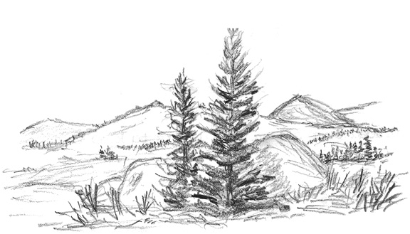
A short walk through lodgepole pines leads to an opening unofficially called Ute Meadows. The Old Ute Trail skirts the northern edge of the meadow area, dodging old beaver-made marshes. Past Ute Meadows the route climbs very steeply through picturesque limber pines to krummholz at tree line and then onto tundra.
Above the trees, the trail heads through Timberline Pass and levels on the south side of Tombstone Ridge. The 2.0-mile walk across tundra below the monolith-lined ridge likely will reveal many fine flowers and possibly a ptarmigan. The trail is easy to follow from cairn to cairn as it descends to Trail Ridge Road.
Most hikers who travel this end of the Old Ute Trail start at the upper trailhead (sometimes called Ute Crossing) on Trail Ridge, 2.0 miles west of Rainbow Curve or 0.8 mile east of Forest Canyon Overlook. Parking for a few cars is available at the trailhead and for more cars a short way up the road. The walk along the road from this parking area to the trail is the most dangerous part of the hike; be alert for traffic hazards.
Hiking the whole length of the trail is easier from top to bottom if you can arrange transportation at each end. More commonly done is a short hike across the tundra approximately to tree line and then back to cars parked beside Trail Ridge Road. This tundra stretch of the Old Ute Trail is described here in detail as a typical example of walking the park’s alpine zone.
Tundra Nature Walk (Alpine Zone)
Wind is the ever-present, most important, least ignorable factor in the tundra environment. At its worst in the winter, it can rage at more than 200 miles per hour across the tundra. Even in summer you cannot walk far along the Trail Ridge without commenting, at least mentally, on the wind.
The higher you climb in the mountains, the faster the wind blows. The average wind speed increases also with height above the ground. When you begin to feel the chill and pressure of the wind on the Old Ute Trail, try lying down for a not-to-be-completely-understood-until-you-try-it lesson in how alpine plants survive by being small.
Plants are short on the tundra because the growing season is not long, because food for growth may be in short supply, and because hugging the ground provides protection from wind. Wind quite simply kills anything that dares to stand upright against it. Wind drastically increases the chill effect of temperature that is already quite cold. It sucks moisture from plant tissues at a time when it cannot be replaced because all water is locked up as ice. Winter winds that often howl between 100 and 200 miles per hour carry bits of gravel and ice, sandblasting anything that gets in the way.
But wind can be beneficial too. It scatters pollen and seeds of willows, sedges, and many other plants. It piles up snow in some places while sweeping other areas bare of snow’s cover, moisture, and insulation. This action creates variety in the life of the tundra; some plants have adapted to heavy snow cover, while others live without protection of snow.
Hikers feel ambivalent about the wind. It is exciting, for it adds a touch of adventure and romance to mountaintop experiences. The best-known quotation from the writings of America’s most famous conservationist, John Muir, states that on mountains, “the wind will blow its own freshness into you and the storms their energy.”
Perhaps. But the wind also saps your energy if you have to walk into it. It chills your body and dries it out, compelling you to carry extra clothing and water. It “burns” exposed skin, brings tears to your eyes, and is more than an inconvenience to contact lens wearers. Although experienced mountaineers can predict what the wind will do, local variations caused by the shape of nearby terrain destroy the usefulness of such predictions.
With its habits subject to unpredictable whims, with its power to both benefit and harm, wind is more human than any other inanimate aspect of nature. It is not surprising that people throughout history have tended to think of the wind as a living force. In fact, the original Old Testament Hebrew of the Bible uses the same word for both wind and spirit. The New Testament follows the same practice with a Greek word.
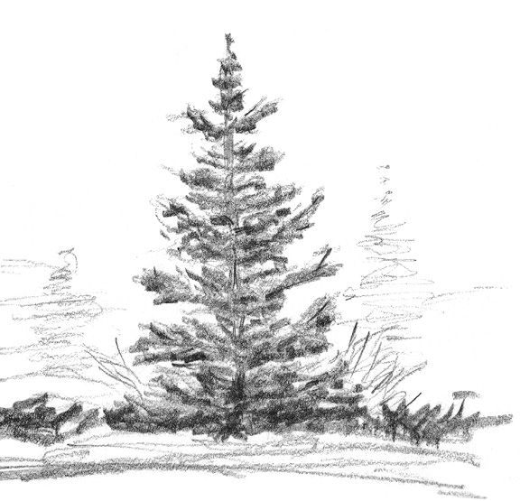
Not only does it seem living, wind even appears to be creative. It sculpts self-portraits out of the conifers that dare to face its fury at tree line. At 11,440 feet the upper trailhead of the Old Ute Trail is only a short distance above tree line. In fact, a few stunted trees bunch together up the hill from the trailhead on the other side of the road.
These are the skirmishers of the forest as it tries to advance its front line in the war between woods and wind for control of the heights. Although they do not look very magnificent, these dwarfed and battered krummholz trees are arboreal heroes.
Krummholz is a German word that translates aptly as “elfinwood.” These trees—usually Engelmann spruce, subalpine fir, or limber pine—sprout from seeds that blow up from tree line. The seeds land in some spot protected from the wind. After several years of growth in this sheltered outpost, a tree peeks above the level of its protection, usually a rock. Almost at once the wind kills the top of the tree by desiccating and sandblasting it. But lateral branches fill the protected area and take root where they touch the ground. Gradually the krummholz expands its beachhead by growing into the shelter of its own increasing bulk.
There is of course a limit to how far this tactic can expand the tree’s living space. The wind prunes off every shoot that extends into its blast. No gardener with active shears could be more zealous or thorough in shaping the krummholz into living sculpture.
Some trees may gain enough erect posture so that their trunks become windbreaks for branches growing on the lee side. All twigs on the windward side are killed, while the leeward branches are flung out like flags on a staff. This distinctive shape has earned the name “banner tree.” Indeed, these trees are the forest’s banners of defiance against the mighty wind.
After the trees establish their positions, they provide shelter for other forms of life. Wildlife such as various birds, snowshoe hares, and even elk find refuge from the wind under krummholz branches. Subalpine flowers can extend their range up a slope if their seeds chance to land within the krummholz sphere of influence. More often than not, however, hikers find that dense stands of krummholz are impassable barriers to walking.
Between patches of krummholz there are large open areas of tundra where the wind continues to dominate. One animal affected by it only indirectly is the northern pocket gopher. The chance of seeing one of these subterranean burrowers lies somewhere between slim and zero. But along this trail, evidence of their activity is easy to find: long mounds of dirt, looking rather like a jumble of heavy rope cable.
In winter, when the soil is frozen, pocket gophers tunnel through the snow where it meets the ground. They dig up tundra plants to eat and dump the dirt behind them in the snow tunnel. When the snow melts, the core of dirt remains to mark the route of the tunnel. These jumbled mounds of dirt are called gopher eskers.
It is difficult to say something flattering about a pocket gopher. A little larger than a rat, it has constantly prominent yellowish-orange incisors. Its eyes and ears are small, its tail is short and hairless, and it has cheek pockets lined with hair that are open to the outside rather than the inside of the mouth. The critter is said to have a grouchy disposition and generally lives alone in unforested habitats at all elevations in the mountains. (In the montane zone, Richardson ground squirrels are hard to miss and often are incorrectly called gophers.)
As burrowers, pocket gophers have no peers in the Rockies. Their strong, heavily clawed front limbs can dig through the rockiest soil. Their lips close behind their prominent front teeth, which they use to carry rocks and dirt. The burrow of a single gopher can be as long as 500 feet, running from 4 to 18 inches beneath the surface. This represents about three tons of excavated soil. Side tunnels and galleries are stuffed with roots and other plant parts stored for future meals. Additional chambers are filled with feces or are used for nesting.
All this digging has a profound effect on the tundra. Pocket gophers are second only to the wind as a force creating diversity among tundra environments on Trail Ridge. Gophers churn up the soil and enrich it with their droppings. On the other hand, the mounds of dirt from their tunneling cover up and kill many plants besides the ones they eat. The dirt dries out and blows away, eventually leaving bare spots where soil rebuilding may take centuries. But before the erosion takes place, the disturbed soil nurtures for decades the most spectacular flower displays on the tundra. Relatively large-blossomed plants like alpine sunflower and many other colorful blooms grow thickly in these “gopher gardens.”
Alpine sunflowers are practically impossible to miss along the Old Ute Trail. They boast the largest blossoms on the tundra, 2 to 4 inches in diameter. These blossoms are all the more prominent because every alpine sunflower points its face to the east, a worshipper of the rising sun.
Most tundra flowers cannot spare the time or energy to produce such large blossoms in the six-week interval between winters at this elevation. Alpine sunflowers achieve relatively gargantuan blooms by growing only roots, leaves, and short stems for several years. When enough food is stored in a large taproot, a sunflower expends it all in a glorious splendor of flower and seeds; then the entire plant dies.
A massive display of alpine sunflowers may indicate that the previous summer was a good one for building food reserves. Additionally, large numbers of sunflowers indicate that the local soil is in transition, containing much sand and gravel and little organic material. Water drains away easily. The soil is still evolving, and decaying alpine sunflowers may contribute to the formation of rich humus that eventually will support different types of plants.
By far the most common tundra flower along the Old Ute Trail is alpine avens. This diminutive member of the rose family grows in a wide range of habitats, although, like the alpine sunflower, it prefers gopher-churned soil. Alpine avens, with its five-petaled yellow flowers, blooms throughout the short summer. The flowers mature to feathery seed heads, and ultimately the fernlike leaves color the autumn tundra red. Alpine avens tend to attract tiny blackflies rather than bees to their nectar. Like many fly-pollinated flowers, these have scant scent.
Quite strong in fragrance is sky pilot, a flower with bell-shaped blossoms growing close together in a loose formation. Bright orange pollen contrasting with royal blue flowers may be sky pilot’s main attraction for bees, but the skunklike aroma of the leaves certainly adds to the plant’s distinctive lure.
When checking the aroma of tundra flowers, be careful. Sedges can puncture your eye. Sedges, a family of grasslike plants, make up the largest proportion of vegetable matter on the tundra. Easy to distinguish from grasses, most sedges are three-cornered and solid. Some grow erect and have sharp tips. I do not let a summer go by without stooping to smell an alpine wallflower. But to avoid injury in the mountains, it does not always pay to keep your eyes open.
Beautiful as they are, gopher gardens eventually are stripped away by the wind. Bare gravel then remains. But not only gophers denude patches of tundra vegetation. Road building causes damage beyond the edge of the pavement. Similarly, the waffle-stomper boots that keep hikers from falling on their faces also exact a considerable toll on tundra vegetation. Both these types of wear have made the tundra rather ragged right at the trailhead.
At the time of this writing, the damage is healing. Cushions of moss campion and mats of white alpine phlox have pioneered the battered gravel and are preparing the way for other plants to follow. The classic shape of cushion plants is a flattened hemisphere. It presents the minimum possible amount of leaf surface exposure to wind and cold and the maximum possible exposure to sunlight for photosynthesis. Also, the low, streamlined profile offers the least resistance to the wind. The shape may be varied to suit particular conditions.
Moss campion (resembling but not truly a moss) is the most common cushion plant. It also is one of the prettiest and fastest growing. Under relatively favorable conditions, it may grow to 0.5 inch in diameter in five years. At ten years it begins to produce dainty pink blossoms; at twenty years blooms cover the cushion. At twenty-five years the cushion may be 7 inches in diameter.
Some of the cushions at the trailhead are being invaded by grasses and other flowers that have taken root in the little mounds of windblown soil captured and hoarded underneath the cushions’ many-branched stems. In another century or so, this area may have evolved from gravel to an alpine meadow densely carpeted with plants. If so, moss campion will have started the reclamation effort.
Of 157 species of flowering plants on Trail Ridge, moss campion probably arouses the most admiration. It invades sterile ground, bearing a pink banner of life. Although moss campion manages to survive the rigors of mountaintop living, it would die quickly if transplanted to a milder climate.
Similarly, the white-tailed ptarmigan is the toughest animal adapted to life above the trees. This small grouse is the only species in its clan to sport white feathers on the edges of its tail. In winter the rest of the feathers also are white, providing perfect camouflage in the snow. The camouflage continues into summer: White plumage is replaced by mottled gray and brown feathers, which blend with the rocks protruding everywhere from the tundra.
Hikers rarely notice ptarmigan along the Old Ute Trail. Holding every feather still, the birds completely trust their protective coloration to disguise them as rocks. Sometimes, though, close approach will cause them to flush and run away. To have inanimate granite transformed into a scurrying bird is startling, no matter how many times the trick is repeated. After fleeing on foot, ptarmigan may take flight if they feel closely pursued.
The invisibility of a ptarmigan hen on her nest defies belief. She probably will expose her eggs to the elements only if she is actually touched. If she does not move, a passing hiker is more likely to hear her pounding heart than to see her. Finding a ptarmigan nest is a very rare privilege, even though they must be relatively common.
Spotting ptarmigan at any time of year is a thrill and joy to mountaineers, who seem to identify with the alpine birds. One similarity may be mountaineers’ down jackets. Ptarmigan, too, use down, but they can control its insulating capacity by raising or flattening their feathers. Widespread toes are covered with feathers in winter to keep the birds’ feet warm and to support them, just as snowshoes support humans. Mountain climbers may even recognize in ptarmigan a heroic stubbornness to survive and enjoy life on the high peaks.
At the trailhead, the coarse sand and gravel that moss campion is invading is mostly decomposed granite. Between 1,400 and 1,450 million years ago, molten rock beneath the earth’s surface cooled slowly to granite, with large grains of quartz and feldspar. Uplifted by forces generated when North America drifted away from Europe some fifty to seventy million years ago, the granite emerged at the surface as erosion stripped away overlying sedimentary rock. The expansion of granite under high-altitude extremes of heat and cold, the expansion of ice in cracks, and the blasting by fierce winter winds are now tearing the granite apart. Fine bits of rock are blown away, leaving only larger bits of rock on the ground.
Look also for a dark boulder of schist, sparkling with bits of mica embedded in it. Among the oldest rocks in the national park, schist originally was laid down as sediment that was cemented into fine-grained rock. Eventually buried deep within the earth, this sedimentary rock was subjected to heat and pressure, which so changed its structure that it became metamorphic rock with almost no resemblance to its original composition.
The Old Ute Trail climbs a slight rise as it departs from Trail Ridge Road, giving hikers a good view to the right into Forest Canyon. Headwaters of the Big Thompson River, the canyon originally was cut in a V shape by water erosion after the most recent uplift of the Rockies, about twenty-eight million years ago. Glaciers 1,000 to 1,500 feet thick flowed down the valley during past ice ages, steepening its walls and broadening its floor to create a U shape.
The most recent glacial period began to abate about 15,000 years ago. Perhaps we are currently in an interglacial time. The valley below may once again fill with a moving tongue of ice.
Probably the most striking thing about the awesome view across the valley is the contrast between the broad, rounded slopes of Terra Tomah Mountain and the jagged precipices along Hayden Gorge. The gorge is to the left of Terra Tomah and culminates in the fanglike tower of Hayden Spire. The relatively gentle tundra slopes of Terra Tomah, like the rolling highlands of Trail Ridge, never have been glaciated. They are the remnants of hills eroded into their present configuration between twenty-eight and sixty-five million years ago, before they were raised 6,000 feet to their present heights. The vertical, ragged rock below the tundra was sculpted by moving belts of glacial ice.
Trail Ridge
During the last ice age, deep snowdrifts did occur in areas on Trail Ridge that were protected from the wind, which swept most of the ridge clear of snow. The abundant snow that fell on the ridge ended up in the valleys below, piling ever higher as more accumulated in winter than melted in summer. When it piled up to approximately 100 feet, the ice crystals at the bottom were compressed and transformed by the great weight of snow on top. The ice at the bottom began to ooze downhill in response to gravity. A glacier was born.
The climate of that glacial era was a good deal more frigid than today’s. Frost heaves—the expansion and contraction of the ground from successive freezing and thawing—tilted rocks on edge. On steep slopes, gravity pulled rock debris downhill, shaping the slopes in a descending flowing pattern. Abundant water from thawing ground and melting snow completely saturated the ground so that large sections of soggy soil began to slide downhill. The process, called solifluction, formed terraces on the slopes below the Old Ute Trail, some of which catch water and form marshes.
As the Old Ute Trail climbs around a shoulder of Trail Ridge, the road is out of sight and hikers are treated to a view of Longs Peak, a blocky, flat-topped tower rising obviously higher than surrounding peaks. At 14,259 feet Longs is the tallest peak in Rocky Mountain National Park.
Where Longs drops temporarily out of sight behind a hill, look west down Forest Canyon to a view of the Never Summer Range. The name of these mountains is a translation from the Arapaho Ni-che-be-chii and may have been inspired by the number of perpetual snowbanks that deck their eastern slopes. Prevailing westerly winds sweep the snow from western slopes and pile it on the eastern slopes. In summer the resulting huge drifts never disappear completely before winter returns to replenish them.
Walking past a ridgetop jumble of rocks, which likely are home to yellow-bellied marmots (large woodchuck cousins) and pikas (small, short-eared rabbitlike mammals, nearly invisible but often identified by their high-pitched bark), hikers receive a good view of the Mummy Range to the left. Beyond some hardy krummholz hiding behind rocks, the ridge to the right breaks to provide another opportunity to look into Forest Canyon.
This break also permits wind to rush through from the west. Because the same volume of air that has been howling across unobstructed space must pass through this constricted area in the same amount of time, the wind must blow faster. A wind scarp, where even cushion plants can achieve scant hold on the gravelly ground, testifies to the bitter gales that scour this stretch of trail in the winter.
Just beyond the wind gap, however, the turf of a well-developed mountain meadow contrasts with the sterile gravel of the scarp. Here rock polygons demonstrate how the expansion and contraction of the ground by freezing and thawing sorts the rocks into patterns amid lush plants.
As the trail begins to descend toward the head of Windy Gulch, hikers notice a tor in the middle of Timberline Pass. A tor is a mass of broken rock. Such formations usually overlie unbroken bedrock. They are formed either by freezing and thawing of exposed rock or by the disintegrating effects of groundwater before erosion of overlying rock uncovers the tors. Such formations are common along the Old Ute Trail.
Below the tor is tree line in Windy Gulch. Farther below is a good view into Moraine Park, named for a lateral moraine along the south edge of the meadowland. This moraine was deposited by the glacier that spilled out of Forest Canyon.
In the cracks of the tor live marmots and the many flowers that feed them: Colorado blue columbine, bushy cinquefoil, sky pilot and the similar cream-colored honey polemonium, blue chiming bells, harebell, yarrow, thistle, sorrel, gooseberry, and many more. Here the flowers of the tundra mix with those of the subalpine zone in a rich floral climax to your tundra nature walk.