Arapaho Glacier Trail
The Rainbow Lakes Trailhead is located adjacent to Rainbow Lakes Campground. To reach the trailhead drive on CO 72 for 5 miles south of Ward or 8 miles north of Nederland. Turn west onto unpaved NFSR 298 identified as the road to the University of Colorado Mountain Research Station. The road forks after 0.8 mile; take the left-hand fork for a very bumpy 4-mile drive uphill to the campground. Drive to the trailhead reconstructed in 2011 and located east of Rainbow Lakes Campground.
It is 1.2 miles to Rainbow Lakes, which are connected by a web of informal trails. From the highest lake you can look up past subalpine forest to a small cirque and the long tundra ridge of Caribou, a 12,310-foot projection unspecified except by the name of a deer not native to Colorado. The Arapaho Glacier Trail (also called Glacier Rim Trail) leaves from the same trailhead east of Rainbow Lakes Campground.
The trail begins by climbing steeply through the forest and then moderates its grade along the fence marking the border of the Boulder watershed. Numerous signs will inform you as to which side of the fence you should travel. More than 1.0 mile from the trailhead, the path turns left away from the fence and zigzags nearly to tree line.
From the crest of a ridge above the trees, you can look down on the beautiful valley of the South Fork of North Boulder Creek. Again the edge of the Boulder watershed is marked; occasional signs may name the reservoirs below. At the head of the valley, to the west, a line of grand but unnamed 12,000-foot peaks follows the Continental Divide. The “thirteeners,” North Arapaho and Arikaree, are high points on the left and right of your view. Mount Albion stands out massively across the gorge.
Be sure to photograph the valley and the peaks before you follow the trail in a sharp left turn up the ridge. As you climb higher past the switchback, the lake-filled valley will drop below your view. The peaks still will be magnificent but will rise out of a tundra slope somewhat less dramatically than from the depths of the valley.
The tundra where you walk is well carpeted with flowers in season; alpine sunflowers may be the most prominent. Through wide switchbacks the trail winds up the slope north of Caribou and then flattens on top of the ridge. Peak baggers may wish to walk to the left (east) of the trail to the cairn marking the top of Caribou. Because several bumps on the same ridge are hundreds of feet higher than this point, I speculate that it was singled out because it was visible from some point below. Try to step on rocks and avoid trampling the rosettes of fleshy leaves that belong to the big-rooted spring beauty.
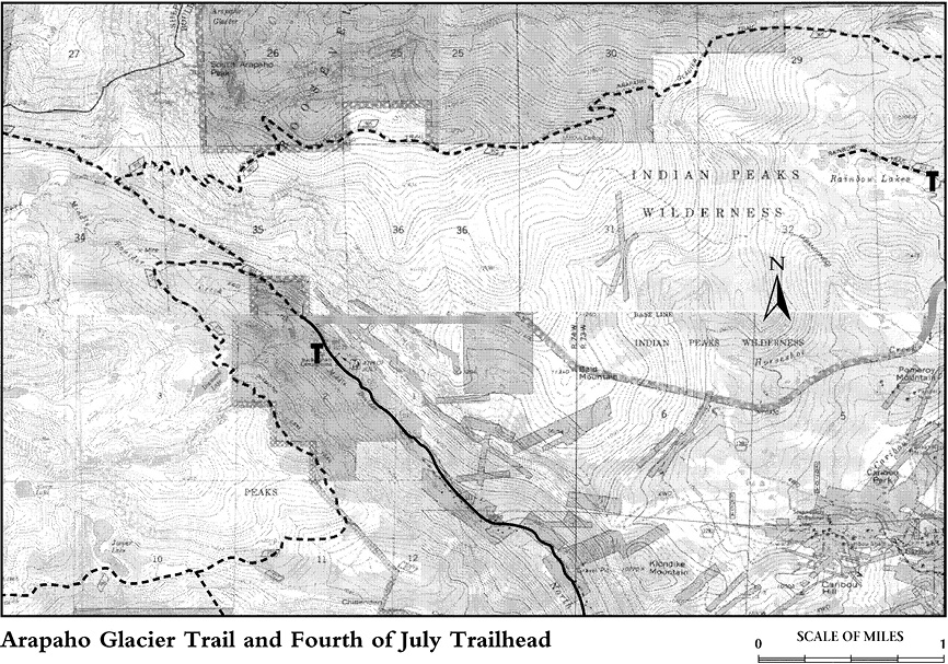
Past Caribou the trail crosses to a south-facing slope and switchbacks up the ridge. Above 12,600 feet the path undulates gradually across the tundra for a few miles. The view of colorful alpine flowers at your feet competes with the view of rugged peaks and hanging lakes across the valley to the south. Six miles from Glacier Rim Trailhead, the trail drops down into the valley of North Fork Middle Boulder Creek. (Yes, the watercourses around here have confusing names.)
From the junction walk uphill a few yards to the viewpoint for Arapaho Glacier, the southernmost glacier in the Rockies. The dramatic conical mountain rising directly above you is South Arapaho Peak. The route to the top is easy to follow over boulders on the south slope, to the left of the east-facing cliffs. A bronze peak finder is cemented into the summit to elaborate on the fine view, especially to the south and west as far away as Mount of the Holy Cross.
The climb over to North Arapaho Peak is somewhat more challenging. It is a 0.5-mile trip—farther than it appears. The route involves a little boulder climbing. Before you have gone far on the southwestern side of the ridge extending between the two Arapahos, splashes of red paint appear on the rocks, marking the route. (These are camouflaged in autumn, however, when the abundant rosettes of the big-rooted spring beauty turn bright red.)
It seems to me—not an avid rock climber—that the route to North Arapaho is interesting without being scary or exposed to dangerous falls. Yet I have met enough wide-eyed folks returning from the peak and exclaiming that they had stared death in the face to suggest that my assessment is wrong. Or perhaps some of the climbers bothered by exposure to long falls got off-route too far to the right and too close to the east-facing precipice above the glacier.
Anyone who has had enough climbing experience to use a rope effectively will probably be experienced enough not to need one on North Arapaho. But a rope in the leader’s hands, belaying a nervous member of the party, may be a useful psychological protection. At any rate, all climbers should be extremely careful.
There is a huge cairn on the summit of North Arapaho—from far and wide a visible monument to the activity of the human species Homo constructus. You can climb the cairn to have your picture taken on the tip-top of the mountain or hold a square dance on the monument if you like. But the best subject for a dramatic photo is a secondary promontory south of the true summit. The photographer stands on the true summit, focusing across at fellow climbers atop an absolutely sheer cliff that juts over Arapaho Glacier with South Arapaho behind them. Do not get too daring as you shoot. It is fatally far to fall.
From the Arapaho Glacier viewpoint below South Arapaho, it is only 3.5 miles down to the city of Boulder’s Buckingham Campground and the Fourth of July Trailhead (USFS). This is about half the distance of the hike back to Rainbow Lakes Campground. Moreover, the trail to Buckingham, on the banks of North Fork Middle Boulder Creek, is very pleasant. Try to work out the logistics of having transportation waiting for you at the campground.