|
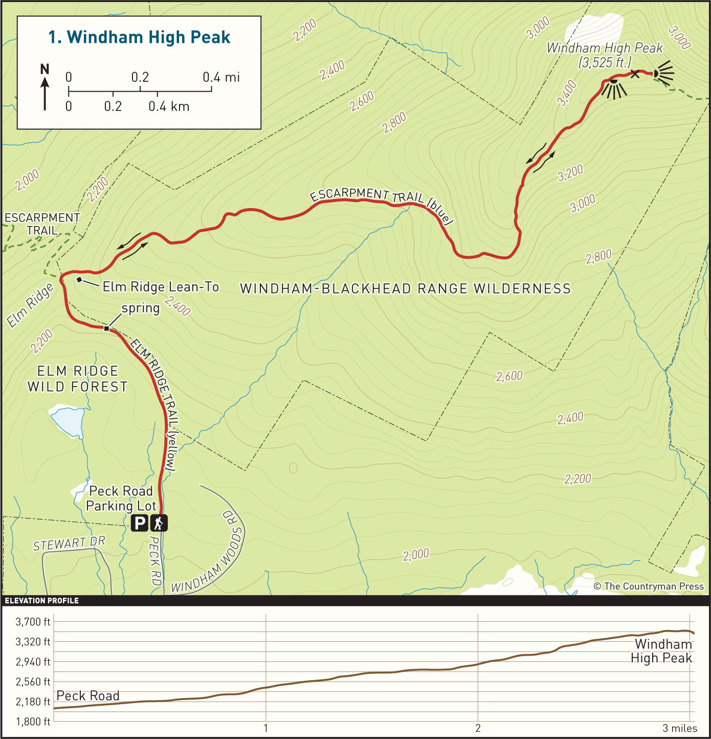
DISTANCE: 6.2 miles TYPE: Out and back TOTAL ELEVATION GAIN: 1,480 feet MAXIMUM ELEVATION: 3,525 feet DIFFICULTY: Moderate HIKING TIME: 3.5 hours |
Windham High Peak is the most northerly 3,500-foot peak in the Catskill Mountains, with views over the Schoharie and Mohawk Valleys to Albany. Though lacking the elevation of many of its peers in the range, Windham nonetheless offers excellent views from several vistas as well as beautiful passages through old-growth forest. For more ambitious hikers, the route can be extended to include Burnt Knob and its vistas (an additional 3.5 miles).
GETTING THERE
Take Exit 20 (Saugerties) from the New York State Thruway, then turn left onto NY-212/NY-32. At the traffic light, take a right onto NY-32 North. In 6 miles, continue straight onto NY-32A. In 1.9 miles, turn left onto Route 23A, and drive up the winding mountain road toward Tannersville. After driving through Tannersville, turn right at the traffic light onto Hill Street (County Route 23C). Follow NY-23C for 6.1 miles, then turn right onto Maplecrest Road (NY-40). Continue on Maplecrest Road for 1.9 miles, then turn right onto Big Hollow Road. In 1.8 miles, turn left onto Peck Road, and follow it until you arrive at the parking area.
GPS SHORTCUT
Type “Peck Road, Maplecrest, NY” into Google Maps and your GPS will lead you to the start of Peck Road. The parking area is at the end of the road.
THE TRAIL
Head north following the yellow blazes on an old woods road. The trail is frequently muddy throughout the year, though short bypass trails have been built around some of the wettest sections. In a little more than half a mile, you will pass a spring, after which the trail will begin to climb.
Soon, you will arrive at a junction with the blue-blazed Escarpment Trail. Turn right onto the Escarpment Trail. Shortly after, look to your right to catch a glimpse of the Elm Ridge Lean-To through the trees. Continue to follow the blue blazes as the trail begins to ascend more steeply. As you climb, you will enter a dense forest of old-growth Norway spruce, one of the few remaining in the Catskills.
Eventually you will begin to find views through the trees, looking over your shoulder toward the Blackhead Range. About 2.5 miles into the hike, the trail bears to the left and begins an even steeper climb.
Just under 3 miles in, a side trail to the right of the path leads to the first major viewpoint. With excellent views looking1 out over the Blackhead Range, this is an ideal spot to stop for a rest. Very shortly after is a second viewpoint, though with more limited views.
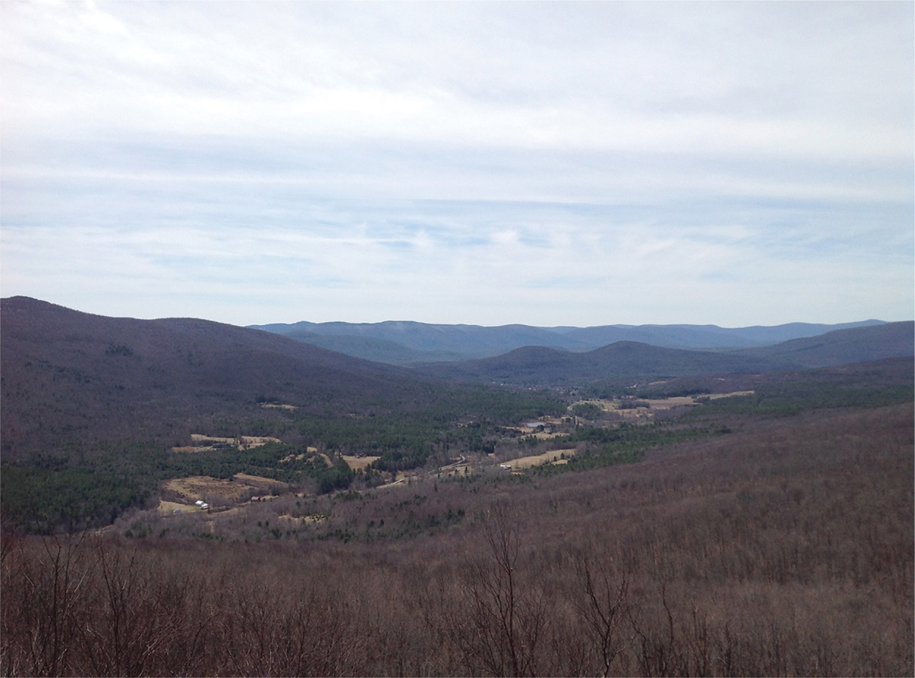
BLACK DOME VALLEY BELOW WINDHAM HIGH PEAK
Just after the 3-mile mark, you will reach the summit of Windham High Peak, indicated by a USGS marker embedded in a rock. Only 200 feet beyond the peak is a rock ledge with views of the Hudson Valley and, on a clear day, north to Albany.
When you are ready to descend, retrace your steps to your car.