
Inspiration Point and Layman’s Monument
|
DISTANCE: 4.7 miles TYPE: Lollipop TOTAL ELEVATION GAIN: 190 feet MAXIMUM ELEVATION: 2,430 feet DIFFICULTY: Easy HIKING TIME: 3.5 hours |
While North-South Lake—historic home to several famous Catskill hotels, and now grounds for a large camping area—is one of the most popular Catskill destinations on its own, the trails that surround the lake offer an equal draw. Together, this area holds some of the richest scenery in the park, and these views happen to be some of the most accessible, too. On the Escarpment Trail that skirts the lake, vistas hit one after another, the sites and history lessons like a “Best Of” for the region. On this loop hike exploring the trails southwest of North-South Lake, you will experience some of the most dramatic of the vistas overlooking Kaaterskill Clove at Inspiration Point and Sunset Rock. At Layman’s Monument, a break in the trees gives an unusual perspective over the clove: straight on, as if floating above the notch between mountains. Here, the Frank D. Layman Memorial commemorates the firefighter who died at this site on August 10, 1900, fighting to protect the area from a blaze.
GETTING THERE
Take Exit 20 (Saugerties) from the New York State Thruway, then turn left onto NY-212/NY-32. At the traffic light, take a right onto NY-32 North. In 6 miles, continue straight onto NY-32A. At Palenville, take a slight left onto NY-23A. The road climbs steeply up the mountain to Haines Falls. At Haines Falls, just after the post office, turn right onto North Lake Road. Continue for 3 miles. Just before the entrance to the North-South Lake Campground, turn right onto Scutt Road. Just down the road is a parking area on the right. Watch for hikers crossing the road to the trailhead. The parking area is large, with two separate tiers, but it still fills up quickly due to the popularity of the hikes in this area.
GPS SHORTCUT
Direct your GPS to navigate to “North/South Lake Campground,” and turn right onto Scutt Road immediately before the campground entrance.
THE TRAIL
From the parking area on Scutt Road, cross the street that you drove in on to find the trailhead, marked by blue blazes. Follow the Scutt Trail heading south. The path starts off level, though somewhat rocky and crisscrossed by roots.
At 0.4 mile, you will cross an old railroad grade running east–west. The tracks here once brought passengers directly from the valley below up into the Catskill Park region. Just after the railroad grade, you will come to the trail register.
Shortly after the trail register, at 0.5 mile, you will reach a four-way intersection. This is the first of many intersections you will encounter on this hike: The North-South Lake area is thick with trails and opportunities to forge new loops, but most trails are very well marked, with wooden signs indicating landmarks and distances at prominent intersections. To your right is the trail you will return on at the end of your loop. For now, stay straight, following the red blazes. The trail will now begin to ascend slightly uphill.
In a quarter mile, you will come to another intersection with a yellow-blazed trail. Keep to the left, following the red blazes. After another 0.75 mile of easy hiking, you will come to a multisection intersection that is the most disorienting portion of this hike. An unmarked trail to your left leads toward the site of the former Kaaterskill Hotel. Little remains of the old structures, but this unmarked narrow pathway does offer a nice short loop through the woods and the scant sights of the former mountain getaway. From this same intersection, only a few steps beyond the first unmarked trail, the aqua-green-blazed Long Path diverges in two directions. To the left, the blue-blazed trail will take you toward North Lake and eastern sections of the ridgeline, where spots like Boulder Rock offer views out to the Hudson Valley.
Take the trail to the right, heading south on the blue blazes. After half a mile, turn right again onto a flat pathway, still following the blue blazes. Shortly after this, turn left to stay on the trail—the path heading straight from this intersection is a horse path cutting back toward the beginning of your hike.
Very soon, views will begin to open up to the left of the trail, offering glimpses of Kaaterskill Clove. There are many scenic viewpoints and dramatic ledges here that make for a perfect lunch site. At Inspiration Point and Sunset Rock, there are a number of ledges where you can sit, catch your breath, and take photographs of the dramatic scenery surrounding you.

LOOKING ACROSS KAATERSKILL CLOVE
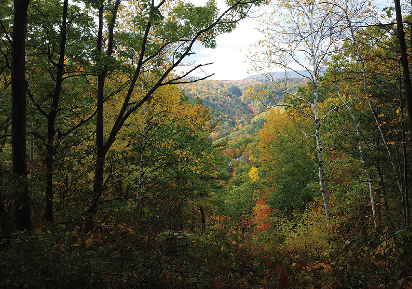
LAYMAN’S MONUMENT OFFERS A VIEW UP KAATERSKILL CLOVE
Stay straight at the intersection with the yellow trail, and continue on, past several more ledges and overlooks, to Layman’s Monument. Here, the foliage opens up, allowing a glimpse of the hikers making their way down NY-23A to Kaaterskill Falls, and the clove stretching westward toward Haines Falls.
At Layman’s Monument, the trail hooks to the right. Follow the blue blazes. After another half mile of hiking, you will begin to see signs for the side trail leading to the viewing station above Kaaterskill Falls. This is a short side trail that can be added on to your hike for an opportunity to see the famous waterfall from another angle.
After the waterfall side path, be mindful of the private property that borders the trail on the north side. Continue on toward the intersection with the trail register. Here you will reach the final leg of the hike, leading back to the parking area. Follow the blue trail you hiked in on north to return to your car.