Codfish Point from Platte Clove
|
DISTANCE: 4 miles TYPE: Out and back TOTAL ELEVATION GAIN: 650 feet MAXIMUM ELEVATION: 2,500 feet DIFFICULTY: Easy HIKING TIME: 2 hours |
The eastern sections of the Catskill Park running parallel to the Hudson River boast some of the most memorable vistas in the range—as evidenced by the heavy focus on this area by the early tourism and hotel industry. Here, just north of the site of the former Overlook Mountain House, a series of cloves and ridgelines drops off severely into the valley below, creating ideal viewpoints at numerous spots. On a clear day, the entire Hudson Valley spreads out before you, with views beyond to the Shawangunk Ridge, the Berkshire Mountains of Massachusetts, and even to the Green Mountains of southern Vermont. Codfish Point delivers on a number of these views, and its rewards are accessible to just about any level of hiker, as this 4-mile round-trip hike poses few difficulties.
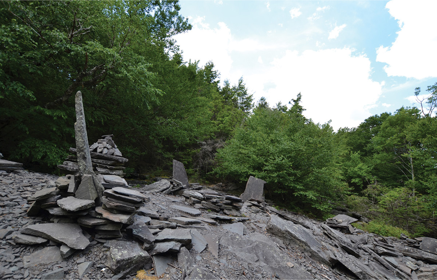
Further adding to the appeal of this hike, handmade stone furniture can be found at various points of the trail, presenting unique opportunities for photo ops and rest spots (though for a more intense experience with the mysterious furniture, one should visit Dibble’s Quarry, Guide #21). More adventurous hikers can choose to extend this hike to Echo Lake (for a total distance of 8.8 miles) or even to the Overlook Mountain House and fire tower (a total of 13 miles). For an easier add-on, the Upper Platte Clove Waterfall (Guide #16) is available from the same parking area and is a very short hike.
GETTING THERE
Take Exit 20 (Saugerties) off the New York State Thruway for NY-32, then turn left to head west on NY-212. Continue on NY-212 West for 2.3 miles, then make a slight right onto Blue Mountain Road. In another 1.4 miles, turn left onto West Saugerties Road/NY-33. Drive for 3 miles before continuing straight onto Platte Clove Road. The road ascends steeply, with winding turns and incredible views of the clove to your left. This road is closed seasonally, so be wary of driving conditions in periods of inclement weather. Parking can be found on either side of the road by the trailhead.
Type “Devils Kitchen, Hunter, NY” into Google Maps and your GPS will navigate you to the appropriate trailhead.
THE TRAIL
Start south on the Long Path and immediately cross the small wooden bridge spanning the Plattekill Creek. The trail will be marked with aqua-colored Long Path markers as well as the blue diamond blazes of the Platte Clove Preserve.
Follow a shady path heavily knotted with thick tree roots. A little under a mile from the trailhead, you will reach a rocky area to the left of the path, where makeshift seats and benches have been crafted from stone slabs. The bluestone of this wild furniture originated from the old quarry at the site, but these days, the clearing makes for the perfect place to stop, relax, and enjoy a snack.
Immediately after the quarry, the trail will reach a sharp fork and the trail markers will change to the blue DEC blazes. First, hike past the red-blazed Devil’s Path trail as it veers to your right, and then almost immediately after, continue straight again as the Long Path and the southern loop of the Devil’s Path trail join, heading west toward Indian Head Mountain.

FOOTBRIDGE SPANNING PLATTEKILL CLOVE
Following the blue markers, you will soon reach the Devil’s Kitchen Lean-To. While its perch just off the path and near an idyllic stream makes it another perfect spot for taking a break, not to mention camping, you’ll have company on most days. Even arriving early in the afternoon, you can expect at least one group of campers to have already staked out a spot. Few hikes in the eastern Catskills are particularly obscure, and thus snagging a prime camping spot during much of the year can be a challenge.
Just after the lean-to, you will reach another bridge. Soon after crossing this stream, the trail will begin to climb slightly. These trails are part of a network of old carriage roads that once allowed visitors to access the Overlook Mountain House, only a few miles to the south (and still accessible via this same trail, as an extended hike).
Tackle this moderate ascent for another 0.75 mile. Shortly before reaching Codfish Point, the trail will level off, and you will spot a cairn marking the yellow-blazed spur trail to your left. Follow this side path for a short distance to reach Codfish Point.
At the overlook, find another of the stone-slab chairs created for you to perch on, and enjoy the sweeping views of the river valley. Facing the east, with an easy, short trail (and a nearby lean-to), Codfish Point makes for an excellent spot to catch the sunrise.
When you are ready to return, retrace your steps to your car.
Platte Clove offers an easily accessible bonus if you’re still looking to explore after your venture to Codfish Point. See the Guide (#16) for the Upper Platte Clove Waterfall to extend your hike and visit the falls, only a short walk from the parking area.