
Plateau Mountain from Warner Creek
|
DISTANCE: 8.5 miles TYPE: Out and back TOTAL ELEVATION GAIN: 2,340 feet MAXIMUM ELEVATION: 3,840 feet DIFFICULTY: Strenuous HIKING TIME: 5 hours |
While this route to the summit of Plateau Mountain is more than 2 miles longer than the trail from Devil’s Tombstone, you’ll likely find it to be a much more manageable ascent. This is due to the fact that you’ll climb more steadily over the course of 3.5 miles, as opposed to the 1,600 feet climbed in 1.3 miles on the Devil’s Path route. That isn’t to say that this hike is easy, since this trailhead is roughly 500 feet lower than the one at Devil’s Tombstone. There are tradeoffs as well. The Warner Creek Trail doesn’t have the large, open vistas that the Devil’s Path offers, but you’ll still be able to catch views from smaller, slightly more obstructed points on the trail. And because it is a longer hike, it’s usually not as busy, so you have a better chance of enjoying these views in solitude.
GETTING THERE
From the New York State Thruway, take Exit 19 (Kingston) and pick up NY-28 heading west. Follow NY-28 West for 22.6 miles, and turn right onto Main Street in Phoenicia. Turn left onto NY-214 in 0.2 mile, immediately after crossing a bridge spanning Stony Clove Creek. Continue on NY-214 heading north, and in 8 miles turn right onto Notch Inn Road. Park on the wide shoulders of the road, a few hundred feet before a bridge crosses a tributary of Stony Clove Creek.
GPS SHORTCUT
Type “Notch Inn Road” into Google Maps, and your GPS will navigate you to the appropriate trailhead.
THE TRAIL
From the trailhead, begin walking up Notch Inn Road. You will cross the aforementioned bridge and proceed to roadwalk uphill for 0.4 mile. Just before the road ends at a private residence, veer left onto a yellow-blazed trail leading into the woods. The trail follows a rocky old forest road, continuing uphill. Follow this abandoned road and in half a mile you will arrive at Silver Hollow Notch, the col between Edgewood Mountain on your right and Daley Ridge on your left. The yellow blazes end here, at the junction of the Warner Creek Trail.
Turn left and follow the blue trail markers of the Warner Creek Trail. In 0.2 mile you will begin to ascend steeply through a series of rocky switchbacks, which will send you up nearly 700 vertical feet. There are some pleasant views of the valley below through the trees as you make your way up. Eventually, the trail will begin to level off as you reach the top of Daley Ridge. For the next mile the trail is much less intense, gently meandering over the mellow crest of the ridge, followed by a gradual descent of about 100 feet.
The last leg of the climb continues to follow the blue blazes going straight up a steep shoulder of the mountain. There are two very good vistas along this trail, leading off to the right on obvious herd paths. These areas are small rock ledges on the rim of the ridge. From these points, you can see Little Rocky Mountain and Olderhark Mountain to the south, across a massive tree-covered bowl. Drainage from the southern flank of Plateau Mountain forms the headwaters of Warner Creek, which eventually joins with Stony Clove Creek north of Phoenicia. Take your time as you ascend and be sure to enjoy these pristine viewpoints.
After 3 miles of hiking on the Warner Creek Trail, you will reach the ridge of Plateau Mountain, shrouded in dense evergreen trees. Turn right here onto a narrow, tunnellike trail, and continue on the red-blazed Devil’s Path for half a mile. At this point you are on the true high point of Plateau. There are no views from here, but if you continue on the Devil’s Path, descending for about a tenth of a mile, you will reach a viewpoint atop a large boulder. From here you can see Sugarloaf Mountain to the east, as well as the Platte Clove Valley.
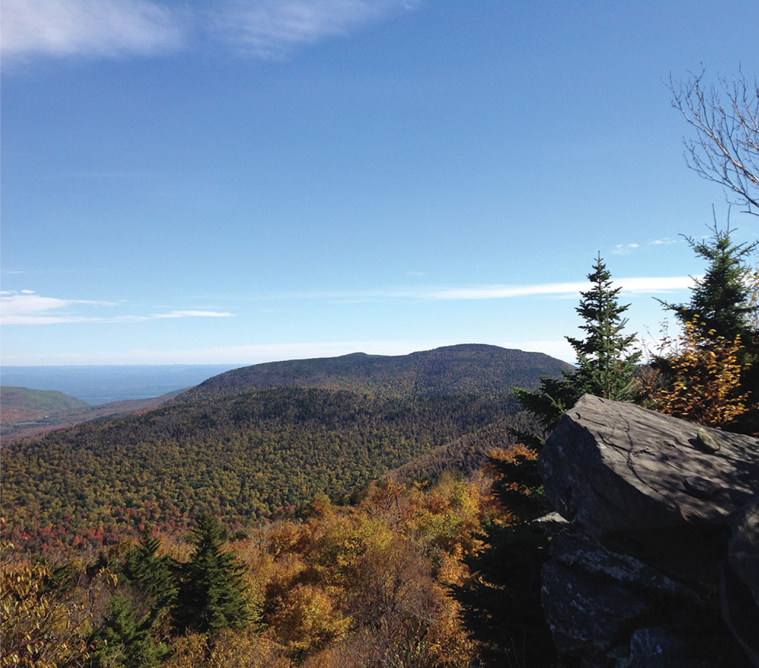
VIEW FROM PLATEAU MOUNTAIN LOOKING EAST TOWARD SUGARLOAF
When you are ready to leave, turn around and head back to the junction of the Warner Creek Trail. Turn left and follow the path back to the yellow-blazed trail. Turn right, follow the yellow blazes, and roadwalk the last portion of the hike back to your vehicle.
There are additional views on the western side of the Plateau ridge, should you wish to extend your hike. To visit these viewpoints, continue to follow the Devil’s Path west, instead of turning left onto the Warner Creek Trail after visiting the true summit. You will reach the furthest vista in 1.7 miles from the turnoff for the Warner Creek Trail. From these areas you can see Hunter Mountain, Southwest Hunter Mountain (Leavitt Peak), Kaaterskill High Peak, and the Blackhead Range in the distance. Return to the junction of the Warner Creek Trail and follow it to get back to the parking area. The hike from the trail junction traverses the Plateau ridge and is easy walking, though it will add 3.4 miles to your total mileage, making for a fairly intense outing, all told.

LOOKING WEST TOWARD PLATEAU MOUNTAIN FROM THE MINK HOLLOW TRAIL