Southwest Hunter Mountain (Leavitt Peak)
|
DISTANCE: 6.2 miles TYPE: Out and back (bushwack required) TOTAL ELEVATION GAIN: 1,640 feet MAXIMUM ELEVATION: 3,740 feet DIFFICULTY: Difficult HIKING TIME: 4 hours |
Also known as Leavitt Peak, in honor of the first finishers of the Catskill 3500 challenge, Southwest Hunter Mountain sits along an unmarked spur trail off of the Devil’s Path. While there are no views from the summit, the route described here is arguably the most scenic, leading you past a pleasant waterfall and a small vista on the way. The last mile to the peak is on an unmarked herd path, with a short, easy bushwhack at the very end. You will have to stay alert to reach the top! Southwest Hunter Mountain can be climbed on its own or in conjunction with Hunter Mountain. There are several ways to access the start of the herd path. The hike described here, while not the shortest, climbs the least amount of elevation of any route to the start of the unmarked trail.
GETTING THERE
From the New York State Thruway, take Exit 19 (Kingston) and head west on NY-28. Continue about 28 miles to the junction with NY-42 in Shandaken. Proceed north on NY-42 for 7.4 miles to the hamlet of West Kill, then turn right. Follow Spruceton Road (County Route 6) for another 6.7 miles, past a dead end sign, to a large parking area for Hunter Mountain on the left side of the road. If this parking lot is full, there are two more lots further down the road.
GPS SHORTCUT
The nearest searchable location is Spruceton Inn in West Kill, NY. Search Google Maps for “Spruceton Inn,” and when you arrive, continue to head east on Spruceton Road for approximately 2 miles to reach the trailhead.
THE TRAIL
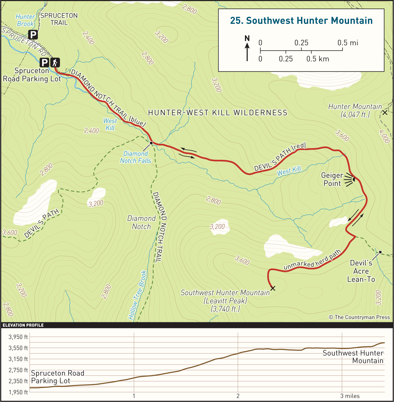
From the parking area, enter the woods at the end of Spruceton Road and begin walking a rocky horse trail alongside West Kill. This is the Diamond Notch Trail, a blue-blazed multiuse trail that will intersect with the Devil’s Path in 0.7 miles. The trail ascends moderately, passing a gate soon after you enter the woods. Continue to follow the blue trail markers until you come to an intersection in a large grassy clearing. Diamond Notch Falls are located to your right and are well worth exploring. The Diamond Notch Trail crosses the creek above the falls and continues south to a shelter, descending on an old road grade further on. The red-blazed Devil’s Path bisects the Diamond Notch Trail, heading across the falls to your right before turning to the west toward West Kill Mountain. From the grassy clearing, go straight, heading east on the Devil’s Path.
The Devil’s Path climbs slightly more aggressively immediately after leaving the trail intersection, and the trail is much rockier than before. You will have to be careful of your footing as you walk this stretch of the trail, since some of the rocks are loose and can easily cause you to sprain your ankle. After about 0.6 mile of relatively easy climbing, the trail bends to the left and starts heading uphill through open forest on a steep grade that is just as rocky. Take your time as you ascend. In the spring and summer, this climb can be wet from runoff and overgrown with stinging nettles. It is recommended that you wear pants or long socks to protect against these pesky plants.
DIAMOND NOTCH FALLS
Toward the top of the climb, you will see an unmarked herd path that leads off to the right. Following this short trail for a few feet will take you to Geiger Point, a small rock ledge that offers terrific views looking out over Diamond Notch Hollow below. Southwest Hunter Mountain will be to your left, and West Kill Mountain is located to your right. Return to the main trail to resume your hike. In a short distance from the vista, the trail levels off significantly. As before, you may experience soupy, muddy sections on this leg of the hike. Continue to follow the Devil’s Path through hemlock, balsam, and birch forest.
Half a mile from Geiger Point you will come to an obvious, unmarked herd path leaving the Devil’s Path on the right side of the trail. If you reach the Devil’s Acre Shelter, then you have gone too far and will have to turn around. Turn onto this unmarked trail, and follow it for roughly 0.75 mile. The grade is easy, as it walks an old gravel railroad bed, through dense conifer forest.
Toward the end of the railroad grade, you will come to a small cairn marking a narrow path leading uphill to your left. This junction can be easy to miss, so stay alert. Head uphill on the narrow path, climbing 140 feet over a tenth of a mile. There may be a decent amount of blowdown along this narrow, overgrown trail, but it is still fairly easy to follow. At the end of this path you will reach the summit of Southwest Hunter Mountain, 3,740 feet above sea level, fenced in by thick vegetation. A canister bolted to a tree marks the summit. Sign into the logbook in the canister if you wish, and return to the old railroad grade the way you came.
From the railroad grade, turn right and head back to the Devil’s Path. Turn left and follow the red markers downhill, back to Diamond Falls and the junction with the blue-blazed trail. Retrace your previous course along this trail, arriving at the parking area and your vehicle, where the Diamond Notch Trail ends.
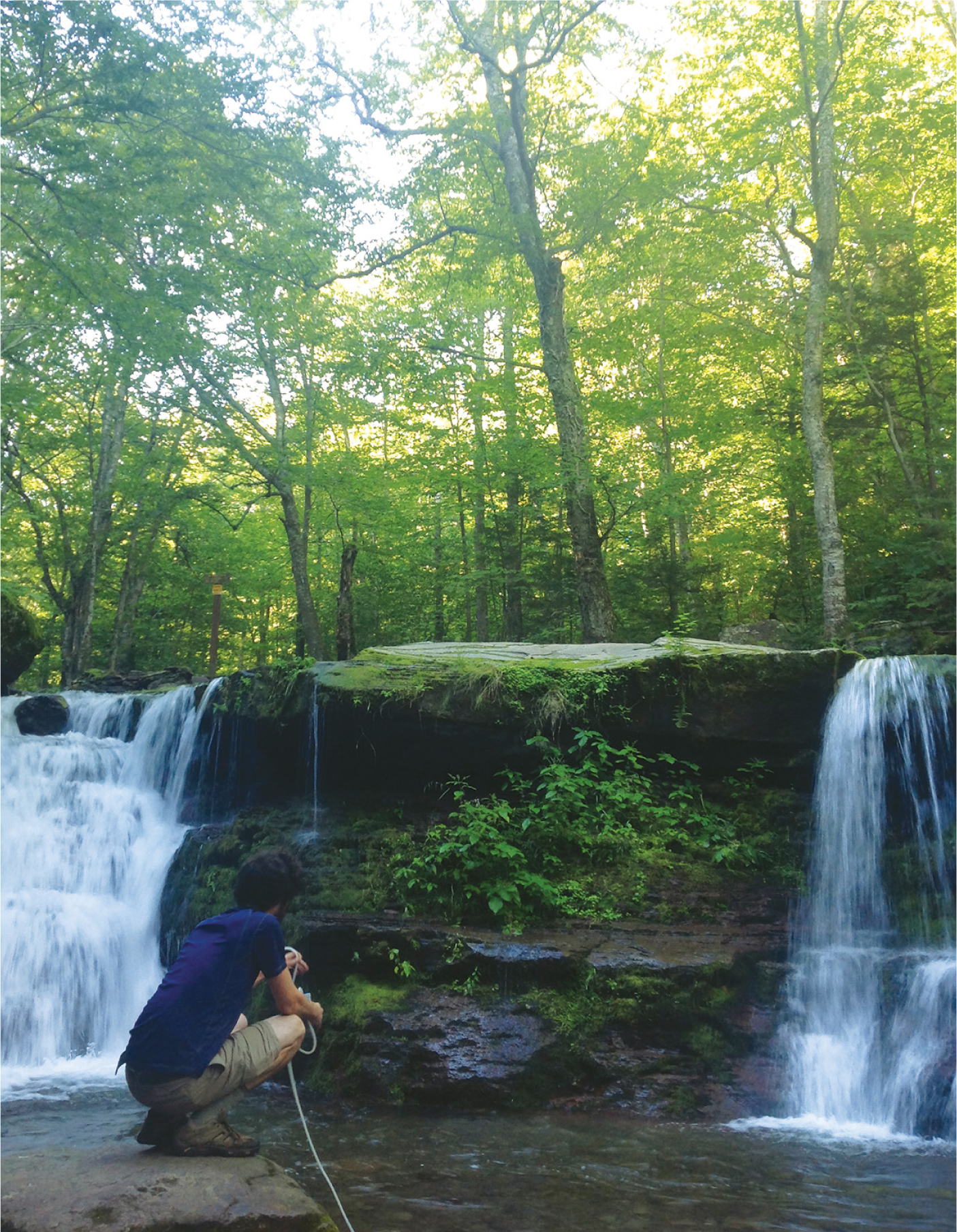
CASCADING RAPIDS, DIAMOND NOTCH FALLS