|
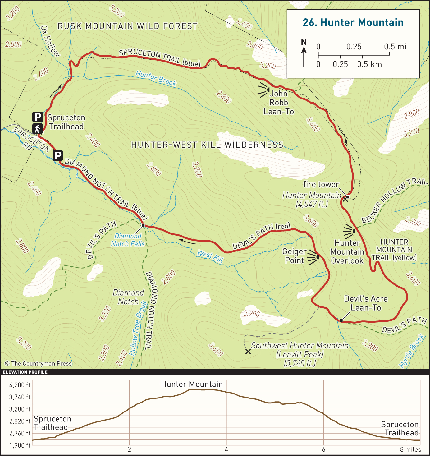
DISTANCE: 8.2 miles TYPE: Loop TOTAL ELEVATION GAIN: 1,900 feet MAXIMUM ELEVATION: 4,045 feet DIFFICULTY: Strenuous HIKING TIME: 6 hours |
Hunter Mountain is well known as a ski resort and festival destination, popular with crowds seeking beer, music, or slopes. In spite of its status as the second-highest peak in the Catskills and its renown as the cultural hub of the region, Hunter does not receive quite the attention Slide Mountain receives as a hiking destination. Nonetheless, it is a fantastic choice for a challenging day hike, with a unique state fire tower: the highest-elevation fire tower in all of New York State.
GETTING THERE
From the New York State Thruway, take Exit 19 (Kingston) and head west on NY-28. Continue about 28 miles to the junction with NY-42 in Shandaken. Proceed north on NY-42 for 7.4 miles to the hamlet of West Kill, then turn right. Follow Spruceton Road (County Route 6) for another 6.7 miles, past a dead end sign, to a large parking area for Hunter Mountain on the left side of the road. If this parking lot is full, there are two more lots further down the road.
GPS SHORTCUT
The nearest searchable location is Spruceton Inn in West Kill, NY. Search Google Maps for “Spruceton Inn,” and when you arrive, continue to head east on Spruceton Road for approximately 2 miles to reach the trailhead.
THE TRAIL
From the first parking area, cross the steel road barrier and follow the blue-blazed Spruceton Trail northward. Stop at the trail register, about 50 feet up the trail, and register your hike before continuing on the wide, relatively level trail. After about half a mile, you will enter the Ox Hollow area and cross over Hunter Brook on a wide wooden bridge. The trail makes a sharp right turn and begins to ascend gradually.
The broad, steady trail—originally built to allow vehicles access to the fire tower—will continue for about 1.5 miles before veering briefly to the north. Here you will reach a junction. The wide vehicle access road continues straight, heading north down the mountain toward the town of Hunter. To the left is a bushwhacking trail ascending East Rusk Mountain. Turn right to follow the blue-blazed trail, which will continue eastward. The trail will now be rougher, with a much steeper incline.
In a little less than half a mile, you will pass a water source. If needed, follow the sign to the spring, which falls on a side trail leading to the John Robb Lean-To. The lean-to itself is notable for its remarkable views over the Spruceton Valley, making this an excellent spot to pause to rest. At this point you have already climbed to about 3,300 feet in elevation, having ascended some 1,400 feet from the parking lot—so a break is by now well-earned!
Continuing on the blue trail once again, you will soon come to a junction with the Colonel’s Chair Trail, to your left. This yellow-blazed trail brings you to the ski lifts of the Hunter Mountain ski area. (Hunter Mountain also runs a Skyride through most of the summer and early fall at select times.)
Continue straight, still following the blue blazes for another mile. The trail will level off for a time before picking up a moderate incline once again, until you at last reach the large clearing at the summit of the mountain. While there are no views from the summit itself, here you will find the fire tower and the fire observer’s cabin.
On a clear day, the fire tower offers views in all directions, including the ski area of Hunter Mountain to the north and the Blackhead Range peaks to the northeast.
When you are ready to make your descent, continue again down the blue-blazed trail. In another quarter of a mile you will reach a four-way trail junction and the former site of the fire tower. To the left, a trail descends to Becker Hollow, and to the right is a short side trail leading to a ledge with an exceptional view over Spruceton Valley. Upon returning to the intersection after enjoying these views, turn right and follow the yellow blazes of the Hunter Mountain Trail.
The forest around you will shift from conifers to maples, oaks, and birch trees as you descend. Continue for a mile and a half until you reach the junction with the red-blazed Devil’s Path trail. This trail leads to Stony Clove Notch and the Devil’s Tombstone Campground. Continue straight. Only a tenth of a mile after the junction, you will spot the Devil’s Acre Lean-To on the right side of the trail.
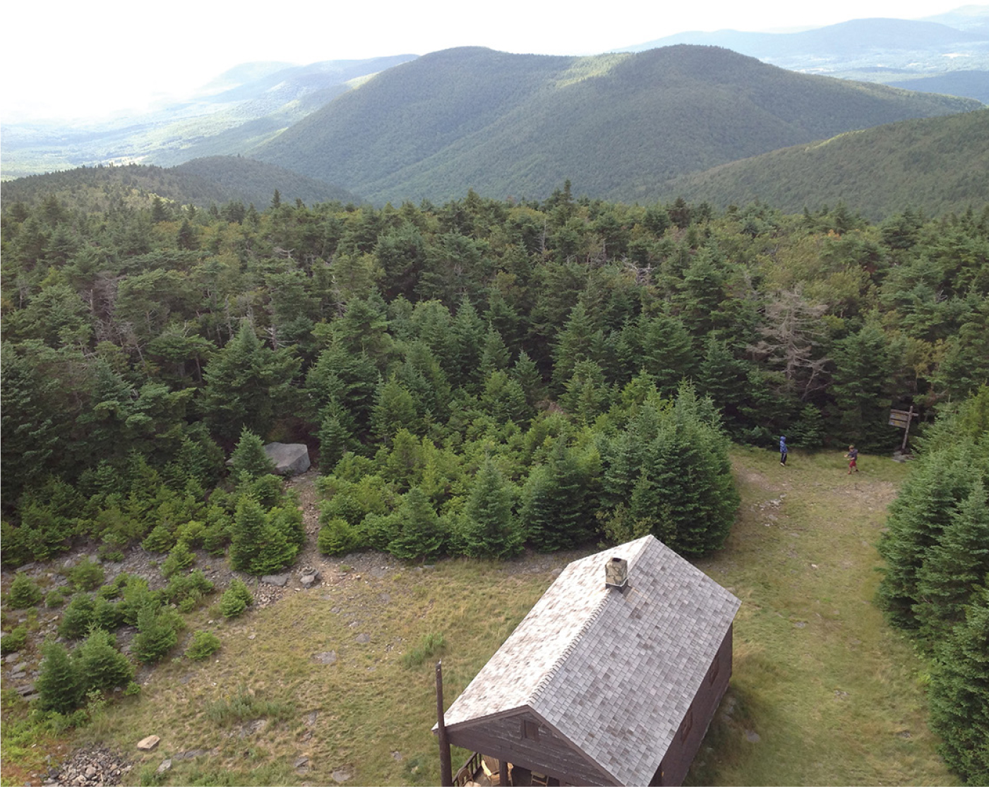
THE RANGER CABIN, FROM THE FIRE TOWER
Continuing on the red-blazed trail, cross a seasonal stream and continue for about half a mile on a relaxed, albeit often wet stretch of trail. The next intersection offers yet another short detour to new viewpoints. Taking the side trail left will bring you to Geiger Point, a rock ledge overlooking Diamond Notch.
After the viewpoint, continue straight and hike for another mile and a half as the trail descends steadily. After crossing another seasonal stream, you will reach a trail junction in a grassy clearing. The Devil’s Path trail turns left to cross the West Kill, but you should follow the blue-blazed Diamond Notch Trail to continue straight ahead. Soon you will pass the Diamond Notch Falls.

VIEW LOOKING EAST FROM THE HUNTER MOUNTAIN FIRE TOWER
Continue until you spot the trail register and reach Spruceton Road. You will have to walk along the road for a quarter mile to reach the DEC parking areas.
