|
DISTANCE: 6.4 miles TYPE: Out and back TOTAL ELEVATION GAIN: 1,780 feet MAXIMUM ELEVATION: 3,890 feet DIFFICULTY: Difficult HIKING TIME: 4.5 hours |
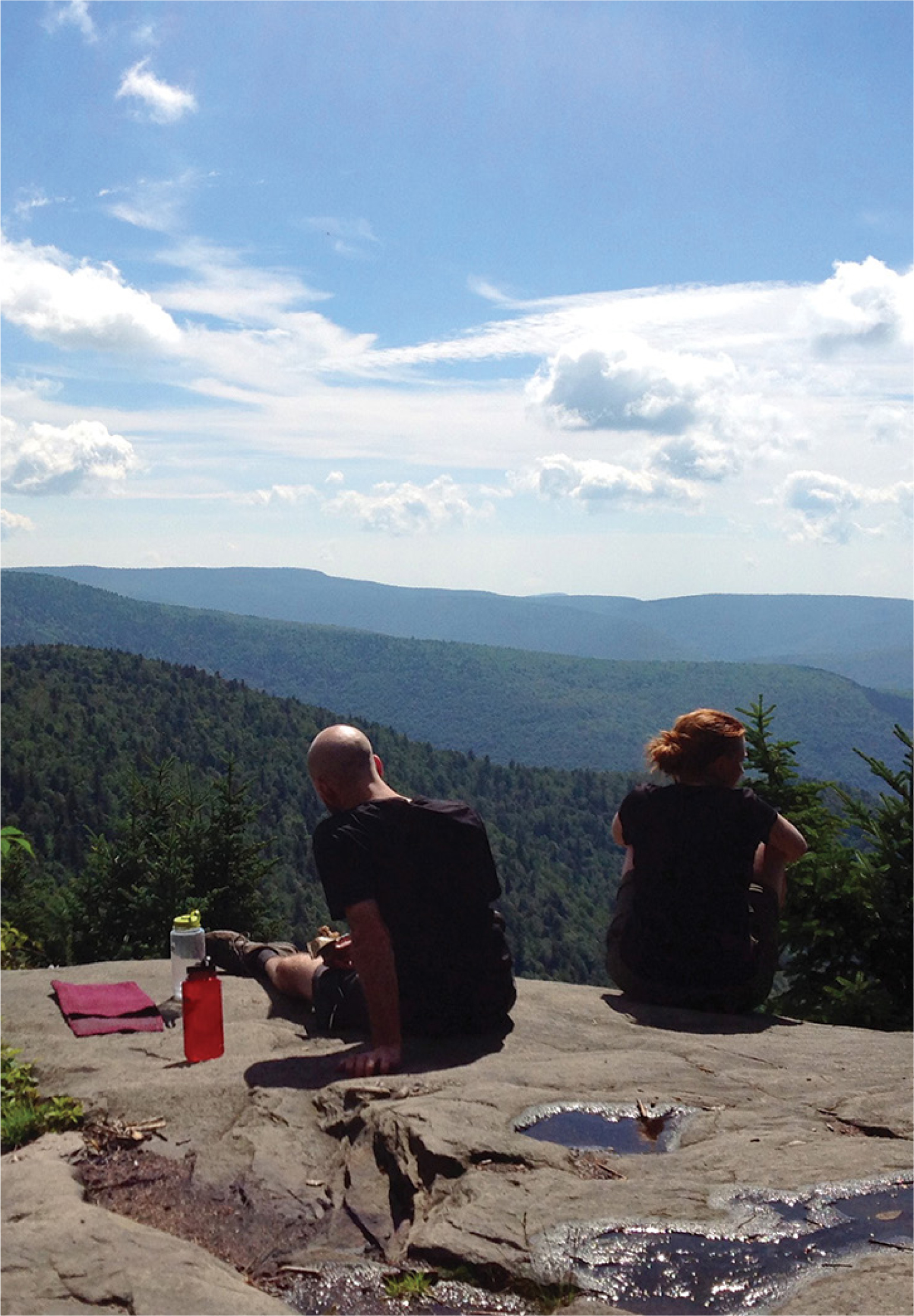
The Buck Ridge Lookout, just below the summit of West Kill Mountain, is a favorite of many Catskill hikers. With dramatic views to the south, it is considered one of the best vistas in the Catskill range. The Devil’s Path route up West Kill Mountain isn’t as challenging as those of some similar hikes, though that’s of course a relative comparison—this is still a very strenuous hike.
GETTING THERE
From the New York State Thruway, take Exit 19 (Kingston) and head west on NY-28. Continue about 28 miles to the junction with NY-42 in Shandaken. Proceed north on NY-42 for 7.4 miles to the hamlet of West Kill, then turn right. Follow Spruceton Road (County Route 6) for another 6.7 miles, past a dead end sign, to a large parking area for Hunter Mountain on the left side of the road. If this parking lot is full, there are two more lots further down the road.
GPS SHORTCUT
The nearest searchable location is Spruceton Inn in West Kill, NY. Search Google Maps for “Spruceton Inn,” and when you arrive, continue to head east on Spruceton Road for approximately 2 miles to reach the trailhead.
THE TRAIL
Walk to the trailhead at the easternmost parking area (if parked in this lot, you will already be right at the trail). Pass the gate at the trailhead and begin hiking on the blue-blazed Diamond Notch Trail. About 100 feet beyond the gate, you will cross over a creek. Continue, following the blue blazes.
After 0.7 mile, you will arrive at a trail junction. Take the trail to the right, passing by Diamond Notch Falls before heading to the summit of West Kill Mountain, as well as toward Diamond Notch. The Diamond Notch Trail follows the path of an old road that once ran from Spruceton Road to Lanesville, cutting through Diamond Notch Hollow. Taking the red-blazed Devil’s Path trail straight would lead you to Hunter Mountain.
Cross over the creek and resume walking the blue-blazed trail. Another split occurs only a few hundred feet after the first junction. Here, the old carriage road heads toward Diamond Notch. Take a right once again, to follow the red blazes west.
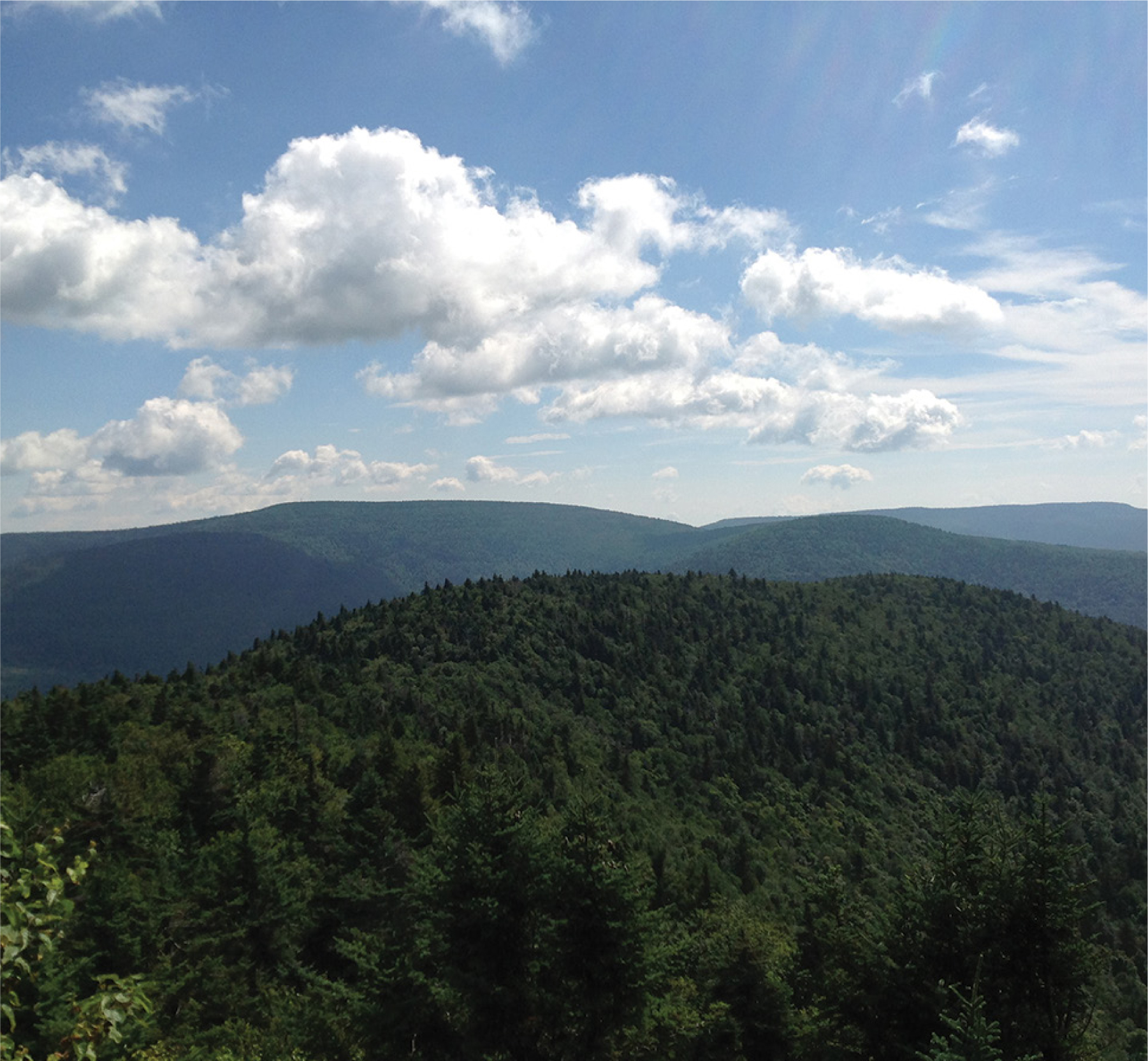
The trail begins a steep uphill ascent. Continue for another 2 miles. As the woods transition into a conifer forest, the trail will begin to level off. Eventually you will reach the first of two viewpoints. The first, on the left side of the trail, is the Buck Ridge Lookout. A massive drop-off below the ledge creates an even more dramatic view. A second ledge offers views from the other side of the trail, looking roughly north, only a short way beyond Buck Ridge. This ledge looks out over the Spruceton Valley.
The summit of West Kill Mountain is only a short distance beyond. When you are ready to return, retrace your steps to your car.