
Table and Peekamoose Mountains
|
DISTANCE: 9 miles TYPE: Out and back TOTAL ELEVATION GAIN: 1,750 feet MAXIMUM ELEVATION: 3,845 feet DIFFICULTY: Strenuous HIKING TIME: 6 hours |
While John Borroughs never commented upon the presence of any moose on the mountain, the famous naturalist was quite fond of the peaceful watershed of the area. The clear waters of the Rondout Creek, a tributary of the Hudson River, are formed on the south and east slopes of Peekamoose and nearby Rocky and Lone Mountains. Burroughs once remarked: “If I were a trout, I should ascend every stream till I found the Rondout.” But these mountains will appeal to more than just creek enthusiasts and misguided moose seekers, with an enchanting, mossy spruce fir forest to be wandered along the way, and ample views of the surrounding countryside.
All things considered, this is a hike lovely enough to make up for the disappointingly simple origin of its name: yet another corruption by early settlers of the Native American tongue. Peekamoose is likely no more than a warping of an Algonquin word meaning “broken off smooth.”
GETTING THERE
Take NY-55 west until it splits with NY-55A, heading northwest along the north side of the Rondout Reservoir. Drive along the length of the reservoir, until 55A reaches Sundown Road. Turn right onto Sundown Road, then immediately make a left onto Sugarloaf Road. Continue for 4 miles, at which point Sugarloaf Road becomes Red Hill Road and continues straight. Continue for 1.7 miles, then turn left on New Road Hill. After 0.8 mile, turn right onto Denning Road. In another 3.5 miles, you will come to the trailhead where the road ends.
GPS SHORTCUT
Type “Denning Rd. Trailhead” into Google Maps and your GPS will navigate you to the appropriate trailhead.
THE TRAIL
From the parking area, start off on the yellow-blazed Phoenicia-East Branch Trail heading northeast. The trail begins flat, following an old carriage road through conifer forest. Sign in at the trail register, a short distance from the start of the hike. You will notice POSTED signs on the trees during this section of the hike—the land surrounding the trail is private, so be sure to stay on the woods road.
A little after 1 mile, you will reach a well-marked trail junction. Wooden signs indicate the distances to Slide Mountain, Table Mountain, and Peekamoose Mountain, and back to the Denning parking area. Turn right to follow the blue blazes toward Table and Peekamoose mountains.
In another quarter mile, a wooden bridge crosses over the Neversink River. The bridge is sturdy, with wooden railings, but a second bridge crossing shortly after the first one is somewhat more precarious. The second bridge is composed of only wooden logs across the water, with no railing.

LOOKING NORTH FROM PEEKAMOOSE MOUNTAIN
Continue on the trail as it runs parallel with the water. Soon, you will come to a split in the trail, with a side trail leading off to a campsite. The main trail turns sharply to the right and begins to ascend Table Mountain.
The trail bobs up and down over a series of hills before beginning a more steady ascent. At 2.75 miles, there is a viewpoint through the trees, though foliage may limit the views.
Continue for another half mile past a side trail leading to a spring. Shortly after the spring is a lean-to, a few hundred feet off the main trail.
At 3.5 miles, you will see the marker indicating you have reached 3,500 feet elevation. Only a quarter mile later, you will arrive at a ledge offering a very dramatic view to the west. There is no view from the top of Table Mountain, so enjoy the horizon here before continuing on to the summit. As you may have guessed (unless you assumed that the mountain was named after more of that strange bluestone mountain furniture), Table Mountain sports a long, flat summit, and it will not feel as if you’ve reached the peak of a mountain. Continue on the level trail across Table Mountain until the path begins to descend again.
Descend to the col between Table and Peekamoose Mountains. The trail here is relatively easy, and it runs flat in between the two summits before ascending a few hundred feet to the peak of Peekamoose. At 4.5 miles, you will come to the 3,840-foot summit of Peekamoose, with a large boulder denoting the spot on the trail. Only a short distance past the rock, a small side trail to the left of the main path leads to a viewpoint. This vista faces east and will give you top-notch views of the surrounding mountainous wilderness.
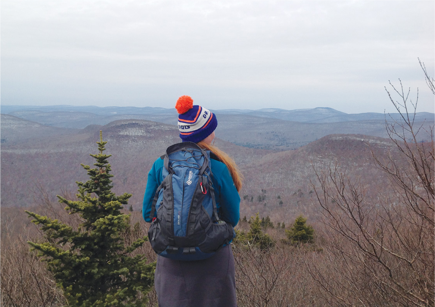
TAKING IN WINTERY VIEWS ON PEEKAMOOSE MOUNTAIN
Continuing to follow the main trail for an additional 0.85 mile will bring you to yet another viewpoint, which faces south. However, this leg of the hike is optional and will add 1.7 miles of hiking to your day.
When you are ready to return, retrace your steps to your car.