|
DISTANCE: 2.8 miles TYPE: Out and back TOTAL ELEVATION GAIN: 850 feet MAXIMUM ELEVATION: 2,990 feet DIFFICULTY: Easy HIKING TIME: 2 hours |
The Red Hill Fire Tower is the southernmost fire tower in the Catskills, as well as one of the last state fire towers built, in 1920, and the last fire tower in the park to have been manned. The Red Hill tower was still staffed through 1990. After this, it was slated to be torn down in accordance with state policy prohibiting nonessential structures on Forest Preserve land. After a campaign by preservationists and forest historians to save the Catskill fire towers, five of the towers (Overlook Mountain, Hunter Mountain, Tremper Mountain, Balsam Lake Mountain, and Red Hill) were restored and added to the National Register of Historic Places. Red Hill’s ranger cabin, included as part of the listing, is one of the oldest buildings of its kind in the State of New York.
Red Hill can claim the distinction of being the easiest of the five Catskill fire tower hikes, making it one of the most accessible views of its kind in the park. The trail is a short, relatively undemanding stroll through a quiet, remote section of woods, and the elevation gain you’ll face on this hike is relatively tame—for the Catskills, at least. With picnic tables and the stately rangers’ cabin offering respite at the midway point, this outing is perfect for a morning or afternoon of quintessential Catskills attractions when you aren’t in the mood to sweat too much.
GETTING THERE
Take NY-55 west until it splits with NY-55A, heading northwest along the north side of the Rondout Reservoir. Drive along the length of the reservoir, until 55A reaches Sundown Road. Make a right, then an immediate left onto Sugarloaf Road. Continue on Sugarloaf Road for 4 miles, then make a sharp left turn onto Dinch Road. Continue on Dinch Road for 1 mile. The parking area will be on the left. The last few hundred feet of the road are not maintained during winter months, so be sure to plan accordingly.
GPS SHORTCUT
Type “Red Hill Fire Tower DEC Parking” into Google Maps and your GPS will navigate you to the appropriate trailhead.
THE TRAIL
The trail begins at the far end of the small parking area. Shortly beyond the trailhead, you will find the trail registration box. Stop and register your hike.
Soon after, you will come to the only stream crossing of the hike. This small stream is seasonal and may not be running during the summer. The trail will begin a moderate ascent as it curves around the mountainside. While rocky in places, the trail is very well maintained and clearly marked.

RANGER CABIN ON THE SUMMIT OF RED HILL
Just under a mile into the hike, the incline will pick up, becoming a moderately strenuous uphill hike in places. You will pass a sign indicating a side trail to a water spring.
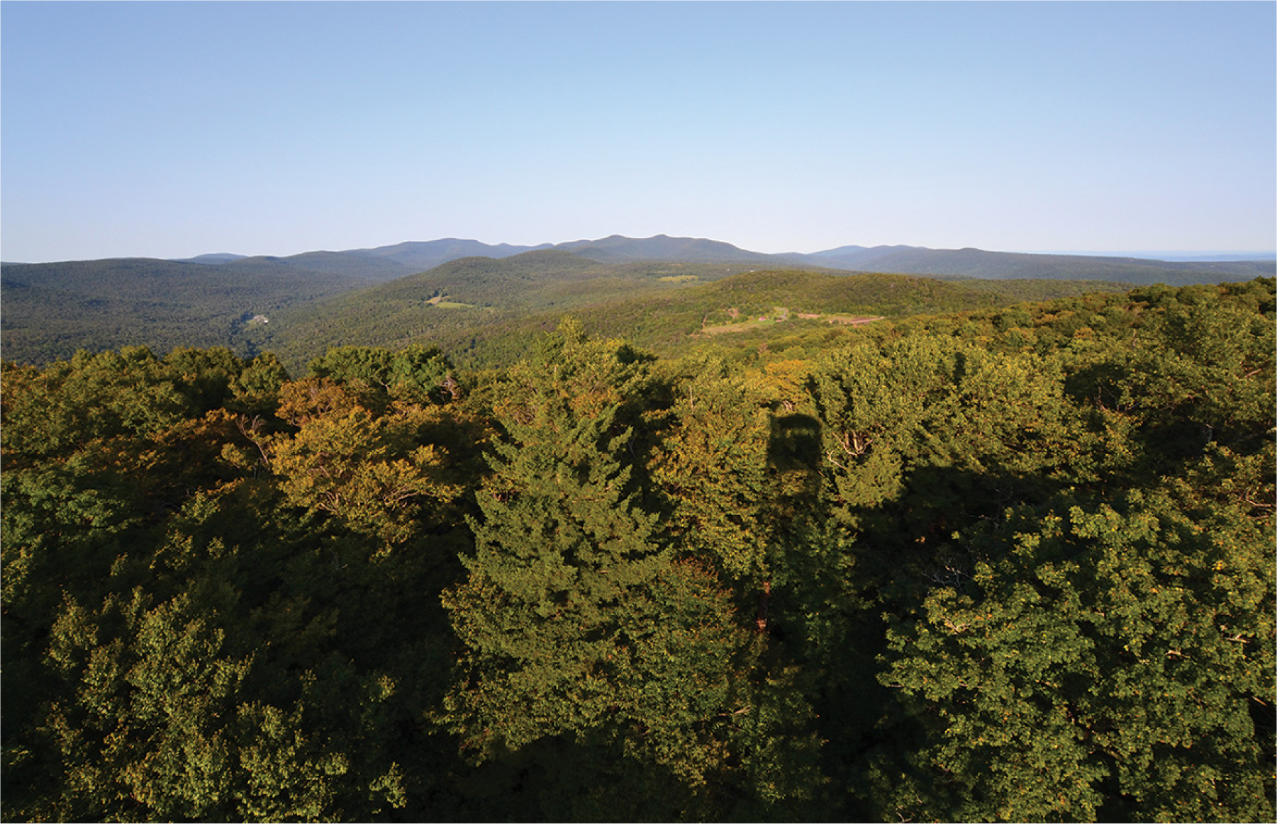
As you approach the summit, 1.4 miles from the parking area, the trail levels off and the ranger station and its outhouse will come into view. A volunteer staffs the cabin on weekends through the summer, answering questions about the tower and the history of the area, and assisting with visits to the top of the fire tower. From the tower itself, excellent views of the surrounding region can be had on a clear day.
When you are ready to return, retrace your steps back to the parking area.