
|
DISTANCE: 5.2 miles TYPE: Loop TOTAL ELEVATION GAIN: 1,600 feet MAXIMUM ELEVATION: 3,600 feet DIFFICULTY: Moderate HIKING TIME: 3 hours |
Not to be confused with Balsam Lake Mountain, which is located to the southwest, Balsam Mountain sits south of the Belleayre Ridge, and can be climbed a number of different ways. The hike described here follows the shortest route, a pleasant loop starting from the west side of the mountain. The peak can be hiked from the east as well, but that route is a mile longer and climbs an additional 400 feet on very steep trail. Balsam is a popular destination for hikers, as it is a required climb for peak baggers seeking membership in the Catskill 3500 Club. Members of the club must climb all thirty-five Catskill peaks over 3,500 feet in elevation, and must also climb four designated peaks for a second time in the winter. Balsam is one of those mountains, along with Panther, Slide, and Blackhead.
GETTING THERE
Take Exit 19 (Kingston) from the New York State Thruway. Turn right onto NY-28 West, then continue west on NY-28 for approximately 36 miles. About a mile after passing through the village of Pine Hill, turn left onto Galli Curci Road, and pass the Belleayre Ski Center shortly thereafter. Follow Galli Curci Road as it winds over the shoulder of the mountain, and merge onto Todd Mountain Road as you descend. In roughly 2 miles, turn left onto Rider Hollow Road and follow it. The parking area is at the end of Rider Hollow Road, 2 miles from the junction with Todd Mountain Road.
GPS SHORTCUT
Type “Rider Hollow, Hardenburgh, NY” into Google Maps to have your GPS navigate you very close to the appropriate trailhead. From there, follow the instructions above to reach the parking area.
THE TRAIL
From the parking area, pass a gate and head into the forest on a wide forest road. Remember to sign in at the DEC register. You will start hiking on the red-blazed Oliverea-Mapledale Trail, passing a herd path to your right immediately after entering the woods. The herd path will take you to a small, underused campsite roughly a hundred feet off-trail. There are a handful of other primitive campsites that you will pass on this hike, farther up the trail, as well as a shelter. The campsites and shelter are available on a first-come-first-served basis, and they would be perfect for transforming this relaxed day hike into a full-blown weekend expedition.
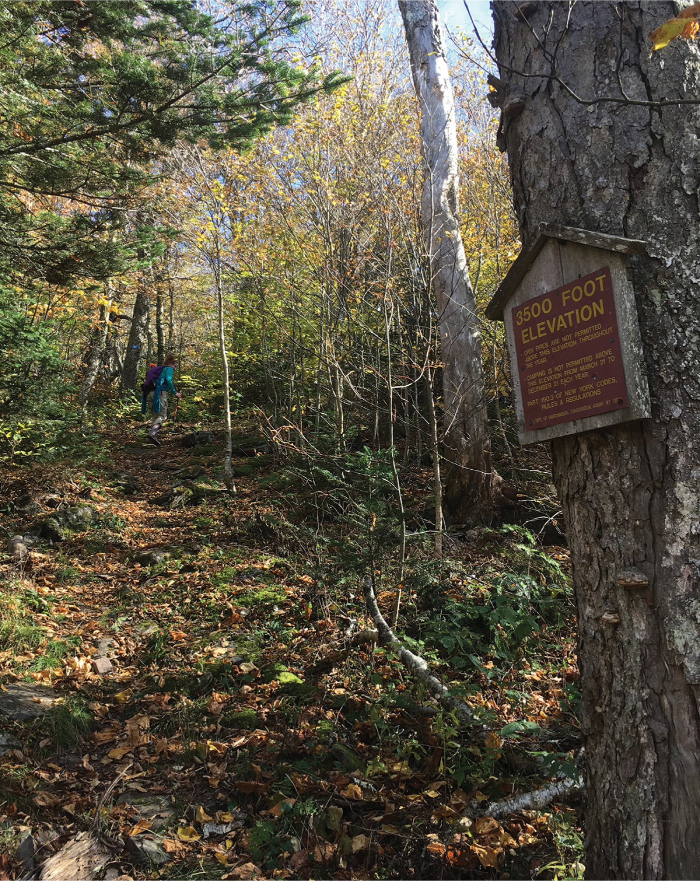
MARKERS ON MOST TRAILS DESIGNATE THE 3,500 FOOT ELEVATION LINE
Hike up the red-blazed trail, and reach a footbridge crossing over a stream in a few hundred feet. Once on the other side, pass the remnants of an old stone fence and continue walking along the stream. In a short distance the trail will veer to the left, leaving the road grade that follows the stream and sending you uphill, climbing moderately. In 0.3 miles you will come to a trail junction. The Oliverea-Mapledale Trail continues to the right, and the yellow-blazed Mine Hollow Trail starts to the left. Turn left and begin walking on the Mine Hollow Trail. This is the start of the loop portion of the hike. You will ascend on a slightly rockier grade, level off for a short distance, and descend to a seasonal streambed. There is a nice open campsite under some old hemlock trees to your right here. Turn left, following the yellow blazes uphill along the streambed. When you reach a grove of large hemlock trees, the trail will cut to the left sharply and climb more aggressively than before. This steep section is fairly brief. When you reach the base of a large stone ledge, turn right and follow the trail as it weaves around the back side, sending you over another smaller ledge shortly. The trail will level off significantly as you gain the ridge of the mountain range and come to the intersection of the Pine Hill–West Branch Trail. The Mine Hollow Trail ends here, a mile from where it splits from the red-blazed trail.
Turn right and follow the blue blazes of the Pine Hill–West Branch Trail as it undulates along the ridgeline. The trail passes sections of forest overgrown with small beech and birch saplings before opening up in an area that is home to several very large maple and oak trees. The trail becomes steeper on the other side of this open area, climbing a short distance up a rocky section. From the top of this cliff you might be able see Belleayre Mountain through the trees looking north, as long as the canopy isn’t too thick.
The incline of the trail mellows a little further on, although you will still climb moderately. Continue to follow the trail, and after a short distance you will come to a sign alerting you that you’ve reached 3,500 feet above sea level. From here you will start to see balsam firs more prominently. The trail levels after this point, following the lip of the ridge, taking you to a grassy clearing, which will be on your left. Although you are not at the summit yet, this is an excellent place to stop and enjoy a snack. You can see the town of Big Indian in the valley below, nestled at the foot of the long sloping ridge closest to you, which leads to the summit of Panther Mountain. Further back, looking left to right, you can see Sherrill Mountain and North Dome, as well as the Devil’s Path range fading into the distance.

BRIDGED STREAM CROSSING ON THE BALSAM MOUNTAIN LOOP
When you are ready to resume your hike, continue up the blue-blazed path climbing a short distance to the top of Balsam Mountain. At this point you have travelled 1.3 miles on the Pine Hill–West Branch Trail. There are no views from here, and you will begin descending on the same trail immediately after crossing the summit. The descent is about as steep as the climb up, but the trail is much rockier on this side of the mountain.
In 0.8 mile from the summit, the red-blazed Oliverea-Mapledale Trail intersects with the Pine Hill–West Branch Trail at the col between Balsam Mountain and Haynes Mountain. Turn right here, and follow the red blazes downhill. You will be thankful that you are descending on this trail, as it is much steeper than your climb up was. Cross over seasonal creek beds a few times as you make your way downhill, and come to the junction of the Mine Hollow Trail in 1.45 miles. A tenth of a mile before reaching the trail junction, you will pass Rider Hollow Shelter. There are two nice primitive campsites nearby, a little further up the trail, just before it crosses a stream over an old metal bridge.
Pass the junction of the Mine Hollow Trail and continue to follow the red blazes, descending to the water’s edge. Cross the footbridge near the trailhead and reach the parking area shortly thereafter.
