
Andes Rail Trail and Bullet Hole Spur
|
DISTANCE: 3.9 miles TYPE: Lollipop TOTAL ELEVATION GAIN: 160 feet MAXIMUM ELEVATION: 1,840 feet DIFFICULTY: Easy HIKING TIME: 2 hours |
Although it is roughly 6 miles outside the boundary of the Catskill Park, the Andes Rail Trail offers hikers scenic views of the Tremperskill Valley, as well as interesting historic facts pertaining to the railroad itself. The trail was built as a collaborative effort between Andes Works! and the Catskill Mountain Club, and it is very well maintained. The first mile of the hike follows the railroad grade and is flat and easy, suitable for hikers of all ages. The spur is more strenuous, but it is well worth the effort, as it allows you to experience quiet forest in a memorable setting.
GETTING THERE
From the New York State Thruway, follow NY-28 West for approximately 57 miles. You will pass by Arkville and Margaretville before NY-28 starts heading north, leaving the Catskill Park and then bending to the west. Continue to follow the road to the village of Andes. Go straight onto Depot Street in downtown Andes, leaving NY-28 as it turns to the right and heads due north. The trailhead is well marked and will be on your left, 0.3 mile after you leave NY-28. Park on the wide gravel shoulder just above the trailhead.
GPS SHORTCUT
Direct your GPS to navigate you to the town of Andes, NY, then follow the above instructions.
THE TRAIL
Walk through a wooden gate bearing the Andes Rail Trail sign and pass a long, white building. This is the Depot Building, which was erected in 1907. Originally this was a stop on the railroad that served the town of Andes. The building was abandoned in 1924, but it has recently been restored.
After passing the Depot Building, pick up the railroad grade as it enters the woods. There will be a trail register on your right, so be sure to sign in. Continue on the railroad grade, which is unmarked but easy to follow. You’ll pass over a wet area on a small footbridge shortly after you sign in. The land on either side of the trail is privately owned, so stay on the path. As you walk, you’ll periodically come to signs offering interesting facts about the history of the railroad and the area itself. At certain points you will notice small bits of coal still littering the trail. For the most part, the grade is flat and grassy, but it may be slightly bumpy at times, due to the railroad ties that are still buried beneath the trail.
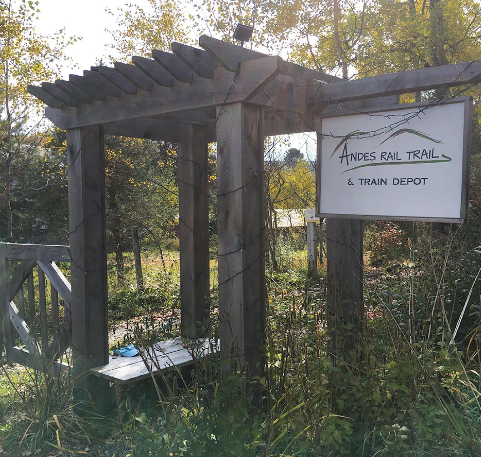
SIGNAGE MARKING THE START OF THE ANDES RAIL TRAIL
Pass through an open field offering bucolic views of the adjacent hillsides. There are the remnants of a turntable used to move locomotives about halfway through the field on your right. Reenter the woods, crossing a small bridge, and shortly thereafter you will have a second chance to take in the countryside, this time from a clearing along a trail detour. The detour parallels the rail trail and is intended to be used when the main trail is muddy. There is another mud detour a little further on as well. In the valley below, you can see the lazy Tremper Kill and the beaver dams that have altered its course.
After 1 mile, the rail trail ends, and the spur segment begins. The spur is blazed with yellow square markers and turns immediately to the right, heading uphill moderately. Follow the blazes as the trail makes its way uphill, switching back a few times. You’ll ascend up and around the hillside, passing several rock formations in a stand of old hemlock trees. The trail turns to the left and begins a short descent into open forest shortly after this. When you come to a stone fence on the edge of a field, turn right and walk alongside the field, following the markers. In a few hundred feet, you’ll turn left, passing through a small notch in the fence. The trail splits shortly thereafter at the corner of a pine grove. This is the start of the loop portion of the trail.
Turn right here and descend slightly along the edge of the pines. Continuing to follow the yellow markers, you will enter a dark hemlock forest. The trail curves to the left, crossing another stone wall and ascending to the edge of the pine grove again. Follow the trail as it skirts around the pine trees and eventually returns to the start of the loop.
To return to your car, follow the yellow blazes back to the rail trail, and walk the railroad grade back to the parking area.
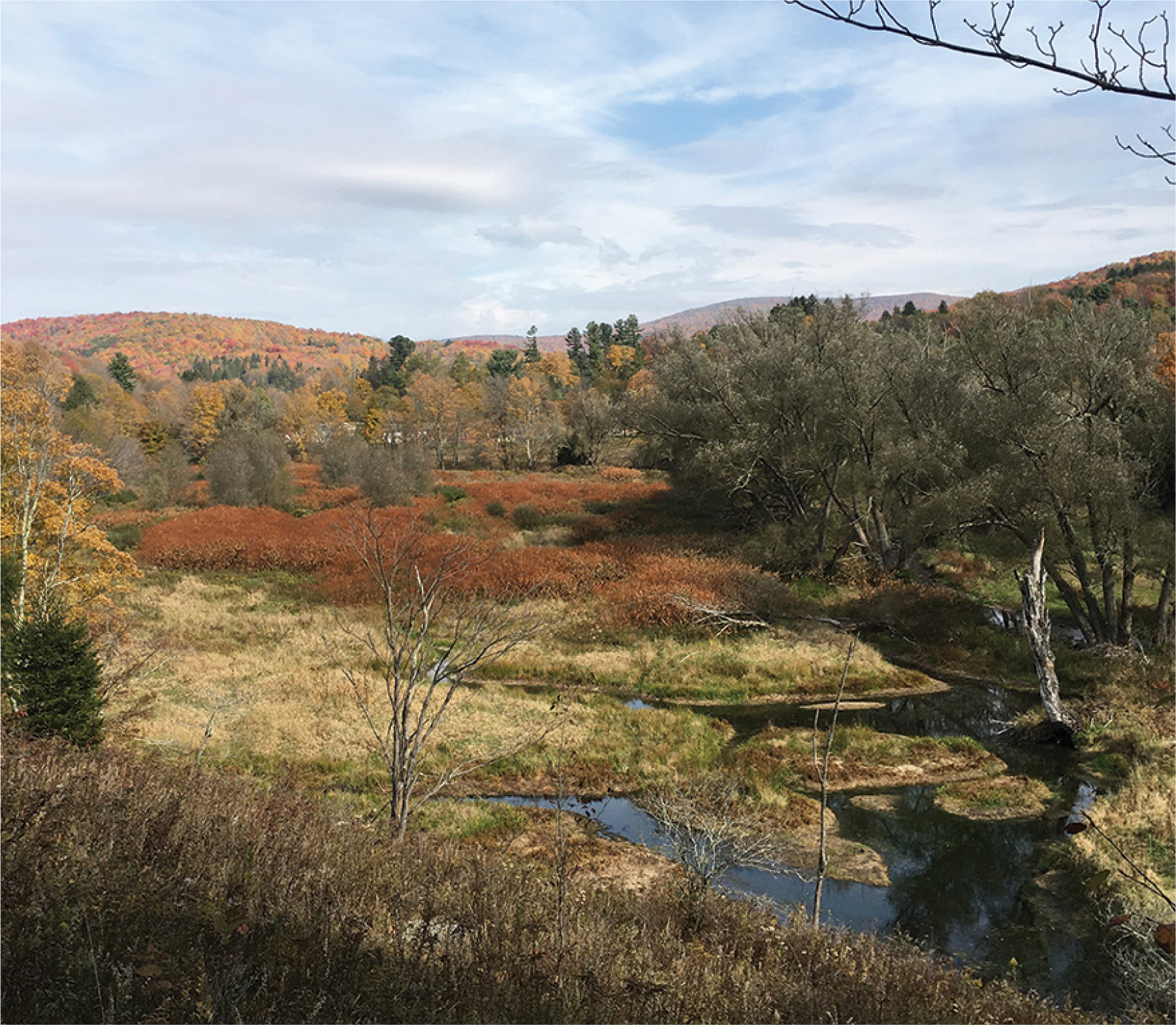
LOOKING OUT OVER THE TREMPER KILL
