Northwest Yosemite
View east from the summit of El Capitan (see Trail 27)
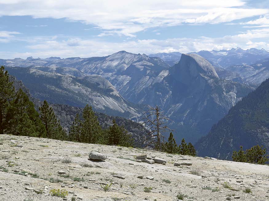
These hikes give you just a slight flavor of the vast, less visited lands of Yosemite’s northwest. Endless domes, lakes, sizeable rivers, and intricate topography define this region. A series of near-parallel river valleys, U-shaped in their upper reaches, drain this region and are notably exhausting to cross between. This and the long distances between “destinations” keep it much emptier than the park’s other lands. As defined in this book, this region’s southern perimeter are the steep-walled cliffs that make up the north wall of Yosemite Valley, forming an abrupt end to the mostly gentler, forested slopes.
Despite calling this a low- to moderate-use area, all but Trail 27 are heavily used. Why? Because there are several prized goals. The first, Kibbie Lake, lies just within the park and is reached by a hike that begins just west of the park. Two other popular lakes in the northwestern lands are Laurel Lake and Lake Vernon, and backpackers in good shape can visit both in a weekend. These midsize lakes, each with abundant campsites, are reached by starting across the dam that has flooded Hetch Hetchy Valley, which is second only to Yosemite Valley as Yosemite’s most impressive U-shaped canyon. Along the north slopes of Hetch Hetchy Reservoir is a popular trail that takes you past vernal Tueeulala Falls to perennial Wapama Falls, whose voluminous water roars in May and June and soaks hikers with its spray. Later on, the falls still put on an impressive show. The trail, undulating as it follows the west side of the reservoir, continues east to Rancheria Falls Camp, a popular, spacious backcountry campground beside cascades and pools of Rancheria Creek.
South of Hetch Hetchy Valley the lakes disappear and the forests, except where burned, prevail. On these lands are two groves of giant sequoias, the Tuolumne Grove, just off the start of Tioga Road at Crane Flat, and the Merced Grove, a few miles west of Crane Flat and south from Big Oak Flat Road. I’ve included only the popular Tuolumne Grove because the closed road to it is shorter and because it has dozens of giant sequoias, some of them very impressive, but both locations are worth a visit.
Finally, just as the previous chapter offers an easy route to the summit of North Dome (as opposed to scaling it from the floor of Yosemite Valley) this chapter offers a relatively easy route to the summit of El Capitan. OK, it is a bit lengthy, especially as a day hike, but it is a lot easier than scaling the face of El Cap.

Western azaleas at Laurel Lake (see Trail 24)

