Yosemite Valley’s South Rim
Looking west down the length of Yosemite Valley to the Cathedral Rocks (see Trail 40)
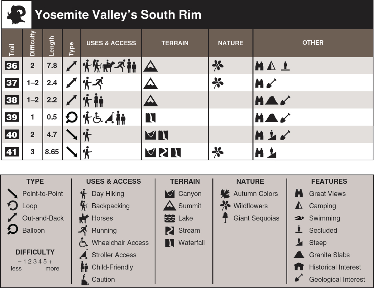
This chapter is actually composed of two groups: four trails starting along Glacier Point Road and heading to extremely scenic viewpoints, and two trails starting from Glacier Point and descending several thousand feet to the floor of Yosemite Valley.
In the first group, visitor use to each viewpoint is inversely proportionate to its distance from the trailhead. Dewey Point is the farthest and may get one or two dozen visitors on a summer’s day, while Glacier Point is easily the closest and receives thousands of visitors. Glacier Point is arguably the best viewpoint in the entire park, if not in the entire Sierra, because more than any other promontory it offers both an aerial view of the most spectacular part of the valley and a panorama of the high peaks behind. Whereas you can drive almost to Glacier Point (followed by just a brief walk), you’ll have to make short hikes (an hour or two, round-trip) to acrophobic Taft Point or to broad-topped Sentinel Dome, which offer slightly different Kodak moments. These two walks can be combined into a single loop, described as an option in the Taft Point hike.
Of the two trails starting from Glacier Point and descending to Yosemite Valley, the Four Mile Trail is shorter, indeed half the length of the Panorama Trail. Most people would consider it the less spectacular, not passing by three waterfalls or beneath the looming presences of Mount Broderick and Liberty Cap, but I rate the view of Yosemite Falls from halfway down as one of the valley’s best vistas.

Enjoying the view up Tenaya Canyon from Sentinel Dome (see Trail 38)