The trio of emirates – Ajman, Umm al Qaiwain and Ras al Khaimah – which make up the northern portion of the UAE see only a trickle of foreign visitors and boast few bona fide sights, although all three offer an absorbing glimpse of a very different side of the country – geographically close to Dubai, but surprisingly distant in atmosphere. None of the northern emirates have enjoyed the oil-and-gas bonanzas of their neighbours to the south, and despite significant funding from the government in Abu Dhabi they remain noticeably less wealthy, less populous and less developed than the big cities further south.

The fortress housing the Ajman Museum.
Kevin Cummins/Apa Publications
Ajman
The smallest of the seven emirates, somnolent Ajman 2 [map] (ajman.travel) is now little more than a suburb of nearby Sharjah, strung out along a superb stretch of tranquil beach dotted with a few upmarket hotels – all that you will find here in the way of modern tourist development. Ajman town is best known for its dhow-building heritage. Pearling dhows sailed from its shores from the 3rd century BC until the 1930s, and fishing dhows are still made on Ajman’s sheltered creek, though today most are made of fibreglass.
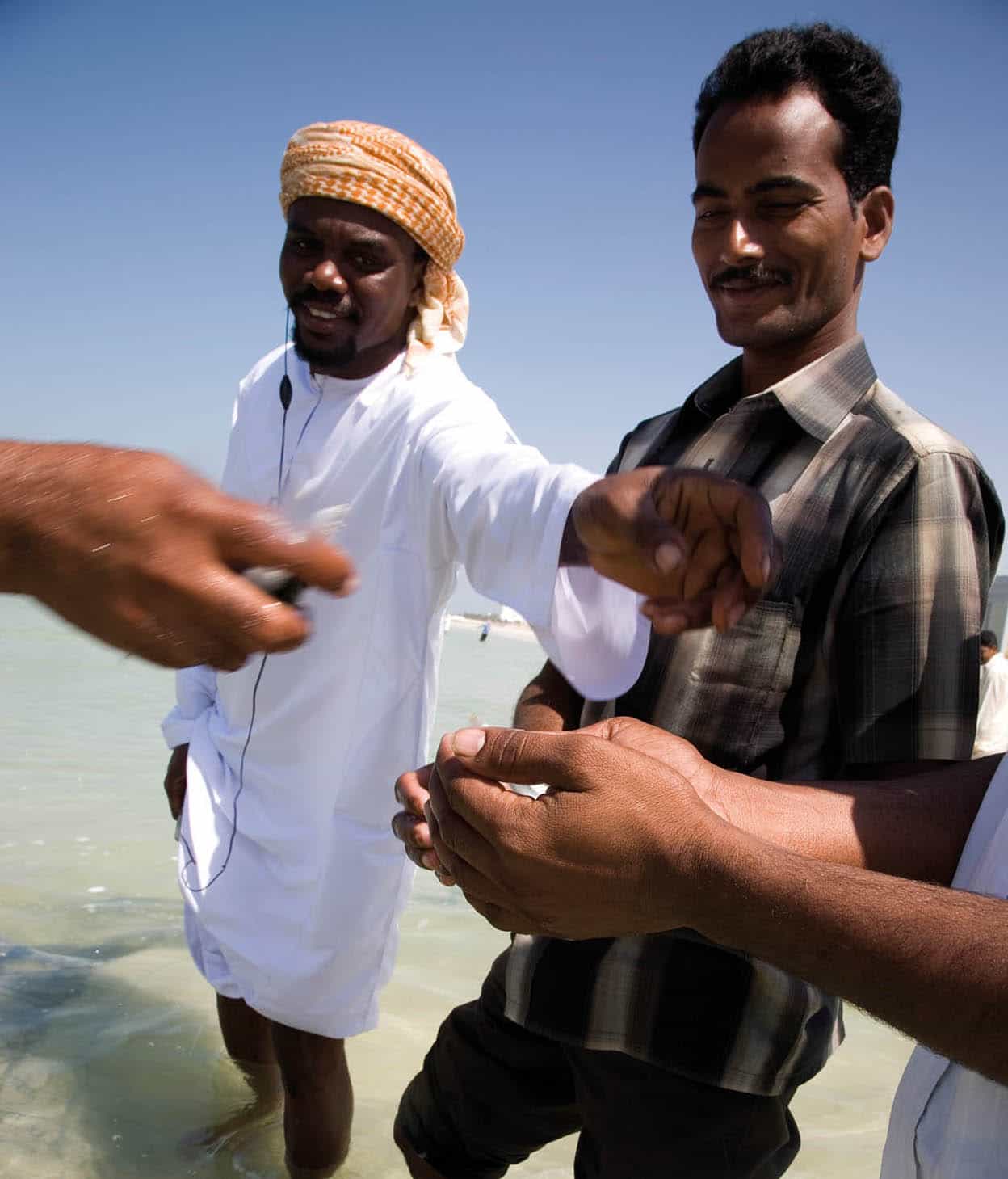
Men in Ajman getting some fish from the catch of the day.
Getty Images
The main attraction in the town itself is the fine old fort A [map] (Sat–Thu 8am–8pm, Fri 2.30–8pm), a pretty assortment of sand-plastered round towers, spiky parapets and a superb wind tower which still provides cooling breezes. Built around 1775, the fort served as the ruler’s residence until 1970. Inside lies the interesting Ajman Museum, showcasing life in the region through the ages, with barasti houses and dhows in the courtyard and displays on policing (practised since the days of the Prophet Mohammed in the 7th century), the bedroom of Sheikh Rashid bin Humaid al Nuaimi (1928–81), a market tableau and displays on traditional medicine.
Opposite the fort, to the west, you’ll find Ajman’s bustling souks, selling gold, clothing, and assorted bric-a-brac. To the north, off Leewara Street, is a fish market and marina where wooden dhows jostle with modern leisure craft.
On the other side of the marina, at the northern end of Arabian Gulf Street, a couple of hotels will let you soak up the sun on their beaches for a fee – the five-star Ajman Hotel has a particularly attractive beach, along with good restaurants and bars. South of here stretches a long swathe of superb golden sand, remarkably more peaceful when compared to Sharjah and Dubai, with a solitary crumbling watchtower still standing guard over the shore. Most of the UAE’s defensive watchtowers are round, but, unusually, this one is square.
From the coast road, Khalid bin al Waleed Street leads to the Ruler’s Palace B [map], which stands on the south side of the junction with Kasr az Zahr Street and Sheikh Rashid Street. The palace, home to Sheikh Humaid bin Rashid al Nuaimi, who succeeded his father in 1981, is not open to the public, but it’s possible to peer into the leafy compound from its main gate.
On the far side of town lie Ajman’s port and boatbuilding yards C [map], situated on the Creek a short taxi ride from the centre. Ajman’s port now houses one of the UAE’s largest ship-repair companies, which maintains oil-field supply boats along more than 5km (3 miles) of Creekside wharfs. Two of the most accessible are on Tareq bin Ziyad Street in the Mushairef district. Typically, a primitive production line of fishing dhow hulls are propped up on oil drums. Although most boats are made of fibreglass now, the deck rails that rise toward the stern are still made of wood.
Umm al Qaiwain
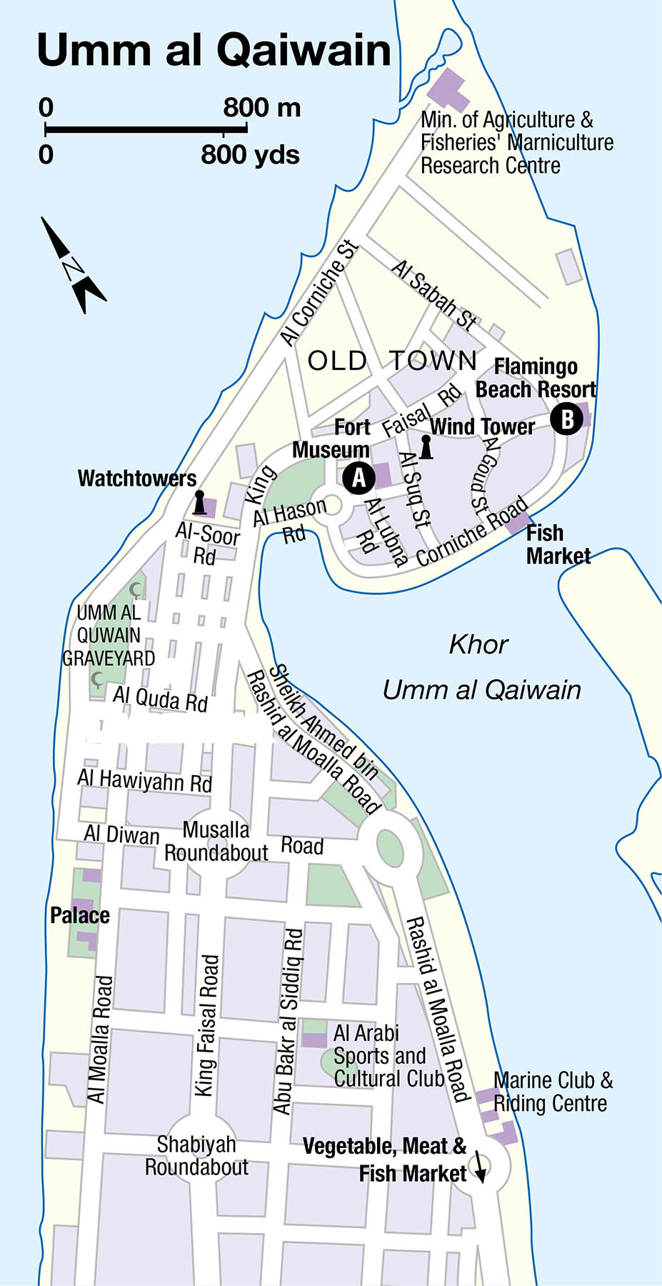
Umm al Qaiwain 3 [map] (known locally as UAQ) is the second-smallest and least populous of the emirates, with 75,000 residents. In the heat of the day there are usually more animals than people on its streets: a mix of scrawny cats, wandering goats and the occasional grazing cow.
Fact
Umm al Qaiwain’s name means “Mother of the Powers”, reflecting its long seafaring tradition. Fishing remains an important local activity, with lines of boats moored up near the Fish Market on Corniche Road.
The town itself lies on a sandy spit of land north off the main highway that links Ajman, some 20km (12 miles) southwest, with Ras al Khaimah. Approaching from the main highway, you will drive down UAQ’s long, straight main shopping street (Al Moalla Road) before reaching the three defensive watchtowers off Al Soor Road. Round and of differing sizes, they were once joined together by a sturdy protective wall which has been partially rebuilt.
Beyond here lies the “old” town – occupying a bulge of land at the end of the spit – although there is not much that is old about it apart from the impressive fort, now housing the Umm al Quwain Museum (Sat–Thu 8am–2pm and 5–8pm, Fri 5–8pm). The neatly restored fort itself offers a welcome contrast to the dusty streets outside, with its pretty coral-stone buildings and a neat courtyard studded with trees. The museum is less appealing, with a collection of traditional artefacts, including weapons, and some rather unexciting archaeological finds (pots, mainly) from the nearby site of Ed-Dur.
East of the fort, the low-key Flamingo Beach Resort (www.flamingobeachresort.ae) offers various activities including boat trips, crab-hunting and deep-sea fishing expeditions (advance reservations essential). Boat trips offer a nice way to see As Siniyyah and the various other islands which dot the coast.
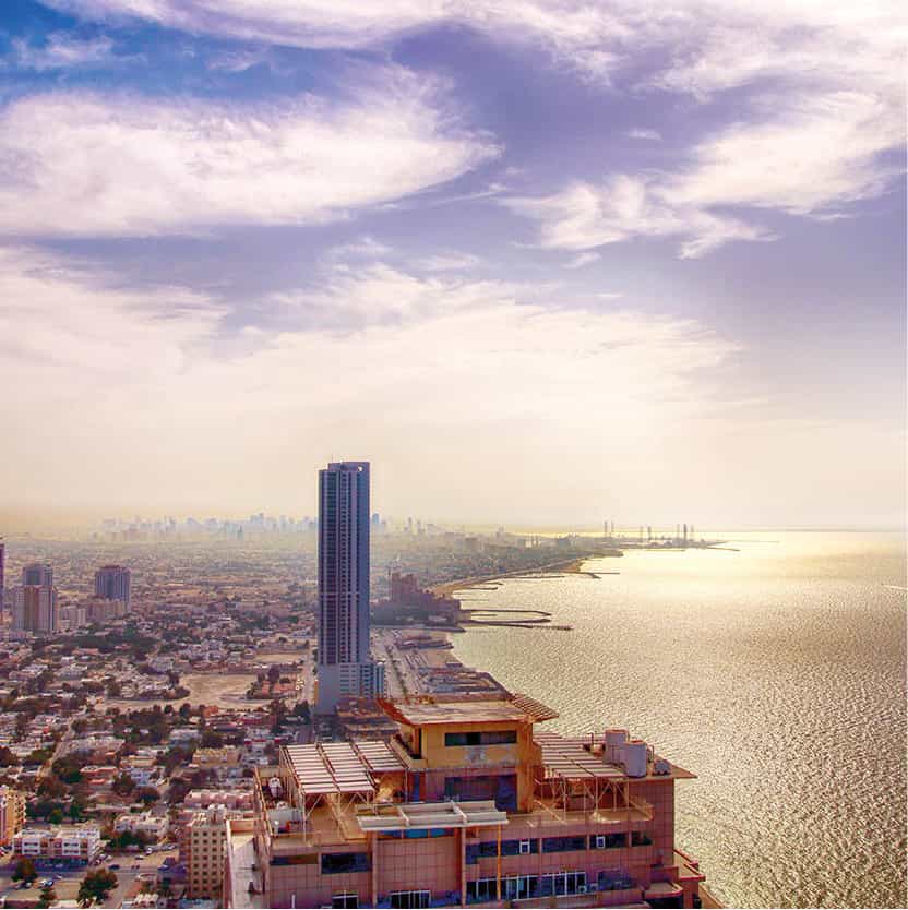
Emirate of Ajman is the smallest of the emirates by area.
Getty Images
Around UAQ
The island of As Siniyyah 4 [map], visible from the old town’s Corniche Road, was the site of the original settlement until water supplies ran out. It is now a haven for wildlife, home to herons, cormorants, flamingos and turtles. Sadly, this will probably not be the case for much longer – at the time of writing, plans were afoot to build a mixed-use development of hotels, apartments and shops on the island.
Permission is needed to visit As Siniyyah, but the coast either side of the town of Khor al Beidah holds further natural attractions, including the country’s largest wintering flock of crab plover and numerous other species, while the intertidal mudflats and mangroves are bounded inland by sabkha (salt-flats) and dunes that host breeding larks.
Just south lie the fragmentary remains of the archaeological site of Ed-Dur, off the coastal highway about 5km (3 miles) north of the turn-off to UAQ town. Extensive artefacts recovered from the site can be seen in the UAQ fort-museum, although there is little to see at the site itself. In 2012, the site was submitted to the Unesco’s tentative world heritage list.
About 10km (6 miles) further north along the main highway lies the Dreamland Aqua Park 5 [map] (daily 10am–6pm, Fri and weekends often 7/8pm; www.dreamlanduae.com), an unexpectedly large and well-equipped water park in this rather out-of-the-way location. Attractions include a huge wave pool, family raft rides and twister slides – not as state-of-the-art as Wild Wadi and Aquaventure in Dubai, admittedly, but a fair bit cheaper and, during the week, a lot quieter as well.
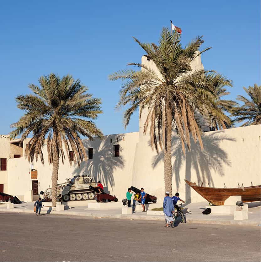
The museum fort in Umm al Quwain.
iStock
Ras al Khaimah
The base of the Qawasim “pirates” in the 19th century, Ras al Khaimah 6 [map] (or RAK, as it’s usually abbreviated) was once a powerful maritime state until being crushed by the British in the early 19th century (en.rasalkhaimah.ae). Modern RAK is still something of a backwater, with one of the UAE’s most scenic and fertile areas, extensive date palm groves and grazing plains for sheep and cattle, ringed by high mountains and rolling dunes, although it has been slowly catching up with the other emirates in terms of tourism and development.
Julfar
The predecessor of modern-day Ras al Khaimah was Julfar, a flourishing port which by around 900 had established itself as one of the major trading centres in the Gulf. Arab geographers such as Al Idrisi (writing in 1154) and Yaqut Al Hamawi (c.1250) described the city and its fertile hinterlands, while it is believed that Ahmad bin Majid, one of the great Arab navigators, was born in Julfar during the 1430s. Julfar’s prosperity inevitably attracted unwelcome attention. From about 1400 the city was controlled by the island of Hormuz, subsequently ousted by the Portuguese in around 1500. The Portuguese continued to occupy the city until 1633, when they were in turn overthrown by local forces, after which Julfar fell into decline, and was eventually abandoned.
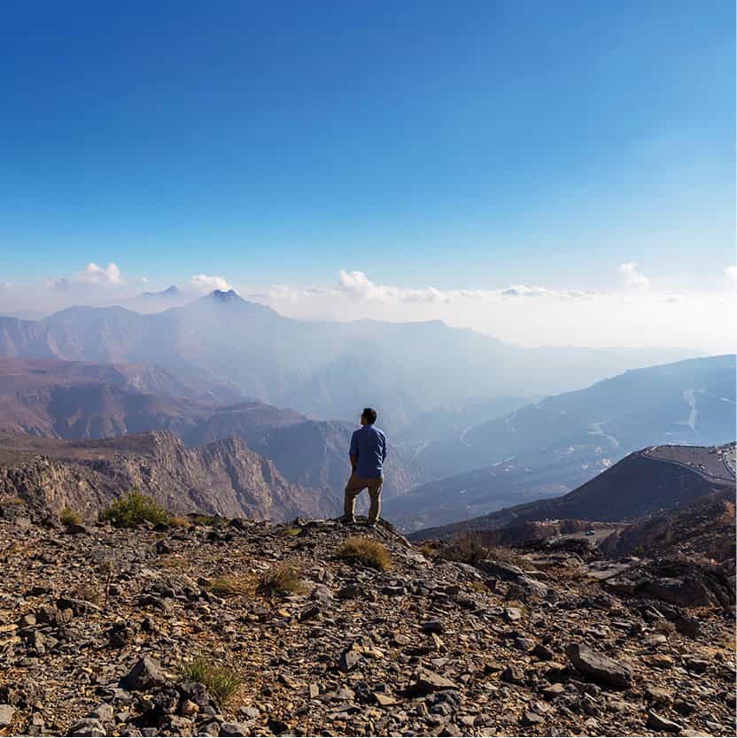
Enjoying the view in Ras al Khaimah.
Getty Images
RAK City
First settled in around 1500, RAK City lies right on the sea, with the oldest part of town next to the mouth of the local khor (creek). RAK is notably more built up and livelier than either Ajman or Umm al Qaiwain, although inconsequential compared with Dubai (or even Sharjah). The central market area, with gold souk, west of the fort is worth a look for its traditional street life, usually busy with robed Emiratis and their wives, veiled from head to toe in black abbeyas – a few still wear the traditional Bedu facemasks which have largely disappeared elsewhere in the country.
The town’s main attraction is, once again, its fort, now converted into the Ras al Khaimah National Museum A [map] (www.rakheritage.rak.ae; Sat–Thu 8am–6pm, Fri 3–7.30pm), a rather grand name for a decidedly modest museum showcasing the usual array of local artefacts and archaeological finds. The 19th-century fort itself is more appealing, with a fine wind tower looming over the pleasantly shady courtyard within.
North of the fort is Al Abrah Market, a small group of stalls set up on the shore of the creek. On a gravel area opposite this market fish nets are prepared daily by local fishermen, and large rolls of barasti (palm fronds) are stored for sale to local farmers. On the same road, under the impressively long Khor Bridge, is Ras al Khaimah’s colourful fruit and vegetable market, with its extensive range of fresh produce.
Beyond the Old Town, modern Ras al Khaimah expands. Houses and commercial buildings spread from the shore of the creek to the edge of the majestic Hajar mountains, running from here into Musandam in Oman.
Around Ras al Khaimah
South of RAK City, the coastal village of Jazirah al Hamra 7 [map] (The Red Island) was originally built on a small promontory, which at high tide became an island. The old village and fort still stand but are abandoned, with the new village now on the mainland. This is where you’ll find the impressive Hilton Al Hamra Beach and Golf Resort, designed in the form of a traditional Arabian fortress and occupying a prime slice of beachfront real estate.
About 10km (6 miles) out of town in the inland village of Digdagga, the Ras al Khaimah Camel Racing Track offers an entertaining way to spend a Friday morning in winter. Locals enjoy the excitement and thrill of following the camels in 4x4s, so watch out for vehicles as well as unwieldly camels.
South of Digdagga, the village of Khatt is home to the pleasant Khatt Hot Springs (daily 5am–11pm), with segregated enclosures offering private bathing in the pleasantly warm waters – although singularly lacking in atmosphere. The eye-catching Golden Tulip Khatt Springs hotel (www.goldentulip.com) rises impressively from a nearby hill, resembling a kind of modern remake of a traditional Arabian fort.
Excavations during the late 1980s at Shimmel (or Shamal) 8 [map], in the foothills north of Wadi Bih, about 5km (3 miles) north of Ras al Khaimah, have uncovered remnants of a settlement dating from about 3000 BC, including a large circular burial tomb dating to around 2500 BC. Shimmel is also home to Hisn Shimmel, popularly known as the Queen of Sheba’s Palace. The stony ruins of the “palace” are believed to have been part of a large fortified hill settlement dating from around the 15th century, some 2,500 years after the death of the legendary 10th-century-BC Yemeni queen, although the view towards Ras al Khaimah and the sea is wonderful.
To reach Hisn Shimmel, head out of RAK on the Oman road heading towards Rams. Turn right after 4.5km (3 miles) at the brown sign and follow this road for 1.5km (1 mile). Turn right at the roundabout and continue for 2.5km (1.5 miles) until you reach a fort-like building. Turn left through the village past a mosque on your left, then turn left past the mosque until a hill surrounded by a broken fence appears straight ahead. You can leave your car at the foot of the hill. Find a convenient break in the fence and climb the hill; you will find the ruins at the top.
The small, quiet villages of Rams and Dhayah, north of Ras al Khaimah, are also worth a visit, with old watchtowers and other coral and mudbrick buildings (including, in Dhayah, an old fort) nestled amongst palm groves. British forces chose Rams as a strategic landing site for their invasion of the southern Gulf in 1819. The people of Rams fled to Dhayah Fort, where they surrendered after four days of intensive fighting.
Around 10km (6 miles) northeast of Dhayah (although to get there you’ll have to take the new road from RAK City) is the mightily impressive Jebel Jais Viewing Deck Park (Sun–Thu 8am–8pm, Fri–Sat 8am–11pm), opened in 2018. Here, beneath sail-shaped shades, there are stunning views to be had of Jebel Jais, the UAE’s tallest mountain (1,934 metres/6345ft), but that’s not all – climbers can traverse the Middle East’s first commercial via ferrata, while this is also the spectacular setting for the world’s longest zip line. Strapped into a special horizontal harness, riders zoom for over 2.8km (1.7 miles), reaching speeds of up to 150kph (93mph) and finishing on an amazing suspended platform, which hangs from ropes attached to the surrounding mountains.


