One
THE BOSTON
ELEVATED RAILWAY
The old elevated North Station stood at the intersection of Causeway and North Washington Streets, serving the Charlestown Elevated, the Atlantic Avenue Elevated, and the Causeway Street Elevated. With the tracks at left shared by both the Charlestown and the Atlantic Avenue lines, the busy intersection required considerable attention to avoid collisions. (Courtesy of the Boston Public Library; photograph by Leslie Jones.)
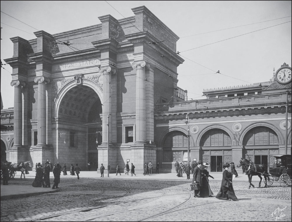
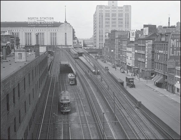
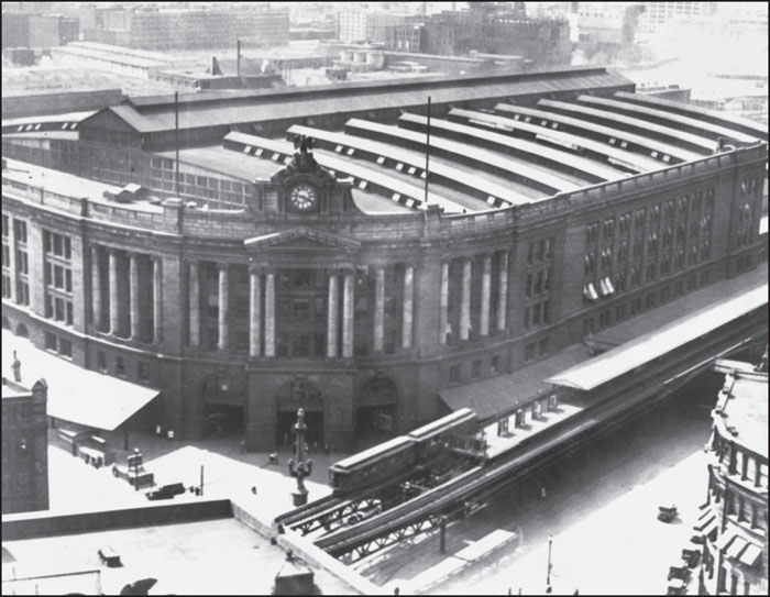
The 1890s image above, by Thomas E. Marr, is of Union Station (sometimes called North Union Station or North Station). Built in 1893 and located on Causeway Street in Boston’s West End, Union Station was a major hub for trains going in and out of the city and was the largest station in the world to accommodate a single railroad. Though intended to serve as a temporary structure, the station was in use for 35 years. Union Station was demolished in 1927 and 1928 to make way for the Boston Garden (home to the Boston Bruins hockey team and to the Boston Celtics basketball team, after the Celtics were founded in 1946) and North Station. The image below, by Leslie Jones, shows the Elevated tracks, Boston Garden, and North Station in 1929. (Both, courtesy of the Boston Public Library.)
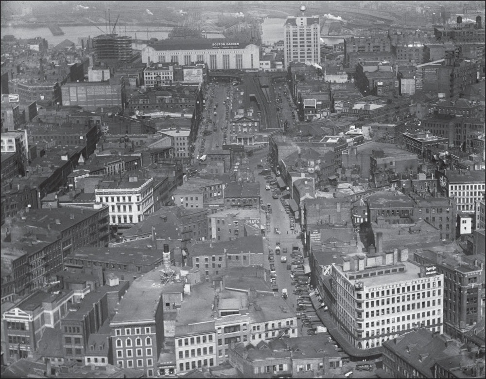
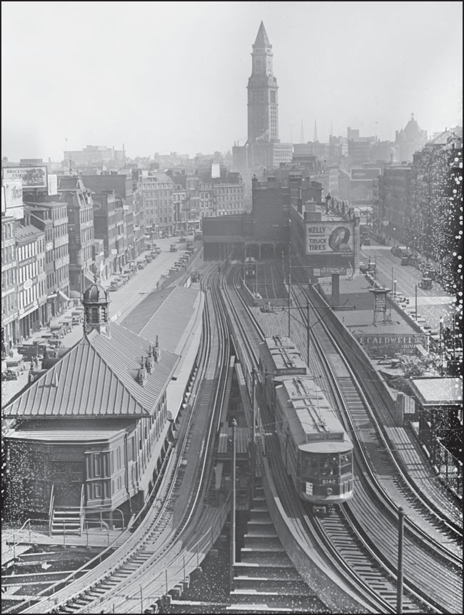
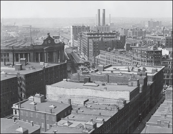
This view from 1929, looking northwest from the Custom House Tower, shows the wider context of the North Station area. The Elevated is visible at center in the upper half of the photograph, emerging from the Washington Street Tunnel between Haverhill and Canal Streets, just beyond Haymarket Square, at the point of the Bulfinch Triangle. (Courtesy of the Boston Public Library; photograph by Leslie Jones.)
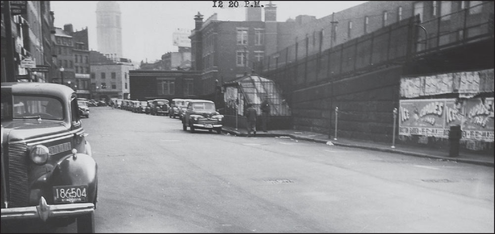
This 1948 image looks southeast down Haverhill Street toward North Washington Street, with the Canal Street Incline at right. At the incline, the Charlestown Elevated, the predecessor to the Orange Line, emerges from the Washington Street tunnel alongside the Tremont Street Subway, the predecessor to the Green Line. (Collection No. 5110.002, City of Boston Archives, Boston.)

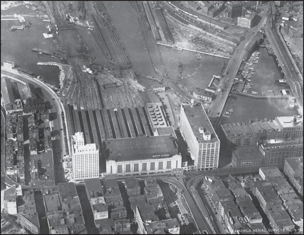
The narrow spire at the center of this image is the Custom House Tower, which was completed in 1918, seven years before this photograph was taken. The Atlantic Avenue El is at far right, cutting a line along the waterfront, and North Station is just visible in the distance at upper left. The circular park in the lower foreground was known as Fort Hill Square. (Courtesy of the Boston Public Library; photograph by Fairchild Aerial Surveys.)
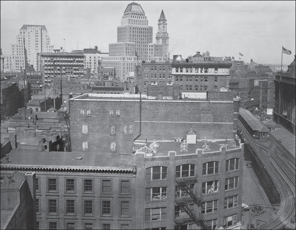
In this 1930 photograph, the Atlantic Avenue El’s South Station stop is visible at right. The tallest building at the center of the image is the United Shoe Machinery Corporation Building, completed in 1929 and considered an excellent example of Art Deco architecture. Next to it is the distinctive Custom House Tower. (Courtesy of the Boston Public Library; photograph by Leslie Jones.)
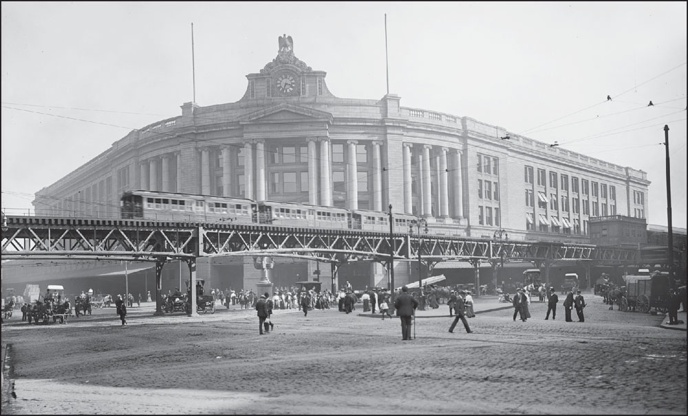
In these c. 1904 photographs, trains and commuters go about their business outside South Station, originally called South Union Station. The station opened in 1899 and quickly became the busiest train station in the United States. Designed by the architectural firm Shepley, Rutan and Coolidge, South Station was added to the National Register of Historic Places in 1975. Today, South Station provides train service to cities around the country as well as local Red Line service as part of the MBTA. As seen in these images, one of the main stops for the Atlantic Avenue Elevated was outside South Station. (Above, courtesy of the Library of Congress, photograph by Detroit Publishing Company; below, courtesy of University Archives & Special Collections, Joseph P. Healey Library, University of Massachusetts Boston: Anthony Mitchell Sammarco Collection.)
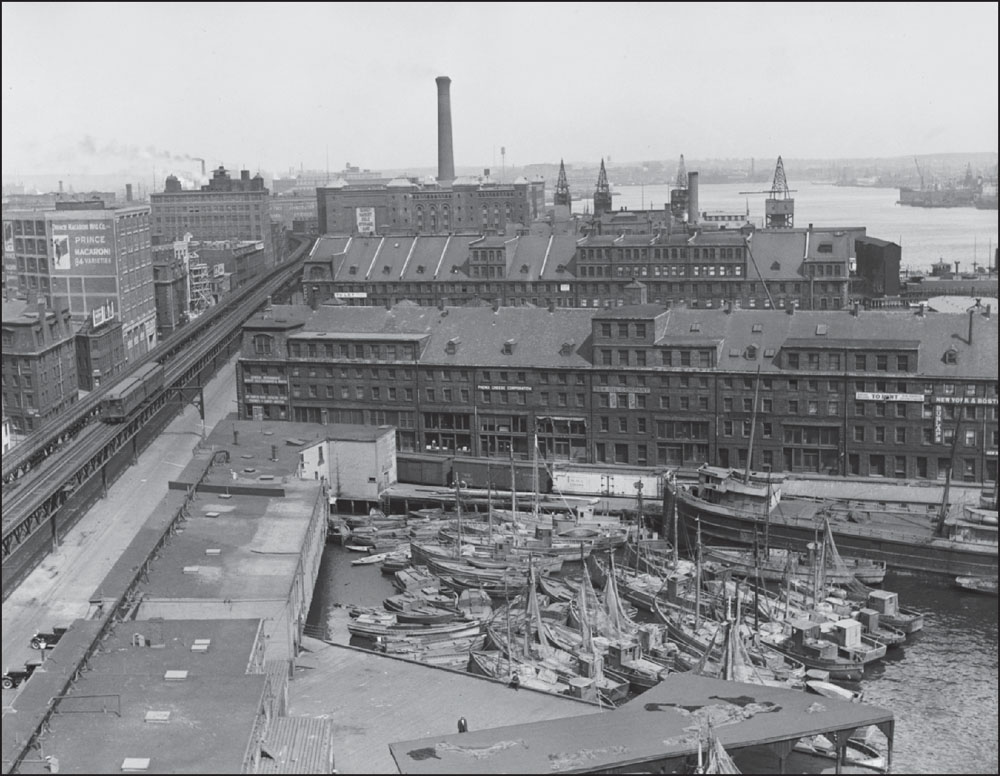
This c. 1930 image shows the Atlantic Avenue Elevated at left; note its proximity to Boston’s waterfront and Commercial Wharf, which served vessels transporting cargo to and from Boston. Today, the wharf is home to leisure vessels. The two-car train traveling the tracks may be evidence of the dwindling use of the Atlantic Avenue Elevated in the 1930s. (Courtesy of the Boston Public Library; photograph by Leslie Jones.)
The building capped with a band of white windows at the center of this 1932 photograph, taken along Atlantic Avenue, is the Hotel Essex. Opened in 1899, this luxury hotel catered to travelers using South Station, which also opened in 1899. In 1983, the building was redeveloped by Hamilton Realty and Intercontinental Developers and now contains commercial and nonprofit offices. (Courtesy of the Boston Public Library; photograph by Leslie Jones.)
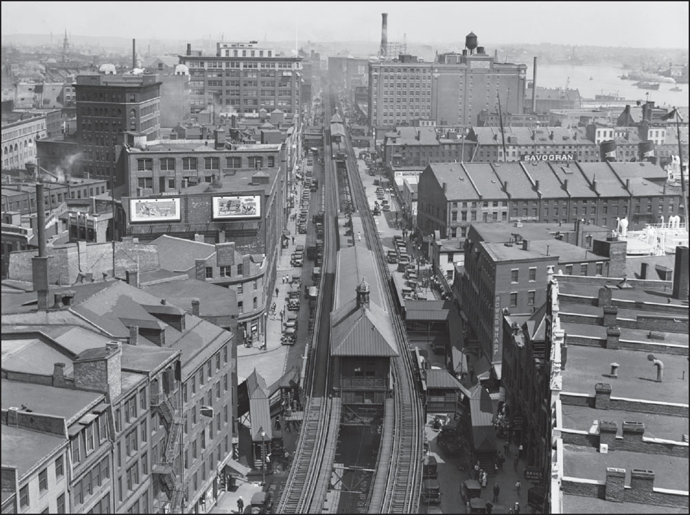
The above view along Atlantic Avenue shows the Elevated station at Rowes Wharf in 1932. In 1959, more than 20 years after the Atlantic Avenue Elevated ceased service, the elevated John F. Fitzgerald Expressway, commonly called the Central Artery, opened along much of this route, cutting a line through downtown Boston until it was moved underground as a result of the Central Artery/Tunnel Project, also known as the Big Dig. Big Dig construction began in 1991, lasted 15 years, and was the most expensive highway project in US history, with a 2006 tally estimating costs to be $14.6 billion. The image below, by Fairchild Aerial Surveys, shows the Boston Garden and North Station, just below and left of center, above the Elevated interchange at the intersection of Causeway and North Washington. (Both, courtesy of the Boston Public Library.)
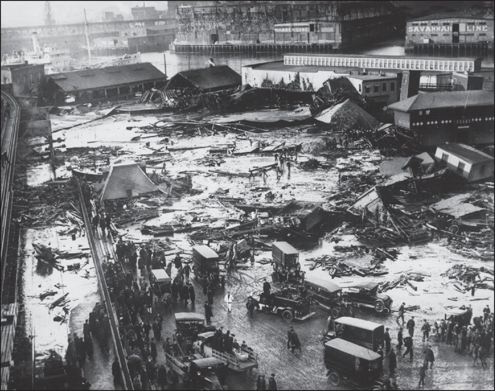
On January 15, 1919, a five-story molasses tank erupted in Boston’s North End, releasing a 15-foot-tall wave of molasses that killed 21 people and engulfed everything in its path. Some still say that they can smell molasses on hot summer days in the North End, while others are skeptical that this is true or possible. (Courtesy of the Boston Public Library; photograph by the Globe Newspaper Company.)
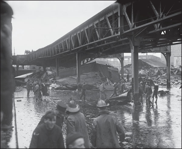
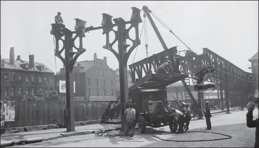
The Atlantic Avenue Elevated was badly damaged as a result of the Molasses Flood. It took more than two months for crews to repair damage to the Atlantic Avenue Elevated and for service to resume between North and South Stations. (Courtesy of the Boston Public Library; photograph by Leslie Jones.)
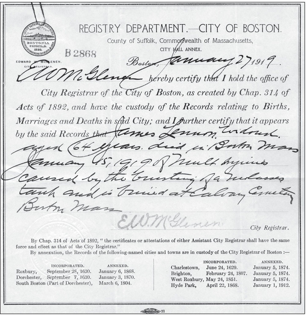
This is the death certificate for James Lennon, one of the 21 people killed in the Molasses Flood. The certificate describes Lennon’s cause of death as resulting from “much injury caused by the bursting of a molasses tank.” (Courtesy of University Archives & Special Collections, Joseph P. Healey Library, University of Massachusetts Boston: Massachusetts Catholic Order of Foresters Collection.)
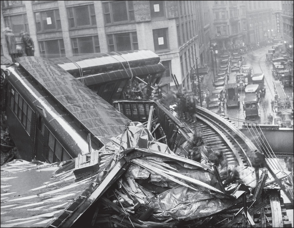
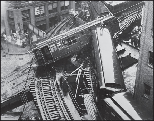
These photographs show an accident that occurred at the intersection of Harrison Avenue and Beach Street on July 22, 1928. The accident, caused by a northbound train headed for South Station, killed three passengers—George Anderson, Martin O’Connor, and Clayton Nickerson—and injured another 23. An inquest by Judge James Parmenter, of the Boston Municipal Court, found the operator of the train to be negligent. In his report, the judge wrote: “I find that the accident was caused by the culpable negligence of Bernard A. McDonald in running upon the curve at an obviously dangerous rate of speed, far in excess of that prescribed by the regulations of the railway company.” In January 1929, however, a jury found McDonald not guilty. (Both, courtesy of the Boston Public Library; photograph by Leslie Jones.)
In September 1938, Edward Dana, president of the Boston Elevated Railway Company, announced that Atlantic Avenue service would end due to decreasing ridership. By then, its trains only made stops at North and South Stations from September to June, and riders found it easier to use bus lines and the subway, which had connected downtown to South Station since 1916. (Courtesy of the Boston Public Library; photograph by Leslie Jones.)
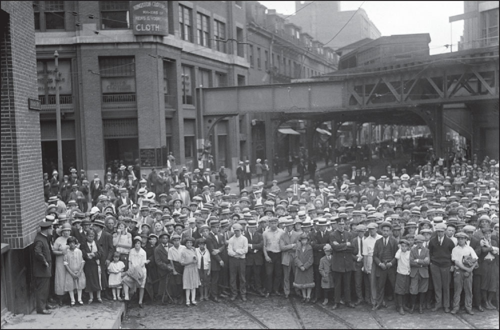
A large crowd poses for a photograph, taken around 1930, at the intersection of Harrison Avenue and Beach Street, the site of the July 1928 Elevated accident that killed three men. The building at left is the Kingston Clothing Company. The event memorialized in the photograph is unknown. (Courtesy of the Boston Public Library; photograph by Leslie Jones.)
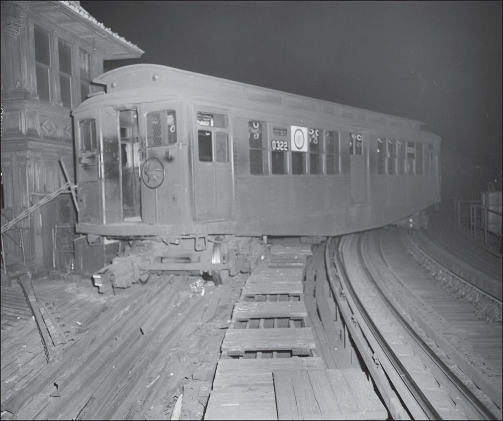
A photograph taken in 1948 or 1949, after the MTA began using its new emblem in train windows, shows a derailed Elevated train car at Sullivan Square Station in Charlestown; this is No. 0322 of the No. 8-type cars first introduced in 1921. To the left is Tower “A,” one of the many control and switching towers along the Elevated route between Everett and Forest Hills. (Courtesy of the Boston Public Library; photograph by Leslie Jones.)
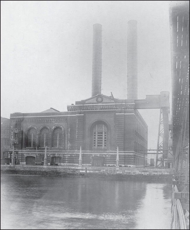
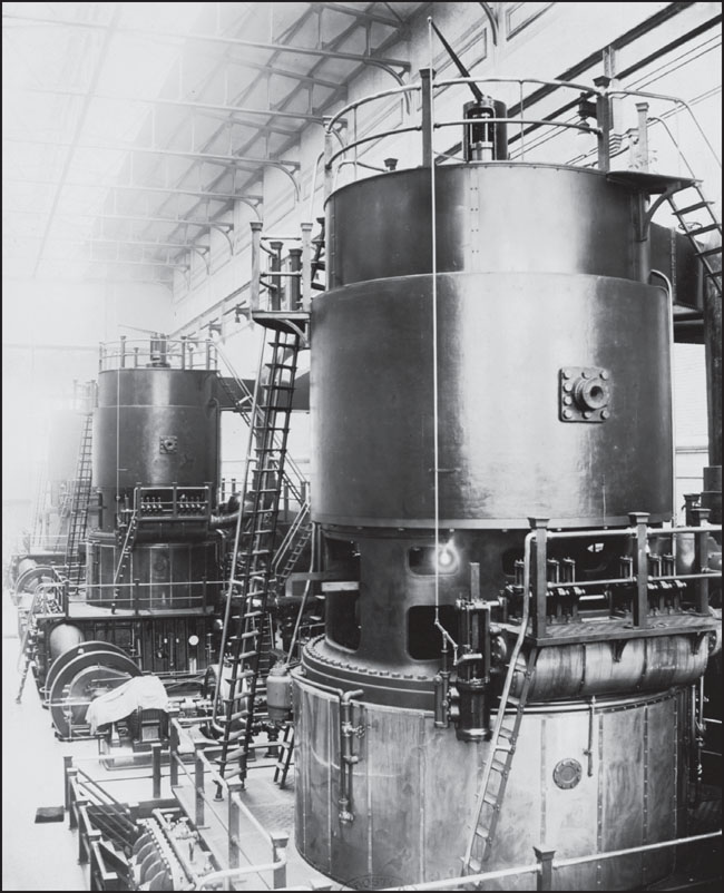
The image at left shows the power station at L and East First Streets in South Boston, just south of the Reserved Channel, which provided electricity for the Boston Elevated Railway. The image below shows a vertical Curtis turbine inside that power station, one of three 15,000-kilowatt turbines that operated in the station until 1950. Because the technology behind generating electricity was still in its infancy, the Boston Elevated Railway Company was forced to build power-generating stations along the Elevated lines to keep the trains moving. Some of these power stations have been repurposed and redeveloped over the years. (Both, courtesy of the Boston Public Library.)