Two
THE CHARLESTOWN
ELEVATED
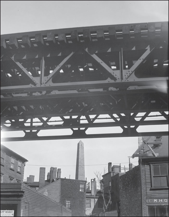
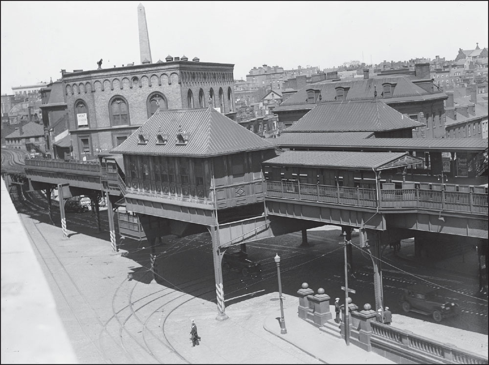
This 1938 image shows the Bunker Hill Monument from beneath the Elevated. The cornerstone of the monument, actually located on Breed’s Hill (where the battle was fought), was laid on June 17, 1825, on the 50th anniversary of the Revolutionary War in a ceremony that included the Marquis de Lafayette and Daniel Webster. The monument was not completed until 1842. (Courtesy of the Boston Public Library; photograph by Leslie Jones.)
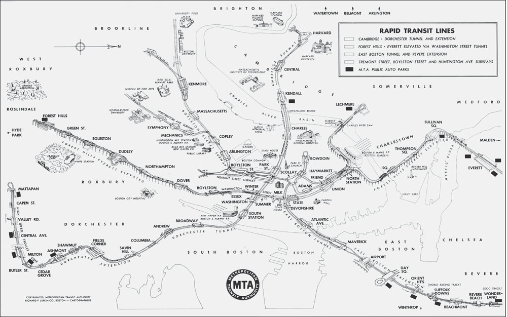
This 1954 Metropolitan Transit Authority rapid transit map shows the original alignment of the system that would later be designated as the Orange Line after the MTA became the Massachusetts Bay Transportation Authority (MBTA). The Elevated traces a path from left to right across the center of this map from Forest Hills, alongside the Arnold Arboretum, across the downtown area where the four lines cross, and ends at Everett at center right. The color coding of the MBTA rapid transit lines was announced in late 1965, around the time of the introduction of the new emblem, the “Circle-T,” but was not implemented until later in 1966. (Courtesy of Otto M. Vondrak.)
This 1950s photograph looks across Charlestown toward the Mystic River Bridge. Construction of the bridge started in 1948, it opened to traffic in 1950, and the bridge was renamed in 1963 after Maurice Tobin, former mayor of Boston. Tobin had ordered the construction of the bridge while serving as governor of Massachusetts from 1945 to 1947. (Courtesy of the Boston Public Library; photograph by Leslie Jones.)
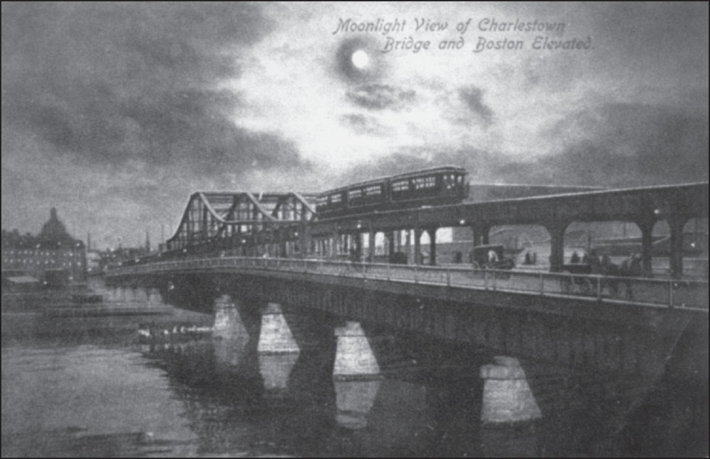
This Metropolitan News Company postcard from 1906 shows the Boston Elevated crossing the Charles River on the Charlestown Bridge into downtown Boston. The silhouetted dome of the Massachusetts State House is in the background. (Courtesy of University Archives & Special Collections, Joseph P. Healey Library, University of Massachusetts Boston: Anthony Mitchell Sammarco Collection.)
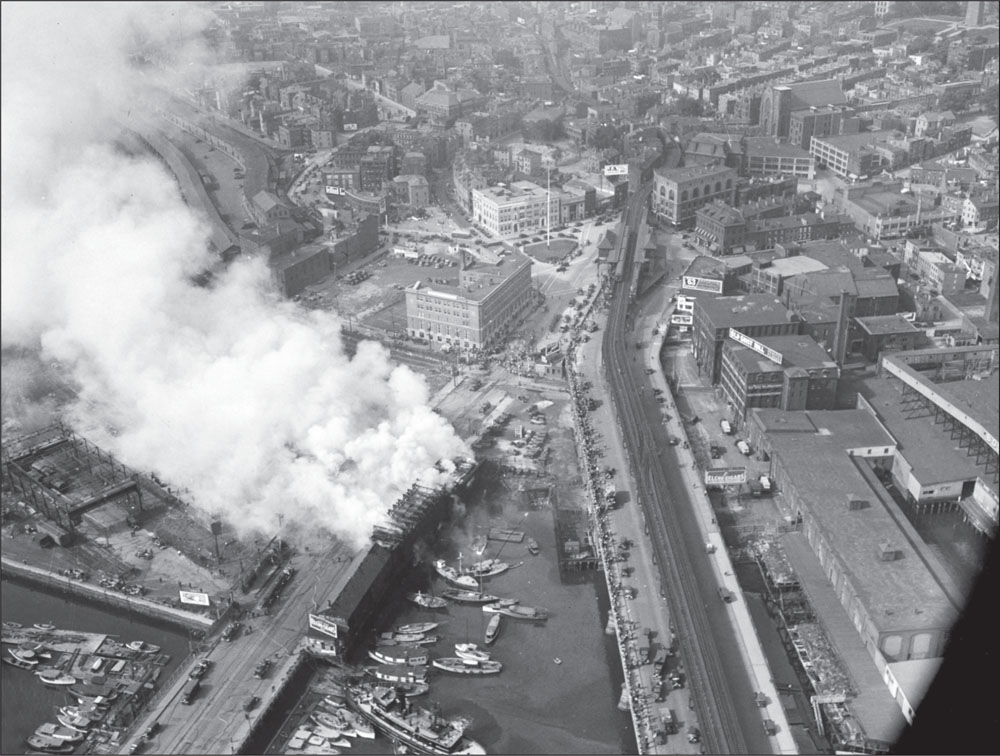
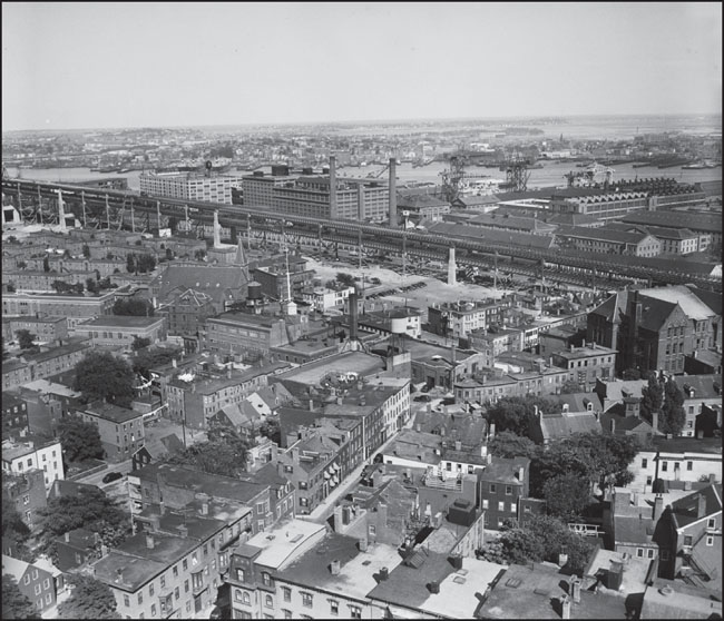
This aerial view from around 1940 shows a fire burning on the edge of the Warren Street Bridge at left. At right, the Elevated tracks cross the Charlestown Bridge and progress through City Square down Main Street toward Thompson Square. The base of the Bunker Hill Monument is visible in the upper right corner of the image. (Courtesy of the Boston Public Library; photograph by Leslie Jones.)
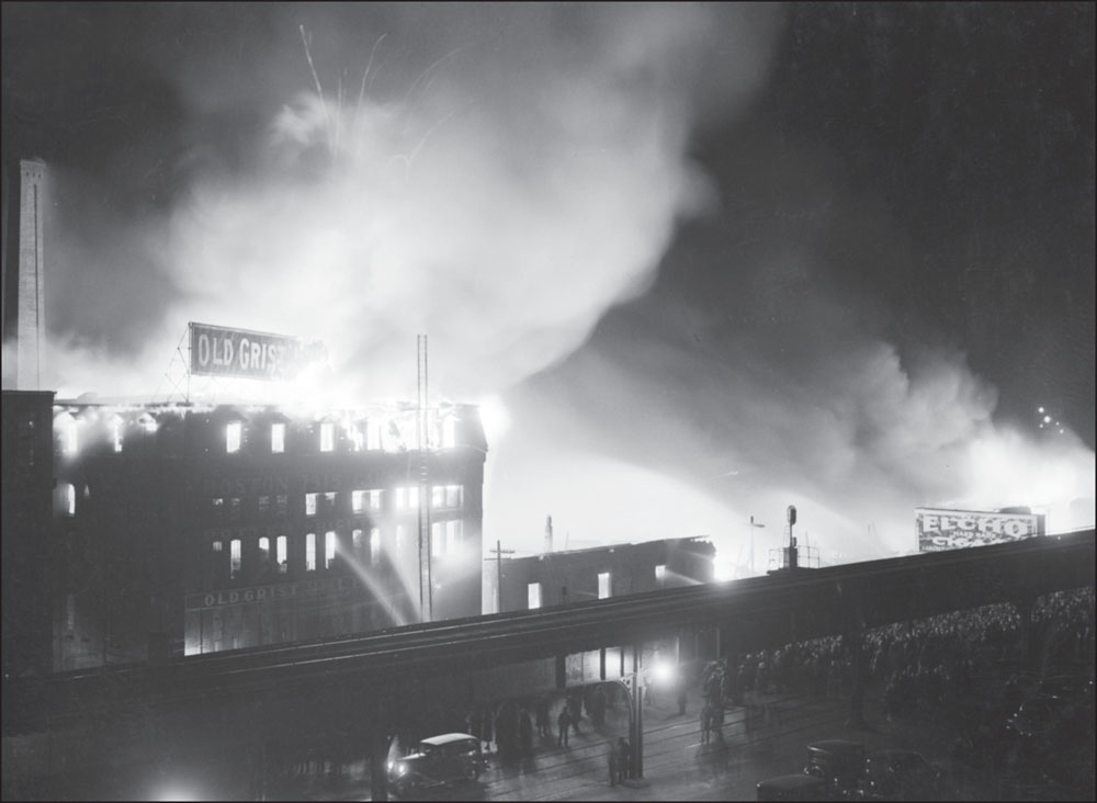
This 1936 image shows a fire near City Square that destroyed the Old Grist Mill and the Boston Globe’s newsprint storage house. Both buildings were owned by the Globe Newspaper Company. News coverage estimated that as many as 10,000 people watched the fire from the Charlestown Bridge. Part of the crowd is visible underneath the tracks. (Courtesy of the Boston Public Library; photograph by Leslie Jones.)
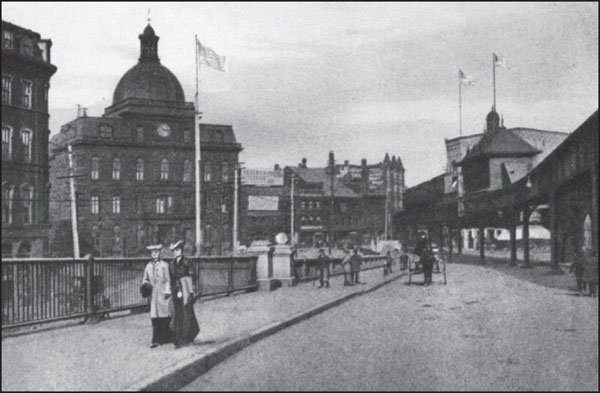
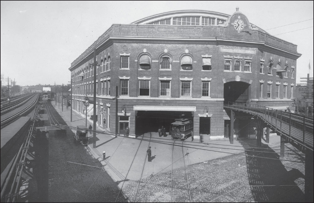
Founded in 1628 and originally called Mishawum by Native Americans, Charlestown was incorporated as a city in 1848. City Square has long been an important civic center in Charlestown. Before Charlestown was annexed to Boston in 1874, City Square was home to a variety of municipal activities ranging from government offices to libraries. The 1930 photograph above, taken by Leslie Jones, shows the City Square Station of the El and, in the left background, the Bunker Hill Monument. In the image of City Square shown below, which was published by the Metropolitan News Company, the domed building is the former Charlestown City Hall. Currently the site of the Charlestown Division of the Boston Municipal Court Department, the city hall shown in this 1901 image was completed in 1869 on the site of the former Town House, which was built in 1657. (Both, courtesy of the Boston Public Library.)
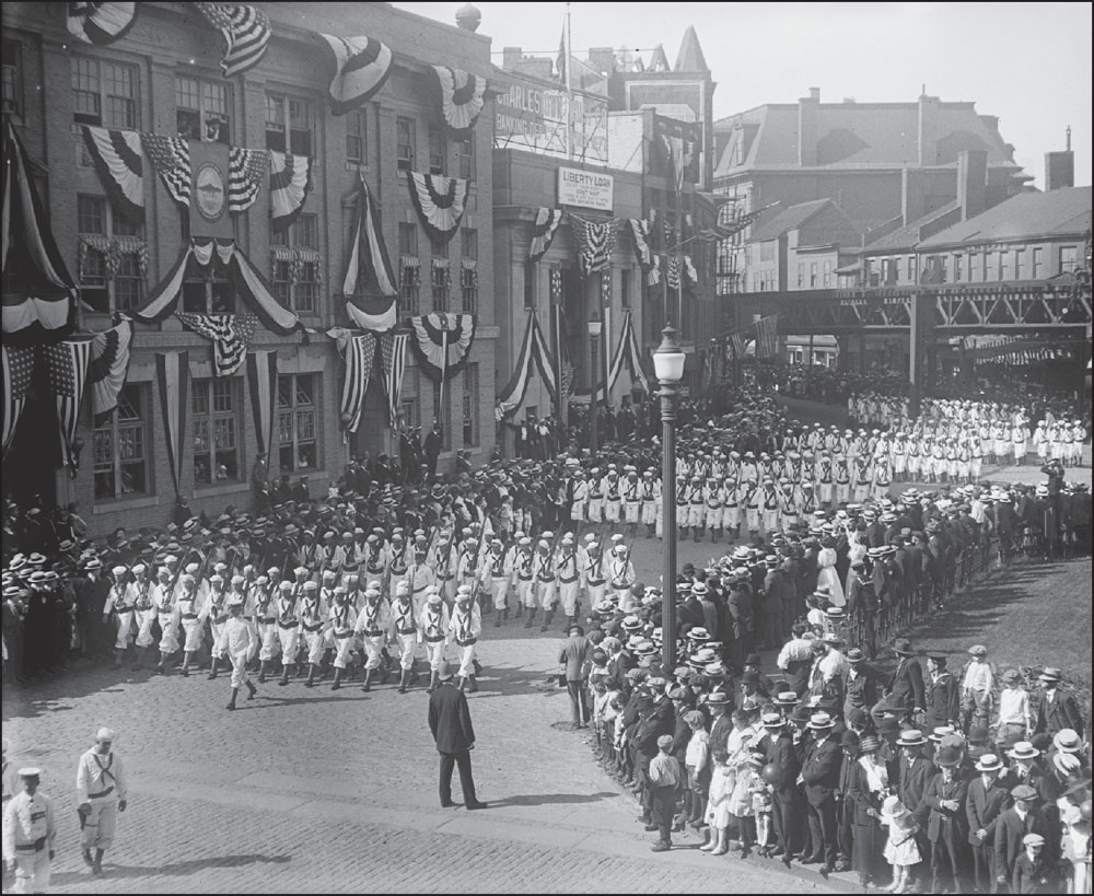
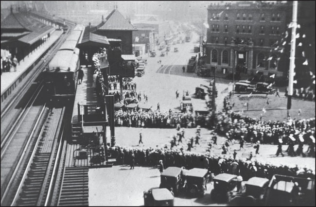
Every year since 1786, on or around June 17, a parade has taken place in Charlestown to commemorate the Battle of Bunker Hill. Fought on June 17, 1775, the Battle of Bunker Hill is considered the first major battle of the Revolutionary War. The above image, by Leslie Jones, shows sailors who were stationed in Boston marching as part of the parade. The El is visible in the background. Each year, sailors stationed to the USS Constitution in Charlestown lead the Bunker Hill Day Parade. The 1926 image below shows the parade as it passes through City Square and under the City Square Station of the El. (Both, courtesy of the Boston Public Library.)
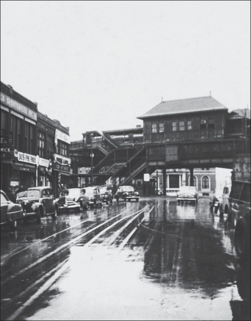
This 1950 photograph shows the elevated City Square Station looming over Chelsea Street on a rainy day. The photograph looks southwest past World Sportswear, Inc., and Dot’s Fine Foods, both at left, with the first floor of the Army & Navy YMCA visible under the station. (Courtesy of Rev. Wolcott Cutler and the Boston Public Library.)
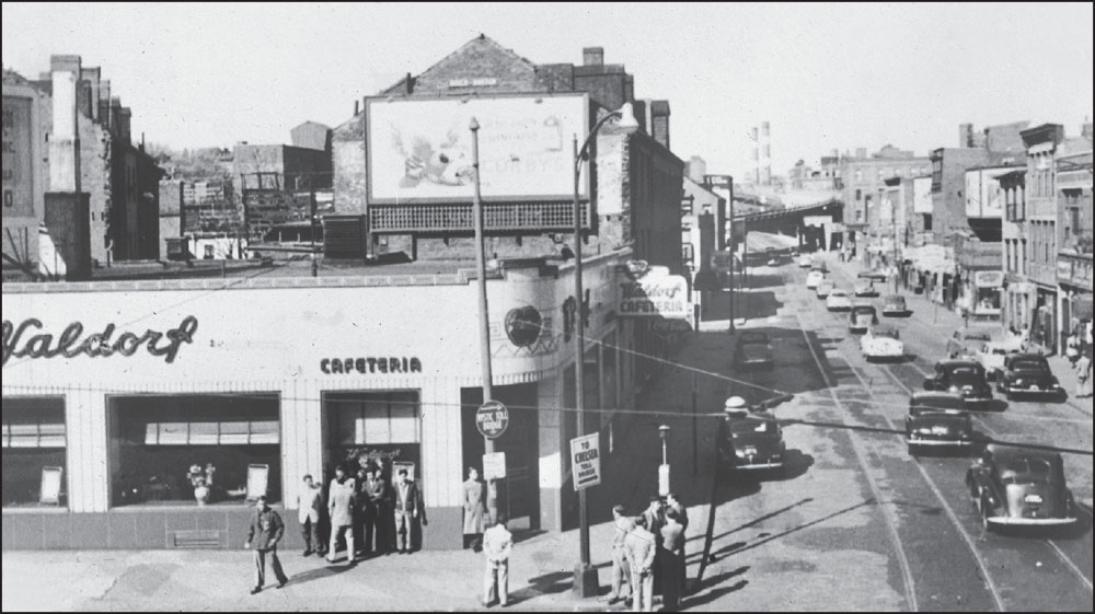
The Waldorf Cafeteria at 23 City Square, pictured here in 1950, was one of several in Boston and Cambridge in the mid-20th century, a period when several large cafeteria chains had a presence in the cities. The era was relatively short-lived, and this Waldorf location closed by 1960. (Courtesy of Rev. Wolcott Cutler and the Boston Public Library.)
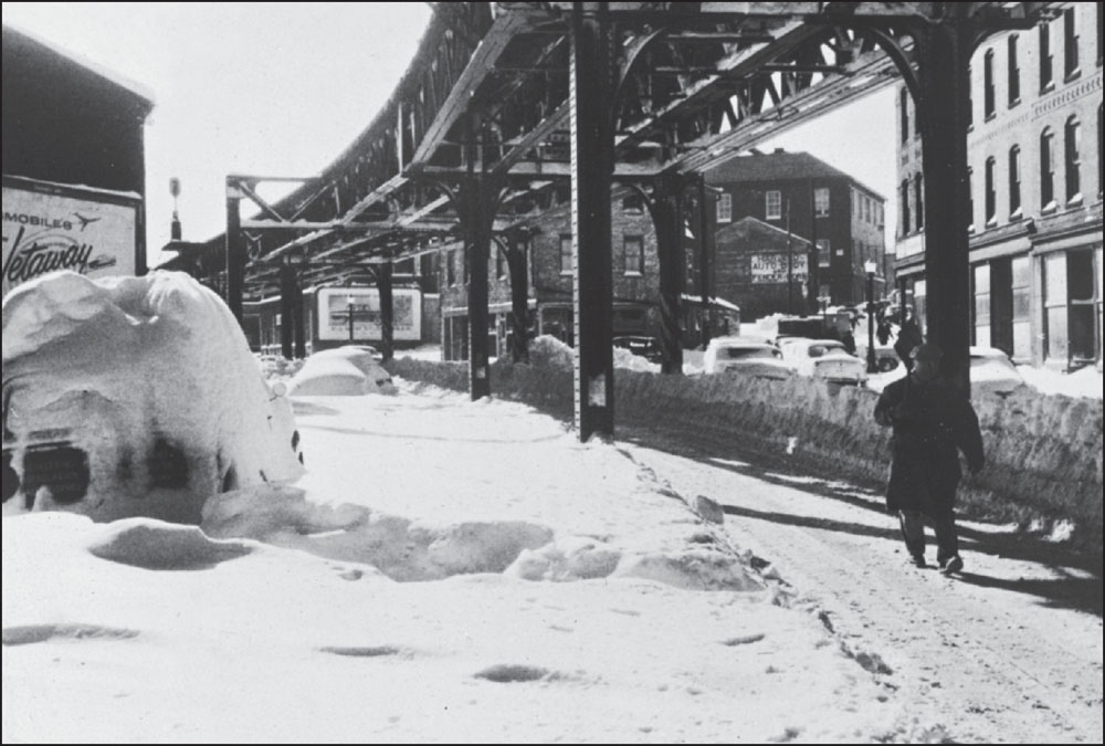
One effect of the Elevated tracks using existing roadways was an often dangerous narrowing of streets, a problem made worse by snow accumulation during winter months. This image from March 20, 1956, shows the intersection of Main Street, Harvard Street, and Devons Street just south of Thompson Square, also known as the Thompson Triangle, in Charlestown. (Courtesy of Rev. Wolcott Cutler and the Boston Public Library.)
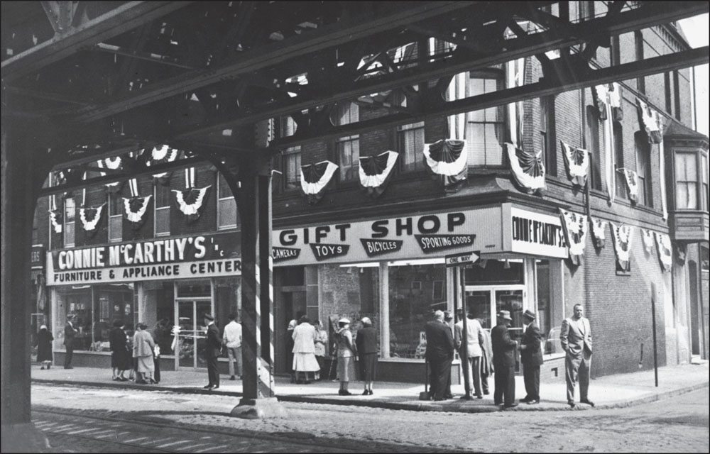
In this 1954 photograph, Connie McCarthy’s Emporium is shown celebrating its opening at the intersection of Main Street and Monument Avenue, just under the El. In 2000, restaurateur Samad Naamad transformed the space into the Moroccan-themed Tangierino Restaurant, a sign of the changing face of a neighborhood once populated mostly by working class Irish Americans. (Courtesy of Rev. Wolcott Cutler and the Boston Public Library.)
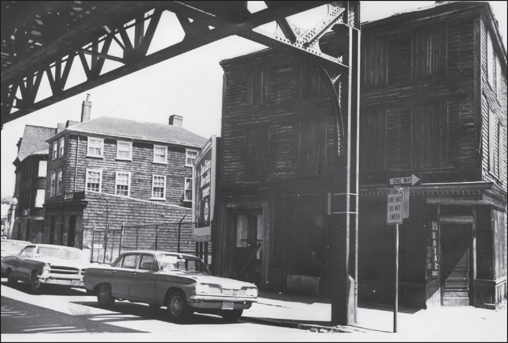
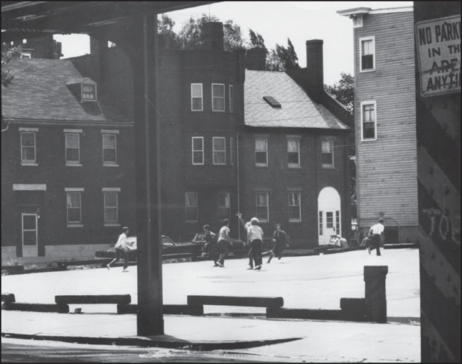
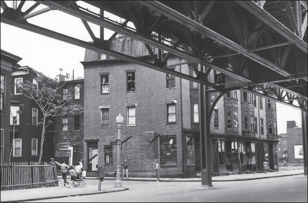
The above image shows the Warren Tavern, at Main and Pleasant Streets, cast in the shadow of the Elevated. Built around 1780, this is believed to have been one of the first houses erected after the British burned much of Charlestown in June 1775, a battle later commemorated by the nearby Bunker Hill Monument. This image from around the 1970s shows the dilapidated condition of the building at the time. The Warren Tavern had suffered, like many neighborhood businesses, from Charlestown’s decreasing population, which went from 40,000 in 1900 to 14,000 in 1970. Today, the Tavern is a popular and lively neighborhood spot frequented by residents and tourists. In the image below, also from around 1970, children play in an empty lot at Main and Union Streets, just up Main Street from the Warren Tavern. (Both, Collection No. 5210.004, City of Boston Archives, Boston.)
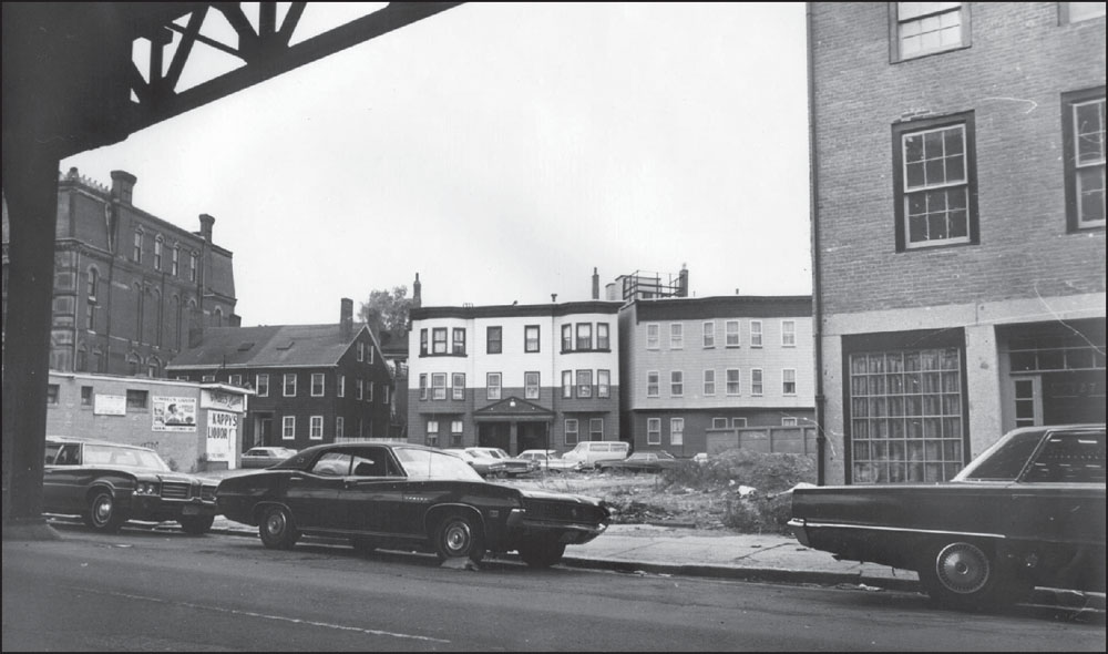
This 1972 photograph shows the meeting of Main and Warren Streets at Thompson Square. The taller structure at left in the image is the former Charlestown Saving Bank; the smaller structure in the foreground at left is a Kappy’s Liquor Store, which had been located in the square at one time. (Collection No. 5210.004, City of Boston Archives, Boston.)
The Thompson Square stop on the Charlestown Elevated opened in the spring of 1902, almost a year after the original stops on the Charlestown line had opened for service. A section of the Bunker Hill Monument, completed in 1842, is visible in the background of this 1972 photograph. The ornate building at right is the former Charlestown Savings Bank. (Collection No. 5210.004, City of Boston Archives, Boston.)
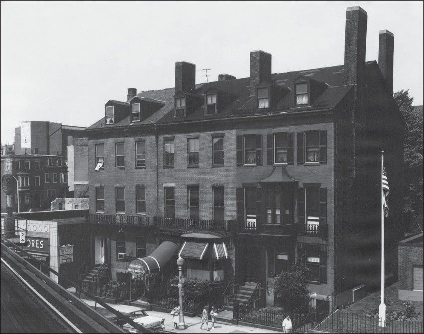
As seen above in a 1972 photograph from Thompson Square, the Elevated station sat just outside the Charlestown Savings Bank, an official Boston landmark built in 1876 in the High Victorian Gothic style with a sandstone facade broken by elaborately arched windows. Incorporated in 1854, the bank occupied the building until 1978, along with a Masonic lodge on its upper floors. The image below shows buildings along Dexter Row next to Charlestown Savings Bank. The awning marks the location of the Daniel A. Wiles Funeral Home, which operated on Dexter Row for decades. (Both, Collection No. 5210.004, City of Boston Archives, Boston.)

This 1970 image shows Thompson Square Station looming over a parking lot at the corner of Austin and Main Streets, just southeast of the station. The area remains a parking lot and now serves a strip mall that features a convenience store and tax preparation office. (Boston Landmarks Commission image collection, Collection 5210.004, City of Boston Archives, Boston.)
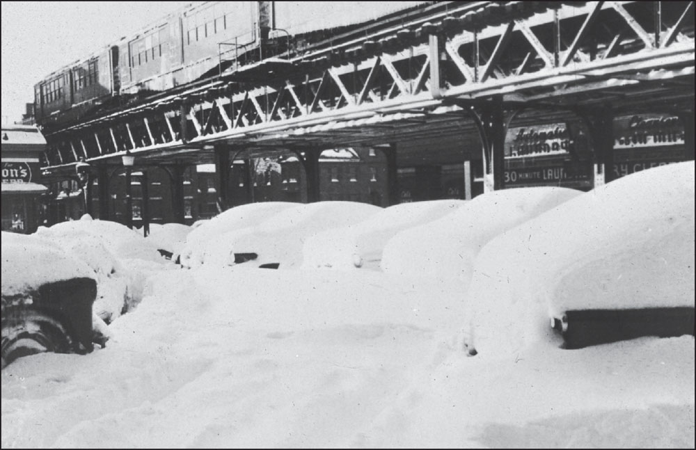
This image from March 20, 1956, shows cars in Thompson Square still buried under snow that fell four days earlier, in what Boston Globe weather writer Sumner Barton dubbed “the St. Patrick’s Eve Blizzard of 1956.” The snowstorm included winds of up to 60 miles per hour, forced thousands to abandon their vehicles, and killed 11 people. (Courtesy of Rev. Wolcott Cutler and the Boston Public Library.)
In this photograph from the 1960s, a group of children have gathered at the corner of Main and Oak Streets between Thompson and Sullivan Square Stations. The row of buildings alongside the El is badly dilapidated, with most windows broken or boarded. (Collection No. 5210.004, City of Boston Archives, Boston.)
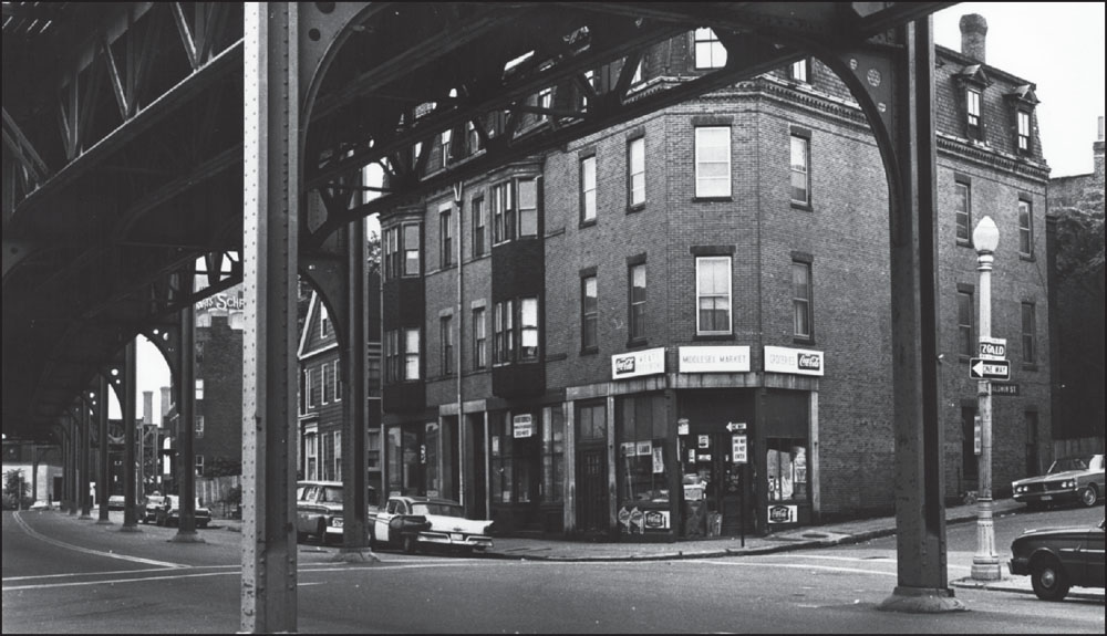
“Happy” Harry Semonian, a lifelong Charlestown resident, owned the Middlesex Market at Main and Baldwin Streets until his death in 1984. In this 1968 photograph, a television and radio repair shop is seen next door to the market, with another business in the next storefront. The first floor of this building was later converted into residential space. (Collection No. 5210.004, City of Boston Archives, Boston.)
This image looks north toward Sullivan Square Station, the original terminus for the Charlestown Elevated before it was extended to Everett in 1919. Much like Dudley Street Station, the original terminus on the Washington Street Elevated, Sullivan Square Station was a major interchange on the Elevated. (Courtesy of the Boston Public Library.)
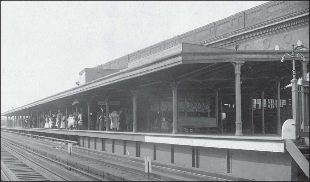
Sullivan Square Station was designed to be a major transfer point, and many streetcar lines that previously carried passengers to downtown Boston were rerouted to end there. In this 1912 photograph of the station’s inbound platform, one sign above the passengers reads “Dudley Street via Tunnel,” while another reads “Surface Cars to Malden and Everett.” (Courtesy of the Boston Public Library.)
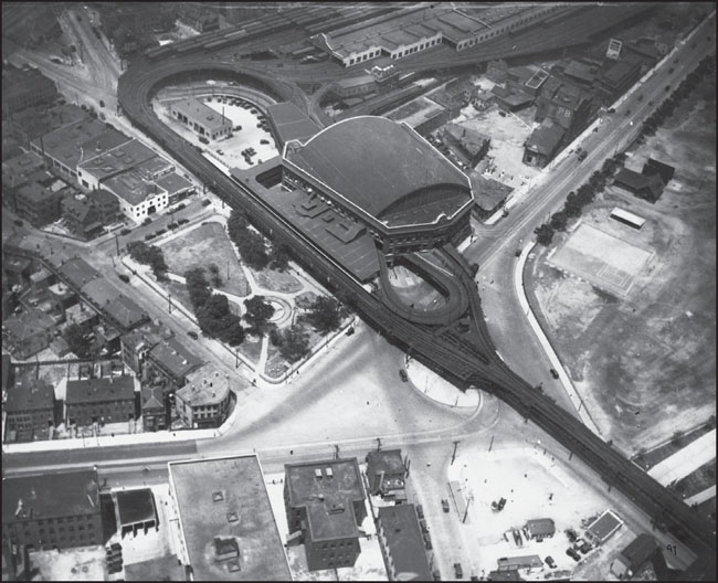
A c. 1915 aerial view shows Sullivan Square Station, near the edge of Charlestown and Somerville, with Charlestown’s Main Street moving diagonally through the image from the lower left. The area surrounding the former Sullivan Square Station is now mostly parking lots and low-rise commercial space. Many of the older structures visible in this image have since been torn down. (Courtesy of the Boston Public Library.)

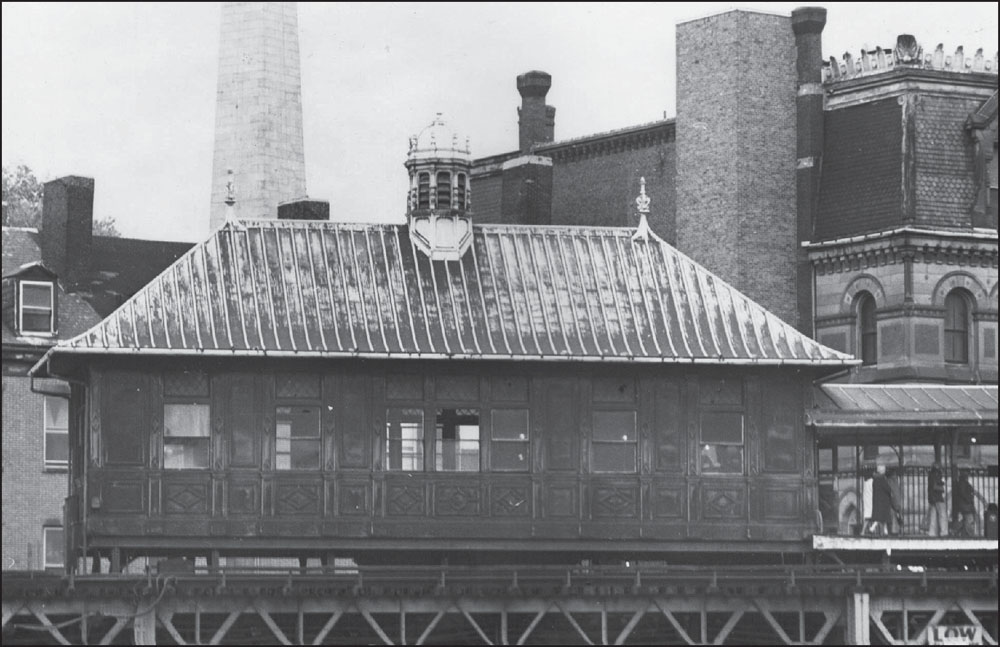
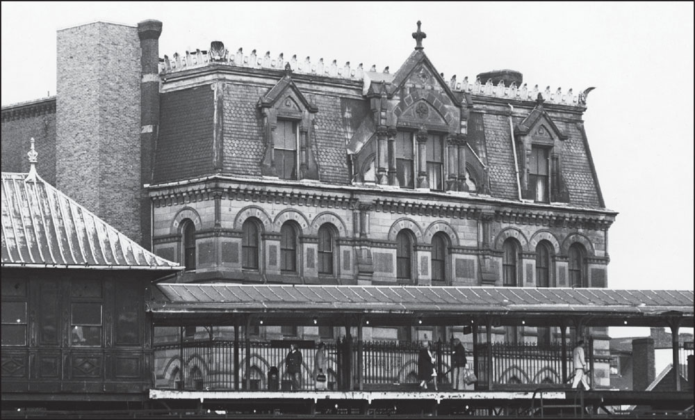
This c. 1912 photograph shows the dramatic interior platform in the Sullivan Square Station. The arched windows look south into the heart of Charlestown. A new Sullivan Square Station was built several blocks to the west in 1975 as part of a reconfiguration of the Orange Line route. The original Sullivan Square Station was damaged by fire and demolished in July 1975. (Courtesy of the Boston Public Library.)
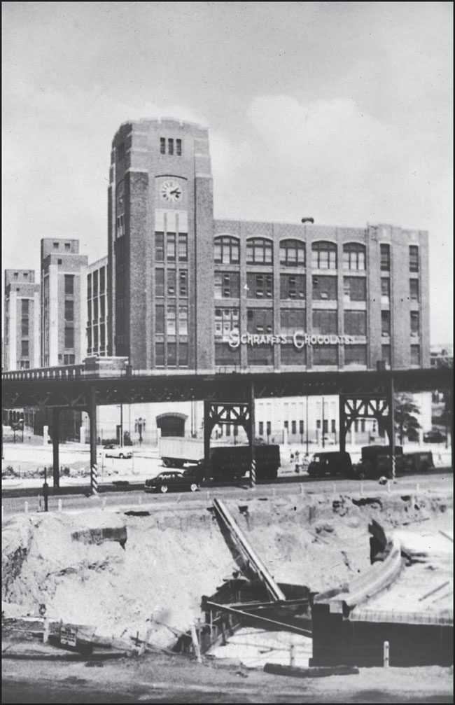
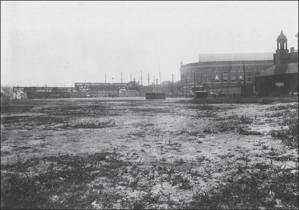
Just east of Sullivan Square Station, Schrafft’s Candy Factory looms over the Elevated in the photograph at right from June 1951. Founded by William F. Schrafft in 1861, Schrafft’s was purchased in 1898 by Frank Shattuck, who expanded the company to include restaurants throughout the northeast. The Schrafft’s building in Charlestown, adjacent to Sullivan Square Station, was built in 1928. Schrafft’s was later purchased by Pet, Inc., and the Flatley Company purchased the building in 1984 and renovated it for use as commercial space. The 1901 image below, from the Boston Parks Department, looking west, shows the Sullivan Square playground with the Elevated tracks and station in the distance. In 1928, this area would become the site of the Schrafft’s Candy Factory. (Both, courtesy of the Boston Public Library.)
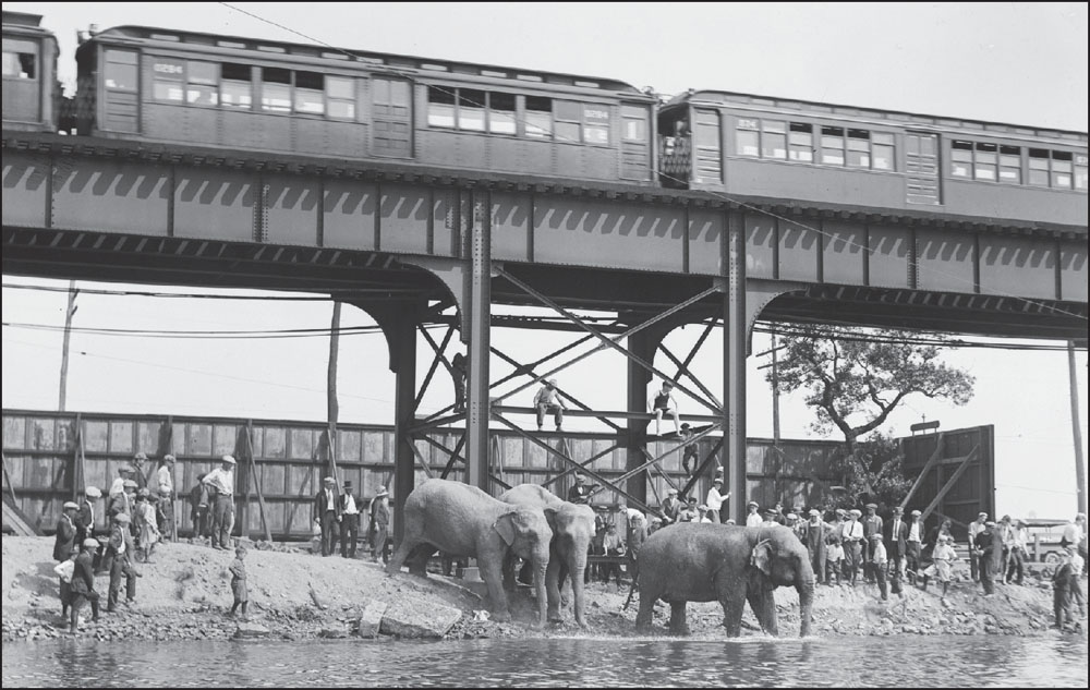
For many years, around the time of Bunker Hill Day in June, a circus visited the Sullivan Square park grounds, located between the station and the Mystic River. This photograph of elephants bathing in the Mystic River was probably taken sometime after the Elevated’s extension to Everett in 1919 and before the mid-1930s, when Boston mayor Frederick Mansfield banned traveling carnivals. (Courtesy of the Boston Public Library; photograph by Leslie Jones.)
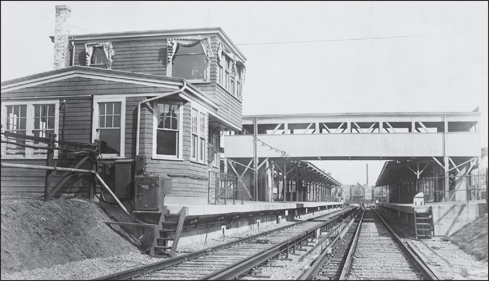
The Charlestown Elevated’s Everett station opened in March 1919. The extension cost $2.5 million but added just one mile beyond Sullivan Square, the original terminus. The Everett terminal, built at surface level, was meant to be temporary in anticipation of an extension to Malden Center, but the line was not extended until the route’s shift to the west in 1975. (Courtesy of the Boston Public Library.)