Three
TRAVERSING A
CHANGING DOWNTOWN
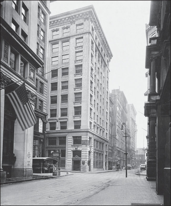
This photograph, taken before the 1930s, shows Devonshire Street at Water Street in downtown Boston. The low, arched canopy at bottom left is an entrance to the East Boston Tunnel, completed in 1904 and now part of the Blue Line, and Milk-State, now simply known as State. This entrance led to trains to East Boston but also offered connections to the Washington Street Tunnel. (Courtesy of the Boston Public Library.)
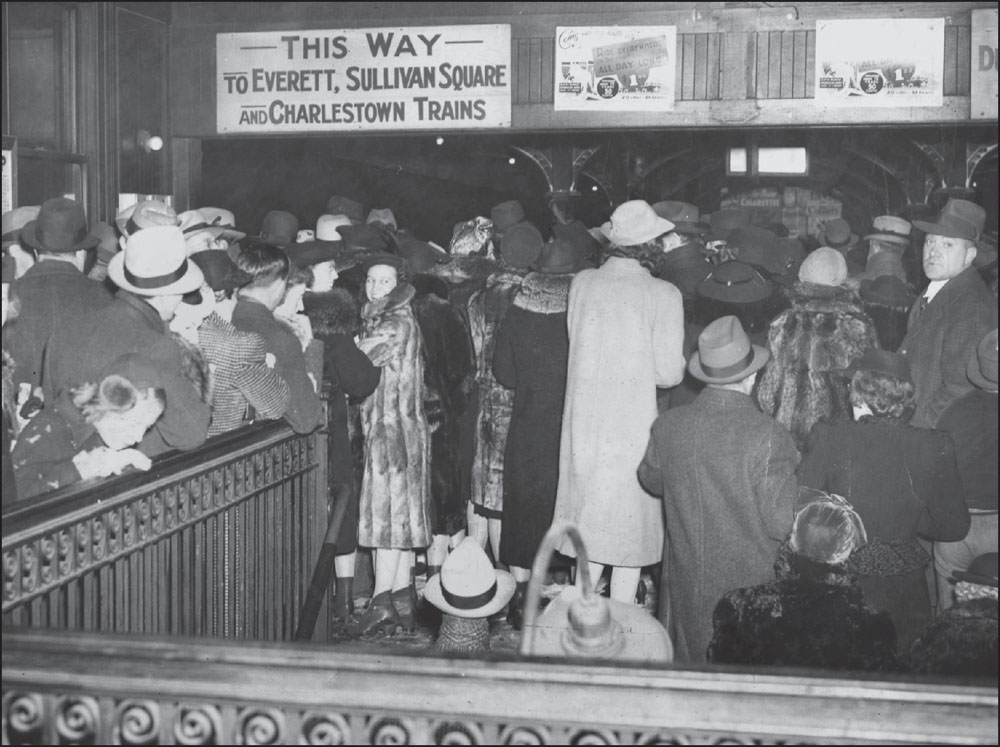
On February 14, 1940, a storm dropped 14 inches of snow on Boston and stranded thousands, including a large number of couples celebrating Valentine’s Day. This image shows crowds at North Station, many of whom had just attended a Sonja Henie ice show at the Boston Garden. By the end of the show, train service throughout New England was cancelled and would not resume until the next morning. (Courtesy of the Boston Globe.)
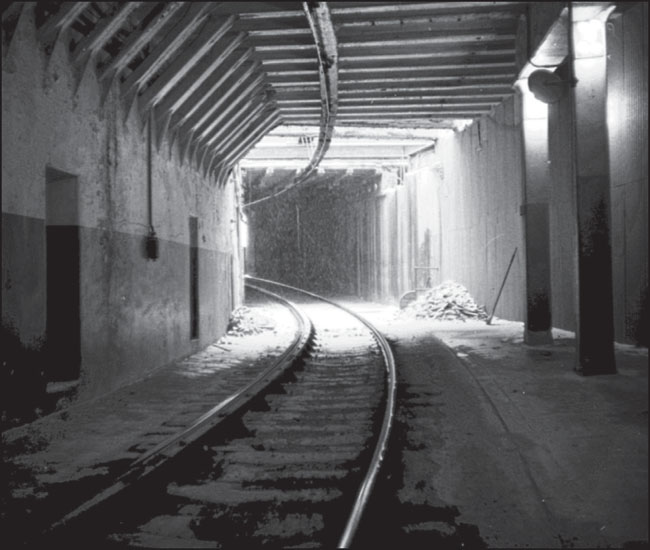
This c. 1967 photograph from the platform at Haymarket looks down the Washington Street Tunnel toward the Canal Street Incline and North Station. The Washington Street Tunnel opened on November 30, 1908. Beginning then, Main Line trains on the Elevated were rerouted from the Tremont Street Tunnel—now the central part of the Green Line—to the new tunnel. (Photograph by and courtesy of Steve Quinn.)
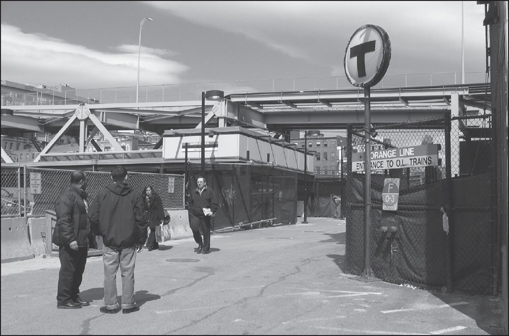
As the old Charlestown Elevated headed north, it emerged from the Washington Street Tunnel, climbed the Canal Street Incline, and stopped at an Elevated station just before the Boston Garden, which was built in 1928 and incorporated a North Station that served commuter and long-distance trains. When the Charlestown El was taken down and the line rerouted into a tunnel under the harbor and beneath Interstate 93 toward its new destination in Malden, the route included a new underground Orange Line stop at North Station. In 1995, the Boston Garden and North Station were replaced by the Fleet Center (now the TD Garden) and the current North Station. As shown in these photographs, North Station was remodeled again in 2005 to accommodate increasing ridership of the T and increasing railroad traffic. (Both, photograph by and courtesy of Andrew Lynch.)
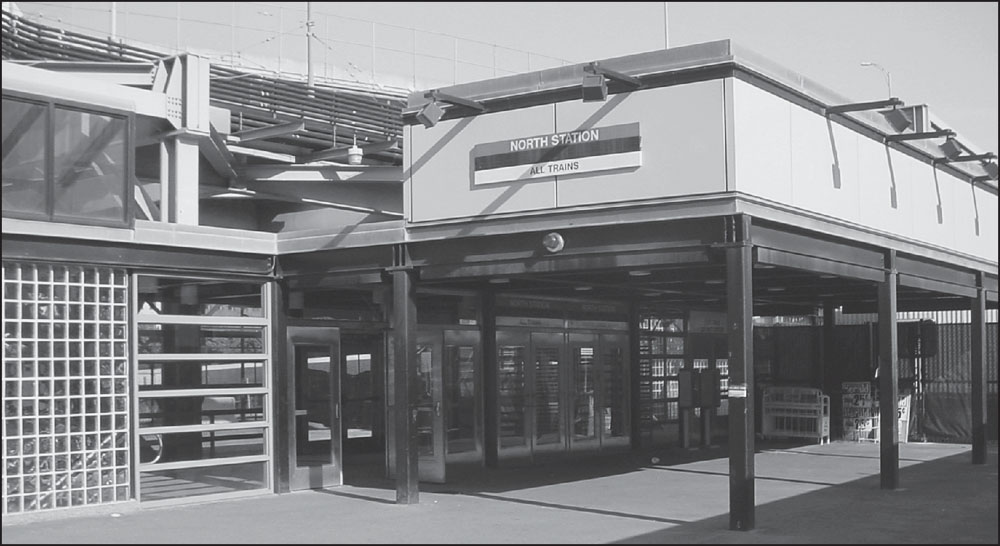
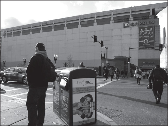
In this recent photograph, the entrance to North Station inside the TD Garden complex is visible at right, near the Leonard P. Zakim Bunker Hill Memorial Bridge, as commuters approach the station. TD Garden, home of both the Boston Celtics basketball team and the Boston Bruins hockey team, sits above the current ground-level main concourse of North Station. (Photograph by Jeremy C. Fox.)
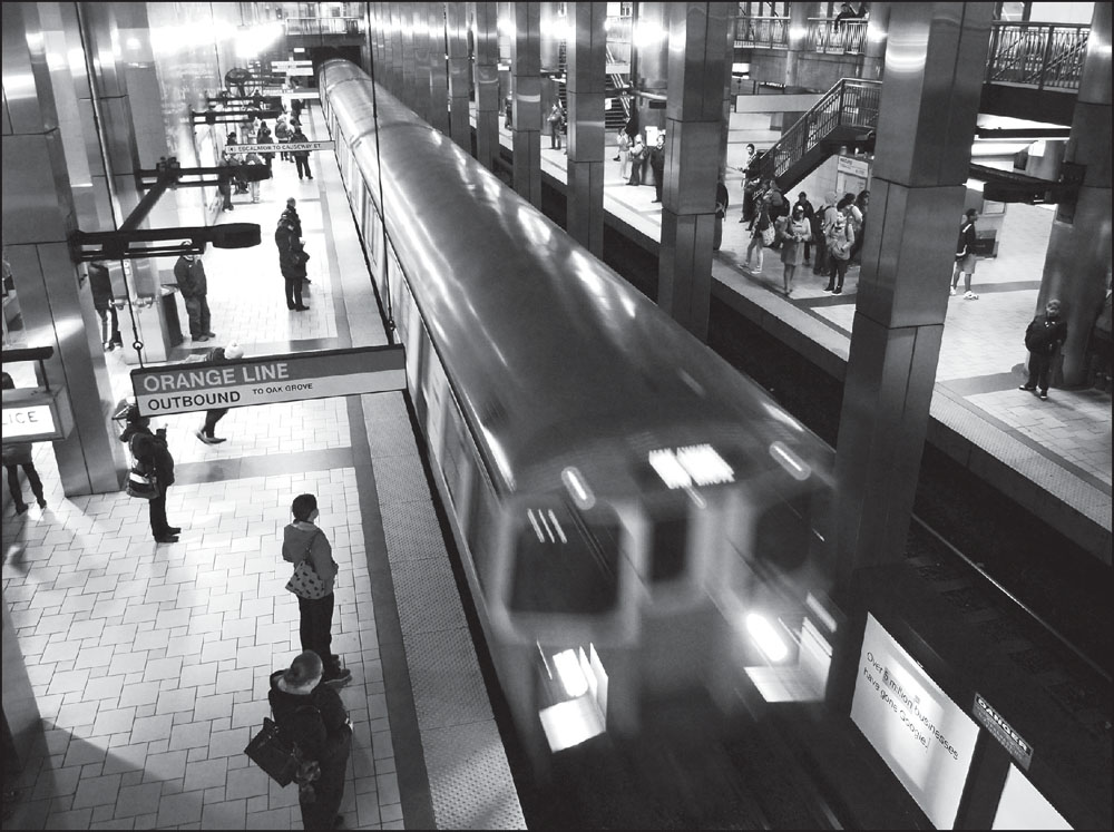
An outbound Orange Line train arrives at North Station as downtown commuters await a rush-hour ride to Charlestown or North Shore suburbs. Besides Commuter Rail, Amtrak, and the Orange Line, the modern North Station includes Green Line trolley service to Lechmere in the north and many points west of downtown at platforms above and alongside the Orange Line platforms. (Photograph by Jeremy C. Fox.)
In this 1929 view looking south from the Haymarket Square Relief Hospital, the Haymarket Station headhouse is at bottom right. Blackstone Street is at left, with the Custom House Tower visible above it. Union Street runs down the center of the photograph, with the dome atop Faneuil Hall visible in the distance. At right, Washington Street leads toward Adams Square. (Courtesy of the Boston Public Library; photograph by Leslie Jones.)
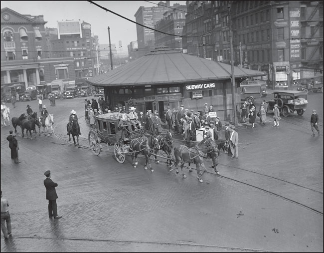
Another 1929 photograph shows Haymarket Square looking north, with the Haymarket Relief Hospital at left. Behind the hospital, Charlestown Elevated trains climbed the Canal Street Incline to North Station. The photograph captures a stagecoach passing the Haymarket Station headhouse during a rodeo parade. (Courtesy of the Boston Public Library; photograph by Leslie Jones.)
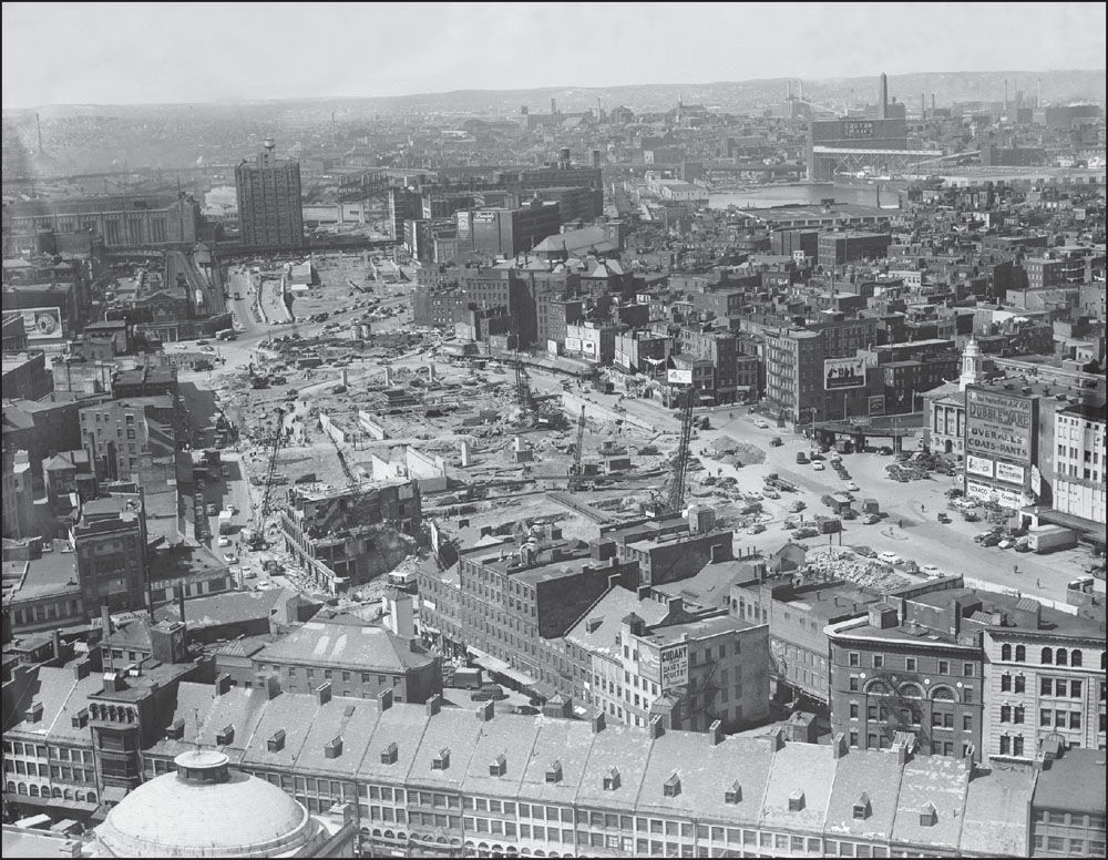
Haymarket Square was spared when adjacent blocks were razed in the 1950s to make way for the elevated Central Artery. As seen in this image looking north down Blackstone Street, demolition stopped right at the edge of the square. Haymarket Square would eventually fall to wrecking balls in the 1960s, along with the old Scollay Square, as Government Center was developed. (Courtesy of the Boston Public Library; photograph by Leslie Jones.)
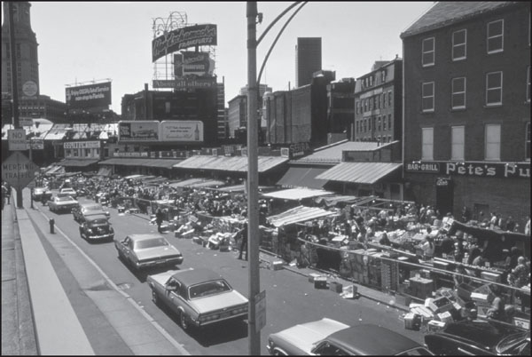
Though the old Haymarket Square was destroyed, the weekly produce market, founded in the 1830s, continued to thrive. This photograph, which looks south along Blackstone Street toward the Custom House Tower, was taken in 1973, and the market was no less lively in 2013, having outlasted the Elevated, the Central Artery, and the Big Dig. (Courtesy of the US National Archives.)

This rubble-filled 1967 photograph appears to show a disused portion of the original 1898 Haymarket Station. Built in the 1890s to serve the Tremont Street Subway, the station began serving Elevated trains between Sullivan Square and Dudley Square in 1901. Elevated trains were rerouted to the Washington Street Tunnel when it opened in 1908 but continued to use Haymarket Station. (Photograph by and courtesy of Steve Quinn.)
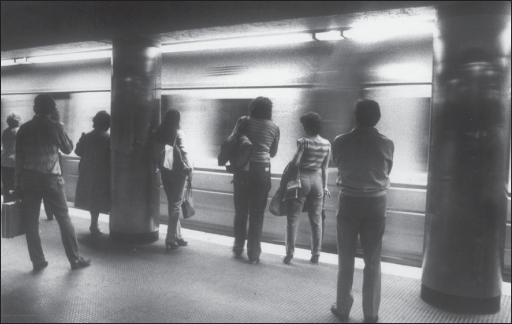
In this photograph from September 16, 1981, people wait for the Orange Line at Haymarket Station. Though still a major bus transfer center today, Haymarket Station became less significant for transfers between the Orange and Green Lines after the Green Line was also rerouted out of the Canal Street Incline and into North Station in 2004. (Courtesy of the Boston Globe; photograph by John Blanding.)
During the Big Dig, a building was constructed on a former parking lot site at Hanover and Congress Streets, southeast of the Government Center Garage, which included access to Haymarket Station below. A vent tower for the Thomas P. O’Neill Jr. Tunnel, the building also contains a parking garage and has spaces planned for the Registry of Motor Vehicles and a public market. (Photograph by and courtesy of Andrew Lynch.)
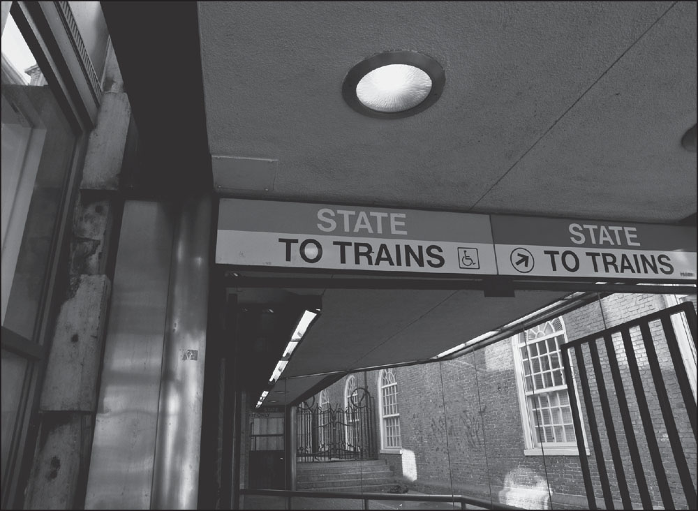
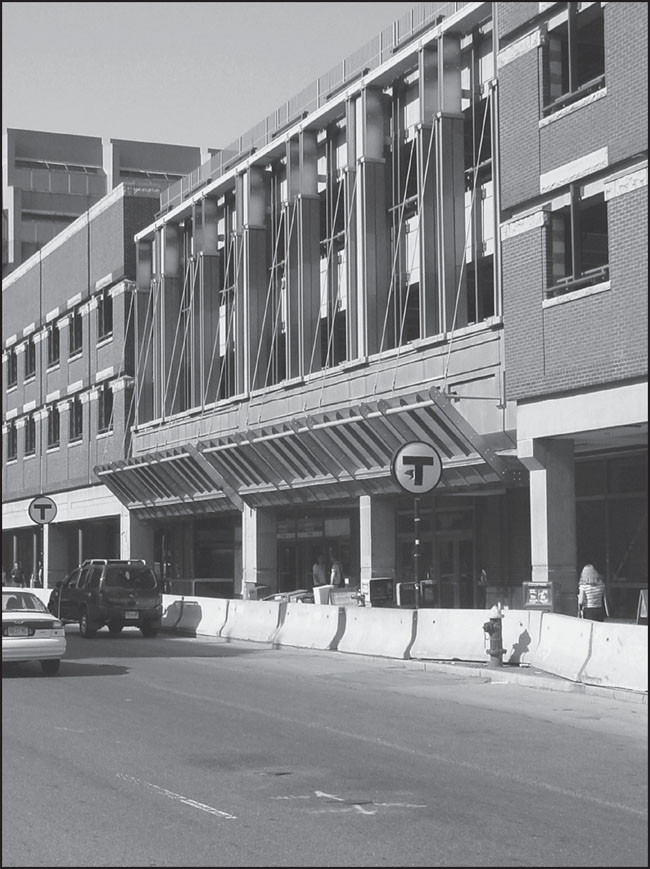
State Street Station is bookended by major historical sites. Its main entrance is a first-floor space inside the Old State House, while a second entrance (pictured) stands beside the Old South Meeting House, visible through the window at right. The station’s northbound platform was known as State, while the southbound platform was called Milk (for its entrance on Milk Street). (Photograph by and courtesy of Nathaniel Marsh.)
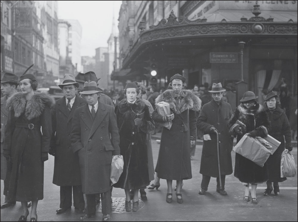
Shoppers dressed in 1940s fashions stand on Summer Street at Washington Street, near Summer Station and in front of Filene’s Department Store. Opened in 1912 by Edward and Lincoln Filene, sons of founder William Filene, who began a chain of retail and clothing stores in Boston in 1881, this Filene’s was the primary competitor of neighboring store Jordan Marsh. (Courtesy of the Boston Public Library; photograph by Leslie Jones.)
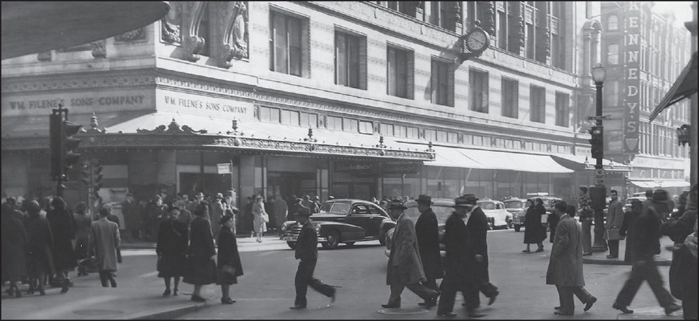
This February 19, 1949, photograph shows Filene’s looking southeast from Winter Street, with Kennedy’s Department Store at right. From the 1920s to the 1980s, Filene’s was part of Federated Department Stores, which eventually included Macy’s department stores. The Filene’s name and brand were discontinued and converted to Macy’s in late 2006, and the Filene’s flagship store was closed. (Collection No. 5110.002, City of Boston Archives, Boston.)

This view looks down the Washington Street Tunnel at the Summer Street platform. The northbound Summer Street platform was named for its location at the intersection of Washington and Summer Streets. The southbound Winter Street platform was so named because Washington and Summer Streets also intersected with Winter Street, a short street that runs from Washington Street to Tremont Street at the Boston Common. (Courtesy of the Boston Public Library.)
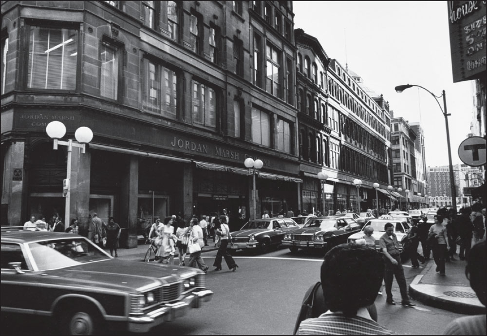
This 1970s photograph shows the old Jordan Marsh store on the present-day site of Macy’s, with the “T” logo at the entrance to Washington Street Station visible at far right. Eben Jordan and Benjamin Marsh went into business together in 1851 and, in 1861, opened their first Jordan Marsh store on Washington Street in the heart of downtown Boston. (Courtesy of the Boston Public Library; photograph by Andrew Zalewski.)
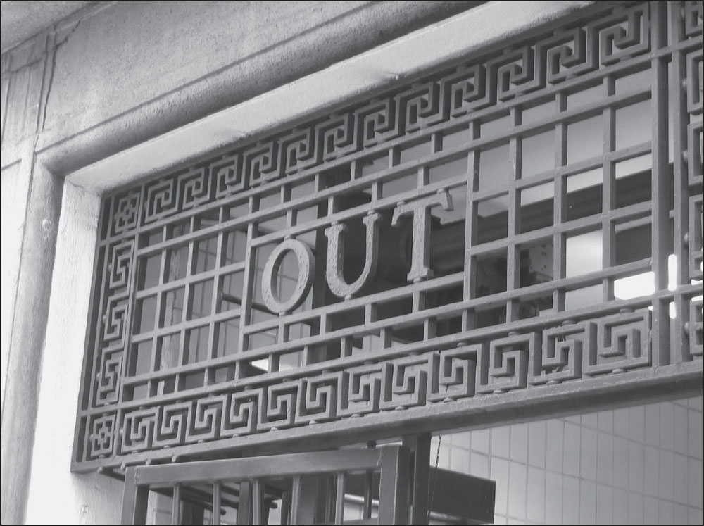
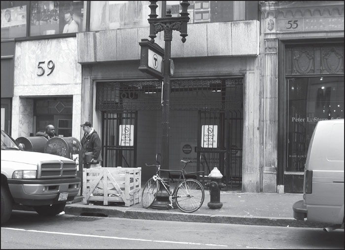
Washington Street Station was renamed Downtown Crossing on May 4, 1987, but many elements of the old station remain. These photographs from the Downtown Crossing entrance, located between 55 and 59 Temple Place, show ironwork that appears to date from its opening as Winter Station in 1908. Winter Station (the southbound platform of what is now Downtown Crossing) and Summer Station (Downtown Crossing’s northbound platform) were officially united, along with the Red Line platforms beneath, under the shared name Washington Station on January 23, 1967, just over 20 years before the MBTA gave the station its current name. (Both, photograph by and courtesy of Andrew Lynch.)
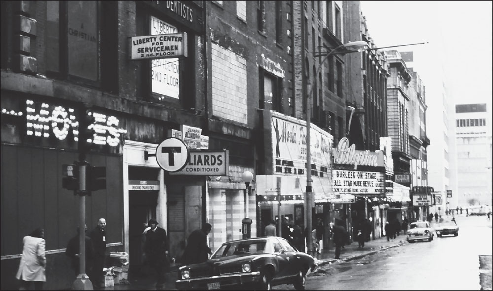
More name changes came on Lower Washington Street, where the southbound platform was first called Boylston and the northbound platform was called Essex. The entire station became Essex in 1967 and then Chinatown in 1987. This 1975 photograph shows Lower Washington Street, with Essex Station at left, when the neighborhood was known as the Combat Zone—a center of prostitution, drug dealing, and violent crime. (Photograph by and courtesy of Thomas W. Ericson.)
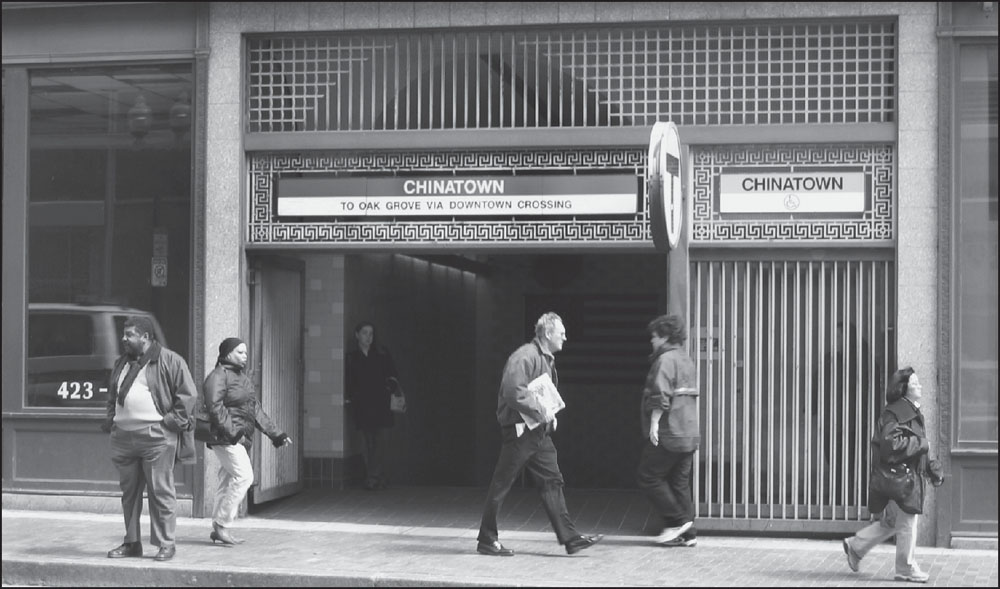
A later view of the same area, looking east across Washington Street, shows Chinatown Station after the neighborhood had been cleaned up and the Liberty Tree Building at 628–636 Washington Street (where this subway entrance stands) had been redeveloped for use by the Registry of Motor Vehicles in the late 1990s. The Boston Landmarks Commission declared the Liberty Tree Block a landmark in 1985. (Photograph by and courtesy of Andrew Lynch.)