Four
THE WASHINGTON
STREET ELEVATED
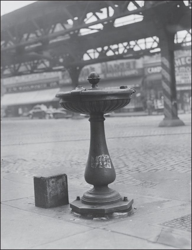
In this photograph taken sometime between the mid-1930s and mid-1950s, a water fountain stands on Washington Street in the South End of Boston, across from Folsom’s Market. Folsom’s Market, which billed itself as “Boston’s Busiest Food Store,” stood between Northampton and Lenox Streets for decades, one of many businesses that operated in the shadow of the Washington Street Elevated. (Courtesy of the Boston Public Library; photograph by Leslie Jones.)
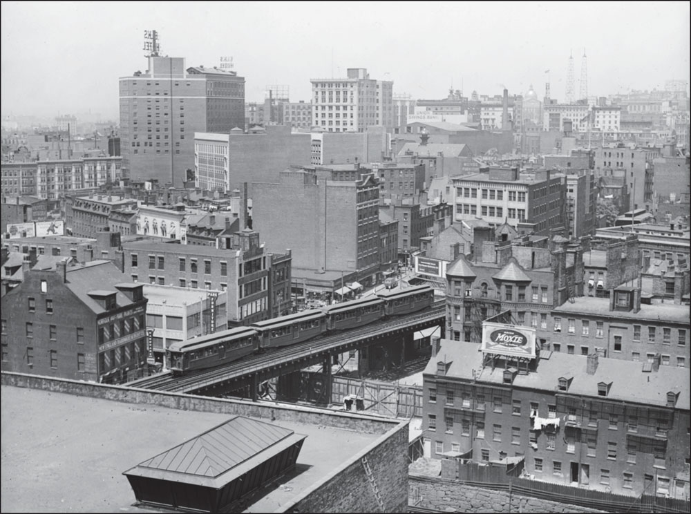
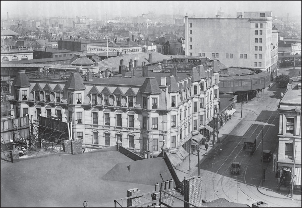
A 1929 image from a South End rooftop shows the Washington Street Elevated, with the Elks Hotel, located in the Theater District, visible at upper left. The four-car train appears to include a first and third car of the No. 1 design, used since the Elevated’s 1901 opening, and a second and fourth car of the No. 7 design, introduced around 1921. (Courtesy of the Boston Public Library; photograph by Leslie Jones.)
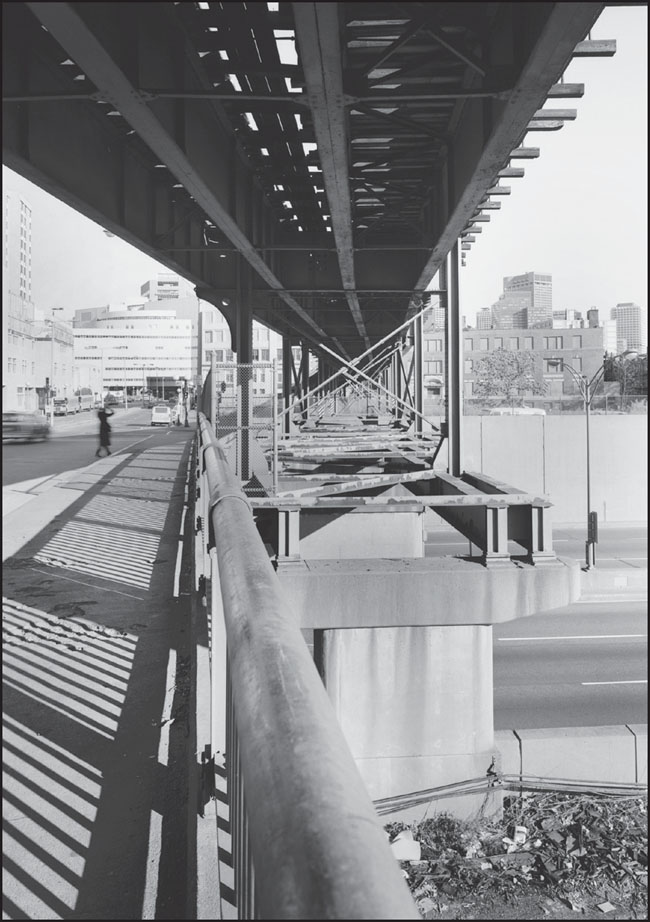
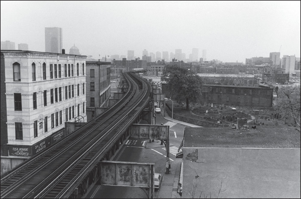
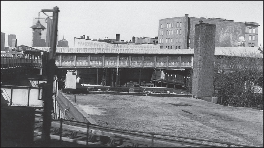
This 1982 image shows the tracks of the Elevated as they emerge from the southern end of the Washington Street Tunnel at the Ash Street Incline. The tunnel opened in 1908 and connected the Charlestown, Washington Street, and Atlantic Avenue lines. The station’s underground platforms, which are still in service, originally had names based on the streets where passengers entered from aboveground. (Courtesy of the Historic American Engineering Record; photograph by Richard Cheek.)
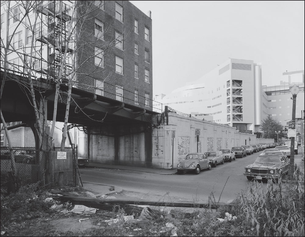
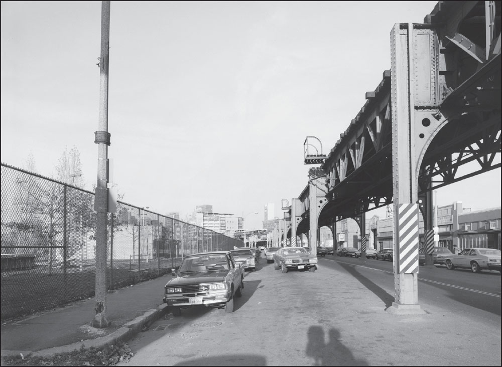
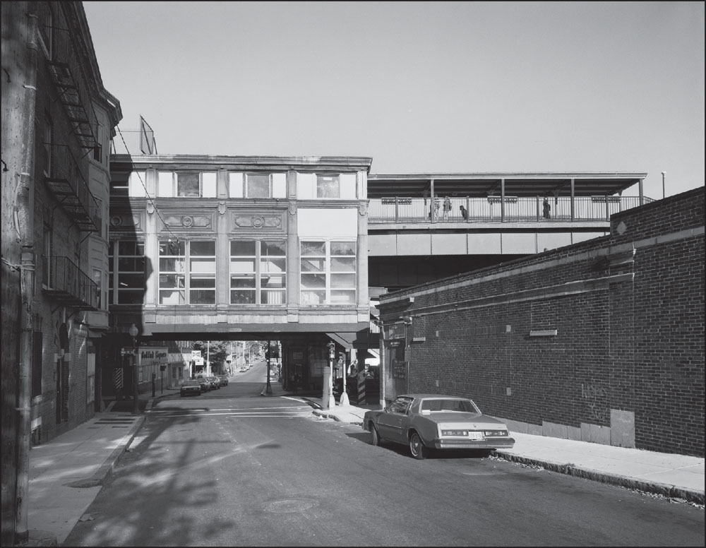
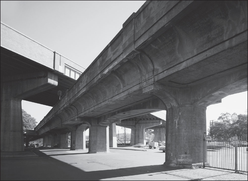
After emerging from the Washington Street Tunnel, the El crossed the Massachusetts Turnpike. The main section of the turnpike—from the New York State border to Route 128 outside of Boston—was completed in 1958. In 1964 and 1965, the Boston extension was completed, bringing the turnpike from Route 128 to the Central Artery in downtown Boston. (Courtesy of the Historic American Engineering Record; photograph by Richard Cheek.)
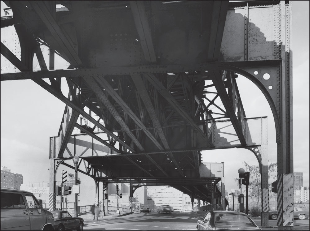
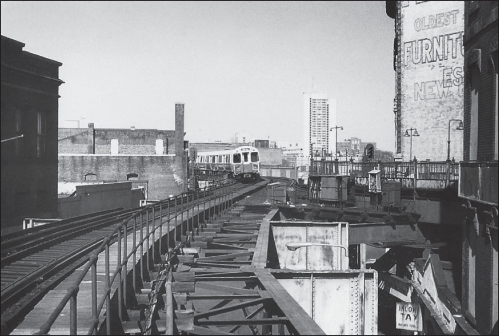
The above photograph was taken at Herald Street (formerly called Castle Street) looking north along Washington Street, past the Massachusetts Turnpike toward the present site of Tufts Medical Center in Chinatown. Just beyond the railway at lower left is the current location of the Josiah Quincy School, which relocated there in 1976. (Courtesy of the Historic American Engineering Record; photograph by Richard Cheek.)
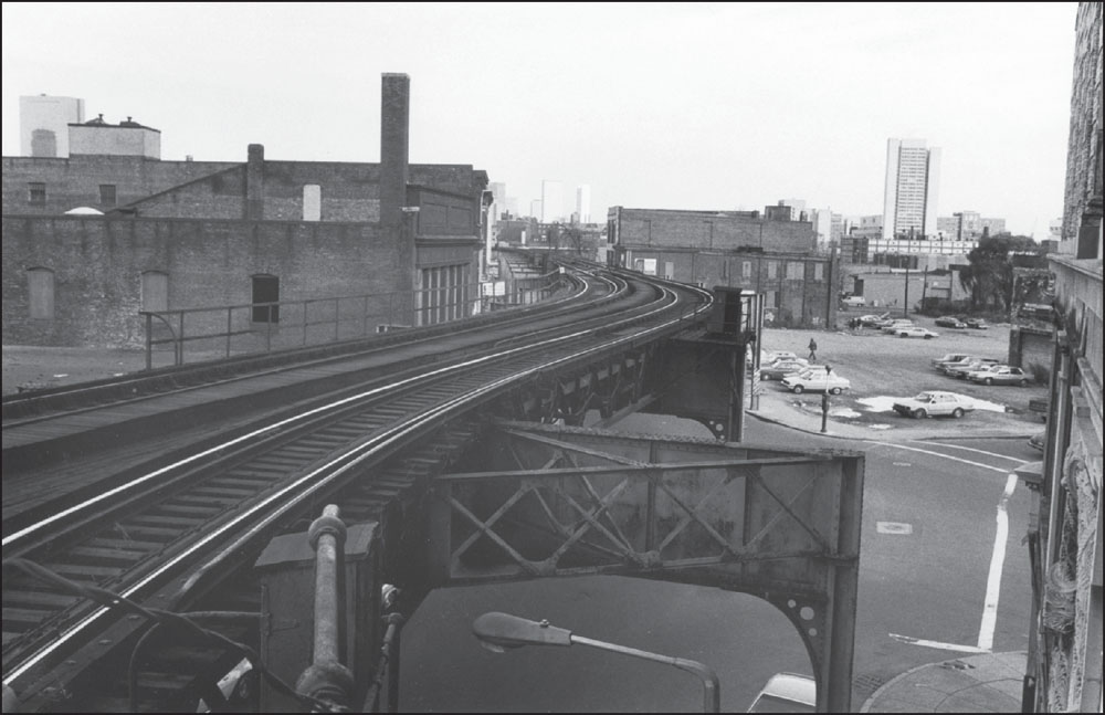
The photograph at left looks northeast at the intersection of Herald (formerly Castle Street) and Washington Streets and shows the remnants of Tower “D.” This intersection was also the site of the Castle Street Wye, which connected the Washington Street and Atlantic Avenue Elevated lines until the Atlantic Avenue line discontinued operation in 1938. (Courtesy of the Historic American Engineering Record; photograph by Richard Cheek.)
A view looking northeast toward downtown Boston from the Dover Street Station platform shows, at left, the rear of the Holy Trinity German Catholic Church on Shawmut Avenue and, at right, a low-rise brick building containing the Graybar Electric Company. Beyond that is the 11-story 1000 Washington Street building. (Photograph by and courtesy of David Akiba.)
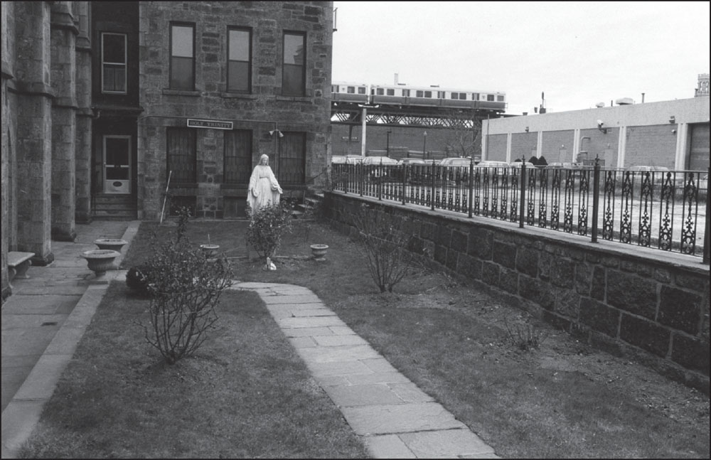
The elevated Orange Line is visible in the background of this view of a small courtyard beside the Holy Trinity German Catholic Church on Shawmut Avenue in the South End. Visible in the distance, just beyond the El and Washington Street, is the Graybar Electric Company building. (Photograph by and courtesy of David Akiba.)
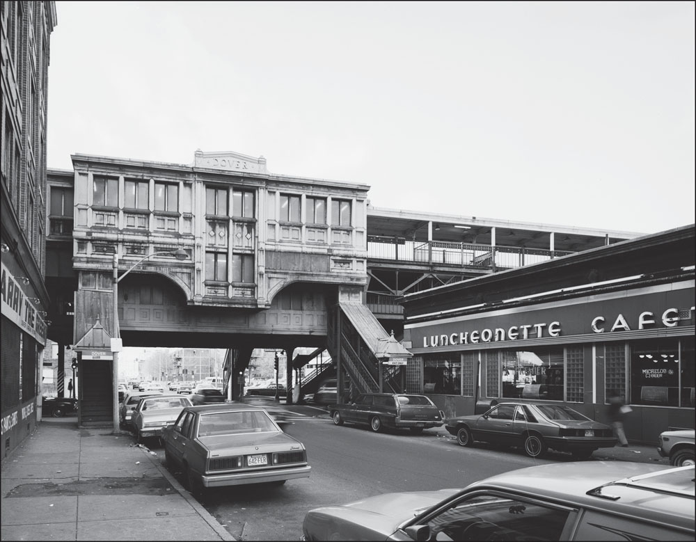
This is a view of the Dover Street Station looking west along East Berkeley Street (formerly Dover Street). Dover Street Station’s copper facade is an example of the distinctive architecture of Elevated stations. At right, in the shadow of the station, is the Premier Deli, a luncheonette, cafeteria, and delicatessen popular among commuters and those in the neighborhood. (Courtesy of the Historic American Engineering Record; photograph by Richard Cheek.)
Dover Street Station looms over Dover Street, which was renamed East Berkeley Street in the 1960s in an effort to remove the stigma associating the area with crime and violence. At the time, Boston newspapers often referred to Dover Street as the city’s “Skid Row.” In recent years, however, community members have been making efforts to change the name back to Dover Street. (Courtesy of the Historic American Engineering Record; photograph by Richard Cheek.)
In this 1986 photograph, a southbound train passes the 1000 Washington Street building, at upper right, as it approaches Dover Street Station. At the time, the 11-story building was the headquarters of Teradyne, Inc., a manufacturer of semiconductors and other electronics. In the 2000s, Nordblom, Inc., acquired and redeveloped the building, leasing office space to private tenants and state agencies. (Photograph by and courtesy of David Akiba.)
This view looking south down Washington Street beneath Dover Street Station offers a glimpse of how the Elevated structure narrowed the roadway and cast the businesses and vehicles below into shadow on even the sunniest day. In the distance at left are the Premier Deli and the stairs up to the station. (Courtesy of the Historic American Engineering Record; photograph by Richard Cheek.)
This photograph from the corner of Washington and the former Wilkes Street shows Dover Street Station in the distance. Wilkes Street was located on what is now Peters Park, a community park with gardens, a playground, a dog park, and sports fields. The tall white building visible in the distance is the Federal Reserve Bank Building of Boston. (Courtesy of the Historic American Engineering Record; photograph by Richard Cheek.)

The Red Fez, visible at left, was a restaurant serving Middle Eastern cuisine that opened in 1940 at Perry and Washington Streets and closed in the mid-1980s. In a review of a restaurant called the Red Fez that opened in 2002, Boston Globe food critics wrote: “People still talk about [the original Red Fez’s] mint salad dressing.” (Courtesy of the Historic American Engineering Record; photograph by Richard Cheek.)
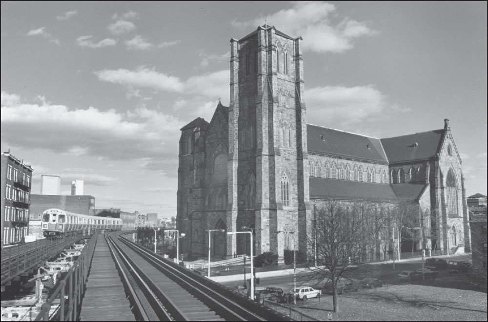
At left, a train rumbles past the Cathedral of the Holy Cross between Union Park Street and Monsignor Reynolds Way. The cathedral is the mother church of the Roman Catholic Archdiocese of Boston. Designed in the Gothic Revival style by the Irish American architect Patrick Keely and dedicated on December 8, 1875, the cathedral has an exterior of Roxbury puddingstone and gray limestone. (Photograph by and courtesy of David Akiba.)
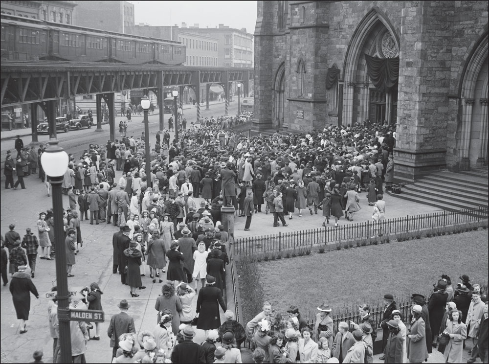
An Elevated train passed as thousands gathered outside the Cathedral of the Holy Cross on April 28, 1944, for the funeral of Cardinal William Henry O’Connell, archbishop of Boston. A sign for Malden Street is visible at lower left; the block alongside the cathedral was later renamed for Monsignor Thomas Reynolds, a pastor of the cathedral who died in 1946. (Courtesy of the Boston Public Library; photograph by Leslie Jones.)

This view looking southeast through Franklin Square shows the former St. James Hotel, built in 1868 at Newton and Washington Streets. It housed the New England Conservatory of Music from 1882 to 1902 and later became a home for working single women. Its exterior appeared in the 1980s television series St. Elsewhere, with the Elevated featured in the opening titles. (Courtesy of the Historic American Engineering Record; photograph by Richard Cheek.)

This view looking south down Washington Street shows Blackstone Park on the opposite side of the street from Franklin Square. These parks were originally designed in the mid-1800s by prominent architect Charles Bulfinch to be one larger park called Columbia Square. (Courtesy of the Historic American Engineering Record; photograph by Richard Cheek.)
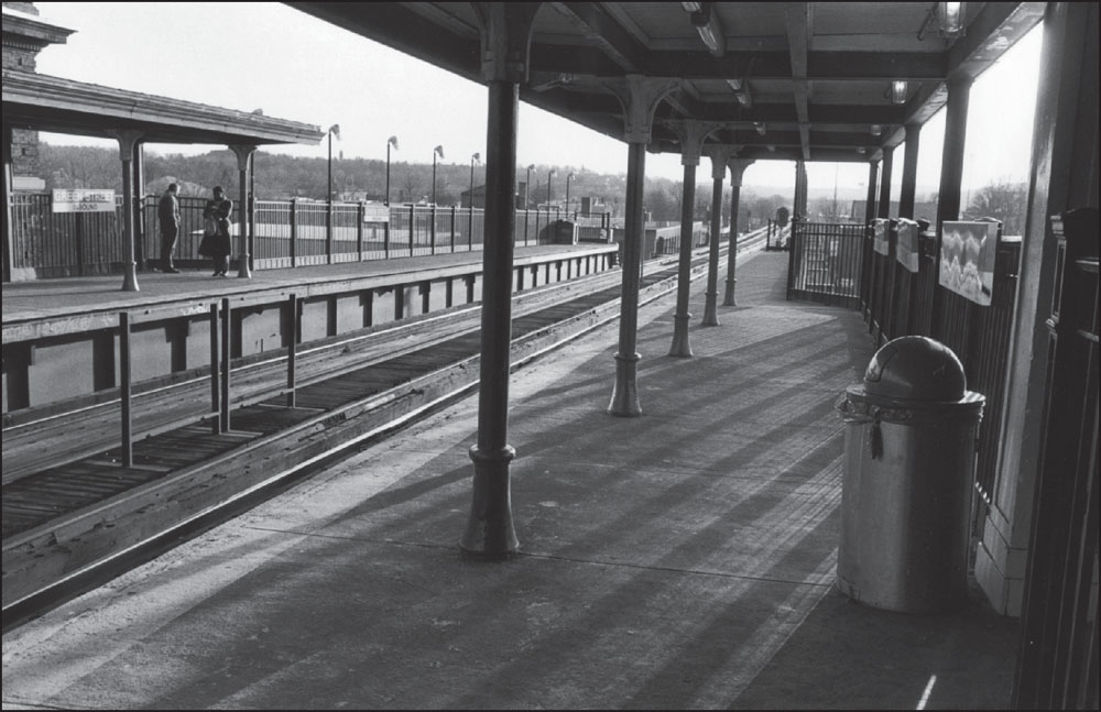
This photograph looks through the South End toward downtown from Northampton Station, with the block between Springfield and Worcester Streets in the foreground. Visible just beyond the platform at lower right is a one-story building that was home to Smith and Sheehan’s, a bar known in the neighborhood as the “bucket of blood” due to the tendency of its patrons to get into brawls. (Photograph by and courtesy of Joe Boncek.)

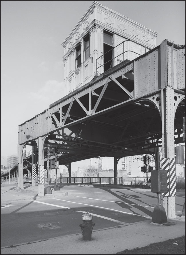
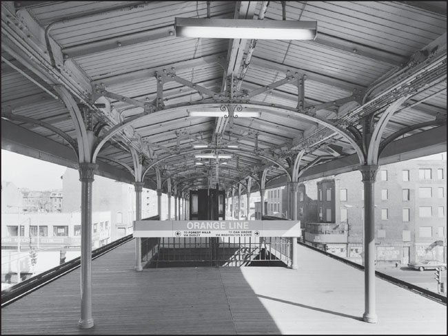
In 1988, soon after the Washington Street Elevated had closed and the Orange Line route shifted, the structure at Northampton Station, pictured in these images from 1982, was in surprisingly high demand. Although the tracks connecting the stations along Washington Street had been dismantled, there were a number of ideas put forth about what to do with the different historical structures along the Elevated. Unlike most stations along the route, Northampton Station had remained largely intact and free from architectural modifications and thus generated much interest from preservationists, government agencies, and the community. The tower from Northampton Station was ultimately acquired by the Seashore Trolley Museum in Kennebunkport, Maine, and is currently on display on the museum’s grounds. (Both, courtesy of the Historic American Engineering Record; photograph by Richard Cheek.)

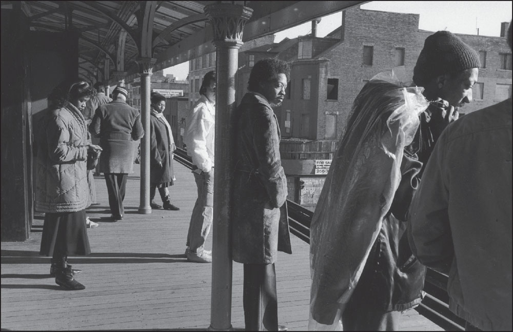
In this 1986 photograph, commuters await an inbound train at Northampton Station. In the center of the image, just beyond the platform, a derelict, dilapidated building with a “For Sale” sign and a closed pharmacy on the first floor stands at the eastern corner of Massachusetts Avenue and Washington Street. (Photograph by and courtesy of David Akiba.)
This 1982 photograph looks north from the platform of the Northampton Station at the intersection of Northampton and Washington Streets. The station platform extended toward the intersection of Massachusetts Avenue and Washington Street. The design of Orange Line signs has not changed in the ensuing years. (Courtesy of the Historic American Engineering Record; photograph by Richard Cheek.)

A family waits for their train to leave Northampton Station in this photograph from 1986, shortly before the Washington Street Elevated was closed. For many years, the Orange Line served the predominantly African American neighborhood of Roxbury and the ethnically mixed South End and Jamaica Plain, providing convenient and affordable access to downtown Boston and from there to points north and south. (Photograph by and courtesy of David Akiba.)
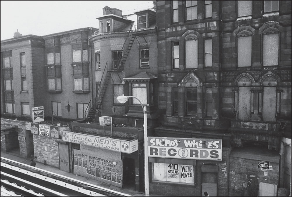
A photograph taken from Northampton Station shows empty storefronts that formerly housed Uncle Ned’s Money to Loan and, in the former Hotel Alexandra at the northwest corner of Washington Street and Massachusetts Avenue, Skippy White’s Records. The record store, first located on the other side of Washington Street between Lenox and Northampton Streets, was a neighborhood institution for many years. (Photograph by and courtesy of Joe Boncek.)
The above 1982 image looks north along Washington Street, with Hancock Center visible at left. To the right, at the corner of Washington and Thorndike Streets, is the Sriberg Furniture Company, which opened in the early 1900s, erected this four-story building in 1946, and closed sometime after 1985. In the 1990s, the building became home to Restoration Resources, a store selling antique architectural elements. (Courtesy of the Historic American Engineering Record; photograph by Richard Cheek.)

This 1823 stone at 2000 Washington Street marking the boundary of Roxbury and Boston (prior to Roxbury’s annexation) was already 117 years old when it was photographed in July 1940. In the background, slightly out of focus, is what appears to be an early Stop & Shop supermarket. The chain was founded in Somerville, Massachusetts, in 1914. (Courtesy of the Library of Congress; photograph by Frank O. Branzetti.)
The Elevated tracks snake down Washington Street alongside the Eliot Burying Ground, visible at right in the middle distance. Dating back to 1630, the year of Boston’s founding, the cemetery is one of the three oldest burying grounds in the city. Inside is the Dudley family tomb, which includes colonial governors Thomas and Joseph Dudley, chief justice Paul Dudley, and Col. William Dudley. (Photograph by and courtesy of David Akiba.)
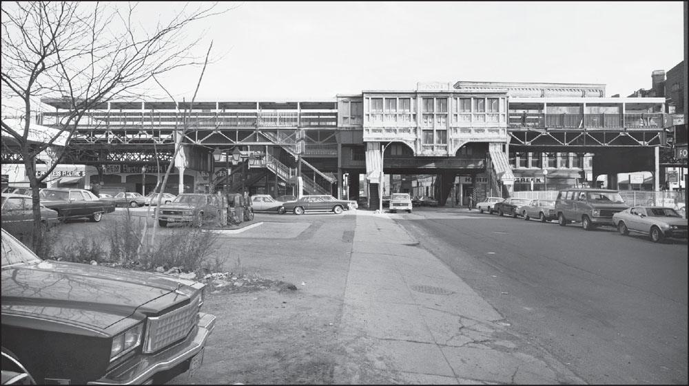
This view looks north along Washington Street at the northerly junction of tracks at Dudley Station with Robell’s Department Store at lower left. As merchants prepared for the loss of the Elevated in 1987, Robell’s manager Eden Gordon told the Boston Globe that she was concerned about the potential loss of many customers. By the early 1990s, Robell’s had closed. (Courtesy of the Historic American Engineering Record; photograph by Richard Cheek.)
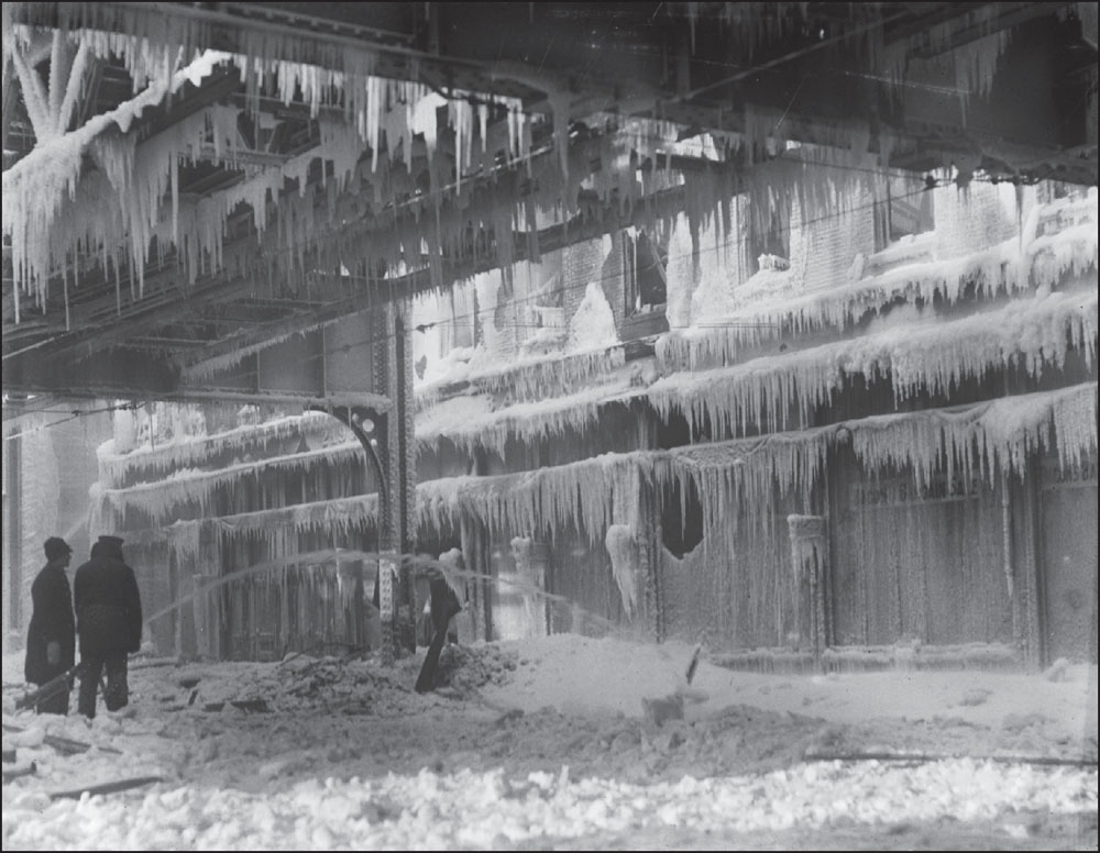
Early on the morning of January 14, 1914, a fire broke out at the W. & A. Bacon department store, located at 2175–2193 Washington Street, just northwest of Dudley Square. The temperature that morning was eight degrees below zero, causing water from the firefighters’ hoses to freeze quickly. One firefighter was killed when a portion of a wall fell on him. (Courtesy of the Boston Public Library; photograph by Leslie Jones.)
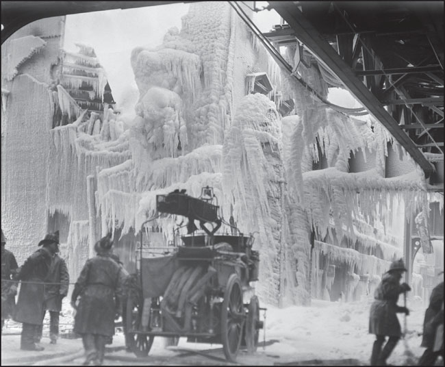
The store’s headquarters,Bacon Hall, was a three-story building constructed in 1858 that stood very near the Elevated structure, impeding firefighters’ efforts. Trains were halted in both directions, and passengers were directed to walk a narrow path to the nearest stations. Horace Bacon, co-owner of the store, told the Boston Globe the total monetary loss was about $150,000. (Courtesy of the Boston Public Library; photograph by Leslie Jones.)
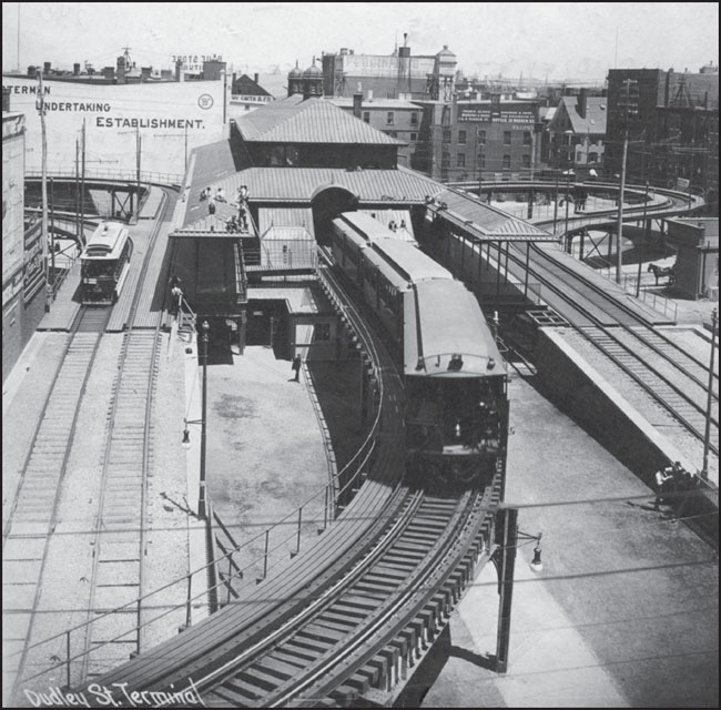
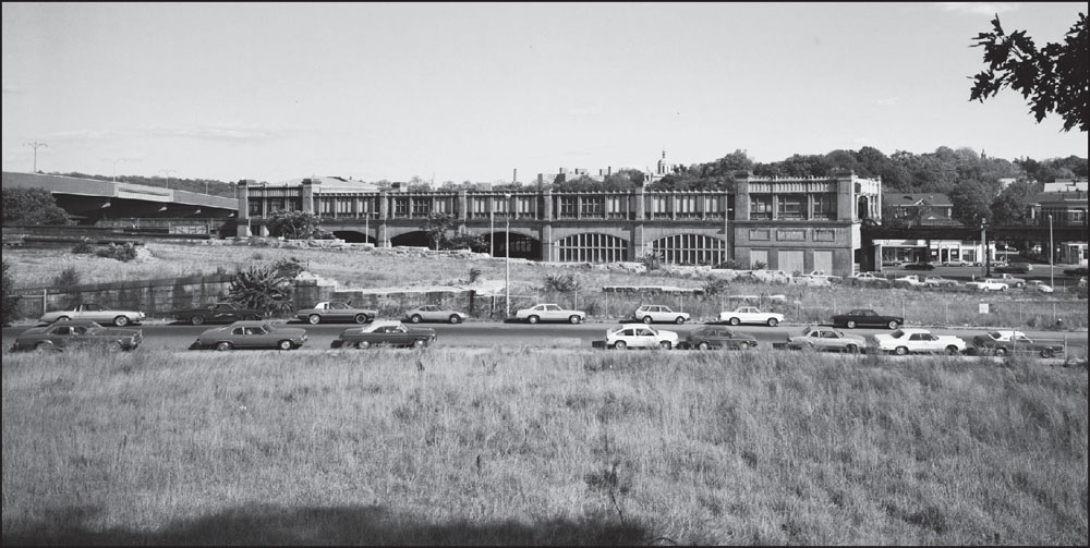
This 1901 photograph shows Dudley Station in its original state, with only the central rapid-transit section enclosed and both the east loop for streetcars (right) and the west loop (left) open. Dudley was the terminus of the Elevated’s Main Line until the Forest Hills extension opened in 1909. (Courtesy of University Archives & Special Collections, Joseph P. Healey Library, University of Massachusetts Boston: Anthony Mitchell Sammarco Collection.)
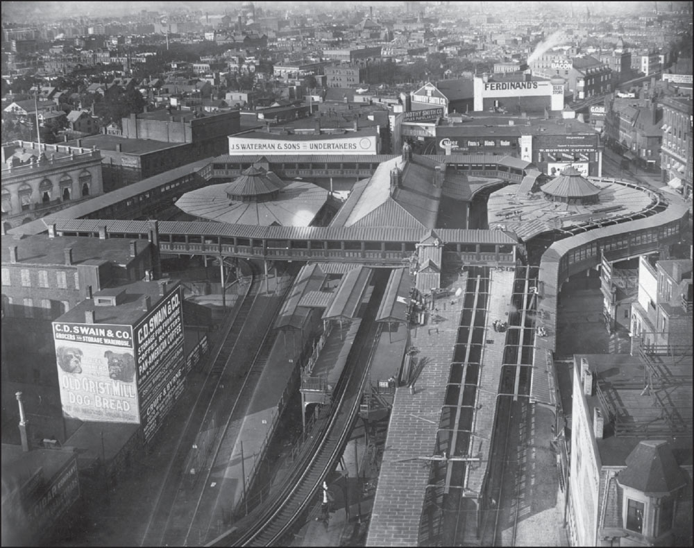
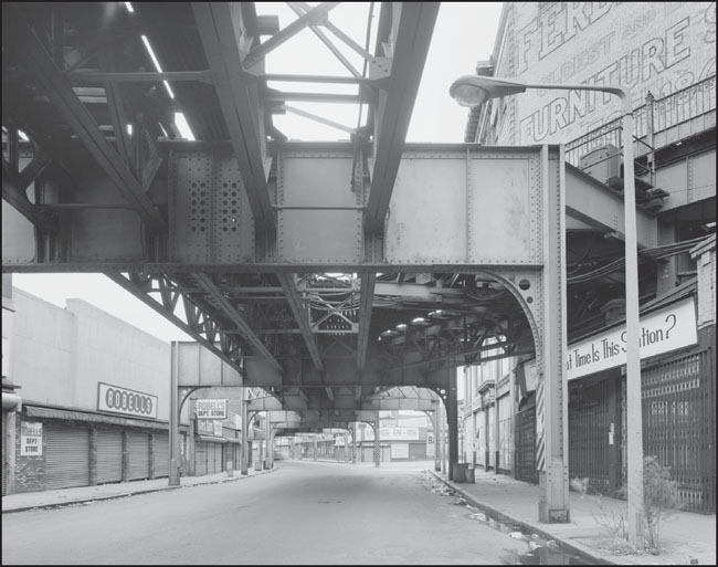
In this aerial view of Dudley Station from September 20, 1910, both loops have been enclosed, and other passageways and stairways have been added to serve the growing ridership. This view also shows a number of longtime Roxbury institutions, including J.S. Waterman and Sons, Inc., and Ferdinand’s Furniture Store, a department store known throughout the region for its home furnishings. (Courtesy of the Boston Public Library.)
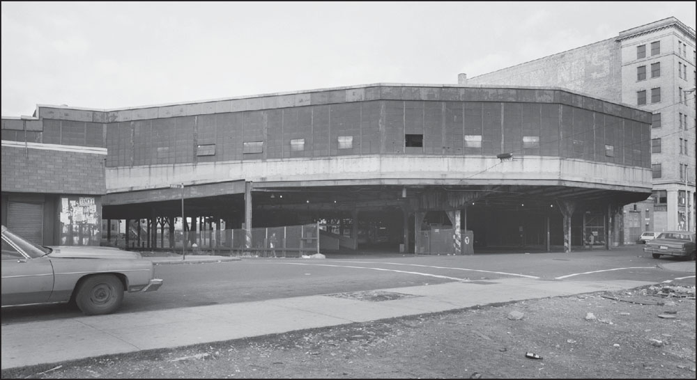
This 1980s photograph offers a street-level view of the Dudley Station as seen from Warren Street looking northeast with the Ferdinand’s Furniture Store Annex at far right. By this time, the streetcar tracks had been removed to accommodate buses. (Courtesy of the Historic American Engineering Record; photograph by Richard Cheek.)
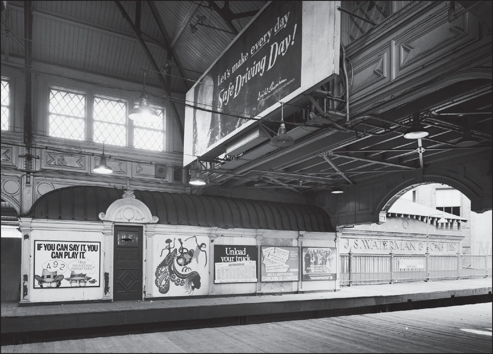
At right in this view of the Dudley Station northbound platform is a sign for J.S. Waterman and Sons, Inc., a funeral services company founded in 1832 by Joseph S. Waterman. The company opened a state-of-the-art facility in Roxbury (next to the future site of the Dudley Station) in 1890. (Courtesy of the Historic American Engineering Record; photograph by Richard Cheek.)
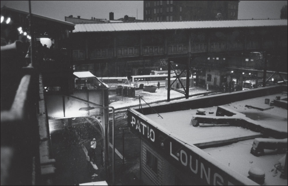
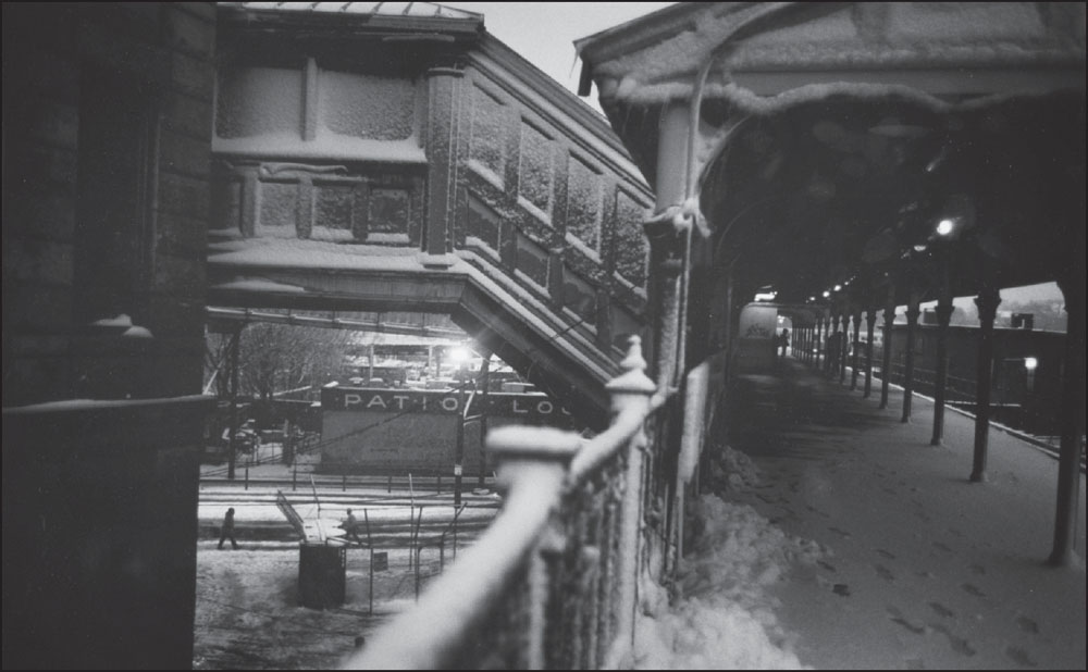
Looking down from Dudley Station in these 1986 photographs, the Patio Lounge, located at 2360 Washington Street, sits under a light blanket of snow. By the 2000s, the building had been replaced with a strip mall containing a Dunkin’ Donuts, a fried-chicken restaurant, and a barbecue restaurant. The busway beneath the station is in the same location today, with the elevated railway removed but portions of the original station repurposed as bus shelters. Former Boston Globe columnist Mike Barnicle wrote in 1975 about Ronnie, a 19-year-old heroin addict who supported his habit by selling the drug in the shadow of the El next to the Patio Lounge. (Both, photograph by and courtesy of David Akiba.)
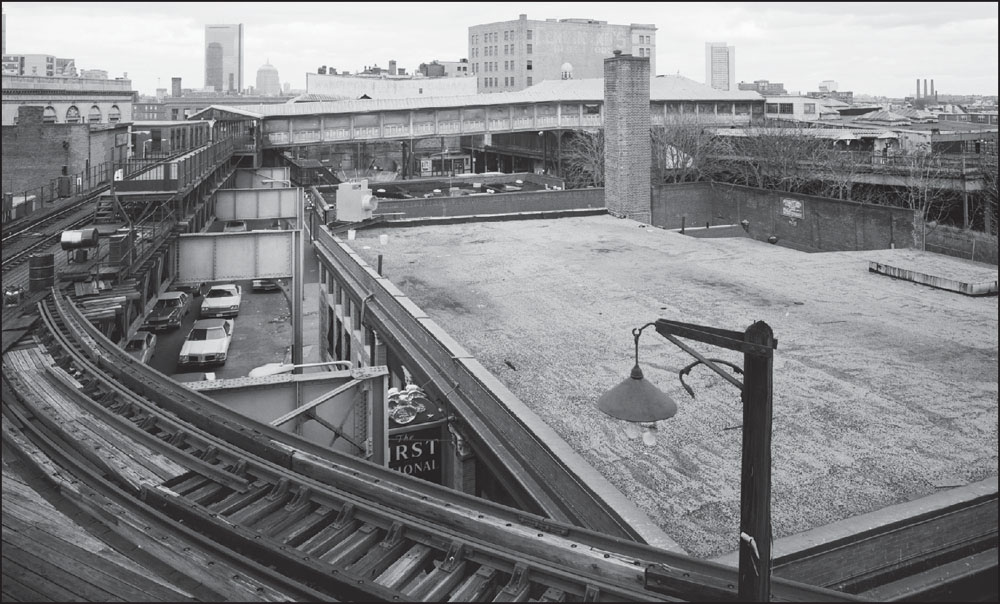
Looking north over 2343 Washington Street, the Hancock Tower is visible nearly two miles away. The roofline of the J.S. Waterman and Sons, Inc., building is visible over the central passage, and the Ferdinand’s Annex is at the upper right. At lower right is the former First National Bank building, which became a Bank of America branch in the 2000s. (Courtesy of the Historic American Engineering Record; photograph by Richard Cheek.)
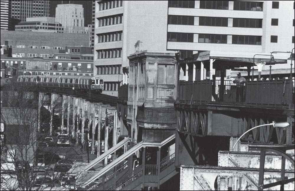
The ornate—but, by this point, badly rusted—ironwork of Dudley Station can be seen in this image facing northeast from the outbound platform, where an approaching train is visible between the rails and the Ferdinand’s building is at right in the middle distance. An inbound train is visible in the near distance, having just left the station. (Photograph by and courtesy of Joe Boncek.)
This view looks northwest from one area of Dudley Station over the roof of 2343 Washington Street with the roofline of the former J.S. Waterman and Sons building visible just over the central passage and Ferdinand’s Annex at the upper right. The area beneath the central passageway became the Dudley Station busway after the removal of the Elevated. (Photograph by and courtesy of Joe Boncek.)
This April 1987 image taken from the outbound platform at Dudley Square facing east shows Ferdinand’s at upper right and the M. Harriet McCormack Nursing Tower on Northampton Street near Boston City Hospital, now Boston Medical Center. A southbound train is approaching the station. (Photograph by and courtesy of Joe Boncek.)
Another April 1987 photograph taken from the outbound platform at Dudley Square facing east shows the M. Harriet McCormack Nursing Tower on Northampton Street near Boston City Hospital, now Boston Medical Center. Just past the curve in the tracks is 2164 Washington Street, the future home of the Hamill Gallery of African Art. (Photograph by and courtesy of David Akiba.)
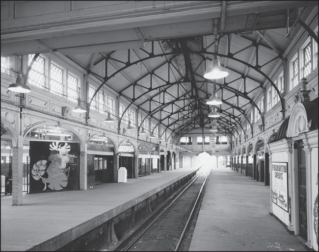
This interior view of the southbound platform at Dudley Station, looking north, gives a sense of the grandeur of the station, which was designed by architect Alexander Wadsworth Longfellow Jr. in a style described in a 1986 National Park Service report as “early French Renaissance.” (Courtesy of the Historic American Engineering Record; photograph by Richard Cheek.)
This view overlooks Warren Street in Dudley Square, with the eastbound loop of Dudley Station visible just beyond the Hotel Dartmouth (just left of center). Across Warren Street, at right, is the Italian Renaissance –style Palladio Hall, designed and built in the 1870s by architect Nathaniel J. Bradlee. (Courtesy of the Boston Public Library; photograph by Leslie Jones.)
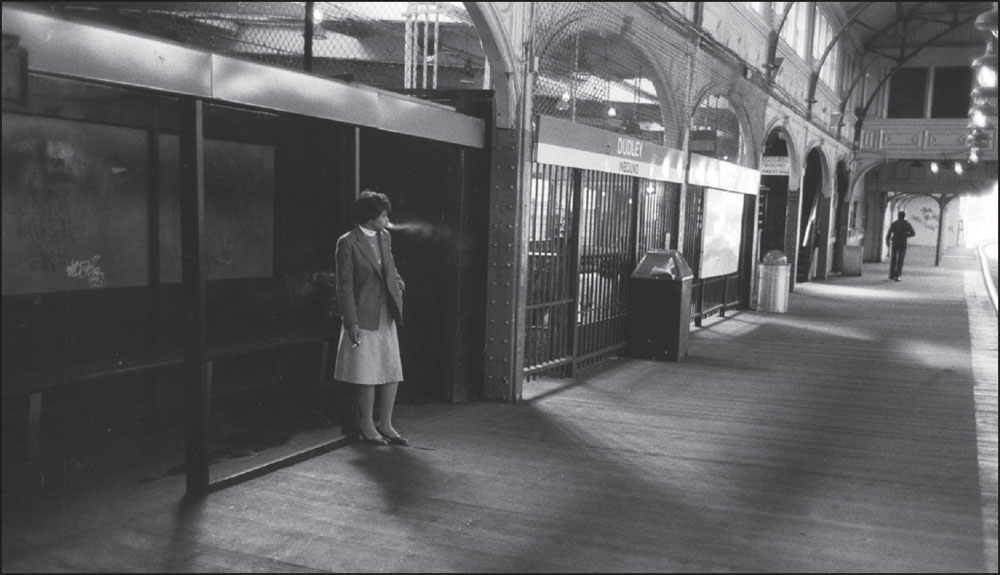
A woman in business attire exhales cigarette smoke on the Dudley Station inbound platform in this c. 1986 photograph. The Massachusetts Legislature outlawed smoking on the MBTA, as well as other public places such as theaters and classrooms, in 1975, but enforcement on the transit system was sometimes spotty. (Photograph by and courtesy of David Akiba.)
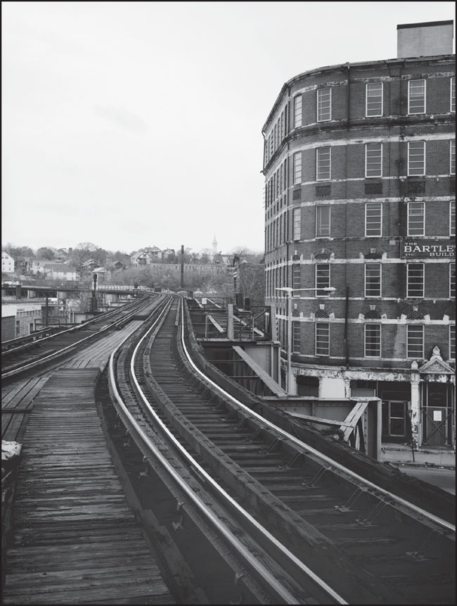
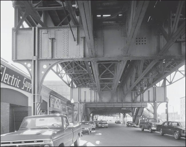
This photograph looks south from Tower “F” toward Bartlett Street Garage, site of the former Guild Street Elevated storage yard. Vacant at the time, the Bartlett building burned down on June 27, 1982. At one time, the Bartlett building was the Dunbar Hotel. (Courtesy of the Historic American Engineering Record; photograph by Richard Cheek.)
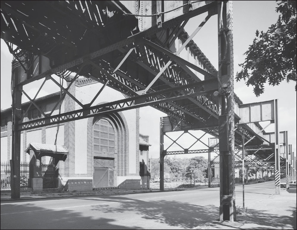
As seen below, the Egleston Square power substation stood on Washington Street just northeast of Columbus Avenue, built to support the extension from Dudley to Forest Hills. After the line was relocated, it sat vacant for years. In 2005, Urban Edge, a community development organization, partnered with the Boston Neighborhood Network to develop the building for BNN’s production facilities and administrative offices. (Courtesy of the Historic American Engineering Record; photograph by Richard Cheek.)
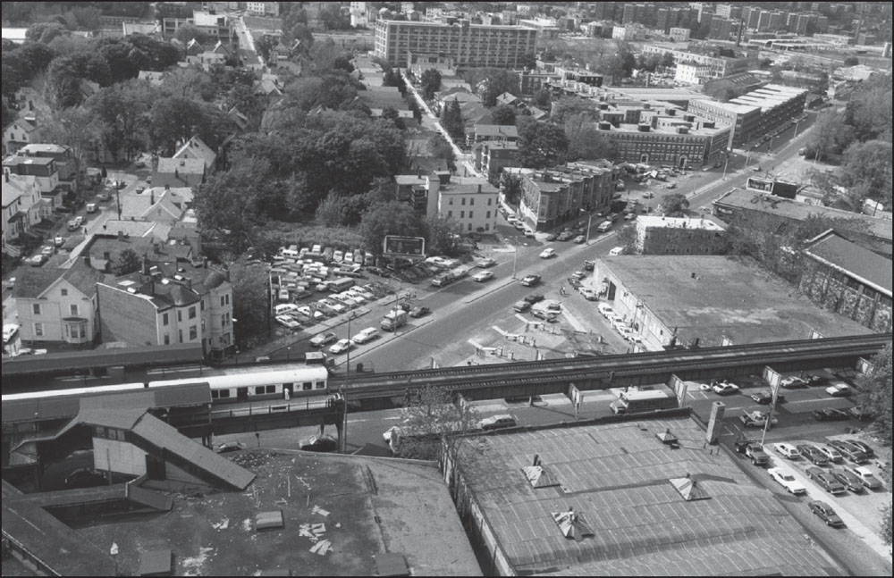
This aerial view shows Egleston Square Station from above, with a train heading downtown and Columbus Avenue stretching north toward the upper right. The homes beyond the station remained nearly 30 years later, and a gas station still stood at the intersection, though it had been modernized. Buildings at the lower left and to the right of the gas station had both been replaced. (Photograph by and courtesy of David Akiba.)
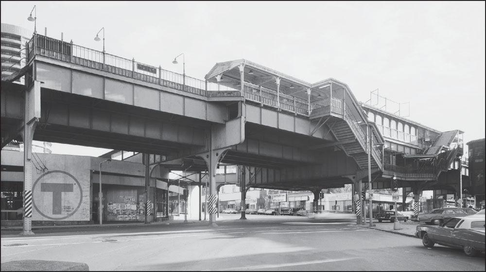
This view shows the Egleston Square Station from the northeast, looking across Washington Street from Columbus Avenue. Visible under the station on the southwest corner of the intersection are businesses, including Ugi’s Restaurant and Egleston One-Hour Cleaners. The once rundown area is now a vibrant business district, thanks in part to the efforts of Egleston Square Main Street. (Courtesy of the Historic American Engineering Record; photograph by Richard Cheek.)
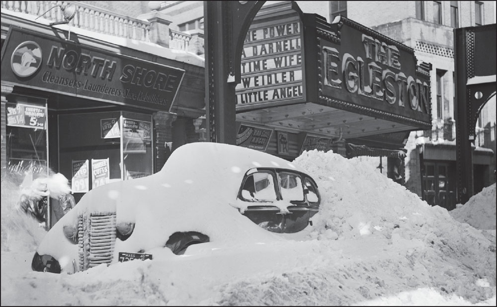
From the silent film era until 1961, the Egleston Theatre was in operation at 3093 Washington Street, just southwest of Egleston Square. At the time of this 1939 snowstorm, it was showing Day-Time Wife, starring Tyrone Power and Linda Darnell, and Bad Little Angel, starring Virginia Weidler. (Courtesy of the Boston Public Library; photograph by Leslie Jones.)
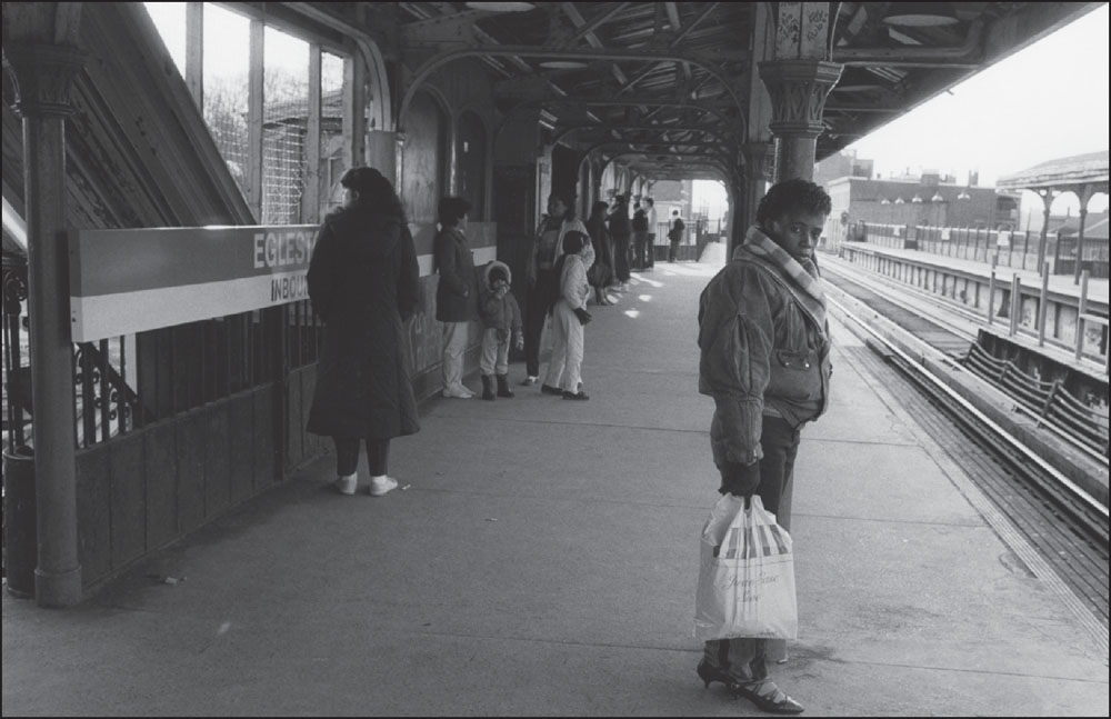
In this 1986 photograph, commuters await a train on the inbound platform at Egleston Square Station. The woman looking at the photographer appears to have been shopping at the punningly named Justin Case Shoes on downtown’s Summer Street. Above her head, the station’s decorative architectural elements have been graffitied. (Photograph by and courtesy of David Akiba.)
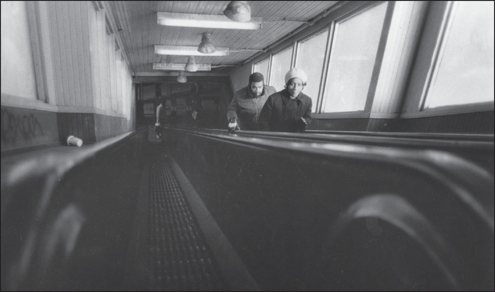
At Egleston Square Station, commuters ride up one of the system’s famous narrow wooden escalators. In a 1982 Boston Globe op-ed, David B. Wilson wrote, “[A]s civic icons go, the clattering, clanking, precipitously sloping wooden-treaded escalators of the T contribute something to the soul of the city; without them, it would be a different and a poorer place.” (Photograph by and courtesy of David Akiba.)
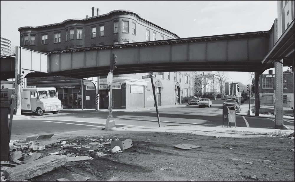
This 1982 photograph looks east across Washington Street and the Elevated structure from School Street in Egleston Square, just south of the Elevated station. Visible under the platform at left are Talley’s Barber Shop, at 3120 Washington Street, and Dr. N.B. Dixit, family dentist, at 3122 Washington Street. (Courtesy of the Historic American Engineering Record; photograph by Richard Cheek.)
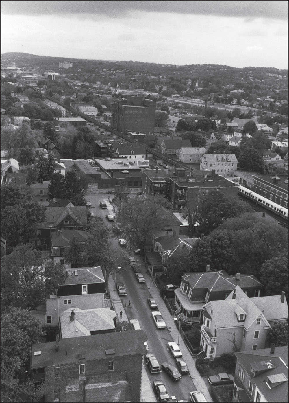
A 1986 view looking southwest from the Walnut Park Apartments Tower on Columbus Avenue in Egleston Square shows Weld Avenue at lower center and the elevated Orange Line cutting diagonally toward Green Street Station, a half-mile away, on its way to Forest Hills. (Photograph by and courtesy of David Akiba.)
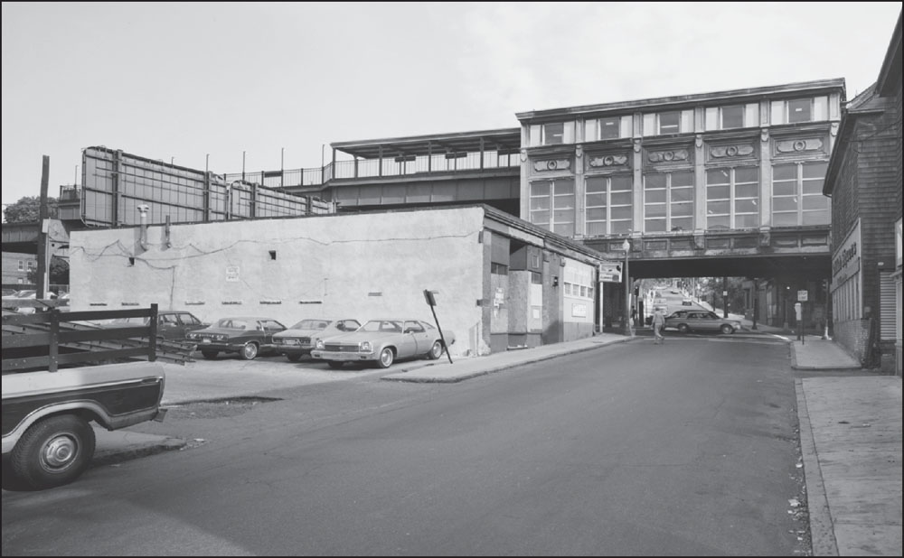
This 1982 photograph looks southeast along Green Street toward Washington and Green Street Station, with Glen Road beyond. A liquor store is at right at the intersection, while Smitty’s Sub Shop is at left; the Smitty’s site is now home to the Jamaica Plain police station. (Courtesy of the Historic American Engineering Record; photograph by Richard Cheek.)
The old Green Street Station was not originally part of the Washington Street Elevated’s extension to Forest Hills but opened for service in 1912. When the station was later relocated along the Southwest Corridor route of the new, submerged Orange Line, it moved only three blocks northwest, one of the smallest changes for commuters. (Photograph by and courtesy of David Akiba.)
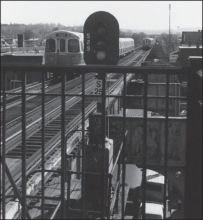
A 1986 image from the Green Street Station platform shows a train approaching in the distance, where the clock tower of the new Forest Hills Station, under construction, is dimly visible. On Washington Street, closer to the station, is Sergio’s Auto Body, a Chinese restaurant, and Schell Printing. (Photograph by and courtesy of David Akiba.)
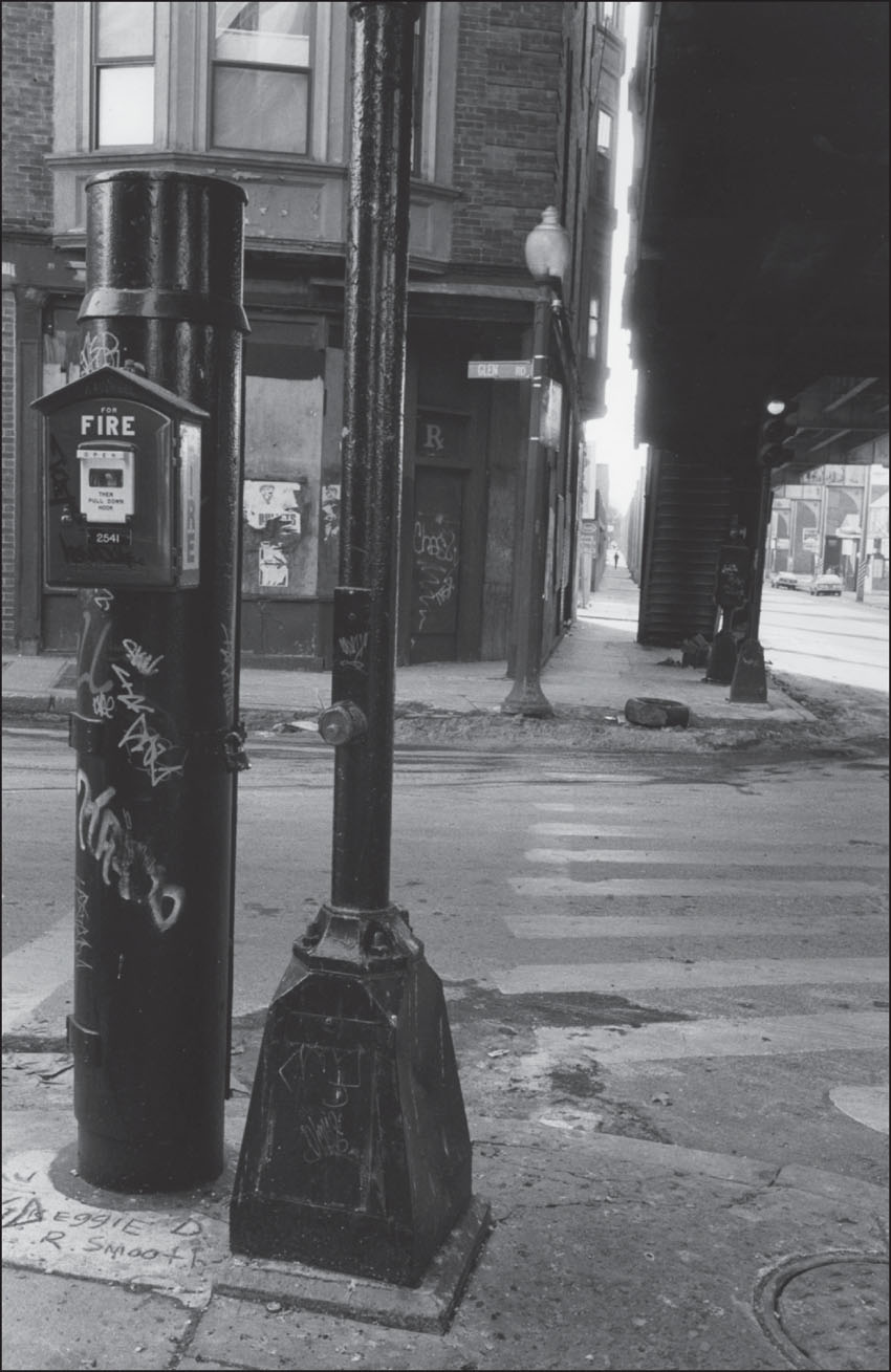
As it crosses Washington Street heading east, Green Street becomes Glen Road, which continues up a hill to Franklin Park. This view, looking south at the corner of Washington Street and Glen Road, offers a sense of how the Elevated tracks were constructed close to buildings. (Photograph by and courtesy of David Akiba.)
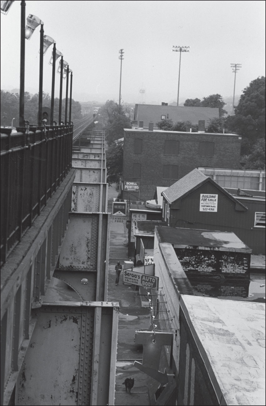
Looking southwest from the Green Street outbound platform toward Forest Hills in April 1987, Schell Printing, at 3399 Washington Street, where it moved in the 1960s and remains today, is partially visible at far right. While many Washington Street businesses have come and gone, Schell Printing stands with nearby Hatoff’s Gas Station and Ruggiero’s Market as establishments that have remained for decades. (Photograph by and courtesy of Joe Boncek.)
This view from 1982 looks west down Glen Road, across Washington Street toward Green Street. The Green Street Station dominates the intersection. Beneath it, across Washington Street at left, is the present-day site of the District E-13 Boston Police Station. In this picture, that corner is home to Ruggiero’s Market, which has since moved just slightly north up the street. (Courtesy of the Historic American Engineering Record; photograph by Richard Cheek.)
The Green Street Station looms over lower-set structures in this 1948 photograph looking south toward commercial and apartment buildings along Green Street. The wooden buildings in this image still stand, but the one-story structure behind the billboard at left has been replaced with a police station. (Collection No. 5110.002, City of Boston Archives, Boston.)

This 1982 photograph, looking north along Washington Street in the shade of the Elevated tracks, gives a sense of how Green Street Station dominated the intersection of Green and Washington Streets and how the Elevated cast entire neighborhoods in shadow. Once the station was removed in 1988, this intersection became practically unrecognizable. (Courtesy of the Historic American Engineering Record; photograph by Richard Cheek.)
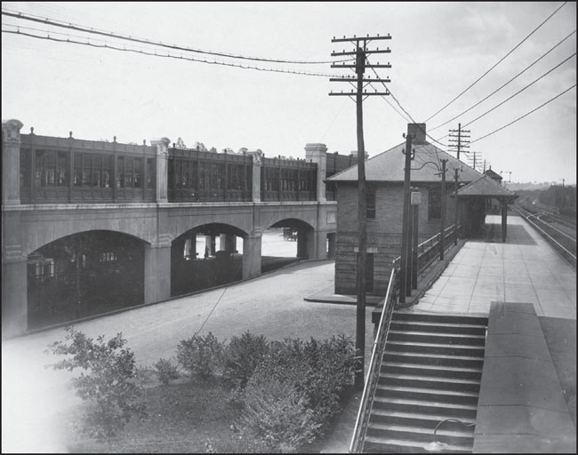
In 1903, just two years after the Elevated opened, the Boston Elevated Railway Company initiated plans to extend service from Dudley Square to Forest Hills. This c. 1930 view of Forest Hills Station shows two sets of tracks. Those on the right serve the Elevated, while those on the left serve the Boston & Providence Railroad. (Courtesy of the Boston Public Library; photograph by Aero Scenic Airviews Company.)
The extension of the Washington Street Elevated was not completed until late 1909, after a series of setbacks stalled the project for many years. This photograph looks south toward the exterior of Forest Hills Station in November 1909, just before the extension of Washington Street Elevated service from Dudley to Forest Hills. (Courtesy of the Boston Public Library.)
This August 1910 photograph, looking south toward Roslindale and Hyde Park, shows the western rise of the recently completed Forest Hills Station. The smaller structure at right is the Forest Hills Railroad Station, part of the Boston & Providence Railroad.In the 1980s, the new Forest Hills Station, serving both the Orange Line and the Commuter Rail, was erected in its place. (Courtesy of the Boston Public Library.)

These two 1982 photographs show the architectural details and grandeur of Forest Hills Station, designed by Edmund M. Wheelwright, who also designed Park Street Station in downtown Boston. Over the years, Forest Hills Station was subject to a number of modifications, including a southward extension that allowed trains to reverse direction. The above image is a view looking north from the station’s platform. The below image shows an interior view of the station, where a stairway to the upper levels is suspended from the main structure of the building. (Both, courtesy of the Historic American Engineering Record; photograph by Richard Cheek.)

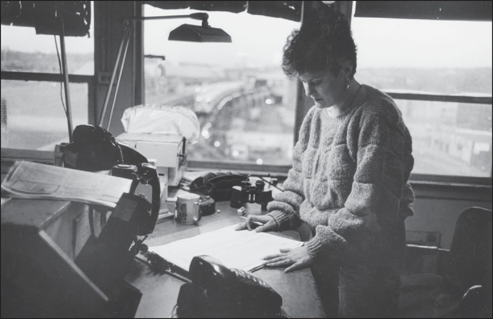
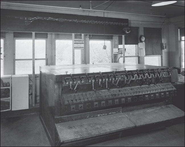
These images were taken inside the Tower “H” control tower at Forest Hills Station. The above image from 1986 shows an unidentified worker inside the control tower with a southbound train about to enter the station. The below image from 1982 offers a view of equipment just to the left of where the woman is standing in the above photograph. To enter the tower, a person had to climb a long, narrow, winding metal staircase that began in the lower Walk Hill storage yard, the sound of their footsteps echoing around them as they climbed to the top. (Above, photograph by and courtesy of David Akiba; below, courtesy of the Historic American Engineering Record, photograph by Richard Cheek.)
On the left side of this view looking east toward Forest Hills Station is the Monsignor William J. Casey Overpass, which carries the Arborway from the area of the Arnold Arboretum in Jamaica Plain toward Forest Hills Cemetery, Franklin Park, and the Dorchester section of Boston. (Courtesy of the Historic American Engineering Record; photograph by Richard Cheek.)
This 1982 photograph offers a closer view of the Casey Overpass above the elevated rail line, which was torn down after the line was rerouted in 1987. In 2011, the Massachusetts Department of Transportation began considering alternatives to replace the overpass, which was constructed in the 1950s and has fallen into considerable disrepair; a surface road is planned. (Courtesy of the Historic American Engineering Record; photograph by Richard Cheek.)