Six
THE SOUTHWEST
CORRIDOR REALIGNMENT

A Boston Globe photographer captured these firefighters in Boston’s South End in April 1988 as they hosed down Elevated tracks being dismantled at the intersection of Washington and East Brookline Streets. The last train rode these Washington Street Elevated tracks one year earlier, on April 30, 1987, as the Orange Line was rerouted to the Southwest Corridor. (Courtesy of the Boston Globe; photograph by Thomas Landers.)
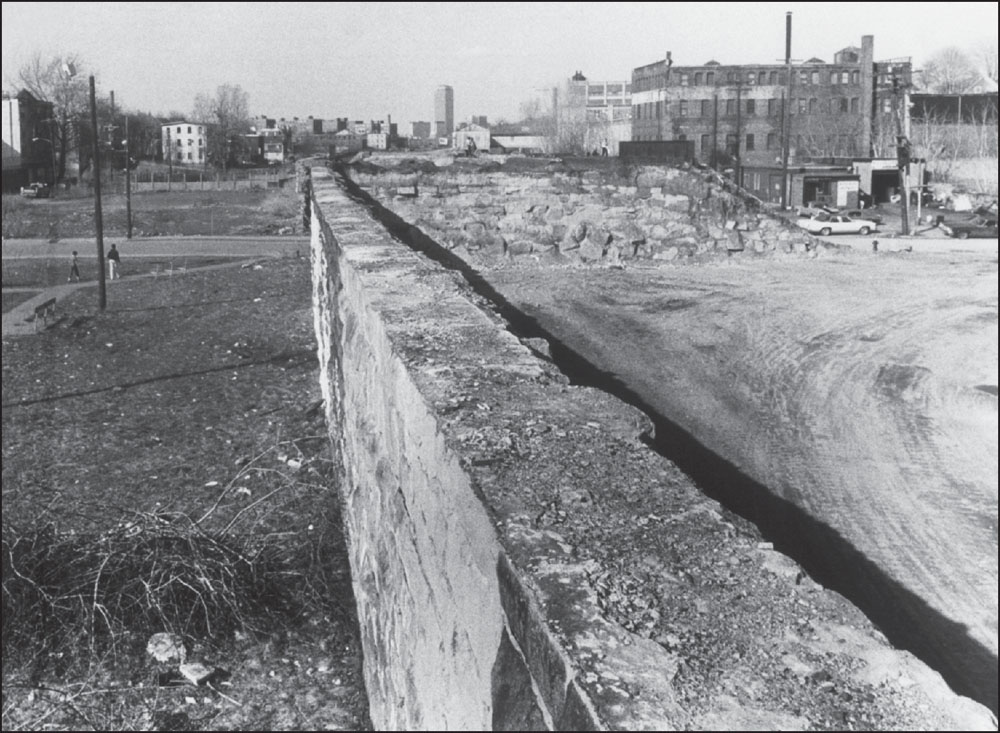
This 1980 photograph, looking north toward downtown Boston, shows a wall scheduled for demolition as part of the Southwest Corridor Project and rerouting of the Orange Line, which came about as a result of the failed Inner Belt highway project. The Inner Belt would have introduced several highways that would run through the city to the Central Artery on the waterfront. (Courtesy of the Boston Globe; photograph by Bill Curtis.)
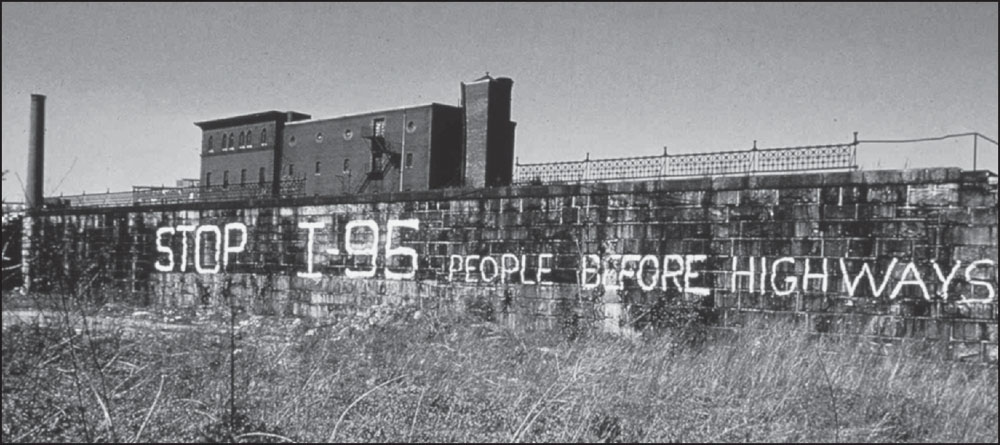
This wall stood just north of Jackson Square at the edge of Roxbury and Jamaica Plain, which would become part of the Southwest Corridor. The slogan was painted amid protests in the late 1960s and early 1970s in response to the proposed Inner Belt, which would have cut through the Boston neighborhoods of Jamaica Plain, Roxbury, and the South End as well as Canton and Milton. (Courtesy of Janet Hunkel.)
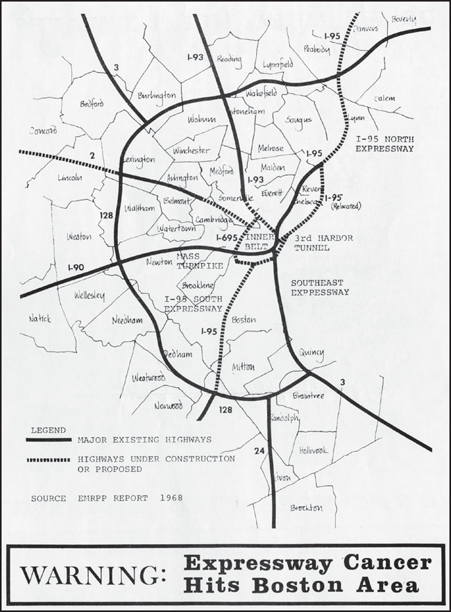
This flyer, produced by those opposed to the Inner Belt, shows the proposed highways as dotted lines. Inner Belt discussions started in the 1930s and included the introduction of an eight-lane Interstate 95, which would have cut through Cambridge and Boston. This southern section of I-95 was referred to as the Southwest Expressway. (Courtesy of University Archives & Special Collections, Joseph P. Healey Library, University of Massachusetts Boston: Ann Hershfang Collection.)
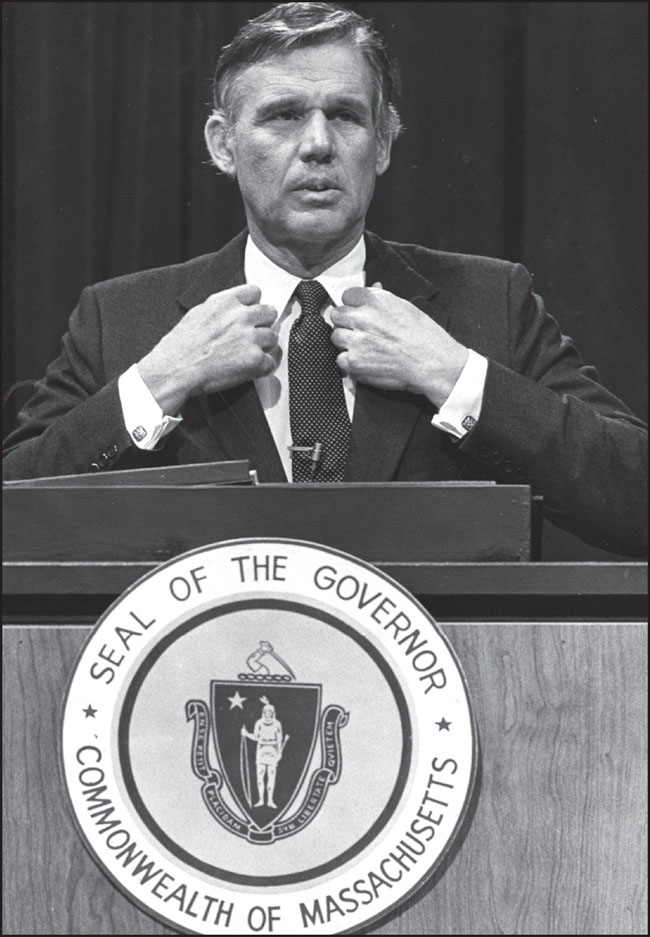
Gov. Francis W. Sargent ultimately abandoned the Inner Belt plan, largely due to community protest, as well as the I-95 proposal. However, while preparations were under way throughout the 1960s, about 150 acres in Roxbury and Jamaica Plain—including homes, businesses, and parkland—were taken through eminent domain and cleared, creating open space eventually used for the Southwest Corridor. (Courtesy of the Boston Globe; photograph by Donald C. Preston.)
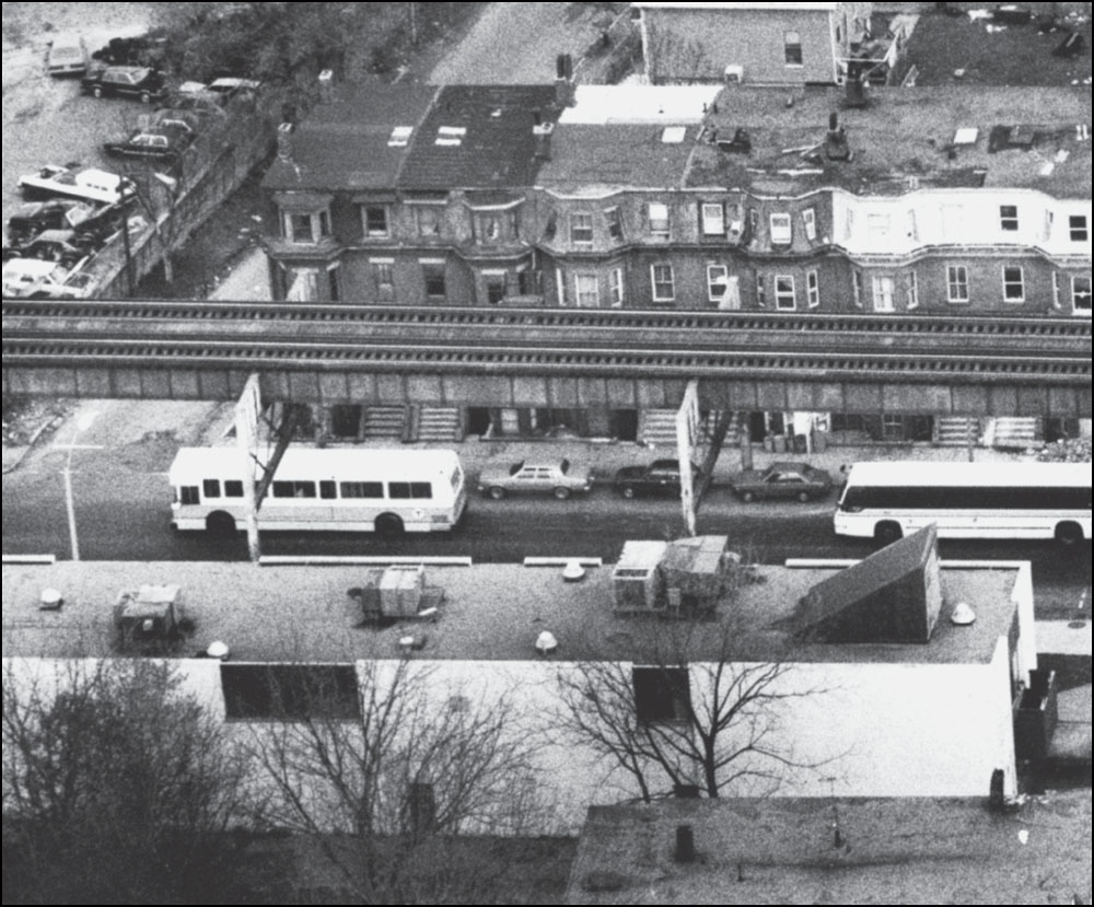
Shortly after the rerouted Orange Line started service on the new Southwest Corridor, buses replaced train service along the Washington Street Elevated, as shown in this May 1987 image of Roxbury. In the years leading up to the scheduled closing of the Washington Street El, the MBTA worked with community members on plans to replace the El with light-rail service. However, light-rail plans were canceled soon after the El ceased operations in 1987, and the MBTA did not introduce its Silver Line service until 2002. The Silver Line is a high-speed bus line that includes service between downtown Boston and areas formerly serviced by the El, including Dudley Square. Many community members have criticized the line as an inadequate replacement for high-speed train service. (Courtesy of the Boston Globe; photograph by Thomas Landers.)
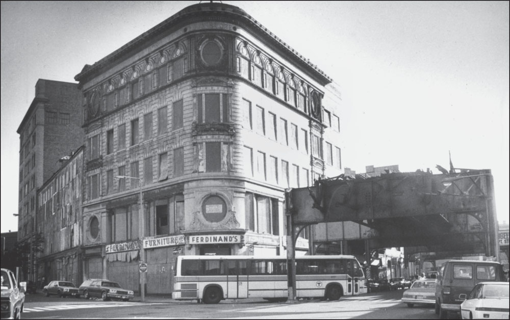
Ferdinand’s Blue Store sat vacant in 1988 as the Washington Street Elevated tracks were dismantled in Dudley Square. Built in a Baroque Revival style in 1895 and designed by architect John Lyman Faxon, it became vacant in the 1980s and fell into disrepair. The preserved facade was incorporated into the design of a new municipal building planned for offices for Boston Public Schools. (Courtesy of the Boston Globe; photograph by Thomas Landers.)

The shell of New England Medical Center Station, seen here at its Tremont Street entrance, was constructed with the South Cove Tunnel around 1968 as part of the planned Interstate 695 but remained unfinished until the Southwest Corridor route was completed. It opened in 1987 and was renamed Tufts Medical Center in 2010 to reflect the change in the hospital’s name. (Photograph by and courtesy of Andrew Lynch.)
An Orange Line train moves east alongside the Massachusetts Turnpike (at far left) on its way to New England Medical Center. The Arlington Street overpass is above the train, with the Mass Pike Towers at upper left and Josiah Quincy School beyond. To the right of the Orange Line are tracks serving Amtrak and Commuter Rail trains; at left are more Commuter Rail tracks. (Photograph by and courtesy of Andrew Lynch.)
At the end of 1979, Commuter Rail service out of the old Back Bay Station ended to make way for Southwest Corridor Project construction. According to community activist Janet Hunkel, who was active in protests related to the defeated Southwest Expressway, this photograph shows the last train leaving Back Bay Station before construction began on the Southwest Corridor. (Photograph by and courtesy of Janet Hunkel.)
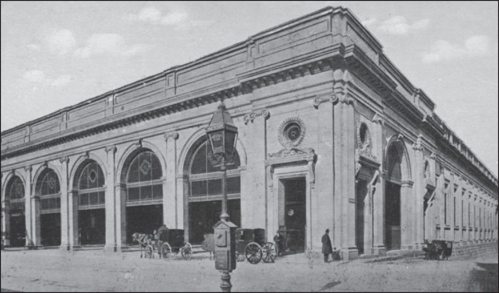
Constructed in 1899, the original Back Bay Station was rebuilt in 1929 after a fire destroyed much of the original structure. The building was demolished to make way for the new Back Bay Station, which opened in 1987 as part of the Orange Line rerouting along the Southwest Corridor. (Courtesy of University Archives & Special Collections, Joseph P. Healey Library, University of Massachusetts Boston: Anthony Mitchell Sammarco Collection.)
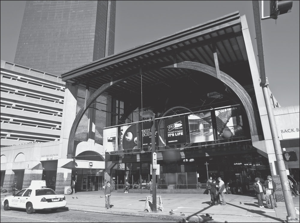
The new Back Bay Station was planned to carry on the monumental tradition of its predecessor. Marianne Abrams, president of the Back Bay Association and a member of the station’s site committee, told the Boston Globe in 1986: “We wanted to reflect the romanticism of the rail and the importance of the Back Bay station, which has existed in some form for 100 years.” (Photograph by and courtesy of Nathaniel Marsh.)
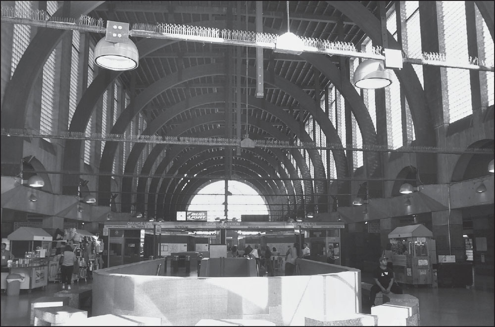
The interior of the Back Bay Station, designed by the architectural firm of Kallmann, McKinnell & Wood, has a dramatic arcade supported by arched ribs. Beneath its high ceiling, more than 500,000 passengers per year use the Orange Line, the Commuter Rail, and Amtrak trains. (Photograph by and courtesy of Andrew Lynch.)
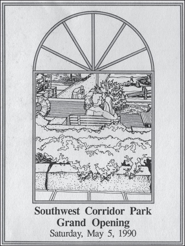
Besides being a transit hub and the second-most trafficked station on the contemporary Orange Line (after Downtown Crossing), Back Bay Station is also the gateway to the Southwest Corridor Park, which officially opened on May 5, 1990, as shown on this opening ceremony program. (Courtesy of University Archives & Special Collections, Joseph P. Healey Library, University of Massachusetts Boston: Ann Hershfang Collection.)
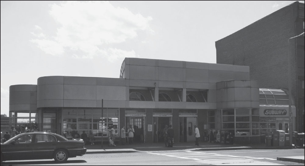
The main entrance to Massachusetts Avenue Station sits on the southwest side of the street. In a nod to the 19th-century architecture surrounding it, the Massachusetts Avenue Station was designed with bowed, windowed elements that refer back to traditional bowfront facades. Along the Southwest Corridor immediately behind this station is the William Carter School, a public school for children with severe disabilities. (Photograph by and courtesy of Andrew Lynch.)
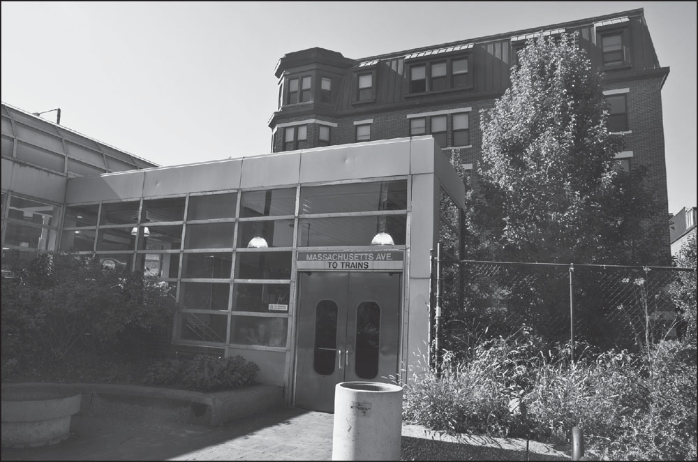
This view shows the smaller entrance to Massachusetts Avenue Station on the northeast side of the street, adjacent to the Southwest Corridor Park, with the Susan S. Bailis Assisted Living Community, located at 352 Massachusetts Avenue, visible behind it. The assisted living community was built in 2003 in a style consistent with surrounding brownstones. (Photograph by and courtesy of Nathaniel Marsh.)
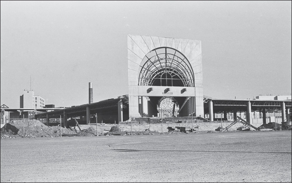
Stull and Lee Incorporated, a Boston-based architecture firm, designed the new stations built along the Southwest Corridor for the rerouted Orange Line, an $800-million project. Stull and Lee also oversaw land use plans and other design plans along the Southwest Corridor. This image from 1986 shows construction of the new Ruggles Station near Columbus Avenue and adjacent to the Northeastern University campus. Each of the new stations on the rerouted Orange Line was designed with considerable community input, as was much of the Southwest Corridor planned in the late 1970s and 1980s. The same community activists and groups who were involved in successfully halting the proposed Southwest Expressway quickly shifted their focus once the Southwest Corridor Project was announced to ensure that community voices, concerns, and needs were addressed in the project’s planning and design. In 1989, the National Endowment for the Arts awarded Stull and Lee with the Presidential Design Award for their Southwest Corridor project. (Photograph by and courtesy of Paul W. Locke.)
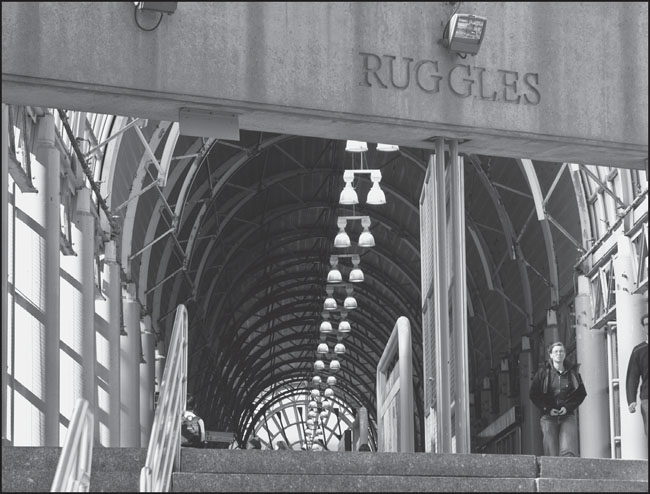
Community involvement is reflected in the neighborhood- and community-inspired art showcased in stations along the Southwest Corridor. John T. Scott’s sculpture depicting movement and African musical tradition was installed under the barrel-vaulted archway (pictured) at Ruggles Station. Adjacent to a stairway is the mural Geometree by Paul Goodnight. (Photograph by and courtesy of Nathaniel Marsh.)
An outbound train approaches Roxbury Crossing at lower left, with the inbound tracks visible at center and Commuter Rail tracks at right. In the distance are the Prudential Tower, completed in 1964; 111 Huntington Avenue, completed in 2002; and Hancock Place, completed in 1976. (Photograph by Jeremy C. Fox.)
Roxbury Crossing Station sits at the intersection of Tremont Street and Columbus Avenue on the edge of Mission Hill and across Columbus Avenue from Roxbury Community College. This station is just over a half-mile east of the old Dudley Station, while Ruggles Station is about a half-mile to the northeast of Dudley Square. (Photograph by and courtesy of Andrew Lynch.)
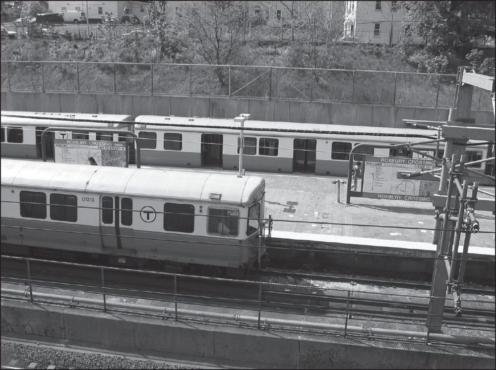
In this image, inbound and outbound trains sit at Roxbury Crossing. Upon the opening of the Southwest Corridor in 1987 and well into the 2000s, the Orange Line has run trains of six 65-foot cars of the 01200 series, built by Hawker Siddeley Canada Car and Foundry between 1980 and 1981. (Photograph by and courtesy of Andrew Lynch.)

When Dudley Station was taken down, the MBTA recycled the 175-foot-long copper-clad canopy that covered the central area of the station, placing it above a reconstructed bus platform. The neighborhood lost its rapid transit but retained some of the grandeur of Alexander Wadsworth Longfellow Jr.’s Beaux-Arts design. (Photograph by Jeremy C. Fox.)
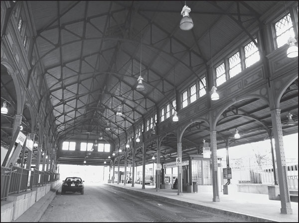
The canopy appears almost entirely unchanged since 1901, though its surroundings and function are wholly different. In 2002, the MBTA introduced the Silver Line, a bus rapid transit system with two routes from Dudley Square to downtown Boston—one ending at South Station and the other at Bowdoin Station. Silver Line buses operate in reserved lanes on Washington Street, tracing much of the old Elevated route. (Photograph by Jeremy C. Fox.)
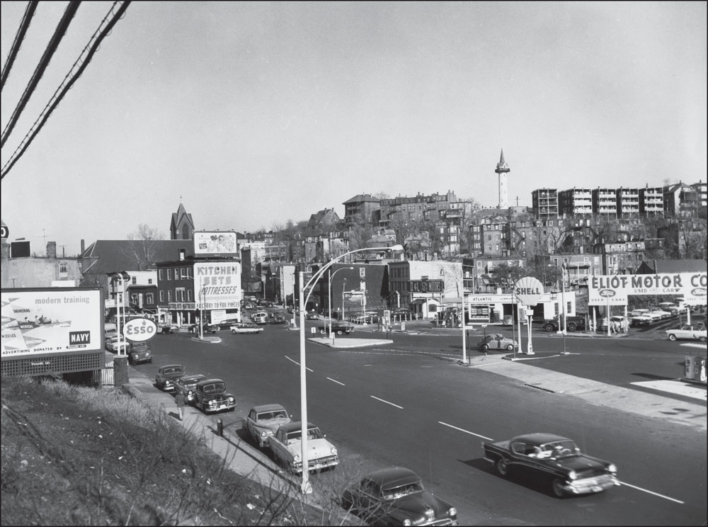
This 1960s image offers a view of the intersection of Centre Street and Columbus Avenue in the old Jackson Square, along the border of Jamaica Plain and Roxbury. Centre Street was completely realigned into two disconnected halves during the neighborhood’s redevelopment as part of the Southwest Corridor Project, while Columbus Avenue was simplified, widened, and made more linear. (Courtesy of the Boston Public Library; photograph by FayFoto/Boston.)
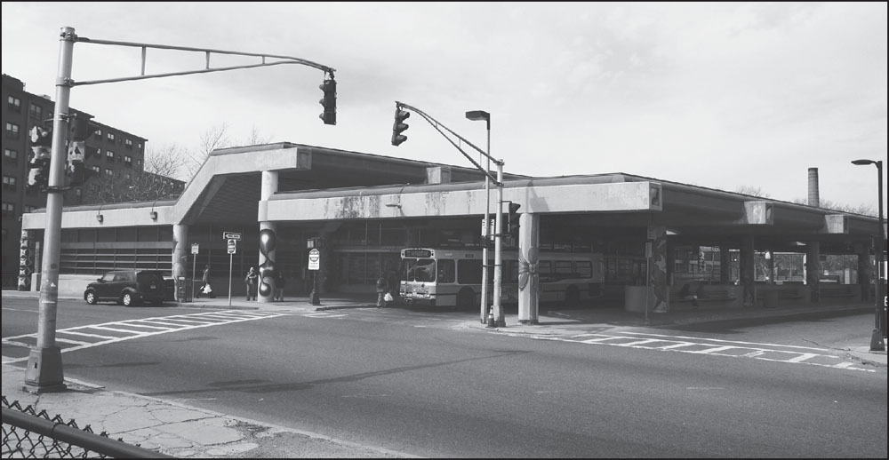
Jackson Square Station was constructed on Centre Street adjacent to the Bromley-Heath public housing project, which is partly visible at far left. In 2004, exterior pillars supporting the station’s roof were painted with fanciful designs by local artist Roberto Chao and a group of 10 young people from the Hyde Square Task Force as part of an effort to make the station more welcoming. (Photograph by Jeremy C. Fox.)
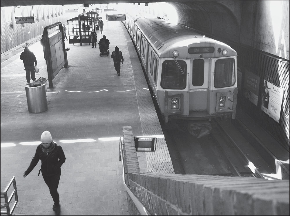
Passengers, including a man in a motorized wheelchair, depart an outbound train at Green Street Station. Like all the new Orange Line stations, and unlike the old Elevated stations, Green Street is fully accessible to people with disabilities. (Photograph by Jeremy C. Fox.)
The new Green Street Station was constructed between Woolsey Square and Amory Street in a largely residential area of Jamaica Plain three blocks northwest of the Elevated Green Street stop and about two-fifths of a mile from the neighborhood’s main business district on Centre Street. (Photograph by and courtesy of Andrew Lynch.)
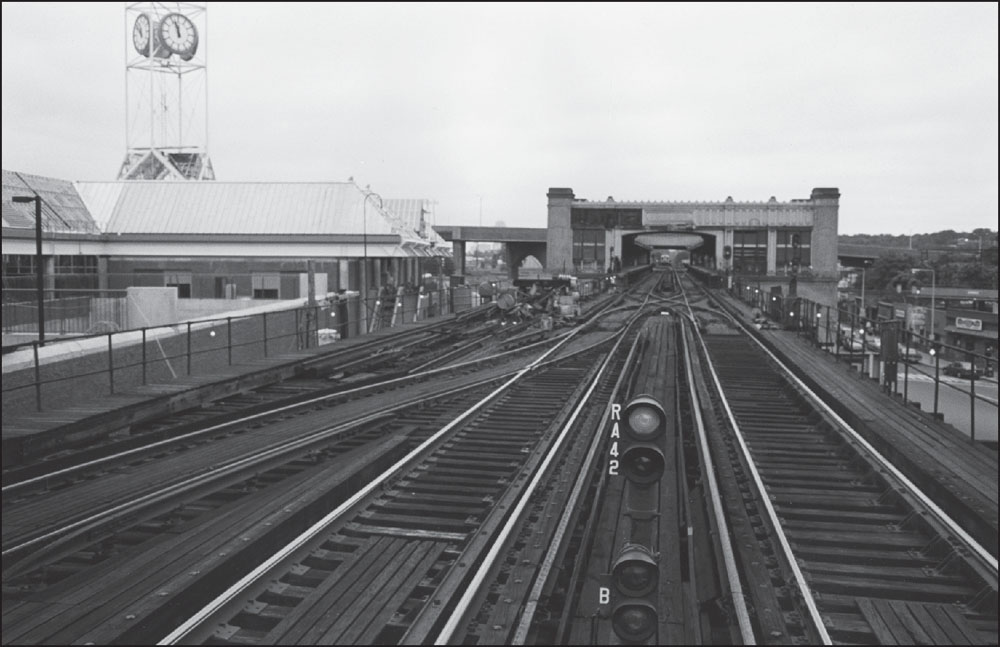
This 1986 photograph shows the newly constructed Forest Hills Station (left), with the station’s distinctive clock tower, alongside the original 1909 station and Hyde Park Avenue (right). After the new Orange Line opened along the Southwest Corridor, the old station was torn down, and the space reused as a busway. (Photograph by and courtesy of David Akiba.)
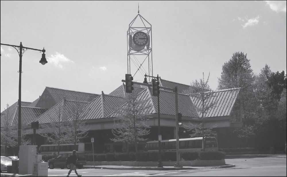
This photograph shows the new Forest Hills Station as seen looking west across Washington Street. The clock tower, one of the station’s signature features, is visible from spots in several nearby neighborhoods and is echoed by another set of four clocks suspended from the ceiling inside the station. (Photograph by and courtesy of Andrew Lynch.)
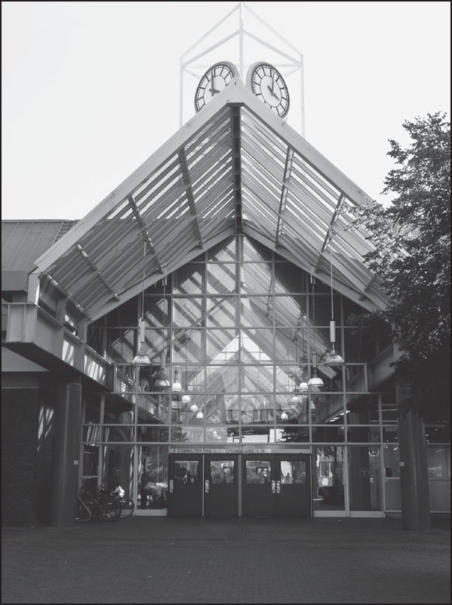
In contrast to the original, monolithic Forest Hills Station, the new station is light and airy, with large sections of glass that flood it with sunlight. Its architects, Cambridge Seven Associates, designed the structure to resemble the greenhouses of surrounding parks. The northern entrance (pictured) leads to a busway and the former Arborway stop on the Green Line, which closed in 1985. (Photograph by and courtesy of Nathaniel Marsh.)
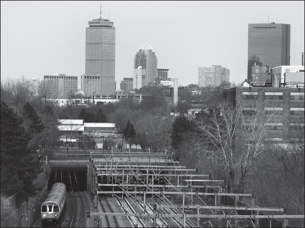
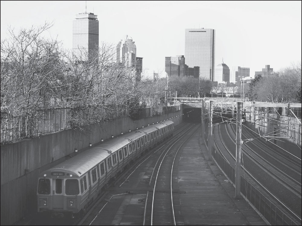
Looking north from Forest Hills, this view shows the Orange Line progressing south along the Southwest Corridor adjacent to Commuter Rail tracks, with the city skyline above, showing some of the areas serviced by the line. Just left of center are the Prudential Tower and 111 Huntington Avenue, both near the Massachusetts Avenue stop, and at right is Hancock Place, near Back Bay Station. (Photograph by Jeremy C. Fox.)