kitsap peninsula
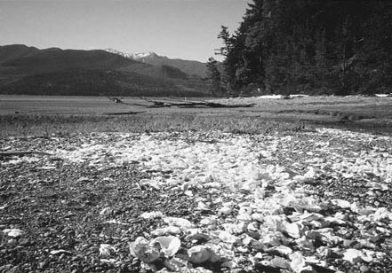
Scads of oyster shells litter the beach at Guillemot Cove.
Kitsap Peninsula
Jutting into Puget Sound like a big arrowhead, the Kitsap Peninsula is Washington’s second great peninsula. With over 240 miles of coastline, and attached to the mainland by an isthmus less than 2 miles wide, Kitsap can feel like an island. But despite its geographical isolation, its proximity to Seattle and Tacoma via ferries and bridge has led to its development. Out of the state’s thirty-nine counties, Kitsap ranks thirty-sixth in size but is the second most densely populated, with nearly 600 people per square mile (only King County is more densely populated).
While development continues to transform much of the peninsula’s rural charm into suburbia, all is not lost. Large expanses remain fairly wild. Along Hood Canal on the peninsula’s western shoreline, large tracts of beach and quiet coves remain unmolested by development. But it won’t stay this way without citizen involvement calling for conservation measures. The Great Peninsula Conservancy, a land trust in the county, has been instrumental in protecting thousands of acres of key shoreline, forest, and lakefront. The Kitsap County Parks Department has also accelerated its land acquisitions.
Surrounded by water and within the shadows of the Olympic Mountains, the Kitsap Peninsula truly is a beautiful place. Hikers will be pleasantly surprised to find that just beyond the suburban sprawl radiating from Bremerton, some fine hiking destinations await.
 |
Harstine Island State Park |


Map: USGS Longbranch; Contact: Jarrell Cove State Park, (360) 426-9226, infocent@parks.wa.gov, www.parks.wa.gov; Notes: Dogs must be leashed; Discover Pass required; GPS: N 47 15.741, W 122 52.227
  |
Hike down into a lush ravine to a deserted beach on an island that has resisted time. Quiet Harstine Island State Park may very well be the best-kept secret in Puget Sound. After combing the tranquil beach, take to the park’s even quieter woodland trails. |
GETTING THERE
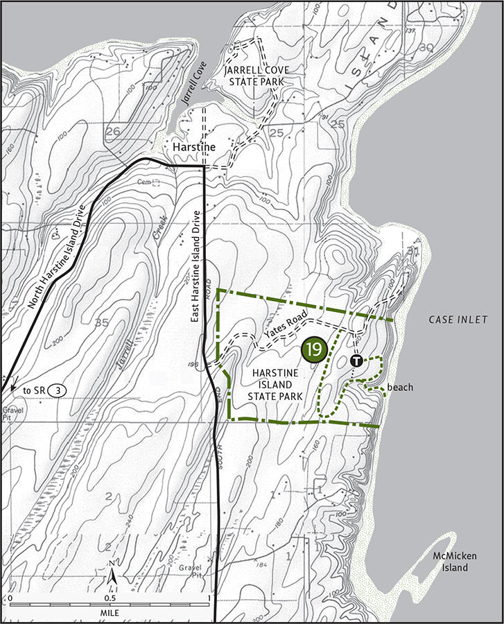
From Shelton, drive State Route 3 east for 11 miles. Turn right on Pickering Road (signed “Harstine Island and Jarrell Cove SP”) and follow it for 3.3 miles. Bear left, cross Harstine Island Bridge, and come to a T junction. Go left on North Harstine Island Drive and in 3 miles come to a four-way junction. Turn right onto East Harstine Island Road North and in 1 mile turn left on Yates Road. Follow this dirt road for 1 mile to the park entrance on the right. The trailhead is 0.25 mile farther. Privy and picnic tables available.
ON THE TRAIL
Short and oh so very sweet, this hike will bring you back to a time when most of Puget Sound’s shoreline wasn’t wall-to-wall homes. One of the largest islands in the South Sound, Harstine has resisted much change. Still rural. Still quiet. Still special. Harstine Island State Park assures that 300 acres of this prime place will remain protected from development.
There are two ways to get to the beach. Both are fairly short, but there’s no hurry: take the trail on the east end of the parking lot to get a little preview before dropping to the shoreline, peeking through gaps in the thick forest to see what lies ahead. In 0.25 mile begin your descent into a cool and dark ravine graced with big cedars and firs. Come to a junction: left to the beach, right to more trails. Head to the beach first. Drop deeper into the ravine, cross a pretty little creek, and in 0.1 mile emerge on a crowd-free beach. Lounge, beachcomb, or if the tide is low hike south below the forested bluffs.
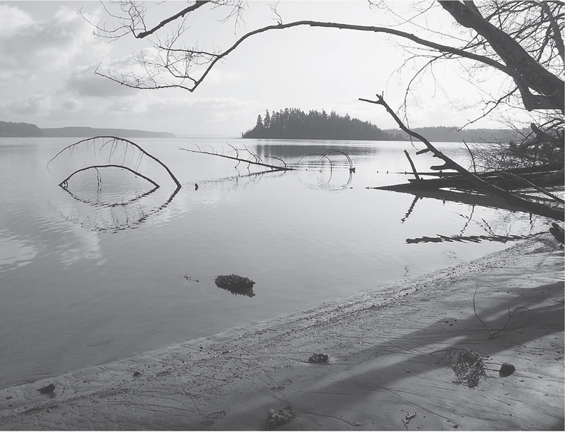
McMicken Island in the background from Harstine Island State Park’s inviting beach
When you’re beached out, return to the junction to explore the park’s uplands. Climb out of the ravine and pass a few ancient cedars spared the ax. In 0.25 mile from the junction reach another junction. The trail right heads back to the parking lot in 0.25 mile. Go left on a good trail lined with bearberry and salal under a canopy of mature second growth. In 0.1 mile the main trail bears right; continue on it. Enjoy a peaceful woods hike, emerging on Yates Road in 0.5 mile. Turn right and return to your vehicle by walking this road for a little less than 0.4 mile.
EXTENDING YOUR TRIP
At low tide it’s possible to walk the beach all the way to McMicken Island State Park (about a mile away). But note that the shore is private property; don’t get stuck by an incoming tide. Nearby Jarrell Cove State Park has a nice campground and a 1-mile nature trail.
 |
Twanoh State Park |

Map: USGS Mason Lake; Contact: Twanoh State Park, (360) 275-2222, infocent@parks.wa.gov, www.parks.wa.gov; Notes: Dogs must be leashed; Discover Pass required; GPS: N 47 22.644, W 122 58.431
   |
Enjoy an easy hike along a salmon-spawning stream in a lush emerald ravine. Twanoh is derived from the Skokomish people, meaning “gathering place.” Twanoh State Park protects 182 acres of prime Hood Canal real estate—a perfect place for hikers and wildlife to gather. |
GETTING THERE
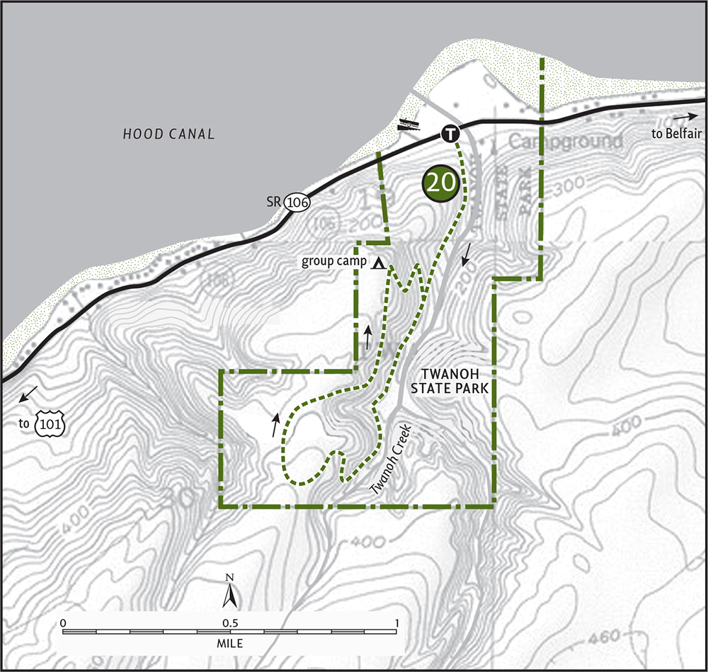
From Bremerton head west on State Route 3 to Belfair. Continue west on SR 106 for 7.75 miles to Twanoh State Park. Turn left into the campground entrance; day-use parking is before the camping information station. The (signed) trailhead is on the south side of the entrance, at Twanoh Creek Bridge.
ON THE TRAIL
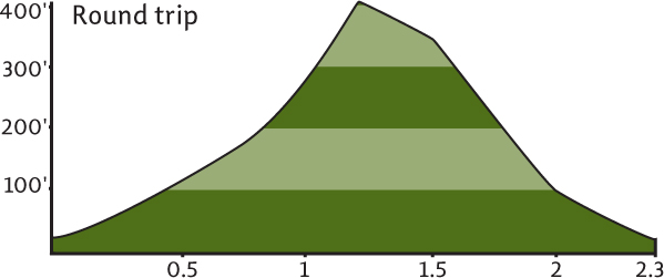
This hike begins with Twanoh Creek immediately at your side. Through a verdant tunnel of rhododendron and cedar, begin working your way up the small ravine that houses this bubbling waterway. The surrounding forest was logged over a century ago. Clumps of ferns engulf springboard-notched cedar stumps smothered in moss. In 0.3 mile come to a junction. Continue forward; you’ll be returning on the trail on your right.
At 0.75 mile the trail begins to climb out of the ravine. Notice the vegetation change on the forest floor to salal and kinnikinnick, an indication that less moisture is being trapped here than near the creek. After two switchbacks, crest the top of the ravine. Now away from the raucous creek, begin a slow descent in quiet forest. At 1.25 mile the trail yields to an old woods road. At 1.5 miles you’ll come to the state park group camp.
Turn right and pick up the trail again. Beneath a few big old Douglas-firs and clusters of leathery-leaved rhododendrons, begin dropping back into the damp ravine. At 2 miles reach the creek and the first trail junction. Turn left and return 0.3 mile to your vehicle.
EXTENDING YOUR TRIP
After your hike follow Twanoh Creek to its small delta on Hood Canal. Comb the beach or go for a swim in some of the warmest saltwater in the state. Check out the Civilian Conservation Corps buildings in the park. Twanoh’s shaded creekside campground makes a perfect weekend retreat.
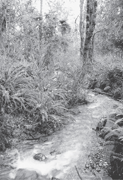
Little Twanoh Creek flowing after a winter storm
 |
Mary E. Theler Wetlands Nature Preserve |


Maps: USGS Belfair, wetlands map available online; Contact: Mary E. Theler Wetlands and Community Center, (360) 275-4898, theler@hctc.com, www.thelercenter.org/wetlands; Notes: Dogs prohibited. Trail open dawn to dusk; GPS: N 47 26.286, W 122 50.194
 |
Spend a couple of hours or all day exploring a wildlife-rich estuary at the farthest reaches of fjordlike Hood Canal. Let eagles, osprey, herons, otters, and deer captivate you on this hike through grassy wetlands and along the Union River. |
GETTING THERE
From Bremerton head west on State Route 3 to Belfair. Proceed 1 mile beyond the junction with SR 300 to the Mary E. Theler Community Center (and sign for the nature trail), located on your right. Park at community center. The trailhead is located in the northwest corner of the parking lot. Privy available.
ON THE TRAIL
Among the many legacies that Sam and Mary Theler left the town of Belfair was land for a Masonic Lodge, church, and school. Out of the 70 acres deeded to the North Mason School District arose the Mary E. Theler Wetlands Nature Preserve. Serving an educational role for area school children, the wetlands have also become the area’s prime hiking destination.
Start your visit by passing under the welcome arch and proceeding 0.25 mile to the Wetlands Project Center. If it’s open, take time to visit to gain a better appreciation and understanding of the complex ecosystem you are about to explore. Children—heck, adults too—will appreciate the hands-on exhibits.
Several trails radiate from the Wetlands Project Center. All are pleasurable to walk and are wheelchair-accessible. The Sweetwater Creek and Alder Creek Trails make 0.25-mile loops. The South Tidal Marsh Trail extends 0.25 mile onto a boardwalk into Hood Canal. It’s ideally positioned for spotting birds among the grasses and reeds and for viewing the Olympic Mountains in the background.
The Union River Estuary Trail offers the longest and best hike in the preserve. Along an old dike the trail elbows across open wetlands—tidal marsh on the left, freshwater marsh on the right. Through a tunnel of shrubs and along active farmland, the trail makes a beeline for the mouth of the Union River. In 0.5 mile you’ll reach the river.
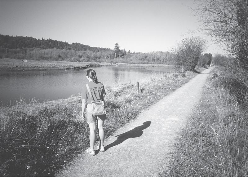
A hiker stopping to observe birdlife at the Theler Wetlands
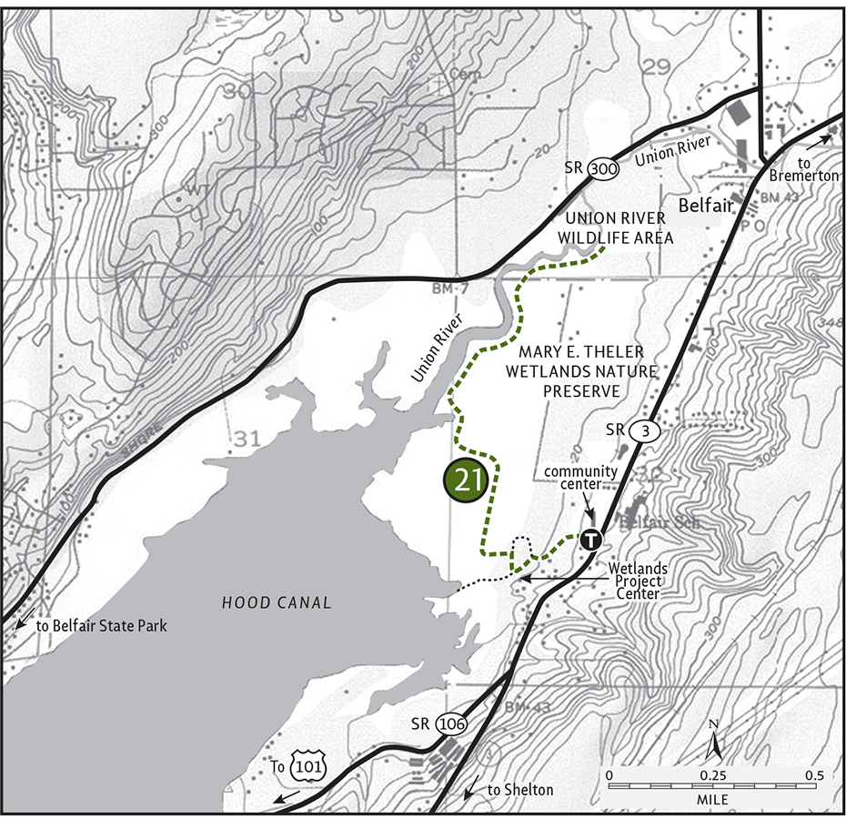
The trail then turns right (northeast) to hug this nutrient-rich waterway for one more mile. Just beyond the 1-mile mark is a small picnic area and restroom. At the trail’s terminus are two short spurs—the one left leads to the river’s edge for prime waterfowl and salmon-spawning viewing. Return to the Theler Wetlands at different times of the year to fully appreciate the life cycles at work in this ecologically important preserve.
 |
Penrose Point State Park |

Map: USGS Fox Island; Contact: Penrose Point State Park, (253) 884-2514, infocent@parks.wa.gov, www.parks.wa.gov; Notes: Dogs must be leashed; GPS: N 47 15.500, W 122 44.736
  |
Saunter out on this small peninsula for stunning views of Mount Rainier rising over Puget Sound. Let eagles and kingfishers announce your passing. Admire contorted bluffs, big Doug-firs, and a procession of passing watercraft. |
GETTING THERE
From Gig Harbor head north on State Route 16. Exit in Purdy, following SR 302 west for 5.3 miles. At a traffic light bear left onto Key Peninsula Highway and proceed for 9 miles. Turn left (east) onto Cornwall Road (approximately 1.5 miles south of the village of Home). In 0.5 mile turn right (south) onto Delano Road and continue 0.8 mile to a four-way intersection. Turn left (north) on 158th Avenue and in 0.3 mile enter Penrose Point State Park. Proceed 0.4 mile to the day-use parking area and trailhead. Water and restrooms available.
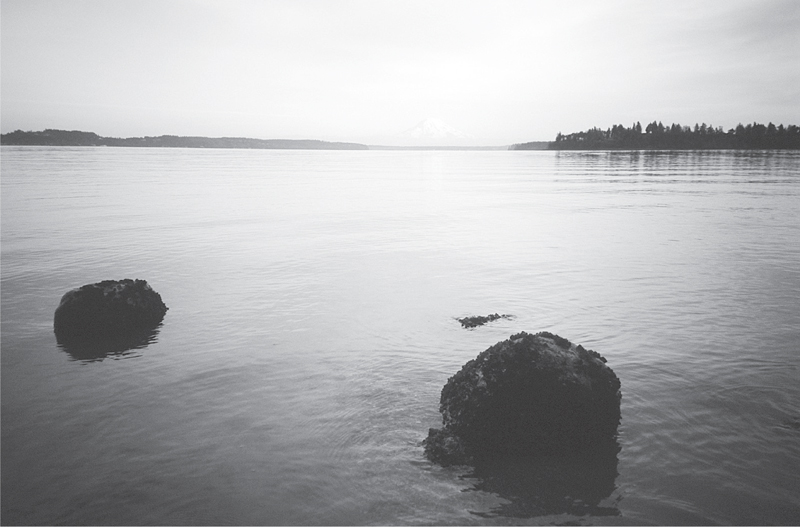
On clear days Mount Rainier can be seen rising above Delano Bay from Penrose Point.
ON THE TRAIL
One of the prettiest state parks on Puget Sound, this old estate-turned-park draws visitors mostly for its lovely beaches, campsites, and grassy shore-abutting picnic grounds. But there are a couple of miles of nice hiking trails here too. They wind through mature woodlands, along a mountain-reflecting coastline and over a quiet hillside.
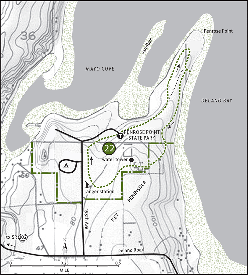
Located on the Key Peninsula, a subpeninsula of the Kitsap Peninsula, Penrose Point is a little off the beaten path. And the paths through the park aren’t well beaten either, but they’re well defined and well maintained. Start your hike at the main trailhead signed as Junction A. You’ll be returning here via a circuitous route.
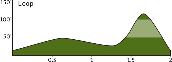
Through a forest of maples and alders the trail climbs slightly on a bluff above Mayo Cove. Go left at Junction B and in 0.25 mile arrive at Junction C. Turn left here for a trip around Penrose Point. Amble under a canopy of massive Doug-firs and flaky rusted-bark madronas. Views are limited, but in 0.75 mile you’ll come to another junction—you guessed it, D. Take the short spur that heads south to a beach. Wham! There’s Mount Rainier staring right at you from across Delano Bay. Framing the bay is Fox Island to the southeast and Anderson Island to the southwest.
Retrace back to Junction D and then head west along a nice shoreline trail. After about a third of a mile you’ll arrive at Junction E. Turn left for a little climb over a quiet wooded knoll, pass a water tower, and then start to descend. At Junction F turn right and proceed under big maples to Junction H (what happened to G?). Turn right and after about 0.25 mile you’ll reach Junction A to close the loop. You’ve now lettered in hiking!
EXTENDING YOUR TRIP
You can easily spend all day at Penrose Point. Heck, all night too—the park’s campground is quite inviting. More hiking can be done on a series of nature trails along Mayo Cove. At low tide look for Native American petroglyphs on an exposed spit in the inner cove. You can also hike around Penrose Point on the beach during low tide—it’s slow going, but worth the opportunity to see contorted bluffs shaped by tides and winter storms.
 |
Guillemot Cove |

Maps: USGS Holly, nature preserve map available at trailhead; Contact: Kitsap County Parks, (360) 337-5350, www.kitsapgov.com/parks/regionalparks/guillemot_cove_county_park.htm; Notes: Dogs prohibited; GPS: N 47 36.942, W 122 54.456
  |
One of the best-kept secrets on the Kitsap Peninsula, this county nature preserve protects almost 200 acres of stunning beach and stately forest on Hood Canal. Hike to a secluded cove teeming with seabirds. With The Brothers looming high above and directly across the canal, you may have to reel your jaw back in before heading home. |
GETTING THERE
From Bremerton follow Kitsap Way (State Route 310) for 3 miles to Kitsap Lake. Turn left on Northlake Way and proceed for 1 mile. Turn left onto the Seabeck Highway, following it for 3 miles. Then turn left on Holly Road, continuing for 5 miles to a junction. Turn right (north) on Seabeck-Holly Road, and after 3 miles turn left onto Miami Beach Road (no kidding). In 1 mile bear left on Stavis Bay Road, following it for 4.5 miles to the Guillemot Cove Nature Preserve. Park on the right; the trail begins across the road.
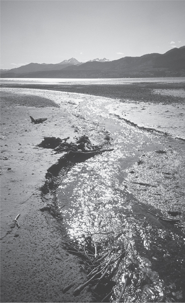
Boyce Creek cuts across mudflats as it flows into Hood Canal at Guillemot Cove.
ON THE TRAIL
A former private estate in a quiet corner of Hood Canal, Guillemot Cove is now one of the crown jewels of Kitsap County Parks. Managed as a nature preserve, it’s open to passive recreation. As surrounding shoreline continues to succumb to development, Guillemot Cove’s value as a refuge for wild critters and people seeking wildlands immensely appreciates.
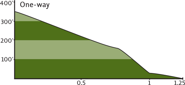
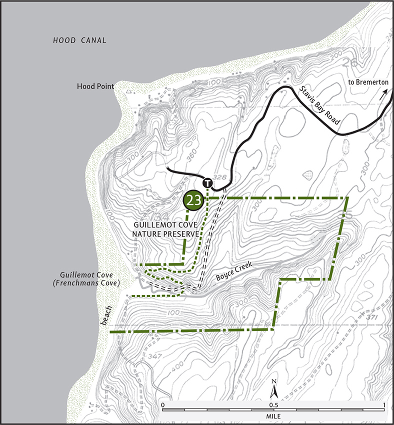
Before setting out, grab a map at the trailhead kiosk. On good tread and through mature forest the trail drops about 350 feet on its way to the quiet cove. Ignore side trails that veer left (they head to the access road), continuing on the signed Sawmill Trail. After passing through a beautiful flat of alders garnished with bouquets of ferns, the trail turns east. Now named the Margaret Trail, it drops sharply into a cool ravine shaded by cedar, hemlock, and the occasional yew.
After rounding a switchback, emerge in the heart of the old estate, 1 mile from the start. A decaying residence and barn grace the surrounding pasture. An information kiosk presents your hiking options. Best choice? Cross the Boyce Creek Bridge on the Beach House Trail. In 0.25 mile the old beach house appears and—no surprise here—so does the beach. And what a beach! The Brothers, perhaps the most identifiable of all Olympic peaks, tower directly above Hood Canal. Five hundred feet deep and a mile across, Hood Canal is Washington’s grand fjord.
At low tide Boyce Creek slithers across a muddy oyster bar. Scores of shorebirds scamper for succulent oyster shooters. Bald eagles sit watch on tall firs on the water’s edge. Explore the rocky and mucky beach, but be mindful of delicate critters exposed to your crushing feet at low tide. And while you’re enjoying this special place you may be thinking, “What’s a guillemot?” It’s a penguinlike seabird—and yes, they’re here.
EXTENDING YOUR TRIP
There are several more miles of hiking trails in the preserve. Try the 0.5-mile Ridge Trail or the 1-mile Maple Tree Trail for solitude. Children will enjoy the 0.25-mile trail to the cedar stump house, domicile to a desperado during the Depression.
 |
Green Mountain |


Maps: USGS Holly, USGS Wildcat Lake, state forest trail map available at trailhead; Contact: Department of Natural Resources, South Puget Sound Region, (360) 825-1631, southpuget.region@wadnr.gov, www.dnr.wa.gov; Notes: Discover Pass required; Trails are multiuse and open to motorized recreation; GPS: N 47 33.104, W 122 49.598
Climb the second-highest peak on the Kitsap Peninsula for good views of Puget Sound, the Seattle skyline, and Mount Rainier. Of course there are views of the Olympics too, and on the way down you’ll get a pretty darn good look at them. This is a working forest, but most of the way is shaded by a cool canopy of evergreens.
GETTING THERE
From Bremerton follow Kitsap Way (State Route 310) for 3 miles to Kitsap Lake. Turn left on Northlake Way, proceeding for 1 mile. Turn left onto the Seabeck Highway and follow it for 3 miles. Then turn left on Holly Road, proceeding for 3 miles. Turn left (south) onto Tahuya Lake Road and in 1.25 miles bear left onto Gold Creek Road. The trailhead is in 2 miles on your left. Privy available.
ON THE TRAIL
Along with neighboring Gold Mountain, Green Mountain makes up the rooftop of the Kitsap Peninsula. Granted, at a grand ol’ elevation of 1639 feet it isn’t exactly nosebleed-inducing. But Green offers enough relief above the surrounding low country—and sits right in the middle of the peninsula—to offer an eagle’s-eye view of a lot of saltwater and snowcapped mountains.
The good news is that Green Mountain is accessed by several well-maintained trails and is surrounded by over 6000 acres of state forest. The bad news is that the trails are open to motorcycles. Now, I don’t want to deny these users their rights to this piece of the public domain. I just would like to see a hiker’s-only route here among the miles of motorized trails. Being in Bremerton’s backyard and as one of the largest tracts of undeveloped land on the Kitsap Peninsula, Green Mountain is far more valuable than as a simple speedway for the throttle-inclined. Meanwhile, come here on a weekday for exhaust-free wandering. Let your mind wander too. Could Green someday become Bremerton’s Tiger Mountain?
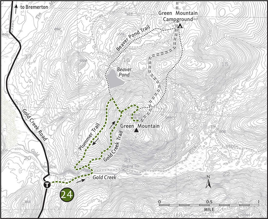
On the Gold Creek Trail, begin your hike in a recently cut area. Forested Green Mountain looms in front of you. In 0.4 mile enter cool forest along chattering Gold Creek. A few minutes later, cross the creek on a good bridge, then turn left at a junction. Shortly after, encounter another junction—on the left is the Plummer Trail, your return route. Hang a right, staying on the Gold Creek Trail.
Through a leathery dark-green understory of salal, bearberry, madrona, and rhododendron (visit in mid-May for the floral show), begin climbing. At 1 mile the trail splits (not shown on map). Either way works—they meet again soon enough. Limited views of the Olympics tease through the trees. At 1.5 miles reach a junction. The left (signed for Green Mountain Camp) is your return route. Continue right and in 0.25 mile come to another junction. Take the trail right, signed “Vista.” Follow it past the summit parking lot (only open weekends in the summer), and in 0.4 mile reach the summit.
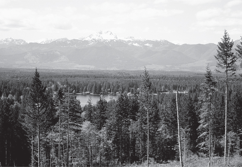
Excellent views of the Olympics can be had from the Plummer Trail.
Find a few picnic tables and a rocky overlook. The once-sweeping vista of the Olympics is being crowded out by new growth. (Call in the loggers! It is a working forest.) Views eastward over Bremerton, Puget Sound, and out to the Cascades remain decent though. The real treat, however, is on the return.
Retrace your steps 0.65 mile to the junction signed for Green Mountain Camp. This is the Beaver Pond Trail. Follow it for about 0.5 mile, dropping a few hundred feet to the junction with the Plummer Trail. The Beaver Pond (more a grassland than wetland) is to the right, about 0.25 mile farther. Take the Plummer Trail left to return. Built by the Backcountry Horsemen, it’s the best hiking trail on Green Mountain.
After 0.5 mile you’ll skirt a recent clear-cut. The view here of Lake Tahuya and the eastern Olympic front is absolutely awesome. Savor it—then continue another 0.5 mile back to the Gold Creek Trail. From this familiar junction it’s 0.5 mile back to your vehicle.
EXTENDING YOUR TRIP
Green Mountain can be hiked using the 4-mile Wildcat Trail, but it’s rocky and receives heavy ATV use. The Beaver Pond Trail extends for 3 miles and is a fairly quiet option for making a longer loop when combined with the Gold Creek Trail and 2 miles of the Wildcat Trail.
 |
Gazzam Lake and Close Beach |

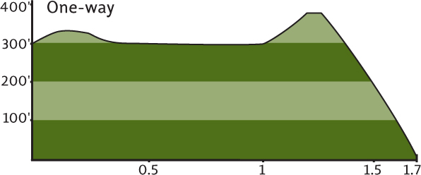
Map: USGS Bremerton East; Contact: Bainbridge Island Parks, (206) 842-2306, www.biparks.org/parks/gazzamlake.html; Notes: Dogs must be leashed; GPS: N 47 36.583, W 122 33.836
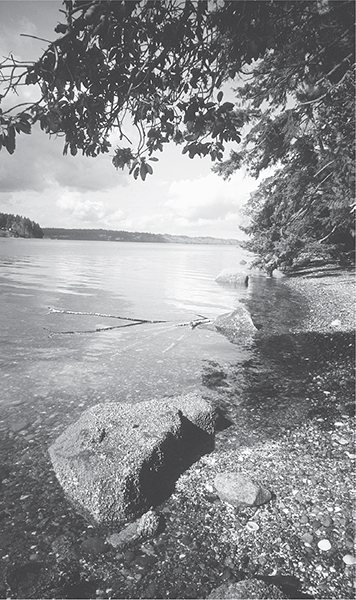
Quiet and remote Close Beach in Gazzam Lake Park
  |
Here’s one priceless piece of property on an island of million-dollar building lots. At nearly 400 acres, Gazzam Lake and Close Beach make up the second-largest undeveloped tract of land on Kitsap County’s Bainbridge Island. Managed as a natural preserve by the Bainbridge Island Parks Department, it’s a prime hiking spot in heavily populated Puget Sound. |
GETTING THERE
From the Bainbridge ferry terminal proceed north on State Route 305 for 0.25 mile, turning left (west) at the first traffic light onto Winslow Way. Continue for 0.5 mile through a business district. Turn right (north) onto Grow Avenue, and in 0.3 mile at a four-way stop turn left (west) onto Wyatt Way. In 0.6 mile Wyatt Way turns left and becomes Eagle Harbor Drive. In 0.3 mile bear right onto Bucklin Hill Road. In another 0.3 mile bear right, and in 0.2 mile bear left onto Lynwood Center Road. Continue for 1 mile and turn right (west) onto Baker Hill Road. In 0.8 mile turn right (north) onto gravel Deerpath Lane (signed “Gazzam Lake”). Proceed for 0.2 mile to the southernmost trailhead. (A northern trailhead is closer to the lake and beach; continue on Bucklin Hill Road, Vincent Road, and then Marshall Road to reach it.)
ON THE TRAIL
This is not the shortest way to Gazzam Lake. It can easily be reached by a 0.25 mile hike from the northern Marshall Road trailhead. But hey, we’re here to hike! Start by heading down the gated dirt road to two rather unattractive water towers and then through a scrappy patch of invasive species. Just wait—in 0.25 mile it gets better when you enter healthy forest. Now on good trail, encounter a junction. Take the right path for a slightly longer hike, or veer left to get right to the point. At 0.6 mile (0.8 if you went right) the trails meet back up.
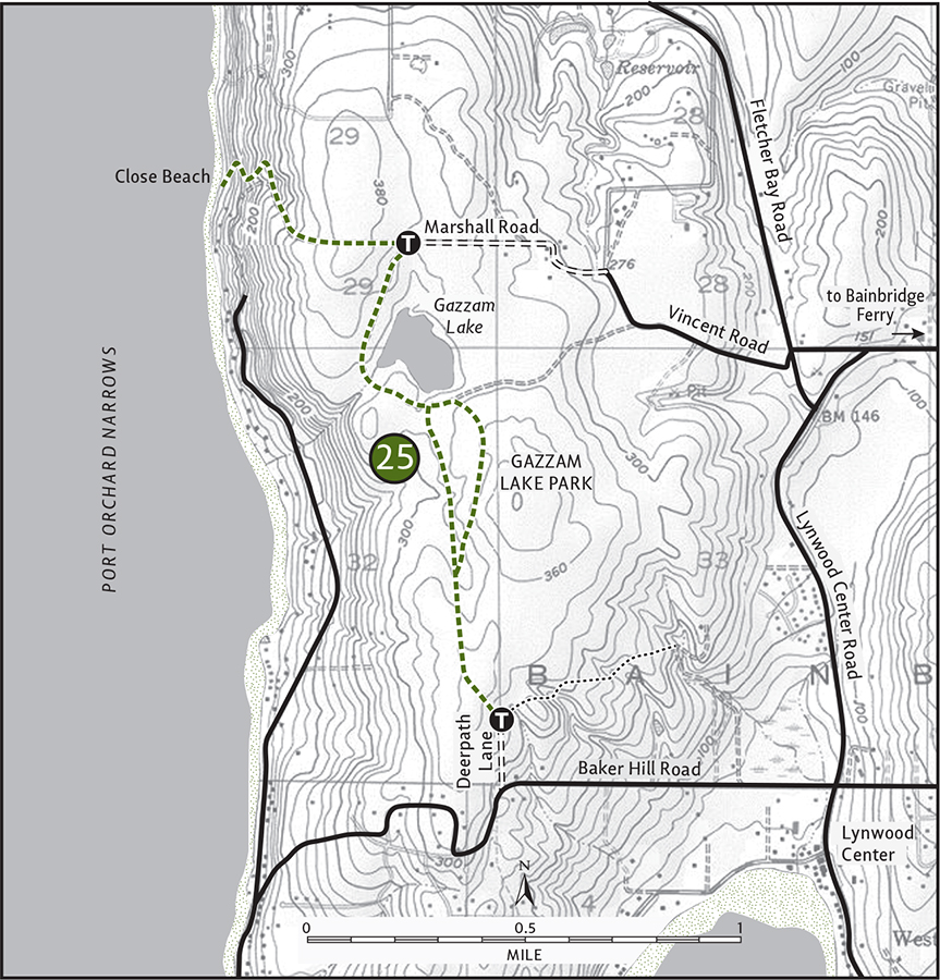
Through a nice forest of cedar and maple, approach Gazzam Lake. Spur paths lead down to the wooded shore. At 1 mile the best of them leads to a small open area complete with a bench. Watch for buffleheads, cormorants, and eagles among the avian residents of this 14-acre lake.
Leave the lake and head north for about 0.1 mile, coming to a junction. The trail right leads to the Marshall Road trailhead. Head left for the best part of this hike. Crest a small hill and begin a steep descent. After 0.6 mile arrive beneath a canopy of big firs to a secluded little beach on Port Orchard Narrows. Pull out your lunch, plop down on a log, and enjoy the sweet smell of salt air along with views of the Kitsap Peninsula and the Olympic Mountains rising behind.
Thanks to the Bainbridge Island Land Trust, $2.5 million was raised to purchase this 550 feet of shoreline and 64 acres of upland, adding it to Gazzam Lake Park. Hikers are sure to get many returns on this wise investment!
EXTENDING YOUR TRIP
From the southern trailhead you can follow Peters Trail northeast for 0.5 mile through a greenbelt of cedars and firs. The Grand Forest, a Bainbridge Island park located a few miles to the north, has several miles of good trails traversing its 240 acres.
 |
Hansville Greenway |


Maps: USGS Hansville, trail map available at meadow kiosk; Contact: Kitsap County Parks, (360) 337-5350, www.kitsapgov.com/parks/regionalparks/hansville_greenways_county_park.htm; Notes: Dogs must be leashed; GPS: N 47 54.529, W 122 33.381
  |
Hike on an old logging railbed through an emerging greenbelt on the northern tip of the Kitsap Peninsula. Lakes, bogs, and wildlife observation platforms await you. A good network of trails allows for plenty of options in this quiet park. |
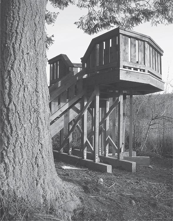
Wildlife observation deck on the Hansville Greenway
GETTING THERE
From Poulsbo take State Route 307 northeast to SR 104. Continue east on SR 104 for 1.5 miles to a four-way intersection and traffic light. (From Kingston follow SR 104 west for 2.5 miles.) Turn left (north) on Hansville Road, driving 7.5 miles. Turn left (west) on Buck Lake Road (signed for Buck Lake County Park and Hansville Community Center). Proceed for 0.8 mile, passing boat launch access in Buck Lake County Park. The trailhead is located in the southwest corner of a ball field. Water and restrooms available, except in winter.
ON THE TRAIL
Here’s what can happen when concerned local citizens come together to work with a governing agency toward a common conservation goal: the Hansville Greenway. Back in the 1990s the Hansville Greenway Association along with Kitsap County Parks began acquiring land for a nature preserve in the relatively undeveloped northern reaches of the peninsula. By 2009 they had preserved 265 acres and built 4 miles of trail. Having recently secured grant monies, these managing bodies are working on doubling the size of the preserve and trail system.
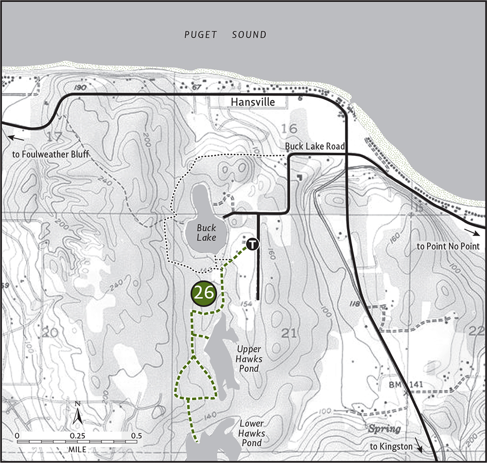
Meanwhile, there’s plenty of ground to explore. Start by heading through the Welcome Wood to the meadow kiosk (at 0.3 mile). Head south through Otter Meadow and continue under stately firs, passing the Muskrat Swamp. Come to a trail junction at Alder Hollow (at 0.6 mile). Turn left (south) on a wide trail on what was once part of a narrow-gauge logging railway built in the 1920s and now part of the Sid Knutson Puget Sound to Hood Canal Trail.
Come to a junction (at 0.7 mile). The trail left leads for 0.3 mile to a planked resting area overlooking Upper Hawks Pond (actually more of a swamp), affectionately called Quiet Place. Continue south on the railroad trail to another junction (at 0.8 mile). Head left, skirting wetlands and traversing pleasant woods to arrive at yet another trail junction (at 1.3 miles). Turn left and head 0.25 mile to Lower Hawk’s Pond. Here at another trail junction you’ll find a beautiful elevated wooden observation platform perfect for scoping this eutrophic waterway. In addition to the myriad of birds that live in and along this nutrient-rich body of water, look for bear, coyotes, and deer.
Return to the main trail and take a left. Shortly after, come to a junction. The trail left leaves the preserve; bear right instead and within 0.25 mile come to the railroad trail again. Turn left and retrace your steps back to the trailhead.
EXTENDING YOUR TRIP
From the meadow kiosk to Bear Meadow Vista on Buck Lake is 1 mile. You can continue from the meadow another 0.7 mile to the community of Hansville. Nearby Point No Point County Park and Foulweather Bluff Nature Conservancy Preserve have nice, albeit short, hiking trails through gorgeous coastal settings.