southwestern washington
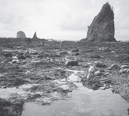
Sea stacks and tide pools south of Cape Alava
Olympic Coast
Majestic sea stacks, secluded coves, deserted strands of smooth sandy beaches, contorted salt-sprayed maritime forests, and tidal pools bursting with urchins, starfish, limpets, barnacles, and all kinds of squishy and crunchy sea critters—this is what you can expect to find while hiking along the Olympic Peninsula’s coast.
The Olympic Coast mostly remains roadless and isolated, with the wildest beaches remaining in the continental United States. And while good portions of this wild, windswept, and rain-drenched world require tenacity and determination to visit, a surprisingly good amount of this country is relatively accessible. Even along the coast’s southern limits—the only area where a road runs parallel to this beautiful land teetering on the far northwest edge of the Pacific Northwest—the feeling is still of remoteness from the civilized world.
Nowhere along these pristine beaches that sport sea and river otters, oystercatchers and bald eagles, grey whales and sea lions, guillemots, puffins, murrelets and murres will you ever have to share the way with cars, trucks, and SUVs—mechanized menaces still permitted to mar the beaches farther south. But it almost didn’t turn out so well for the Olympic Coast. A coastal highway, oil drilling, and surfside development nearly wreaked havoc on this sacred land of the Makahs, Quileutes, Hohs, and Quinaults. Most of the coastal strip wasn’t added to Olympic National Park until 1953, and Shi Shi Beach only joined the protected ranks in 1977 after officials had to evict back-to-the-earth squatters who left plenty of traces.
From Kalaloch’s miracle strand of broad sandy beaches to Cape Flattery’s towering cliffs over tumultuous currents, there’s plenty of good hiking to be had in Washington’s wild northwestern corner.
 |
Kalaloch-Browns Point |


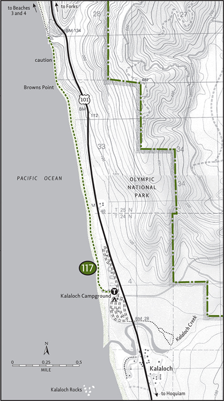
Maps: Green Trails La Push No. 163S, Custom Correct South Olympic Coast; Contact: Olympic National Park, Wilderness Information Center, (360) 565-3100, www.nps.gov/olym; Notes: Dogs must be leashed. Browns Point can only be rounded during low tides, consult tide chart; GPS: N 47 36.771, W 124 22.570
   |
The wide sandy beaches of Kalaloch are the perfect introduction to the wild Olympic Coast. Although the highway is never far, towering bluffs and hidden coves give this area a remote feeling. Perfect for children and Rover too (dogs are allowed on these beaches, but they must be leashed), spend days exploring this area’s extensive tide pools and headlands. The hike to Browns Point, a jumbled collection of rock islands and surf-splashed cliffs, makes a fine half-day objective. |
GETTING THERE
From Hoquiam follow US 101 north for 70 miles to Kalaloch. (From Forks travel 34 miles south on US 101.) Turn left (west) into Kalaloch Campground (just beyond the lodge and ranger station), and park in the picnic day-use area. Water and restrooms available.
ON THE TRAIL
From the picnic area bluff descend 25 feet, hopping over a tangled pile of drift logs to reach the beach, and then head north on the wide and smooth expanse of sandy shoreline. Throughout most of the summer a shroud of fog impairs the view. But on clear fall and spring days you can see all the way to Hoh Head on the northern horizon. Destruction Island, a 60-acre barren outpost over 3 miles from shore, can also be seen when the skies are clear. Uninhabited, it’s one the Pacific Coast’s most important seabird colonies.
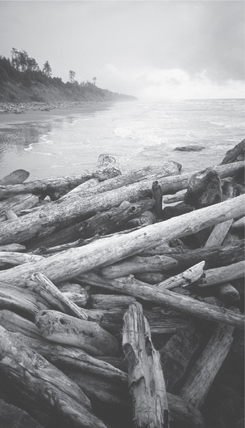
Beached logs at Browns Point–Kalaloch Beach
In 1 mile high grassy bluffs rising to your right increase the feeling of remoteness. At 1.6 miles a series of ledges and cliffs encroaches upon the surf. If the tide is high, this is as far as you can safely go. Turn around and enjoy the beaches south of the Kalaloch Campground.
But if the tide is low, work your way over, around, and even through (there’s a small sandstone arch, look for it) the rocks and ledges making up Browns Point. Explore tidal pools and cliffside caves. Admire orange and purple starfishes tightly cemented to barnacle-clad rocks. Peer down at spongy urchins and other sea critters in nature’s little saltwater baths. But remember, the intertidal zone is a fragile ecosystem. Please don’t remove or disturb its inhabitants. That’s the job for raucous oystercatchers in search of tasty morsels.
Come to the other side of Browns Point at 2 miles. Beyond, Beaches 3 and 4 offer more wide sandy stretches. Don’t forget to check your tide chart for the return if you decide to go farther.
EXTENDING YOUR TRIP
Pitch your tent at Kalaloch, one of just a few oceanside campgrounds in the state. Hike the delightful 1-mile Kalaloch Creek Loop Trail or explore more beaches. North of Browns Point, you can hike 4 miles to Ruby Beach (Hike 118). South of Kalaloch, over 3 miles of sandy shoreline await your footprints.
 |
Ruby Beach |

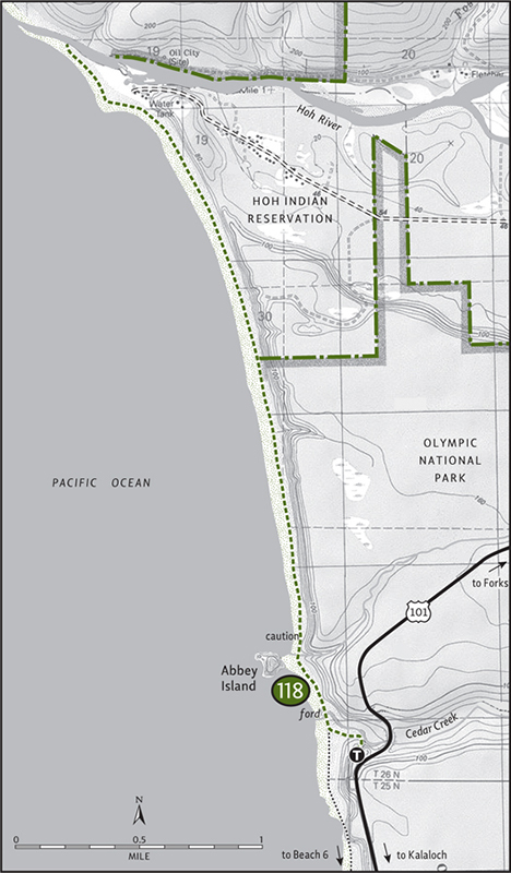
Maps: Green Trails La Push No. 163S, Custom Correct South Olympic Coast; Contact: Olympic National Park, Wilderness Information Center, (360) 565-3100, www.nps.gov/olym; Notes: Dogs must be leashed. Consult tide chart before hiking beach; GPS: N 47 42.591, W 124 24.816
   |
Consider Ruby Beach to be Olympic wilderness coast lite. You’ll get the same great wilderness taste as Cape Alava, Shi Shi Beach, and Third Beach, but for a lot less calories. The hike to Ruby Beach is a mere 0.25 mile, but it’s a glorious 0.25 mile. Through a wind-blasted maritime forest, follow a well-groomed trail lined with salt-sprayed shrubs to the mighty Pacific. Emerge behind a barrier of surf-tossed logs and consider your options: south to Beach 6 or 3 lonely miles north to the mouth of the Hoh River. |
GETTING THERE
From Hoquiam follow US 101 north for 77 miles, 7 miles beyond Kalaloch. (From Forks travel 27 miles south on US 101.) Turn left (west; signed “Ruby Beach”) and proceed 0.1 mile to a large parking area and the trailhead. Privy available.
ON THE TRAIL
Make the 0.25-mile jaunt to the sea. Most hikers might be content right where the short trail meets the sea. They’ll wander a bit and photograph the contorted sea stacks that greet them. Perhaps they’ll comb the beach looking for treasure or try to capture the beauty of offshore Abbey Island on a memory card, whiling away the afternoon at this spectacular spot. But if the tide’s low and your ambitions are high, consider hiking north for nearly 3 miles to the mouth of the Hoh River.
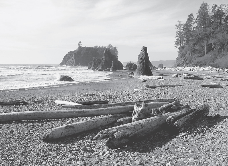
Ruby Beach—Abbey Island in background
Check your tide chart. You’ll need a low one to rock-hop across Cedar Creek and to safely round the small headland just north of it. After that it’s an easy, straightforward hike to the mouth of one of the peninsula’s most famous rivers. On a wide sandy beach beneath bluffs rising 150 feet, hike all the way to where the rain- and glacier-fed Hoh River empties into the world’s largest ocean.
En route you’re sure to see bald eagles perched in high snags hanging precariously above the eroding bluffs. You may even encounter a deer or two out on the deserted beach. At the river you’re likely to meet anglers in pursuit of a prize salmon.
Spend some time exploring the mouth of the river (which lies within the small Hoh Indian Reservation), and then plan for your return. Don’t forget about the tides. Let Abbey Island act like a beacon to guide you back to Ruby Beach. Early settlers to the area thought that the imposing block of an island resembled a cathedral, hence the name. Whether the island looks like a house of worship to you, like an abbey this island and coastline are indeed sacred. And despite easy access, Ruby Beach is as beautiful and wild as any of the Olympic Peninsula’s famed wilderness beaches.
EXTENDING YOUR TRIP
During a low tide you can hike south to Beach 6. Look for small caves carved into the steep bluffs lining the beach.
 |
Second Beach |

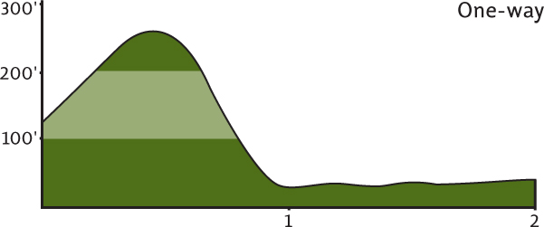
Maps: Green Trails La Push No. 163S, Custom Correct South Olympic Coast; Contact: Olympic National Park, Wilderness Information Center, (360)565-3100,www.nps.gov/olym; Notes: Dogs prohibited; Trailhead frequently targeted by car prowlers (see Trailhead Concerns, page 39); GPS: N 47 53.890, W 124 37.429
  |
Just south of the village of La Push are three Olympic Coast charms: First, Second, and Third Beaches. Each one is sandy and broad and hemmed in by dramatic bluffs and headlands. And while they’re in close proximity to each other, you can’t hike from one to the next because those headlands block the way. With roadside access, First Beach is the easiest to get to and so can be crowded. Third Beach requires a 1.2-mile slog down a forested trail. But Second Beach is just right: a hike just long enough to discourage crowds, yet short enough to encourage all who want to see this beautiful beach. |
GETTING THERE
From Port Angeles follow US 101 west for 55 miles to the junction with State Route 110 (signed “Mora–La Push”). (From Forks the junction is 2 miles north.) Continue west on SR 110. In 7.7 miles at Quillayute Prairie, SR 110 splits. Take the left fork (La Push Road), and drive 5.2 miles to the trailhead, located on the south side of the road (you’ll pass the Third Beach/Hike 120 trailhead and the Quileute tribal office).
ON THE TRAIL
Well-constructed and well-maintained, the trail starts on the Quileute Indian Reservation. Immediately cross a small creek lined with imposing Sitka spruce before beginning a short climb. At the height of the land enter Olympic National Park, and then begin a short, steep descent to the beach, the distant surf growing louder with each step you take. Soon, start catching glimpses of offshore sea stacks through the surrounding towering spruce. Before you know it, emerge on the log-lined shore. Take a deep breath. The beauty of this place just may leave you short of breath.
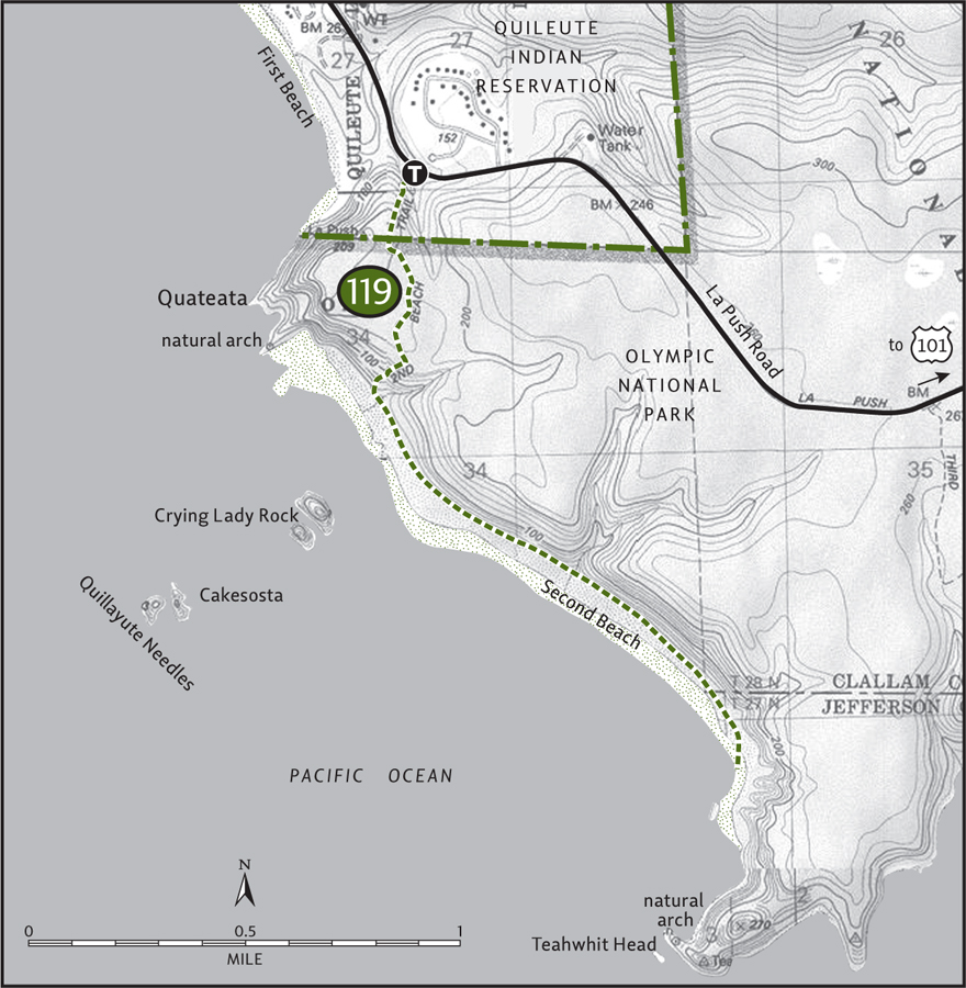
You can hike a short distance along the beach northward. Do it, for it’ll lead you to a natural arch. But to really stretch your legs and get the most out of Second Beach, head south. Over 1 mile of sandy beach awaits your footprints.
Immediately offshore is a consortium of battered islets and sea stacks known as the Quillayute Needles. Crying Lady Rock is the largest of the batch. These forbidding landmarks are part of the Quillayute Needles National Wildlife Refuge. Inhospitable to humans, they’re productive breeding grounds to thousands of seabirds, oystercatchers, murres, gulls, petrels, cormorants, and auklets among them.
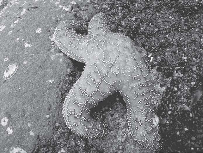
Starfish on tidal rocks at Second Beach
Continue wandering. Taste the salty spray coming off the crashing breakers. Eventually you’ll come to an impasse, the headland named Teahwhit Head. But before you turn around and retrace your steps, scan the rugged bluff. Teahwhit Head is also graced with a natural arch. In retrospect you may conclude that with two arches, an awesome seascape, scores of pelagic birds, and an inviting sandy shoreline, Second Beach is second to none.
 |
Third Beach |


Maps: Green Trails La Push No. 163S, Custom Correct South Olympic Coast; Contact: Olympic National Park, Wilderness Information Center, (360) 565-3100, www.nps.gov/olym; Notes: Dogs prohibited; GPS: N 47 53.435, W 124 35.941
  |
An easy hike to one of the Olympic Coast’s famed wilderness beaches. Walk the wide sandy beach to the foot of a waterfall tumbling from a towering bluff right into the crashing surf. Feeling more energetic? Leave the crowds behind by grunting over Taylor Point to a secluded beach flanked by steep sea stacks and flower pot islands. |
GETTING THERE
From Port Angeles follow US 101 west for 55 miles to the junction with State Route 110 (signed “Mora–La Push”). (From Forks the junction is 2 miles north.) Continue west on SR 110. In 7.7 miles at Quillayute Prairie, SR 110 splits. Take the left fork (La Push Road) and proceed 3.8 miles to the trailhead, located on the south side of the road. Privy available.
ON THE TRAIL
Start off on an old road through a scrappy forest of Sitka spruce, hemlock, and alder. The trail has been greatly improved over the last decade. No longer are you at risk of being swallowed by a mud hole on the way to Third Beach. After 0.5 mile the trail veers left, leaving the old road and entering a more attractive forest.
Continue walking and soon you’ll hear the surf and taste the salty air. Begin a slow descent, and after 1.3 miles of hiking, voilà—the beach! Hemmed in by two imposing headlands, Teahwhit Head and Taylor Point, Third Beach extends for about a mile along Strawberry Bay. Hard to imagine that this wild sweep of coastline was once explored for oil. Luckily for the integrity of the environment and for us hikers, the drillings never proved abundant or profitable.
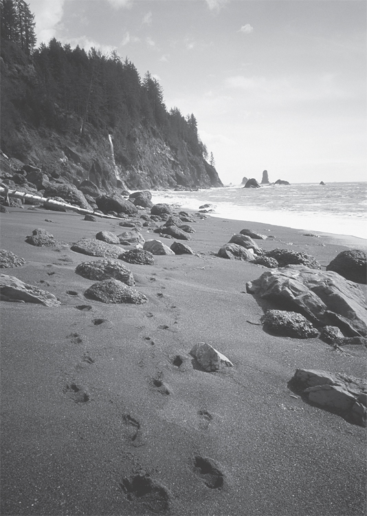
Footprints in the sand at Third Beach—waterfall on Taylor Point in the background
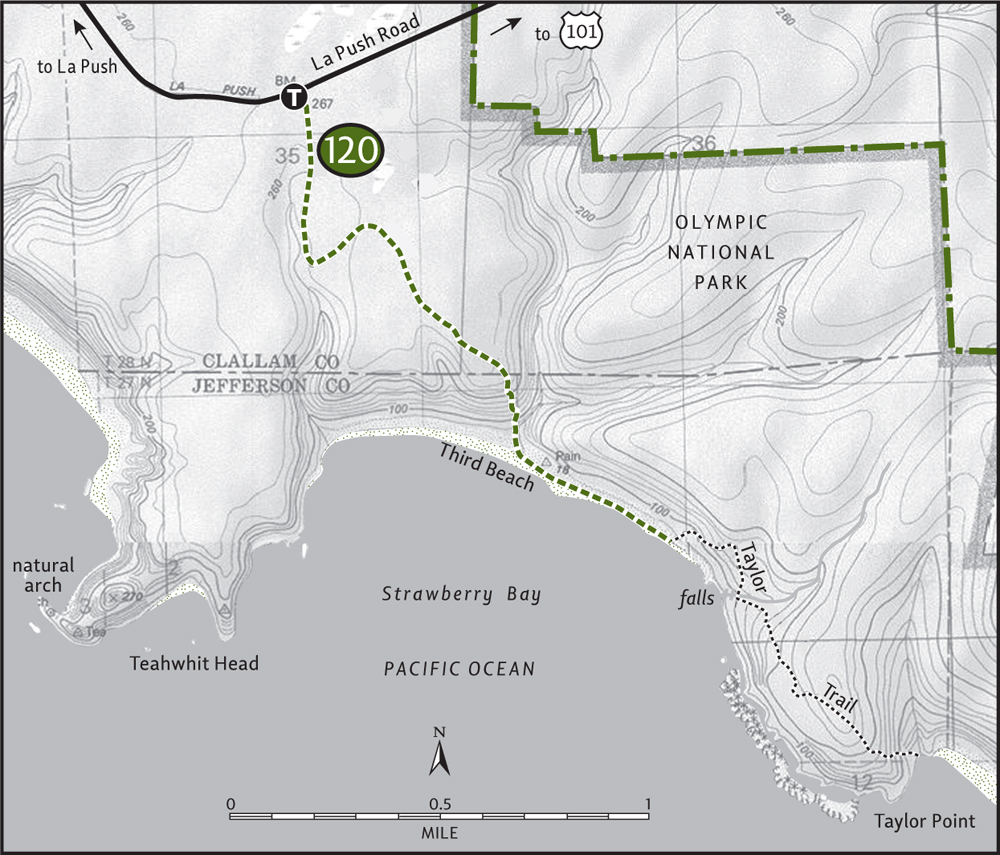
If you care to escape Third Beach’s frequent crowds, hike left (south) 0.5 mile toward the overland trail to admire a waterfall plunging from its heights straight into the pounding waves below.
EXTENDING YOUR TRIP
To see some really spectacular maritime scenery, head over Taylor Point via the overland trail. Sand ladders and ankle-twisting terrain climb 250 feet up and over the imposing headland. Travel through a grove of old-growth Sitka spruce before making a steep descent back to sea level. After 1.75 difficult miles of overland travel, a quiet and secluded beach is your reward. To go farther requires planning for tides. Find a smooth drift log and savor the surrounding sea.
 |
Hole-in-the-Wall |
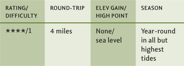

Maps: Green Trails Ozette No. 130S, Custom Correct North Olympic Coast; Contact: Olympic National Park, Wilderness Information Center, (360) 565-3100, www.nps.gov/olym; Notes: Dogs must be leashed, prohibited beyond Ellen Creek. Exploration of Hole-in-the-Wall is only possible at low tide, consult tide chart; GPS: N 47 55.269, W 124 38.291
  |
Hike to a real hole in the wall of a place: a genuine natural sea arch carved by surf and wind in an out-of-the-way section of the wild Olympic Coast. And while the Hole-in-the-Wall is an outstandingly beautiful place, the hike there via Rialto Beach doesn’t exactly suffer from a dearth of spectacular scenery. Flanked by sea stacks, lined with giant logs, windswept and strewn with cobblestones, Rialto has all the makings of an Olympic wilderness beach. But unlike its wild counterparts, you don’t have to hike very far to get here. The beautiful beach begins right from the parking lot. |
GETTING THERE
From Port Angeles follow US 101 west for 55 miles to the junction with State Route 110 (signed “Mora–La Push”). (From Forks the junction is 2 miles north.) Continue west on SR 110. In 7.7 miles at Quillayute Prairie, SR 110 splits. Take the right fork (Mora Road), proceeding 5 miles to the road’s end and the trailhead. Water and restrooms available.
ON THE TRAIL
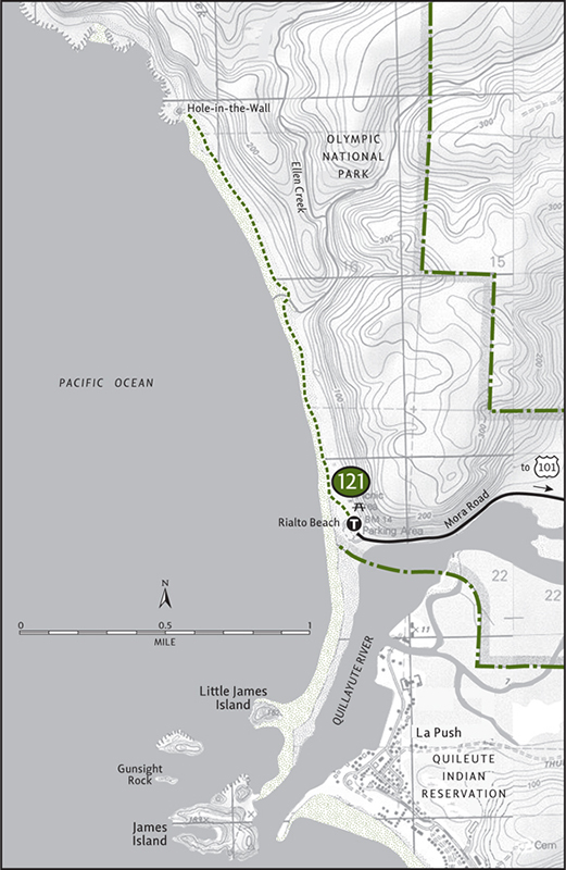
Rialto Beach stretches northward from the Quillayute River for over 3 miles. From the parking lot it’s a 2-mile hike to the beach’s northern boundary at Hole-in-the-Wall. This dramatic sea arch can only be hiked through during low tides. However, the beach can be hiked during almost any tide. But before you bound across the surf-blasted beach, gaze seaward out to high-bluffed, forest-capped James Island. Guarding the mouth of the Quillayute like a sentinel, for centuries this island acted as a natural fortress, protecting the Quileute people from northern invaders.
Begin your hike northward across Rialto Beach. Like a giant split-rail fence, surf-battered logs line the beach. Admire their symmetry, but never climb on them during high tides; a wave can easily jostle them loose, trapping and endangering you.
A salt-blasted maritime forest rises behind the rows of downed timber. Look for eagles perched in the higher trees. Along the gently sloping beach, listen for the ringing crik-crik-crik of the black oystercatcher. Watch the swelling surf for guillemots, scoters, grebes, and harlequin ducks. Don’t forget to admire the scenery too. Sculpted sea stacks, shelved ledges, and battered offshore islands will keep you oohing and aahing.
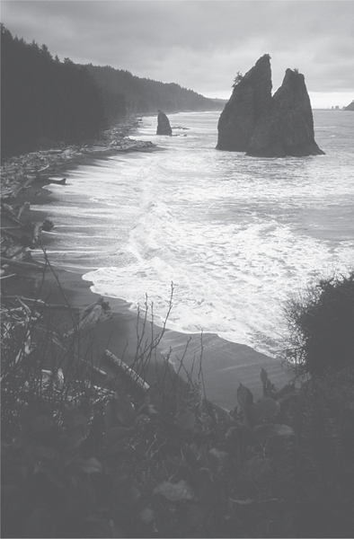
Rialto Beach from Hole-in-the-Wall
At 1 mile you’ll come to Ellen Creek, the end of the line for four-legged beach hikers. Crossing Ellen Creek may be tricky. Look for a log, or take your boots off and plod through the tannic and chilled waters. Hole-in-the-Wall, now coming nicely into view, lies 1 mile farther.
Once you hit the Hole-in-the-Wall, if the tide is out stroll through it for a whole new meaning to barrier-free hiking. Comb the adjacent tidal pools. Hike up the short overland trail that guarantees passage around this landform if the tide is in. The view of Rialto from the crest of the bluff is a classic, endlessly replicated in murals, photos, and memories.
EXTENDING YOUR TRIP
The Chilean Memorial, which lies about 2.25 miles farther, makes for a good all-day beach hike. Be sure to carry and consult a tide chart, though, for two spots are impassable in high tides and you don’t want to be trapped.
 |
Quillayute River Slough |

Maps: Green Trails La Push No. 163S, Custom Correct South Olympic Coast; Contact: Olympic National Park, Wilderness Information Center, (360) 565-3100, www.nps.gov/olym; Notes: Dogs prohibited; GPS: N 47 55.089, W 124 36.160
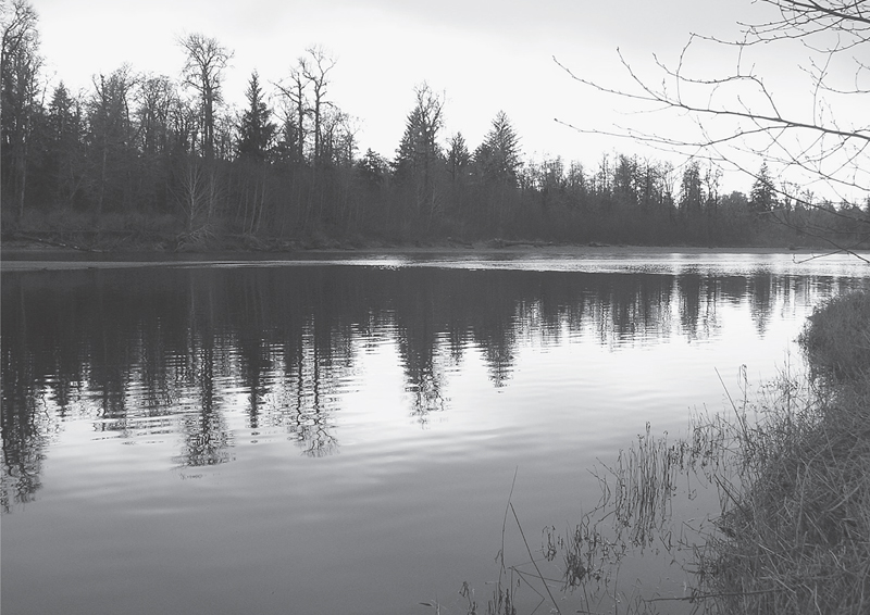
Evening along the Quillayute River
 |
A quiet trail from a popular campground along a rainforest river lined with giant spruce. Hike this trail early in the morning or late in the evening for wildlife-and bird-watching. The Quillayute River is famous for its steelhead and salmon fishing, so you may want to consider bringing your fishing pole along as well. |
GETTING THERE
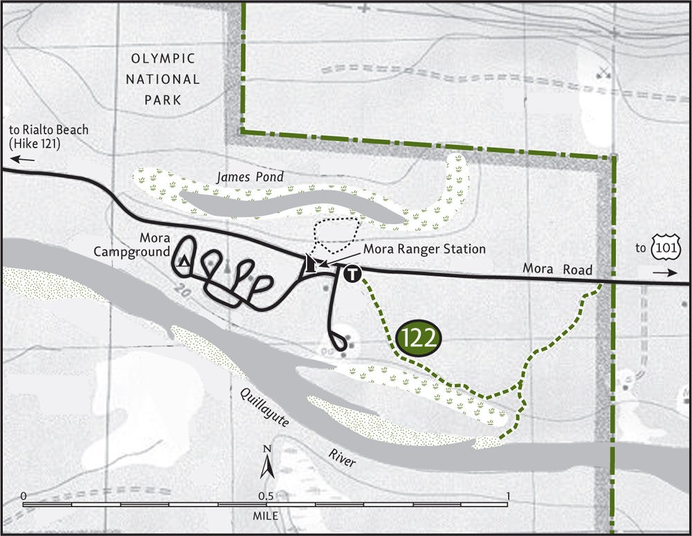
From Port Angeles follow US 101 west for 55 miles to the junction with State Route 110 (signed “Mora–La Push”). (From Forks the junction is 2 miles north.) Continue west on SR 110. In 7.7 miles at Quillayute Prairie, SR 110 splits. Take the right fork (Mora Road), proceeding 3.3 miles to the Mora Ranger Station. Park here. The trailhead is located on the east side of the parking lot.
ON THE TRAIL
Mora Campground is a great place to car-camp for exploring nearby Rialto Beach. But it’s not necessary to venture too far from your site, as the Quillayute River Slough Trail originates from the campground itself. Many hikers ignore it or miss it—all the better for quiet ramblings.
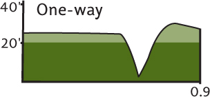
The trail starts out flat and gentle through a forest of scaly-barked spruce carpeted with mosses. Look for large burls on some of the big trees. After about 0.25 mile the trail crests a small ridge above one of the many sloughs along the Quillayute. Formed by three main rainforest rivers—the Bogachiel, Sol Duc, and Calawah—the Quillayute snakes and oxbows to the Pacific at La Push. The river takes on an almost southern appearance of a lazy waterway cutting through lush bottomlands.
At 0.5 mile you’ll come to a junction. The trail right leads a short distance to the slough, along the way passing a massive old Sitka spruce. The trail left leads 0.3 mile to Mora Road at the national park boundary. Hike them both before returning to the campground. Take your time, however, enjoying the natural riches of this productive environment.
EXTENDING YOUR TRIP
Also originating from the Mora Campground is the James Pond Trail. This short 0.5-mile loop leads to an oxbow pond surrounded by lush vegetation. Ducks, herons, and eagles are frequently observed at this peaceful body of water.
 |
Ozette Triangle |


Maps: Green Trails Ozette No. 130S, Custom Correct Ozette Beach Loop; Contact: Olympic National Park, Wilderness Information Center, (360) 565-3100, www.nps.gov/olym; Notes: National park entry fee required. Dogs prohibited. Coastal section can be difficult during high tides, consult tide chart; GPS: N 48 09.642, W 124. 43.890
 |
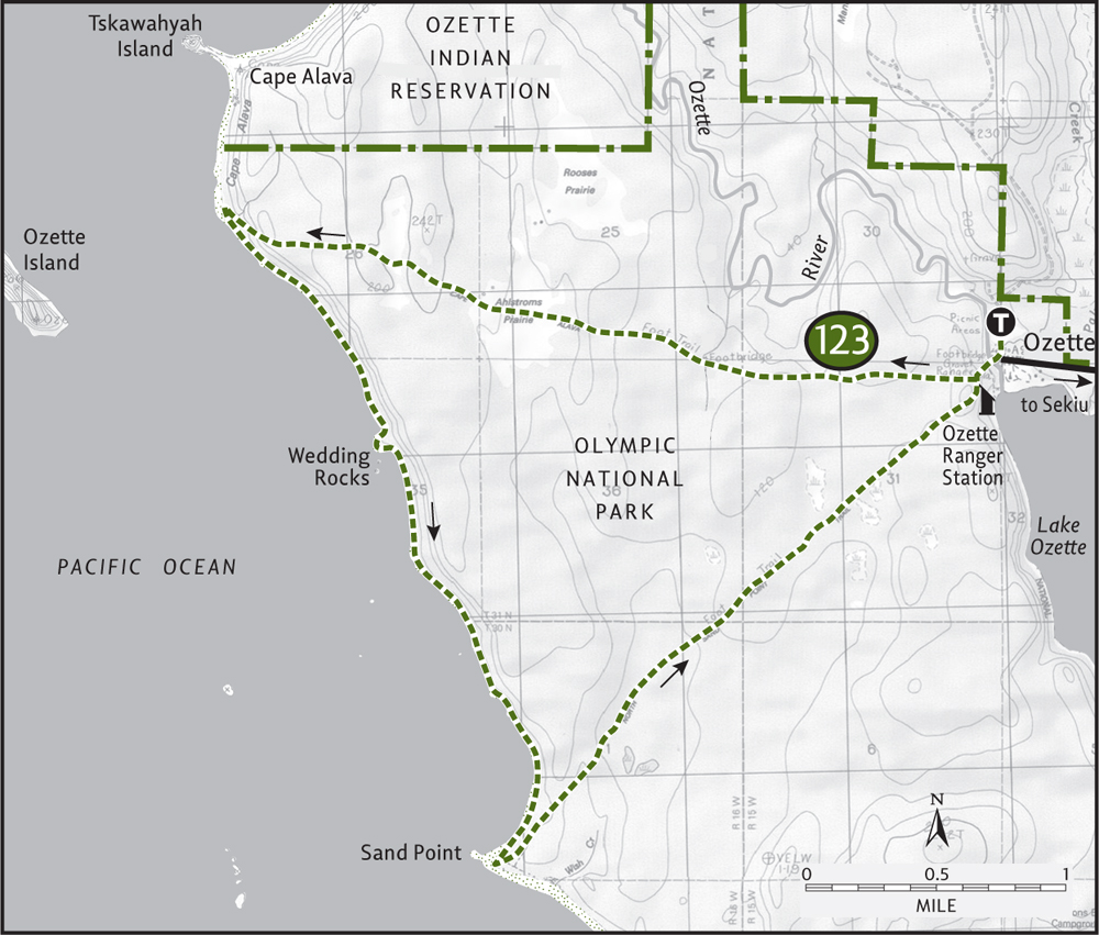
With sea stacks, sea otters, sea lions, and ocean scenery for as far as you can see, the 9.4-mile Ozette Triangle is one of the finest hikes on the Olympic Coast. Easily accessible and a loop hike, the Triangle (named for the loop’s shape) is a perfect introduction to America’s wildest coastline south of Alaska. You won’t be alone on this section of wilderness beach, however, for Ozette’s admirers are legion. But there’s plenty of room, and if you venture this way on a winter weekday you might just find yourself alone with the harlequin ducks. |
GETTING THERE
From Port Angeles follow US 101 west for 5 miles to the junction with State Route 112. Turn right (west) on SR 112, continuing for 46 miles to the community of Sekiu. (Alternatively, take US 101 to Sappho and drive SR 113 north to SR 112 and then on to Sekiu. This way is longer, but not as curvy.) Drive 2.5 miles beyond Sekiu and turn left onto the Hoko-Ozette Road. Follow this paved road for 21 miles to the Ozette Ranger Station and trailhead. Water and restrooms available.
ON THE TRAIL
From Lake Ozette, one of the largest natural bodies of freshwater in the state, the loop begins its 3.3-mile journey to the sea. Cross the lazy and brackish Ozette River on an arched bridge, coming to a junction in 0.25 mile. Take the trail right (the left trail is your return route), proceeding through a thick forest of western cedar and Sitka spruce. Most of the way is via a cedar-planked boardwalk, convenient for traversing the saturated terrain but slippery during periods of rain. The Park Service has been replacing sections of boardwalk with elevated tread, making for some non-slippery trail sections.
Continue through lush maritime forests drenched in sea mist. Towering ferns line the elevated path, and in early spring the boardwalk is lined with thousands of nature’s lanterns: blossoming skunk cabbage. At 2.25 miles pass through Ahlstroms Prairie, an early homestead site long-since reclaimed by the dense greenery that thrives in this waterlogged climate.
Raucous gulls and the sound of crashing surf announce that the ocean is nearing, and at 3.3 miles a slight descent delivers you to the wild beaches of Cape Alava. Now for real fun! Turn south and follow the shoreline for 3.1 adventurous miles. Look out to offshore islands. Search the ocean waters for seals, whales, and scores of pelagic birds. Look in tidal pools for semisubmerged starfish tenaciously clinging to barnacle-encrusted walls. Look for oystercatchers cruising down the aisles of this open fish market. Look up in the towering trees hugging the shoreline for perched eagles.
Search for Makah petroglyphs etched into the Wedding Rocks, a cluster of shore-hugging boulders about halfway along the coast. Respect these historic and sacred artifacts, which predate European settlement in the Northwest. If the tide is low, continue along the surf. If it is high, use the steep but short trails (signed) that bound over rough headlands. Continue on wide beach and approach another spot that may require a detour if the surf is high.
At 3 miles from Cape Alava and after 6.3 miles of hiking, you’ll arrive at Sand Point. Over 2 glorious miles of some of the finest sandy beaches in all of Washington extend south from this point.
When you must relinquish this heavenly environment back to its rightful owners—the seals, oystercatchers, otters, and sanderlings—return to Lake Ozette via another 3-mile-long boardwalk trail through expansive cedar bogs and under a dense canopy of majestic Sitka spruce. The sound of the surf slowly fades in the distance, but the Ozette Triangle will chime in your memories for quite some time.
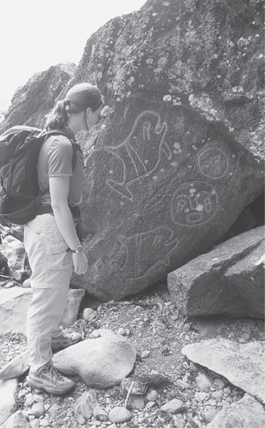
A hiker inspects the petroglyphs at the Wedding Rocks on the Ozette Triangle Hike.
EXTENDING YOUR TRIP
The Park Service maintains a small and attractive car campground at Lake Ozette, convenient for exploring area trails. North of Cape Alava, 2 miles of wide, sandy, and scenic beach can be explored to the Ozette River. Fording the river can be extremely dangerous. Please stay off of Tskawahyah Island, a sacred spot for the Makah people. The area across from the island was once the site of a flourishing Makah village. Artifacts from it are on display in the Tribal Museum in Neah Bay.
 |
Shi Shi Beach and Point of the Arches |


Maps: Green Trails Cape Flattery No. 98S, Custom Correct North Olympic Coast; Contact: Olympic National Park, Wilderness Information Center, (360) 565-3100, www.nps.gov/olym; Notes: Dogs prohibited. Makah Recreation Pass required, available at Washburn’s General Store in Neah Bay. Point of Arches is inaccessible at high tide, consult tide chart; GPS: N 48 17.623, W 124 39.905
 |
Revered through the ages, Shi Shi Beach has its share of disciples, from First Peoples to first-time visitors, naturalists, bird-watchers, hard-core hikers, beach bums, conservationists, politicians, and just plain ordinary folk. And Northwest hikers have consistently rated Shi Shi as one of the region’s most beautiful beaches. Though this natural gem’s history has had a few blemishes, including access issues, thankfully many of those problems have been washed out to sea. |
GETTING THERE
From Port Angeles follow US 101 west for 5 miles to the junction with State Route 112. Turn right (west) on SR 112, continuing for 64 miles to the community of Neah Bay. (Alternatively, take US 101 to Sappho and drive SR 113 north to SR 112 and then on to Neah Bay. This way is longer, but not as curvy.) Just past the Makah Tribal Museum is Washburn’s, where you can purchase the required recreation pass. Continue west on Bayview Avenue for 1 mile, following signs for “Cape Flattery and Beaches.” Turn left on Fort Street, and in 0.1 mile turn right on 3rd Street. In another 0.1 mile turn left on Cape Flattery Road. Follow this road 2.5 miles to a junction just before the tribal center. Turn left onto Hobuck Road and—staying on the main paved road, following signs for the fish hatchery—drive 4.3 miles to the trailhead, located on your right. Privy available.
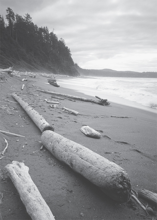
Deserted and beautiful Shi Shi Beach
ON THE TRAIL
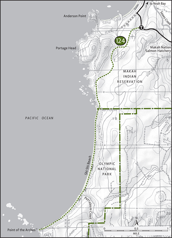
One of the last additions to Olympic National Park, Shi Shi Beach’s inclusion in 1976 was met with a fair amount of resistance. Abutting landowners had to be convinced to allow public access. Land developers had to be discouraged from turning the area into an enclave of second homes. And once the Park Service acquired title, they had to remove counterculture squatters and tidy up the mess left behind. Even then the fight to secure Shi Shi for the public wasn’t over; in the late 1990s the trail was closed in a land-access dispute. But after much wrangling and negotiating, the Park Service and landowners broke the impasse. The Makahs developed a new trailhead and built a new trail to the beach, and it’s top-notch in both design and standards.
The first mile winds through pockets of mature Sitka spruce, traversing rain-saturated bogs via cedar-planked boardwalks and bridges. The new trail then intersects part of the old trail, where 0.5 mile of somewhat muddy terrain must still be negotiated. Eventually this part of the trail will be rehabilitated. At 1.75 miles you’ll reach the national park boundary. Now, the only thing separating you from the spectacular beach is a steep trail down a 150-foot bluff.
Brace your knees and emerge at the northern end of the 2-mile sandy beach. Taste the salty air. Feel the pounding surf at your feet. Embrace the raw beauty of this wilderness beach and immediately forget about the civilized world. Dunes and bluffs hem the sandy shoreline. Giant logs dance in the thundering breakers. Eagles belt out high-pitched welcomes from overhanging snags.
In 1.3 miles from the bluff descent you’ll come to Petroleum Creek. Cross it and continue. Point of the Arches, a mile-long cavalcade of sea stacks and natural arches, comes into better view. It’s 1 mile farther to reach them. During a low tide, there’s no better place on the Olympic Coast for admiring these wind- and water-sculpted landforms. The only thing grander than Shi Shi’s natural beauty is its resilience in the face of forces that would have prohibited us from enjoying and admiring this national treasure.
EXTENDING YOUR TRIP
Nearby Hobuck Beach contains 1 mile of wide sandy shoreline. Its accessibility makes it ideal for children and hikers looking for an easy beach hike.
 |
Cape Flattery |


Maps: Green Trails Cape Flattery No. 98S, Custom Correct North Olympic Coast; Contact: Makah Indian Nation, (360) 645-2201;Notes: Dogs prohibited. Makah Recreation Pass required, available at Washburn’s General Store in Neah Bay; GPS: N 48 23.065, W 124 42.940
 |
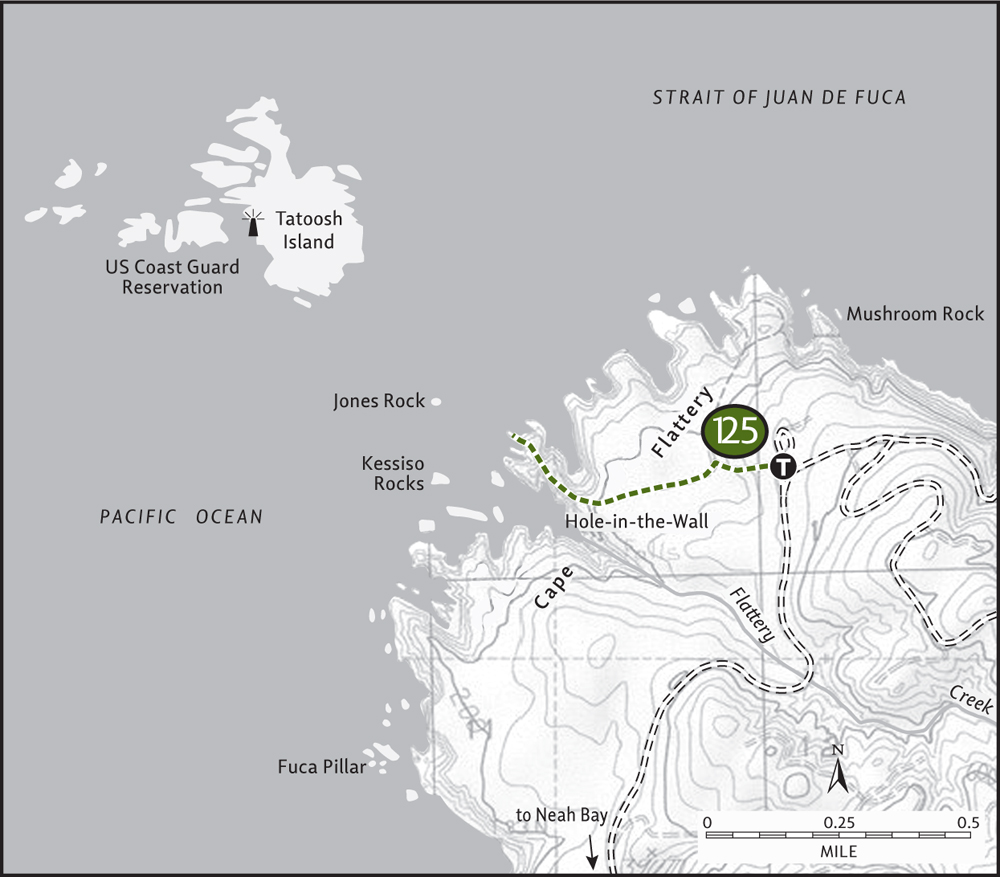
Hike to the northwesternmost point in the continental United States. Here, where the Strait of Juan de Fuca meets the Pacific, Cape Flattery protrudes into a sea of tumultuous waters. A land of dramatic headlands, sea stacks, and deep narrow coves, Cape Flattery exhibits sheer rugged beauty. Scores of seabirds ride the surf and scavenge the sea stacks. Watch for whales and sea lions too. And the sunsets… they’re simply divine. |
GETTING THERE
From Port Angeles follow US 101 west for 5 miles to the junction with State Route 112. Turn right (west) on SR 112, continuing for 64 miles to the community of Neah Bay. (Alternatively, take US 101 to Sappho and drive SR 113 north to SR 112 and then on to Neah Bay. This way is longer, but not as curvy.) Just past the Makah Tribal Museum is Washburn’s, where you can purchase the required recreation pass. Continue west on Bayview Avenue for 1 mile, following signs for “Cape Flattery and Beaches.” Turn left on Fort Street, and in 0.1 mile turn right on 3rd Street. In another 0.1 mile turn left on Cape Flattery Road. In 2.5 miles pass the Tribal Center. Proceed for another 5.1 miles to the trailhead. Privy available.
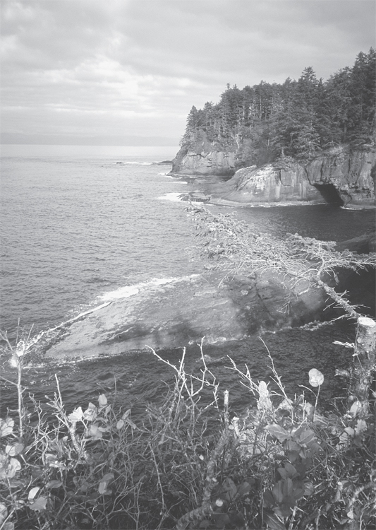
Forbidding headlands at Cape Flattery
ON THE TRAIL
Thanks to the Makah Indian Nation, the stewards of this land, a well-constructed trail leads to this remote corner of the Northwest. Start through a mist-drenched forest of Sitka spruce. Utilizing boardwalks and steps, drop to a series of promontories that provide stunning vistas of rugged Cape Flattery. At 0.75 mile reach the final viewing platform teetering on the edge of terra firma.
Admire the cape’s abrupt contours of sea stacks, caves, and forbidding sheer cliffs. A hostile environment of strong currents, swift breezes, and frequent storms—all forces responsible for creating this stunning landscape.
But nature has a way of adapting to such brutal conditions. Look carefully at this intimidating world where sea meets land and you’ll see life. Lots of life! Puffins and guillemots surf the turbulent waters. Murres nest in the fortresslike cliffs. Oystercatchers probe the tidal pools left behind on offshore reefs. Sea otters, once on the brink of extinction, bob in the protected coves. Whales can often be spotted farther out.
People, too, have adapted to this landscape, which is often draped in fog and receives over 100 inches of annual rainfall. Directly offshore is Tatoosh Island. Named for a Makah chief, this 20-acre treeless island once served as a summer fishing camp for the Makahs. The U.S. Coast Guard first constructed a lighthouse on the island in 1857. The current structure is automated. Now only sea lions, seals, and scads of seabirds live on Tatoosh.
The Makahs have declared Cape Flattery a nature sanctuary—an enlightened move for this wild world sitting on the brink of the continent.