‘Ecuador is a sombre land.’
—Walker Lowry, writer of the classic Tumult at Dusk: Being an Account of Ecuador
IN YOUR QUEST TO UNDERSTAND ECUADOR, you will find that it is one of the most unique geographical places on Earth. It is a very small country with lots of geography. Imagine being near glaciers, hours later tramping in the rainforest, then a few hours later boating through the mangroves on the Pacific coast. If Walt Disney were looking for a location for a nature park this would be the ideal place. (They might have to add a number of restrooms, however.)
In a region about the size of Colorado, with an area of 269,178 sq km (103,930 sq miles), Ecuador’s geography has been a major factor in the development of the cultures that have resided there. It is also a virtual mosaic or museum of almost every type of terrain, flora or fauna to be found on our planet. There are so many types of flora that many have not even been described or catalogued to date. Ecuador is a very special place which is under increasing stress from human and commercial pursuits.
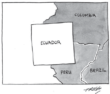
Ecuador is one of the smallest Andean countries located in the north-western corner of South America. It borders Colombia to the north; Peru to the south and east; and the Pacific Ocean to the west. The mainland is comprised of three unique geographical regions. These areas are referred to as the Costa (coastal lowlands in the west), the Sierra (central mountainous region) and the Oriente (eastern region, also known as the Amazon region, which slopes easterly from the Andes Mountains). There is a fourth geographic zone called the Galápagos Islands or Archipiélago de Colón, lying about 998 km (620 miles) off the Pacific coast.
The Costa and Sierra make up about 60 per cent of Ecuador’s land area and the Oriente, the remaining 40 per cent. The Costa and Sierra regions are home to most of the population, with slightly more people living in the Costa. Only about 5 per cent of the population live in the Oriente.
Population
In July 2000, the population was approximately 12.9 million, with about 60 per cent between 15 and 64 years of age and about 36 per cent younger than 14 years of age.
The Costa is an alluvial plain on the west coast, as much as 161 km (100 miles) wide in some places and as narrow as 19 km (12 miles) across. Its main rivers are the Esmeraldas to the north and the Guayas to the south, forming a fertile delta in between. This is the food basket of Ecuador, producing crops such as bananas, cacao, rice, sugar, coffee and toquilla palm (from which the inaccurately named Panama hat is made). Petroleum and gold are also produced here. This used to be the centre of oil production but the oil has largely run out and the Oriente is where about 85 per cent of Ecuador’s oil is now pumped. Guayaquil, on the banks of the Guayas River, is Ecuador’s largest port and a major source of economic capital.
The northern and eastern Costa is covered with tropical rainforest, including lianas, epiphytes, balsa and cinchona trees. Moving south, the rainforest gives way to deciduous and semi-deciduous woodland. Here, palms which provide nuts for buttons and fibre for the Panama hat can be found. The swampy coast and river floodplains were once covered by dense mangroves which have now been cleared for shrimp farms.
The Costa is the most populous region of Ecuador. Most of the country’s agriculture production and industry take place in this region, with the focal area being Guayaquil, Ecuador’s largest seaport. The Costa also holds a tremendous amount of opportunity for tourism, which has not been fully exploited to date. Economics, unfortunately, always seems to rule over conservation. The streams and the rivers in the Sierra flow to the sea through the lowlands of the Costa through its soil, which makes its basins rich for agriculture. My first time in Guayaquil, I remember I was amazed to see mangoes and papayas the same size as large cantaloupes in the United States!
Climate
The temperature is generally high throughout the year here. Temperatures average between 24–32°C (76–90°F). The rainy season (December–May) is warmer and more humid than the dry season.
The Costa’s dry season takes place during the second half of the year. Humidity can be quite high and stifling. Much of this depends on the wind patterns and rainfall.
The southern Costa near the border with Peru receives very little rain and is quite arid. The northern Costa, comprising rainforest and mangroves, receives between 1,270–2,032 mm (50–80 inches) of rain annually. Guayaquil receives about 1,016 mm (40 inches) of rain per year. The southern Santa Elena Peninsula is a dry area, with rainfall averaging 101 mm (4 inches) a year.
Every four to seven years, during the rainy season, the infamous El Niño phenomenon may occur, resulting in torrential rains. I have experienced two El Niño seasons over the last eight years and have witnessed the amount of damage they can do. During the 1982–1983 season, there was a huge loss of life and damages amounting to billions of dollars. During the 1997–1998 season, numerous dead blue-footed boobies washed up along the Ecuador coast, about 966 km (600 miles) from their Galápagos Islands habitat. I also heard that Ecuadorian bananas and aquatic reptiles were found in Peru. Deadly floods and mudslides washed away towns and destroyed highways. Unusually warm waters caused coral near the Galápagos Islands to bleach. A terrible drought also hit the Amazon region, resulting in raging forest fires.
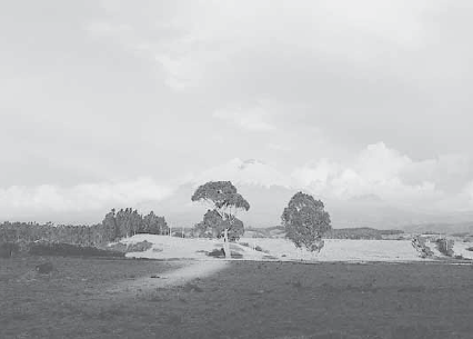
The Sierra is the central mountainous region of Ecuador, consisting of the Andean highlands which run north to south along the entire length of the country. The world’s highest active volcano, Cotopaxi, is found here, standing at 5,897 m (19,347 ft). The slope to the west is quite steep but more gradual to the east toward the Oriente. There are two distinct Andean ranges—the Eastern and Western Cordilleras. The fertile valley between them is called the Avenue of the Volcanoes. The Sierra has more than 12 peaks which are higher than 4,877 m (16,000 ft), and most are capped with snow. Ecuador’s highest peak is Chimborazo (6,310 m / 20,702 ft), an inactive volcano.
Ecuador has a long history of volcanic explosions and earthquakes. Tungurahua, an active volcano, is known locally as The Black Giant. On 10 November 1999, explosions of ash and incandescent material occurred some 25–35 times per day from The Black Giant, and loud bangs could be heard as far as 19 km (12 miles) away.
The Cotopaxi Volcano—a photographer’s dream.
Ecuador’s major rivers and streams begin in the Sierra, making deep trenches in the landscape and causing much erosion. This has limited the amount of land available for agriculture in the highlands.
Much of the Sierra feels as if it were in an eternal spring. Temperatures average around 16°C (60°F) and the sun sets at almost the same time every day. North of Quito, on the way to Otavalo, there is a mountain range which makes you think you are in the mountains of Arizona. However, rainfall patterns can be quite varied, decreasing toward the centres of canyons and valleys. The interior plateau and slopes are very dry and cold. The rain here is often very fine, producing misty conditions. Some basins in the Sierra are comparatively arid. Rainfall reaches a maximum during the equinoxes. The rainy months are from October to November and February to May.
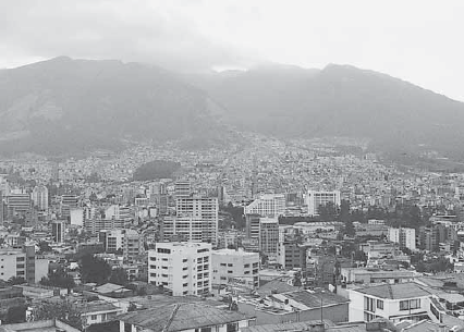
Quito is nestled in the Andes Mountains, at an altitude of 2,850 m (9,350 ft). Having limited contact with the outside world until recently, Quito and the other Sierra cities of Cuenca and Loja have developed into bastions of conservative Spanish culture. Even today, alongside modern office buildings and apartments stand some of the finest examples of colonial art and architecture in all of Latin America.
The Quito skyline on a cloudy day.
Slowly descending from the Sierra into eastern Ecuador, you will enter the mystical jungle region of the Oriente. Comprising the eastern slopes of the Ecuadorian Andes and the lowland areas of rainforest in the Amazon basin, the Oriente takes up about 40 per cent of Ecuador’s land area. There are three principal waterways in the region, with the slow and wide Amazonian rivers and their tributaries—Río Napo, Río Pastaza and Río Santiago.
Fantastically coloured birds, such as long-beaked toucans, noisy macaws and flitting hummingbirds, share this land with exquisite butterflies, 28-foot anacondas and ferocious howler monkeys.
Largely undeveloped, this region is home to only about 5 per cent of Ecuadorians. Most of them are Indians, the largest Indian community being the Jíbaros, who live on the banks of the rivers in the south-eastern jungles. A fiercely independent people, they successfully fought off the Spanish by killing them, abducting their women and setting fire to their settlements. Headhunters and skillful warriors, they can blow poisoned darts with deadly accuracy. Other communities found here include whites and mestizos from the highlands, the nomadic Huarani, the Quichua-speaking Záparos and Yumbos and the tunic-wearing and ornamented Cofáns.
Petroleum and timber and, previously, gold are the major economic resources of the Oriente. Oil was discovered here around 1970. Plantains and cassava are important staple food crops and corn (maize) and oranges are also cultivated. Cattle are left to graze.
The Oriente is very hot all year round and experiences continuous and abundant rainfall. Temperatures range from a high of 29–33°C (84–91°F) during the day to a low of 20–24°C (68–75°F) at night. This region has a poor drainage system because of the low gradient of the topography.
The fourth geographical region of Ecuador is the Galápagos Islands. American novelist Herman Melville described these islands as such: “Take five and twenty heaps of cinders dumped here and there in an outside lot, imagine some of them magnified into mountains and the vacant lot the sea; and you will have a fit idea of the general aspect of the Encantadas, or Enchanted Isles.” These heaps of cinders consist of 13 major islands, ranging in area from 14 to 4,587 sq km (5.4 to 1,771 sq miles), six smaller islands and scores of islets and rocks lying west of the mainland of Ecuador. The islands have a total land area of 8,010 sq km (3,093 sq miles).
The government of Ecuador designated part of the Galápagos Islands a wildlife sanctuary in 1935. In 1959, the sanctuary became the Galápagos National Park. This archipelago is Ecuador’s main tourist magnet. When I first visited Ecuador in the early 1980s, it still seemed to be an exotic destination reserved only for scientists and the rich. Now, tens of thousands of tourists arrive every year. The value of the Galápagos Islands tourism to the Ecuadorian economy is estimated to be more than US$ 55 million a year.
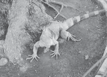
An iguana lounges in Guayaquil.
Only five islands are permanently inhabited, San Cristóbal being the most populous. Some 80 per cent of the islanders live on the islands of Santa Cruz, San Cristóbal and Isabela. Many Ecuadorians try to move to the Galápagos Islands to cash in on the tourism. Every few years you will notice efforts by the government to restrict migration to these islands. Tourism and migration places severe pressures on the ecosystem and great care should be taken to preserve the qualities of the Galápagos Islands, qualities which make it such a unique destination.
Underwater volcanoes formed the islands millions of years ago. The first historical report of these islands dates from 1535 when it was discovered by accident by the Bishop of Panama, Tomás de Berlanga, when his ship drifted off course. He did not name the islands but reported tortoises or galápagos “so big that they could carry a man on their backs.” This was probably what led the Flemish cartographer Ortelius to name the islands Insulae de los Galopegos. A seafaring Spaniard, Diego de Rivadeneira, visited the islands after Berlanga and named them Las Encantadas (The Enchanted Isles) after strong currents threw his ship mysteriously off course, giving the impression that the islands could move out of his reach at their own will.
It was, ultimately, Charles Darwin who drew international attention to Las Encantadas or Archipiélago de Colón as they are known locally. This was where Darwin, arriving in 1836 and staying for five weeks, gathered evidence for his momentous study—the ‘Origin of Species by Means of Natural Selection’. His study of the Galápagos finch (or Darwin’s finch) gave him evidence for his thesis that ‘species are not immutable’.
An Abundance of Life
Numerous species of plant and animal life are endemic to the Galápagos Islands. There are approximately 625 plant species and subspecies found here, of which 36 per cent are endemic. There are approximately 1,000 insect species present (including 50 spider species), and more than 60 species of snails. Some 298 fish species have also been recorded.
One animal endemic to the Galápagos Islands is the famous giant tortoise (Geochelone elephantopus). Whalers and sealers have decimated the tortoise population and now only 15,000 remain. The small-winged flightless cormorant (only 700 to 800 are still in existence), the dark-brown Galápagos hawk with a 4-foot wingspan, the small and scurrying Galápagos rail, the hideous and prickly-pear-eating iguanas, the drab and non-poisonous Galápagos snake and the luxuriously coated Galápagos fur seal are just a sampling of the local inhabitants.
The climate here is influenced by the ocean currents. January to May is the typical hot or rainy season. June to December is the dry or cool season. There is minimal rainfall, which often forms a mist.
Two of the most interesting islands are San Cristóbal and Santa Cruz. San Cristóbal is the easternmost island. The first permanent settlers arrived here in 1869. Many of the cruise tours of the islands begin in San Cristóbal.
Santa Cruz is where the National Park headquarters and the Charles Darwin Research Station are located. A number of tours also begin from this island. The US Navy had a small installation just off this island during World War II.
Ecuador is one of the richest places in the world for flora. Ten per cent of the world’s vascular plant species are located within an area that covers just 0.2 per cent of the Earth’s surface. Ecuador houses some 25,000 species of vascular plants. (All of North America only has 17,000 species.) This is largely due to the diverse ecological conditions created by the great altitudinal differences in this small land. The vegetation varies from xerophytic scrub to rainforest.
This land is one of the largest growers of roses in the world. More than 10 per cent of all the orchid species in the world grow here. Forests, from which many exotic woods such as cedar, ebony, cyprus and myrtle are derived, cover much of the country. Other plants include vanilla, cinnamon and chicle. Montane rainforest covers the eastern slopes of the Andes. The soils in the Sierra are porous and there is poor forest coverage except for the eucalyptus, which was imported from Australia. The lower levels of the Sierra are comprised of scrub brush and cacti. The higher levels consist of tufted grass, just before the glaciers begin.
Ecuador’s wildlife is just as impressive. In the Sierra, llamas exist alongside pumas and jaguars. The Costa and Oriente are populated by many varieties of parrots and monkeys, which you might see for sale on the streets of cities such as Guayaquil. There is a wide variety of rodents, bats, alligators, turtles and iguanas.
If you are a bird-lover, Ecuador is also the place for you! There are about 1,500 species to be found here, a number endemic to Ecuador. In 1998, a new species from the Antpitta family was discovered—a bird which barks like a dog and hoots like an owl! There are also over 115 species of hummingbirds that add a lot of colour to the geography.
Frogs and butterflies are also abundant here. I remember seeing, during my first trip from Guayaquil to Cuenca, places in the lower Andes which were just covered with blue butterflies. There are also more than 450 marine species and 800 freshwater species in Ecuador’s teeming waters.
Understanding the names of places in any country can give you substantial insight into the local culture. The country of Ecuador is divided into 24 provincias (provinces). These provinces are divided into cantones (regions), which are in turn divided into parroquias (parishes). Very small villages, where there may be just a few homes, are called caseríos.
A number of places have older names that were changed by the local government. However, the locals continue to refer to the place by the old name, even though it officially has a new name. One example is J Gómez Rendon, a small city, which was originally called Progreso. The locals still refer to it as Progreso despite the fact that, when you go through the town, it is marked J Gómez Rendon. A number of towns are named after saints such as San Miguel de Salcedo. Towns named after male saints outnumber towns named after female saints.
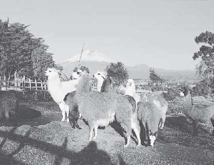
Llamas at play, watched over by the Cotopaxi Volcano.
In the Sierra, many town names were originally in the Quechuan language. A number of town names have aquatic associations, named after nearby bodies of water. Examples are Los Encuentros where two rivers meet or La Bocana which refers to the mouth of a river. A number of provinces and towns have taken on the names of volcanoes. Examples are Cotopaxi and Cotocachi. Towns within certain provinces use names of lesser-known volcanoes such as El Altar and Toacaso.
In the Costa region, you will see names of cities which refer to the elevation of the area or of certain vegetation. Some examples are Lomas de Sargentillo, which refers to the hills, and Zapotal, which is named after the Zapote tree.
Other cities may have used the last name of the founder such as Rivera or Mariano. Some townships use the name of a large land owner or of a ranch. Often a feminine name will be used, as in La Hacienda Mercedes (Plantation Mercedes). Names may also refer to a certain ideal or concept. Examples are El Progreso (progreso means progress), La Paz (paz means peace), or El Paraíso (paraíso means paradise). Houses are often named, no matter how humble. You may also see a home or small home with the name of the female occupant over the front door. An example is Villa Rosa.
Villages and cities come and go with time. Acts of nature and man contribute to the death and change of communities.
In Ecuador, both earthquakes and volcanoes have a tremendous impact on both geography and societies. A potent combination of lava and ice has caused significant mud and river flooding, aggravated by deforestation. Riobamba and Ambato have been destroyed three times. The most serious earthquakes and volcano explosions have had their major impact in the Sierra.
Humans have also played their part. Many of the initial Spanish settlements in the Oriente were wiped out by Indians. Other settlements such as Tomebamba and Mocha also suffered similar fates. During colonial times, Guayaquil, Manta and Portoviejo were attacked by pirates and their locations shifted. Since many of the earlier houses were built from cane, fires burnt down many towns, especially in the Costa region. Guayaquil burned down a total of three times prior to the 20th century. Babahoyo, Esmeraldas and Vinces have also been damaged by fire.
Ecuador’s main challenge in the 21st century is maintaining the balance between man and geography. Planning, discipline and the curbing of greed will be indispensable in keeping Ecuador a beautiful natural location. The country is considered ecologically unique, with an unrivalled variety of ecosystems and diversity of species. Its breadth of ecological variation is largely attributable to the biodiversity on the Galápagos Islands.
The engines of economic development and enterprise (such as petroleum exploration, lumber production and agricultural cultivation) are putting this delicate ecosystem under threat.
The Destruction of the Environment
Unsound environmental practices have contributed to considerable environmental degradation and given rise to grave environmental problems—deforestation, as a result of petroleum exploration and lumber production; soil erosion, as a result of over-grazing, poor agricultural cultivation practices and deforestation; desertification; water pollution; and deterioration of biodiversity.
There is a huge demand for shark’s fin around the world, in particular Asia, with its insatiable appetite for shark’s fin soup. A bowl of shark’s fin soup can cost up to US$ 100 in some Hong Kong restaurants. World Heritage Sites and Marine Reserves, such as the Galápagos Islands and the Cocos Island (in the Indian Ocean south-west of Java), are increasingly raided by illegal fishermen, as shark populations in outside reserves decline. Some fishermen take only the fins, dumping the maimed sharks back into sea, often still alive. At US$ 50 per lb (0.45 kg) for the fins, local fishermen also have no qualms about killing sea lion pups for bait. In 2004, the government issued a decree which prohibits the sale and export of shark fins. However, the Central Bank reported 70,871 kg (156,246 lbs) were exported in 2004.
Sea cucumbers lack an advantage that other sea creatures have, i.e. the ability to scurry or swim away from attackers. Due to their profitable return (up to 25 times their cost), the sea slug is particularly susceptible to over-fishing. Following the alarming decrease in numbers in the early 1990s and an Executive Decree in 1993, all fishing of sea cucumbers in the Galápagos Islands was banned.
The government of Ecuador has committed itself to an environmental agenda called Agenda 21. In accordance with this, there is an urgent need to replace exploitative practices with sustainable development. The aims of Agenda 21 includes establishing a programme to conserve and preserve the biodiversity of the Galápagos Islands; strengthening its system of protected areas; and applying strategies for reforestation. Ecuador must also formulate a legal framework, based on public policies, to address and regulate these suggested measures.
The regulation and protection of the environment in Ecuador is controlled by the Ministry of the Environment and the Dirección General del Medio Ambiente (General Directorate for Environment). The non-governmental environmental organisations and entities that are active here include the Amigos de la Naturaleza de Mindo, EcoCiencia and the Fundación Charles Darwin para las Islas Galápagos.
Most scholars of the Galápagos Islands agree that the human population here has reached unsustainable levels.
The growing number of visitors who have come to witness the natural wonders of the Galápagos Islands have the potential to endanger them. The Park Service has found it difficult to limit the number of visitors to the islands but does regulate the licensing of guides required for disembarkation to the islands as well as the designation of low-impact landing sites. The National Park has to deal with the conservation problems that motor yachts and their rubbish (often dumped in the waters outside Park limits) bring. Although responsible tourism is a sustainable means for preserving the park, its negative effects have to be closely monitored.
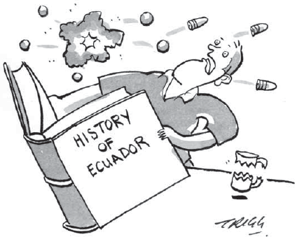
Several years ago, on a flight from Ecuador, a young American woman sitting next to me commented that she regretted not having read more about Ecuador’s history prior to her visit. She felt, as she looked in the residents’ eyes and at the colonial architecture, that there was much she had missed.
She was right. History is the golden key that will help you unlock the mind of the Ecuadorian. So we should start by trying to unravel some of the threads of this small country’s intricate past.
Pottery figures have been discovered that date from 3,000 to 2,500 BC. This indicates that Ecuador was inhabited as early as 5,000 years ago. Apparently, a great variety of tribes (nearly 50) had settled along the coast, in the Sierra and in the Amazonian hinterland. However, unity was not achieved among these Indians. The greatest divisions existed between the tribes of the coast and of the mountains.
Some of the earliest civilisations included the Valdivia, the La Tolita and the Manta cultures, which settled along the Pacific coast.
The Incas invaded and dominated Ecuador’s groups before the Spaniards. They would have a substantial impact on local history, despite reigning supreme in the region for only a hundred years.
The Incas first established themselves in the 12th century in Cuzco, now part of modern-day Peru. Their main period of territorial expansion came during the reign of Inca Pachacuti Yupanqui (1438–1471). They moved south to the Titicaca Basin and north to Quito, ruling over the Chancas, the Quechuas and the Chimús.
Cleverly resettling the locals, the Incas practised the divide and rule principle, making organised revolt difficult. The Inca Topac Yupanqui (1471–1493) extended the southernmost border to central Chile, and his successor, Huayna Capac (1493–1525), northwards to the Angasmayo River, obtaining power in what is now southern Colombia.
Quito became a vital administrative and military centre for the Incas. Huayna Capac divided the empire for his two sons with Atahualpa governing the north (including Quito) and Huáscar ruling the south. Huayna Capac’s death set off a struggle for succession, which was still unresolved when the Spanish arrived in Peru in 1532.
At its height, the Incan civilisation controlled about 12 million people in more than 980,000 sq km (380,000 sq miles) of territory. They introduced taxes, the Incan religion and the Quechua language. An extensive network of roads and bridges was laid—4.6 m (15 ft) wide in some places. (This network ironically aided the Spanish conquest.) Llamas were used for transport and runners were used to relay messages, covering hundreds of miles in one day.
Incan society was highly stratified. The emperor ruled with the aid of an aristocratic bureaucracy, exercising authority with harsh and often repressive controls. Indians were at times forced into labour but the Incas did not tax them on the production of their own fields.
Incan technology and architecture were highly developed, although not strikingly original. Their irrigation systems, palaces, temples and fortifications can still be seen throughout the Andes. The economy was based on agriculture, its staple crops being corn (maize), white and sweet potatoes, squash, tomatoes, peanuts (groundnuts), chili peppers, cocoa, yuca (cassava) and cotton. They raised cuy (guinea pigs), ducks, llamas, alpacas and dogs. Much clothing was made from llama wool and cotton. Practically every man was a farmer, producing his own food and clothing.
The Incan religion combined features of animism, fetishism and the worship of nature gods. The pantheon of gods was headed by Inti (the sun god), and included Viracocha (a creator god and culture hero) and Apu Illapu (the rain god). The Incan religion was a highly organised state religion, but, while the locals were required to worship the sun god, their native religions were tolerated.
The descendants of the Incas are the present-day Quichua-speaking indigenous Indians of the Andes. They combine farming and herding with simple traditional technology. Rural settlements are of three kinds: families living in the midst of their fields, true village communities owning fields outside inhabited centres and a combination of these two. Towns are centres of mestizo communities. An Indian community is usually close-knit, and intermarriage within families is common. Much of the agricultural work is done cooperatively. Their religious beliefs are a form of Roman Catholicism infused with the pagan hierarchy of spirits and deities.
After the discovery of the New World, stories spread about the fabled wealth and riches of the Incan dynasty. A number of Spanish expeditions set out from Panama in search of gold. It is the view of some that it was the Spanish conquest that brutalised the region and put in place a rigid class structure. The area of Ecuador was first discovered by the Spaniards on an exploratory voyage which landed at Esmeraldas in around 1526.
Francisco Pizarro departed from Panama in 1531. He ventured further south, landing in 1532 at Tumbez, on the present-day Peruvian coast. At that time, at least four culturally related Indian groups who possessed gold and jewels: the Esmeraldas, the Mantas, the Huancavilcas and the Punáes, occupied the coastal lowlands. The highland peoples included the Pastos, the Caras, the Panzaleos, the Puruhás, the Cañaris and the Paltas. The Esmeraldas worked with gold and platinum and were hunters. The Mantas lived south of the Esmeralda and worked with gold jewellery and emeralds. They were extensive traders and sailed up and down the coast.
Pizzaro continued down the coast to what is now Isla Puná (Puná Island), in the Gulf of Guayaquil. He had heard of gold in Tumbez but found it in ruins as a result of an Indian battle. He travelled into what is now Peru to Cajamarca where he planned to take Inca King Atahualpa into custody and hold him for ransom (a common tactic of the Spanish). When he arrived in Cajamarca, he found that Atahualpa was not there but had moved himself and many of the residents to the surrounding hills. The Spanish pressed Atahualpa to visit and he foolishly accepted. He was taken captive and promised his freedom only if he could fill a room with gold. Atahualpa did so once with gold and twice with silver. The Spanish still executed him. It was from here that they tightened their noose around the region. The Inca, weakened by internal division and defenseless against Spanish horses, canons, guns and swords, did not put up much resistance.
One of Pizarro’s lieutenants, Sabastián de Benalcázar, headed north with a band of 200 men. Forming an alliance with the local Cañari people, they fought their way along the inter-Andean valley to Quito. Even the great Incan tactician, Rumiñahui, was finally forced out of Quito, but not before razing it to the ground. Benalcázar would initiate one of the first municipal governments and become a lieutenant governor to Pizarro. (Benalcázar’s home still stands at calle Benalcázar y Olmedo in Quito.) He conquered most of Ecuador, including Guayaquil in 1533. This was a brutal time when the Indians were basically beaten into servitude.
The half-brother of Francisco Pizarro, Gonzalo Pizarro, was made governor of Quito in 1539. In 1541, with about 200 Spanish troops, some 4,000 Indians, horses and other animals, he made an expedition into the unexplored region east of Quito. The expedition ran into trouble when supplies dwindled. The Indians did poorly in the tropics and died. The Spanish were also not accustomed to such difficult terrain. They had previously obtained supplies by stealing them from the locals but the Indians they encountered in the new areas escaped. Gonzalo’s lieutenant, Captain Francisco de Orellana, left with some men down the Napo River in search of provisions. Pizarro waited and waited and waited for Orellana. After his men had eaten their dogs, horses, shoes and saddles, Gonzalo, realising that Orellana and his men were probably not coming back, stumbled back to Quito with the survivors—only to find the city in upheaval. Francisco Pizarro had been assassinated by the Almagristas and another Spanish faction was seeking control of the region. Something good did come out of this expedition, however—the discovery of the Amazon River!
The Spanish Crown was upset with the situation and specifically with the enslavement and maltreatment of the Indians. The Crown ruled that the Indians be set free. It was also declared that the land acquired by the conquistadors was to be returned to the Crown for management after their death. This caused an uproar since many of their widows and children would be reduced to poverty. In 1544, a new viceroy was sent to try to manage the local administration. Blasco Nuñez had a short and violent career. It started with him trying to impose the New Laws of Bartolomé de Las Casas to the letter. He stepped hard on many important toes and either ordered a murder or committed one himself.
Opposition grew against him and he was arrested and packed off home to Spain. On the way home, however, he was killed by troops loyal to Gonzalo Pizarro.
In 1547, the Crown then sent Pedro de la Gasca, a priest and lawyer, to try to calm things down. He succeeded by granting amnesty to the rebels and repealing many of the most hated laws. Pizarro had planned an attack against Gasca, refusing all offers of a peace accord, but he was grossly outnumbered and his troops deserted him, professing allegiance to Spain. When Pizarro was taken into custody, he knew his time had come. Before he was beheaded in 1548, he asked the executioner to make it quick and clean.
The colonial period of Ecuador continued to be a difficult time for the inhabitants. It is important to understand that Ecuador’s history at this time was really one of Peru’s. At the same time, it is was during the colonial period that the seeds of nationalism were sown, starting a long but painful gestation that would bear fruit with independence in 1830. This identity crisis explains, to some degree, the persistent problems between Ecuador and Peru and the regional divisions within present-day Ecuador.
In 1563, the northern region acquired the status of audiencia and came under the auspices of the viceroy of Lima in Peru. The audiencia was the highest tribunal of justice and a general administrative board for the region. The hierarchy of authority was absolute and began with the King of Spain. Under the king and governing the new colonies of America was the Council of Indies established in 1524 and residing in Spain.
Under the council were four viceroys who resided in the new Americas. The viceroy of Peru was based in Lima and was founded in 1544. The area of Ecuador and Quito reported to Lima. The audiencia or judicial body of Quito was formulated in 1563. Under the audiencia were provinces with a corregidor (governor) also appointed by the king. In what is modern-day Ecuador there were five provinces, consisting of Cuenca, Guayaquil, Loja, Quito and Zamora. In 1739, Ecuador became part of the new Spanish Viceroyalty of Nueva Granada, which included Colombia and Venezuela, with its capital in Bogotá (Colombia).
Colonial cities were governed by a city council, its councillors appointed by the king. This was very likely a position for life. The councillors were referred to as regidores and would select a city leader or judge called an alcalde. In some instances, there could be two alcaldes. The management style was quite onerous and the sole reason for the existence of these positions was to handle the king’s affairs. Spain had no system in place to handle the conflicts in its new territories. All decisions had to be approved by Seville and answers could take longer than a year to obtain.
While Spain’s primary interest was to expand its wealth, it professed a desire to convert the indigenous population to Catholicism. The Church became extremely important in the development of what is now Ecuador and became powerful and wealthy. In many ways, the Church became more powerful than the government organisations. There was much bickering between the bishop and president of the audiencia as to who held the higher social status. The people of Quito found themselves constantly battling sickness, droughts, earthquakes and volcanoes.
In the 1580s, there were attacks by pirates along the Ecuadorian coast. In 1591, Spain realised that it needed numerous ships to protect its interests and a tax was levied to raise money for shipbuilding. The residents of Quito were upset with this and felt that the coast and Guayaquil should take care of itself. They revolted. A number of rebels were jailed and troops were sent from Lima. A representative was sent from Spain and a number of people were hung.
It was during colonial times that Ecuador developed a strict social or caste type system. These social divisions have endured until today and one’s place in society is often determined by the shade of one’s skin. The social levels in colonial Ecuador were basically divided into five different levels:
Blacks were among the lowest echelon of society. In fact, they were not considered human and had no rights. The clergy made no attempt to convert or care for the blacks. They were originally brought to Ecuador along the northern coast of Ecuador in the late 16th century to work the sugar plantations. However, in present-day Ecuador, blacks are considered a step above the Indians in society.
Indians provided most of the labour in colonial Ecuador. In general, they were passive and did as they were told. They were usually attached to a large hacienda (plantation) and would be called from time to time to work on large public projects. The Church made efforts to teach the Indians to read and to convert them to Catholicism.
Mestizos claimed the next level of society and were often fathered by a Spaniard and had an Indian mother. They had very little access to positions of power or prestige. There was some movement by mestizos into the Church culture.
The criollos were of Spanish descent and officially had the same rights as the Spaniards. However, it was the Spaniards who received the best positions and the favour of the courts. There was a great deal of quarrelling and hatred between the criollos and the Spaniards.
The Spaniards clearly held the highest places in society. There were approximately 1,000 Spaniards at that time. Most of the early Spaniards were conquistadors. They believed that the Indians were there to do their manual labour, having a distaste for working with their hands. This is still the case in Ecuador where it is believed that only the lower classes work with their hands.
Some Spaniards married Indian women because there were few Spanish women then. Their children had little opportunity of moving into the higher circles of society and were often relegated to managing groups of Indian labourers. Many became artisans and contributed significantly to much of the beautiful architecture of Quito.
The lower classes had literally no representation at that time and were perceived to exist to serve the higher classes. Greed and ambition existed among the higher classes.
Ecuador’s independence from Spain followed similar lines to the unrest spreading across the South American continent. The first rumbles started in Quito in 1592, recurred in 1765 and erupted in the events which took place between 1770 and the end of the 18th century.
One of the strongest proponents for independence for Ecuador was Francisco Javier Eugenio de Santa Cruz y Espejo, a mestizo medical doctor. A well-regarded scholar, he had a wide range of interests and a grand vision for Ecuador’s future. Advocating complete freedom from Spain, autonomous government for each colony and nationalisation of the clergy, he was persecuted, imprisoned and later exiled for his ideals. Eugenio Espejo published the first newspaper in Ecuador (Primicias de la cultura de Quito) that was heavily critical of the Spanish government. This newspaper only made seven issues. He died in 1795, but not before he had planted the hope of independence in many Ecuadorian hearts.
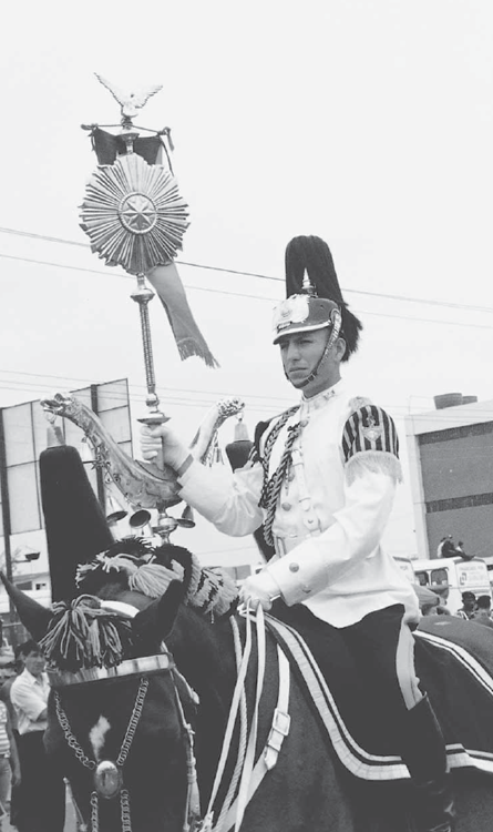
A soldier in parade dress during an independence parade in Guayaquil.
The independence of North America, the French Revolution and the invasion of Spain by Napoleon fed existing anti-Spanish sentiments. The Spanish government had tried to dominate all aspects of economic and political life and many locals found its rule unjust and oppressive, bringing more negative consequences than benefits. They blamed the Spaniards for establishing hateful racial, economic and cultural castes; stealing land from those who depended on it for their livelihood; forcing the poor into slavery; bringing with them infectious diseases such as smallpox and syphilis; and stripping Indians of their self-respect.
A group of Quito elites formed a junta on 10 August 1809. Successful for a year, it collapsed due to a lack of support from other Ecuadorian cities. Further plans for rebellion were held in check by the locals’ fear of the Spanish Pacific fleet. But the military’s abuses caused much of the population to side with the rebels, resulting in riots in 1810. After an agreement for a troop withdrawal, the junta was told it could exist, but only under the leadership of the audiencia. The viceroy of Peru opposed this plan. The Spanish remained in control for the next 10 years.
By 1819, the Spanish threat had lost its teeth. Another movement for independence had begun in Guayaquil. Leaders were able to enlist the assistance of Simón Bolívar from Venezuela and José de San Martín from Argentina who were marshalling independence struggles on both sides of the continent. Simón Bolívar (nicknamed The Liberator) had a grand vision of several large independent countries across the continent—Gran Colombia. He had soon entered Bogotá, the capital of Colombia, taking the Spanish by surprise in the Battle of Boyacá on 7 August 1819. In 1821, troops were sent from Colombia under the command of Antonio José de Sucre. The liberators foiled the Spanish troops in Guayaquil and then focused on the Sierra. General Sucre defeated the royal troops in the mountains above Quito at the Battle of Pichincha. Venezuela was freed from Spanish rule in 1821 and Ecuador in 1822.
It was in Quito that Bolívar won Ecuador’s independence, and it was also in Quito that he won Manuela Sáenz’s heart. Sáenz was an ardent revolutionary who united her life with Bolívar’s cause. She saved him from conspirators in 1828 in Bogotá and attempted suicide when he died in 1830. Exiled to the small Peruvian port of Paita, she spent her last days eking out an existence selling sweets and tobacco.
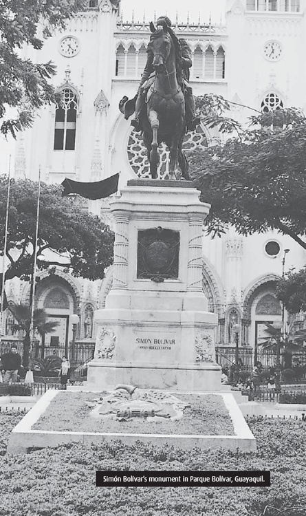
Bolívar’s goal at that time was to combine Colombia, Ecuador and Venezuela into the Viceroyalty of New Granada. Bolívar and San Martín met from 26–27 July 1822 in Guayaquil on the banks of the Guayas River, where there is now a statue of the both of them. San Martín’s campaign was to liberate Peru but Bolívar wanted it as part of his Gran Colombia. What was said between the two was not recorded but they parted quickly, neither promising aid to the other. Guayaquil was divided and had three options to determine its existence:
 Unite with Bolívar and become a part of Gran Colombia
Unite with Peru
Become self-governing
Bolívar made the first point come true, delivering the final blow to the Spanish colonial regime in South America two years later.
As a part of Gran Colombia, Ecuador became embroiled in military campaigns to liberate Peru. Ecuadorians resented the 30 per cent tax Bolívar had levied on Guayaquil’s cacao exports to finance his Peruvian campaign.
The Guayaquil elites agitated for self-rule and on 13 May 1830, the independent republic of Ecuador was proclaimed. Juan José Flores was appointed president five months later. Venezuela and Quito both withdrew from Gran Colombia in 1830. Bolívar died of tuberculosis, soon after his dream, in the house of a Spaniard near Santa Marta, Colombia. His last words were “(South) America is ungovernable. Those who have served the revolution have plowed the sea.”
While Ecuador gained its independence, it in no way lost the tremendous and deeply entrenched culture of Spain. The divisions between the social classes continued, and power remained in a few aristocratic hands. The lower classes had no say and little influence.
The distinct geographical divisions also played a considerable factor in dividing the three distinct regions (Costa, Sierra and Oriente) into one country. The main divide lay between the Sierra’s wealthy landowners and the coastal merchants, centred around Quito and Guayaquil respectively. They had contrasting economic and social attitudes. The inhabitants of the Sierra were conservatives, devout Catholics and supporters of Church-sponsored education for all. Their economic interests revolved around the close management of native labour.
In contrast, the coastal peoples were liberals who favoured free enterprise, the development of agricultural exports and other trades. They opposed the Church’s involvement in matters of state.
Juan José Flores
Juan José Flores was a general in Simón Bolívar’s army. A Venezuelan by birth, he married into an influential Quito aristocratic family and became a national hero during the fight for independence.
Flores was merciless in his pursuit for power. He called an assembly to declare the Republic of Ecuador a new nation and himself president. Flores’ autocratic rule, poor administrative ability, his support of entrenched privileges, especially those of the Church, and his perceived favouritism towards the Sierra provinces, fed opposition against him.
Based in Guayaquil, Vicente Rocafuerte headed opposition to Juan José Flores. In 1834, at the close of Flores’ first term as president, civil war broke out between Quito and Guayaquil. To quell this dangerous unrest, Flores cleverly installed Rocafuerte as president from 1834 to 1839. Flores retained a great deal of power from behind the scenes, however, by keeping a strong hold on the army.
Vicente Rocafuerte’s term in office was a productive one. He promoted civil liberties and established public schools. Many reforms were carried out to protect the rights of native Indians and to advance and secularise education.
Once Rocafuerte’s term ended in 1839, Flores resumed control with the support of Venezuelan and Colombian soldiers loyal to him. The tussle between these two strong leaders continued, but with Flores as president up until 1845. Rocafuerte went into self-exile in 1843 in protest against Flores’ unsavoury dictatorial practices, including inviting the Spanish to return. A young student, Gabriel García Moreno, made a failed assassination attempt on Flores. The coastal liberals finally forced Flores into exile. Even then, Flores stirred up trouble in Ecuador, attempting to overthrow the government from abroad.
The period 1845–1860 saw Ecuador in chaos, with a string of weak leaders jostling for power. In 1859, a general controlled Guayaquil, both Loja and Cuenca declared themselves independent and Quito had a provisional government. During this vulnerable time, Peru invaded southern Ecuador and placed a blockade on Guayaquil. There was discussion with Colombia about dividing up the country.
Even as Ecuador seemed to be torn apart politically and wrecked economically, some saw this as a time of emancipation. The first laws to the advantage of the indigenous population were passed at this time, many slaves were liberated and three centuries of compulsory tribute payments by Indians were ended.
Gabriel García Moreno was watching and waiting in the wings. He was repulsed by the chaotic violence that liberalism and self-interested factionalism had brought about. Careful analysis of Ecuadorian society convinced him that the country was hopelessly divided by regional interest, class, race and language. Convinced that the only thing that could unify Ecuador was religion, García Moreno, himself a devout Roman Catholic, saw religion as the only means to create nationalism and foster social cohesion. To achieve this, Ecuador desperately needed a period of peace and a strong government.
In 1859, Peru took possession of Ecuador’s southern provinces. Drastic action was needed. Courting the help of the man he wanted dead in the 1840s, García Moreno joined forces with Juan José Flores, forced the Peruvians out and began uniting the country.
García Moreno’s presidency inaugurated many public works projects. Schools (from primary to polytechnic level) and hospitals were built. Construction started on the Quito-Guayaquil railroad to link the Costa and the Sierra, and roads were built. Eucalyptus trees were even brought in from Australia to alleviate erosion in the Sierra. Agricultural reforms improved production. Cocoa exports grew from approximately US$ 1 million to US$ 10 million annually. Guayaquil developed as the key port for Ecuador and a rising middle class.
The object of countless assassination attempts, García Moreno was said to have had an indefatigable confidence in the future, allegedly declaring: “The enemies of God and the Church can kill me but God does not die.” Not long after his third term, his presidency was abruptly ended when he was hacked to death on the steps of the presidential palace.
After García Moreno’s death, the liberals and conservatives jostled for power. Due to the increasing economic importance of the coast, the Guayaquil-based liberals began to take the upper hand. General Eloy Alfaro, a magnetic liberal hero emerging from the lower classes, became the constitutional president for two terms (1897–1901 and 1906–1911).
Under Alfaro, the affairs of the State were separated from those of the Church. Commercialism was promoted, as was freedom of religion and speech. Divorce was permitted as was civil marriage and burial. The Church title was abolished and many large estates confiscated by the State or liberal leaders. Alfaro continued and completed many of Moreno’s road and railroad projects—the Quito-Guayaquil railroad was completed in 1908.
During World War I and the short boom which followed, power shifted into the hands of the wealthy merchants and bankers of Guayaquil. This clique made attempts to take control of the agriculture of the coastal plain. The 1920s brought economic depression, the devaluation of the sucre and a fungal epidemic which destroyed cacao crops. This precipitated urban discontent, the formation of trade unions in Guayaquil, riots and even massacres conducted by the army. Riots broke out in November 1922, killing hundreds.
The army stepped in and seized power in 1925. They were unable to unite Ecuador, however, and the country entered a period of instability. Twenty-two presidents, dictators or juntas were catapulted in and out of power over the next 25 years.
The 1930s were horrendous for the country. It would not be until the late 1990s that Ecuador would experience such difficult times again. During the 1930s, a number of new political parties evolved and presidents came and went. Border disputes were frequent during this time.
In 1830, there was a signed agreement with Peru designating the Marañon–Amazon River as the border. However, Peru had continuing and deep disagreements with this accord. During the mid-1930s, Colombia turned over a section of territory that Ecuador had claimed in exchange for Colombia’s access to the Amazon River. In the mid-1930s, Peru would continue to contest the eastern border without any success.
On 5 July 1941, Peru invaded Ecuador while President Carlos Arroyo del Río was still trying to work this dispute out diplomatically. With 13,000 Peruvian troops aligned against them, the 1,800-strong Ecuadorian troops in the affected areas in the eastern Amazon and sections of the southern provinces of Ecuador were unable to put up much resistance.
In 1942, a meeting was held among numerous countries in Brazil discussing the entrance of the United States into World War II. The issue of Ecuador and Peru was debated. Ecuador ceded more than half of its territories to Peru and four countries (Argentina, Brazil, Chile and the United States) guaranteed that this new border would stand. In exchange, Peru promised to remove its troops from the southern provinces of Ecuador. This treaty was called the Protocol of Río de Janeiro and was signed on 29 January 1942. Thus far, 400–500 Ecuadorians and just over 100 Peruvians have been killed over this border conflict.
An interesting fact about this conflict is that paratroopers were used for the first time in Latin America by Peru. More significantly, the Peruvian invasion and the outcome of the Protocol of Río de Janeiro brought about the political demise of Arroyo del Río. Violence erupted across the country. José María Velasco Ibarra was then president for four years, operating as a dictator.
In 1948, Galo Plaza Lasso was elected president. He was an influential landowner from the Cotopaxi region. He didn’t have the support of the military but he took some progressive measures. He brought in a number of outside experts to assist in the development of the country. However, Ecuador had limited funds and many of his plans never came to fruition. During this period, agriculture developed and a number of new roads were constructed.
But the presidents played musical chairs and Velasco Ibarra returned from exile and was re-elected. Velasco Ibarra had a propensity towards socialism and kept close contact with Russia and Cuba. However, he never turned down aid from the United States. He made significant promises to the poor but little happened. He only lasted 14 months this time. Velasco Ibarra was president five times but only completed one term of office.
In 1961, the vice-president Carlos Julio Arosemena was made president. He, too, had strong socialist or communist leanings. Fearing a communist takeover, the military took control of the country. A number of the communists were exiled.
In 1964, the government introduced numerous agrarian reforms. However, regionalism remained a constant thread through the 1960s, the people from the coast (costeños) often felt cheated that the people from the Sierra (serranos) received the best share of everything, including the fruits of the costeños’ labour. There were numerous riots in 1965.
The military performed a coup in 1972, claiming that it would be better for the military to run the oil deposits for the country so that the elite would not get all the benefits. Money had started to roll in from oil exports by this time. Significant oil reserves were discovered in Ecuador in the 1960s and with it, the promise of changing fortunes. Modernisation programmes began and the debt started to pile up with the belief that oil revenues would make all the difference. A middle class developed and many set up businesses. For example, there were only a handful of automobile parts importers in the mid-1970s but, by the 1980s, there were several hundred.
In 1979, Jaime Roldós Aguilera from Guayaquil became president. He was a technocrat and inherited many of the problems that came with a country deep in debt. He was killed along with his wife and several military leaders in a plane crash in 1981. Ecuador’s economy suffered tremendously during the 1980s and much of the middle class disappeared. Ecuador went through a number of presidents including socialist Rodrigo Borja Cevallos from Quito. Inflation went out of control and the indigenous problem continued.
In 1995, Ecuador had a brief battle with Peru again over their border. At that time, I was in Guayaquil and my nephew was called into military service. It was a tense time as many young men from both Ecuador and Peru were placed into action against each other. After dozens of troops were killed and hundreds were injured, a ceasefire was called. Thousands of troops were withdrawn from the Cenepa Valley where most of the conflict was lodged and more than 140,000 troops were demobilised. Negotiations began immediately and lasted for the next few years until a peace accord was signed in 1998. Peru was granted a 48-mile section in the eastern Amazon. Ecuador was granted, in the middle of this area, a 250-acre hill called Tiwintza. Ecuador defended this area during the conflict. A new treaty was drawn up around four major themes:
Securing a land boundary between the two countries.
Establishing a commerce and navigation treaty.
Defining and resolving security issues.
Providing a comprehensive accord as to the integration of the borders.
I feel that there will be tremendous growth and development over the next 50 years along the border of Ecuador and Peru. There are numerous restructuring projects which have been instituted and planned, including highway connections and human development projects. Two negative aspects of the peace accord involve land mines that remain in the area and the rights of indigenous groups that were not consulted during the settlement process.
The Horror of Land Mines
At least 11,000 of the original 60,000 land mines remain which threaten to maim and kill residents. At least 114 Ecuadorians and Peruvians have been killed or injured from the mines along the border since the end of the war in 1998.
Chile entered into an accord to assist Ecuador and Peru in the removal of these mines over an 8 to 10-year period. Ecuador had 260,000 mines stockpiled of which about 4,000 remain.
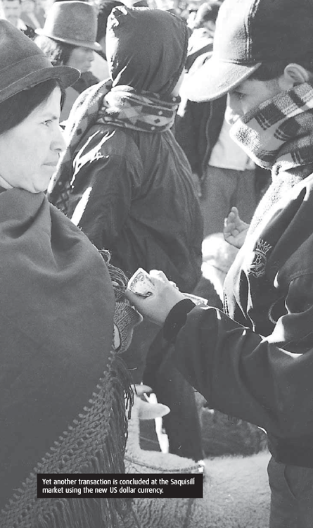
In 1996, Abdalá Bucaram was elected president and made many promises to the poor. However, corruption and mismanagement led to him being voted out by congress and exiled to Panama. From the late 1990s to 2000, Ecuador went through several more presidents. It would also suffer its worst financial situation in nearly 70 years. So bad was the situation that between 1999 and the end of 2000, nearly a million Ecuadorians left their homeland for economic opportunity. (Please refer to Chapter Three, Ecuadorian Society for more details on the exodus of the 1990s.)
There was much dissentient opposition to the government and President Jamil Mahuad in the late 1990s. He had proposed that Ecuador remove the sucre as the official currency, to be replaced by the US dollar (US$). Inflation was at over 60 per cent and the gross domestic product had shrunk at least 7.3 per cent primarily because of low oil prices. Unemployment had jumped from 12 per cent to 17 per cent. There was much opposition to Mahuad’s proposal and, on 22 January 2000, thousands of indigenous people and middle to lower level military members walked into congress (which was unoccupied) and placed a three-man junta in charge of the country.
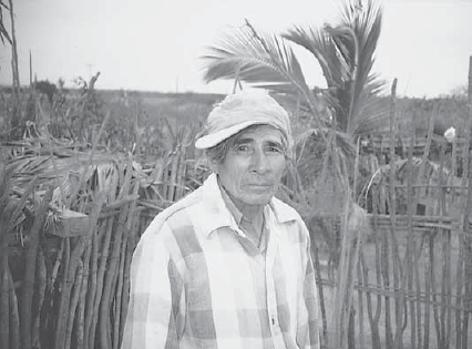
The care-worn face of an indigenous farmer. Originating from Manabí province but driven by need, he has moved south to Chanduy, an ancient fishing village on the coast south of Salinas.
The United States placed pressure on this group and the committee was disbanded. Vice-president Gustavo Noboa was instituted as president to fulfill the remaining three years of office. Noboa vowed to continue with the dollarisation plan and attack corruption. Now in his early 60s, he is an educator and is viewed by many as intelligent and honest, not appearing to have acquired material wealth for himself. Noboa does not belong to a political party and his priorities are modernising the state and economic reform.
The indigenous community felt betrayed by the military as the government was put back in the hands of those sympathetic to the oligarchy. I agree with Walker Lowry who said in his book Tumult at Dusk: “Ecuador means equator. It ought to mean Indian.” The Indians are now more organised than ever before and are committed to controlling their destiny and Ecuador’s. There has been increasing activism from indigenous groups. The Confederation of Indigenous Nationalities (CONAIE) is leading the struggle for representation in Ecuador. The CONAIE President, as of 2006, is Luís Macas. (Related material can be found on CONAIE’s website: http://www.CONAIE.org.)
Here is an extract from a statement by the former President of CONAIE, Antonio Vargas:
‘If they want to find the coup participants, they should look for them in the corridors of the oligarchies, the parliament, the corrupt courts and bankers who with their policies and holdups have deepened the misery, the hunger, unemployment, and the migrations from the countryside to the city ... Again historical injustices are repeated. During 500 years of oppression, our towns rose up demanding justice and the respect to the human rights which were cruelly violated again and again. But when there were uprisings, leaders like Rumiñahui, Tupac Amaru, Jumandi, Daquilema, and many others were taken prisoner, tortured and assassinated ... But they must understand that there will be no wall nor any bars that can stop our ideas and our equitable and deeply participative fight, because with wrath and wisdom of centuries we are up building pressure like our sacred volcanoes to construct Ecuador as a just and participating Nation.’
The deep-rooted contrasts of Ecuador’s varied peoples and the divisive powers of external influences have been dominant threads in Ecuador’s history. This author feels that Ecuador is on the verge of tremendous change. In thinking about Ecuador’s future, I fear that Ecuador could fall prey to ambitious dictators, drug lords or guerrilla groups from Colombia in the next five to ten years. Whatever the outcome, we can only watch anxiously as Ecuadorians forge their unique identity in these tumultuous times.
Instability is often the norm when it comes to Ecuadorian government and politics. This is partially evident by the number of constitutions (20) which have been instituted since 1830. The longest period of time between new constitutions was from 1978 to 1998.
In 1998, there were significant changes when a new constitution was enacted which placed limits on state intervention in the economy and rights were widened to all Ecuadorians including the youth, Afro-Ecuadorians and indigenous groups. However, geographic regions still played a significant role in politics.
In 2006, Socialist Rafael Correa was elected president. His power was significantly increased when in September of 2008, he pushed through a referendum for a new constitution. He viewed it as a civic resolution to eliminate corruption as well as to promote economic stability and provide social equality. The new constitution also called for the ability for the president to serve two consecutive terms. He has now been elected to a second term on 26 April 2009. It also rid the government of a congress by replacing it with a national assembly. It also gives the government greater power over the legislature, judiciary and the economy. The constitution is well over 400 articles and has some similarities of both the Bolivia and Venezuela constitutions.
There are three main branches of the government, which are comprised of the executive, legislative and judicial sectors. The executive branch position is to manage all sectors of the government. The legislative branch is responsible for running the congress. The judicial branch administers the justice programmes. Voting is compulsory between the ages of 18 and 65 and the president is elected every four years, serving a single term.
The executive branch consists of the president and vice-president. His responsibility as head of the government is to manage the public administration, maintain internal order, public security, present a government plan and inform the congress each year of the government’s and country’s status. He also coordinates the development of new laws and selects ministers and diplomats. He is elected to take office on 10 August of the year following his election by the people. The president must be at least 35 years old and born in Ecuador. If he becomes incapacitated, the vice president or a designated minister takes over. If both of them are not able to serve, the president of the national congress steps into place until congress selects a new president to serve the remaining term within 10 days. President Gustavo Noboa was elected to office on 22 January 2000 following a coup which deposed President Mahuad. Vice President Pedro Pinto has been in office since 28 January 2000.
The military exercises considerable power in Ecuador, reporting directly to the president. It is known to support labour unions which oppose the privatisation of many of the country’s state-owned companies. Many of the leaders in the military are from the Sierra. The military, during the early years of oil exports, took over the government. Profits from petroleum allegedly provide an unofficial source of funds for the military. It was a military-indigenous coup which toppled democratically elected President Jamil Mahuad.
In 1998, a new constitution was drawn up, largely as a response to the deep depression the country was in. Limits were placed on state intervention in the economy and rights were widened to all Ecuadorians, including the youth, Afro–Ecuadorians and indigenous groups.
There are numerous changes to the new constitution. Here is a brief sampling:
Article 2 calls for Spanish as the official language. Kichwa and Shuar are official languages in intercultural relations. The speakers of particular indigenous languages also consider languages official in issues and the areas that are inhabited by the speakers of the particular language. The State is to respect and stimulate discourse and use of the language.
Article 62 states that voting is obligatory for those between 18 and 65 years of age. Even individuals who are incarcerated are to vote if they have not been sentenced. Citizens age 16 to 18 are now eligible to vote.
Article 63 permits foreigners that are residents of Ecuador to vote. There is a minimum of five years residency requirement.