Start |
Jubilee Clock, South Cave, grid ref 923313 |
Finish |
Goodmanham Parish Church, grid ref 890432, or the Londesborough Arms, Market Weighton, grid ref 877417 |
Distance |
19km (12 miles) |
Maps |
OS Landranger 106, OS Explorer 293 |
Terrain |
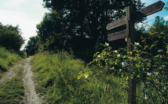
Easy roads, tracks and paths with a few ascents and descents on reasonably gentle slopes. Route-finding is intricate at first but easier later. |
Refreshments |
Pubs off-route in North Newbald. Pubs, restaurants, cafés and takeaways at Market Weighton. |
Public Transport |
East Yorkshire bus X46 links Arras and Market Weighton with Hull and Beverley, Pocklington and York. |
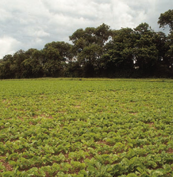
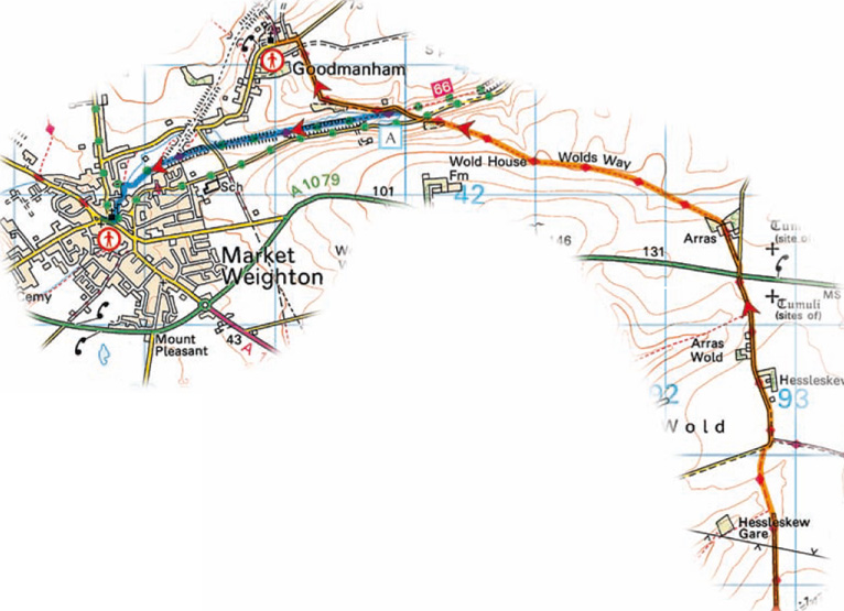
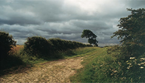
The Yorkshire Wolds increase in height as this day’s walk unfolds, although the higher parts are simply rolling fields rather than hills. A series of charming, steep-sided dales are visited — some wooded, some grassy — two of which have had railways routed through them in the past. After leaving South Cave facilities actually on the way are very limited indeed, with the village of North Newbald located 1.5km (1 mile) off-route if food and drink are needed in the middle of the day. After passing the remote farmstead of Arras, walkers are faced with a choice of routes. Either follow the main route to Goodmanham, which has a pub and bed-and-breakfast, or take an alternative loop through Market Weighton where there is a hotel and several opportunities to enjoy food and drink.
Leave South Cave by following Beverley Road out of the village, then turn left on the outskirts as signposted Wolds Way. Cross a footbridge and follow a narrow path uphill beside a small plantation of willow. Walk into Little Wolds Plantation and turn right to follow a broad woodland path — the wood is managed by the Woodland Trust and enjoys open access. The path climbs almost to 120m (395ft) to reach a junction with a wider track. Turn right to walk down the track, which is flanked by trees and bushes but allows a glimpse back to the Humber Estuary. Watch out for a gate on the left where the Wolds Way runs down a grassy path through little Comber Dale. Swing right near the bottom of the slope to reach a bridle kissing gate — a huge kissing gate for horses (cross a stile alongside if unsure how to operate it).
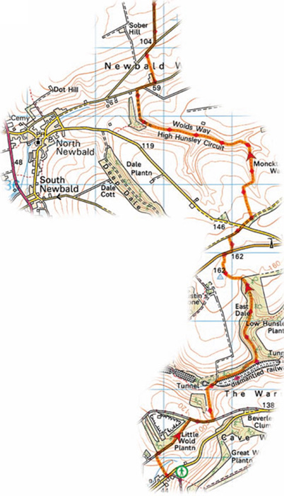
NORTH NEWBALD
The village offers a few facilities in an area otherwise lacking services. Clustered around the Green are two pubs, the Gnu and the Tiger Inn, both serving food and drink and the former also providing accommodation. The Post Office and Stores also faces the Green. Use the road signposted Beverley to get back onto the Wolds Way.
The Wolds Way uses a high track between Newbald Wold and Hessleskew
Main Route
Simply stay on the road to follow the main course of the Wolds Way. The road climbs out of the wooded dale, swinging right to proceed at a gentler gradient. Turn left at a road junction to walk into Goodmanham.
Alternative Route
Turn left along the old railway trackbed, signposted the Hudson Way. The line operated from 1865 to 1965 and its founder, George Hudson, made and lost a fortune on the enterprise. Follow the track through a well-wooded dale. There is no doubting the way ahead, which is always clear and generally flanked by trees and bushes. The route soon brushes alongside Market Weighton. Watch out for a turning on the left that leads into town by way of Station Road and a passage beside All Saints Church known as Church Side. This leads to the main shopping street beside the Londesborough Arms.
GOODMANHAM
This delightful little village surrounds an old church and features fine houses and cottages. Of particular note in the church is the lavish baptismal font carved with the words, ‘wyth owt baptysm no soull ma be saved’. The only facilities are the Goodmanham Arms and a bed-and-breakfast. Limited buses run to and from Market Weighton,
MARKET WEIGHTON
This is the only town of any size actually on the Wolds Way, apart from Filey at the end, and it offers a good range of services. While considering its size, also consider the size of William Bradley, born at Bradley House on York Road in 1792 and buried in the churchyard of All Saints Church in 1820. He was the tallest man in the country, standing 2.36m (7ft 9ins). A life-size statue stands outside his birthplace.