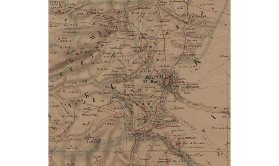
Plate 1 Heinrich Berghaus, Karte von Syrien (Map of Syria) (Gotha and Berlin, 1835)
Source: FBG SPB 2°1010.88f (5)

Plate 1 Heinrich Berghaus, Karte von Syrien (Map of Syria) (Gotha and Berlin, 1835)
Source: FBG SPB 2°1010.88f (5)


Plate 2 Heinrich Kiepert, Karte von Palaestina vorzüglich nach den Itinerarien von E. Robinson und E. Smith (Map of Palestine mainly according to the itineraries of E. Robinson and E. Smith) (1840), hand-drawn sketch map, extract
Source: SBB-PK Kart. D 6940

Plate 3 Heinrich Kiepert, Karte von Palaestina. Vorzüglich nach den Itinerarien und Messungen von E. Robinson und E. Smith (Map of Palestine mainly according to the itineraries of E. Robinson and E. Smith] (Halle, 1840), extract
Source: FBG SPK 547-112619762

Plate 4 Heinrich Kiepert, Karte von Palaestina nach den neuesten Quellen (Map of Palestine according to the newest sources) (Berlin, 1842), with hand-drawn grid, extract
Source: FBG SPK 547-112619568

Plate 5 ‘Ghuzzeh (Gaza)’. Lithography from the album van de Velde, Pays d’Israël (Paris, 1857), no. 71
Source: Private collection


Plate 6a–h C.W.M. van de Velde, Karte von Palästina (Map of Palestine) (Gotha, 1866), sections 1–8
Source: FBG SPA 2° 316


Plate 7 August Petermann, Diagram … on the Fall of the Rivers (London, 1848)
Source: FBG SPK 547-11255346X

Plate 8 August Petermann, Physical Map of Palestine and the Adjacent Countries, hand-drawn sketch (London, 1850), extract
Source: FBG SPK 547-112707688

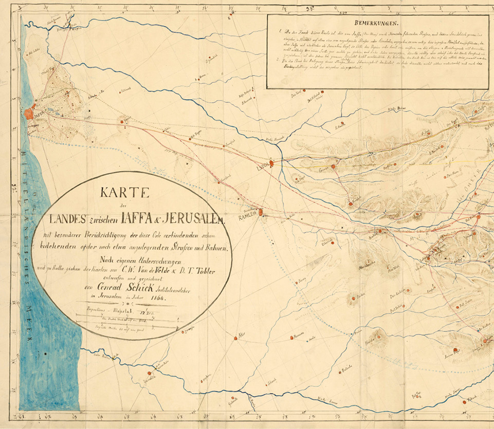
Plate 9 Conrad Schick, Karte des Landes zwischen Jaffa und Jerusalem (Map of the Land between Yafo and Jerusalem), hand-drawn sketch (Jerusalem, 1864), extract
Source: FBG SPK 547-112550002

Plate 10 August Petermann, Palästina (Palestine), hand-drawn sketch (Gotha, 1868), extract
Source: FBG SPK 547-112664288